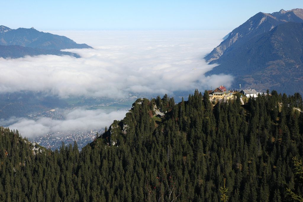
The Kreuzeck is a mountain in the Wetterstein mountain range of Bavaria, Germany with an elevation of 1,651 m (5,417 ft) above sea level. It is part of the present-day Garmisch Classic ski resort.
The first ski area at Kreuzeck 1,340 m (4,396 ft) was developed for the 1936 Winter Olympics in neighboring Garmisch-Partenkirchen, the first Olympics to feature alpine skiing. The sole event was the combined, with one downhill run and two runs of slalom. The Kreuzeck valley base station served as finish line for the downhill, while the slalom was run at Gudiberg, adjacent to the ski jumping hill, Große Olympiaschanze.
The Kreuzeck featured Germany's first Mountain Gondola (Kreuzeckbahn 1926) which made the Kreuzeck range the alpine portal to the neighboring areas of the Kreuzjoch, the Alpspitze, and the Höllental and provided the infrastructure to host the downhill event for the 1936 Winter Olympics. The original Olympic course is still maintained and accessible. The current downhill course garnered notoriety as a designated "Kandahar" event and continues to host World Cup events in downhill, super G, and giant slalom. It hosted the World Championships in 1978 and 2011.
There's a trail leading to the summit.
The nearest mountain hut is Kreuzeckhaus located 29m/96ft ENE of the summit.
We use GPS information embedded into the photo when it is available.
3D mountains overlay
Adjust mountain panorama to perfectly match your photos because recorded by camera photo position might be imprecise.
Move tool
Rotate tool
Zoom
More customization
Choose which peak labels should make into the final photo and what photo title should be.
Next
Photo Location
Satellitte
Flat map
Relief map
Latitude
Longitude
Altitude
OR
Latitude
°'''
Longitude
°'''
Apply
Register Peak
Peak Name
Latitude
Longitude
Altitude
Register
Teleport
PeakVisor
This 3D model of Sagarmatha National Park in Nepal was made using the PeakVisor app topographic data. The mobile app features higher precision models worldwide, more topographic details, and works offline. Download PeakVisor maps today.
Download OBJ model
PeakVisor
The download should start shortly. If you find it useful please consider supporting the PeakVisor app.
PeakVisor for iOS and Android
Be a superhero of outdoor navigation with state-of-the-art 3D maps and mountain identification in the palm of your hand!