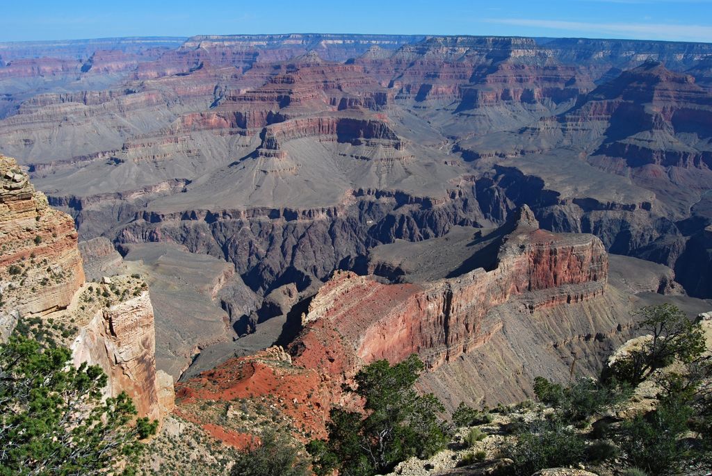
Dana Butte is a 4,964-foot (1,513 m) prominence, (named for geologist and volcanologist James Dwight Dana), adjacent the course of the Colorado River, in the Grand Canyon and sits on the south side of Granite Gorge. The butte is roughly 2.5 miles (4.0 km) north-northwest of Grand Canyon Village of the central Grand Canyon, and lies about 2.0 miles (3.2 km) due north of Pima Point (South Rim).
The butte lies at the end of a higher elevation bright-red, very narrow Supai Group ridgeline, and the spire of Dana Butte sits on the cliff-former Redwall Limestone that creates not only massive cliffs, but platforms that support younger rock units above. Dana Butte's prominence spire is dull gray, sitting on gray debris on the platform, and is composed of weathered Supai Group Manakacha Formation, also a cliff-former rock. Dana Butte drains west into the Salt Creek (Grand Canyon) drainage, and east into the adjacent canyon of the terminus of Salt Creek.
We use GPS information embedded into the photo when it is available.
3D mountains overlay
Adjust mountain panorama to perfectly match your photos because recorded by camera photo position might be imprecise.
Move tool
Rotate tool
Zoom
More customization
Choose which peak labels should make into the final photo and what photo title should be.
Next
Photo Location
Satellitte
Flat map
Relief map
Latitude
Longitude
Altitude
OR
Latitude
°'''
Longitude
°'''
Apply
Register Peak
Peak Name
Latitude
Longitude
Altitude
Register
Teleport
PeakVisor
This 3D model of Sagarmatha National Park in Nepal was made using the PeakVisor app topographic data. The mobile app features higher precision models worldwide, more topographic details, and works offline. Download PeakVisor maps today.
Download OBJ model
PeakVisor
The download should start shortly. If you find it useful please consider supporting the PeakVisor app.
PeakVisor for iOS and Android
Be a superhero of outdoor navigation with state-of-the-art 3D maps and mountain identification in the palm of your hand!