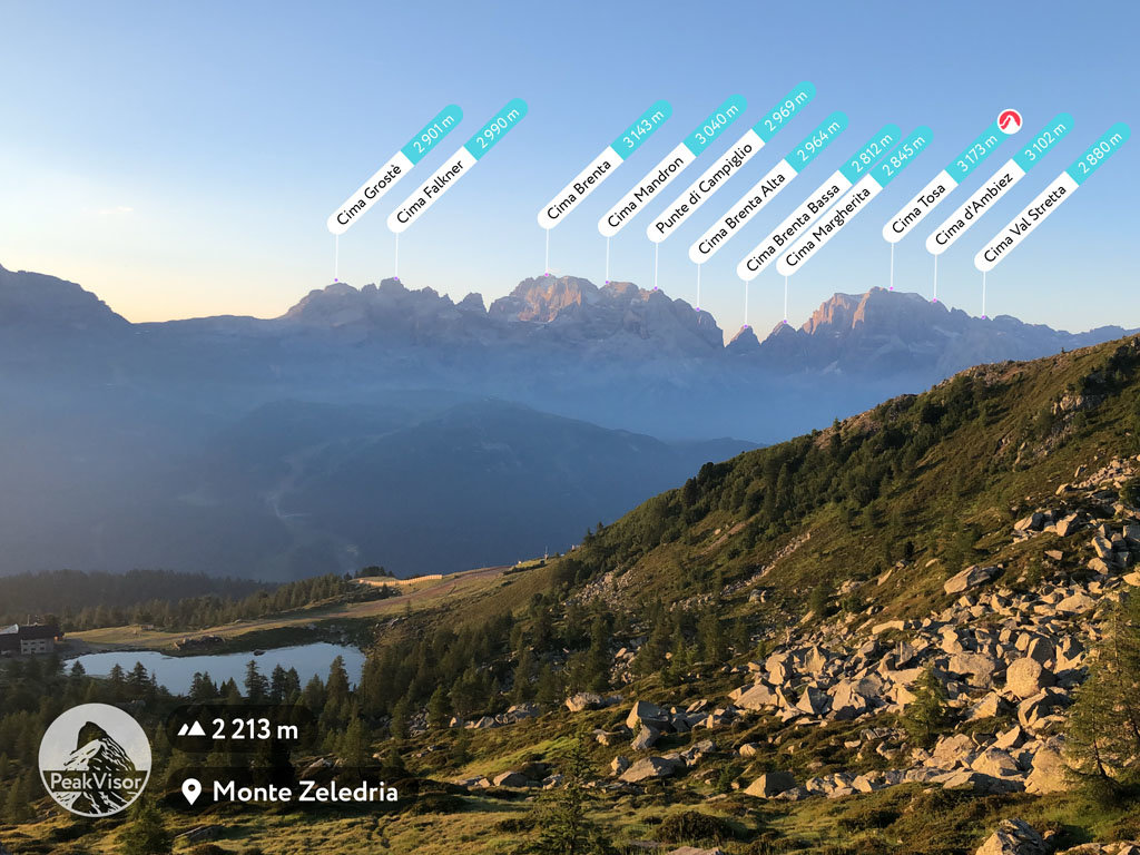
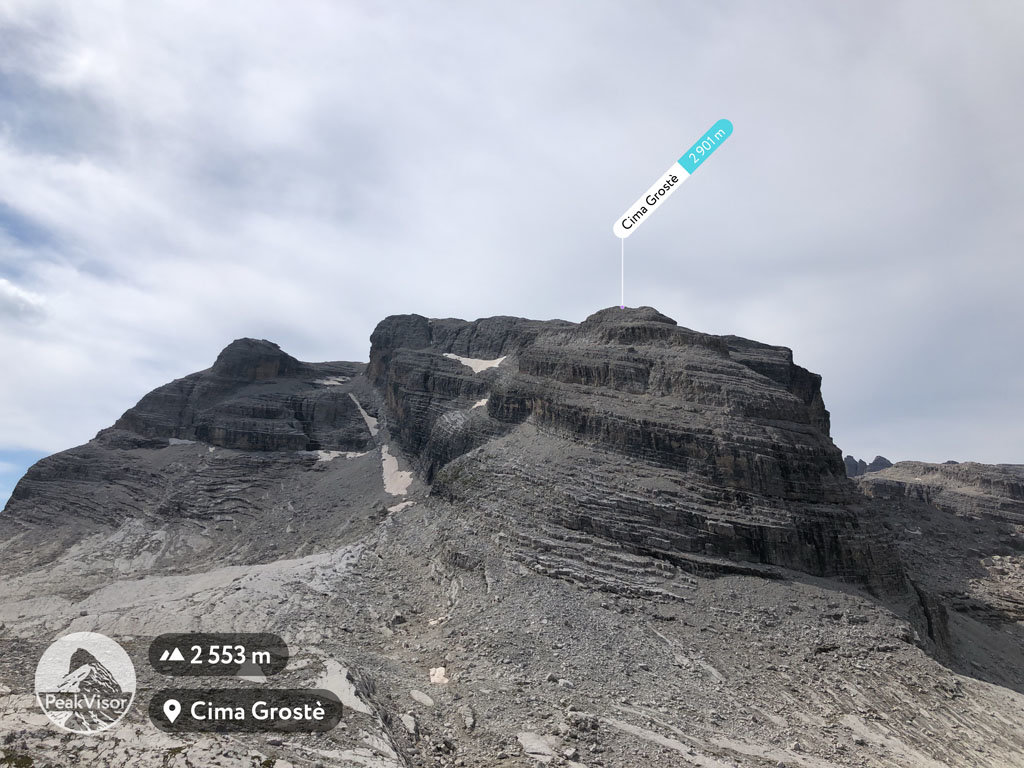
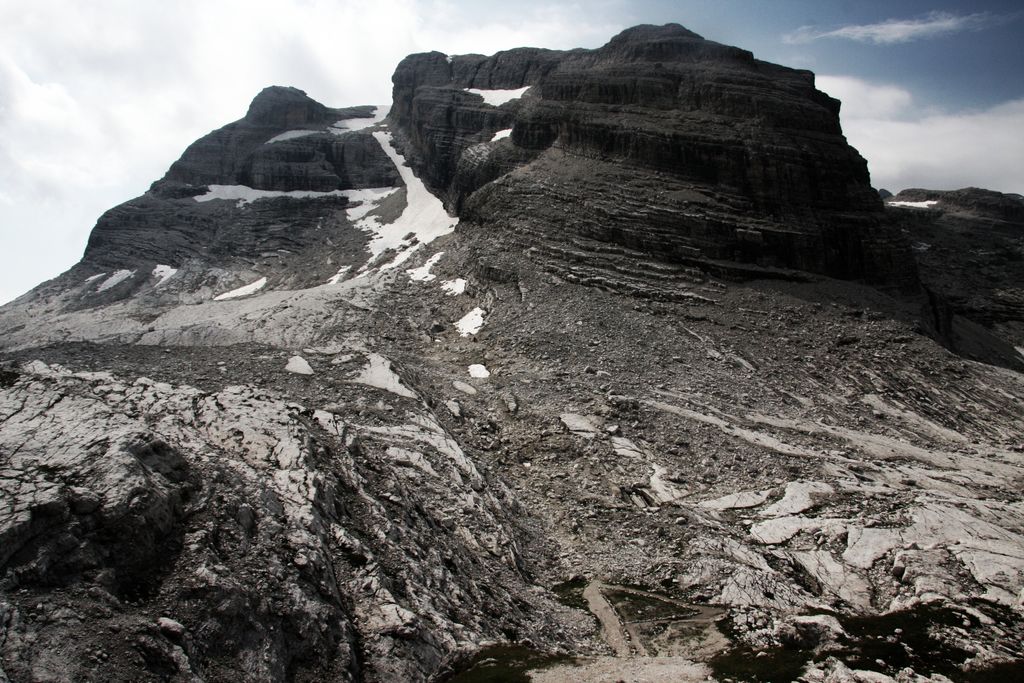
At an elevation of 2,901 m (9,518 ft.), and with a prominence of 117 m (384 ft.), Cima Grostè forms part of the Southern Rhaetian Alps. It is situated near the town of Madonna di Campiglio, in Trento Province of the South Tyrol region, Italy.
Cima Grostè is one of the most pleasurable climbs in central Brenta and is, in fact, the easiest to scale. Reach the peak of Cima Groste via the Passo Grostè, which is very popular among tourists.
TIP: Since the Passo Grostè also leads to Ferrata delle Bocchette Alte, few hikers ever go to the peak, yet a visit is recommended for photographers and nature lovers.
The nearest mountain hut is Rifugio Quintino Sella located 1 882m/6 175ft WSW of the summit.
By elevation Cima Grostè is
# 27 out of 207 in the Brenta group # 93 out of 307 in Parco naturale dell'Adamello-Brenta
By prominence Cima Grostè is
# 47 out of 207 in the Brenta group # 64 out of 307 in Parco naturale dell'Adamello-Brenta
We use GPS information embedded into the photo when it is available.
3D mountains overlay
Adjust mountain panorama to perfectly match your photos because recorded by camera photo position might be imprecise.
Move tool
Rotate tool
Zoom
More customization
Choose which peak labels should make into the final photo and what photo title should be.
Next
Photo Location
Satellitte
Flat map
Relief map
Latitude
Longitude
Altitude
OR
Latitude
°'''
Longitude
°'''
Apply
Register Peak
Peak Name
Latitude
Longitude
Altitude
Register
Teleport
PeakVisor
This 3D model of Sagarmatha National Park in Nepal was made using the PeakVisor app topographic data. The mobile app features higher precision models worldwide, more topographic details, and works offline. Download PeakVisor maps today.
Download OBJ model
PeakVisor
The download should start shortly. If you find it useful please consider supporting the PeakVisor app.
PeakVisor for iOS and Android
Be a superhero of outdoor navigation with state-of-the-art 3D maps and mountain identification in the palm of your hand!