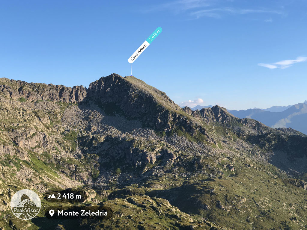
At an elevation of 2,614 m (8,576 ft.), and with a prominence of 115 m (377 ft.), Cima Artuic forms part of the Southern Rhaetian Alps. It is situated near the village of Madonna di Campiglio, in Trento province of the South Tyrol region, Italy.
Cima Artuic is popular amongst skiers, primarily since it provides beautiful views of the Cima Artuic and the Piana delle Malghette.
When hiking up Cima Artuic, visitors can make use of the Malghette Refuge overlooking the charming Malghette Lake, before heading up to the peak. For the most part, the climb is easy to moderate, with only the last stretch proving more trying as it angles upwards more steeply.
The nearest mountain hut is Malga Artuick located 1 574m/5 163ft NW of the summit.
We use GPS information embedded into the photo when it is available.
3D mountains overlay
Adjust mountain panorama to perfectly match your photos because recorded by camera photo position might be imprecise.
Move tool
Rotate tool
Zoom
More customization
Choose which peak labels should make into the final photo and what photo title should be.
Next
Photo Location
Satellitte
Flat map
Relief map
Latitude
Longitude
Altitude
OR
Latitude
°'''
Longitude
°'''
Apply
Register Peak
Peak Name
Latitude
Longitude
Altitude
Register
Teleport
PeakVisor
This 3D model of Sagarmatha National Park in Nepal was made using the PeakVisor app topographic data. The mobile app features higher precision models worldwide, more topographic details, and works offline. Download PeakVisor maps today.
Download OBJ model
PeakVisor
The download should start shortly. If you find it useful please consider supporting the PeakVisor app.
PeakVisor for iOS and Android
Be a superhero of outdoor navigation with state-of-the-art 3D maps and mountain identification in the palm of your hand!