Available for connected Garmin and Suunto accounts.
Scan the QR code and open PeakVisor on your phone
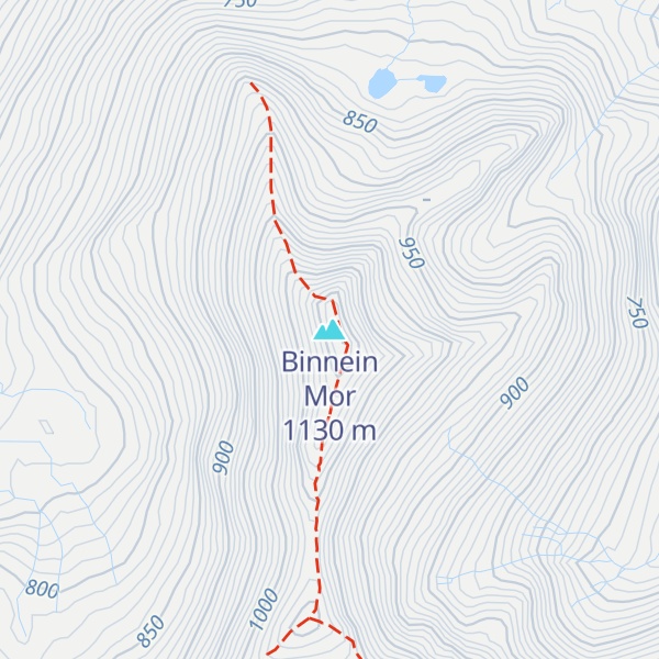
Binnein Mor map
Binnein Mor
R
Add photo
1 130 m
Elevation
Elevation is the altitude of a place above sea level.
760 m
Prominence
Peak’s prominence is the least vertical to be covered to get from the summit to any other higher terrain.
Proportional Prominence1 048 m
Munro
Mountains in Scotland with a height of over 914 m / 3 000 ft bear a special name, the Munros. They are named after Sir Hugh Munro, the 4th Baronet (1856–1919), who produced the first list of such hills, known as Munro’s Tables, in 1891.
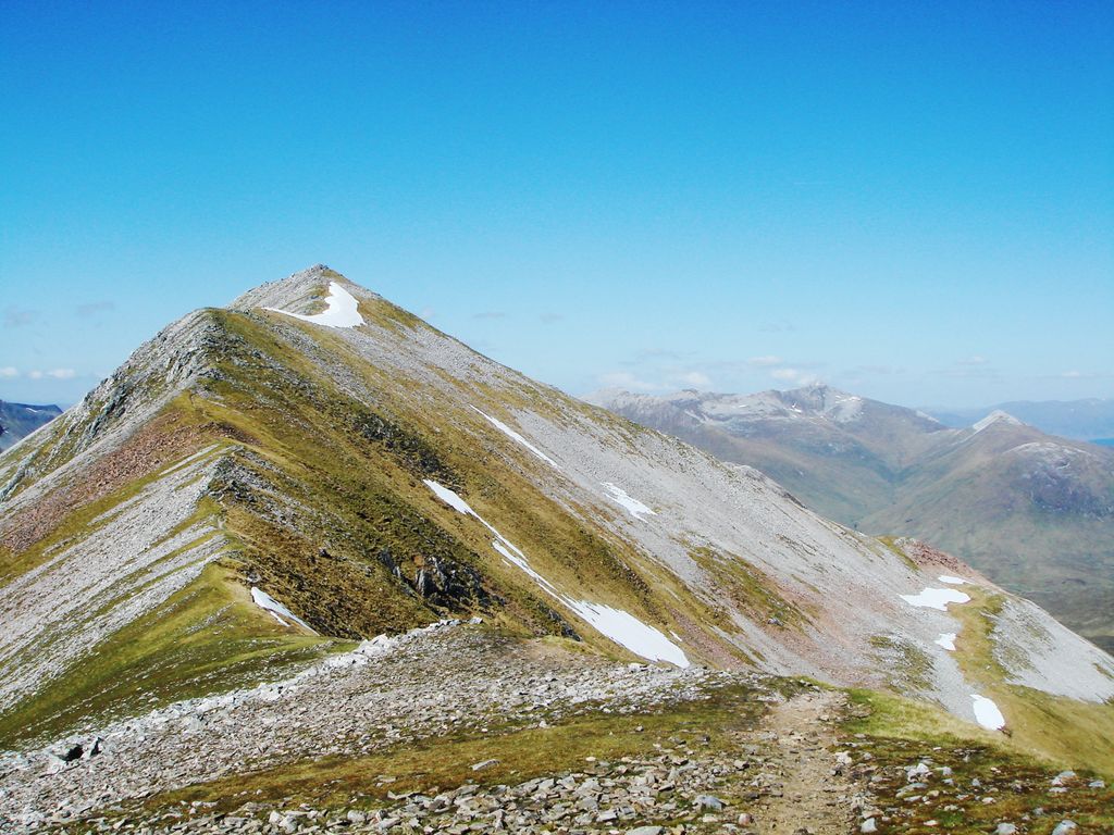
Binnein Mòr is the highest peak in the Mamores, the range of mountains between Glen Nevis and Loch Leven in the Highlands of Scotland, located about five kilometres north-northeast of Kinlochleven. The pyramidal summit of Binnein Mòr lies above the uninhabited upper section of Glen Nevis, north of the main Mamores ridge. To the south, a short narrow ridge links to the main ridge at an unnamed 1062 m subsidiary top listed in Munro's Tables as Binnein Mòr south top. Binnein Mòr's second subsidiary top, Sgòr Eilde Beag (956 m), lies about a kilometre to the southeast and forms the eastern end of the main Mamores ridge.
Despite being the highest mountain in the Mamores, Binnein Mòr is not one of the most commonly visited, due in part to its relative remoteness. It is most frequently climbed from Kinlochleven, often together with Na Gruagaichean, the next peak to the west.
There's a hiking trail (T2) called Na Gruagichean leading to the summit.
By elevation Binnein Mor is
# 26 out of 4967 in Highland # 47 out of 18277 in Scotland # 47 out of 34760 in United Kingdom # 41 out of 5485 in the Grampian Mountains
By prominence Binnein Mor is
# 19 out of 4967 in Highland # 30 out of 18277 in Scotland # 33 out of 34760 in United Kingdom # 13 out of 5485 in the Grampian Mountains
We use GPS information embedded into the photo when it is available.
3D mountains overlay
Adjust mountain panorama to perfectly match your photos because recorded by camera photo position might be imprecise.
Move tool
Rotate tool
Zoom
More customization
Choose which peak labels should make into the final photo and what photo title should be.
Next
Photo Location
Satellitte
Flat map
Relief map
Latitude
Longitude
Altitude
OR
Latitude
°'''
Longitude
°'''
Apply
Register Peak
Peak Name
Latitude
Longitude
Altitude
Register
Teleport
PeakVisor
This 3D model of Sagarmatha National Park in Nepal was made using the PeakVisor app topographic data. The mobile app features higher precision models worldwide, more topographic details, and works offline. Download PeakVisor maps today.
Download OBJ model
PeakVisor
The download should start shortly. If you find it useful please consider supporting the PeakVisor app.
PeakVisor for iOS and Android
Be a superhero of outdoor navigation with state-of-the-art 3D maps and mountain identification in the palm of your hand!