
Scan the QR code and open PeakVisor on your phone
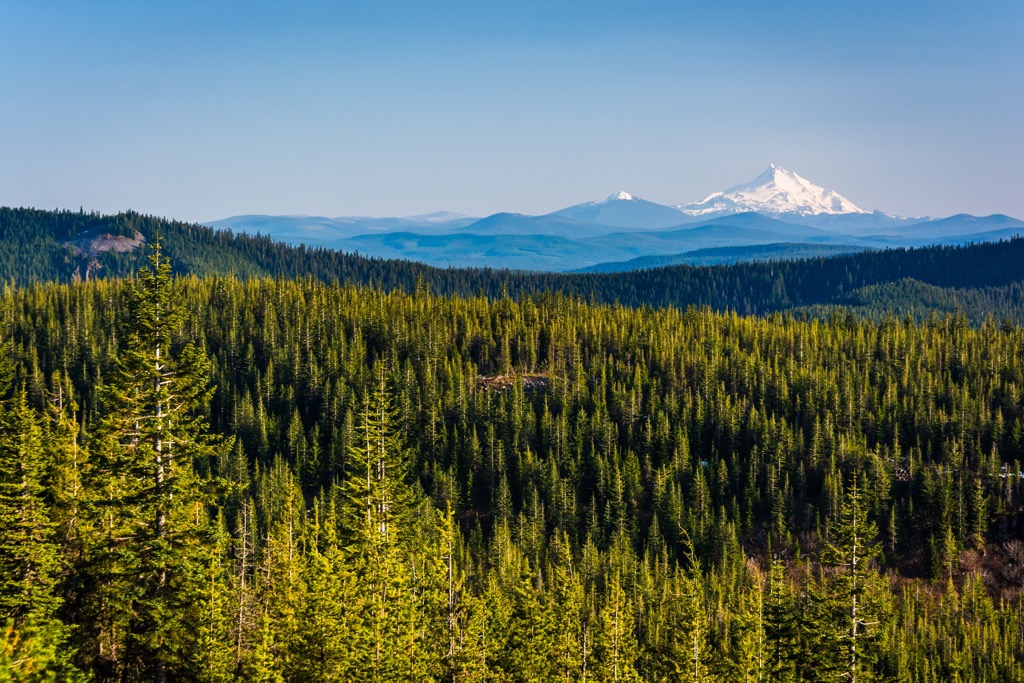
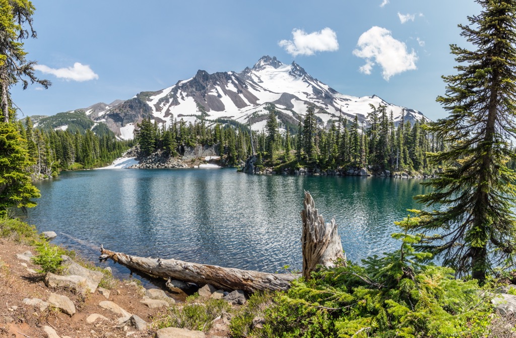
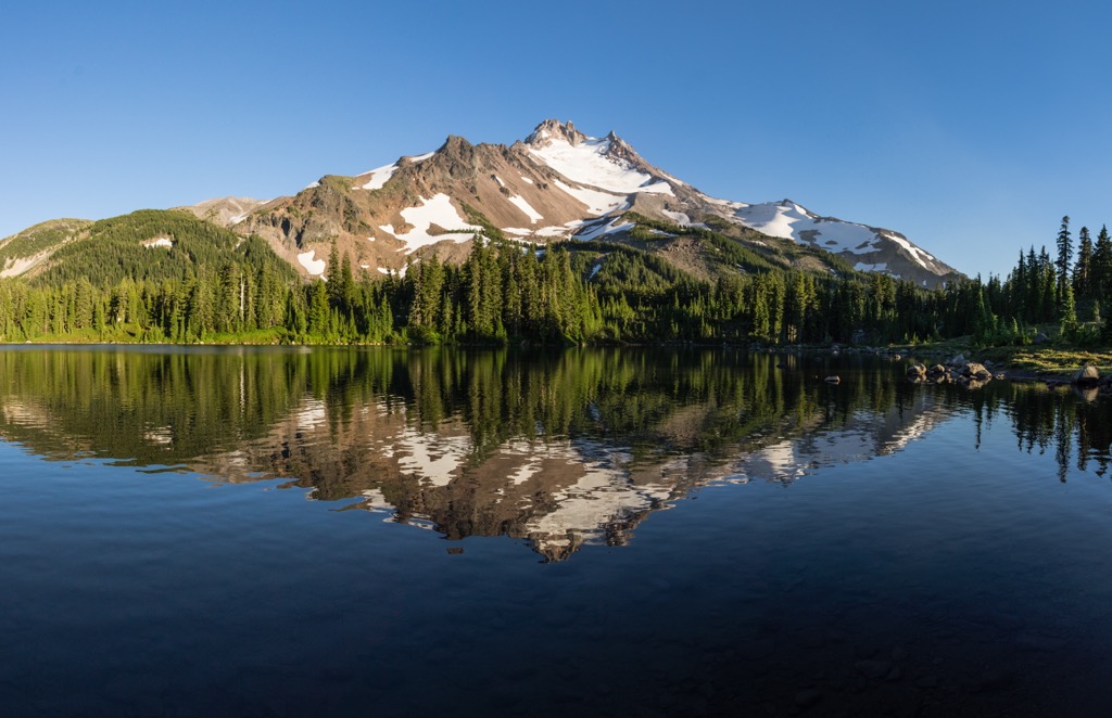
Stretching from the Cascade Mountains to the Deschutes River in Oregon, USA, Warm Springs Indian Reservation is the state’s second largest reservation. The area contains 48 named mountains, the highest and most prominent being Mount Jefferson, reaching 10,502 ft (3,201 m) at the summit, with a prominence of 5,787 ft (1,764 m). The second tallest and most prominent mountain is Olallie Butte, a shield volcano that rises 7,215 ft (2,199 m) and has a prominence of 2,254 ft (687 m).
Warm Spring Indian Reservation encompasses 644,000 acres (260,618 hectares) of northwest and central Oregon and is the state’s second largest reservation. It first became a reservation in the late 1800s but the Wasco, Warm Springs, and Peiute tribes officially banded together and became the Confederated Tribes of Warm Springs in 1934.
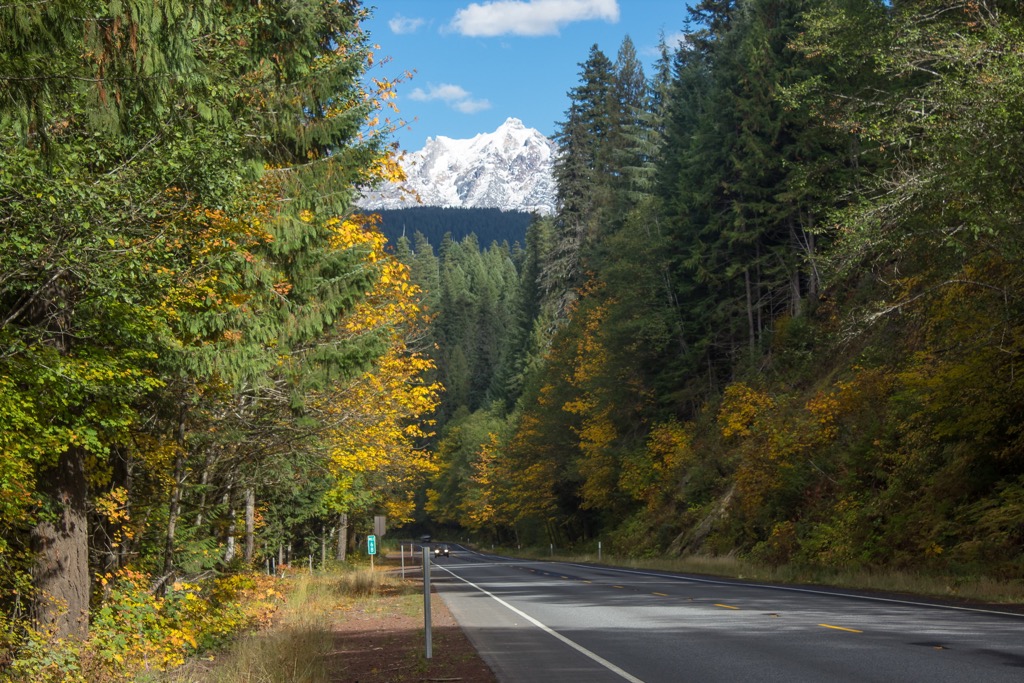
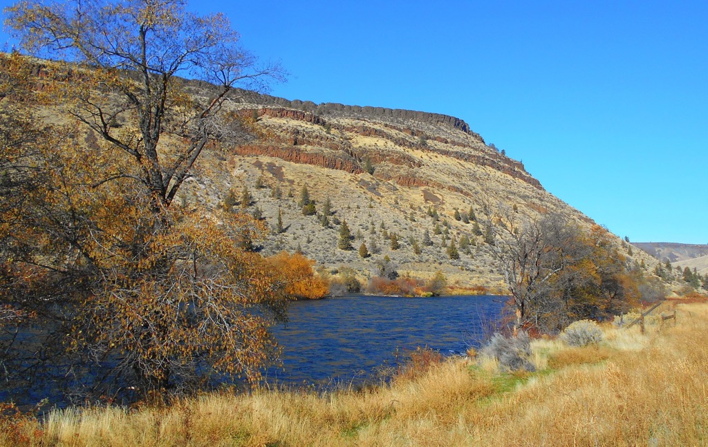
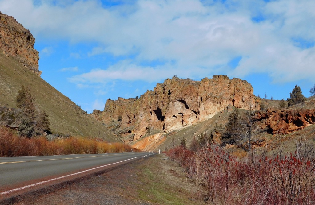
The reservation spans from the Cascade Mountains to the cliffs along the Deschutes River. Along its west and north perimeter, it borders Mount Hood National Forest and lies just south of Mount Hood.
The reservation shares its eastern border with the Mount Jefferson Wilderness, and sits north of Willamette National Forest. A portion of the Pacific Crest Trail runs through the reservation, and the tribe has granted an easement to thru-hikers on the trail. All other visitors are required to obtain a permit before accessing any of the trails, backcountry, or fishing opportunities within the reservation.
The tribe’s department of Natural Resources manages conservation easements surrounding the reservation including Oxbow, Mainstem Forrest, Middle Fork Forrest, Dunstan, Pine Creek, Red Hills, Little Sweden, and Austin Hot Springs Conservation Areas.
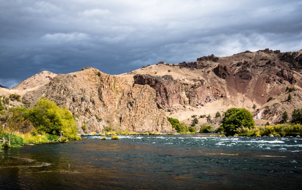
A major part of Oregon’s geologic history can be summarized into the subduction of oceanic plates beneath the western edge of the North American plate during the late Paleozoic and Paleocene. Beginning in the Eocene and continuing through the present day, arc volcanism has shaped the region, creating the striking glaciated volcanoes seen today in the Cascade Range.
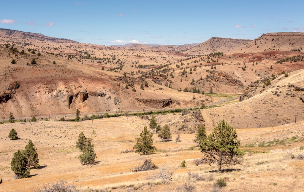
During the Miocene, the Yellowstone Hotspot caused the Columbia River flood basalt flows, covering half the state in lava. Due to the volcanic activity in the state, many of the mountains are composed of andesite, basaltic andesite, basalt flows, flow breccia, and pyroclastic deposits.
The tribe’s Wildlife Department manages the natural resources within the reservation. This job has considerable scope, covering wildlife, fisheries, habitat conservation, sustainable range and agriculture use, and forestry, all with a dual lens of cultural conservation.
As far as rangeland goes, focus is on managing wild horse populations and invasive plants, establishing irrigation systems to support hay-growing for livestock and for commercial agriculture, and coordinating grazing plans for livestock.
Wildlife management focuses on growing deer, elk, bighorn sheep, and mountain goat populations, as well as maintaining habitat and monitoring the health of predator populations in the ecosystem.
Watershed management strives to support aquatic and riverine habitats in order to return culturally significant fish species to sustainable, harvestable populations. Chinook salmon and steelhead trout have both historically been important to the livelihoods of the tribes.
Higher elevation forests in the region primarily support Pacific silver fir, mountain hemlock, Douglas-fir, and lodgepole pine. Mid-elevation forests consist of Douglas-fir and ponderosa pine with an understory dominated by bitterbrush, snowbrush, and manzanita. There is also an abundance of huckleberry and other berry bushes during the summer. The other main ecoregions can be grouped into the category of rangeland and include grasslands, oak woodlands, and shrub-steppe communities.
Warm Springs Indian Reservation is a confederacy of three tribes – the Wasco from northern Oregon, the Warm Springs, and the Peiute whose main traditional territory fell in the southeast section of the state.
The Wasco tribe lived along the Columbia River, their livelihoods intricately tied to the salmon who returned each year to spawn. The Warm Springs band traditionally lived to the south along the Deschutes and John Day river tributaries. While the Warm Springs depended on salmon, they also shifted seasonally for hunting and gathering. The two tribes frequently came into contact and communicated with a common language known as Chinook Jargon.
A third tribe, the Paiute band, tended to stay in a southeastern territory of Oregon but had occasional contact with the other two tribes. The drier climate of southeastern Oregon meant the Paiute had to cover more ground to meet their hunting and gathering needs.
Spanish and British explorers arrived in the region in the 1500s, but the 1800s entered in a new era of European settlers. By the mid 1800s, tribes were forced to cede land. The Wasco and Warm Springs ceded 10 million acres of land and together formed the Warm Springs Reservation. The Paiute joined the reservation in 1879 after conflict with settlers displaced them from their traditional territory.
Shortly after the Indian Reorganization Act in 1934, the Wasco, Warm Springs, and Paiute Tribes officially formed the Confederated Tribes of Warm Springs.
Non-tribal members are required to get a permit before recreating on the reservation. Hikers within or near the reservation should be respectful of whatever signage they encounter and turn back if they run into a “No Trespassing” sign.
That being said, the reservation does support visitors and an online form can be used to get permits to Dunstan, Middle Fork Forest, Pine Creek, Mainstem Forest, Oxbow, or Redhills Conservation Area. Fishing permits can also be acquired online.
Backpacking and horse-packing are allowed if they are at least one mile away from the highway and the county road and visitors must practice “leave no trace” ethics. All visitors, whether staying overnight or not, must register when entering and leaving the property.
Although part of Mount Jefferson is located on the reservation, it is accessed from the other side. The trail to Olallie Butte was previously maintained. However, a couple decades ago it was placed within the jurisdiction of the tribe. As a sacred site for indigenous people, it is unclear whether it is acceptable to use the trail or not. Those looking to hike it can reach out to local authorities to inquire about permits or for the latest update on accessing the butte.
**Closed until 2023** This popular 2.5 mi (4 km) loop leaves from the Kah-Nee-Ta Resort parking lot which has been closed since the resort shut down in 2018. The resort will reopen in 2023 which will once again allow access to this trail. It climbs about 650 ft (200 m) to the top of a large mesa with beautiful views from the top.
Warm Springs Indian Reservation granted an easement for the PCT to pass and about 25 mi (40 km) of the trail crosses the reservation. The appeal of this trail is that in peak season, it will likely be less crowded than other trails. It does not have too much elevation gain, is mostly shaded, and offers occasional glimpses of Mt. Hood through the trees.
Camping is allowed at Pine Creek Conservation Area and the Robinson Campground accommodates tent, car, and RV camping. Visitors must make a reservation online in advance. The campsite is currently under development with work to improve roads and facilities. There is not currently potable water available on site.
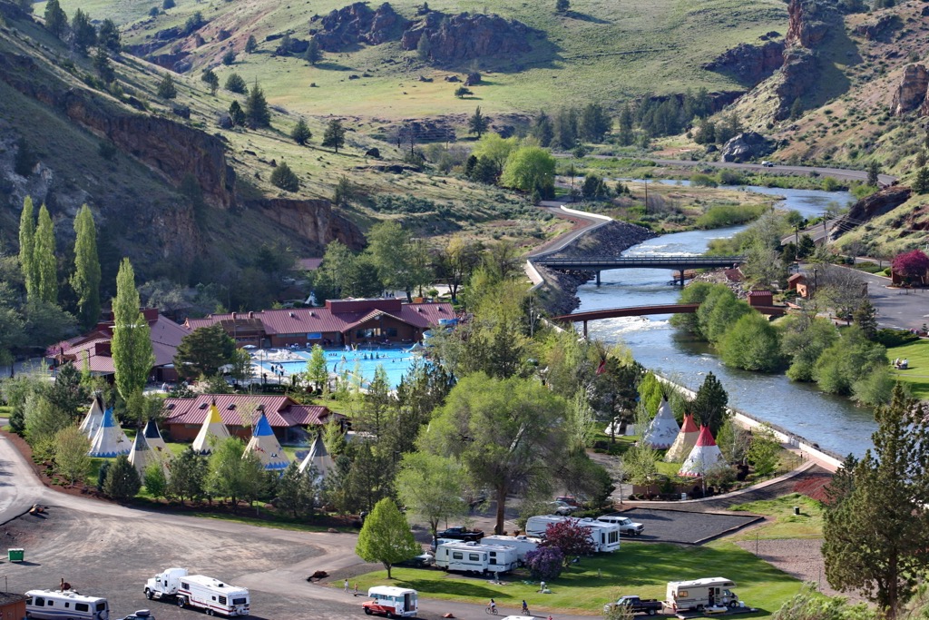
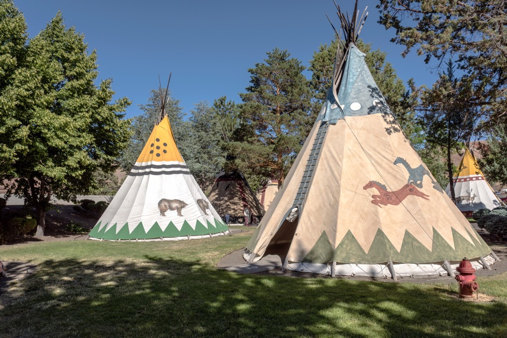
The main hub of the Warm Springs Indian Reservation is often called Warm Springs Agency. The tribe invites guests to visit the Museum at Warm Springs, home to a comprehensive collection of Native American artifacts, artwork, and cultural items telling the history of the tribe. Day visitors can also explore local hiking and biking trails, go fishing, or purchase artwork and crafts made by local artisans. Those hoping to stay overnight have the option to make a camping reservation. The current population is just over 3,000.
Madras is a small town south of Warm Springs with a population of 7,000 people. The community lies in the heart of ranching and farming country. It has all basic amenities – hotels, motels, a small selection of restaurants, and grocery stores. Those looking for adventure can find sky diving operators nearby or visit Cove Palisades State Park just outside of town for hiking, boating, and camping.
With a population around 650,000 people, Portland is a hip city less than two hours drive from the reservation. It hosts a wide array of activities, everything from music festivals to cycling events to farmers markets. The lush city has numerous parks and gardens and plenty of museums to explore on a rainy day.
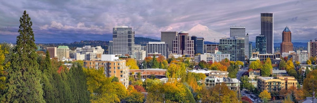
Just outside the city visitors can go whitewater rafting and horseback riding, hike Mount Hood, or check out any number of spectacular waterfall trails along the Columbia River Gorge.
Portland is known for being a big foodie city. From fine dining to experimental dishes, and an outrageous number of food trucks, there is no shortage of eating options! Staying over in the city is easy as well. Options include camping and RV sites, hostels, B&Bs, hotels, and vacation rentals.


ultra
glacier
volcano
oregon-9000ers
cascade-range-9000ers
chemeketan-18-nw
cascade-volcanoes-pin
mazamas-cascades-award
mazamas-16-nw-award
oregon-ultras
ultra
glacier
volcano
oregon-9000ers
cascade-range-9000ers
chemeketan-18-nw
cascade-volcanoes-pin
mazamas-cascades-award
mazamas-16-nw-award
oregon-ultras


