
Scan the QR code and open PeakVisor on your phone
The Vanderwhacker Mountain Wild Forest is an outdoor recreation destination situated in the northern region of the US state of New York. The wild forest is located in the central part of the Adirondack Park. There are 34 named peaks in the wild forest, the highest and most prominent of which is Vanderwhacker Mountain (3,406 ft/1,038 m).
The Vanderwhacker Mountain Wild Forest is located in the Adirondack Park of Upstate New York. The forest is situated in the east-central region of the park, and it is surrounded by various other wild forests and wilderness areas.
The forest consists of nearly two dozen non-contiguous pieces of land that cover a total area of 91,854 acres (37,172 ha). The Hudson River traverses the wild forest in a northwest to southeast fashion, though a majority of the forest is located to the north of the river.
Along the eastern boundary of the wild forest lies Schroon Lake and Highway 87, which separate the Vanderwhacker Mountain Wild Forest from Lake George. Just to the west of the wild forest lies a series of lakes, wetlands, and small streams that all drain into the Hudson River.
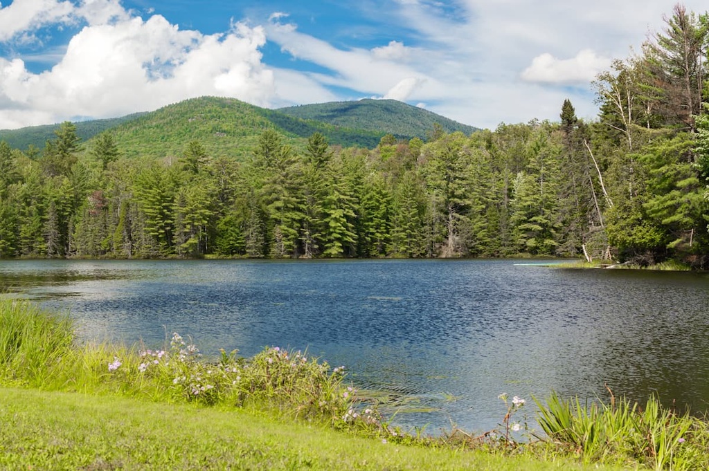
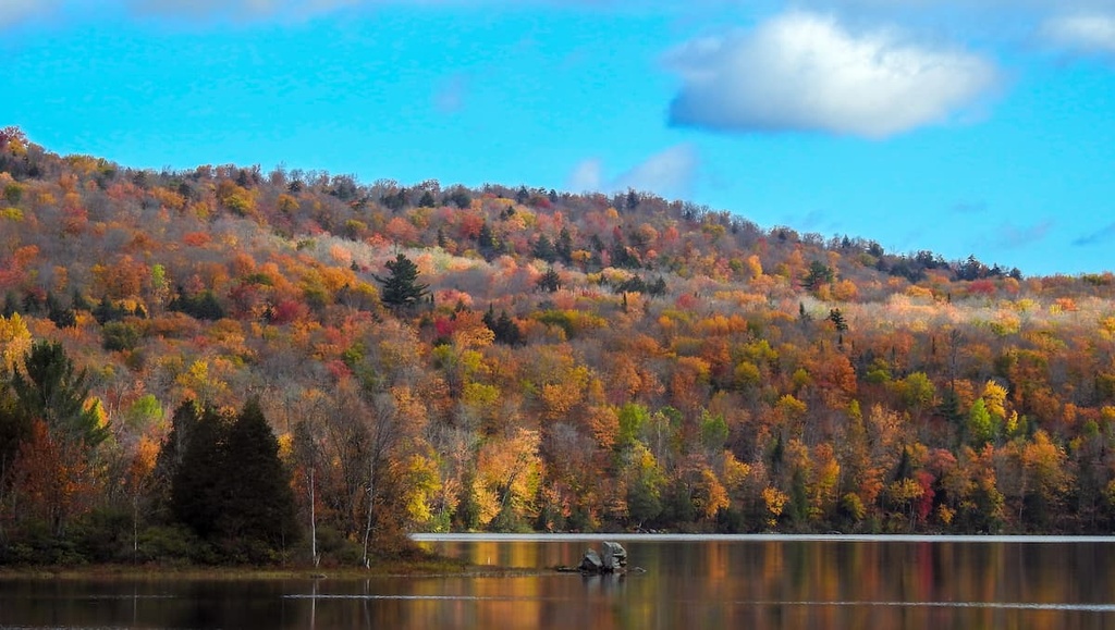
The Vanderwhacker Mountain Wild Forest features over 44 small ponds and lakes as well as a portion of the Boreas River. The rest of the wild forest that’s not covered by water is dominated by rolling and forested hillsides. A few of the summits of the taller peaks in the wild forest are tree-free, so they offer sweeping views of the Adirondack Park.
A well-marked trail leads hikers to the top of the wild forest’s tallest peak, Vanderwhacker Mountain, which provides views of the High Peaks in the Adirondack Mountains. The effects of forest fires that took place in the region during the early twentieth century are still visible from the summit of Vanderwhacker Mountain to this day.
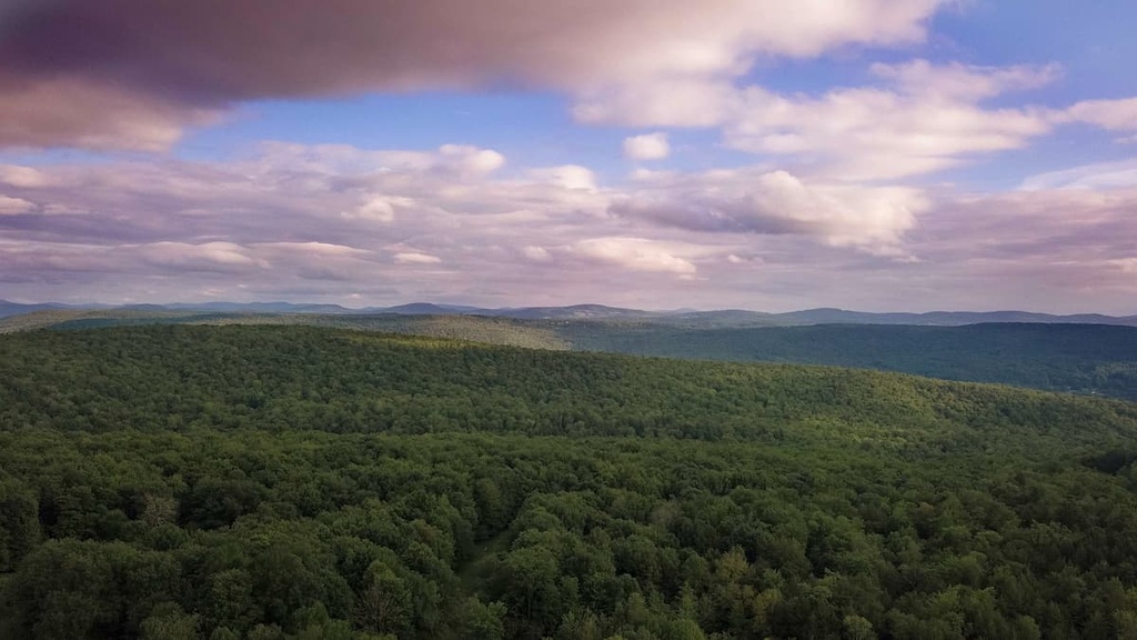
Within the wild forest, a series of forested ridgelines and a multitude of lakes define much of the landscape. As the Vanderwhacker Mountain Wild Forest is surrounded by other wild forests and wildernesses, hikers in the area often find that the region feels rather remote, despite the fact that it’s located close to a handful of sizable towns.
Additionally, the Vanderwhacker Wild Forest is located near a number of other parks and destinations for outdoor recreation. The forest is situated within the Adirondack Park near both the Jessup River and Blue Mountain wild forests. Furthermore, the High Peaks Wilderness and the Hoffman Notch Wilderness are located to the north of Vanderwhacker Mountain while both the Wilcox Lake and Lake George wild forests lie to the south.
The Vanderwhacker Mountain Wild Forest lies within the Adirondack Park in Upstate New York. The park’s boundaries are loosely defined by the Adirondack Mountains, a vast massif that encompasses much of the northern portion of the state.
The Adirondacks cover 5,000 sq. miles (13,000 sq. km) of terrain, and they roughly form a circular dome. The rocks visible throughout the wild forest are estimated to have begun forming 2 billion years ago. At this time, these rocks were actually situated along the seafloor near the equator.
The peaks that we see in the Adirondacks today were slowly uplifted during the Grenville orogeny, which took place between 1.5 and 1 billion years ago. Over the course of millions of years, intense heat and pressure transformed the region’s sedimentary rocks into the metamorphic rocks that are now characteristic of the Adirondacks.
On a topographic map, the Adirondack Mountains appear to be a continuation of the Appalachian Mountains. However, the two ranges are geologically distinct. The Adirondacks are found exclusively in Upstate New York while the Appalachian Mountains run most of the length of the eastern US and Canada.
The Adirondacks were further eroded away around 600 million years ago when a shallow sea covered the region. Around 10 million years ago, a hot spot beneath the Earth’s crust thrust the peaks to their current height. Alternating glacial and interglacial periods carved out the landscape over the course of millions of years, leaving behind the series of ridges and valleys that now define the region.
Major peaks that are located in the Vanderwhacker Mountain Wild Forest include Vanderwhacker Mountain, Green Mountain, Beaver Mountain, Oliver Hill, and Moxham Mountain.
The Vanderwhacker Mountain Wild Forest contains sections of the eastern forest-boreal transition ecoregion. In order to protect the ecoregion in the wild forest, lumber production has been drastically reduced and restricted within the Adirondack Park.
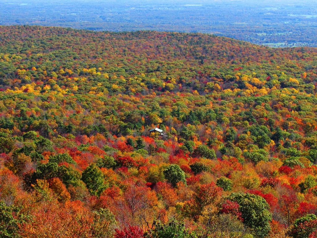
The rolling hillsides in the wild forest are dominated by a mix of coniferous and deciduous trees. Most of the lower elevations in the wild forest are dominated by northern hardwood species such as sugar maple, red maple, American beech, and yellow birch. Meanwhile, as you move to higher elevations in the wild forest, you’ll also find some coniferous trees, such as red spruce, black spruce, and balsam fir.
The vast network of wild forests and wilderness areas in the region allow for a variety of fauna to thrive in the Vanderwhacker Mountain Wild Forest. Larger mammals that live in the area include black bears, red foxes, bobcats, gray foxes, and white-tailed deer. Beavers, porcupines, and raccoons are also relatively common in the region.
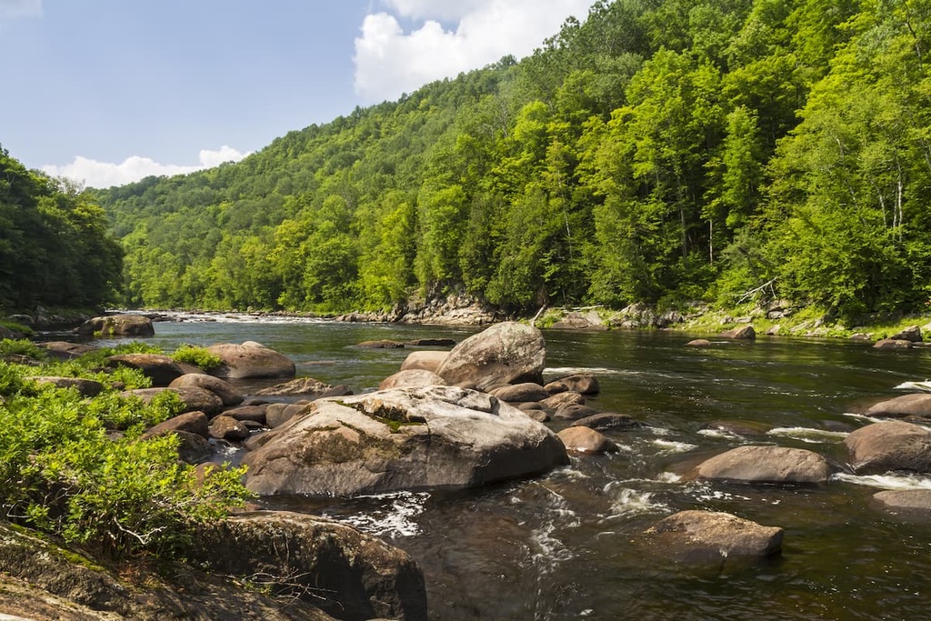
Among these dense forests lie dozens of lakes, ponds, bogs, and wetlands. The network of ponds, streams, and wetlands in the wild forest provides the ideal habitat for species like great blue herons, spotted salamanders, painted turtles, and bullfrogs. Some of the larger ponds in the area are also stocked with brook trout, brown trout, rock bass, smallmouth bass, and northern pike.
The land within the Vanderwhacker Mountain Wild Forest has been inhabited by humans for thousands of years. The earliest artifacts that have been uncovered in the region date back to around 15,000 to 7,000 BCE.
The Oneida (Onʌyoteˀa·ká) and Mohawk (Kanienʼkehá꞉ka) were historically the main Tribes that lived in the region. Both Tribes valued the region as it offered quality hunting grounds. In later years, the Oneida and Mohawk would also become two of the five original member nations of the Haudenosaunee (Iroquois Confederacy).
The Battle at Ticonderoga in 1609 (called the Iroquois War of 1609) was arguably the first recorded major fight between the Haudenosaunee and Europeans. Technically, the war was initially between the Haudenosaunee and the Innu, Algonquin, and Huron; however, Samuel de Champlain allied the French with the Huron, Innu, and Algonquin during the battle.
During the seventeenth century, the arrival of European diseases such as measles and smallpox decimated Haudenosaunee communities since Indigenous people in the area did not have any natural immunity to these ailments. The Oneida tried to remain neutral during the American Revolutionary War, but they were eventually forced to work as scouts for the rebel troops near Fort Stanwix.
The Treaty of Canandaigua was signed between the Oneida and other Haudenosaunee nations and the US at the end of the eighteenth century. The treaty originally granted the Tribes about 6 million acres (2.4 million ha) of land, a majority of which was located near the Adirondack Mountains.
The land granted through the treaty was drastically reduced in size by the US government over the following decades. This reduction in land eventually forced many Oneida to relocate to Wisconsin and parts of Canada. Today, the Oneida are organized into four nationally recognized nations, two in the US and two in Canada. This includes the Oneida Indian Nation in New York, the Oneida Nation of Wisconsin, Oneida at the Six Nations of the Grand River, and the Oneida Nation of the Thames.
After the Civil War, the land to the south of what’s now the Vanderwhacker Mountain Wild Forest was heavily logged, primarily for white pine, hemlock, and red spruce. Logging in the region was particularly heavy around the area’s waterways as harvested logs were primarily transported down rivers and streams to mills along the Hudson River and beyond.
In addition to logging, both the tanning and mining industries were particularly active in the region around what is now the Vanderwhacker Mountain Wild Forest. The region’s mines were mostly focused on iron ore extraction, though the iron was initially believed to be of low quality. However, when miners discovered that the impurities in the region’s iron were actually titanium deposits, mining became particularly important in the area during World War II.
The Adirondack Park was first protected under law in 1885 by the New York State Legislature as a forest preserve. It was then established as a state park in 1892 under legislation that outlined the specific boundaries of the Adirondacks. A few years later, in 1985, the park received constitutional protection in New York State.
In the years after the creation of the Adirondack Park, New York State started to acquire land in the Vanderwhacker Mountain region. The state had started acquiring land in the area as early as the 1870s, though most of the acreage in the wild forest was acquired in the late nineteenth century and during the Great Depression.
New tracts of land have been added to the Vanderwhacker Mountain Wild Forest in recent decades, too. In recent years, the state acquired two notable areas of land that were later added to the wild forest—the Boreas Pond Tract and the MacIntyre East Tract—both of which are also partly located within the High Peaks Wilderness.
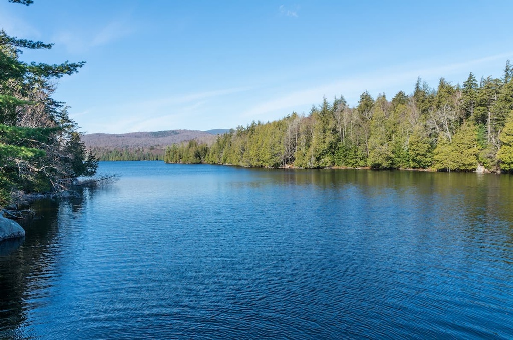
Nowadays, the Vanderwhacker Mountain Wild Forest is a relatively popular outdoor recreation destination. The wild forest features dozens of hiking trails along with over 40 small lakes and ponds that are popular spots among anglers and paddlers.
The Vanderwhacker Mountain Wild Forest is home to a number of wonderful trails for outdoor recreation. Here are a few of the trails in the forest that are worth checking out during your next visit.
The route up to the summit of Moxham Mountain offers hikers one of the most stunning views in the entire wild forest. From the trailhead, this trail climbs steadily through the forested landscape that defines much of the Adirondack Park. Once you get closer to the summit, the trees begin to thin, and you’ll eventually reach a rocky bluff.
At the summit, hikers have views of both the region’s rolling hillsides and Clear, Long, and Fuller ponds. This out and back trail is 5.5 miles (8.9 km) in length and it has 1,338 feet (408 m) of elevation gain.
Vanderwhacker Mountain is the tallest and most prominent peak in its namesake wild forest. The trail to the top of the mountain starts out as rather flat but it becomes steeper as you near the summit. Once at the top, hikers have the option of ascending a fire tower to get unobstructed views to the north.
This route is known for having one of the best views of the High Peaks in the Vanderwhacker Mountain Wild Forest and in the Adirondack Park as a whole. In total, this hike is 6.1 miles (9.8 km) in length and it has 1,706 feet (520 m) of elevation gain.
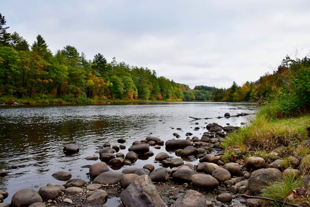
There are dozens of ponds and lakes that are located within the Vanderwhacker Mountain Wild Forest. One of the most popular bodies of water in the wild forest among visitors is Wolf Pond, which is fed by Andrew Brook along its northern shore. The route to Wolf Pond is relatively flat, though it features some rolling terrain.
From Wolf Pond, hikers can enjoy views of the region’s surrounding ridgelines and peaks, making the trek to the area well worth the effort. The trail to Wolf Pond is 5.3 miles (8.5 km) long round trip and it has 410 feet (125 m) of elevation gain.
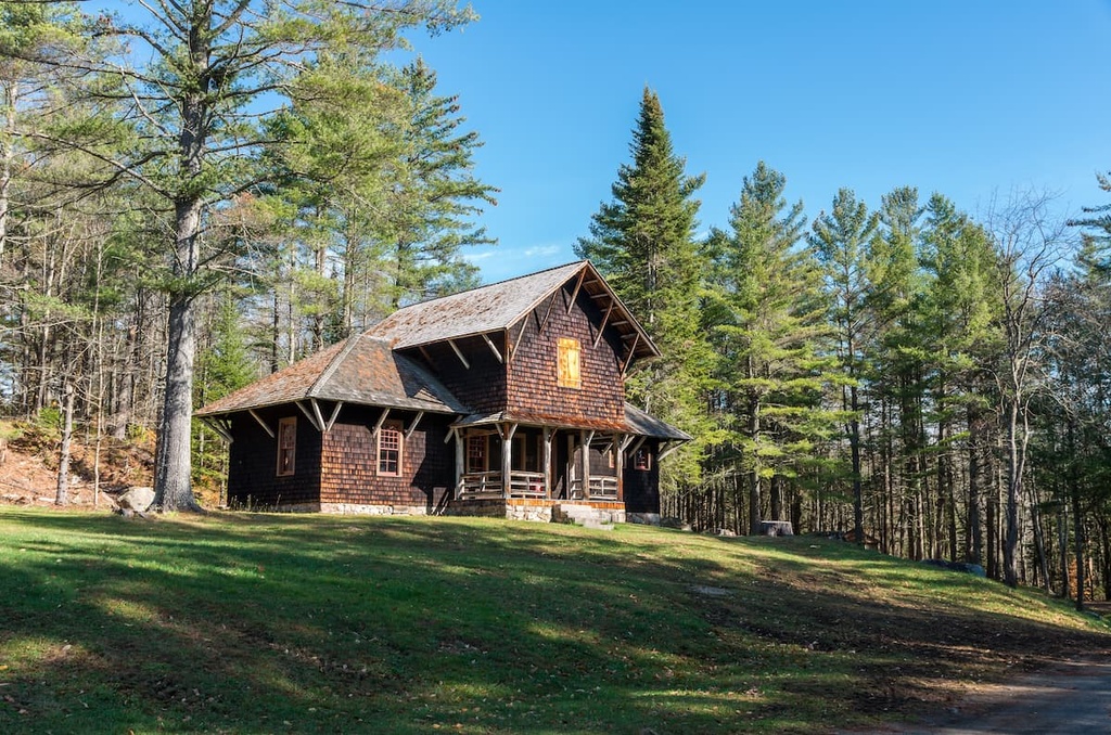
Looking for a place to stay near the Vanderwhacker Mountain Wild Forest? Here are some of the best cities and towns to check out in the region.
The closest town to the wild forest is Minerva, which is home to around 800 residents. The town of Minerva was named after the Roman goddess of wisdom and was established back in 1804.
As it is located in the heart of the Adirondack Mountains along the shores of Minerva Lake, the quaint town of Minerva features plenty of opportunities for various outdoor activities, such as hiking, camping, swimming, biking, cross-country skiing, and snowmobiling.
Minerva also provides an ideal escape from the hustle and bustle of the more popular vacation towns in the region like Lake George. The nearby town of North Creek also offers restaurants and amenities for visitors to Minerva to enjoy during their stay.
The city of Saratoga Springs is located to the south of Vanderwhacker Mountain Wild Forest. With a population of around 29,000 residents, the city of Saratoga Springs is easily one of the largest communities in the region. It is also known for its close proximity to year-round outdoor recreation destinations in the Adirondacks.
The famous thoroughbred horse racing track, the Saratoga Race Course, lies within the city limits of Saratoga Springs. Other notable sites to visit while in the city include the Saratoga Springs History Museum, Saratoga Arts Center, and the National Museum of Racing and Hall of Fame.
The surrounding Adirondack Mountains provide visitors to Saratoga Springs with opportunities for hiking, biking, golfing, and various water sports during the summer months. The downtown streets of the city are also lined with local shops, restaurants, cafes, and sporting goods stores, so you can find anything you might need in Saratoga Springs during your trip to the area.


