
Scan the QR code and open PeakVisor on your phone
Chuyunshan Nature Reserve has 6 named peaks. The highest is Chuyunshan at 2,772 m. Other notable peaks include Damenglangshan, Menglangshan and Donglaishan.
In southern Taiwan’s countryside are the misty natural forests of Chuyunsahn Nature Reserve (出雲山自然保留區), an area known for its scenic landscape of dramatic mountains. Out of 6 named peaks, Chuyunshan (出雲山) is the tallest and most prominent, measuring 2,772 meters (9,094 ft).
Chuyunshan Nature Reserve lies at the intersection of Kaohsiung City’s (高雄市) Taouyan (桃源區) and Maolin (茂林區) districts. Holding 6,248 ha (15,439 acres) of broadleaf and coniferous natural woodlands, this southern Taiwan nature reserve has an elevation range of 400 to 2,772 meters (1,312 to 9,094 ft) of low valleys and lofty pinnacles.
Part of the Central Mountain Range (中央山脈), Chuyunshan Nature Reserve’s peaks are staggering, with Chuynshan nearly reaching 3,000 meters (9,843 ft). The other five mountains are Damenglangshan (大孟浪山), Menglangshan (孟浪山), Donglaishan (東來山), Xinjishan (新集山), and Dongfanlishan (東蕃里山).
These six named hills lie near some of southern Taiwan’s top nature destinations. Nearby in the north is Tenghih National Forest (藤枝國家森林遊樂區), while to the southwest is the butterfly sanctuary of Maolin National Scenic Area (茂林國家風景區). In the east is Guanshan Major Wildlife Habitat (關山野生動物重要棲息環境), while the southern peaks of Yushan National Park (玉山國家公園) lie in the northeast.
Much like Taiwan’s precipitous region in Yushan National Park, multiple climate zones nurture specific plant growth on the towering hills. Thus, a subtropical climate and plant life thrive in the lower elevation, climbing to warm temperate, temperate, and finally cold temperate in the higher elevations.
Even though the terrain is dramatically varied, Chuyunshan Nature Reserve doesn’t escape southern Taiwan’s warm climate, with an average annual temperature of 77℉ (25℃). In the height of summer, the average temperature reaches 86℉ (30℃), while it dips to 64℉ (18℃) in winter. Meanwhile, the humidity drives copious rainfall exceeding 3,000 mm (118 in), mainly during the summer between May and September.
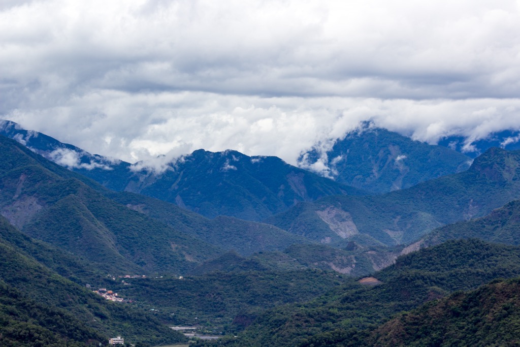
Chuyunshan Nature Reserve’s hills belong to the Central Mountain Range, Taiwan’s longest massif spanning 260 km (161 mi). Stretching along Taiwan’s inland spine, the Central Mountain Range has the most dramatic hills in the center, which taper in height and intensity towards the north and south of the island.
Chuyunshan and the surrounding hills’ rock strata belong to the Bilushan layer from the Eocene epoch and the Lushan layer of the Miocene epoch, comprising an intermixture of slate, phyllite, and metamorphic sandstone.
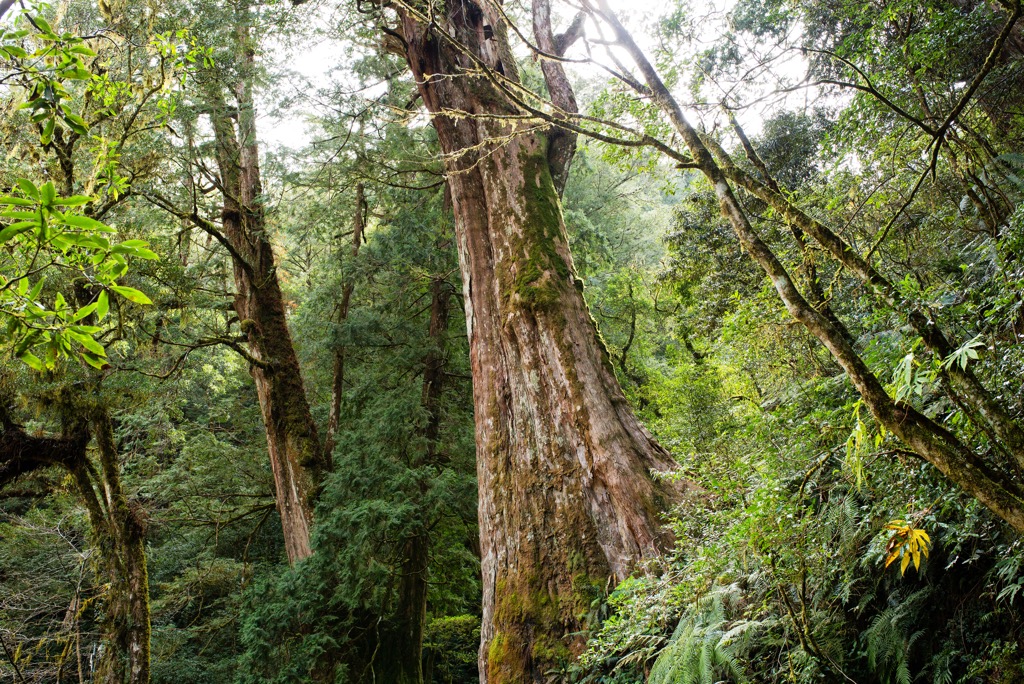
There are four distinctive forest zones in the Chuyunshan Nature Reserve. In the subtropical zone from 500 to 800 meters (1,640 to 2,625 ft), Taiwan ash and Jiuxong trees thrive. The broadleaf forest climbs along the elevation from 800 meters to 2,000 meters (2,625 to 6,562 ft), where a flourishing camphor forest grows. An oak forest dominates the vegetation between 2,000 to 2,300 meters (6,562 to 7,576 ft), while red juniper thrives between 2,300 to 2,500 meters (7,576 to 8,202 ft). Above 2,500 meters (8,202 ft) lies a hemlock forest.
The Rukai people of Taiwan trace their origins to Chuyunshan, considered one of their birthplaces. This area is home to early tribal ruins, with one notable discovery being the Wanshan Rock Sculpture. This remarkable find provides a complete record of the prehistoric carvings and paintings created by the Rukai ancestors. The Wanshan Rock Sculpture is now considered a priceless treasure in Taiwan and serves as the highest national cultural site in the country.
Explore these hiking trails and areas in and around Chuyunshan Nature Reserve:
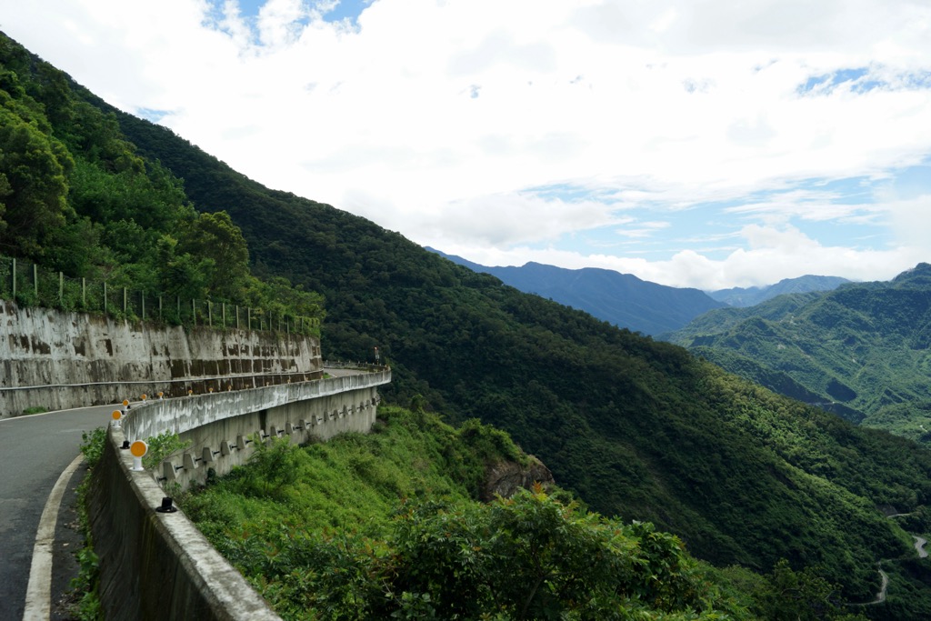
Lying west of Dongfanlishan is the forest-soaked hill of Fanlishan (蕃里山). While climbing up this steep peak with countless collapses, you’ll understand how access to these mountains is limited due to the impenetrable dense forest and sheer terrain.
The path to Fanlishan’s summit is adorned with overgrowth, creating a shaded route to the top. On the way, you’ll encounter evidence from the Rukai tribe who once resided in these hills. Stone-stacked walls, ancient fireplaces, and discarded kitchenware offer a snapshot of these mountain-dwelling people.
When you least expect it, you’ll reach Fanlishan’s overgrown summit, with lush ferns and a thriving broadleaf forest that obscures any view. The only parts of the trail that afford any vistas are the narrow paths atop the sheer cliffs in the lower elevations, where you’ll need to practice caution while taking in Chuyunshan Nature Reserve’s verdant, undulating hills.
The revered South Section Hiking Trail is Eastwards from the Chuyunshan Nature Reserve. The route is known for its intensity, challenging conditions, and arduous 53 km (33 mi) alpine trek. Situated in the southernmost region of Yushan National Park, the South Section Hiking Trail encompasses six mountains, all exceeding 3,000 meters (9,843 ft). Five belong to Taiwan’s 100 tallest peaks, also known as Baiyue.
A dream for experienced hikers who love a physical challenge, you’ll begin ascending Kuhanuoxin Shan (庫哈諾辛山), then make your way south as you summit Guan Shan (關山), Hainuonanshan (海诺南山), Xiaoguan Shan (小關山), Maxibaxiushan (馬西巴秀山), the only non-Baiyue hill, and finally Beinan Zhushan (卑南主山).
Due to its remote location and untouched land, you’ll find thriving alpine plant forests and wildlife in their natural habitats. The real winner is the sweeping outlooks of jagged backcountry mountains rippling before you from each summit. From Kuhanuoxin Shan in the north, you can even locate Yushan (玉山), Taiwan’s tallest peak.
The demanding trail has slippery gravel slopes, vertical climbs, giant boulders, and a constant undulating path with a height difference of 2,200 meters (7,218 ft). However, the enchanting juniper woodlands and dramatic mountainous scenery are well worth the effort. In addition, you’ll find evidence of mountain-dwelling life from the Bunun tribe in the hills’ lower elevations, where they lived before the Japanese forced their removal.
Situated above the Chuyunshan Nature Reserve is the flourishing broadleaf oasis of Tenghigh National Forest, featuring several nature trails to admire the emerald countryside's seasonal flowers and scenic outlooks. One trail showcasing this beauty is the Dong Tengzhi Shan Hiking Trail.
This picturesque pathway leads to the summit of Dong Tengzhi Shan (東藤枝山) over a distance of 3.5 km (2 mi). Along the trail, the swallowtail butterflies and emperor moths add vibrant splashes of color as they gracefully navigate the dense woodlands.
While at the peak of Dong Tengzhi Shan, an observation deck awaits, providing a panoramic vista of the forest below. From this vantage point, marvel at the splendid views of Yushan, Beidawushan (北大武山), Guan Shan, and Xiaoguan Shan.
To the west of Chuyunshan Nature Reserve is Maolin National Scenic Area, which showcases a butterfly sanctuary nestled in a pocket of mountainous terrain with gurgling streams, picturesque valleys, and steaming hot springs. This luscious area is a hiker’s dream, with countless paths to explore this region’s beautiful biodiversity.
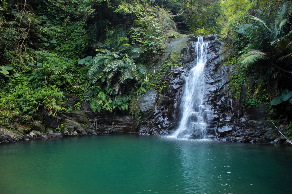
The area is known for its variety of butterfly species, including the purple crow and swallowtail butterfly. Witnessing these colorful insects in their natural habitat is a photographer's and wildlife enthusiast’s dream. Beyond the butterfly sanctuary, Maolin Scenic Area boasts a mesmerizing valley adorned with breathtaking waterfalls.
As you explore the area, you'll have the opportunity to encounter several cascading waterfalls, each with its own unique charm. These flowing wonders create a serene atmosphere, making it an ideal place to relax and connect with nature.
Shi Keng Hot Spring (十坑溫泉) in southern Taiwan is a prominent attraction in the region. Visitors must trek 10 km (6 mi) to access the hot spring, leading to visually striking cavern walls exhibiting crystallized white, turquoise, and black hues.
The hot spring is a tributary of the Baolai River and features neutral sodium bicarbonate waters that simmer at an approximate temperature of 50°C (122°F). Shi Keng Hot Spring stands out among the area's various hot springs. Its allure lies in its captivating scenery and serene ambiance.
Along the Shi Keng Hot Spring trek, Taiwanese carp gracefully swim in the streams while Japanese tree frogs hop along the river's edge. The area's abundant foliage attracts a diverse bird population, providing opportunities for hikers to encounter species such as the Taiwan blue magpie and blue-bellied pheasants along the trail.
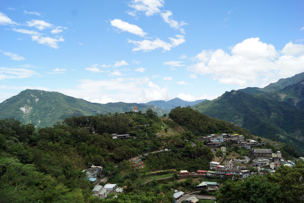
Kaohsiung City and Pingtung City (屏東市), located near Chuyushan Nature Reserve, offer distinctive attractions and a lively cultural scene.
Kaohsiung City, basking in the southern tropical sunshine and enjoying a consistently warm climate throughout the year, exudes a distinct atmosphere of tranquility. As Taiwan's southern hub, the city boasts a more laid-back ambiance, immersing visitors in a relaxed and leisurely environment.
Firstly, explore one of Kaohsiung’s protected areas of Shoushan National Nature Park (壽山國家自然公園), known for its vibrant nature of coastal hills, a remote Banyan forest, and remarkable limestone caves. In addition, the park is home to a diverse population of monkeys thriving in its mountainous forest. Spend a day traversing the park's hiking trails, which offer stunning vistas of Kaohsiung City's skyline and the nearby coastal waters.
Take a ferry to Cijun Island from Kaohsiung Harbor to enjoy beach walks, fresh seafood, and refreshing cocktails. Experience tropical vibes from the palm-tree-lined beach and explore the ornate Cihou Tianhou Temple for a cultural experience. Local delicacies include fresh grilled calamari and tempura prawns.
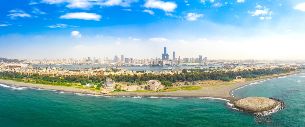
The serene environment of Kaohsiung Central Park (中央公园) is also one of the cities leading attractions. The local government established the park to transform the city’s once-industrial past into a liveable and vibrant metropolis. Complete with a tranquil lake, gentle waterways, fascinating water fountains, and an oasis of greenery, it's the perfect place to relax and admire nature, with the city skyline peeking over the trees.
Pingtung City is its county's serene and captivating capital, often considered a hidden gem. With its tranquil atmosphere, the city offers a lesser-explored destination that exudes an artistic and cultural charm in a stunning landscape that embodies the essence of slow-island living.
Explore Pingtung’s 1,005-ha (2,483 ac) flatland forest that doubles as an energy-efficient ecological park. Linhousilin Forest Park (林後四林平地森林園區) has countless trails, from shaded woodland trails to paths that look onto Taiwan’s mountainous inland region. Forestation efforts are in place to rebuild the natural ecology of Beidawushan and neighboring peaks. Nature lovers will appreciate the park’s diverse ecology and its work on creating a more green environment.
Next, Liudui Hakka Cultural Park (六堆客家文化園區) showcases exhibitions that center on the traditions and lifestyle of the Hakka people in the Pingtung region. When visiting, you can participate in Hakka language lessons and witness cultural performances, including Hakka dances and songs. The park spans 30 ha (74 ac) and features a flower garden, lake, expansive grasslands, and beautifully landscaped grounds.
Finally, Pingtung Night Market (屏東觀光夜市) is perfect for exploring Taiwan's food scene in the evening. Here, you can find various street vendors and food stalls offering unique dishes that sizzle and fry, filling the air with delicious aromas. It’s easy to sample Taiwan's cuisine, including turkey rice, swordfish soup, and beef noodles, through bite-size snacks at the market.
While Chuyunshan Nature Reserve lies near Kaohsiung City, getting there involves limited public transport and a long drive. Start your journey in Kaohsiung City, connected to Taiwan’s major cities via the Taiwan High-Speed Rail (HSR) and local express train (TRA). Then, rent a car or scooter to make the 128 km (80 mi) drive to the Reserve.
Namasia, Kaohsiung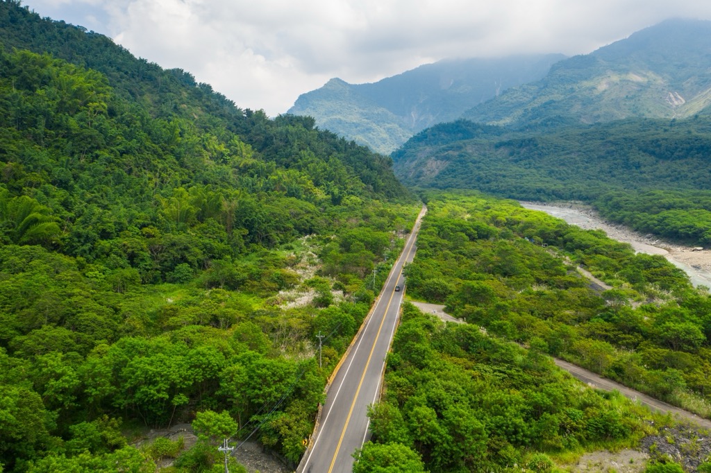


The highest peak in Chuyunshan Nature Reserve is Chuyunshan, at 2,772 m.
Notable peaks in Chuyunshan Nature Reserve include Chuyunshan, Damenglangshan, Menglangshan, Donglaishan and Xinjishan.


