
Scan the QR code and open PeakVisor on your phone
Pizzo di Evigno has 12 named peaks. The highest is Pizzo d'Evigno at 989 m. Other notable peaks include Pizzo Montin, Monte Ceresa and Monte Caro.
Pizzo d’Evigno is a mountain massif that’s located in the Ligurian Prealps of northern Italy. The massif contains 12 named peaks, the highest and the most prominent of which is Pizzo d'Evigno (989 m/3,245 ft).
Pizzo d’Evigno, also known as Monte Torre or Torre d’Evigno, is situated along the border of the Ligurian provinces of Savona and Imperia, on the western Ligurian riviera. The massif is located close to the municipalities of Andora, Chiusanico, Diano Arentino, Diano S. Pietro, Pontedassio, Testico, and Villa Faraldi.
Part of the Pizzo d’Evigno massif is protected by a nature reserve due to its important biodiversity. The protected area contains around 20 sq. km (8 sq. mi) of land.
To the south of the main peak of the massif, there’s a ridge that separates the Impero Valley from the Diano Valley. To the east, there’s also a ridge that divides the Merula torrent and the adjacent Monte Ceresa. Pizzo d’Evigno takes its name from Diano Evigno, a small hamlet that’s located on the mountain's southeastern slope.
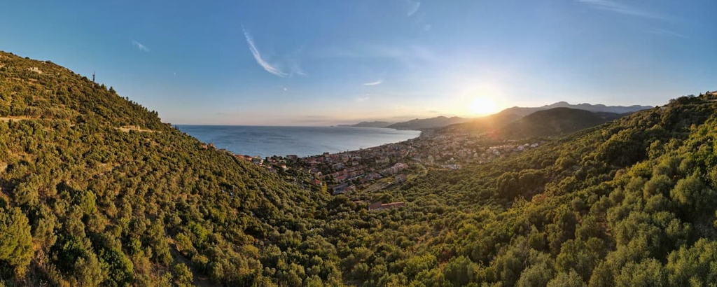
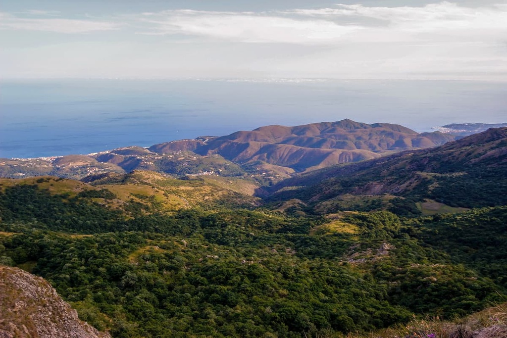
The peak of Pizzo d’Evigno is arguably one of the most beautiful panoramic points in the area around Imperia. From the summit, you can enjoy views out over the Ligurian Alps and Mediterranean Sea as well as across the Ligurian Apennines, Tuscan-Emilian Apennines, and Apuan Alps.
Pizzo d’Evigno is part of the Ligurian Alps, which were formed millions of years ago from the sediments at the bottom of an ancient ocean. The mountains emerged around 38 million years ago and have been shaped by water and other elements over the course of millions of years.
Pizzo d’Evigno is a grassy pyramid-shaped mountain with slopes that are largely made up of pastures and that are dotted with emerging limestone and marl rocks. There is a slight imbalance in the massif between the steep northern slopes and the more gentle southern slopes that fall toward the coastline.
The area around Pizzo d’Evigno contains part of the San Remo flysch complex, which primarily features marly limestone, marls, and shales.
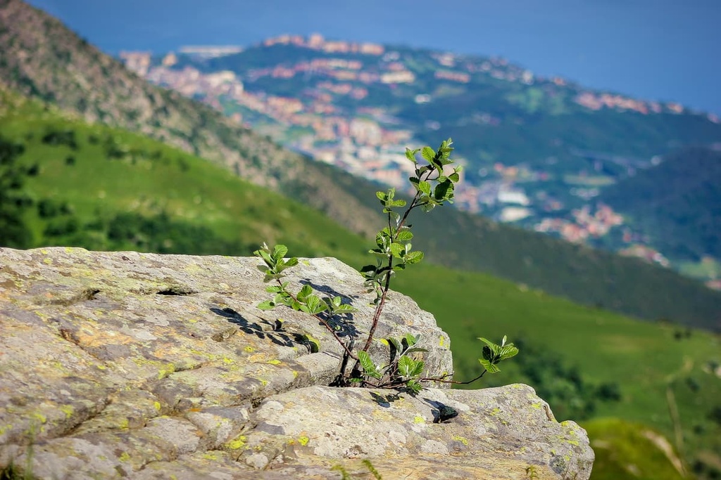
The habitats on and around Pizzo d’Evigno consist primarily of grassy pasture and mixed woodlands.
There are also pine woodlands on the northern slopes of the massif and Mediterranean scrub areas found elsewhere. The northern slopes of the massif are more wooded, whereas the southern slopes are characterized by human-influenced grasslands that are slowly being re-conquered by woody vegetation.
A small 20 sq. km (8 sq. mi) area of the Pizzo d’Evigno massif has been protected due to its important biodiversity. It has also been ruled as an area of community interest.
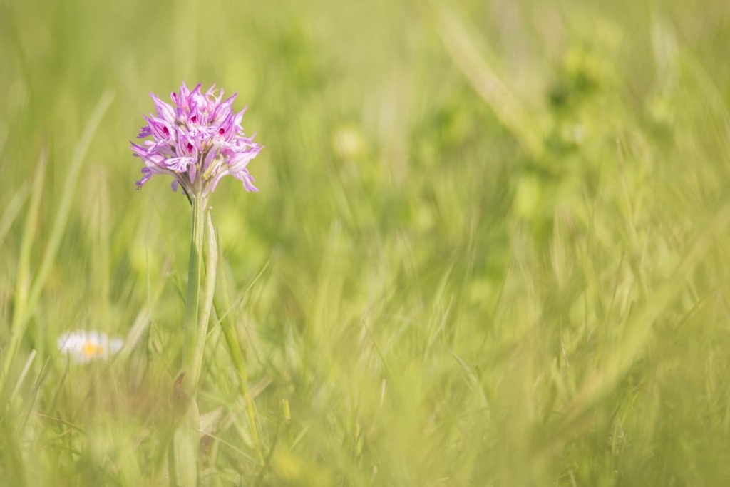
The extensive grassy terrain on the massif is the most interesting habitat in the region in terms of its flora. In particular, it contains a large population of orchids that includes at least 20 different documented species.
Some of the species documented include the giant orchid, three-toothed orchid, pink butterfly orchid, and burnt orchid, amongst others. There are also several Ophrys species found on the massif such as the somber-bee orchid, early spider orchid, Bertolini’s bee orchid, and bee orchid.
Other interesting plant species found in this habitat are the Montpellier aphyllanthes, and the Alpo globe daisy.
The protected area around the massif is considered an area of interest not only for its flora but also for its fauna. Wildlife on the massif includes the Montpellier snake and numerous birds, such as the harrier eagle, European nightjar, and the red-backed shrike.
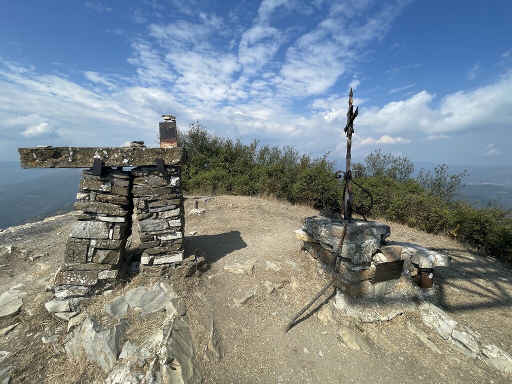
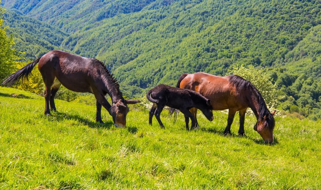
The slopes of Pizzo d’Evigno are dotted with caselle, which are characteristic dry stone constructions that are typical of western Liguria. These structures are the ancient seasonal shelters of shepherds who took their livestock to graze on the grassy slopes of this small mountain massif during the summer months.
Shepherding is still practiced in the region today and it’s not uncommon to come across cows, sheep, and horses along the footpaths.
The surrounding area features extensive evidence of early human presence. There have been various archeological discoveries in the area, including a Bronze Age ax, which is now housed in the civic museum of Diano Marina.
There are also remnants of Roman settlements around the massif. In particular, the town of Diano Marina was believed to be a former resting stop along the Roman road Via Giulia Augusta.
In the eleventh century, the area’s economy was boosted when the Benedictine monks introduced the cultivation of olive trees to the region. By the sixteenth century, the community had become the main commercial base for olive oil in the western part of the Ligurian riviera.
Today the area is better known for its tourism industry, as visitors from all over Europe come to enjoy the region’s mild climate. It is also known for its agricultural activity, particularly with respect to the cultivation of basil, tomatoes, and flowers.
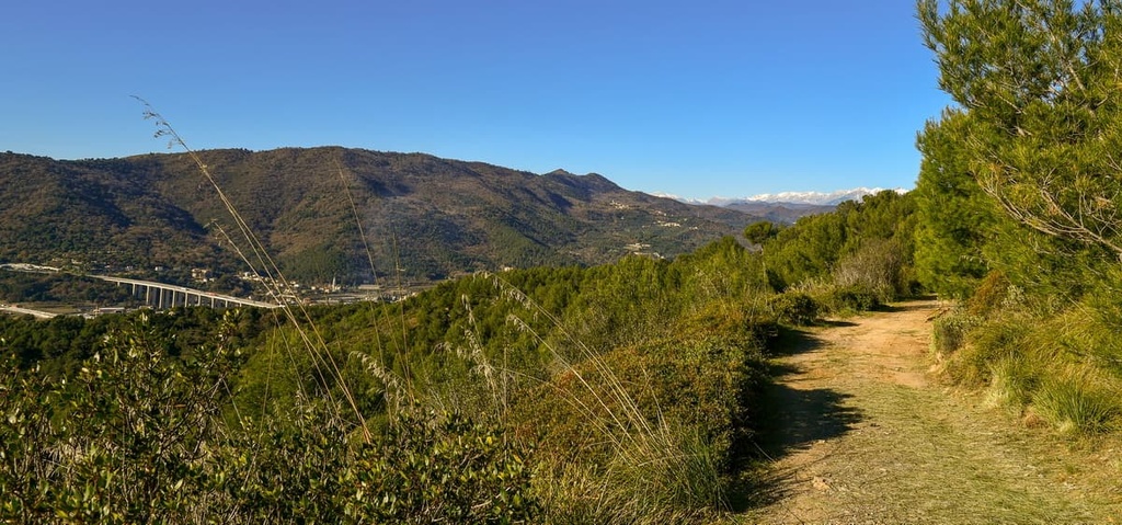
Although the Pizzo d’Evigno is a small area, there are plenty of opportunities to enjoy a hike to the peak where you can enjoy the stunning panoramic views. There are also plenty of nearby hiking trails available if you want to travel around the wider area.
There are several different ways to enjoy a walk to the peak of Pizzo d’Evigno:
Join the tenth leg of the Ligurian High Route (Alta Via dei Monti Liguri) up to the peak of the nearby Monte Galero. This part of the route can be walked between Colle San Bartolomeo d’Ormea and Colle San Bernardo di Garessio.
The full route is made up of 43 legs that travel between Ventimiglia at the French border and La Spezia at the Tuscan border.
The Ligurian Alps Regional Natural Park is located around a 1.5 hours drive from Pizzo d’Evigno, so it’s close enough to consider for a day trip. It’s a great place to visit thanks to its myriad of hiking trails that take you across valleys and into stunning Alpine environments.
Pizzo d’Evigno’s proximity to the coast of Liguria means that a visit to the massif gives you plenty of opportunities to discover the region’s nearby towns. Here are some of the best cities and towns to check out during your visit.
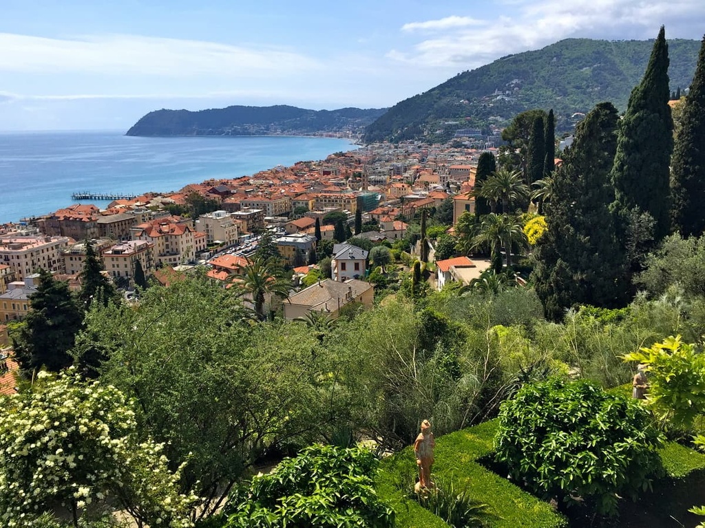
Alassio is located on the western part of the Ligurian riviera in the province of Savona. The town is flanked by a long sandy beach and has many bars and restaurants to enjoy. Alassio’s most famous attraction is its “muretto di Alassio,” a wall full of colorful tiles filled with famous people’s autographs.
Other attractions in Alassio include the botanical gardens of Villa della Pergola, which were once a British residence but are now a luxury hotel. The gardens are open to the public during the summer, however the villa can be visited either as a guest of the hotel or its onsite restaurant.
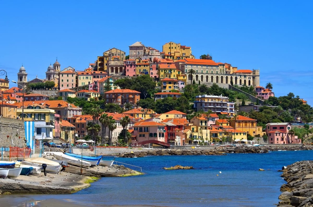
Imperia is situated between Savona and Ventimiglia on Liguria’s western riviera. The town is best known for its history of flower and olive cultivation.
Imperia is also known as a summer holiday destination. It offers plenty of beaches, bars, and restaurants for visitors to enjoy.
Diano Marina is a small coastal town with beautiful long sandy beaches that are commonly associated with Liguria’s western riviera. The town is located between Alassio and Imperia and is regularly part of the Giro d’Italia and Milano–Sanremo cycling races.
Popular activities in Diano Marina include enjoying the local beaches, enjoying the local bars and restaurants, cycling along the seafront, and hiking along the nearby footpaths.


The highest peak in Pizzo di Evigno is Pizzo d'Evigno, at 989 m.
Notable peaks in Pizzo di Evigno include Pizzo d'Evigno, Pizzo Montin, Monte Ceresa, Monte Caro and Monte Mezzogiorno.


