
Scan the QR code and open PeakVisor on your phone
Parco Nazionale del Circeo has 2 named peaks. The highest is Monte Circeo at 541 m. Other notable peaks include Monte Circello.
Circeo National Park is one of the 25 national parks in Italy. It is located in the Lazio region and its main feature is its diverse landscapes, which include mountains, forests, wetlands, and beaches with sand dunes. There are few other places where you can find all of this in Italy, particularly within a couple of hours' drive of Rome. In total, there are 2 named mountains in the park, the highest and the most prominent of which is Monte Circeo (541 m / 1,775 ft).
The name of Circeo National Park (Parco Nazionale del Circeo) refers to the park’s main feature—Mount Circeo, which is located on the cape of the same name along the Tyrrhenian Sea. Therefore, the park and the mountain are also known as Cape Circeo or Circeo Promontory.
In turn, the name of the mountain comes from the name of the enchantress Circe (Maga Circe in Italian), one of the main characters of Homer's The Odyssey.
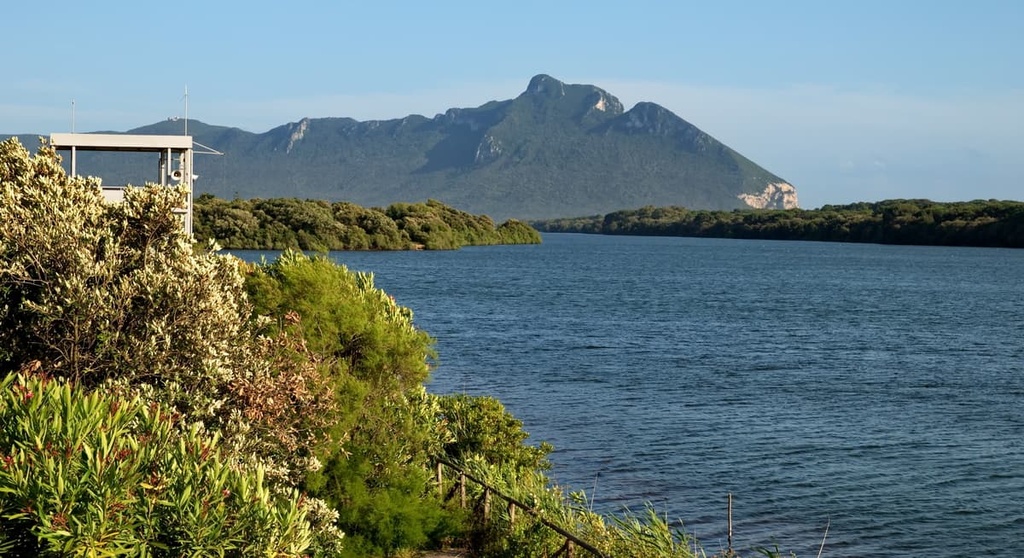
Locals say that, from the west side of the town of Anzio, the landscape’s silhouette looks like that of a woman lying down and that the mountain’s highest point is her nose. From the east, however, such as from the towns of Sperlonga or Gaeta, the landscape does not look like a cape at all, but like an island.
The second important detail about the mountain's name is that according to one of the popular versions of the myth, Cape Circeo is the famous mythological island of Aeaea from The Odyssey.
According to this myth, Aeaea is where the enchantress Circe lived. The island also appears in the famous poem Argonautica by the ancient Greek author Apollonius Rhodius. This poem, unlike Homer’s The Odyssey, accurately indicates the island’s position here on Cape Circeo.
In The Odyssey, Odysseus stayed with Circe for a year during one of his many stops on his 10-year journey back home from Troy (in present-day Turkey) to Ithaca, which is an island in Greece. From here, Odysseus sailed to the kingdom of Hades to learn from the soothsayer Tiresias about the trials that lay ahead of him. He then continued on past the Island of the Sirens on his way home.
It is believed that, during the times of Homer, the cape was indeed an island. In other words, during this time, the cape was not connected to the mainland by a piece of land as it is today. There is plenty of evidence for this: the discovery on the cape of sandstone, which was later found at a depth of 300 m (984 ft), fossilized marine furrows, and traces of marine erosion, among others.
This long and tangled story ends with Circe giving birth to Odysseus’ son Telegonus, who, according to one version of the myth, later caused the death of his father by killing him accidentally in battle.
Circeo National Park is one of the oldest national parks in Italy, as it was founded in 1934. The only national parks in the country that are older than Circeo are Gran Paradiso (1922), Abruzzo, Lazio, and Molise (1923), and Stelvio (1935).
The park is located on the Tyrrhenian Sea coast between the cities of Latina and San Felice Circeo in the Lazio region of west-central Italy, of which Rome is the capital. The area of the park is 84.40 sq. km (32.59 sq. mi). It’s one of the smallest national parks in Italy but it has a huge concentration of attractions for such a relatively small protected region.
In particular, the park includes several forest nature reserves that are protected with the utmost care. These include the “Selva di Circe" UNESCO Biosphere Reserve (Riserva della Biosphere UNESCO “Selva di Circe"), but also the "Rovine di Circe" Nature Reserve (Riserva Naturale “Rovine di Circe"), “Piscina delle Bagnature” Nature Reserve (Riserva naturale Piscina delle Bagnature), "Lestra della Coscia" Nature Reserve (Riserva naturale "Lestra della Coscia",) Selva Piana-Baia di Argento and Eucalipteto.
Circeo National Park is one of the most easily accessible national parks in Italy, thanks to its close proximity to the major cities and resorts of the Lazio metropolitan area. The distance from Rome to San Felice Circeo, which is located at the foot of Mount Circeo, is 105 km (65 miles) or an hour and a half by car.
To get to the park via public transport, take the Trenitalia trains from Rome to the Monte San Biagio-Terracina Mare station. From there, take the local Cotral bus to Terracina, where you will change buses to get to San Felice Circeo or Sabaudia (if you are interested in the forested part of the park). The ticket costs about €1.30 for the entire journey.
Capes generally form as a result of coastal erosion—but not in the case of Circeo. This cape-mountain is a remnant of the geological processes that formed the Apennine Mountains, that is, it is part of this long mountain system that stretches across Italy.
Various geological studies have also shown that the promontory is mainly composed of marl and sandstone that dates back to the Paleogene and limestone from the Lower Jurassic.
These two features clearly distinguish the Circeo from other mountains on the coast, including the famous Mount Vesuvius (1,281 m / 4,202 ft) near Naples. Many of these other coastal mountains in western Italy are of volcanic origin.
In general, the parks in Italy are located within a single natural area, be that a forest, mountain, valley, or coast. But the landscape of Circeo National Park is a combination of five natural areas, which makes it unique in this respect.
In fact, this park includes the Mount Circeo promontory, dunes of the Tyrrhenian Sea coast, selva forest, wetlands and lakes, and an island in the Tyrrhenian Sea. Here’s what you need to know about each of them.
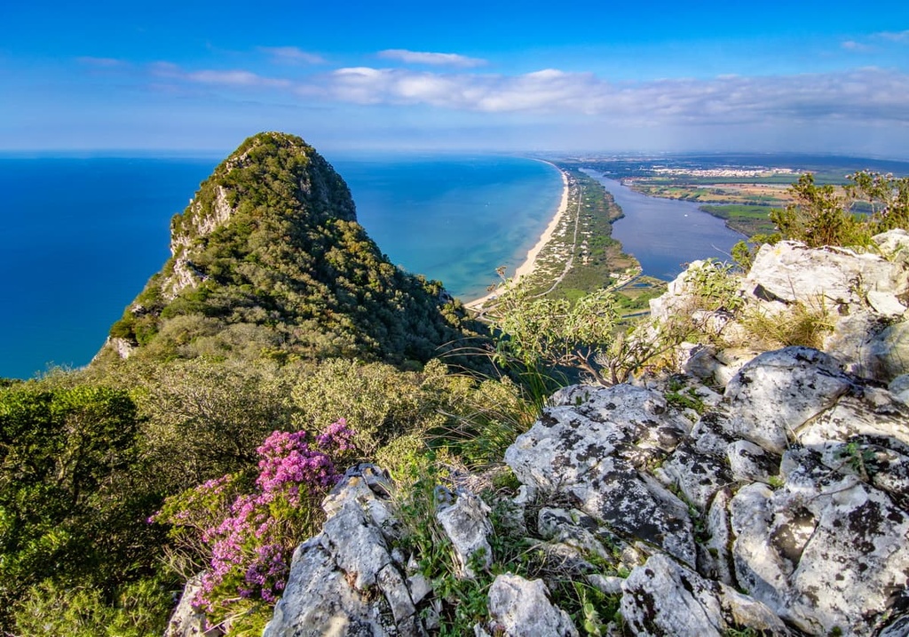
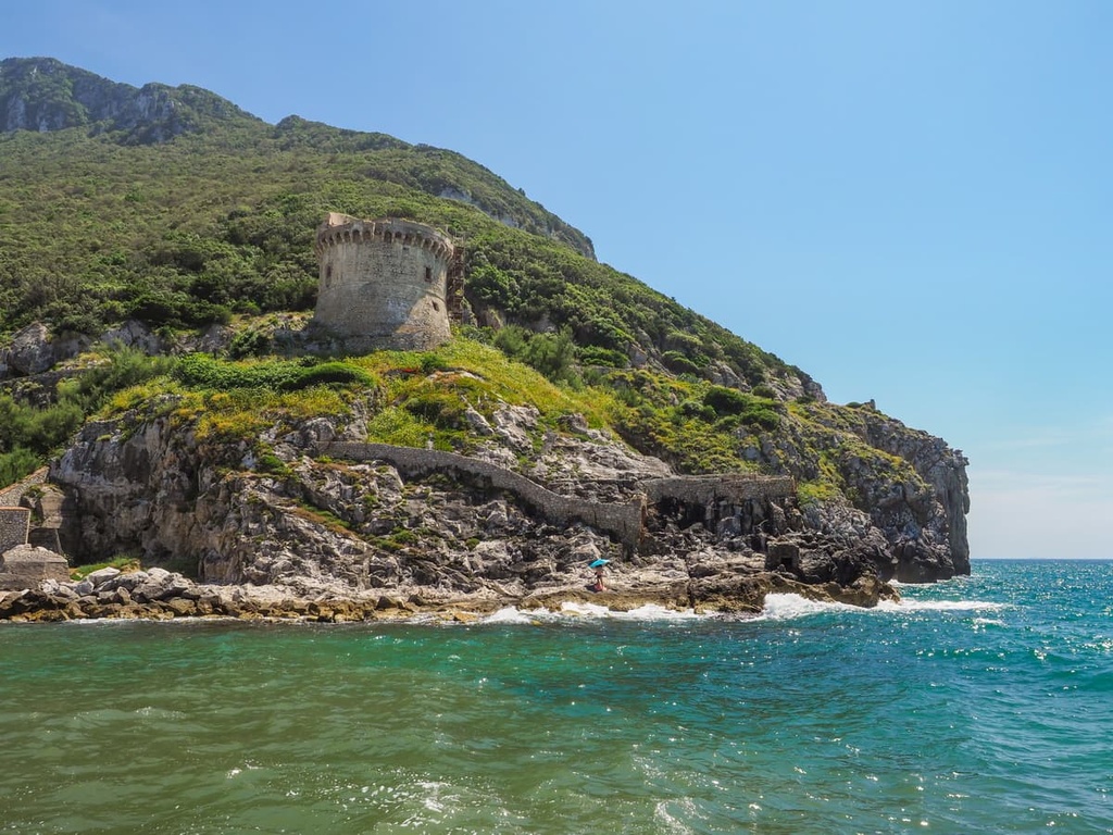
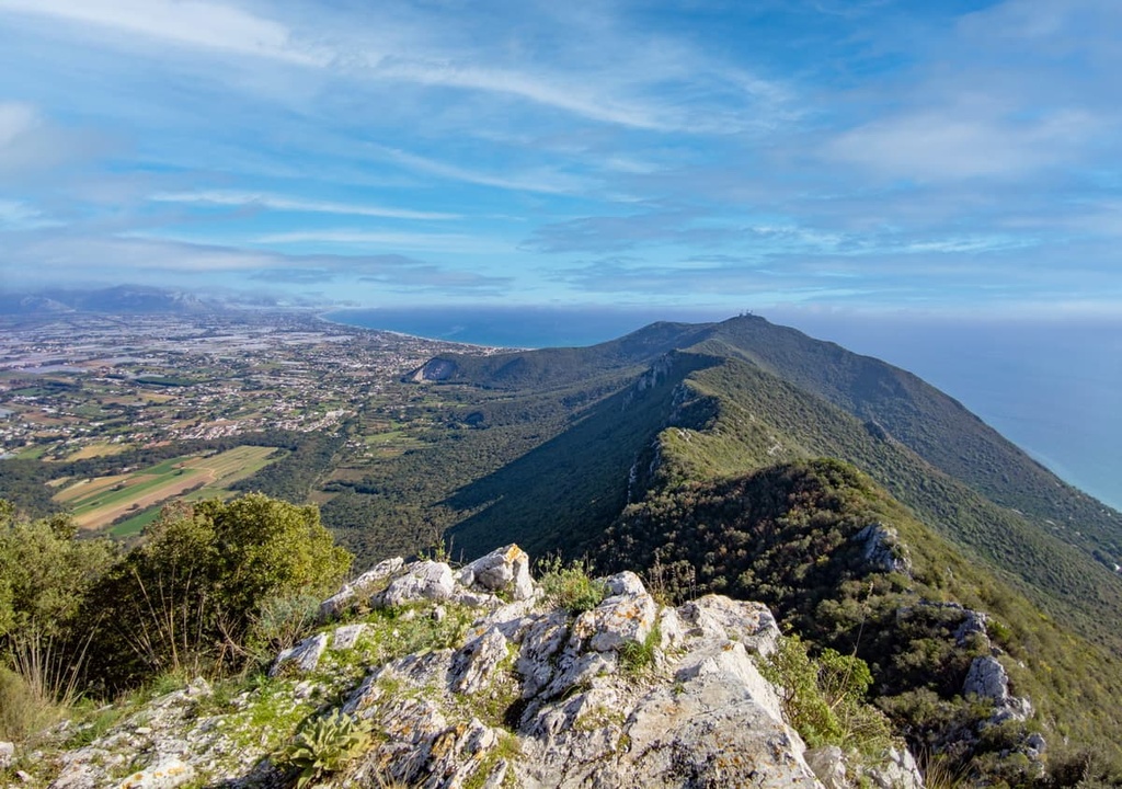
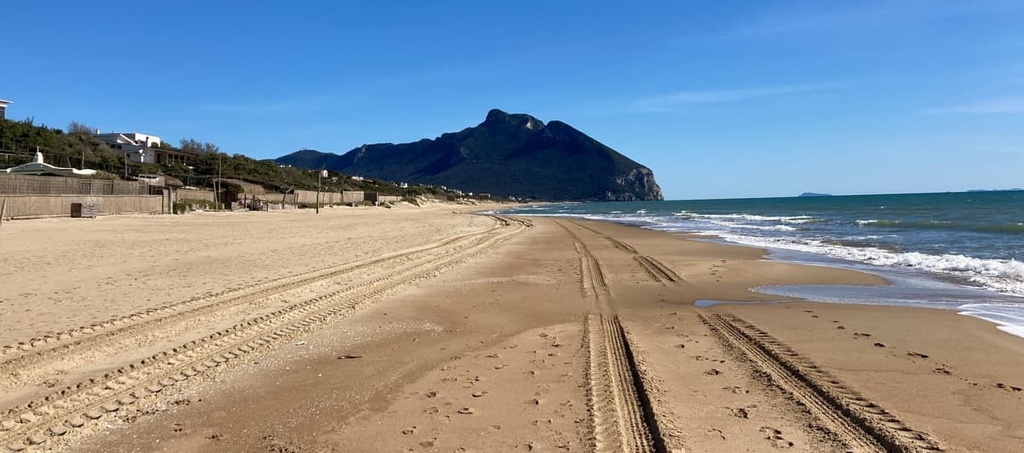
The Mount Circeo promontory is a large cape with several mountains that extends into the Tyrrhenian Sea. Its maximum height is equal to that of its highest peak, Mount Circeo (541 m / 1,775 ft), and it is about 7 km (4.3 mi) long. Except for the highest point, the mountain is completely covered by a dense forest on all sides.
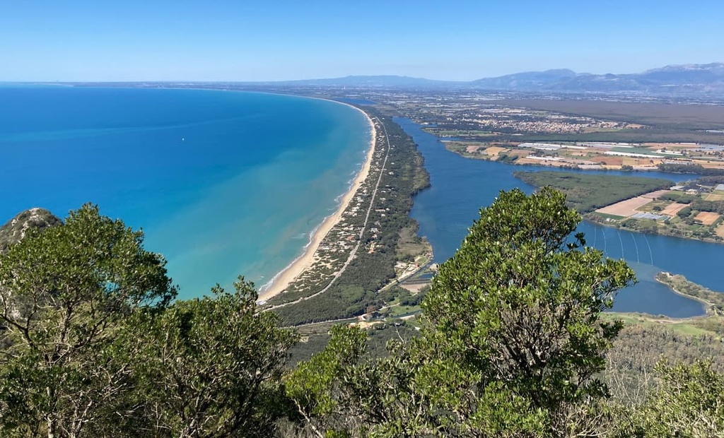
The sand dunes of the Tyrrhenian Sea coast are dunes located on a beach that is 22 km (13.6 mi) long and that extends between two capes: Circeo Cape and Portieri Cape.
This area is home to one of the longest strips of sand dunes in Europe. The highest of these dunes reaches a height of 27 m (88 ft). There are private houses and a few hotels in the region, but this strip of coastline is primarily a wilderness area rather than a typical Italian beachfront with entertainment for tourists.
The “Selva di Circe” forest is a huge selva-type forest in the north of the park. It is similar to the humid equatorial forests or rainforests that grow mostly in South America. This forest is the last piece of what was once a much larger forest area and it was the main reason for the park's creation. Still, it is huge in size and it dominates most of the park's area.
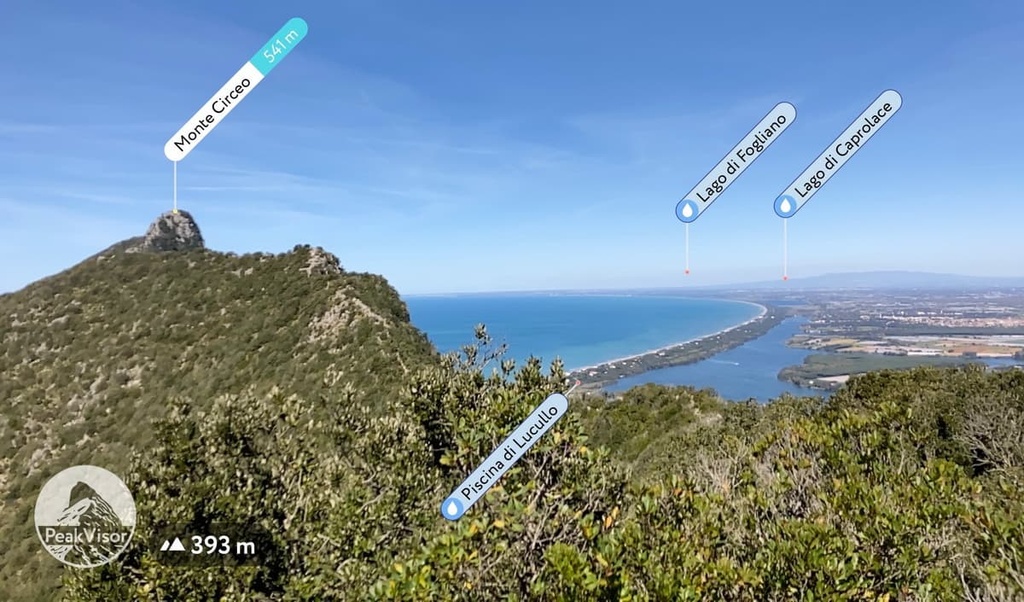
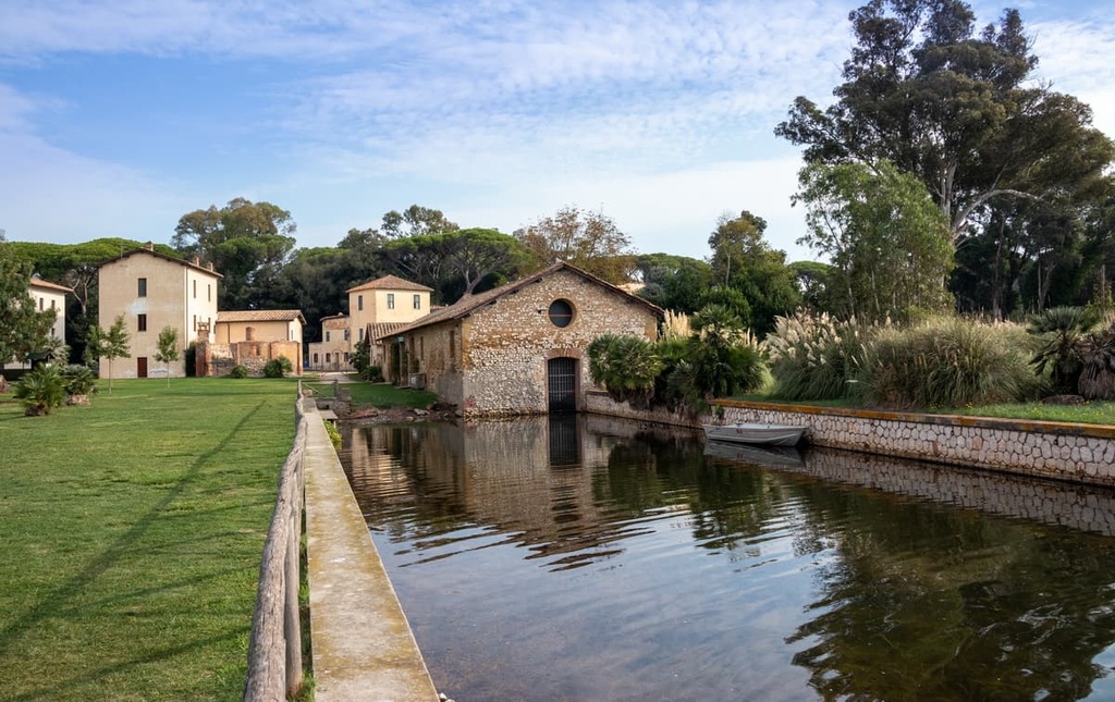
The Circeo wetlands is a region located between the selva-type forest and the shore of the Tyrrhenian Sea. It is part of the former Pontine Marshes that once existed here and that once covered the Pontine Plain.
Additionally, these wetlands include four large lakes: Sabaudia (Paola), Caprolace, Monaci, and Fogliano. The lakes are a nesting place for migrating birds and you can sometimes see pink flamingos in the region.
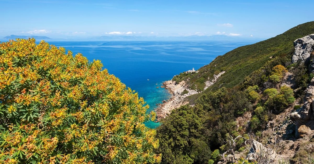
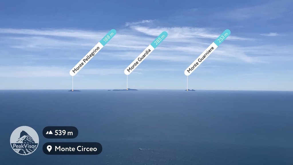
Zannone Island is one of the six Pontine Islands, a small archipelago located in the Tyrrhenian Sea, approximately 12 nautical miles (22 km) from Cape Cirсeo.
The other islands are Ponza, Palmarola, Gavi, Ventotene, and Santo Stefano. These islands are also full of attractions, including small settlements, and they are linked to the mainland via ferry.
The above-mentioned park zones and landscape features are the main destinations in the Circeo National Park. But there’s much more to explore in the region, such as:
Given that the park consists of five different natural zones, its flora and fauna are extremely diverse. Each zone has its own characteristics, but they also share some common features.
The slopes of Mount Circeo, the most popular part of the park, can be divided ecologically into northern and southern regions.
The northern part of the mountain is colder climate-wise (it’s referred to as the Quarto Freddo or Cold Quarter). It is characterized by vegetation that is less resistant to low temperatures and wind.
This part of the park features typical Mediterranean forests with evergreen oaks and hop-hornbeams. There are also manna ash, olive tree, Italian buckthorn, tree heath, strawberry tree, Spanish broom, and other similar plants in this part of the park.
The southern slope of the mountain has a warmer climate (it is called the Quarto Caldo, or Hot Quarter). Here, the plants are exposed to an environment with minimal wind, high temperatures, and limited rainfall.
Mauritania grass, mastic, wild madder, Montpellier cistus, and other plant types all grow here. The best time for plant observation in this part of the park is from March to July. During my hike through the park in mid-April, the forest was full of flowers.
Other parts of the park also feature a diversity of plants, especially the rainforest.
On the cape, you can find lots of wildlife, such as wild boars. Other mammals that you may find here include badgers, weasels, hazel dormice, and various bat species, though you’ll generally only see bats in the grottos and caves.
Some of the many other animals that live in the forest part of the park include foxes, hedgehogs, fallow deer, and others. There are also mouflons on Zanone Island. In my case, while passing through the dunes, I managed to see a wild rabbit.
Among the birds, there are rare peregrine falcons and some other passerines that are usually found in rocky environments, such as blue rock thrush, northern wheatear, and wallcreeper black redstart. Some of these birds nest on the cape permanently or only during the winter. Meanwhile, others use it only as a temporary stopover during their migration.
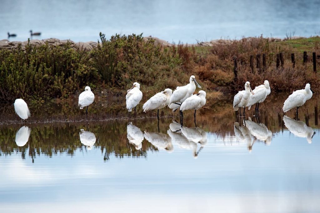
But there are many more bird species that live in the Circeo wetlands. To be precise, there are over 260 waterfowl species that live here during the spring and autumn, so it is an ideal place for birdwatching. As a result, it was declared a "Wetland of International Importance" under the Ramsar Convention.
There are countless reptiles that live in the park, too, from green lizards to snakes. You’re almost certain to hear and see the green lizards as they tend to scatter in different directions at the sight of hikers. There are a few venomous snakes in the region, so do watch your step as you hike.
If you’re lucky, in the park’s wetlands, you might get to see its cutest resident: the Hermann's tortoise. These small tortoises are native to southern and southeastern Europe, though they are listed as endangered by the IUCN around Italy.
Circeo is the main mountain in the park. It is relatively low in elevation, but it features a 7 km (5.4 mi) long ridge that stretches from west to east along the coast of the Tyrrhenian Sea.
However, it looks like this is only on the western side of the park. From the east, the mountain and the cape that it’s located on look like an island in the sea. From the town of Terracina, and even further away from Sperlonga and Gaeta, you can only see the strip of coast connecting the mountain to the land if you look very closely.
The ridge of Mount Circeo includes several peaks, the highest of which has the same name—Circeo—but it is known among Italians also as Picco di Circe (541 m / 1,775 ft). This dome-shaped peak is located in the eastern part of the massif, and it stands out clearly against the other peaks, especially since there are so few of them.
The second highest peak, Circello (449 m / 1,473 ft), is located in the western part of the massif. However, the summit of Circello is not accessible to hikers as the pass is a military zone and is closed to the public.
On Mount Circeo, there are several other minor peaks of lesser height: Vetta di Paola, Punta di Torre Moresca, Punta di Vasca Moresca, Punta del Fortino di Cretarossa, Punta del Semaforo, and Punta dell’Acropoli o delle Crocette. You will climb many of them on your way to Circeo if you’re hiking the mountain from the west.
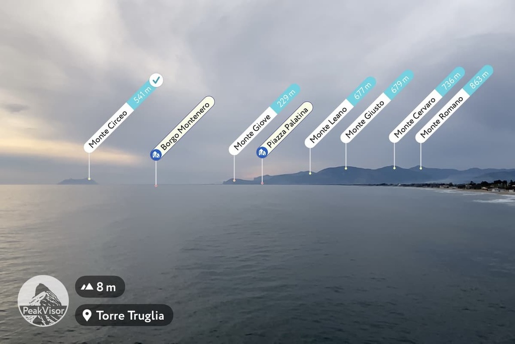
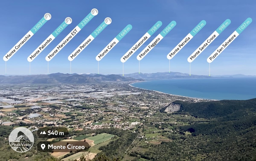
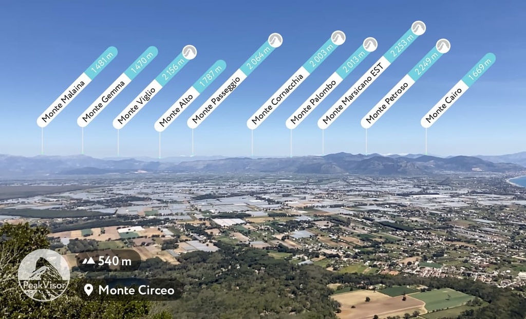
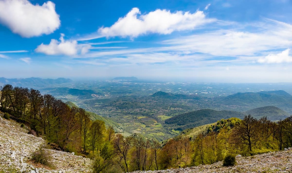
But the summit of Circeo is known not so much for itself as for the view that you can get from its summit. Once you reach the top of Circeo, you’ll be able to see the following peaks on a clear day:
To the north and south of Circeo, there are also several hills in the park, including Peretto, Guardia Orlando and Monticchio, and Monte Morrone and S. Rocco, respectively.
Last but not least, we should discuss the mountains on the park’s island: Zannone. The highest peak of Zannone Island is Monte Pellegrino (194 m / 636 ft). From Circeo, you can also clearly see two other peaks on the other two islands of the archipelago: Monte Guardia (285 m / 935 ft) and Monte Guarniere (253 m / 830 ft).
All five parts of Circeo National Park feature hiking and biking areas with marked trails of varying lengths and levels of difficulty. Here are some of the best hikes in Circeo National Park to consider during your next trip to the region.
There is a small series of at least six numbered trails on the Mount Circeo Promontory.
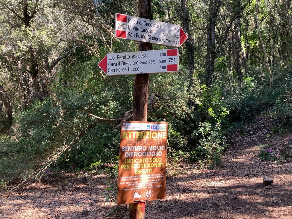
The main trail in the area is trail 750, and it is about 7 km (4.3 mi) long. It starts just outside the old town of San Felice Circeo and runs along the whole mountain ridge toward the sea through the highest mountain Circeo.
Although it has just a relatively small elevation gain of about 500 m (1,640 ft), it is a challenging route for trained hikers (as a result, it is rated EE, Escursionisti Esperti). There is a warning sign on the trail about this, which I recommend following, so be sure to consider your skill level before setting out on the route.
The main difficulty on this trail is the numerous rocks that cover the mountain and through which you have to wade for most of the route. The trail also has stretches of both steep up and downhill travel—one might say that it is a combination of hiking and climbing (but you don’t need special equipment). Be careful on the steep sections on this trail as there are quite a few of them.
From the top of the mountain, you can take a faster but also steeper route, which will be signposted Direttissima, to the easier and lower trail 751. Direttissima is a climbing term meaning a direct climb to or descent from a summit. It’s usually best to avoid routes that are too steep for descents, but this trail has many trees to hold on to as you walk, making it easier to descend.
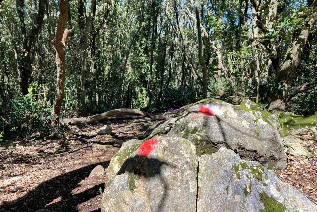
On the plus side, the 750 trail along the ridge also has almost no intersections and is well numbered with signposts, arrows, and red stone markers, so it is nearly impossible to get lost on it as you hike.
You’ll probably spend at least 4 and a half to 5 hours on this journey, but I recommend budgeting for an hour or even two more, especially if you’re traveling via public transportation. The mountain looks relatively small but the hiking trails on it are quite challenging.
However, don’t hike this trail during the hottest period from June to October.
There is plenty of shade on the trail, but it will not save you from the region’s high summertime humidity. Conversely, in spring, fall, and winter, this is an ideal hiking destination. During these seasons, only strong winds (and of course precipitation) can be a problem.
The other routes in this part of the park lead to Mura Ciclopiche (754), Brecciaro (755), the old tower of Guardia Orlando, and Torre Fico (757). You can reach these areas by car or on foot from Monte Circello.
All 22 km (13.6 mi) of the park’s coastal strip is also one long trail that can be hiked in about 6 to 7 hours.
Conditions for walking are better at low tide. That’s because, near the water, a wide strip of wet firm sand forms at low tide. It is generally easier to walk on this wet sand than it is to walk on dry sand.
This trail can also be combined with the hike to Circeo. For example, after climbing the summit and going down, you can walk another 7 km (4.3 mi) along the sea to the town of Sabaudia, from where you can take a bus to Terracina. By doing so, you can visit three of the park’s five natural areas at once. Eureka! The total distance of this journey is about 15 km (9.3 mi).
Along the coast, there is also a local road with few cars that is suitable for cycling. But be aware that there may be many parked cars along this route during the summer months.
In the marshy areas of the park, you can hike in the area to the east of Sabaudia above Paola Lake. There’s also a small network of marked trails in the region.
The “Selva di Circe” Forest also offers a network of trails that takes you between the marshes and streams of the park. These trails are generally more suitable for biking than hiking, considering the size of the forest. In particular, the longest trail runs from southeast to northwest, giving you a chance to traverse the park diagonally.
The main trail on Zannone Island runs between the settlement of Caletta del Varo, where boats dock, and Il Faro (a lighthouse). You can also turn off the trail to climb the island’s highest peak, Monte Pellegrino, which offers beautiful views of Mount Circeo from a distance.
Before or after your hike through Circeo National Park, be sure to visit its visitor center, which is located at its northern end in the town of Sabaudia.
Ente Parco Nazionale del Circeo
Via Carlo Alberto, 188, 04016, Sabaudia, LT, Italy
+390773512240
Within Circeo National Park and its boundaries, as well as the nearest surrounding towns, you will find more than 160 different accommodation options, including hotels, campings, B&Bs, and holiday farms, among others. Most of these accommodations are located in the municipality of Sabaudia.
Some of the many accommodation options in the park include:
San Felice Circeo and Sabaudia are the two main towns located closest to the park. San Felice Circeo is located on the southern slopes of Mount Circeo, but it also occupies a large parcel of land between the mountain and the sea. Meanwhile, Sabaudia is located in the swampy area to the west of the mountain.
Here’s what you need to know about the best places to stay near Circeo National Park before your next trip to the region.
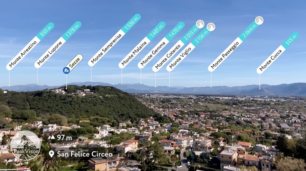
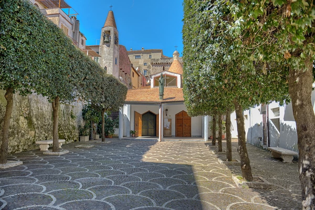
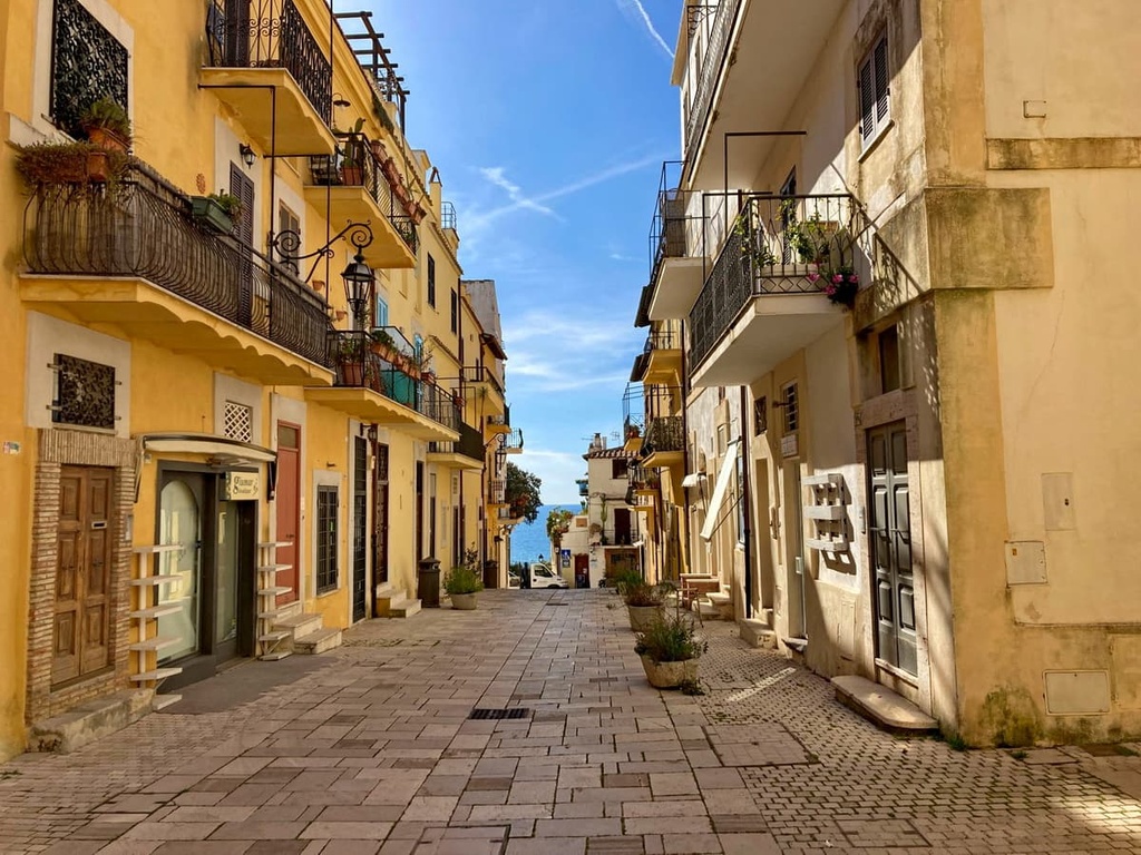
San Felice Circeo has been inhabited since Antiquity. It is located at an elevation of 98 m (321 ft), and it includes the smaller towns of Borgo Montenero, Colonia Elena, La Cona, and Pantano Marino. The city has a population of around 10,000 people.
The city’s main architectural and cultural attractions include its port, the Old Town with its many historic buildings, a historic watchtower (Torre dei Templari), the main square (Piazza Vittorio Veneto), and the Villa Aguet, among others.
For more information, check out the city’s official tourist site: SanFeliceCirceo.eu.
Sabaudia is a new community that was founded in 1933. It is situated at an elevation of 17 m (56 ft) and includes the smaller towns of Baia d’Argento, Bella Farnia, Borgo San Donato, Borgo Vodice, Cerasella, Mezzomonte, Molella, Sacramento, Sant’Andrea, and Sant’Isidoro. The city has a population of around 20,000 people.
The main architectural and cultural attractions of Sabaudia are its town hall with its high tower, the Church Holy Annunciation (Chiesa della Santissima Annunziata), and the Post Office and Telegraph Palace (ll Palazzo delle Poste e Telegrafi), among others.
For more information, check out the city’s official tourist site: ProLocoSabaudia.it.


The highest peak in Parco Nazionale del Circeo is Monte Circeo, at 541 m.
Notable peaks in Parco Nazionale del Circeo include Monte Circeo and Monte Circello.


