Share

Scan the QR code and open PeakVisor on your phone
Scan the QR code and open PeakVisor on your phone
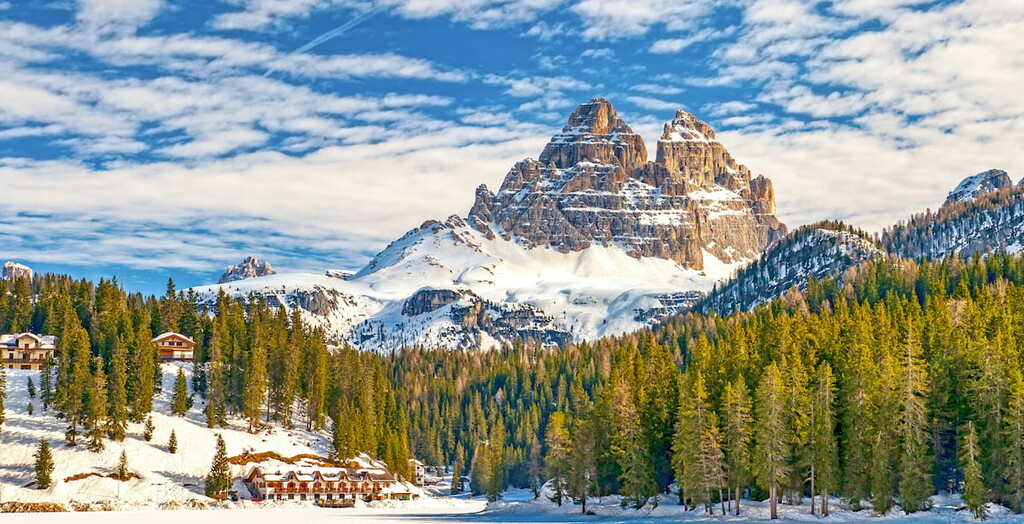
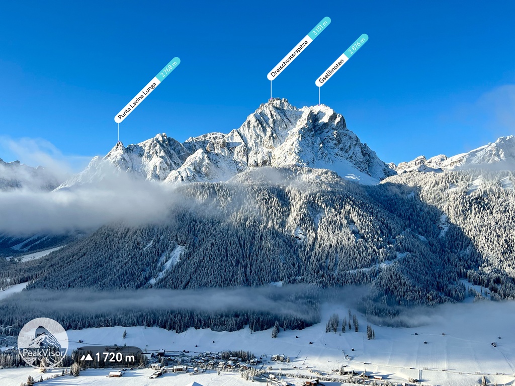
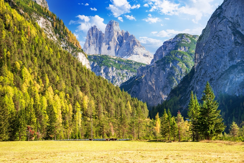
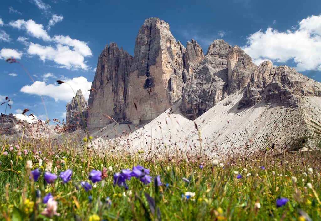
The Three Peaks Nature Park (Italien: Tre Cime / German: Drei Zinnen) is one of the treasure troves of the Dolomites in Italy. The park covers an area of 11,891 hectares (29,383 ac) and is in the northeastern Dolomites, nearly on the border with Austria. There are 75 named mountains in Tre Cime; the highest and most prominent mountain is Punta Tre Scarperi / Dreischusterspitze (3,152 m / 10,341 ft), which translates to “Peak of Three Shoemakers.”
Tre Cime is in the northeastern Dolomites, one of the most famous subranges of the Alps. The park’s northern border is the Pustertal/Pusteria Valley, the eastern side runs along the Sesto Valley (Sextental or Val di Sesto), the southern border is along the province of Belluno, and the western along the Höhlensteintal Valley (Val di Landro). These valleys effectively surround the massif.
The park's southern border is also the border between the regions of Veneto (province of Belluno) and Trentino — Alto-Adige / South Tyrol in Italy.
The Tre Cime Nature Park is part of the European Natura 2000 network — a Europe-wide ecological network of nature conservation areas designed by European Union member states. The network has over 27,800 sites, covering almost a fifth of Europe's land area. The goal is to promote the conservation of wildlife habitats and ensure the sustainable development of Europe.
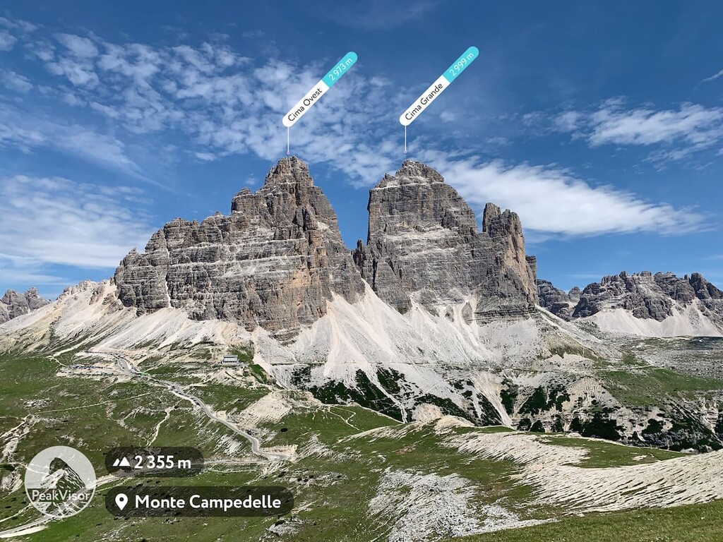
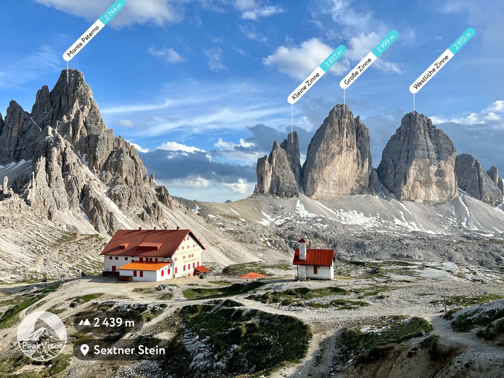
In addition to Punta Tre Scarperi / Dreischusterspitze, significant peaks include:
The Visitor Center is a great place to find more information on Tre Cime and Fanes-Sennes-Prags / Fanes-Sennes-Braies Nature Park, just adjacent to Tre Cime. A permanent exhibition offers information on the following topics:
There is a library with a reading corner, an aquarium representing the water life of the local Toblach Lake, and an adventure workshop for children. You can virtual tour the Visitor Center on the official Tre Cime website.
Drei Zinnen / Tre Cime Nature Park Visitor Centre
Cultural Centre Grand Hotel Toblach / Centro Culturale Grand Hotel Dobbiaco, Dolomitenstraße, 37 / Via Dolomiti, 37, Toblach / Dobbiaco, 39034.
+39 0474 973017
info.dz@provinz.bz.it
The Alpine Orogeny, which occurred between 64 and 2.5 million years ago, created the entire European Alps. The orogeny results from the African and Indian plates colliding with the Eurasian plate, forcing the crust upwards.
In many places, the orogeny is ongoing - namely, the Himalayas, because the Indian plate has only recently collided with Eurasia and continues to exert force on the crust. Even at a few tens of millions of years old, the Alps are still young, hence the towering, jagged peaks and low valleys. The mountains have not had time to erode, and the valleys have not filled with sediment.
The Dolomites are a sub-range of the European Alps where dolomitic rock, similar to limestone, was forced above the Earth’s surface. In other parts of the Alps, tectonic forces exposed gneiss, granite, and other rocks, but no other subrange features as much dolomitic rock as the Dolomites.
The park belongs to one of the nine main mountain systems of the Dolomites called Dolomiti settentrionali. The Tre Cime formed in the warm shallow waters of the Tertiary Mediterranean before being buried, developed into dolomite, and then forced above the crust’s surface by tectonic forces. While the massif is primarily composed of dolomite, there is also a substantial amount of volcanic rock, sandstone, and mudstone.
The current Tre Cime landscape was shaped by water and glacier ice over the past 2-3 million years. In particular, glacier activity is visible on the plateaus around the Drei Zinnen / Tre Cime di Lavaredo and in the Bacherntal Valley / Alta Val Fiscalina.
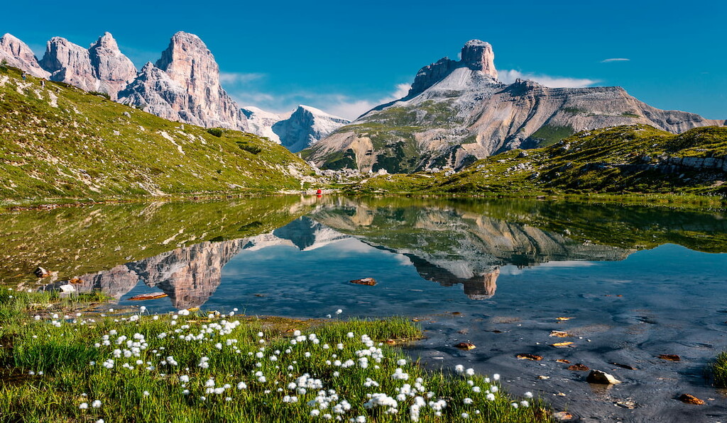
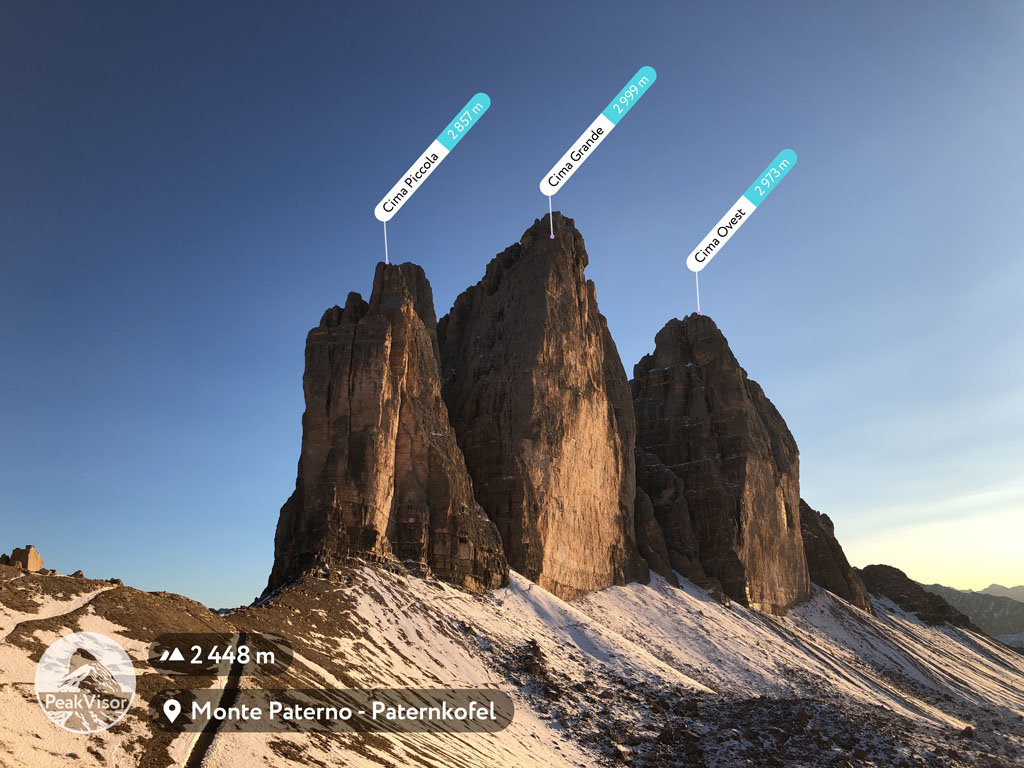
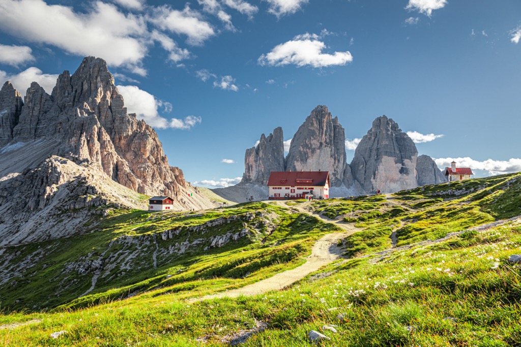
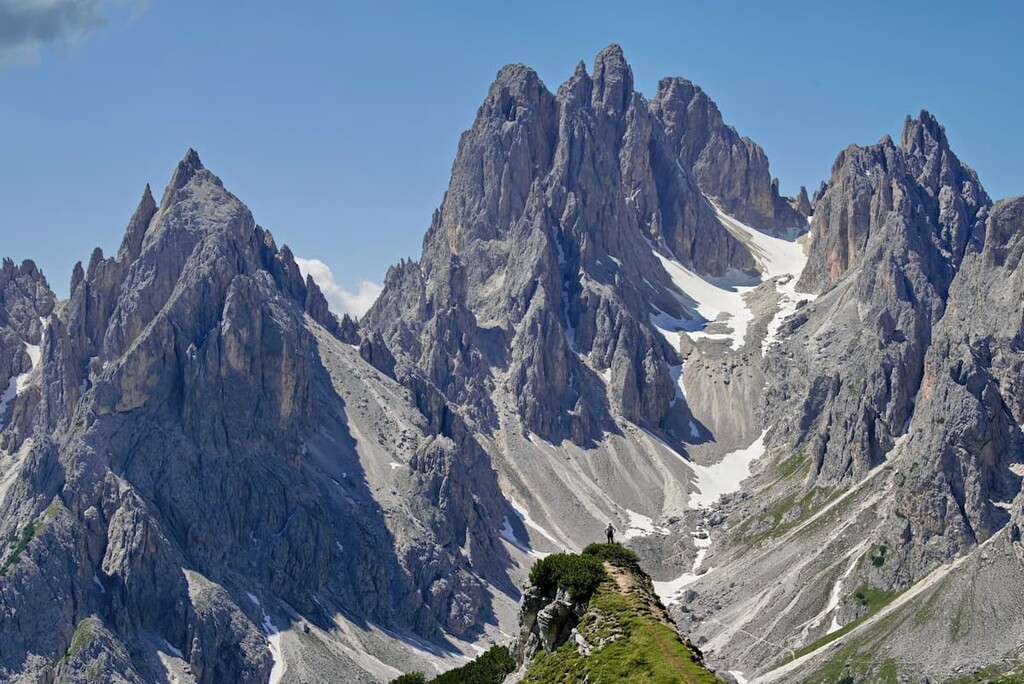
The park is characterized by an extensive collection of mountains with unusual shapes due to the erosive properties of dolomite compared to other rocks of the Alps. Cadini di Misurina resembles a set of needles, while Monte Paterno / Paternkofel is pyramidal-shaped. But the main event is, of course, the Tre Cime di Lavaredo. The three sharp teeth are considered the symbol of the Dolomites.
Dolomite is not the strongest rock. Tre Cime Park features incessant rockfall from the alpine cliffs and peaks, accumulating in massive aprons throughout the range. If you’re anywhere near cliff faces, whether hiking or rock climbing, it’s a good idea to wear a helmet.
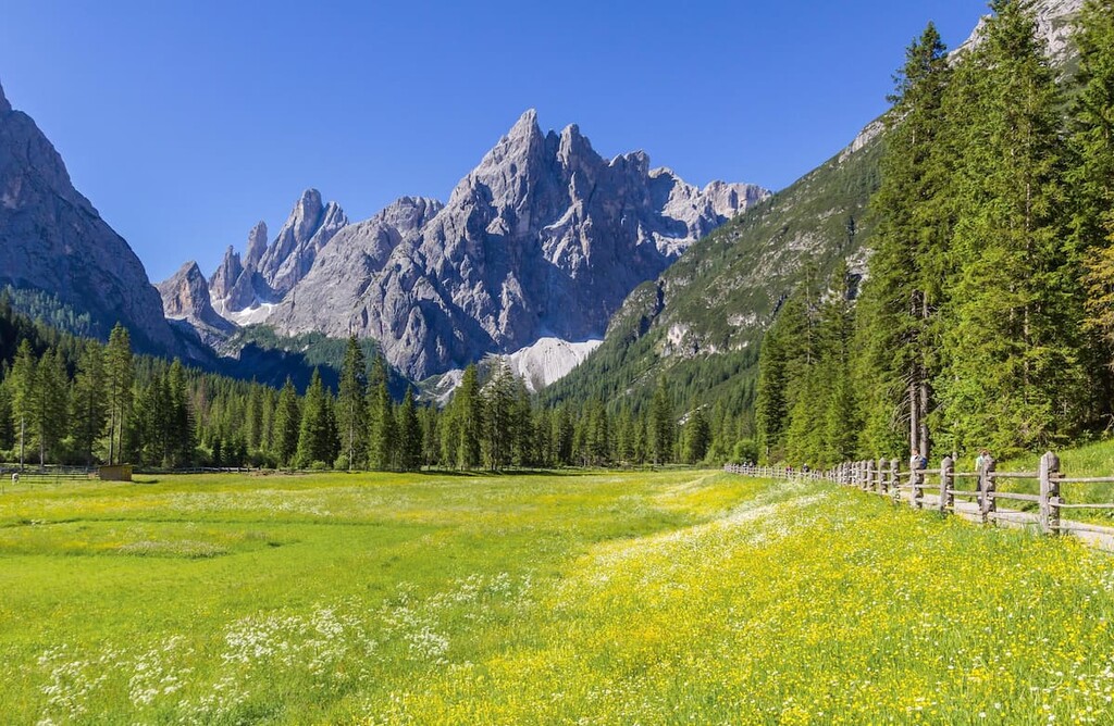
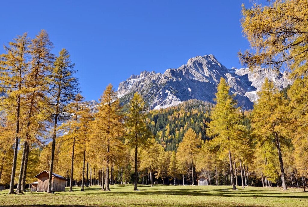
The Tre Cime Park is fairly biodiverse. At lower altitudes, there are larch and spruce forests, while in the dry soil of the dolomite rocks, Scots pine forests thrive. The region also features an occasional leafy deciduous forest consisting of birches, mountain ashes, alders, and willows.
Above the forests lie the treeless Alpine meadows, which existed without human intervention. Many hardy plants survive here: dwarf alpenrose, auricula, Achillea oxyloba, aquilegia, rosacea, dwarf rhododendron, yellow yarrow, gentian, and, of course, edelweiss — the most famous Alpine flower. Some of these plants are endemic, meaning they are found solely in this area.
Deer, chamois, and marmots comprise the most common mammal species. Avain residents include the pygmy owl, rock ptarmigan, rock partridge, black grouse, capercaillie, wallcreeper, snow finch, Alpine accentor, eagle, and many different woodpecker species. Salamanders and newts inhabit the riparian habitats.
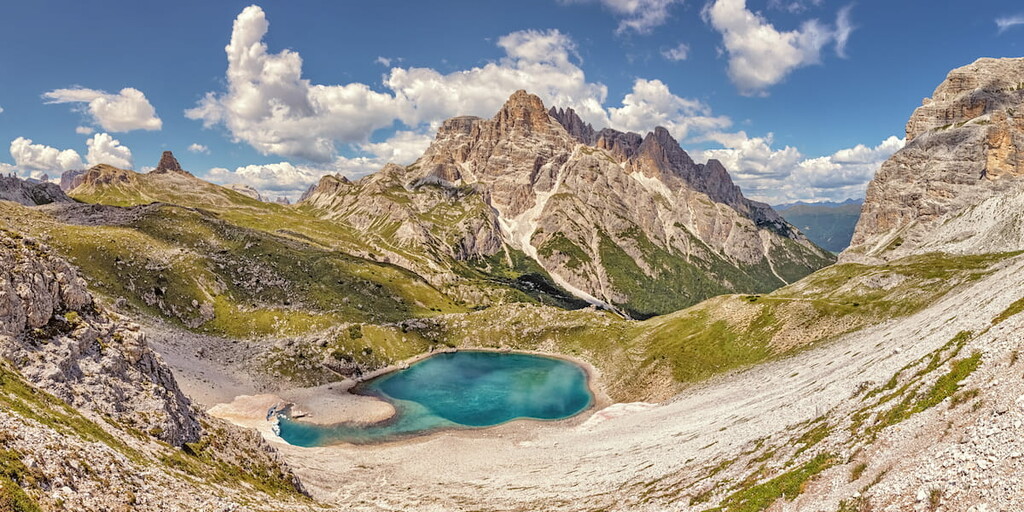
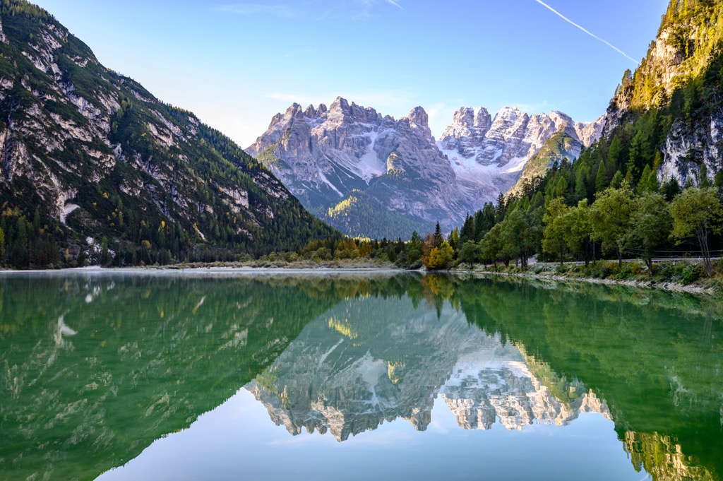
The Rienz / Rienza river flows along the Langalm Alpine pasture. The Tre Cime park has one large lake, the Dürrensee / Lago di Landro, located in Höhlensteintal / Val di Andro Valley, and numerous smaller mountain lakes. In Italian: lago di Malga di Mezzo, laghi dei Piani, laghetti sull'Alpe Lunga, laghi di Cime. Lago ((Laghi in plural form) means just a lake; laghetti stands for ponds or very small lakes.
The park’s many freshwater springs include the Drau / Drava Springs at the foot of Haunold / Rocca dei Baranci and the sulfur and iron springs of Wildbad Innichen / Bagni di S. Candido and Bad Moos / Moso, which have been used for medicinal purposes for centuries. The Wildbad Innichen / Bagni di S. Candido springs also produce mineral water.
Anatomically modern humans probably permanently settled in the region around 40,000 years ago. However, limited evidence of these early pioneers exists. The first Homo sapiens likely replaced Homo neanderthalis, who had inhabited Europe tens of thousands of years prior.
Celtic tribes inhabited the Dolomites during the Celtic maximum expansion, which peaked around 275 B.C. Soon after, the region came under Roman influence, which lasted until the fall of the Roman Empire.
The Dolomites remained pastoralist throughout history. Pastoralism still exists to a large degree, but tourism has replaced it as the primary economic driver.
The Tre Cime massif was the boundary between Italy and Austria-Hungary until the early 20th century. During WWll, many Via Ferratas were built (translating to ‘Iron Road,’ these were routes across the mountains using rungs bolted into the rock).
The park was officially founded on December 22, 1981, but under a different name: Dolomiti di Sesto. Rebranding took place in 2010 to commemorate the most iconic peaks of the Dolomites - the Three Peaks (aka Tre Cime, Drei Zinnen). The whole territory of the Dolomites became a World Heritage Site by UNESCO in 2009.
The most popular route of the park traverses around the Tre Cime di Lavaredo mountain group. The trail begins at the parking lot near Rifugio Auronzo. From there, it's up to you whether to go left (counterclockwise) to Rifugio Locatelli or right (clockwise) to Rifugio Lavaredo.
Basic information about the route:
Some other main trails run through the park but do not cover the Tre Cime di Lavaredo.
Check out the PeakVisor app for the park’s map for more details on these routes. The PeakVisor app allows you to see the trail in 3D with natural features, elevation gains, ascents, and descents.
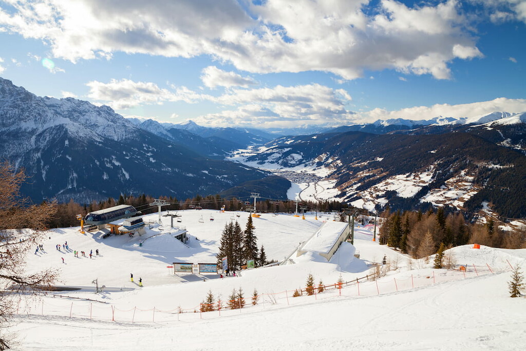
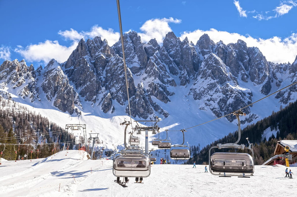
Near the park's northern borders, in the Alta Pusteria Valley, sits the park’s eponymous ski resort — the Tre Cime Dolomites Ski Resort (3 Zinnen Dolomiten). The ski resort is part of the Dolomiti Superski system and is one of its 15 resorts. The resort features four peaks, virtually guaranteed snow, and perfectly prepared pistes for all ability levels.
Basic information on the Tre Cime Ski Resort:
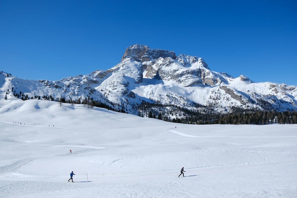
Tre Cime Ski Resort is Italy's number one cross-country skiing destination. There are 200 km of linked cross-country tracks with panoramic views of the Dolomites, including night skiing, FIS tracks, and high-altitude tracks.
Some tracks lie within the Tre Cime Nature Park, i.e., the Circular Trail in the Fischleintal Valley. You can find it under Number 18 on the maps. It is a magnificent trail in a romantic valley with views of the Sesto sundial. The trail length is 4.5 km / 2.8 mi. Difficulty: easy (blue).
Check the Tre Cime ski resort map on the larger Veneto ski map of Italy in the World Mountain Lifts section of the site. It includes real-time information about open ski lifts/slopes in the Tre Cime Dolomites with opening dates and hours. There are also year-round cable cars, funiculars, cog railways, aerial tramways, and all other types of mountain lifts.
Check the rules and regulations page (in German and Italian languages) on the official website for a complete guide to the park’s rules. In general, follow your common sense and don’t harm the beautiful place you are in.
Other mountain huts in the park include rifugio Talschlusshütte / Fondavele (1,548m), rifugio Pian di Cengia (2,528m), rifugio Dreischusterhütte / Tre Scarperi (1,626m), and rifugio Zsigmondy-Comici (2,224m), which opened in 1926.
Near the park’s borders, there are more mountain huts, including rifugio A. Berti Al Popera (1950m), rifugio Selvapiana I. Lunelli (1,568m), rifugio A. Bosi Monte Piana (2,205m), rifugio G. Caducci (2,297m).
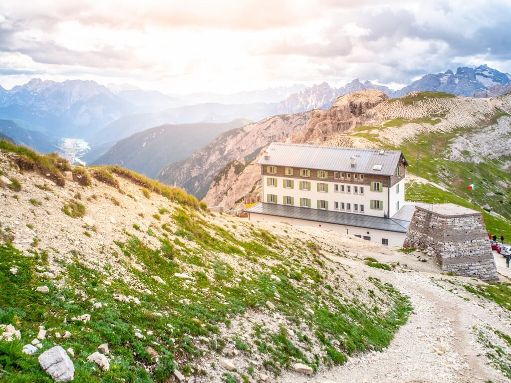
Several free alpine shelters are in the park or close to its borders. Usually, a shelter in the Alps refers to a small building made of wood, stone, or metal where you can stay free of charge. There are generally a few beds inside with mattresses, blankets, and pillows (but no bed sheets; bring a sleeping bag), but this can vary. There could be a stove or a fireplace for cooking and heating, as well as some kitchen materials.
Learn how to stay in the free alpine shelters in the Dolomites.
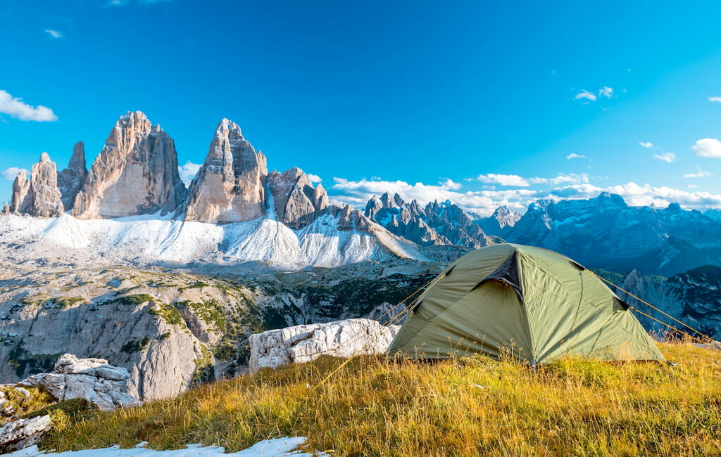
No camping is within the park, but it is available near its borders.
The park has no hotels because it is a protected area, but many exist in neighboring towns.
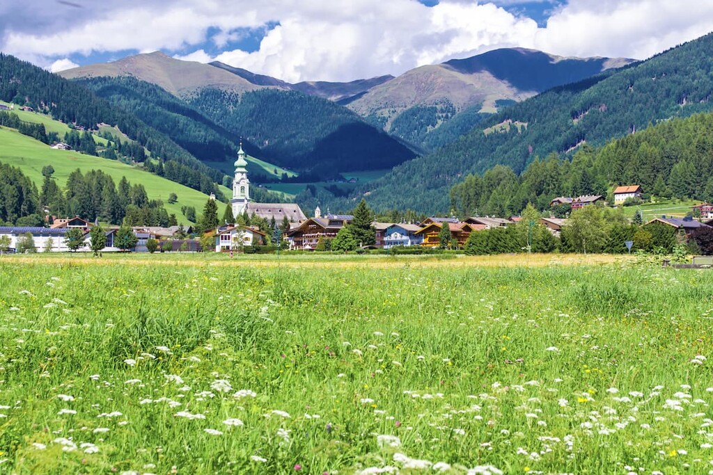
Toblach, aka Dobbiaco, is located between two beautiful valleys, the Valle di San Silvestro and Valle di Landro. It is considered one of the doors to the Dolomites from the north. The Romans used it as a strategic point to connect the Empire's north and south via Alemagna Road.
Like all towns and villages in the Dolomites, Toblach is surrounded by nature. The area’s two lakes are Dobbiaco Lake and Landro Lake, and the town is just 1.6 km (1 mile) from the Tre Cime Visitor Center. It is an ideal place for summer and winter sports and outdoor activities. The town's main architectural and cultural attractions are the parish church in Valle San Silvestro, the Shrine of Santa Maria, and the Herbst castle.
There’s an annual cross-country skiing competition called Granfondo Dobbiaco Cortina each winter. In addition to sports competitions, the town organizes Dolomiti Ballonweek, the Krampus parade with St. Nicholas, and other events.
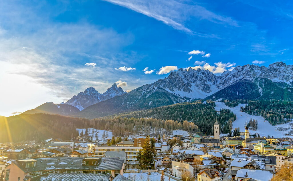
The village of Innichen has been relevant since ancient times. It consists of several hamlets (or satellite villages outside the main village): Versciaco, Prato Drava, and Monte San Candido.
The main architectural and cultural attractions are the Collegiate church, the parish church of St. Michele, old thermal baths that have been operational since the Middle Ages, and the Dolomites Museum.
Summers feature hiking, cycling, tennis and squash, and family fun in the well-equipped water park, Acquafun. The most important local non-sportive event is the Heugabel (farmers’ market), where you can sample local products. The town hosts the International Snow Sculpture Festival each winter. The distance from the town center to the Tre Cime Visitor Center is 6 km (3.7 mi).
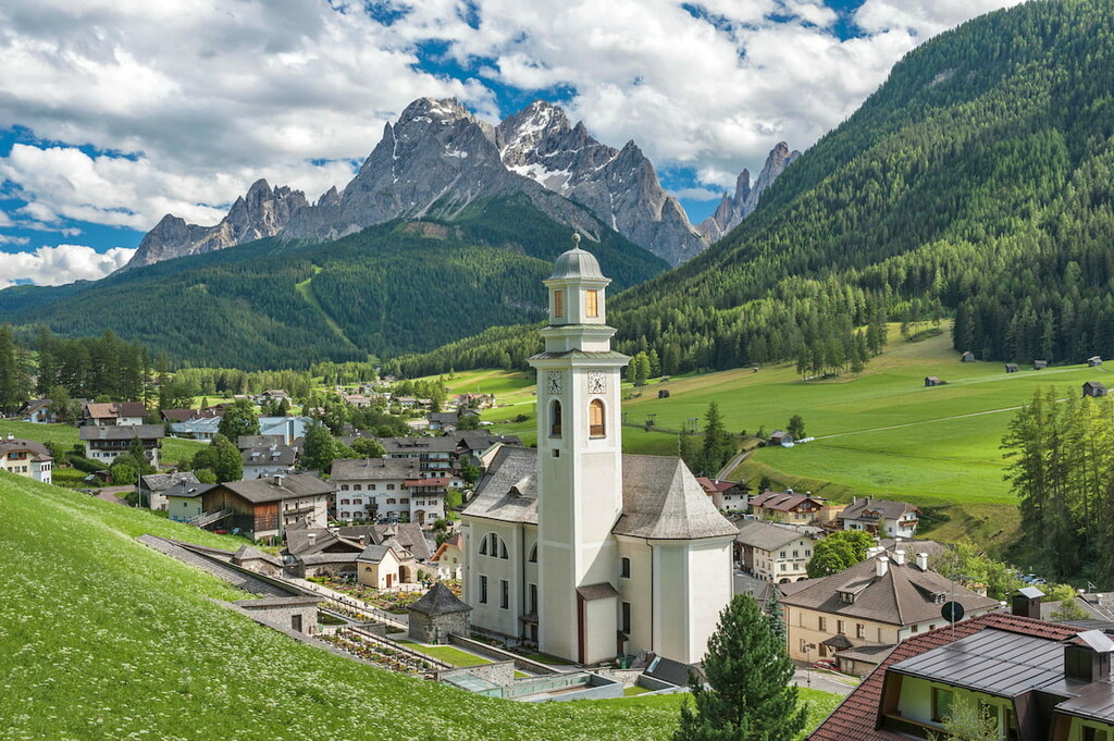
There are two valleys near the town of Sesto: Val Campo and the wonderful Val Fiscalina, an ideal starting point for your hikes in the Dolomiti di Sesto Natural Park. The town is located on the Setso River, and the distance from the center to the Tre Cime Visitor Center is 12.4 km (7.7 mi).
The area around the town is also like an open-air fitness center with many opportunities for outdoor recreation: bike tours, hikes, downhill runs, and cross-country skiing in Monte Elmo — Croda Rossa, Waldheim, and Val Fiscalina. There are also tennis, swimming, golf, and minigolf facilities.
The town's foremost architectural and cultural attractions are the Rudolf Stolz Museum, the Crib Museum, and the parish church of St. Peter and Paul.
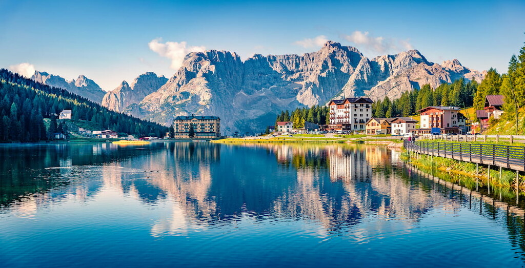
The nearest village to the park’s southern boundary is Musurina. Misurina is mostly a planned, artificial village with hotels and private houses. Nevertheless, it is the starting point for many hiking trails. Buses from other towns arrive here before heading up to Auronzo mountain hut at the foot of the Tre Cime di Lavaredo.
As an alternative to the Tre Cime di Lavaredo, summers in Misurina offer trekking and mountain biking in the nearby mountains of Cadini di Misurina.
Misurina is on a lake of the same name. It is considered one of the Dolomites' most beautiful and perfect for sunbathing and fishing. An important horse polo championship on the frozen lake is held every February.
Misurina is ideal for quiet family holidays; there are vast spaces, a training slope for beginner climbers, and almost no traffic. The distance from the village center to the Tre Cime Visitor Centre is 20 km (12.4 mi).

Explore Tre Cime Nature Park with the PeakVisor 3D Map and identify its summits.