Scan the QR code and open PeakVisor on your phone
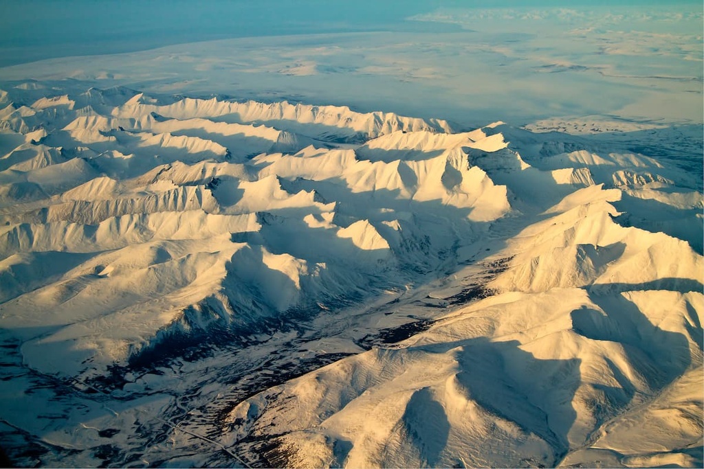
Located in the northwestern part of the US state of Alaska, the National Petroleum Reserve-Alaska (NPR-A) is an area of federally owned land that’s administered by the Bureau of Land Management (BLM). The area encompasses critical habitat for migrating birds, waterfowl, and marine and Arctic mammals. It contains 47 named mountains, the highest of which is Kivliktort Mountain in the Brooks Range with an elevation of 4,442 ft (1,354 m) and a prominence of 2,398 ft (731 m).
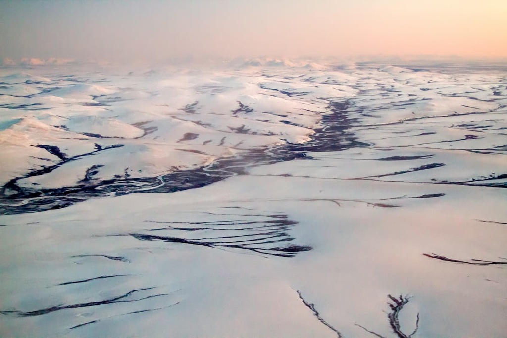
The National Petroleum Reserve-Alaska (NPR-A) is an area of public land that contains 23.5 million acres (9.5 million hectares) of terrain in the North Slope region of northwestern Alaska. It was established in 1923 as an oil source for the US Navy and is the largest single block of public land in the US.
Surrounding the reserve is the Chukchi Sea to the west, the Beaufort Sea to the north, Gates of the Arctic National Park and Preserve to the southeast, and the Noatak National Preserve to the southwest. Although it does not directly border the NPR-A, the Arctic National Wildlife Refuge is located a relatively short distance away to the east.
The reserve contains numerous habitats that are vitally important to the region’s waterfowl and migrating birds, calving caribou herds, and marine mammals. Among these critical sites are Teshekpuk Lake, the Colville River and delta, the Utukok River, and Peard Bay, to name a few.
Interestingly, despite the fact that it’s called a “national petroleum reserve,” the NPR-A is not a major active oil drilling area. Rather, the region is currently managed by the Bureau of Land Management (BLM) primarily as an area of particular ecological importance. There are also a number of traditionally Iñupiat villages that are located around the NPR-A, including Utqiaġvik.
The NPR-A lies in the center of the north Alaska petroleum province. The province extends about 680 mi (1,100 km) from Alaska’s border with Canada all the way west to the state’s maritime border with Russia. It also extends between 60 mi (100 km) and 375 mi (600 km) to the north from the Brooks Range to the edge of the continental shelf.
Within this province, the NPR-A spans from the Brooks Range in the south to the Arctic Ocean in the north. As its name suggests, the NPR-A does contain sizable deposits of petroleum. It’s unclear precisely how much petroleum and natural gas are located in the area, though researchers believe there are around 896 million barrels of undiscovered oil and 53 trillion cubic feet of undiscovered natural gas in the reserve.
Even beyond these oil and gas deposits, Alaska has a rich and diverse geological history. The region boasts some of the state’s oldest rocks as some of the rocks in the reserve are more than one billion years old.
Rocks in northwestern Alaska, particularly to the north of the Tintina Fault System, are typically metamorphosed sedimentary rocks as well as igneous rocks. These mixed groups came together as a result of the opening of the Canadian Basin (which later formed the Arctic Ocean), an event that began about 150 million years ago.
Besides being a potential source of oil and gas for the US, the habitats within the NPR-A have tremendous ecological and cultural value. Not only do the various wetland and marine ecosystems support thousands of birds, caribou, and marine and Arctic mammals in the reserve, but by supporting these animals, they also maintain the traditional subsistence food sources for thousands of Iñupiat who live in the area.
One of the most important sites in the area is Teshekpuk Lake—a large wetland wilderness that provides the ideal habitat for many important species, including Arctic cisco, Dolly Varden, Arctic grayling, Chinook salmon, chum salmon, and lake trout. The lake is also an important nesting and resting spot for both shorebirds and migratory waterfowl.
For decades, the area has been recognized as ecologically valuable and, therefore, has been closed to oil and gas development. To give an idea of the scope of the lake’s ecological importance, it’s worth noting that the area can see up to 35,000 white-fronted geese and 37,000 Brant geese that come to molt near the lake each year. Furthermore, the area is the primary calving ground for the Teshekpuk Lake caribou herd, which has around 60,000 individuals.
There are several other areas of notable ecological significance in the NPR-A. For example, the Colville River and delta are often used as feeding, nesting, or calving grounds by a wide array of raptors, shorebirds, and waterfowl, as well as Arctic mammals such as foxes, musk oxen, wolves, and caribou.
The headwaters of the Utukok, Meade, and Colville rivers are also found in the Utukok River uplands, and they support an incredibly high density of wolverines. They are also the primary calving grounds for the Western Arctic caribou herd, Alaska’s largest herd at around 500,000 head, and they see lots of wolves and grizzly bears each year.
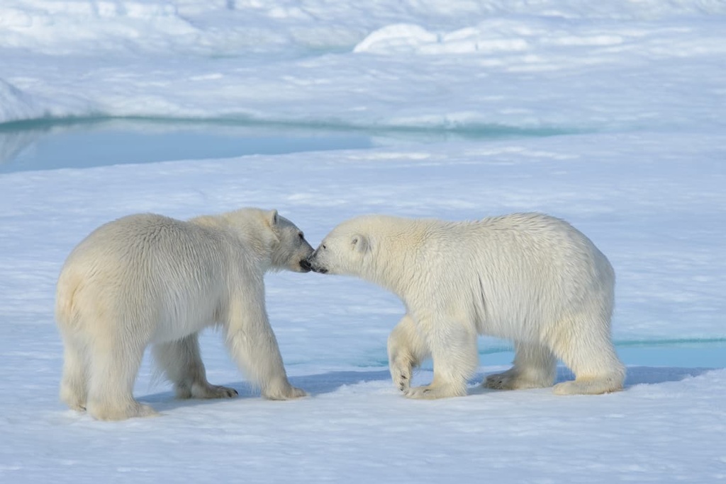
In addition to providing valuable habitat for waterbirds, the Dease Inlet and Meade River also support ringed and spotted seals as well as polar bears.
Beluga whales calve and molt in the Kasegaluk Lagoon, too, which also can see up to 35,000 walruses hauling out in the area at any given time. Peard Bay is also known for its seal, polar bear, and seabird populations while the Delong Mountains and their foothills are home to grizzlies, wolves, wolverines, and migrating caribou.
The Iñupiat and Yupik people have lived on what is now called the North Slope of Alaska for thousands of years. Many Iñupiat and Yupik people who live in the region still practice traditional hunting and harvesting as they have done for centuries, and they are integrally tied to the landscape and the life it supports.
The NPR-A was established in 1923 by President Warren Harding as a source of oil for the US Navy at a time when the Navy wanted to reduce its reliance on coal by switching to oil to power most of its operations.
Administration of the area transferred from the Navy to the Department of the Interior in 1976 with specific instructions for the Department of the Interior to manage the land for the “maximum protection” of wildlife and habitat while also exploring for oil and gas. In 1980, Congress opened the reserve for commercial oil and gas leasing while also requesting that companies “minimize ecological disturbance” of the area in the process.
The reserve has been a point of contention over the decades as each new US administration weighs the balance between economic opportunities created by drilling for oil versus preserving key habitat and wildlife populations. Most recently, the US government rolled back a land use plan that would have opened the reserve up to oil drilling and leasing by reducing the land open for possible development from 19 million acres (7.7 million hectares) to 12 million acres (4.9 million hectares).
There aren’t many hiking trails in the NPR-A due to its remote location. However, part of the Brooks Range is located within the reserve, so there are some hiking opportunities available for the more adventurous among us. In fact, from time to time, photography tour groups will visit Teshekpuk Lake in the hopes of spotting some of the region’s incredible wildlife.
As there are no marked trails in the NPR-A, anyone wanting to hike or backpack here should be experienced in backcountry travel and should come prepared to be self-sufficient for the duration of their journey. Emergency services may be difficult to access here and a rescue from the backcountry can be difficult, if not impossible, to pull off. Therefore, hiking in northern Alaska, especially in the NPR-A is only for very experienced trekkers.
With that in mind, some of the best hiking destinations that are located in and around the NPR-A include:
Because the National Petroleum Reserve-Alaska is so remote, there are relatively few communities located nearby. However, there are some communities in the region that are located somewhat close to the NPR-A. Here’s a look at some of the main settlements that you’ll find in the region.
Located along the Arctic Ocean, Utqiaġvik is one of the largest Iñupiat settlements in the world. It is also the northernmost community in the US. Utqiaġvik was formerly known as Barrow, but the city decided to change its name back to its Iñupiat name in 2016.
Humans have lived in what is now Utqiaġvik since at least 800 CE. The population of the community is around 4,300 people, which is very large for a city in northern Alaska. Many of the residents in Utqiaġvik identify as Iñupiat and many residents take part in traditional subsistence hunting practices for whales, seals, walruses, caribou, and waterfowl, just as their ancestors have for millennia.
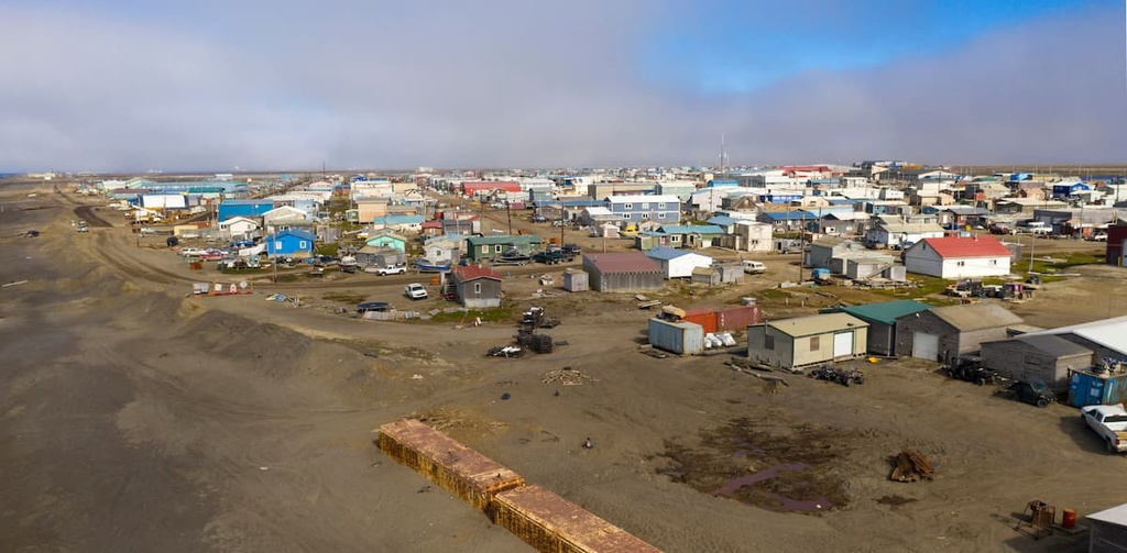
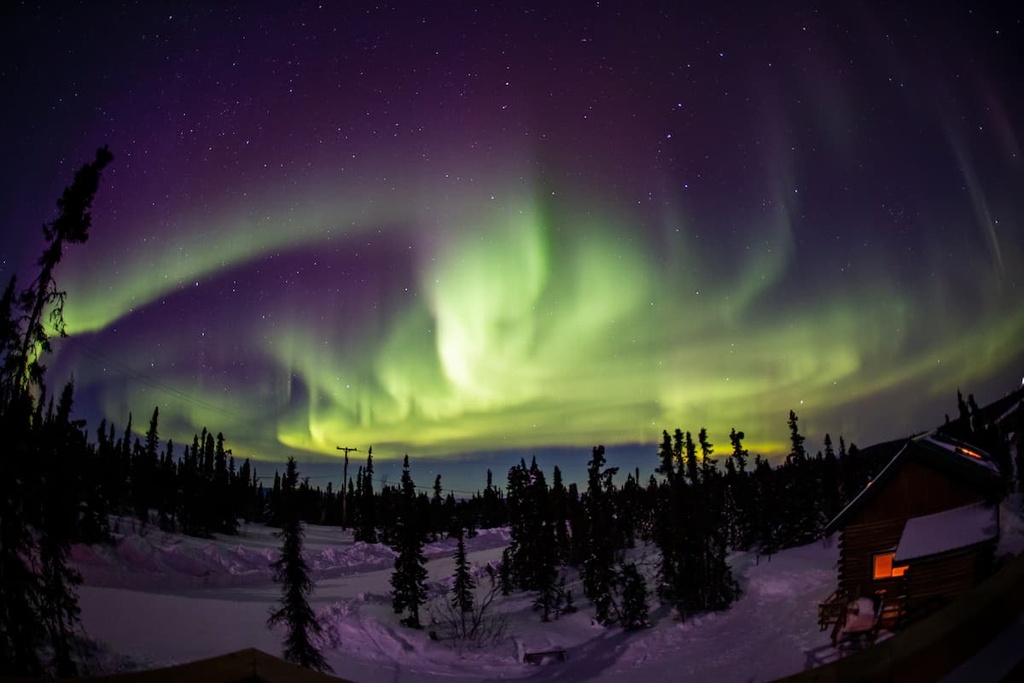
As it is located so far north, Utqiaġvik experiences over two months of constant sunshine during the summer and more than two months without any sun during the winter. During the summer, visitors can go on tours to spot polar bears and snowy owls or they can visit the Iñupiat Heritage Center and other historic cultural sites. Not many people visit the area during the winter but viewing the northern lights and dog mushing are both popular winter activities in Utqiaġvik.
The town is only accessible by plane, so regional flights connect the airport at Utqiaġvik to the cities of Anchorage and Fairbanks. Despite the fact that it is so small and remote, guests in Utqiaġvik can choose between hotels, inns, and B&Bs for accommodation during their stay. There is also a decent assortment of restaurants available in Utqiaġvik that serve up a range of cuisines, including Mexican, Chinese, and American dishes.
Kotzebue (Qikiqtaġruk) is a small city with a population of just over 3,000 people that’s located slightly to the north of the Arctic Circle. Approximately 80% of residents in Kotzebue identify as Iñupiat and the city itself is the seat of the Northwest Arctic Borough.
In Kotzebue, there are plenty of attractions for visitors to enjoy, including the Northwest Arctic Heritage Center, which is located in town. From Kotzebue, there is also relatively easy access to the incredible Noatak National Preserve, Kobuk Valley National Park, and the Cape Krusenstern National Monument.

Most activities that leave from the city take advantage of the region’s remote wilderness. While in the area around Kotzebue, you can enjoy everything from backpacking and hiking to rafting and wildlife viewing. There are a few restaurants and coffee shops available in Kotzebue, too, as well as grocery stores, and a hotel and B&Bs. The town also has a regional airport with service to Anchorage, Nome, and a number of smaller communities in the area.
Fairbanks is one of the largest cities in Alaska. It has a population of around 100,000 people, making it second in size only to Anchorage.
Although Fairbanks is one of the most populous areas in the northern part of the state, it isn’t terribly close to the NPR-A, especially when compared to Utqiaġvik or Kotzebue. However, you can get to Fairbanks by road, rail, or air from Anchorage and most other major populated places in south-central Alaska, so it’s a good starting point for journeys to the northern part of the state.
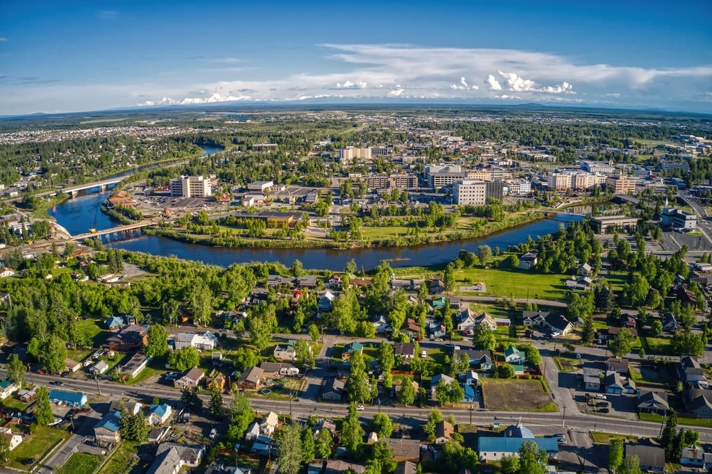
Fairbanks also has a wide range of activities and places for visitors to enjoy, including museums and cultural events. There are also opportunities for hiking, fishing, canoeing, and relaxing in hot springs while in Fairbanks. Plus, as a major city, Fairbanks has a wide selection of accommodation options and restaurants for visitors to choose from during their travels.