Scan the QR code and open PeakVisor on your phone
Located in southeast Arizona in the United States, Mount Graham Wilderness Studay Area (WSA) lies within Safford Ranger District of the Coronado National Forest. The WSA encompasses a portion of the Pinaleños Mountains and lies close to Mount Graham, the tallest peak in the range. There are 14 named peaks in the the WSA. Hagens Point is the tallest at 9,573 ft (2,918 m) and Stowe Knoll (5,285 ft/1,611 m) is the most prominent (604 ft/184 m).
The Mount Graham Wilderness Study Area covers more than 60,000 acres (24,280 ha) in southeastern Arizona. It is part of the Safford Ranger District of Coronado National Forest and was created in 1984 as part of the Arizona Wilderness Act.
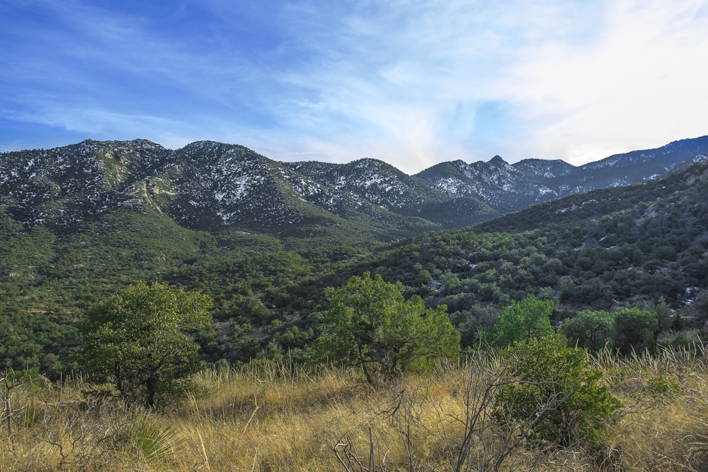
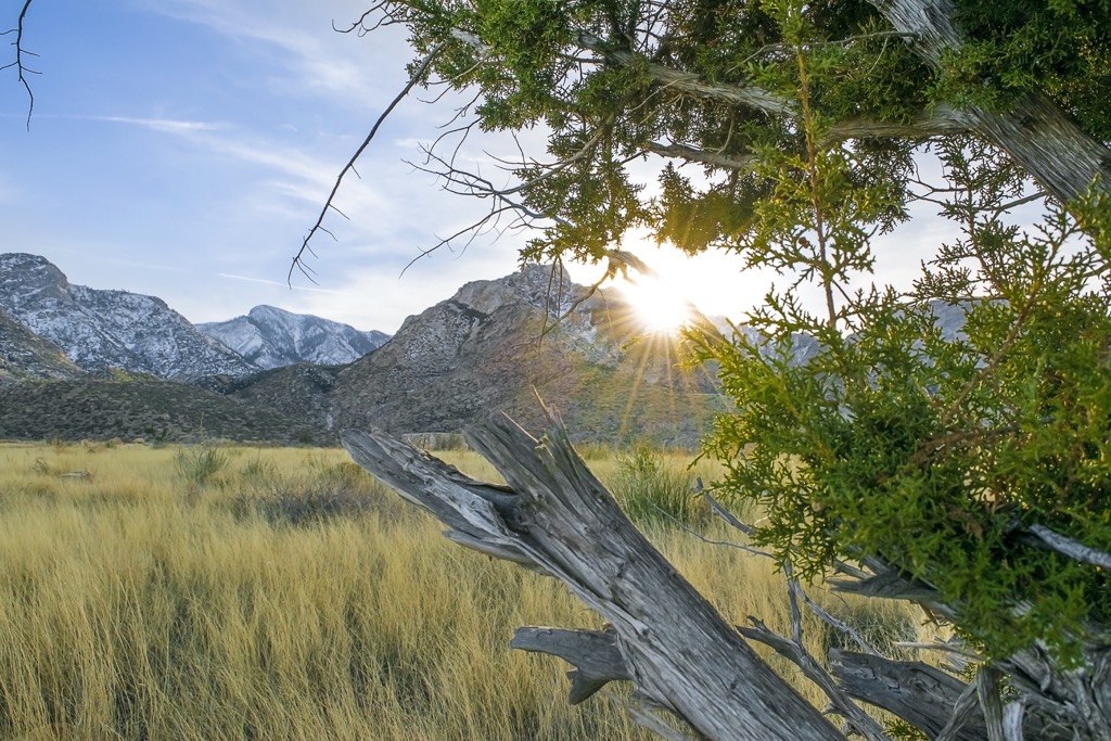
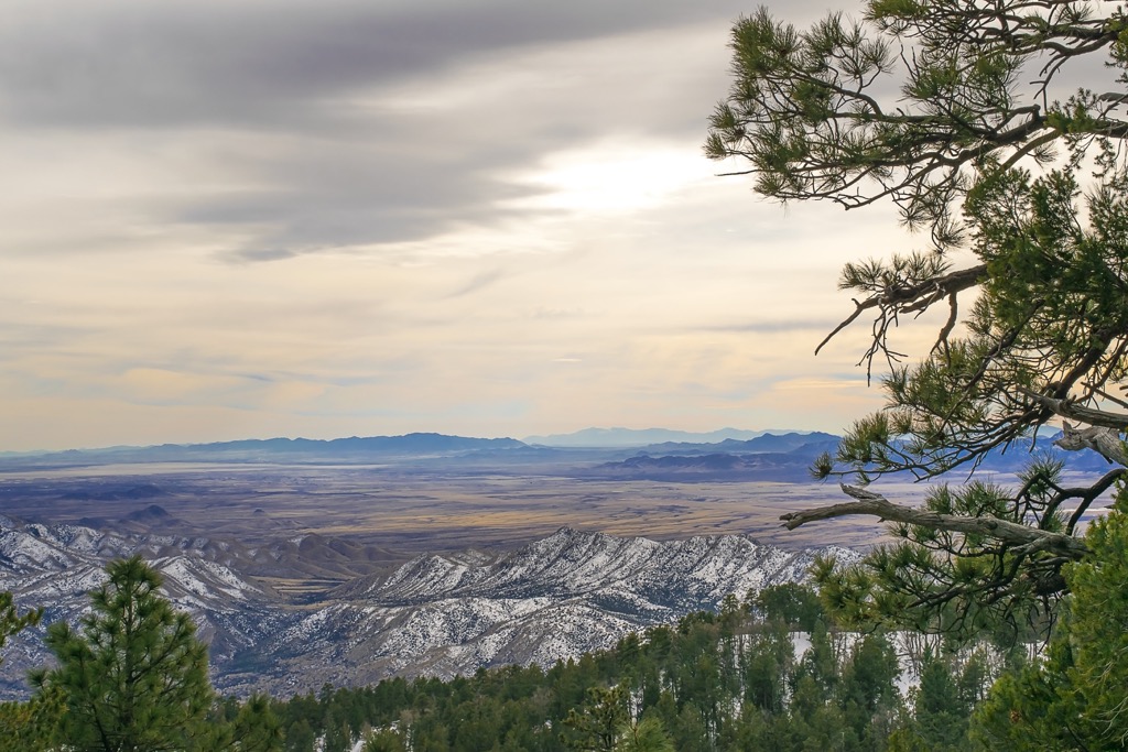
The WSA covers parts of the Pinaleño Mountains, Arizona’s highest Sky Island mountain range. Its boundaries lie close to taller peaks, such as Mount Graham (10,699 ft/3,261 m), but does not include them. The three tallest peaks in the WSA are Hagens Point (9,573 ft/2,918 m), Eagle Rock (9,452 ft/2,881 m), and Merrill Peak (9,295 ft/ 2,833 m).
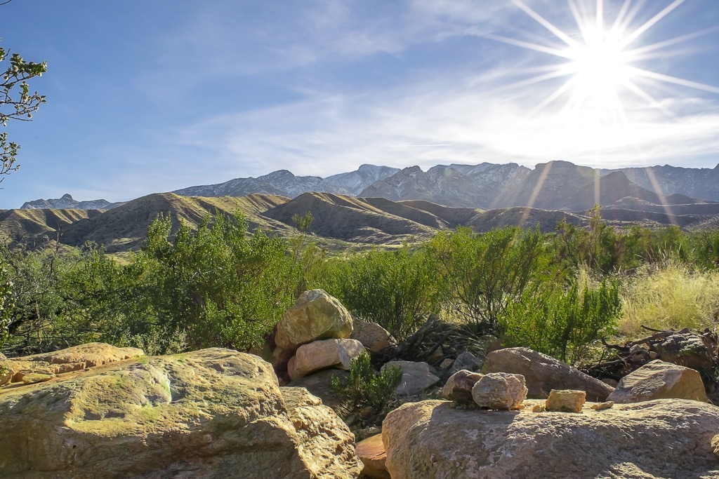
To the east of the Mount Graham WSA is San Simon Valley and Sulphur Spring Valley neighbors it to the west. Near to the WSA are a number of campsites and popular recreation areas, a road that follows the crest of the Pinaleño Mountains and Mount Graham, and a number of jeep and pack trails.
The Pinaleño Mountains are composed of Precambrian metamorphic and igneous rocks. The range is a prime example of the fault bounded, uplifted blocks of the Mexican Highlands, a sub-province of the southern Basin and Range Province.
The metamorphic rocks date back to the Early Proterozoic (1,650 to 1,800 million years ago), primarily quartzo-feldspathic gneiss with biotite, biotite and hornblende, and some amphibolite and schist. There are igneous intrusions from the Middle Proterozoic (1,400 million years ago) composed of granite and granodiorite. The southern portions of the area contain mainly oracle granite.
There is no mining activity in the area and only a little bit of mining activity to the south of the WSA.
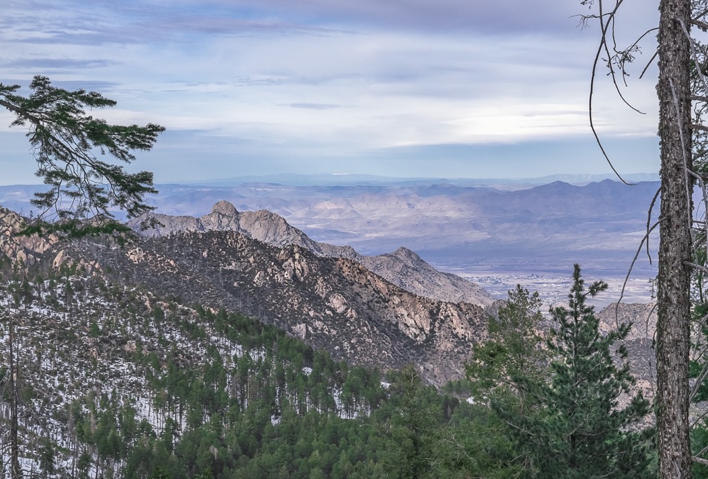
The steep slopes of the Pinaleño Mountains house a number of forest communities across the varying elevations. There are pinyon, juniper, evergreen and oak, madrean pine-oak, ponderosa, evergreen forest, and mixed-conifer forest communities.
Common conifer species include pinyon pine, ponderosa, southwestern white pine, Arizona cypress, and redberry juniper. Arizona white oak, Emory oak, gray oak, meatloaf oak, and silverleaf oak are the main oak species found within the Madrean pine-oak woodlands.
At higher elevations, white fir, Douglas-fir, quaking aspen, rocky mountain maple, bigtooth maple, box elder, Scouler’s willow, and gambel oak are present. Moving down the slopes, chaparral and scrub vegetation appear including manzanita, desert ceanothus, fendler ceanothus, mountain mahogany, silktassles, shrub live oak, rock spray, and sumacs.
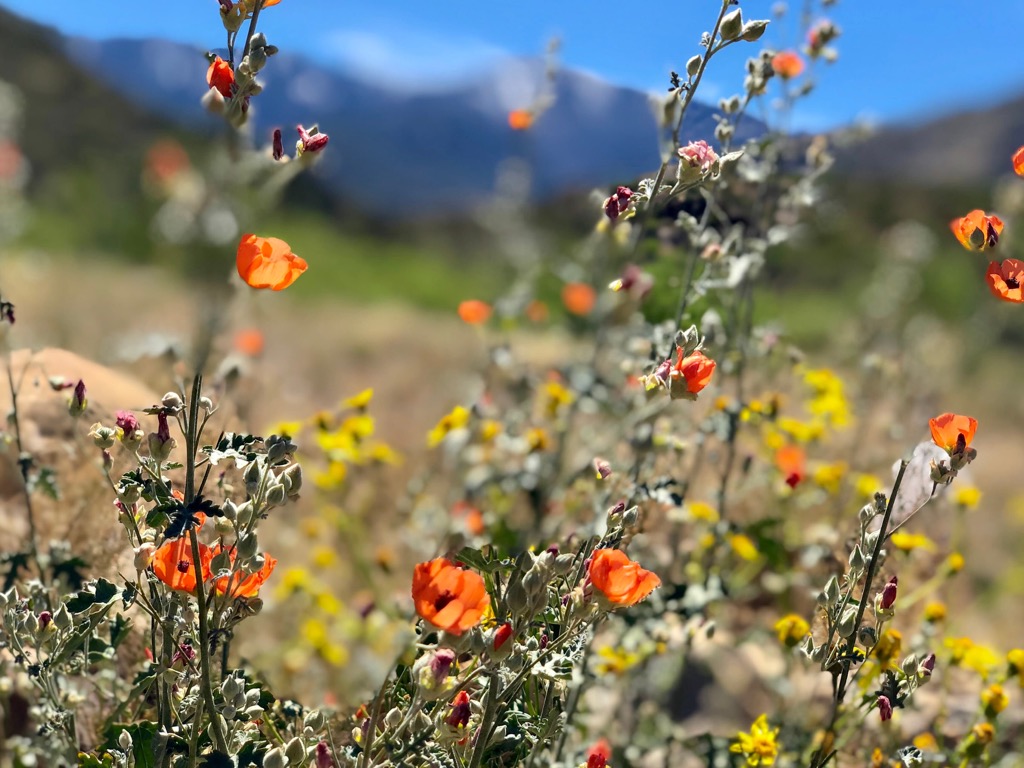
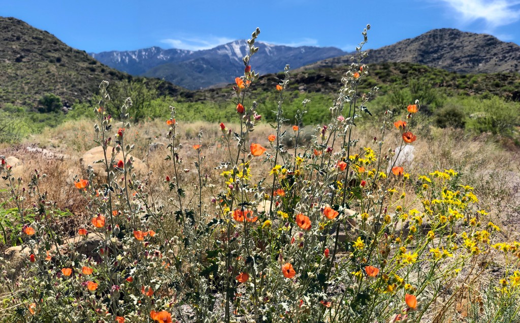
Among the desert grasslands are threeawns, blue grama, sideoats grama, rothrock grama, Arizona cottontop, plains lovegrass, curly-mesquite, green sprangletop, muhly grasses, and Texas bluestem. There are also agaves, yuccas, sotol, beargrass, Acacias mimosa, mesquite, cholla, and prickly pears at lower elevations.
In riparian areas, such as stream beds running through canyons, cottonwood, Arizona sycamore, willows, Arizona alder, and ash grow. The canyons were historically logged for wood to supply nearby communities but now second growth forest has filled in. A few significant wildfires since 1995 have burned more than 40,000 acres (16,190 ha) in the Pinaleño Mountains.
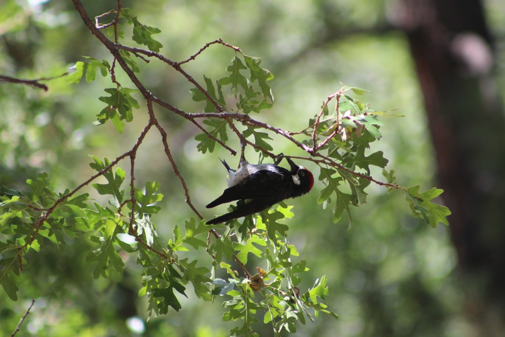
The Mount Graham WSA provides habitat for threatened or endangered species such as the Mount Graham red squirrel, the Mexican spotted owl, northern goshawks, Pinaleño pocket gophers, long-tailed voles, and Apache trout. Common mammals include a variety of bats, raccoons, coatis, ringtails, foxes, mountain lions, bobcats, porcupines, elk, white-tailed deer, mule deer, and a very healthy black bear population.
Coronado National Forest is named after Fancisco Vasquez de Coronado. In 1540, he traveled through the land of the Zuni and Hopi tribes. The area continued to be explored by Spanish conquistadors during the 1500s. Occasionally artifacts from this time of exploration still turn up on the slopes of Mount Graham.
Prior to and during the arrival of foreign explorers, the Western Apaches – the San Carlos Apaches, Mountain Apache, and Yavapai tribes – occupied the area around Dzil Nachaa Si’an (Mount Graham). In the 1870s, the US government established reservations which removed Native Americans from their traditional lands, thus separating them from the natural world that sustained their traditional practices and livelihoods.
Mount Graham received its current name in 1846. During the war with Mexico, a party of the Army of the West came down the Gila River and named the mountain after a senior officer in the Army Corps of Topographical Engineers. Coronado National Forest was created in 1902 and the Arizona Wilderness Act established wilderness areas in 1984. The area is currently used for recreation, primarily hiking and horseback riding.
There are a handful of trails in the Mount Graham WSA, as well as numerous trails surrounding it within Coronado National Forest.
Clark Peak (9,012 ft/2,747 m) is the 4th tallest peak in the WSA. The Clark Peak Trail runs up and down along the ridge of the Pinaleños. It begins at the end of Swift Trail (FR 803) at 9,000 ft (2,745 m). From there, the trail drops nearly 2,000 ft (610 m) to Taylor Pass, before climbing again about 1,600 ft (490 m) to West Peak (8,694 ft/2,650 m). The trail is 6.7 mi (10.8 km) long with elevations ranging from 7,100 ft to 9,000 ft (2,165 m to 2,745 m).
Ladybug Trail begins near Ladybug Peak (8,750 ft/2,667 m), named for the numerous ladybugs that show up here throughout the year. The trail runs 5.9 mi (9.5 km) between 5,200 ft and 8,780 ft (1,585 m and 2,675 m) elevation. Along the way, the path crosses through mixed conifers, oak woodlands, and manzanita and desert scrub.
Views along the way take in Jacobson Canyon, and the Gila Mountains and Gila Valley in the background. The greater area has a fairly high density of black bears and there is the potential to spot a black bear, or signs of them, on this trail.
Deadman Peak (6,365 ft/1,940 m) is connected to Mount Graham by a high, sharp ridge. The Deadman Trail leads up the drainage of Deadman Creek, passing by a couple scenic waterfalls during spring flows. The trail stays in canyon for its entirety, before running in to Round the Mountain Trail #302. A stream along the canyon floor holds water for most of the year. The trail is 3.4 mi (5.5 km) between 4,560 ft and 6,280 ft (1,390 m and 1,915 m) elevation.
The Arcadia Campground and Hospital Flat Campground lie in close proximity to the WSA. Small towns such as Willcox and Safford are nearby with basic amenities.
Tucson, Arizona is 140 mi (225 km) to the southwest, about a 2.5 hour drive away. The city has a population of 545,000 people and many ways for visitors to connect with the rich desert landscape and the area’s diverse history. Sabino Canyon is a popular outdoor location, known for its hiking trails and waterfalls. The Arizona-Sonora Desert Museum highlights local flora and fauna with a zoo, aquarium, botanical gardens, and a natural history museum. Saguaro National Park is also close to the city.
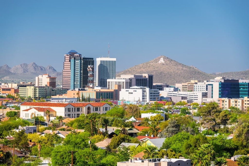
To learn a bit more about Tucson’s diverse cultural influences, stop by the Tucson Desert Art Museum, an educational blend of history and art, or the Mission San Xavier del Bac church, an impressive piece of architecture from the city’s Spanish Catholic missionary history.
As UNESCO’s first City of Gastronomy, Tucson has an exciting dining scene that draws on strong indigenous and Mexican influences. Many foods sourced from the landscape appear on menus – prickly pear, chiles, mesquite, and native seeds and grains to name a few. Along with top-notch Mexican food, there are classic Sonoran hot dogs, cafes, breweries, and more. It is easy to find an affordable hotel or motel in the city, a historic B&B, or relax at a guest ranch or spa near the city to soak up the natural beauty of the desert.
190 mi (305 km) away, a little over a 3.5 hour drive, to the northwest, Phoenix is Arizona’s capital and has a population of 1.66 million people. Some top spots to explore while in the city include the Heard Museum – dedicated to American Indian art and displaying textiles, jewelery, ceramics, baskets, and more; Taliesen West – Frank Lloyd Wright’s winter home; the Musical Instrument Museum; the Desert Botanical Garden; and the Japanese Frienship Garden.
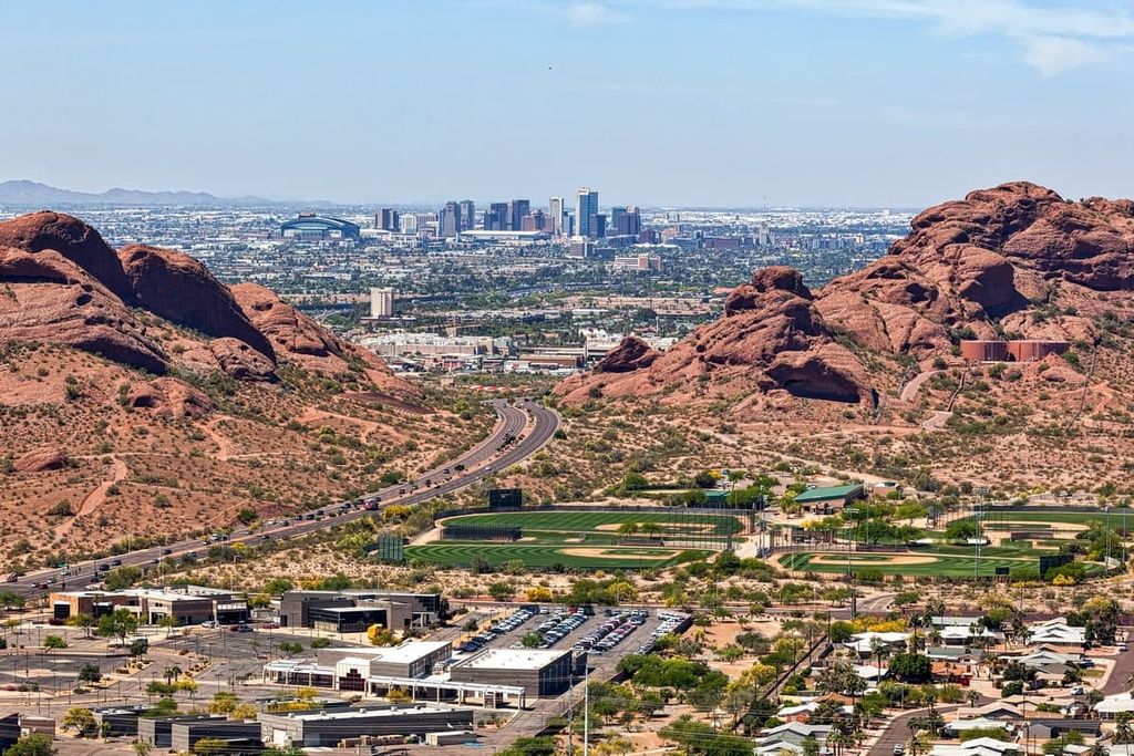
Just outside the city, one can hike up Camelback Mountain (2,707 ft/825 m) along either Echo Canyon or Cholla trails and enjoy amazing views from the top.
Phoenix has a diverse dining scene with a heavy Mexican influence. One can find a variety of cuisines such as Middle Eastern, Latin, and Thai, as well as classics like taco trucks, coffee shops, pubs, and breweries. Many wineries in Arizona have tastings in Phoenix, so one can spend an afternoon sampling local Arizona wines. There are many options for where to stay whether it is a hotel or B&B in the city, a campsite or RV park under the desert stars, or a peaceful retreat at a resort or guest ranch outside the city.