Scan the QR code and open PeakVisor on your phone
While Montenegro’s small area may make it easy to overlook on a map of the massive Balkan peninsula, the rich natural, historic, and cultural opportunities present in Montenegro make the country just as worth a visit as its larger neighbors. It is home to 4573 named peaks, the tallest of which is Zla Kolata (Kolkata e Keqe) at 2,535 m (8,317 ft) in elevation and the most prominent of which is Bobotov Kuk with 1,475 m (4,839 ft) of prominence.
Montenegro is a country located in a corner of the southwestern Balkan Peninsula. It neighbors the Adriatic Sea in the west and it shares its borders with five other countries. This includes Croatia and Bosnia and Herzegovina to the northwest, Serbia to the northeast, Kosovo to the east, and Albania to the south.
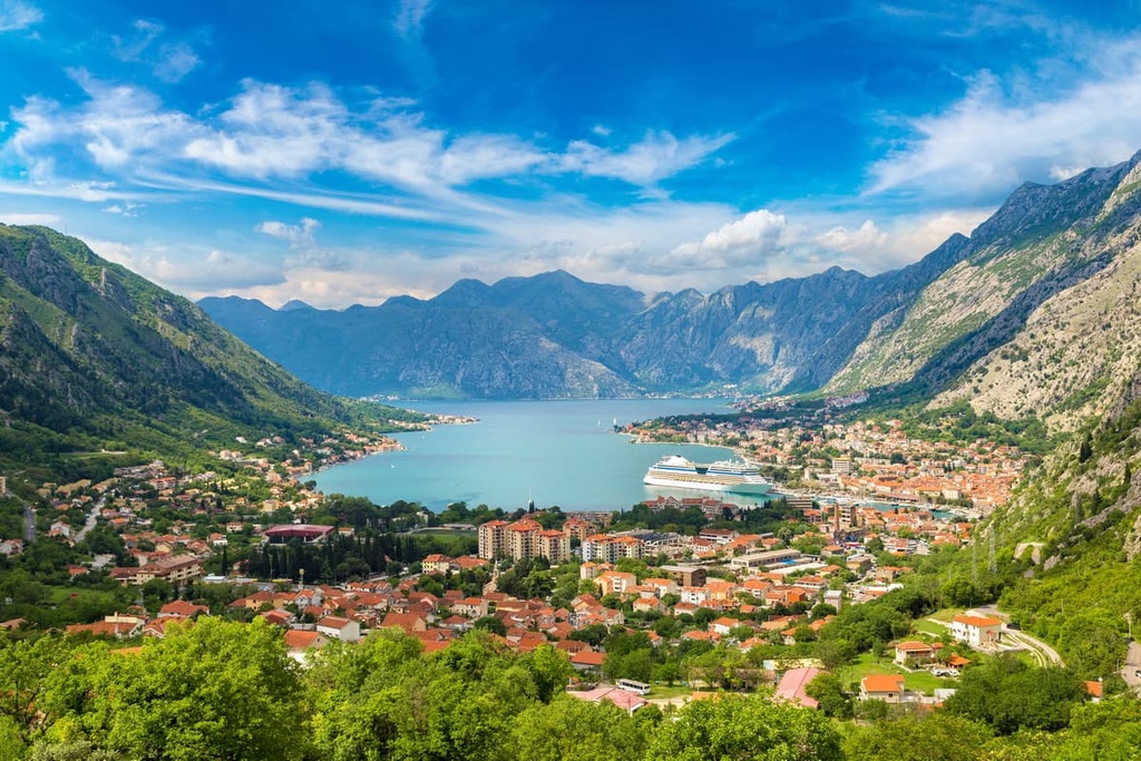
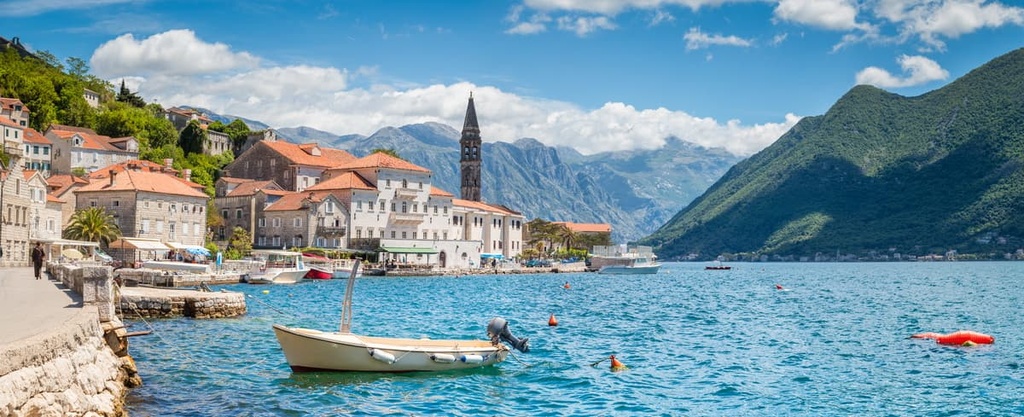
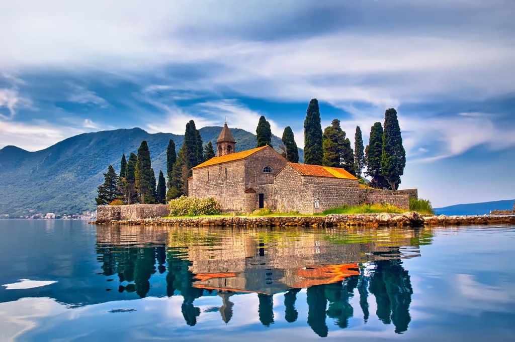
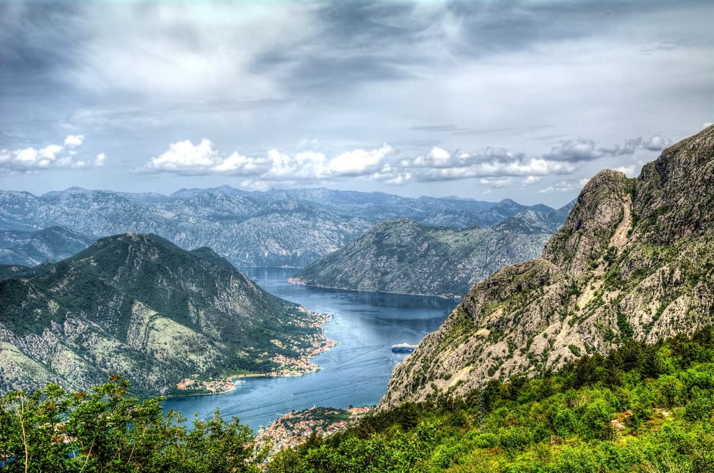
On Montenegro’s Adriatic Coast, there’s a large inlet known as the Bay of Kotor. The bay is actually a submerged river canyon that’s bounded by tall mountains, including the Lovcén mountain peaks of Štirovnik and Jezerski and those of the Orjen range. There are a few islands off Montenegro’s coast, but none with any major human settlements.
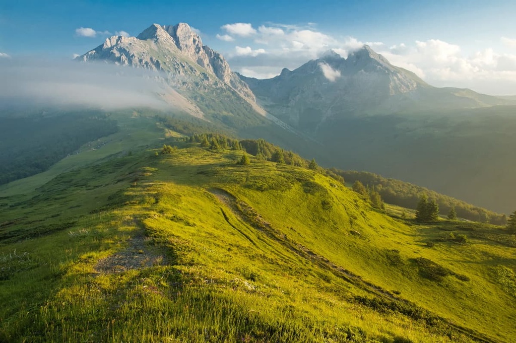
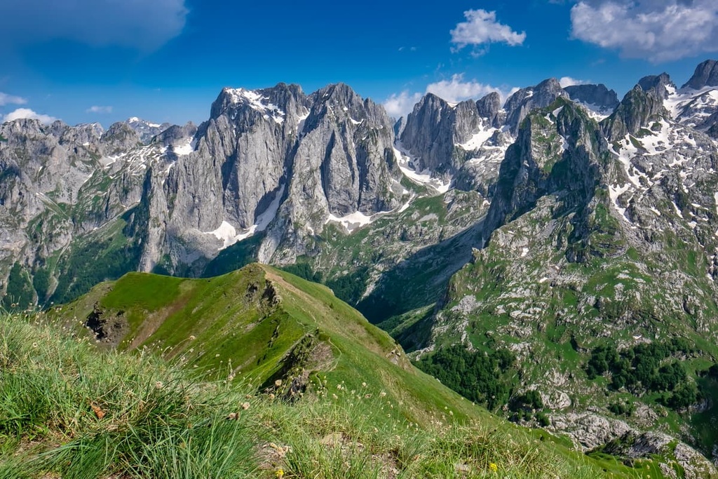
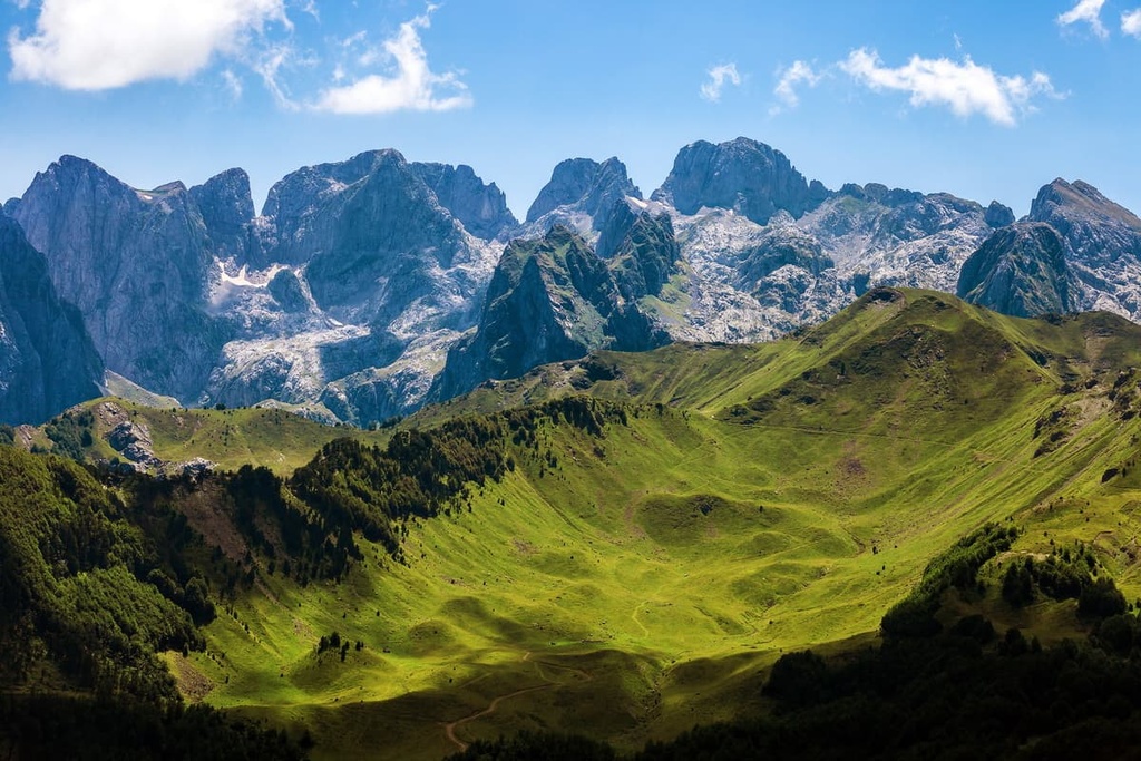
The Dinaric Alps run through Montenegro, and over two-thirds of the country’s land area is considered mountainous.
In northern Montenegro, there’s the Dinaride massif of Durmitor, which contains Bobotov Kuk. Durmitor is surrounded by the river canyons of the Tara, Piva, and Komarnica in all directions, save for the east, where it opens up before a 1,500 m (4,921 ft) tall plateau. Across this plateau is the 2,277 m (7,470 ft) mountain of Sinjajevina, or Sinjavina.
The aforementioned Orjen is a sizable mountain range that borders both Montenegro and Bosnia and Herzegovina. Its highest peak, the 1,895 m (6,225 ft) Veliki Kabao, is the tallest peak in the Sub-Adriatic portion of the Dinaric Alps. Northeastern Montenegro shares the Accursed Mountains with Albania and Kosovo, too.
Montenegro’s terrain, besides being known for its mountainous nature (especially in the north), is also heavily calcareous. It features karst plateaus like Bijela Gora. There are also a number of karstic mountains and poljes prevalent in the central and western regions of the country, particularly along the coast.
Certain valleys in Montenegro host swaths of fertile lowlands and plains, such as the Zeta River Valley near southeastern Montenegro.
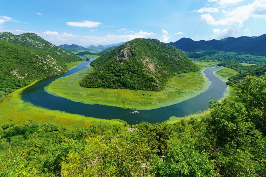
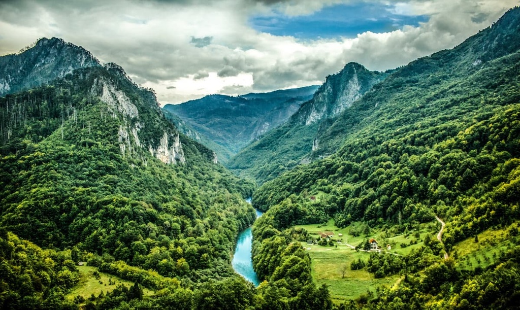
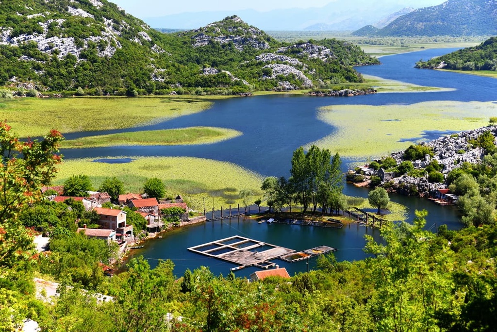
The largest lake in the country is Lake Skadar (Lake Scutari, Shkodër, or Shkodra), which resides inside a depressed karstic polje. Skadar sits on the border of Montenegro and Albania, though about 60 percent of it is located in Montenegrin territory. The Drina River, coming from Bosnia and Herzegovina and Serbia in the north, splits into several notable tributaries inside Montenegro, including the rivers Tara, Piva, and Lim.
Montenegro’s climate is a mix between Mediterranean along the coast and continental further inland.
The coastal Mediterranean climate is moderate throughout most of the year, though its sunny summers can get rather hot, and precipitation occurs the most during autumn and winter. Inland locations that are still at sea level, such as Montenegro’s capital, Podgorica, typically face hotter summers and colder winters than sea level along the coast.
As elevations increase with Montenegro’s continental mountains and hills, winters get colder and snowfall becomes more frequent. Meanwhile, summers remain warm and pleasant, and average amounts of sunshine decrease as elevations increase. On Montenegro’s highest mountains, especially toward the northern border with Serbia, the climate gets colder and resembles the climate of the Alps, with occasional cold waves that come through.
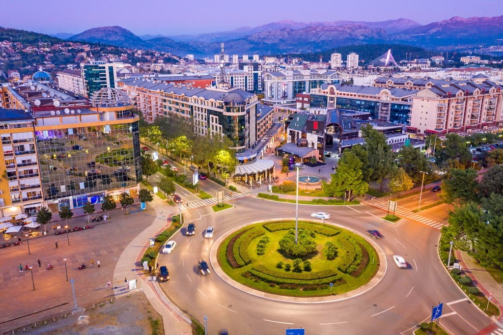
Montenegro contains 24 municipalities as well as 3 unofficial regions—Northern, Central, and Coastal. Podgorica is Montenegro’s capital city and by far its largest, with its population of around 150,000 residents constituting almost one-fourth of the country’s total population of 620,000 people.
Montenegro’s geology is primarily marked by its karstic nature as karst dominates well over half of Montenegro’s land area. The country is also home to the Dinaric Alps, though there are several large-scale zones and formations that can be used to further break down the country’s geological make-up.
Toward southwestern Montenegro is the Dalmatian-Herzegovinian Zone, a Dinaridic zone with a foundation of Middle Triassic flysch and limestone. It also features layers of Late Triassic volcanic and sedimentary rock, Late Triassic and Jurassic carbonates, and both Cretaceous and Paleocene limestone.
Around the country’s border with Albania and reaching into central and northwestern Montenegro is the Sarajevo Sigmoid, a sequence of Mesozoic flysch formations that also includes Permian and Triassic marine carbonates and clastic rocks.
Then, in northern and eastern Montenegro, is a complex of nappe formations from the Devonian known as the East Bosnian-Durmitor Block. These formations contain a diverse mix of rocks, including Paleozoic conglomerate-, limestone-, and keratophyre-based clastics, Triassic limestones and volcanic rocks, and, in the southeast, groups of mafic rocks and granite anomalies.
The High-Karst Zone, which consists of Mesozoic limestones and dolomites, spans much of the country’s mountainous terrain. This includes the Orjen range of the Dinarides, known for its unique karstic and glacially carved topography. Its karstic nature is a result of the region’s foundation of Cretaceous limestone, which now features plenty of caves and sinkholes.
The Accursed Mountains are another karstic Dinaric range marked by heavy glacial erosion. The Maganik mountain range of central Montenegro likewise consists of limestone, all Cretaceous, Triassic, and Jurassic in age.
Montenegro also has a few hotspots of fossil preservation, including the Porphyrin-Hornstein and Wengener Schichten formations with their Triassic bivalves. There’s also the Budoš limestone of the Nikšić region, a Jurassic formation brimming with paleontological plant material.
Though Montenegro is one of Europe’s smallest nations, it boasts one of the highest rates of biodiversity on the entire continent.
This biodiversity is dispersed throughout its 3 main ecoregions: the Balkan mixed forests, Dinaric Mountains mixed forests, and Illyrian deciduous forests. The first two belong to the temperate broadleaf and mixed forests biome, while the latter is part of the Mediterranean forests, woodlands, and scrub biome.
In small portions along Montenegro’s northeastern and eastern borders are Balkan mixed forests.
These forests are dominated by Hungarian oaks and other oak species that are mixed with conifers like pines, Norway spruces, and silver firs. Additionally, these forests are interspersed with grasslands, woodland-pastures, and high valley populations of beeches and hornbeams.
Dinaric Mountains mixed forests occupy central and eastern Montenegro. However, this region has such a wide variation in elevations, that there are actually two forest zones in this ecoregion.
Between 1,200 to 2,500 m (3,937 to 8,202 ft), you can find the mountainous conifer zone, where silver firs, black pines, and spruces are prevalent.
Below these elevations, the forests are dominated by broadleaf beeches and mixed oaks. These forests are home to a range of tree species, including Hungarian oaks, sessile oaks, downy oaks, common oaks, Turkey oaks, field elm, European ash, common hornbeam, maple, and rowan. European forsythia and the common lilac may be found as relicts in Dinaric canyons.
Some of Montenegro’s national parks reside within this bioregion, including Durmitor and the Accursed Mountains.
In these protected areas of Dinaric Mountain mixed forests, a great variety of mammals can be found, including predators like the gray wolf, Eurasian lynx, Eurasian brown bear, red fox, Eurasian otter, and European wildcat, and herbivores and omnivores like the wild boar, red deer, fallow deer, roe deer, and chamois.
There are also many bird species in this ecoregion, including the golden eagle, peregrine falcon, snake eagle, and European honey buzzard. This ecoregion is also home to scops owls, Eurasian eagle owls, capercaillies, rock partridges, and snow finches.
Also calling these forests their home are reptiles like Prokletije rock lizards, green lizards, fence lizards, horned vipers, adders, and Greek tortoises. Some of the amphibians that live in the region include the yellow-bellied toad, fire salamander, and fire-bellied toad.
Along Montenegro’s coast, the landscape is dominated by Illyrian deciduous forests, which are defined by their mixed broadleaf zones below 1,200 m (3,937 ft). Above this elevation, this ecoregion mostly consists of coniferous forests.
These conifer forests include all sorts of mixed firs, spruces, beeches, and pines. Meanwhile, the broadleaf zones feature beeches and mixed oaks. Additionally, along the coast, this ecoregion mostly features populations of Aleppo pines, maquis shrubs, and holm oaks.

The Illyrian deciduous forests of Montenegro also contain a great diversity of bird species, from capercaillies and peregrine falcons to kestrels and griffon vultures.
Montenegro’s continued existence as an independent state despite its size and proximity to larger powers is one of the most remarkable things about the country itself.
Long before the country was populated by the Slavic peoples it is perhaps most associated with today, it was home to the mysterious Illyrians, an ill-defined group of Indo-European peoples who inhabited the western Balkans well through ancient times.
Colonies began popping up in what is now Montenegro around the seventh century BCE. Researchers believe that the Greeks established the colony of Bouthoe around the fourth century BCE. In fact, Bouthoe is still an active town known as Budva.
In the second century BCE, Roman expeditions around the area resulted in a full-scale conquering of the Illyrians. The area that is now Montenegro eventually became incorporated into the Roman province of Illyricum, alongside various Illyrian lands along the Dalmatian coast and further inland. As a result of the split of the Western and Eastern Roman Empire, Montenegro was split between Roman and Byzantine rule.
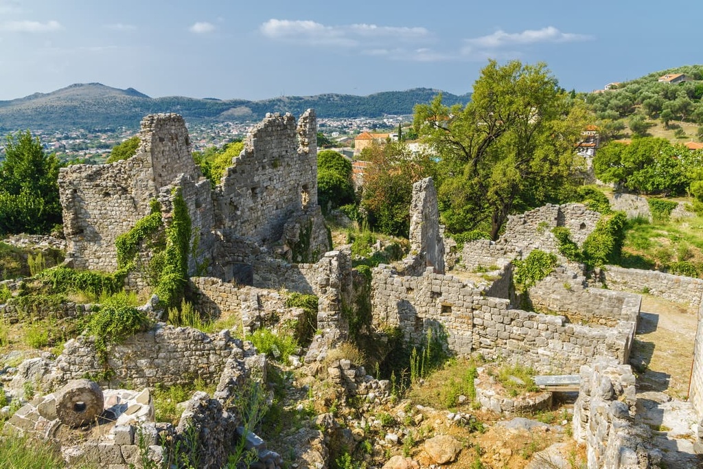
Right outside Montenegro’s modern capital of Podgorica is the ancient Illyrian city Doclea, which had Romanized and eventually became the capital of the Roman province of Praevalitana.
Doclea, much like the Roman Montenegro and the Roman Empire as a whole, suffered in the fifth and sixth centuries at the hands of barbarian attacks. The city was decimated by Visigoths and Avars and, later and notably, the Slavs.
In the ninth century, the Slavs were simultaneously Christianized and largely organized into the state of Duklja in what is now southeastern Montenegro. However, the area was again occupied by the Byzantines two hundred years later. This ended quickly after a Slavic revolt, and in the following centuries, Montenegro was controlled by various Balkan dynasties and the Republic of Venice.
Venetian control of coastal Montenegro would last until the nineteenth century, while other parts of Montenegro fell under Ottoman rule, and others remained independent. Conflicts between Montenegrins and the Ottoman Empire would persist for quite some time, though Montenegrin victories in the 1800s gradually led to their eventual independence as a state, with the country forming its first constitution in 1855.
The twentieth century saw Montenegro react and change in response to Balkan conflicts.
It was involved in World War I alongside the Allies. The country was famous for winning the Battle of Mojkovac despite a severe numbers disadvantage against Austria-Hungary. That said, the country was occupied by Austria-Hungary for about two years
Montenegro was then part of the Kingdom of Yugoslavia before it was occupied by Italy. Finally, it again became part of the Social Federal Republic of Yugoslavia.

After the dissolution of Yugoslavia in 1992, the country entered into a federation with Serbia that lasted until 2003, when it became a political union. Three years later, in 2006, Montenegro officially seceded and became the fully independent country of Montenegro (Crna Gora).
Despite its small size, Montenegro is home to a collection of popular hiking destinations. Here are some of the best hiking areas to check out in the country:
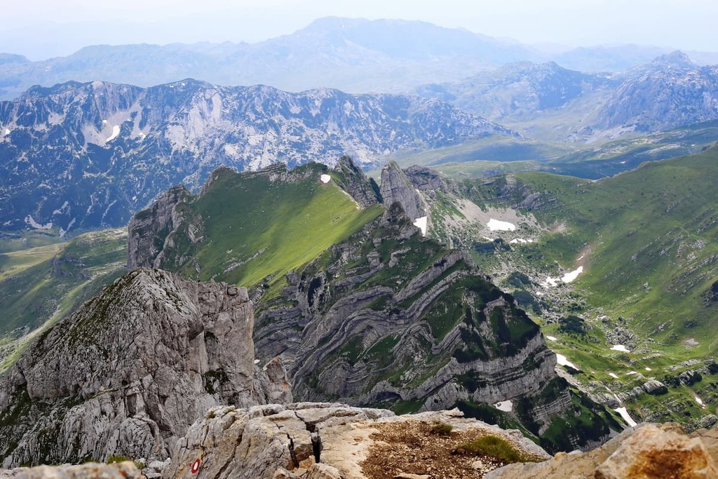
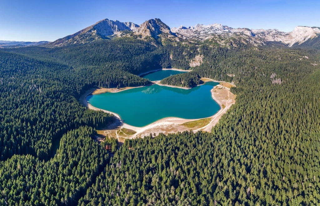
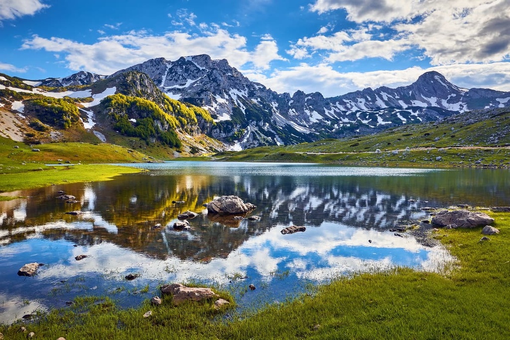
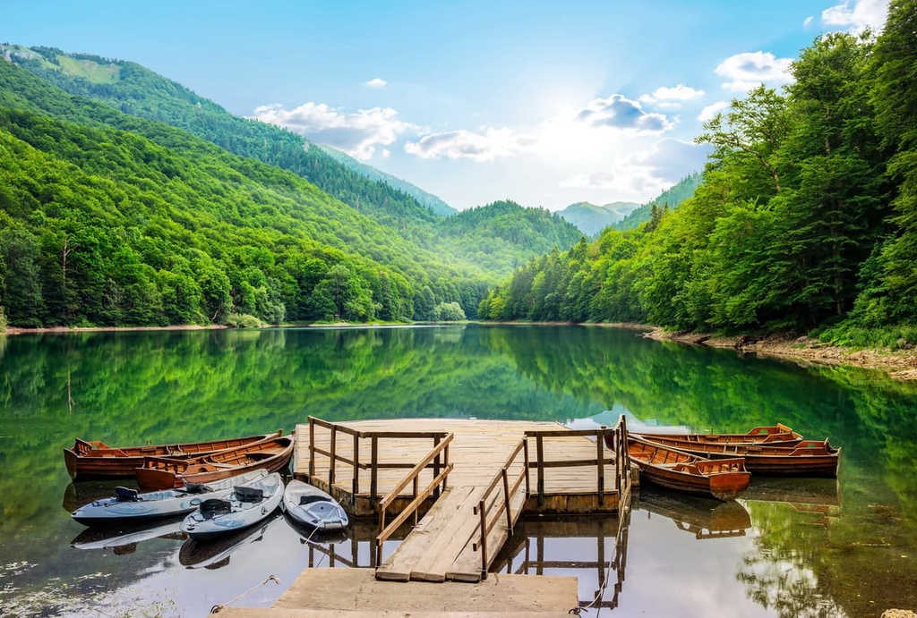
Durmitor National Park in northern Montenegro has been designated a UNESCO World Heritage Site since 1980. It features a collection of stunning 2,000 m (6,562 ft) peaks that includes Bobotov Kuk as well as 18 pristine glacial lakes, and the dramatic Tara River Canyon.
Any of the aforementioned features of Durmitor make for a great day of hiking. Of the lakes, Black Lake (Crno Jezero) is the most popular, with many trails starting and ending around it, though there is also a 3-4 hour trail around the lake itself. The Tara Canyon viewpoint is another casual hiking option that features great views of the lush green canyon below.
A 9.8 km (6.1 mi) trail up Bobotov Kuk with almost 914 mi (3,000 ft) gained in elevation is a great option for an occasionally challenging Durmitor hike with amazing vistas of the surrounding area.
Further challenging options for experienced hikers include the 12.4 km (7.7 mi) hike to the Ice Cave (Ledena Pecina) in the center of the park and the 6-8 hour Red Rock (Crvena Greda) hike, which features some of the best views of the whole park.
Other notable hiking locations in Durmitor National Park include:
The primeval forests of beech, fir, maple, and ash that are found in Biogradska Gora National Park make it an exceptional place to visit, despite its relatively small size compared to other national parks in Montenegro.
Biogradska Gora also features glacial lakes, forested mountains, an abundance of monuments, traditional architecture, and a plethora of archeological sites.
For those who wish to embark upon the longer trails of Biogradska Gora, or simply to hike as many as possible, you might want to stay in a katun during your travels. A katun is a traditional wooden shepherd’s hut that has been repurposed to provide lodging for hikers.
Hiking in Biogradska Gora largely revolves around the lakes, including Biogradsko, which is home to a nice 3.5 km (2.2 mi) trail.. There are also several notable peaks, including Crna Glava, Zekova Glava, and Bendovac, that all have incredible views of the park.
Some popular routes to take if you want to see these peaks include:
Located near Montenegro’s southwestern coast is Lovćen National Park. The park was named after the imposing Mount Lovćen, which consists of the peaks Štirovnik and Jezerski.
Most hikes in Lovćen begin in the quaint forest village of Ivanova Korita, and they often lead into the rugged and forested heart of the park.
One such 8.4 km (5.2 mi) trail leads to the Mausoleum of Njegoš and thus to Jezerski near the mausoleum, a major attraction of the park that offers an extraordinary panorama of the landscape. There is another 18.1 km (11.2 mi) loop from Njegusi that also leads to the mausoleum, but it passes by Podjezero and Jezero instead.
Another hiking option is the Wolf Trail, which is a 7 km (4.4 mi) hike that’s often completed with a 3.2 km (2 mi) detour to the 1,474 m (4,836 ft) Babina Glava hill. This trail offers views of the coasts, mountains, rich forests, and an old rural village.
From Ivanova Korita, you can also find a 6.8 km (4.2 mi) trail to Krstac and the 12.6 km (7.8 mi) Kuk Loop that takes you up Štirovnik. You can also take the 9 km (5.6 mi) trail from Cetinje and the 10 km (6.2 mi) Kotor Trail if you want to venture to Ivanova Korita.
Edging out Durmitor for the title of Montenegro’s largest national park, Lake Skadar National Park, which is located on the country’s Albanian border, is a spectacular karstic landscape that features the crystalline water of the Balkans’ largest lake.
There are around nine hikes that travel around Lake Skadar, though some aren’t passable in the early summer when the lake is full of snowmelt. One popular trail is Komarno–Rijeka Crnojevíca, a 6.4 km (4 mi) caravan road that takes you to see gorgeous mountains, old stone bridges, and ancient water mills. Once you reach the historic town of Rijeka Crnojevíca, you can also enjoy a famous viewpoint of Lake Skadar.
Zabes Godinje, a 4.5 km (2.8 mi) trail from the village of Zabes with lookouts along the way, is another well-known path around the lake, as is the 10 km (6.2 mi) trail from the village of Pinčići.
Prokletije National Park is a national park located along the Montenegro-Albania border. It is known for its rugged and jagged peaks, winding river valleys, dramatic slopes, glacial lakes, and mineral springs. Around one-third of all Balkan plant species can be seen in the park.
The signature hike of Prokletije is Volušnica, a moderately-difficult 5 hour hike that boasts unforgettable views of the surrounding mountains. The 6 hour Krosnja–Šuplja vrata hike up the Karanfili mountains also boasts great views, particularly of the Grebaje Valley. It culminates at the namesake rock arch of Šuplja vrata.
Other notable hikes in Prokletije include:
The Via Dinarica is a network of hiking trails that travels through the Balkans via the Dinaric Alps, passing through many famous parks and hiking areas.
The primary route of the Via Dinarica is the 1,261 km (783.5 mi) White Trail, which cuts through central Montenegro while passing through expansive alpine meadows, primeval forests, glacial lakes, natural springs, and karstic landscapes.
Other notable hiking areas include in Montenegro:

Although Montenegro is not a country known for its metropolises, there is still much to be said about its history-rich cities, both large and small, and the numerous beautiful towns and villages that speckle the landscape between them.
The small city of Podgorica, Montenegro’s capital with a metropolitan population of around 185,000, may not contain all the hustle and bustle of a larger European city, but is nonetheless a center of great cultural and historical significance with plenty to explore.
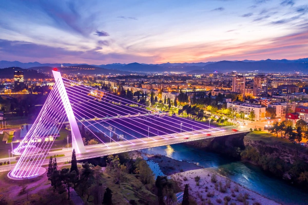
From Roman ruins in nearby Doclea and an Ottoman clock tower to communist architecture and its futuristic Millennium Bridge, thousands of years of Montenegrin history stand on display in Podgorica.
The Montenegrin National Theatre, Podgorica City Museum, National Museum of Montenegro, Petrović Castle and art gallery, and Mark Miljanov Museum are just a handful of Montenegrin cultural institutions that call Podgorica their home.
Stunning Catholic cathedrals and brutalist Roman Catholic churches, centuries-old Orthodox Christian monasteries, and stone-built mosques further embody the diverse and long-standing cultural significance of the city.
The green oasis of King’s Park, palm-tree-lined and car-free center of Republic Square, and the well-preserved Old Town–harkening back to Podgorica’s Ottoman past, full of stone homes and quaint villas–offer additionally insight into city life in Podgorica. As for bars, restaurants, and general nightlife, Bokeška Street is seen as the premiere place to be in the city.
The main modes of public transport in Podgorica are bus lines and taxi services. Additionally, the city is also at the heart of the Montenegrin rail network so it offers easy access to Montenegro’s extremities and neighbors. Not too far from the city center is Podgorica Airport, the country’s main international airport.
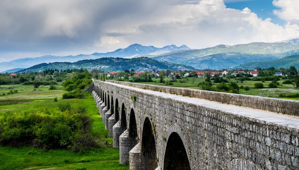
The second largest city in Montenegro, 72,000-person Nikšić, is an area of both great urban and natural beauty that’s also known for its thriving arts and cultural scenes. The city is connected to Podgorica via the Nikšić-Podogrica Railway.
Right next to the city are the artificial Lake Krupac, a popular recreational destination, and Trebjesa Hill, which is home to a massive Yugoslav memorial and views of Nikšić’s many layers of historical architecture. Right below the hill are several of the city’s main attractions, like the ornate King Nicholas Palace, the lively Freedom Square, City Park, and the St. Basil of Ostrog cathedral.
The most famous images of Nikšić tend to evoke the grandeur of Carev Most, a hundred-year old stone bridge over the Zeta river that’s surrounded by Montenegro’s rolling plains and mountain landscapes. Near the city, atop a green hill, is Bedem Castle, which is made of the stones and red tiles that give the city its signature Balkan flair.