Scan the QR code and open PeakVisor on your phone
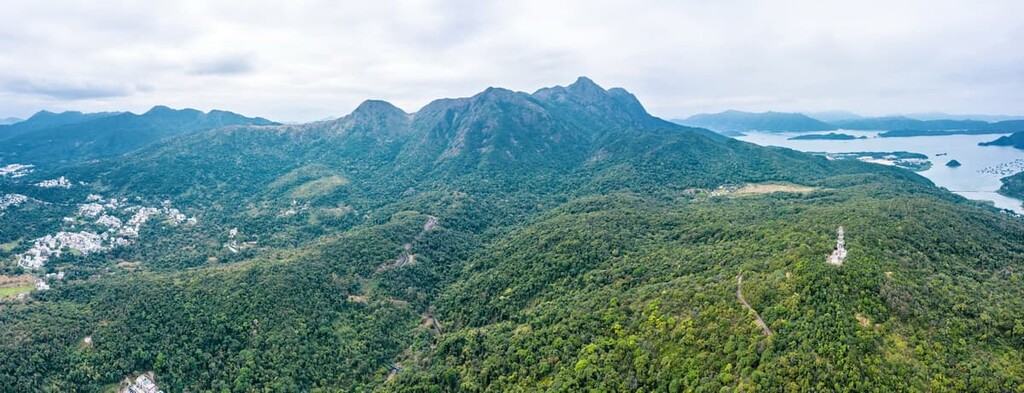
Ma On Shan Country Park consists of 2,880 hectares (7,117 acres) of rugged countryside in eastern New Territories in the Hong Kong Special Administrative Region of China. There are 34 named peaks in the park. The park is named after its highest peak, Ma On Shan (702 m/ 2,303 ft), which literally translates to “horse saddle hill” in Chinese.
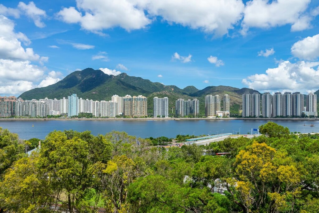
Ma On Shan Country Park is situated in Hong Kong between the district of Sha Tin to the west and the Sai Kung peninsula to the east. It borders the residential area of Ma On Shan to the north and extends into Kowloon to the south. It is adjacent to Lion Rock Country Park and Sai Kung West Country Park
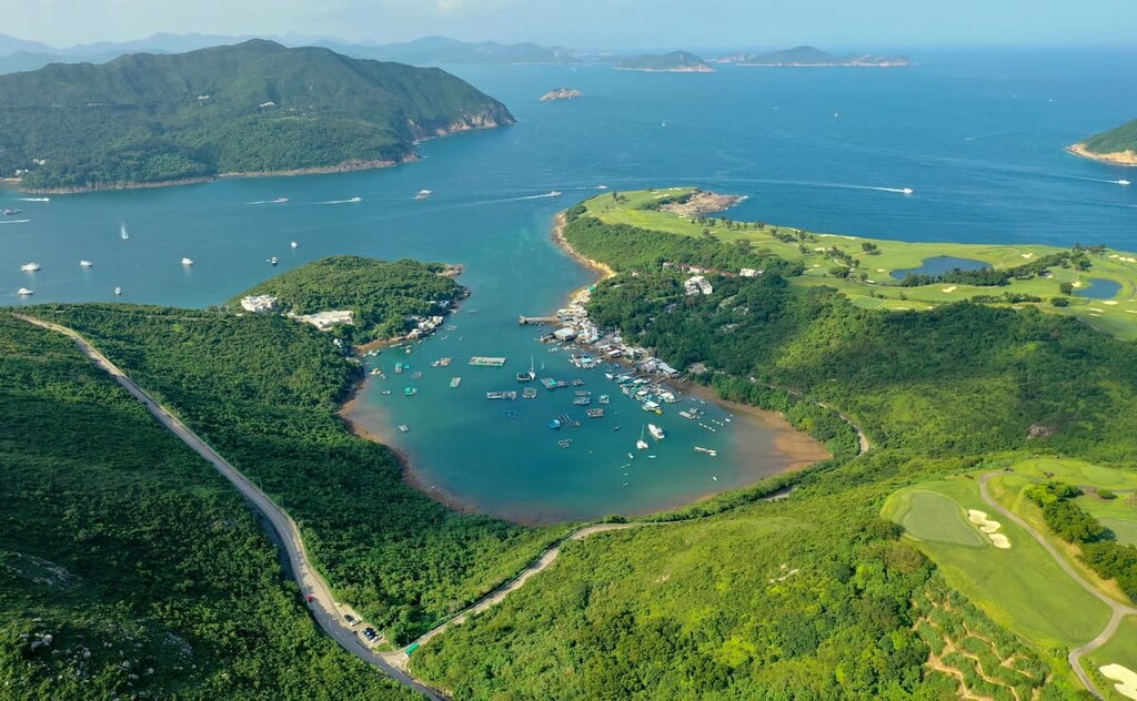
The park also has a separate South Portion that’s located on Hebe Haven, a small peninsula with beaches, capes, and an old village.
With a location that straddles New Territories and Kowloon, Ma On Shan Country Park is crisscrossed with many ancient trails that used to serve as highways for villagers. Today, the modern-day highway of Tate’s Cairn Tunnel runs beneath the park between Sha Tin in the north and Diamond Hill in the south.
Close to the Sai Kung side of the park is Ngong Ping (not to be confused with Ngong Ping on Lantau Island), one of the very few plateaus in Hong Kong. In a city where high vantage points almost guarantee views of high-rises in heavily built-up neighborhoods, this plateau is one area that may make you forget you are in Hong Kong.
Igneous, sedimentary and metamorphic rocks can all be found in Ma On Shan Country Park. Ma On Shan is one of the few places in Hong Kong with metamorphic rocks, which make up less than 1 percent of the city’s land surface. The rocks were originally sedimentary rocks, mostly limestones, that formed more than 300 million years ago.
In the middle Jurassic Period (about 170 million years ago), magma intrusions and plate movements produced high temperatures and pressures that transformed pre-existing rocks into metamorphic rocks. This volcanic activity also led to the formation of volcanic rocks such as vitric tuff, tuffite and rhyolite lava on top of the metamorphic rocks.
Among many types of mineral deposits found in Ma On Shan, there are iron ore bodies that were mined from 1906-1976. The minerals were carried by magma from the mantle to the crust in the form of hydrothermal fluid which forced into the cracks of the limestones. The end product is called skarn, a metamorphic rock that bears concentrated minerals.
The original open cast mine destabilized the slopes which were wrecked by landslides in the late 1950s. The mining operations turned fully underground afterwards and the open cast mine was abandoned.
The Ma On Shan area also contains plant fossils of Leptophloeum rhombicum, an extinct species with elongate-rhomboidal leaf cushions that is characteristic of the late Devonian Period (about 360 million years ago).
The park has a few “rock jungles” that feature whimsically shaped crags such as the “canoe rock” and “lizard rock.” Having formed about 130 million years ago after a volcanic eruption, the rocks in these crags are tuffs containing lapilli and unevenly-sized grains.
These rock jungles are susceptible to weathering processes that have disintegrated them and etched grooves on their surfaces. The biggest rock jungle is in Shek Lung Chai on Luk Chau Shan.
The volcanic soil in Ma On Shan is rather poor in nutrients. The trees are mostly native species such as deciduous sweet gum (Liquidambar formosana), evergreen Hong Kong orchid tree (Bauhinia × blakeana) and ivy tree (Schefflera heptaphylla).
The park has some pockets of abundant and adaptable vegetation despite the hostile environment. For example, the 2-hectare (5-acre) feng shui forest in Mui Tsz Lam contains 72 native tree species, the highest number among the hundred or so feng shui forests in Hong Kong. One of the major species there is Hance’s syzygium (Syzygium hancei).
Feng shui forests are native woodlands that sheltered villages from strong winds, protected slopes from erosion and reputedly blocked evil spirits in the old days. Fruit trees and other plants with economic and medicinal value were grown on the edge of these areas, making these “enhanced” forests exceptionally rich in biodiversity.
The acidic and iron-rich soil on the slopes of Ma On Shan Country Park also provide the ideal habitat for wild rhododendrons, including all six wild species found in Hong Kong. The flowers bloom in a riot of pink, red, mauve, white and yellow in spring, though signs are pointing to earlier flowering and migration to higher grounds as a result of climate change.
Other native flowering plants include a few species of orchid like purple bulb orchid (Tainia hongkongensis) and bamboo orchid (Arundina graminifolia), Hong Kong Lily (Lilium brownii) and loose-flowered euonymus (Euonymus laxiflorus).
The area of Mau Ping, a designated Site of Special Scientific Interest, is home to the largest pocket of the rare Crapnell's camellia (Camellia crapnelliana). It is also known for its giant box bean liana (Entada phaseoloides), which is commonly known as the “king of vines.” This plant is famous for how it can twist its way over trees and even buildings.
Many species of butterflies can be found in the park, including some hilltopping species like yellow rajah and white commodore. Hilltopping is a mate-location behavior when males fly up to the hilltop, compete for the best territory and wait for females that fly up to seek out the strongest males to mate with.
The Hunch Backs, in particular, is a hotspot for butterflies and other insects such as longhorn beetles and tiger beetles.
Caves left behind by iron mining have been colonized by bats and crustaceans. Other animals in the park include wild boar, common muntjac (also known as barking deer), Chinese pangolin, Chinese porcupine and leopard cat.
Archaeologists have established that human activity in the Ma On Shan area dates back to the late Neolithic Period (around 2500 BCE). The oldest villages that can still be seen have a history of about 400 years. Most were founded by ethnic Hakka people who migrated to Hong Kong from Guangdong province in mainland China, and the villagers used to make a living by subsistence farming.

The villages inside the park have been abandoned, though some village ancestral halls are still being maintained, while other buildings have been left to the elements. Many footpaths used by villagers for commuting have become hiking trails.
In 1905, an Australian discovered iron ore in the area, and open-pit mining began in the following year. Underground excavation was introduced in 1953 when iron in the upper and middle levels began depleting, and operations went fully underground in 1959 after a landslide.
Ma On Shan Iron Mine was by far the biggest mine in Hong Kong, employing thousands of people in its heyday in the early 1950s. Production peaked in the 1960s with an annual production of 200,000 to 400,000 tons of crude ore. The iron was shipped to Japan for processing.
However, global recession and plummeting ore prices forced the mine to suspend operations in 1976, even though the mining lease did not expire until 1981. Consequently, 400 people were laid off from their jobs. The remaining structures on the surface were listed as historical monuments in 2016.
The miners and their families lived in Ma On Shan Village close to the mine, though the village is now excluded from the borders of the country park. The population of the village was only about 300 people before 1948 but then soared to nearly 7,000 people, following China’s civil war, which led to an influx of new arrivals in Hong Kong.
Nowadays, former miners and their descendants still living in the village number less than 200 people. Part of the village and mining site have also been restored. A museum and some structures are now open to the public for visitors who want to learn more about the history and culture of the park.
The park has an extensive network of hiking trails. The following are the major hiking areas to check out during your next visit.
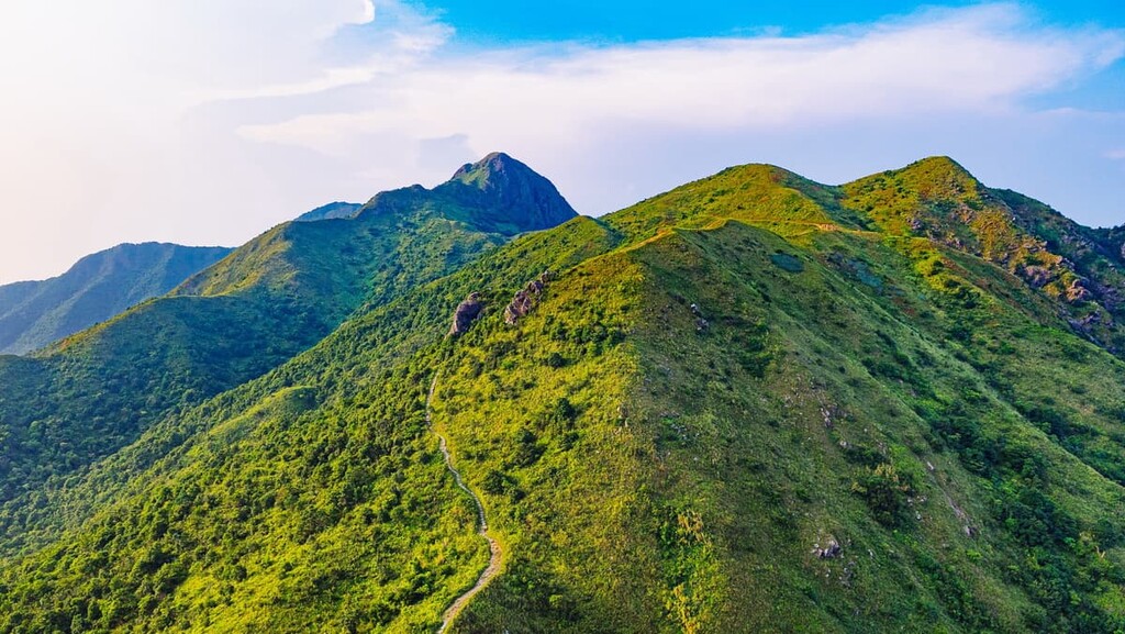
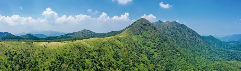
The northern part of Ma On Shan Country Park contains the connecting peaks of Ma On Shan, The Hunch Backs, Tiu Shau Ngam, and Pyramid Hill. It also includes the plateau of Ngong Ping.
Ma On Shan offers a challenging hike to the highest point in the park, though you will pass by many other viewpoints along the steep and rocky trail. The ridge or saddle that leads up to the summit from the north is very narrow at times, with sheer drop-offs on both sides. It is easier to approach from Ngong Ping from the south and climb down on the north side.
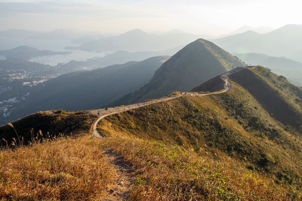
The Hunch Backs is the subpeak of Ma On Shan on the northern side of the saddle. With an incline of up to 70 degrees, the hike involves a fair bit of clambering to complete. Only slightly lower in elevation than the main peak, this subpeak affords sweeping vistas of Tolo Channel and Pat Sin Leng Country Park. Located a bit to the east is Tiu Shau Ngam, which is also a treacherous hike.
Pyramid Hill is a great place to admire the distinct profile of Ma On Shan and the seascape beyond Sai Kung peninsula. It is just a short climb from Ngong Ping, though the trail is covered by loose gravel.
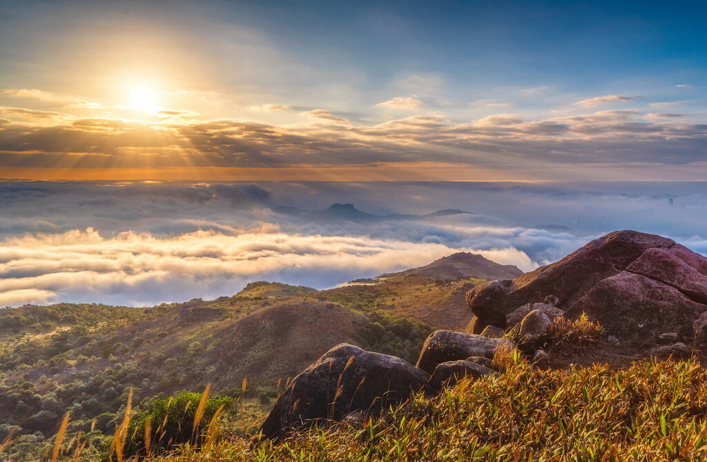
Ngong Ping plateau is popular for camping, picnicking and paragliding. Facing the east at an altitude of 400 m (1312 ft), it is also a prime location for watching the sun rising against the backdrop of the Sai Kung sea.
This eastern-central part of the park includes the connecting peaks of Buffalo Hill, West Buffalo Hill and Shek Nga Shan. A bit further away is Luk Chau Shan and Nui Po Shan. Though not as well-known as Ma On Shan and its connecting peaks, this area offers interesting rock formations such as the phallic rock on Nui Po Shan and three pockets of “rock jungles” on Luk Chau Shan alone.
Deserted villages also crumble on the foothills of this area. The Mui Fa Ancient Trail, Mau Ping Ancient Trail and Pak Kong Ancient Trail are remnants of a bygone era when villagers used to walk the trails toting produce with a carrying pole.
Mau Ping is a commonly photographed place, thanks to its giant vines that lie on top of a derelict building. Some stretches of the Pak Kong Ancient Trail are “bamboo tunnels,” with overhanging bamboo forming a slanted roof over the trail.
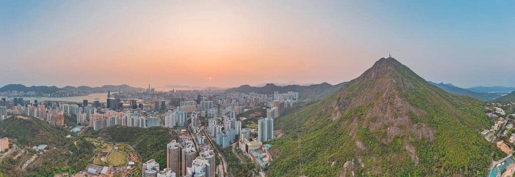
Located on the southern side of the park, the Kowloon Peak Area includes the connecting Kowloon Peak and Tate’s Cairn, and a few other peaks.
If you approach from Fei Ngo Shan Road, it is a moderate hike to reach the top of Kowloon Peak, which offers stunning views of Kowloon peninsula and Victoria Harbour. However, it is a risky affair to climb the Suicide Cliff, as iconic for its dramatic profile as it is infamous for having a record of serious accidents. Additionally, thanks to the many cliffs and crags on its slopes, Kowloon Peak is a mecca for rock-climbers.
Tate’s Cairn houses a few government buildings on the top, including a globular meteorological station, a police post and a radio station. There are other peaks in the area such as Tung Shan and Tung Yeung Shan.
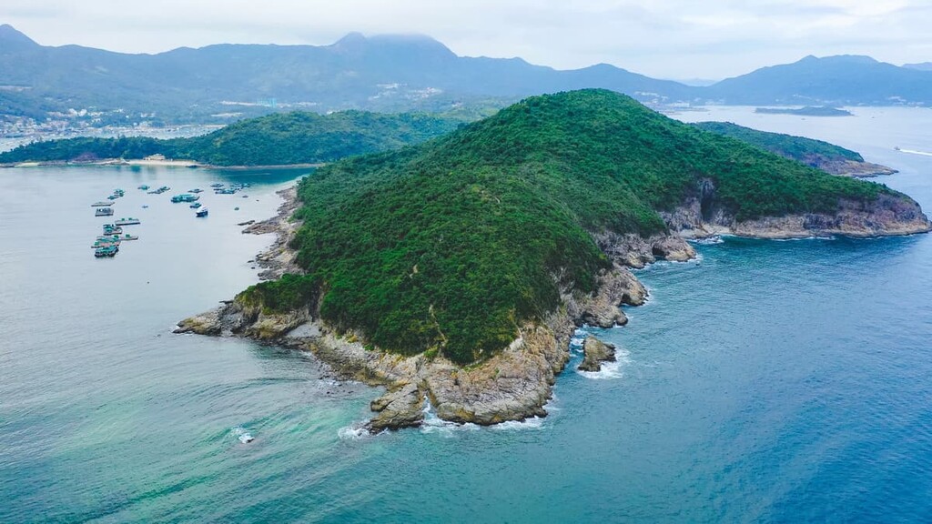
The small peninsula of Hebe Haven, or Pak Sha Wan, offers quite a different experience from the main portion of the park, which is located entirely inland. The English name for the area was taken from the ship HMS Hebe, which was in turn named after the Goddess of Youth, Hebe, in Greek mythology.
There are three main attractions on the peninsula: the secluded Trio Beach, the idyllic Ma Nam Wat Village, and the rugged cape of Pak Ma Tsui. The Royal Hong Kong Yacht Club is also on Hebe Haven, though the club and some other stretches of coast are excluded from the country park.
Depending on which part of the park you are visiting, Ma On Shan Country Park can be accessed from several neighborhoods. Here are some of the best places to visit during your next trip to the park:
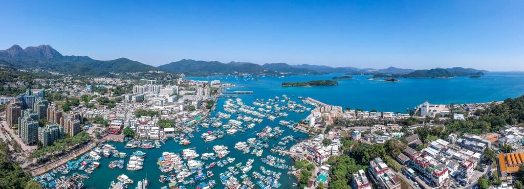
The gateway to the eastern side of the park and Hebe Haven is Sai Kung Town, a neighborhood that has mostly escaped the large-scale developments in urban areas.
With its waterfront promenade and age-old villages, the Sai Kung Town has a laid-back vibe even when it gets crowded with visitors on weekends and holidays. The waterfront teems with seafood restaurants, specialty eateries, and weekend markets, which make it an appealing stopover for hikers.
The western side of the park can be accessed from Sha Tin, which saw booming urbanization in the 1970s that transformed the place from a remote rural area to a well-planned “new town.” Yet it still preserves some centuries-old villages like Tsang Tai Uk, and other attractions include the Hong Kong Heritage Museum, Ten Thousand Buddhas Monastery and Che Kung Temple.
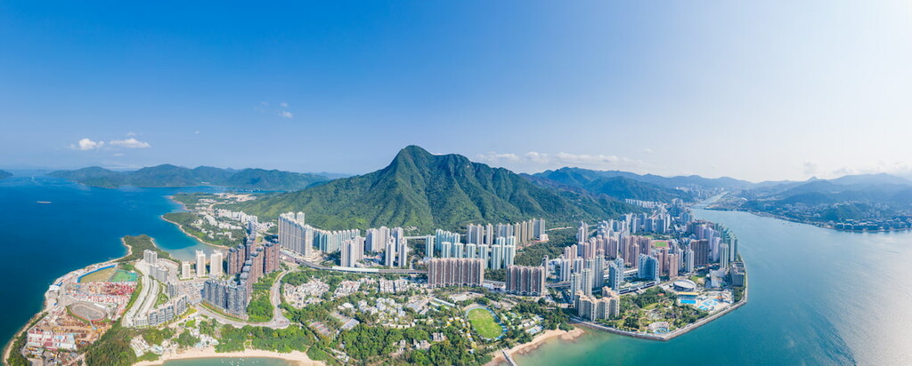
To the north of the country park is the residential area of Ma On Shan, originally an extension of Sha Tin New Town. It has grown so much that it is now a “new town” on its own though it remains part of Sha Tin in an administrative sense. People interested in local history should not miss Grace Youth Camp, which houses a museum with revitalized parts of the old mine and mining village.
The Kowloon Peak area can be accessed from Clear Water Bay Road in Kowloon. On the northern side of the road, luxury villas with private swimming pools nestle on the slopes of Kowloon Peak.
Standing in stark contrast across the road is Shun Lee Estate, a public housing complex with old and cramped apartments. Not far away is Jordan Valley Park, a spacious and well-organized public facility built on a reclaimed landfill.