Get PeakVisor App
Sign In
Search by GPS coordinates
- Latitude
- ° ' ''
- Longitude
- ° ' ''
- Units of Length

Yes
Cancel
❤ Wishlist ×
Choose
Delete
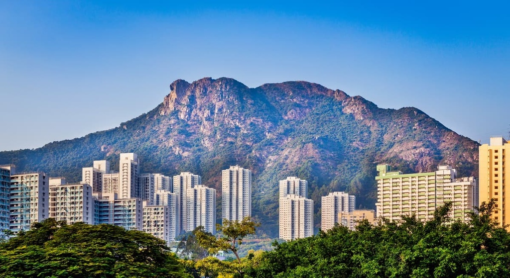
Looming over the urban sprawl in the Hong Kong Special Administrative Region of China, Lion Rock Country Park is known for its culturally significant iconic lion-shaped crag. This park has 9 named peaks, the highest the most prominent of which is Lion Tail (495 m/ 1,624 ft).
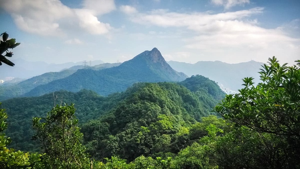
Occupying an area of 557 hectares (1,376 acres), Lion Rock Country Park encompasses the narrow mountain range of Lion Rock that runs from east to west across a section of south-central Hong Kong. The park is dominated by a massive crag that resembles a crouching lion in profile, hence the name Lion Rock.
The southern slopes of the range are much steeper than the northern side. Apart from the peaks of Lion Rock, other hills in the park include Beacon Hill (459 m/ 1,506 ft) and Eagle’s Nest (305 m/ 1,000 ft) in the west as well as Unicorn Ridge (437m/ 1,434 ft) in the east.
The northern part of the park borders on Sha Tin district in New Territories, while the southern part lies in Kowloon next to the district of Wong Tai Sin. The park adjoins Kam Shan Country Park to the east and Ma On Shan Country Park to the west.
Although the hills in the park divide New Territories and Kowloon, the Lion Rock Tunnel that goes through the hills actually connects these two regions. The tunnel has been an important transport artery in Hong Kong since 1967.
Given its unmistakable shape and its visibility from the most urbanized areas in Hong Kong, Lion Rock is a major landmark in the city.
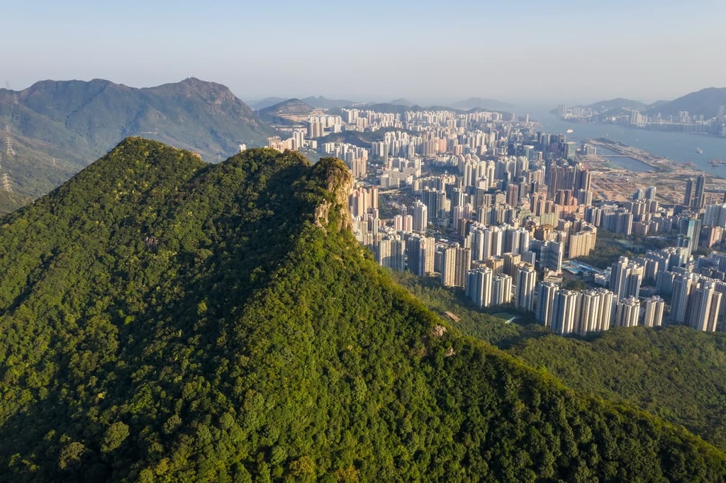
Lion Rock Country Park consists primarily of granitic rocks typical of the Kowloon area. However, granitic rocks in Hong Kong generally produce lower and gentler topography than other rocks on the island since they are more susceptible to erosion in this subtropical climate. The rugged and prominent Lion Rock stands out as an exception.
The rocks in the area are medium-grained granite that formed from cooling magma about 140 million years ago, though they were intruded by a small amount of younger, fine-grained granite in the form of dykes and a thin capping around Lion Head. This is probably the reason behind Lion Rock’s resistance to weathering processes.
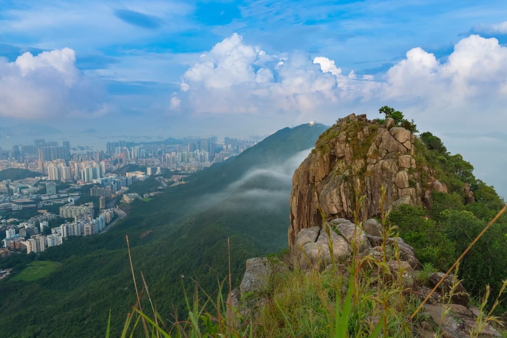
The crag that forms the lion is a surface outcrop of bedrock that is commonly seen on the summits and ridge crests of granitic peaks. The crag is barren, making it so that the rocks are clearly visible from the surrounding area.
Located on the northern slope of Lion Rock, the 15-m (49-ft) Amah Rock is another natural landmark in the city. This well-jointed granite tor, which looks like a statue, is a corestone left behind after the outer rock layers in the area weathered away.
Legend has it that Amah Rock was originally a woman whose husband traveled across the ocean to make a living. She climbed the hill with her baby on her back every day to wait for her husband’s return from sea, not knowing he had drowned. She and her baby were turned to stone so her spirit could unite with that of her husband.
The abundance of crags, cliffs and boulders in the area makes the park very popular with rock climbers. There are many well-climbed routes of various difficulty levels, especially on Beacon Hill and Lion Rock, the latter of which was named Hong Kong's most beautiful climbing destination by CNN.

Sustained by a healthy network of streams, the gentler northern slopes of Lion Rock Country Park are lush with vegetation. In contrast, the steeper and drier southern side of the park has thinner vegetation. Most of the flora was planted after World War II, following a period of extensive ecological devastation in the area by the Japanese.
Some of the most common trees are Chinese hackberry (Celtis sinensis), Chinese red pine (Pinus massoniana), microcos (Microcos paniculata), strawberry tree (Myrica rubra) and ivy tree (Schefflera heptaphylla).
The park is home to a few species of bamboo, including the rare endemic Shiuying bamboo (Arundinaria shiuyingiana), which was named after local botanist Shiuying Hu. Flowers such as platycodon (Platycodon grandiflorus) and Chinese New Year Flower (Enkianthus quinqueflorus) adorn the greenery of the park.
The park also harbors a diverse assortment of birds, especially raptors like black kite, brahminy kite, white-bellied sea eagle, crested serpent eagle and crested honey buzzard. The pine-covered hill of Eagle’s Nest, true to its name, is a nesting ground for a large number of raptors.
Snakes are quite common in the park, as in other county parks in Hong Kong. They are most active in the fall just before hibernation. The venomous bamboo pit viper alone is responsible for 90 percent of all snake bites in the city, though these bites are rarely fatal.
The most conspicuous residents in the region are probably the macaque in the western side of the park. Unlike the shy snakes, these monkeys are not afraid to make their presence felt. They may snatch food from people, and they can get aggressive when threatened.
In the late seventeenth century, during the early Qing Dynasty, a fortified mound manned by an army unit, the Kowloon Mound, was set up in Kowloon Pass between Lion Rock and Beacon Hill. It was one of the five fortified mounds in present-day Hong Kong, though none of them remain today.
Beacon Hill occupies a strategic position with its unimpeded views of Kowloon and Victoria Harbour. It was often used as a lookout post in the old days, giving signals by means of smoke and fire. Nowadays the summit houses a surveillance radar station.
During World War II, the area around Beacon Hill was a key point on the Gin Drinkers Line, an 18-km (11-mi) defensive line deployed in anticipation of a Japanese invasion. Some of the trenches and pill boxes from this era can still be seen in the park today.
After WWII, high birth rates and an influx of immigrants from Mainland China led to rapid population expansion in the city. Much of the growing populace settled on the southern foothills of Lion Rock in Kowloon, giving rise to a hodgepodge of squatter settlements, public housing, and small factories.
Even though many of those people started out penniless and without education, they made it up the social ladder with hard work and determination. They became the driving force behind Hong Kong’s transformation from a poor backwater to a prosperous economic powerhouse.
From 1972 to 1995, then from 2006 to 2020, an acclaimed TV drama series called “Below the Lion Rock” portrayed topical social issues and the everyday life of Hong Kongers. Over time, “Below the Lion Rock” became a household name representative of local livelihood.
A theme song “Below the Lion Rock,” performed by famous singer Roman Lo, was released in 1979 and remains a timeless classic. The main ideas of the song are overcoming obstacles, setting differences aside and pursuing dreams together.
In 2002, when Hong Kong was suffering from the after-effects of the Asian financial crisis, the financial secretary quoted lyrics from “Below the Lion Rock” in his budget address to rally the citizens.
Politicians have since taken to invoking the “Lion Rock Spirit” in challenging times, elevating the rock to a sort of spiritual anchor. The theme song is sometimes considered the city’s unofficial anthem.
In the government’s “Brand Hong Kong” campaign that promotes the place as “Asia’s World City,” a logo with a stylized flying dragon has been heavily advertised. The dragon’s body consists of three curved lines, one of which is the outline of Lion Rock, a symbol of the city’s can-do spirit.
While hard work, perseverance and solidarity are undisputed qualities underpinning Hong Kong’s economic success, the “Lion Rock Spirit” has been re-interpreted as the social and political environment changes.
To some people, that spirit has come to embody justice, social equality and democracy. Lion Rock was also used as a stage for expressing political views when people dangled huge banners from the peak.
A network of trails crisscrossing the park makes it possible to start and finish hikes in all directions. Here are the best sights and routes to check out in Lion Rock Country Park.
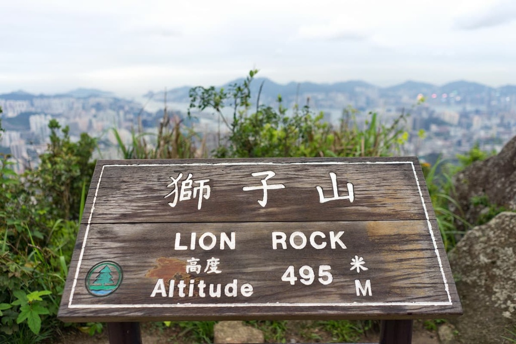
As it is home to the star attraction of Lion Rock, the south side is the most frequently visited area of the park. This area consists of the peaks of Lion Tail (495 m/ 1,624 ft) and the slightly lower Lion Head (493 m/ 1,617 ft). It commands epic views of Kowloon Peninsula, Hong Kong Island, and the Sha Tin district.
The hill draws hikers day and night, and a sunset hike offers the best of both as the densely-packed buildings below gradually give way to a sea of sparkling light.
None of the official trails on the hill are particularly difficult, but the top has been listed as a high-risk location since there have been fatal accidents on the hills in the past.
The North Side is home to Amah Rock, another icon in the park. Protruding from a height of 250 m (820 ft), the rock overlooks the district of Sha Tin. It was voted the most beautiful rock in Hong Kong.
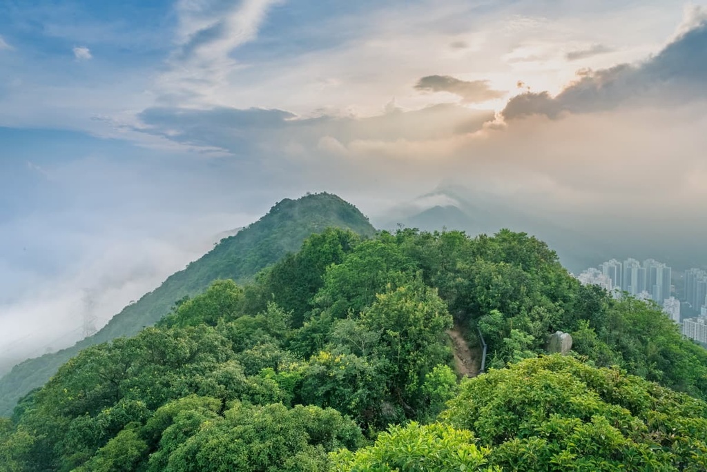
The fame of Amah Rock, on the downside, made it the most graffitied rock in the city. The graffiti has been cleaned thanks to diligent efforts of volunteers, though traces are still visible.
A trip to Amah Rock can easily include a walk at Hung Mui Kuk Nature Trail, a 1.3-km (0.8-mi) route with informative signposts about the plants and geographical features along the trail.
Section 5 of the 100-km (62-mi) regional MacLehose Trail follows the ridge of the Lion Rock range that connects Unicorn Ridge, Lion Rock, Beacon Hill and Eagle’s Nest. This 10-km (6-mi) section starts in neighboring Ma On Shan Country Park and ends at the western border of the park.
This trail does not reach the top of Lion Rock, though the summit is just a short detour away. While a large part of it is shaded, viewpoints, such as the summit of Beacon Hill, offer unrestricted vistas of the urban areas and Kowloon Reservoir in neighboring Kam Shan Country Park.
Located on the southern foothills of the Lion Rock range, the district of Wong Tai Sin was named after its landmark, Wong Tai Sin Temple. Completed a century ago, the temple is dedicated to the Taoist deity of healing, Wong Tai Sin. It is now one of the most visited temples in the city.

People visit the temple not only to admire its colorful and intricate architecture, but also because of Wong Tai Sin’s reputation for being responsive to wishes of the faithful. The temple has spawned a Fortune-Telling and Oblation Arcade located next door.
The district also includes Diamond Hill, which used to be a squatter settlement. It is now famous for Chi Lin Nunnery, a Buddhist temple complex, and the adjacent Nan Lian Garden. Both were built in the Tang Dynasty architectural style that retains an elegant and tranquil atmosphere despite hordes of visitors.
To the north of Lion Rock Country Park is the district of Sha Tin, which saw booming urbanization in the 1970s that transformed the area from a remote rural area to a well-planned “new town.” Yet it still preserves some centuries-old villages like Tsang Tai Uk, which is one of the best kept of its kind.
Other attractions in Sha Tin include the spacious Hong Kong Heritage Museum, the impressive Ten Thousand Buddhas Monastery and the busy Che Kung Temple. Sha Tin is also known for culinary delights such as chicken congee and roasted pigeon.
Explore Lion Rock Country Park with the PeakVisor 3D Map and identify its summits.


