Scan the QR code and open PeakVisor on your phone
Pat Sin Leng Country Park is situated in northeastern New Territories in the Hong Kong Special Administrative Region of China. It has 24 named peaks including 8 adjoining peaks known as the ridge of the “Eight Immortals,” named after a group of eight deities in Chinese folklore. The highest peak in the park is Wong Leng.
Pat Sin Leng Country Park sprawls across the districts of Fanling and Tai Po in the northeastern New Territories. It borders Plover Cove Country Park to the east, and is surrounded by rural areas on other sides, including the area of Luk Keng and Nam Chung famous for their wetlands, and Sha Lo Tung, which is an important habitat for butterflies and dragonflies.
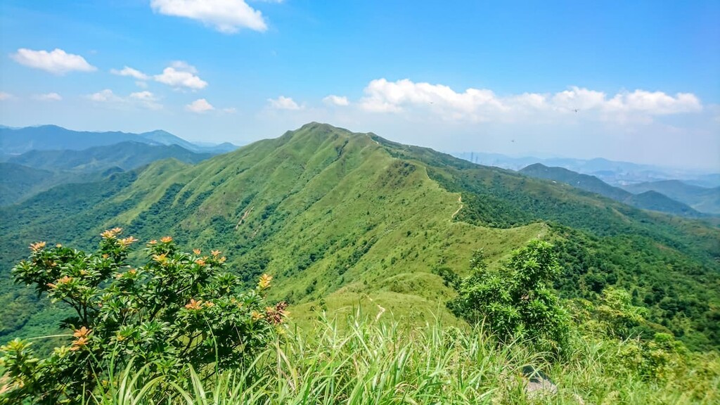
The Pat Sin Leng range runs for about 1 km (0.6 mi) from east to west, and is connected to a few other peaks including Wong Leng.
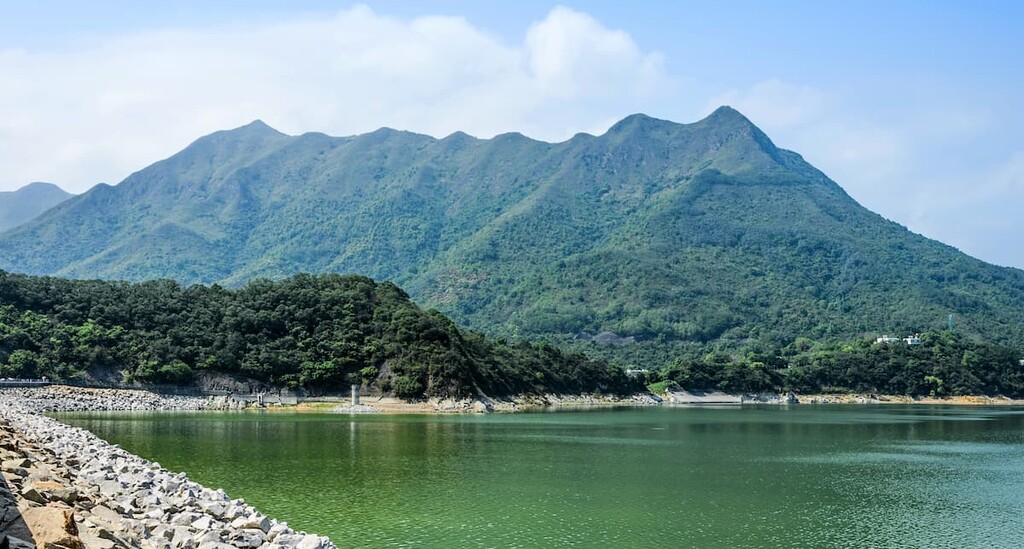
There are two small irrigation reservoirs on the western side of the park: Hok Tau Reservoir and Lau Shui Heung Reservoir. Beyond the park’s southeastern boundary lies Plover Cove Reservoir, while its northern borders are just a few kilometers away from Mainland China.

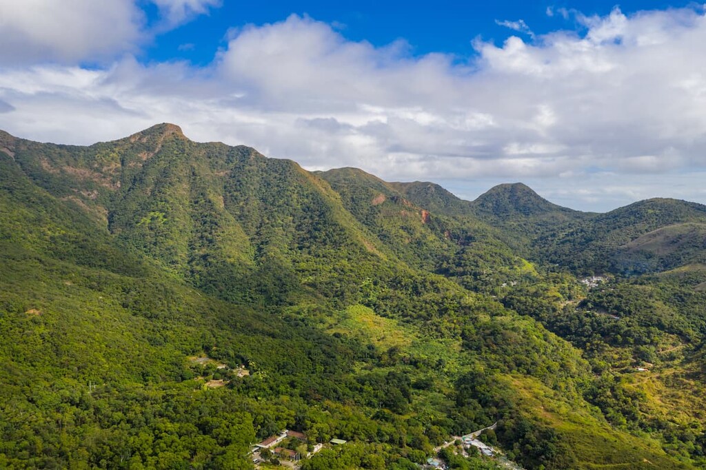
The Pat Sin Leng Range is an escarpment that was formed by the tilting of underlying rock beds. This tilting created a ridge with a steep southern slope and a moderately dipping slope on the north side. It is the only large escarpment in Hong Kong.
The Pat Sin Leng formation consists of sedimentary rocks from the Cretaceous period (about 100–140 million years ago), which lie on top of coarse tuffs from the Jurassic period (about 164 million years ago).
After volcanic activities in Hong Kong came to an end in the early Cretaceous, sediments were deposited in river channels and later pushed up to form the top of the range. The sedimentary rocks consist of greyish-white conglomerates and reddish siltstones and sandstones. Only occasional patches of these rocks remain on the peaks, particularly on Wong Leng, as most of these rocks have been eroded away in the region.
The streams on the northern side of the range have long, branching courses that flow perennially, while those on the much steeper southern side tend to be linear and shorter with seasonal flow. Large amounts of debris have been deposited below the sheer cliffs on the southern side.
Dense woodlands carpet the northern slope of the Pat Sin Leng Range in the park, almost reaching the top of the peaks. On the contrary, the much steeper and drier southern slope sustains mostly grasses and shrubs. The foothills are densely forested with species such as Hong Kong pavetta (Pavetta hongkongensis), Taiwanese sweet gum (Liquidambar formosana) and aromatic litsea (Litsea cubeba).
On the fringe of Lau Shui Heung Reservoir, weeping willows (Salix babylonica) and fortune's keteleeria (Keteleeria fortunei) grow in abundance among a plethora of tree species. Flowers adorn the park at different times of the year, such as caduous-petal camellia (Camellia kissi) in winter and rhodoleia (Rhodoleia championi) in spring.
The areas around the reservoirs are important sanctuaries for butterflies and dragonflies. There are about fifty species of butterflies and roughly the same number of dragonfly species, including the Macromidia ellanae, which is only found in Hong Kong.
The lush woodlands harbor many birds such as magpies, mynas, bulbuls, and kingfishers. They also shelter mammals like muntjacs, pangolins, porcupines, masked palm civets, and leopard cats. The streams and reservoirs teem with freshwater fish including the Hong Kong paradise fish (Macropodus hongkongensis).
The foothills of Pat Sin Leng used to be populated by ethnic Hakka people living in several villages complete with a school, an ancestral hall and farmlands. The villages were abandoned in the 1960s as the inhabitants relocated to places with better access to roads, and have since been left to the elements.
Some trails blazed by the villagers have become hiking trails like the Wang Tsat Ancient Trail and the Fung Ma Ancient Trail. Crumbling facades and remnants of farm terraces still remain along the trails.
In February 1996, the most devastating wildfire in local history broke out near Sin Kwu Fung on the Pat Sin Leng Range. It killed two teachers, three students and injured thirteen other students who were on a school trip. The Spring Breeze Pavilion was built after the tragedy to commemorate the two teachers who lost their lives while saving the students.
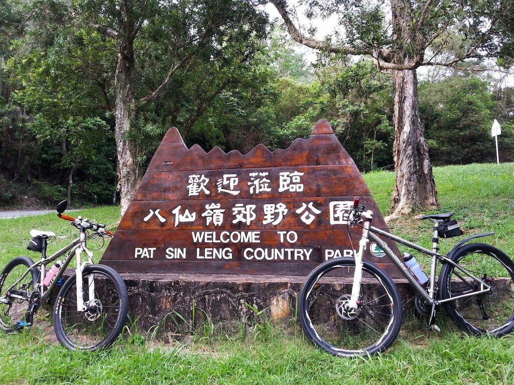
Pat Sin Leng Country Park offers hiking routes of various lengths and difficulty. There are also campsites and barbeque sites within the park. Here are some of the main attractions to check out in the region:
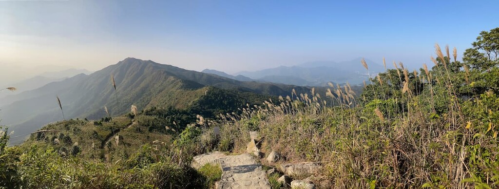
This strenuous hike traverses the top of Pat Sin Leng ridge, ascending and descending each of the Eight Immortals’ peaks as well as the connecting peaks of Lai Pek Shan, Wong Leng, and Ping Fung Shan.
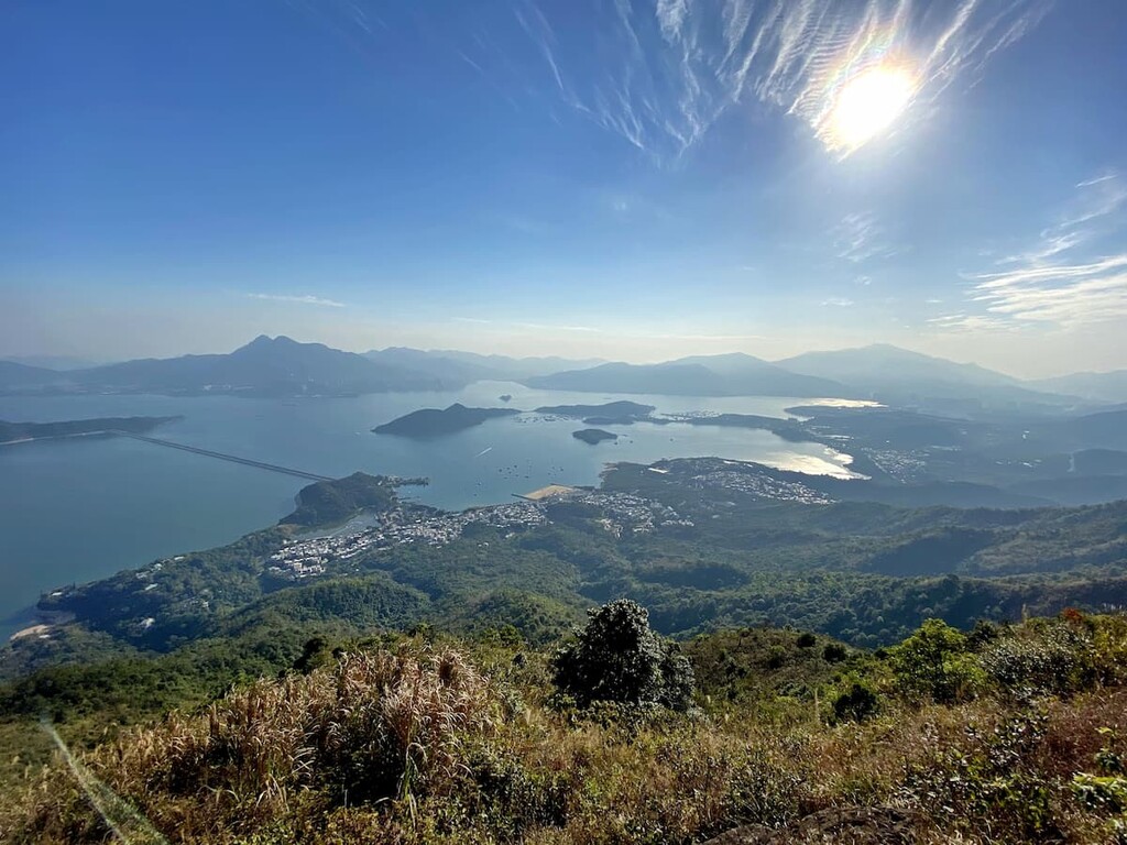
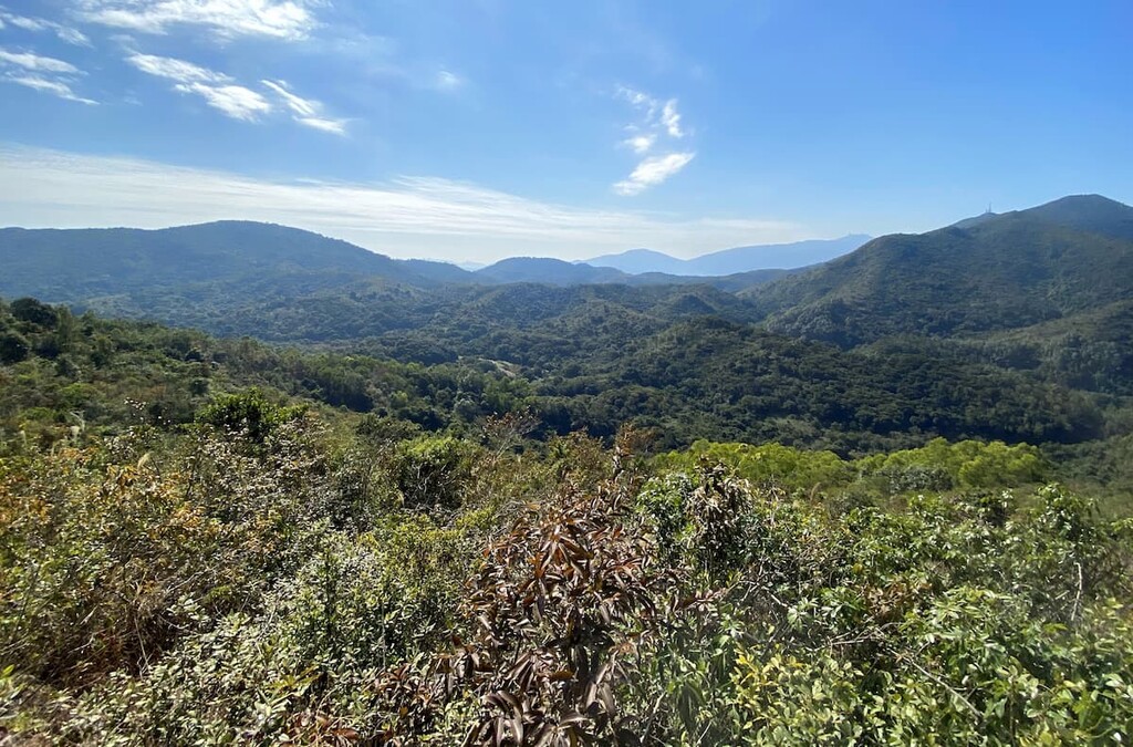
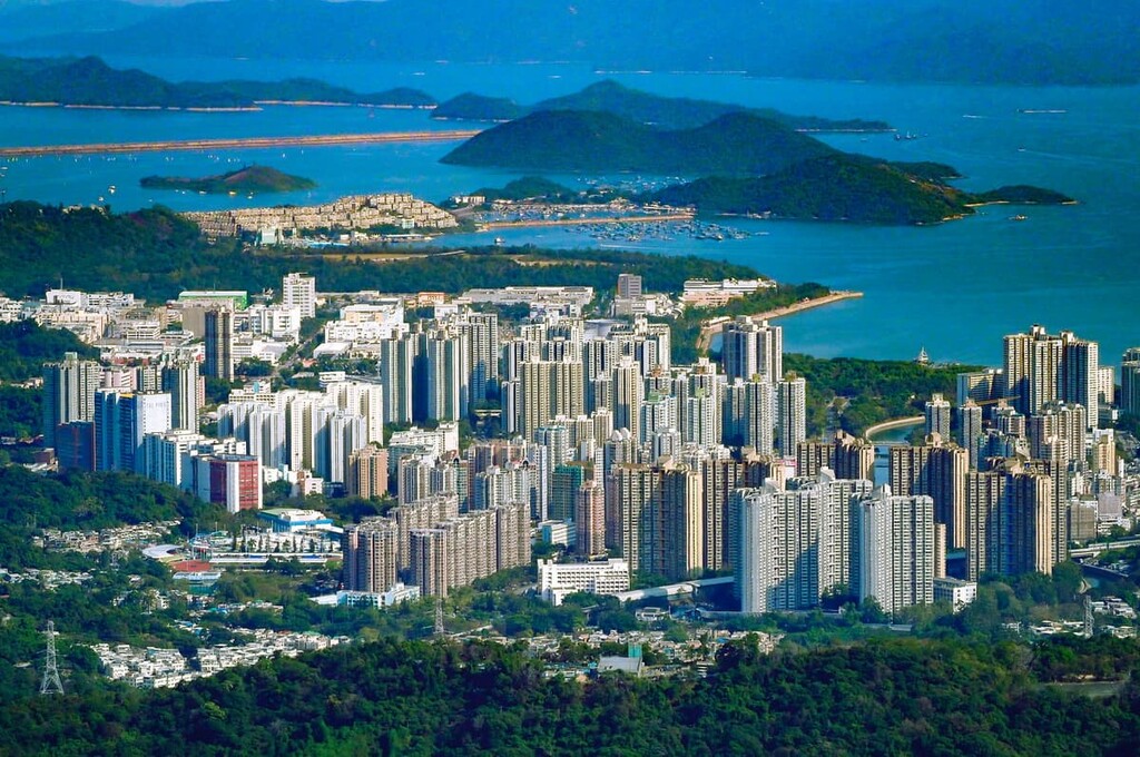
As the ridge is much higher than the surrounding areas, hikers who make the effort are rewarded with unrestricted views of vast expanses of rolling greenery and a sinuous coastline with many coves and inlets. The vistas extend to Sai Kung Peninsula beyond Plover Cove and the sprawling metropolis of Shenzhen on the Chinese Mainland.
Many trails lead to the ridge, and the most common route begins and ends at Tai Mei Tuk on the eastern side. On the western end, the starting and exit point can be Fung Yuen in Tai Po or Hok Tau Reservoir in Fanling.
The former option would make a 15-km (9.3 mi) hike from start to finish, while the latter would cut the trip down to about 11 km (6.8 mi). Other trails along the ridge branch off to Luk Keng, Nam Chung, Tan Chuk Hang, and other nearby destinations.
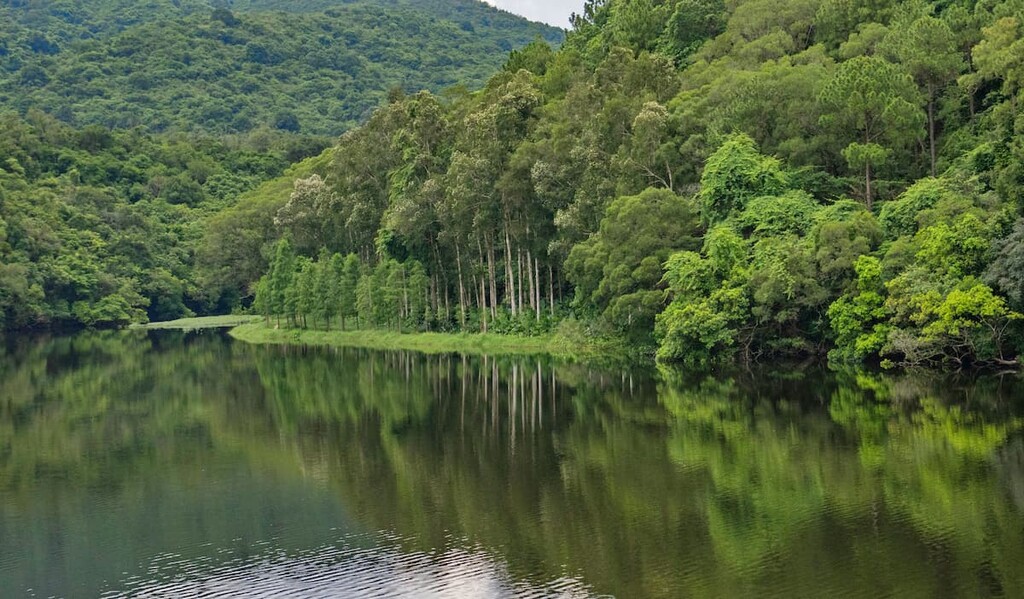
The two small reservoirs, which are only about 2 km (1.2 mi) apart, make a picturesque and relaxing walk in the refreshing shade of luxuriant woodlands.
Lau Shui Heung Reservoir is surrounded by bald cypress and paper-bark trees that cast dream-like reflections on the placid water surface, earning it the nickname of “mirror in the sky.” In the winter, the different shades of green become a riot of colors reminiscent of temperate climes.
Hok Tau reservoir is a squiggly-shaped body of water tucked in a verdant ravine. The Hok Tau Reservoir Family Walk which skirts the water is ideal for watching dragonflies.
This 10-km (6.2 mi) route cuts through the park in a north-to-south direction, with Tai Mei Tuk on the southern end and Nam Chung on the other end. The Wang Tsat Ancient Trail used to be an important path that connected the different villages in the area.
The southern part of the route coincides with Pat Sin Leng Nature Trail, which affords views of Plover Cove Reservoir, while the northern side offers vistas of idyllic villages and wetlands, as well as the cityscape of Shenzhen across the Starling Inlet. The trail passes through deserted buildings in various stages of decay under the shade of overgrown foliage.
The park can be accessed from Tai Po on the southern and eastern sides, and from Fanling on the northern and western sides.
Tai Po is a district with a history of a thousand years. Once an important market town, the urban area of Tai Po remains a vibrant community with busy streets and bargain goods.
It is also a popular base for outdoor activities because of its many nature reserves and beautiful coves. Other attractions include the Kadoorie Farm & Botanic Garden and the old village of Lam Tsuen.
Fanling is traditionally a rural area populated by Indigenous clans. Today, historic villages and farms co-exist with high-rise apartment complexes. Sights include the imposing Taoist temple of Fung Ying Seen Koon, the walled village of Fanling Wai, and the Lung Yeuk Tau Heritage Trail. It is also a gateway to the vast countryside in northern New Territories.