Scan the QR code and open PeakVisor on your phone
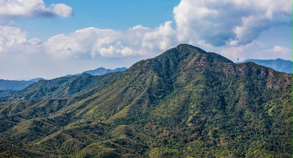
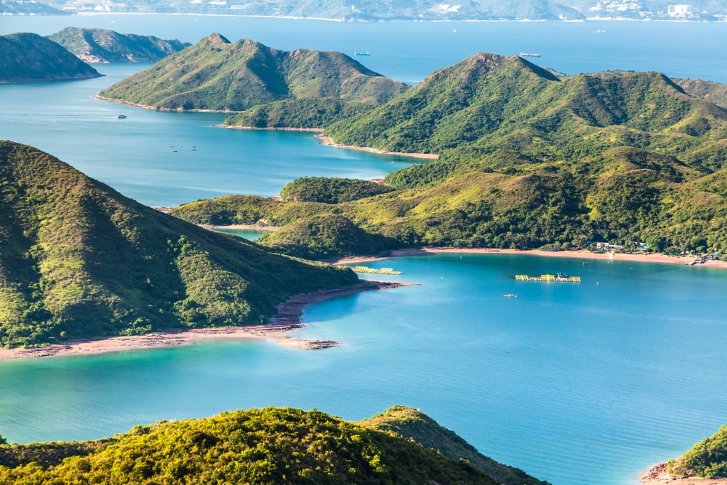
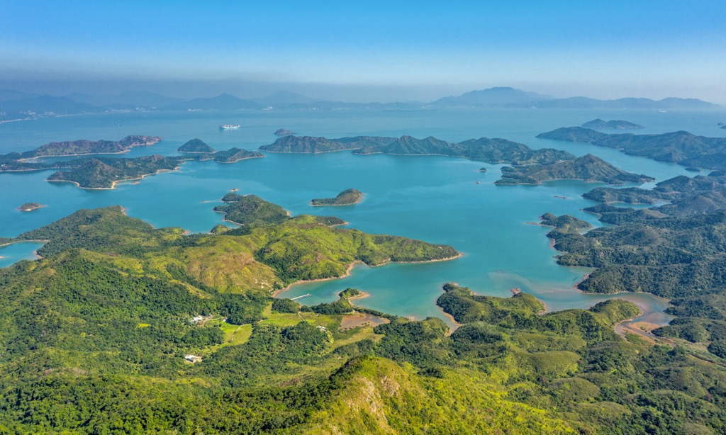
Plover Cove Country Park is a natural terrain of green hills and blue waters in the Hong Kong Special Administrative Region of China. There are 40 named peaks in the park. The highest and the most prominent of them is Tiu Tang Lung (416 m/ 1,365 ft).
The park is located in northeastern Hong Kong in the district of Tai Po. It contains 4,600 hectares (11,367 acres) designated in 1978 (referred to as the “main park” in this article), and an extension park of 630 hectares (1,557 acres) designated a year later.
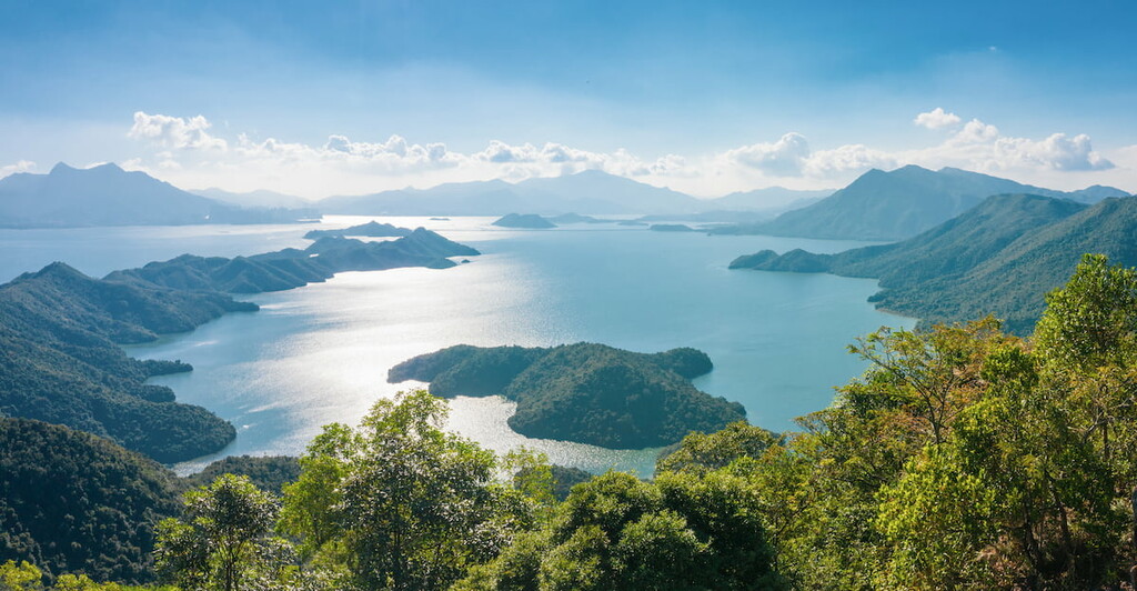
Plover Cove is adjacent to Pat Sin Leng Country Park to the west and surrounded by the sea on three sides. The extension park consists of a few islands off the east coast, including Double Haven and Tung Ping Chau.
Double Haven (also known as Yan Chau Tong) is made up of a few islands—mainly Double Island (or Wong Wan Chau), Crescent Island (or Ngo Mei Chau) and Crooked Island (or Kat O)—as well as the harbor between the islands and the main park.
Tung Ping Chau is the farthest-flung island in Hong Kong that marks the city’s easternmost point. It is closer to the Dapeng Peninsula in Mainland China than Hong Kong.
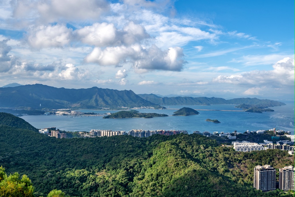
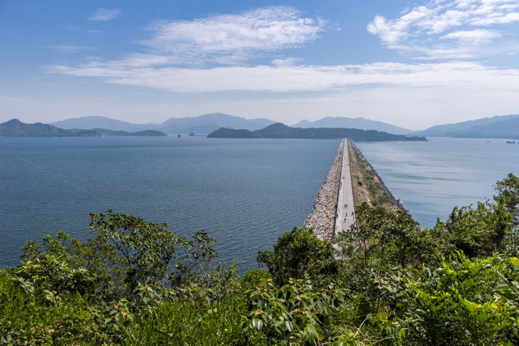
The inlet on the southern side of the main park was dammed and drained in the 1960s to form the Plover Cove Reservoir, the world’s first “reservoir in the sea”. The 2-km (1.2 -mi) main dam is the longest in the city while the reservoir is the largest by area and second largest by volume.
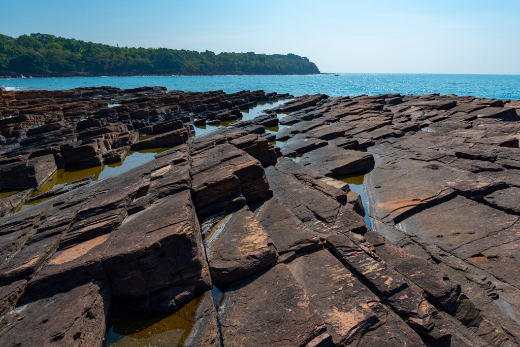
Plover Cove Country Park boasts the oldest as well as the youngest rocks in Hong Kong. Its islands are a major part of the Hong Kong UNESCO Global Geopark.
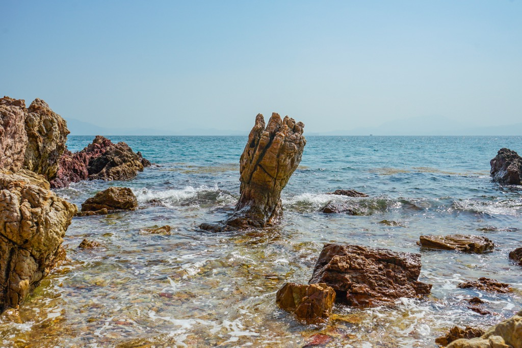
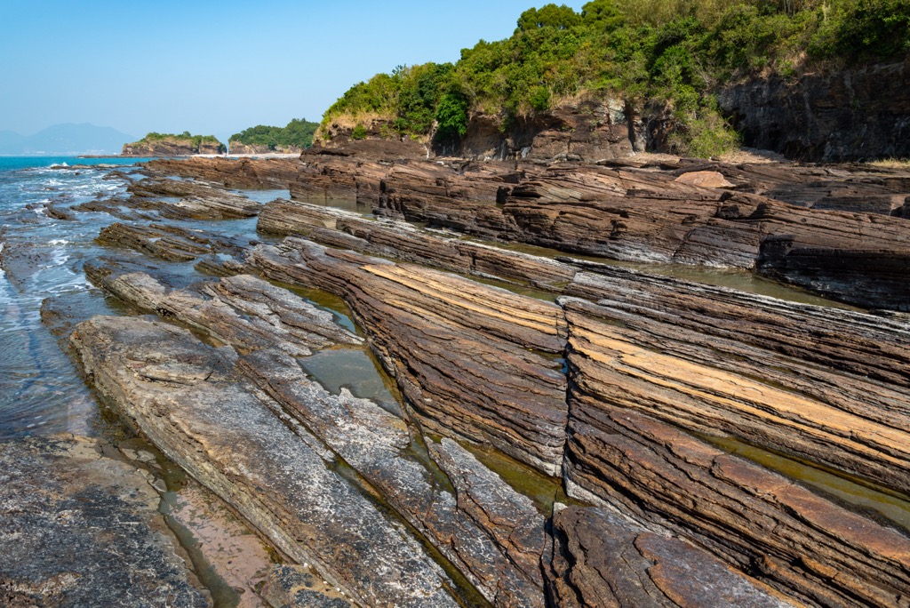
Bluff Head (or Wong Chuk Kok Tsui) is an elongated headland jutting from the southeastern end of the main park. It contains the city’s oldest rocks that date to the Devonian Age of the Paleozoic Era, about 400 million years ago.
The rocks in Bluff Head are mainly sedimentary sandstones originating from fluvial deposits. The initially horizontal rock strata were later tilted almost vertically because of various geological processes.
The iconic Devil’s Fist at the tip of Bluff Head is a product shaped by erosion, which sculpted the “fingers” of what looks like a clenched fist pointing to the sky. The base of the rock became a narrow “wrist” as a result of the repeated action of sea waves.
By contrast, the rocks on the island of Tung Ping Chau formed only about 55 million years old, when the area was a saline lake where silt began to deposit in layers. The layers have been well-reserved because of the calm setting, also giving rise to the flat topography of the island.
The island is dominated by shale, which is a fine-grained, laminated sedimentary rock formed from the compaction of silt and clay. There are sedimentary structures such as ripple marks and mud cracks, as well as erosion landscapes like wave-cut platforms and deposition landforms like beaches.
Double Haven used to be a land of mountains and valleys, which became bays and islands when the sea level rose at the end of the last glacial period. The islands are notable for their deep red granite, a product of oxidation accelerated by high humidity and temperatures.
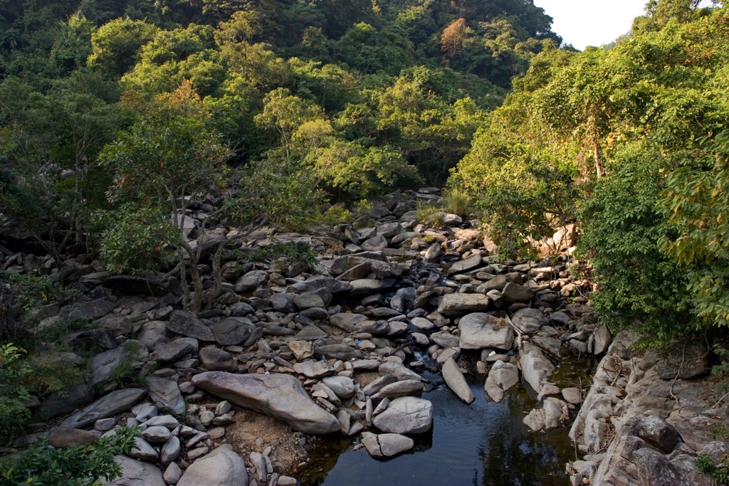
The park has a wide variety of natural habitats, including forests, shrublands, mountain streams, wetlands, coral reefs and algal beds.
The inland areas of the park harbor some animals widespread in Hong Kong’s countryside, like the Chinese porcupine and Chinese pangolin. Less common animals include the crab-eating mongoose and yellow-bellied weasel.
The park is a hotspot for butterflies, with rare species such as the hill jezebel, bi-spot royal and yellow coster. Males of the hill jezebel display hilltopping behavior, meaning they congregate at high points to compete for the best breeding territory.
The rural settlement of Lai Chi Wo, in particular, has remarkable ecological value. It is famous for its crescent-shaped feng shui forest, which is a native woodland enhanced with economic and medicinal trees. The villagers take great care of the forest as it is believed to bring good luck and fortune.
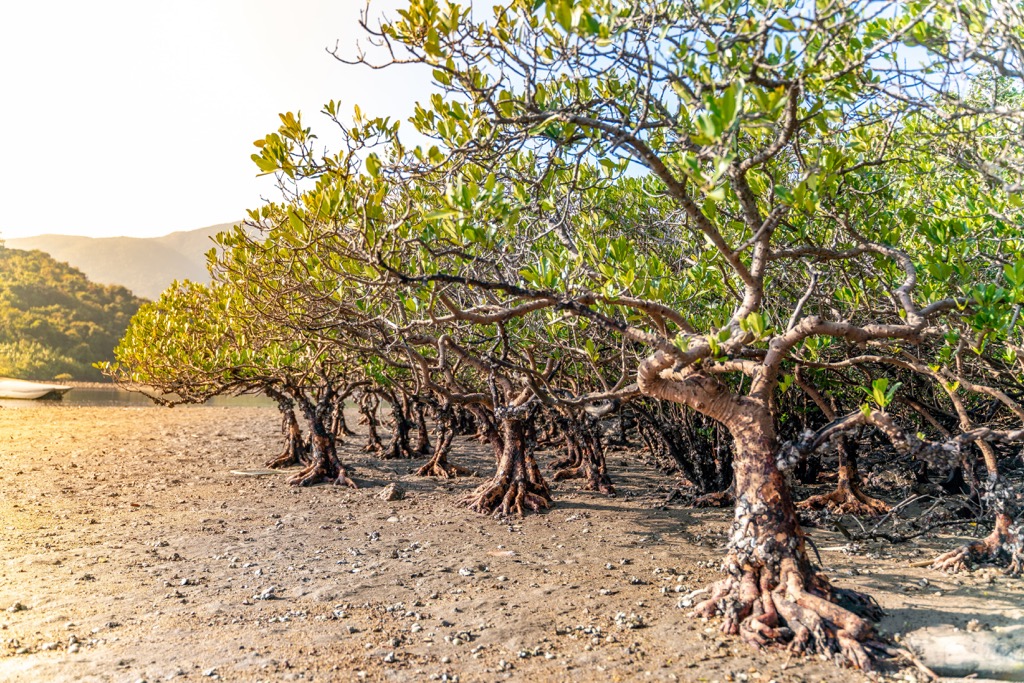
Lai Chi Wo has one of the biggest and most intact freshwater wetland areas in Hong Kong. It supports all of the eight native mangrove species found in the city, including the coastal heritiera (Heritiera littoralis), which can reach up to 15 m (49 ft) in height.
Another impressive plant species in the wetlands is the white-flowered Derris (Derris alborubra). It is a woody climbing plant with stems that can grow to a foot in diameter. The grove of white-flowered Derris in Lai Chi Wo is the only one in Hong Kong.
The waters off the island of Tung Ping Chau provide sanctuary for 65 coral species, which in turn nurture some 130 species of fish and 200 species of marine invertebrates. They also contain the best algal beds in Hong Kong with 65 species of seaweeds including green algae, brown algae and red algae.
There are many centuries-old villages in the area, most of which were founded by ethnic Hakka people. The majority of the villagers made a living by fishing and farming, though all of the settlements are now either sparsely populated or deserted.
Kat O (Crooked Island) in Double Haven used to be a major fishing market and a busy stopover for vessels sailing between Hong Kong and Mainland China. The settlement was co-developed by many different clans—a rare phenomenon among traditional communities in Hong Kong.
The island’s development reached a peak in the 1950s and 60s, when the population exceeded six thousand. Surplus catches brought by motorized fishing gave rise to a bustling industry—the production of sun-dried seafood. Kat O became a prosperous community with some 60 shops lining its main street.
However, motorized fishing also depleted the fisheries, leading to mass migration of people and a switch to aquaculture. Currently the number of permanent islanders is fewer than fifty.
Tung Ping Chau shares a similarly checkered history with Kat O. Once a vibrant outpost with over two thousand inhabitants, the island now has fewer than a dozen permanent residents and more than 350 abandoned buildings.
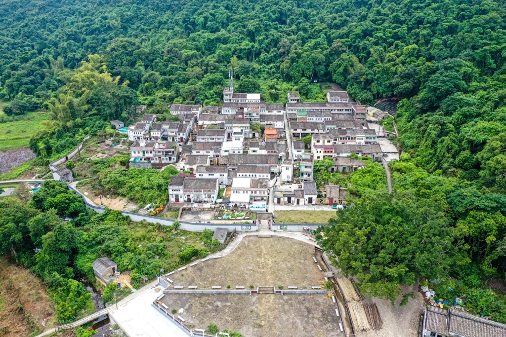
One of the best-preserved settlements in Plover Cove is the walled village of Lai Chi Wo, which is nearly four hundred years old with more than 200 houses and three ancestral halls. It used to have over a thousand residents in its heyday, but the population declined rapidly from the 1960s.
A revitalization project to revive the rural landscape has been under way in Lai Chi Wo since 2013. With a focus on eco-agriculture and carefully managed tourism that help preserve the unusual biodiversity, this pioneering initiative received Special Recognition for Sustainable Development in the UNESCO Asia-Pacific Awards for Cultural Heritage Conservation.
The construction of Plover Cove Reservoir in the 1960s resulted in the submergence of six fishing villages and the resettlement of villagers. Some of the ruins can be seen when the water level drops.
Most of the trails in the main park start at the village of Wu Kau Tang off the northwestern corner of the reservoir. Ferries to the islands depart from Ma Liu Shui Ferry Pier in Shatin.
The following is an overview of the best trails and attractions.
This 18-km (11-mi) trail around the reservoir is a demanding hike with steep slopes and difficult terrain. It typically starts at Wu Kau Tang, then winds around the reservoir in a clockwise direction and ends after the main dam.
Although the peaks on the trail are moderate in height, there is a lot of ascending and descending. Many vantage points offer fantastic views of the coast around Double Haven and the massive reservoir itself.
This narrow headland off the eastern side of the reservoir is home to some of the city’s most interesting geological formations, including Devil’s Fist. A good part of the route follows the Plover Cove Reservoir Country Trail.
It is a whopping 30-km (18.6-mi) return trip, or a speedboat can be hired for a drop-off at Bluff Head. Parts of the trail are overgrown and poorly signposted. Any hiker attempting this trail must be well prepared.
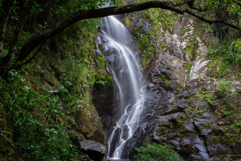
The trail is named after Bride’s Pool, the most famous waterfall in Hong Kong. According to legend, a hapless bride drowned in the pool on her wedding day. At the end of the trail is another waterfall, the 35-m (115-ft) Mirror Pool.
At just 1 km (0.6 mi) one-way in length, the trail makes a short relaxed walk with refreshing scenery among dense woodlands. It is easy to walk on to the main dam from there.
This classic Hakka village is equally prized for its cultural heritage as its natural wonders. A story room and a boardwalk serve as an excellent introduction to this rural gem. It is possible to stay in one of the renovated village houses for an authentic Hakka experience.
Lai Chi Wo is about 7 km (4.3 mi) and mostly downhill from Wu Kau Tang, and there is a weekend ferry service to/ from Ma Liu Shui Ferry Pier. The route passes through Sam A Tsuen, another picturesque village well worth a visit.
Tung Ping Chau teems with extraordinary landforms such as Kang Lau Shek, a pair of sea stacks resembling watch towers, and Lung Lok Shui, a belt of rock that looks like the back of a dragon descending to the sea.
Kat O (Crooked Island) is steeped in fishing culture. A heritage trail links up historical spots that serve as reminders of the island’s former prosperity, including the main street, a 250-year old Tin Hau Temple and old pig farms.
Tung Ping Chau and Kat O are reachable by ferry on the weekend and public holidays, though new ferry routes to Kat O and nearby Ap Chau are being opened up. Other islands in Double Haven can only be reached by kayak or private boat.
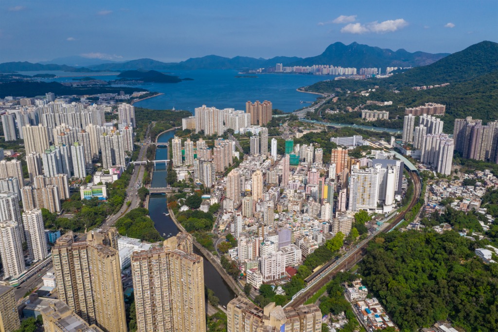
The park is accessed from Tai Po, a district with a history that stretches back to over a thousand years ago. As an important market town for centuries, the urban area of Tai Po remains a lively community with a strong local flavor.
Tai Po is also a major base for outdoor activities because of its myriad nature reserves and ample coastline. Other attractions include the Kadoorie Farm & Botanic Garden and the old village of Lam Tsuen.