Scan the QR code and open PeakVisor on your phone
The Hammastunturi Wilderness Area is one of the 12 wilderness areas in Finland. It is located in the Lapland region in the northern part of the country. The main feature of the area is the beautiful Ivalojoki River, which was the site of the Lapland gold rush of the nineteenth century. There are 55 named mountains in the wilderness area, the highest of which is Hammastunturi (532 m / 1,745 ft) and the most prominent of which is Korkianokka (509 m / 1,670 ft).
The name of the Hammastunturi Wilderness Area (Hammastunturin erämaa) comes from the name of one of the mountains located in it, Hammastunturi.
As is the case with almost all of the other peaks in Lapland, the name of Hammastunturi comes from the Sámi language. The origin of the name isn’t very clear, though it is sometimes translated as ‘tooth fell,’ which could be a reference to the topography of the area.
Hammastunturi Wilderness Area is located in northeastern Lapland in the northernmost part of Finland. It is situated within three large municipalities: Inari, Kittilä, and Sodankylä. The total size of the wilderness area is 1,825 sq. km (704 sq. mi).
The wilderness area is bordered by Inari Lake in the north and Porttipahta Reservoir (Porttipahdan tekojärvi) in the south. To the west, the wilderness is closely bordered by the Lemmenjoki National Park, the largest national park in the country by area. To the east of the wilderness, you’ll also find the Sompio Strict Nature Reserve and Urho Kekkonen National Park.

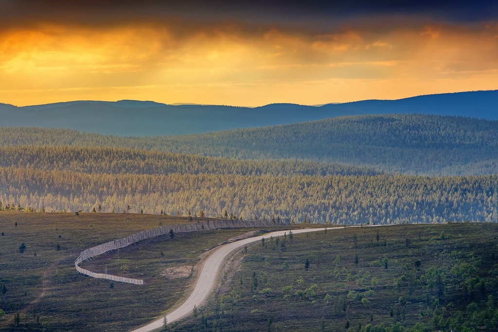
Lemmenjoki and Hamastunturi are separated by a regional road, the Seututie 955, which runs from Inari to Kittilä via Pokka. To the east of Hammastunturi, you’ll also find the country’s main highway, the E75, which runs from Helsinki in southern Finland to the town of Vardø in Norway.
In other words, in terms of geography, this part of Lapland is one of the main places for outdoor recreation in Finland as it features many great wilderness areas, national parks, and nature reserves that are clustered in a single region.
Thanks to the presence of a regional airport in the small town of Ivalo, you can get from Helsinki to the Hammastunturi Wilderness area via a direct flight in just a few hours. Once you arrive in Ivalo, you can book a taxi or rent a car for easy onward travel throughout Lapland.
The main entry point to the wilderness area is from the east. You can get here along Route 9694, which travels from Kuttura on the E75 to Kakslauttanen in the west. In fact, this road leads to a small settlement, which is one of the only year-round inhabited places around the wilderness area.
If you want to travel by public transport, you can get to the edge of the wilderness area by Matkahuolto buses, which operate daily from Sodankylä to Ivalo and Inari. There is also a coach connection from Rovaniemi to Sodankylä. You can get to Rovaniemi from Helsinki by train in less than 12 hours.
Or, if you’re up for a big drive, you can travel the whole distance from Ivalo to Helsinki, which is 1,113 km (691 mi) and takes about 13 and a half hours of non-stop driving.
Geologically, Hammastunturi Wilderness Area features the same types of rocks as that you’ll find elsewhere in Lapland. This land consists mostly of various kinds of granites, gneisses, shales, and quartzites, which are among the oldest rocks in Europe. They date back to the Archean (4 to 2.5 billion years ago) and Proterozoic (2.5 billion to 541 million years ago).
There are two major rock formations in the wilderness area:
The Kola and Karelian domains are two of five such domains that occur in Finland, along with the Scandinavian Caledonides, Svecofennian orogen, and Jotnian sediments.
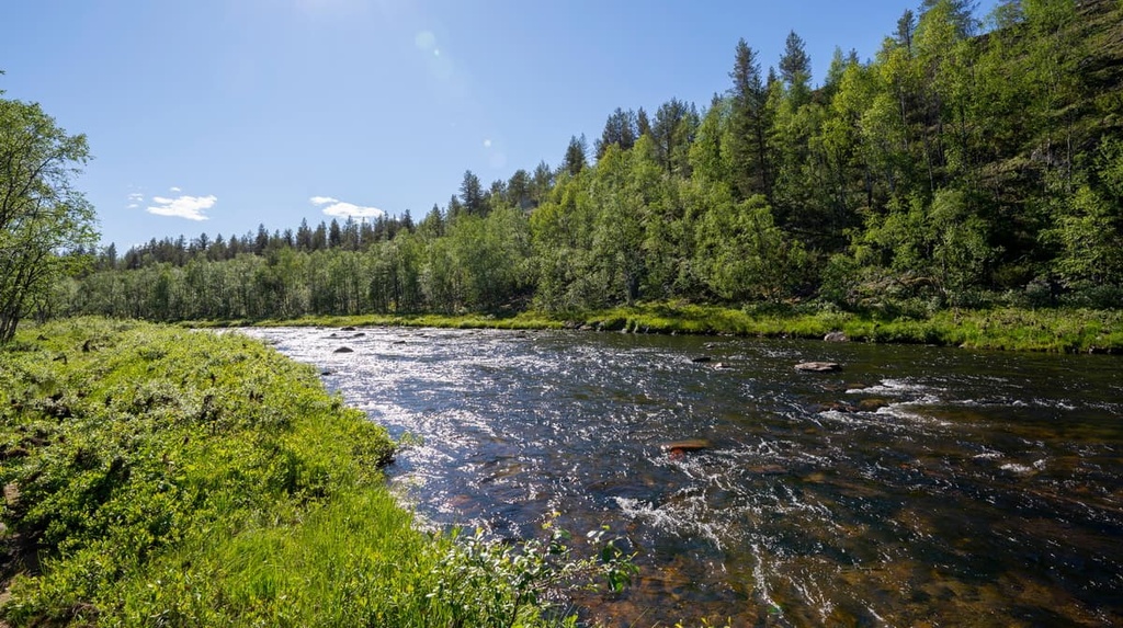
The main feature of the Hammastunturi Wilderness Area landscape is the Ivalojoki River.
The Ivalojoki River is a powerful and beautiful meandering river that’s 180 km (110 mi) long. It originates at Peltotunturi Fell (457 m / 1,499 ft) in the Pulju Wilderness Area. From there, it flows through Hammastunturi and the town of Ivalo to Inari Lake, after which, it flows into the Arctic Ocean via the Paatsjoki River.
Additionally, the Ivalojoki River is known primarily as the birthplace of the Lapland gold rush, which began in 1870. The gold rush then spread throughout the north of the region, and it lasted for several years until the gold deposits ran dry. For this reason, Ivalojoki is sometimes known as the Golden River.
Along the river, you can still visit the Kultala Gold Mining Village as well as a number of other historic sites from this time period such as Ritakoski. You can visit many of these sites along a marked trail if you’re interested in learning more about the history of the region.
Finally, the river attracts many nature and outdoors enthusiasts each year, thanks to its 30+ rapids, most of which are concentrated in a stretch of 70 km (43.4 mi) from Kultala to Ivalo. The rapids make the river a great route for experienced paddlers in Lapland.
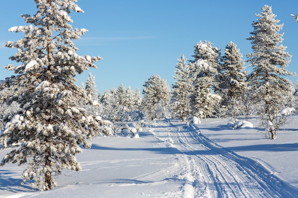
As far as flora goes, the Hammastunturi Wilderness Area is located near the northernmost extent of the spruce growing region in Finland. In fact, spruce isn’t as common in the northern part of the country as the dominant tree species here is pine.
It is also worth noting that the vegetation here is very sparse because of the harsh climate and because the soils in the area are fairly acidic. As a result, the soils have a relatively low nutrient content and can only support a small amount of vegetation.
The vegetation in the wilderness is mostly concentrated on the banks of rivers. This includes species such as Moor-King (Pedicularis sceptrum carolinum), which was named after the Swedish King Charles XII.
Along the rivers, you can also see species such as parnassus, angelica, Alpine milkvetch, Alpine bartsia, and Lapland lousewort. There are also black bearberry, Alpine azalea, and blue heath (Phyllodoce caerulea) plants that live on the wilderness area’s fells.
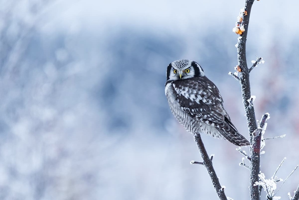
The animals of Hammastunturi are very typical of the boreal forests in the region. Among birds, there are pine grosbeak, three-toed woodpeckers, northern hawk owls, willow grouse, Siberian tits, Siberian jays, rough-legged buzzards, and golden eagles, among others.
Mammals that live in the wilderness include stoats, least weasels, red foxes, and otters. By the way, if you see an animal that seems rare or unusual to you—for example, the Arctic fox—report your discovery to the Main Forestry Office of Finland. This information helps researchers keep track of the wildlife in the area.
The mountains in the Hammastunturi Wilderness Area belong to the Karelides as well as the granite belt of northern Lapland, Norway, and the Kola Peninsula in Russia.
At the same time, some of the mountains belonging to the Karelieds are also part of a smaller mountain range that’s locally known as Maanselkä. This range is located on the border of Finland, Norway, and Russia.
The highest mountain in this range is Sokosti (718 m / 2,356 ft), which is located in Urho Kekkonen National Park. The range also includes Gora Nuorunen (576 m / 1,890 ft), which is believed to be the highest in Paanajärvi National Park and in the Republic of Karelia in Russia.
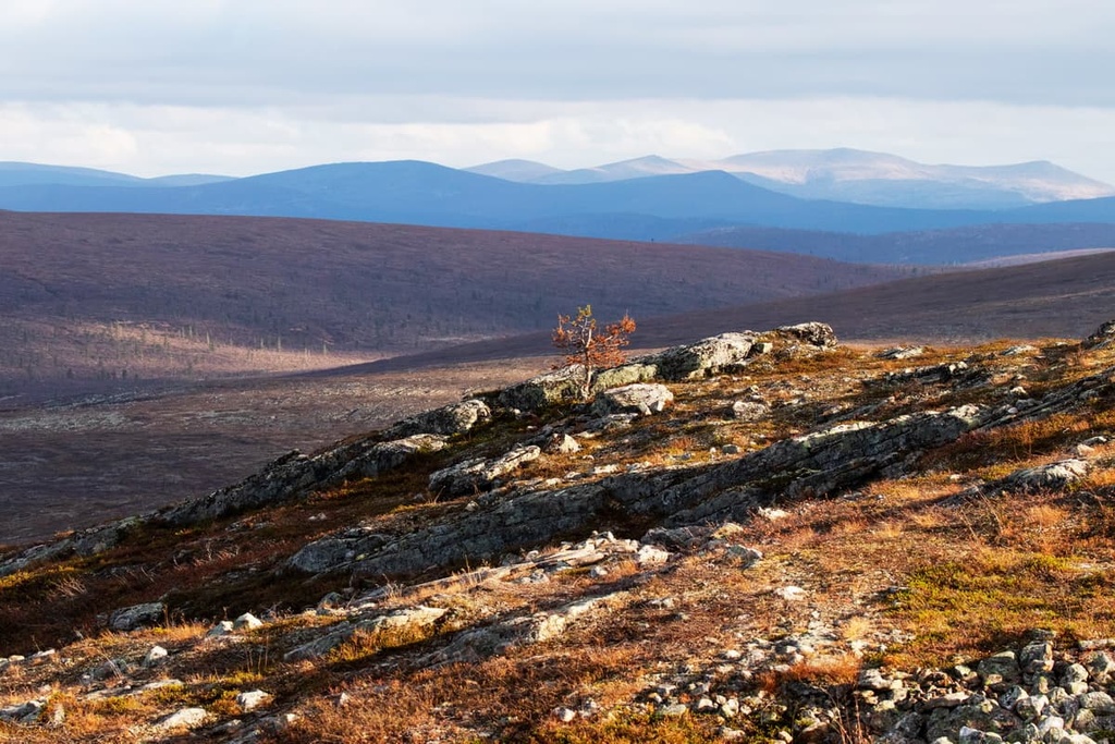
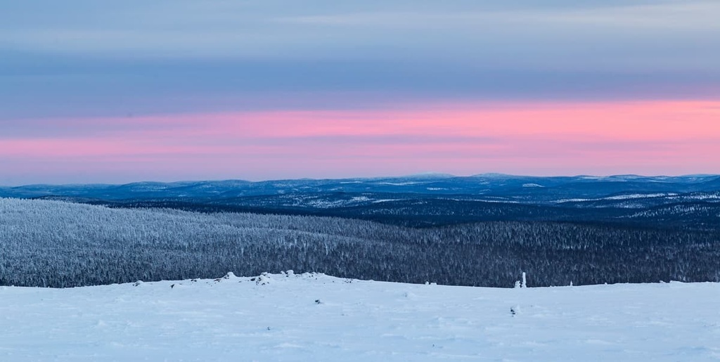
As far as Hammastunturi is concerned, the core of the area is dominated by the uplands of three fells: Hammastunturi (532 m / 1,745 ft), Appistunturi (484 m / 1,587 ft) and Kehäpää (408 m / 1,338 ft).
These and other higher elevation areas of the wilderness are concentrated mostly in the east and north of the area. But these mountains, including the two highest, Hammastunturi and Korkianokka (509 m / 1,669 ft), are located away from the main trails so it takes a bit of navigating to reach them on a summit attempt.
Of the more southerly peaks of the territory, the most notable are Litmuorvaarat (455 m / 1,492 ft), Hirvipaat (380 m / 1,246 ft), and Naalaselka (333 m / 1,092 ft).
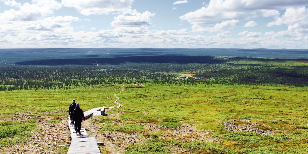
The main hiking area in the Hammastunturi Wilderness Area is located in the eastern part of the wilderness.
There is one marked trail in the wilderness area. It is 24 km (14.9 mi) long round trip, and it begins at Pahaoja, which can be accessed from the Pahaojantie road that leads to the village of Kuttura. The trail itself takes you to the bank of the Ivalo River and to the village of Kultala, which is a former gold-mining community.
At the beginning of the trail, in Pahaoja, there is also a small museum that features buildings and machinery from the region’s gold mining days. Along the trail itself, you will cross several rivers, including the Sotaoja River. You’ll also ascend and descend several peaks, including Björklundinvaara Fell (327 m / 1,072 ft).
For those who wish to learn about the history of gold mining in the region, you have a number of hiking opportunities to choose from.
One such opportunity is the 7.5 km (4.6 mi) long Kultareitti Nature Trail, which is located to the south of the wilderness. The start of the trail is approximately 1.5 km (0.9 mi) to the south of Laanila village on the Sodankylä–Ivalo road.
Not far away, there is also the Tankavaara Gold Prospector Museum. It is located on the westernmost borders of Sompio Strict Nature Reserve and Urho Kekkonen National Park. There are a number of educational trails around the museum for visitors to enjoy.
As far as skiing in Hammastunturi goes, there is a great cross-country ski trail that’s worth checking out. It travels from the Saariselkä Tourist Center to the Tolosjoki River on the eastern edge of the wilderness. There are two campfire shelters along the trail, where you can rest during your adventure.
According to the Finnish Forestry Administration, you can also use the snowmobile trails for skiing. One such snowmobile trail runs along the entire western border of the area parallel to the road. Another option is to ski the trail that runs from Inari to Ivalo and onward to Saariselkä.
For Alpine skiing, your best option is the nearby Saariselkä Ski Resort. It has 7 km (4.3 mi) of pistes and 5 lifts. For larger runs, go to the Luosto Ski Resort, which is located further to the south.
Given the remote nature of the area, there is no visitor center in Hammastunturi, but you can find one in Ivalo. There are also visitor information centers in other nearby parks, such as the Urho Kekkonen National Park Customer Service "Kiehinen" in Saariselkä and the Northern Lapland Nature Center "Siida" in Inari.
Ivalo Customer Service
Sairaalantie, 3B, 99800, Ivalo, Lapland, Finland
+358206397701
When hiking or skiing in the Hammastunturi, you can camp anywhere you’d like, thanks to the Everyman’s Right Law in Finland.
In Finnish wilderness areas (but not in national parks or nature reserves), you can also make a campfire wherever you’d like, but please do so responsibly and heed any fire bans that may be in effect. It’s also best to use impacted fire rings whenever possible.
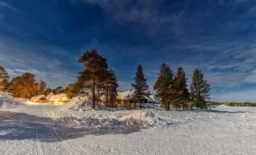
There are also many open wilderness huts in Hammastunturi, such as Ivalojoen Kultala, Louhioja, Liljeqvist, Ritakoski, Suivakkojärvi, and Taimenjärvi. Each of these huts can accommodate up to 6–8 people.
There are also five rental huts in the area, including Ivalojoen Kultala, Ritakoski, Juntinoja, and Kirakkajoki. They differ in that they allow you to book the entire hut in advance. Fees vary for these huts, but they are normally between €55 and €80 per night.
You can also stay in the workers’ quarters in the Kultala Gold Village. These workers' quarters operate as a reservable wilderness hut, where you can book a bed in a shared room. This hut was originally built in the nineteenth century, but it has recently been renovated.
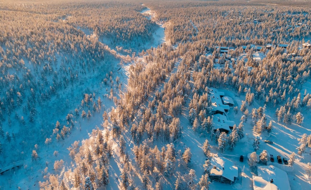
Ivalo and Saariselkä are the two main villages and resorts in the area around Hammastunturi.
Like almost everywhere else in Lapland, except its capital Rovaniemi, Ivalo and Saariselkä are very small settlements, so do not expect to find big city life in this part of Finland. The main treasures of Lapland are, of course, its nature, but also the rich culture of the Sámi people.
In Ivalo, you’ll find a small but busy airport, which is a landmark in its own right because it’s the northernmost airport in the country. Here, you can also visit the St. Nicholas Orthodox Church and Ivalo Library or you can check out one of the town’s many restaurants for a taste of the local cuisine.
For more information, check out the official tourist site of Lapland: Lapland.fi.