
Scan the QR code and open PeakVisor on your phone
Pulju Wilderness Area is one of the 12 wilderness areas of Finland. It is located in the northern Lapland region and its main feature is its namesake fell, Puljutunturi (470 m / 1,542 ft). Additionally, the vast bogs in the wilderness are known for their abundance of cloudberry, which is called the “queen of all northern berries.” There are 10 named mountains in Pulju Wilderness Area. The highest and most prominent mountain in the wilderness is Kätkätunturi (515 m / 1,690 ft).
The name of the Pulju Wilderness Area comes from that of the Puljutunturi Fell (470 m / 1,542 ft). In turn, the name of the fell comes from the Sámi language, which is the language of the Indigenous people of Lapland. In the local dialect, the name of Puljutunturi can be roughly translated as ‘ridge,’ which is a reference to the Pulju moraines.
A Pulju moraine is a special type of glacial moraine found in northern Finland, which forms the “ice-walled-lake plains” type of landscape that we see in the region. These are ridges of about 5 m (16.4 ft) in height and between 50 and 300 m (164 and 984 ft) in length.
They were first described in written texts by the Finnish geologist Raimo Kujansuu in 1967. These moraines are located about 7 km (4.3 mi) to the north of the Pulju village, which is situated on the southern border of the wilderness area.
The word fell is also a characteristic local word. It means ‘mountain’ and it comes from the Old Norse word fjall. The Finnish name of the wilderness area is Puljun erämaa-alue.
Pulju Wilderness Area is located in the geographical center of northern Lapland near Finland’s border with Norway. The wilderness covers 614 sq. km (237 sq. mi) of terrain. Administratively, the wilderness belongs to the municipalities of Kittilä and Enontekiö, the latter of which is the largest municipality in Lapland.
The wilderness area borders Lemmenjoki National Park to the east and Pöyrisjärvi Wilderness Area to the northeast. The northern boundary of the wilderness is the Finnish-Norwegian border, where it is located adjacent to the Norwegian Øvre Anarjohka National Park.
Just to the west of the wilderness area, you will also find Pallas-Yllästunturi National Park, which is the most popular national park in Finland based on its total number of annual visitors (typically more than 500,000 a year).
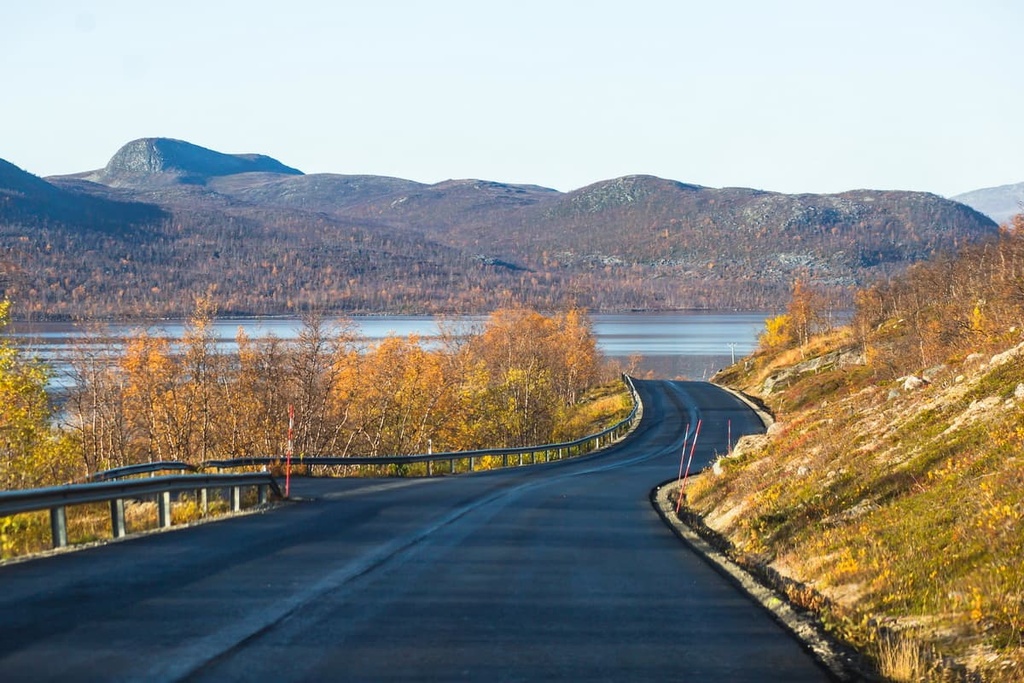
In the western part of the wilderness area, between the settlements of Kaunismaa and the namesake Pulju in the south and Nunnanen in the north, there is a regional road. This road makes the Pulju Wilderness one of the most accessible wilderness areas in Lapland. You can drive along this road and pull over wherever you want to go for a hike.
From Nunnanen, it's only a 41 km (25.4 mi) drive to Enontekiö along this road. You can get to Nunnanen by car or bus from the capital of Lapland, Rovaniemi, in about 3.5 hours (249 km / 155 mi). Alternatively, you can get to Nunnanen from Helsinki by car in about 13 hours (1,075 km / 668 mi).
For those who prefer to travel by public transport, keep in mind that there is no direct bus service to the wilderness area. The closest town to the wilderness area is also Enontekiö. Lapland can be reached by plane from Helsinki on Finnair flights. The nearest airport is Kittilä.
As you can see, getting to Pulju Wilderness Area is a real adventure in its own right, to say nothing of the hiking you can enjoy once you arrive. But part of the fun of Lapland comes in the journey, so traveling overland to the wilderness area can be quite an incredible experience, too.
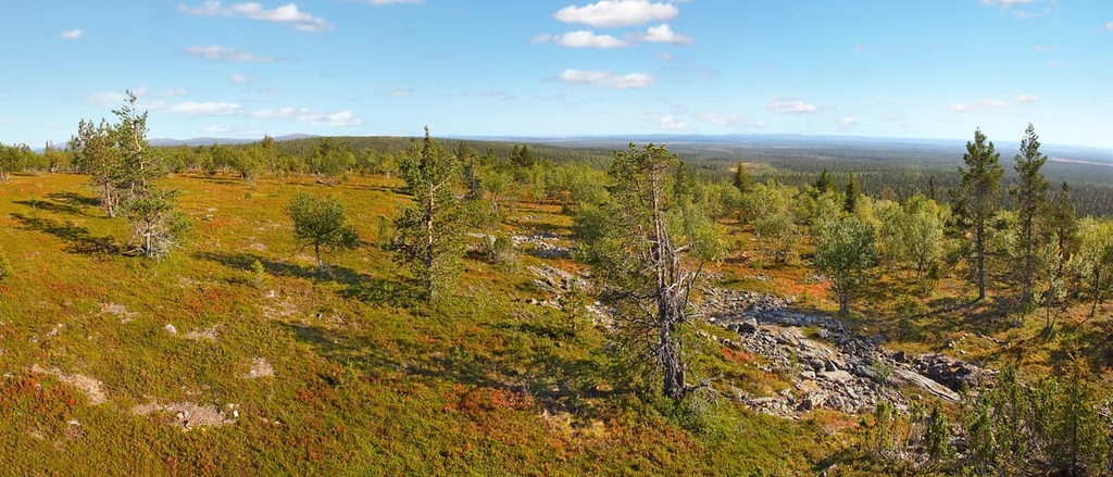
The flora of the Pulju Wilderness Area is typical of northern Lapland, but it has a few unique characteristics. Here’s a quick overview of what you can expect in the wilderness area.
The Pulju Wilderness Area is covered with spruce and pine forests, though it is home to one of the northernmost such forests in the region.
Outside of the forests, the terrain in the wilderness area is covered by relatively little vegetation. What vegetation does exist consists mainly of various shrubs and bushes of blueberries, cranberries, and cloudberries. In particular, cloudberries dominate the vast marshes in the southern part of the wilderness area.
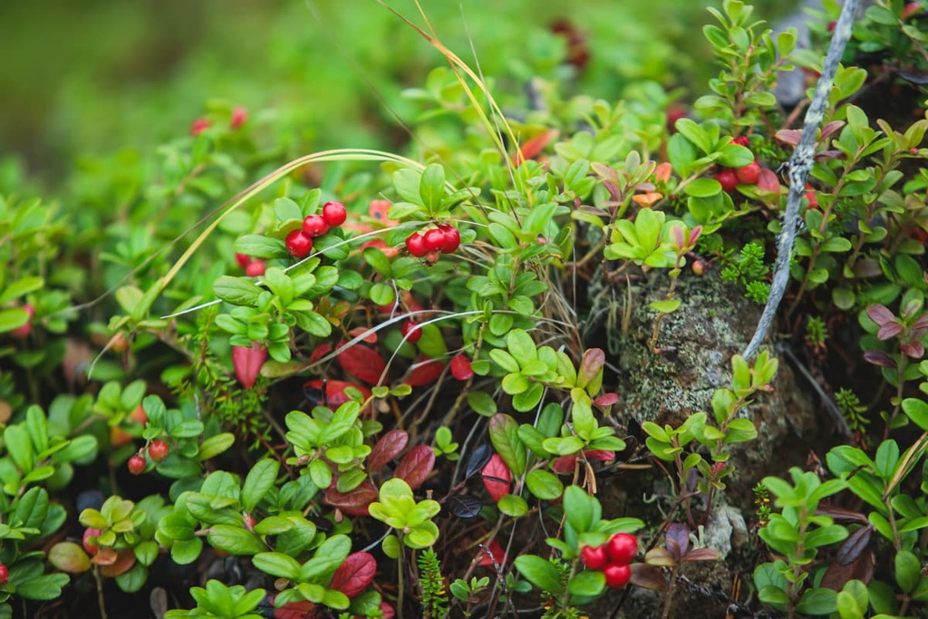
In my experience of traveling to Finland, Finns are very fond of cloudberries, and some sources describe them as “Finland’s favorite fruit.” Cloudberries are less common than other types of berries in the region but they have a beautiful yellow-orange color.
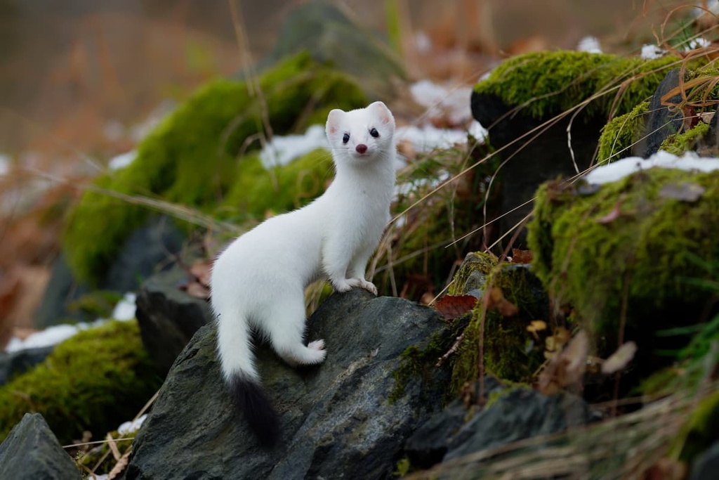
Both small and large predators, such as ermines, American mink, least weasels, wolverines, and bears, inhabit the area. Wolves are also present in the wilderness, but they are very difficult to spot.
The marshes of the territory are an ideal habitat for many types of birds, such as waders, Eurasian golden plovers, wood sandpipers, short-eared owls, and willow grouse, among others. While hiking around the area, you are sure to see and hear many of these birds.
An interesting feature of the Pulju is that its southern peaks belong to the Karelides range (these are low-lying hills that run from North Karelia to Lapland), while the northern ones can be considered part of the foothills of Norway, where the main range is the Scandinavian Mountains.
The most famous of the 10 named peaks of the wilderness area, Puljutunturi Fell (470 m / 1,542 ft), is located on its southern borders to the north of the village of Pulju. The highest peak of the wilderness area, Kätkätunturi (515 m / 1,690 ft), is located to the east of Pulju.
Other notable mountains in the area include Korsatunturi Tornilaki (464 m / 1,522 ft), which forms the border between the municipalities of Enontekiö, Kittilä, and Inari. Some other major high points in the wilderness include Muurilaki (452 m / 1,482 ft), Avisuoratunturi (462 m / 1,516 ft), and Peltotunturi (457 m / 1,499 ft).
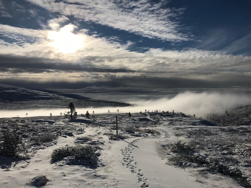
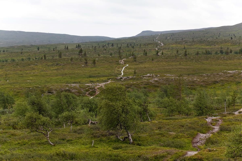
The Pulju Wilderness Area does not have any marked hiking trails, which makes it truly wild. However, in this and other similar areas in Lapland, you can follow old folk trails, forest roads, and other similar informal paths.
These paths tend to be highly visible in the landscape, so finding them usually isn’t too challenging. In this area, there is one particularly notable route that’s about 10 km (6 mi) long and travels from Kalmakaltio, near the village of Nunnanen, to Pahtajärvi Lake in the neighboring Lemmenjoki National Park.
For those driving to the wilderness area from the south, you can climb Puljutunturi Fell (470 m / 1,542 ft) from the village of Pulju.
The trail starts at Road 956 and runs through the lower part of the Varkaanvaara Hill to the beautiful lake named Varkaanvaaranjärvi before it heads up to the summit of Puljutunturi. From the top of the mountain, you can return along the Retkeilyreitti Trail to make a loop. The total length of this trail is around 8.2 km (5 mi).
In the Pulju Wilderness Area, you are also free to ski anywhere you want during the winter months. However, there are no maintained or marked cross-country skiing trails, so you will either need to create your own trail or follow another kind of path.
One potential place for skiing in the wilderness area is on a snowmobile track that runs between the villages of Nunnanen and Pulju along Road 956.
Meanwhile, the closest major ski resort to the wilderness area with marked ski trails and lifts, Ylläs, is located on the southern borders of Pallas-Yllästunturi National Park. It is one of the largest and most famous resorts in the country.
You can find more information about the ski resorts in Finland and the Lapland region on the World Mountain Lifts section of the PeakVisor website. These pages also have real-time maps of open ski slopes at different ski areas around the world during the winter season.
The closest visitor centers to the wilderness area are the Fell Lapland Visitor Center in the municipality of Enontekiö and the two similar centers that are located in Pallas-Yllästunturi National Park.
Be sure to visit at least one of these visitor centers before your first hike in the wilderness. That way, you can learn more about other possible routes and things to do in the area from local experts.
Fell Lapland Visitor Center
Peuratie, 15, 99400, Enontekiö, Lapland, Finland
Open all year round with different schedules
Hours (May 31 to October): Mon to Sun, 9 am to 5 pm
+358206397950
Pallastunturi Visitor Center
Pallastunturintie, 557, 99330, Pallastunturi (Muonio), Lapland, Finland
Open all year round with a varying schedule
+358206397930
Yllästunturi Visitor Centre Kellokas
Tunturintie, 54, 95970, Äkäslompolo (Kolari), Lapland, Finland
Open all year round with a varying schedule
+358206397039
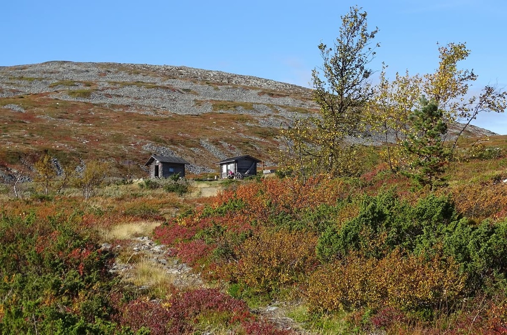
There are two open wilderness huts in the Pulju Wilderness Area that are suitable for short stays of about one to two nights. These include Gorsastohpu (Korsatupa), which is located on the Korsajärvi Lake, and Avesuorri (Avisuora), which is located to the southeast of Kalmankaltio on the boundary between the municipalities of Enontekiö and Inari.
Near the main mountain of the area, Puljutunturi Fell (470 m / 1,542 ft), there is a lean-to shelter where you can rest before you make your trip back to the trailhead. During the warm season, these lean-tos could be also used as a type of overnight accommodation. However, if you can avoid doing so, it’s best not to sleep in Finnish lean-tos until late summer when there are fewer mosquitos.
Alternatively, throughout the wilderness area, you are allowed to pitch your tent and make a campfire anywhere you’d like in accordance with the Everyman's Right law. There are some restrictions on this law in certain highly protected areas in Finland, so always double-check if camping is allowed in a given location before you set off on your adventures.
Before and after your hike, you can also find hotels and cottages in the villages that are located around the Pulju Wilderness Area, such as Enontekiö and Kittilä.
Enontekiö and Kittilä are the two largest municipalities in the vicinity of the Pulju Wilderness Area. The first is located to the north of the wilderness area and the second is situated to the south.
Hetta is the main village in the municipality of Enontekiö. It is located on the shore of the large and picturesque lake named Ounasjärvi.
The village was founded in 1877 and it has over 1,800 residents, many of whom identify as Sámi. The main architectural and cultural attractions of the village are the Enontekiö Church (Enontekiön seurakunta) and the Enontekiö Local History Museum.
While in town, you can also check out the Enontekiö Airport, which is located 9 km (6 mi) to the west of Hetta but no longer has regular flights. The closest operating Finnish airport to Enontekiö is Kittilä, which, by the way, is a great alternative place to fly to if you don’t want to travel all the way to Rovaniemi.
For more information, check out the official tourist site of Enontekiö: EnontekioLapland.com.
Kittilä is a tourist resort and community that is located near Haudanperä Lake and the Ounasjoki River. The town was founded in 1854 and it has a population of over 6,400 people.
The main architectural and cultural attractions of Kittilä are the art galleries Raekallio and Sibakow-Mansikka, the library Kirjasto, and the history museums Särestöniemi and Palsa. There is also the interesting baroque-style Kittilä Church, which was built from wood between 1829 and 1831. The church also features the beautiful 170-person Maria’s Chapel.
For more information, check out the official tourist website of Kittilä: Kittila.fi.


