Scan the QR code and open PeakVisor on your phone
Dajianhou Mountain Special Scenic Area (磺嘴山大尖後山外圍核心特別景觀區) is located on the eastern part of Yangmingshan National Park (陽明山國家公園) in northern Taiwan. The area contains a total of 14 named mountains, with the highest and most prominent mountain being Mount Dajianhou (大尖後山) at an elevation of 885 metres (2,904 ft).
Dajianhou Mountain Special Scenic Area forms part of the Jinshan (金山區) and Wanli (萬里區)districts of New Taipei City (新北市). As an area of Yangmingshan National Park, Dajianhou Mountain Special Scenic Area sits just north of Taipei (台北市), and it boasts extensive views of the New Taipei City and the port city of Keelung (基隆市).
The volcanic crater of Direkou (地熱口) borders is the north of Dajianhou Mountain Special Scenic Area, with Nei Shuang Xi Shan (內雙溪山) forming the southern barrier. Lukuping (鹿堀坪) is the easternmost mountain, with Mount Beiwuzhi (北五指山) extending towards the western boundary.
There are a number of mountains of interest in the park, including Mount Dajian (大尖山), Mount Huangzui (磺嘴山), Mount Gaoding (高頂山), and Mount Ding (頂山).
Dajianhou Mountain Special Scenic Area is wilder and less frequented than the neighbouring Qixingshan (七星山自然文化景觀核心特別景觀區) and Datunshan Lianfeng (大屯連峰自然文化景觀核心特別景觀區) special scenic areas. However, these same features draw adventurous and avid hikers who want to test their endurance and grit and be alone in the environment, savouring the wild jungle of overgrown nature.
Areas of interest near Dajianhou Mountain Special Scenic Area include the tallest volcano and mountain in Yangmingshan National Park, Mount Qixing (七星山) to the west. Other important nearby areas of interest include Yehliu Geopark (野柳地質公園) to the east, Songshan (嵩山) to the north, and Xinshan (新山) to the south.
Mount Dajianhou is an extension of Mount Qixing, a dormant volcano in Yangmingshan National Park. Both Mount Dajianhou and Qixingshan belong to the Datun Volcano Group (大屯火山群), a dispersion of andesitic lava volcanoes found along the east-west belt of the area of Yangmingshan National Park that erupted in several stages, between 200,000 to 1 million years ago.
Two types of volcanoes are featured in Dajianhou Mountain Special Scenic Area. Mount Dajianhou resembles a conical volcano based on its steeper cone-shaped appearance created by viscous felsic lava. As the lava has a thick consistency, it does not travel far down the volcano before it solidifies. This has allowed the peak to develop a steeper gradient than would be expected in a volcano with less viscous lava.
The nearby Mount Huangzui is an example of a composite volcano as its formation was caused by alternating layers of pyroclastic rocks and lava flow. Composite volcanoes are more tapered at the base but have increasingly steep inclines moving closer to the peak. The peak of Mount Huangzui forms a crater in the shape of an inverted bowl of 50 to 70 metres (164 to 230 ft) deep.
The primary rock strata of the Datun Volcano Group are igneous and sedimentary rock. Volcanic eruptions that occurred during the Pleistocene epoch formed igneous rocks that are andesitic in composition. Meanwhile, the sedimentary rock in the region resulted from an accumulation of sediment in shallow sea waters on the Eurasian plate during the late Oligocene to Pliocene epochs.
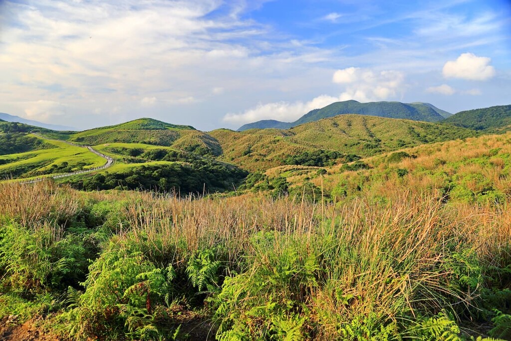
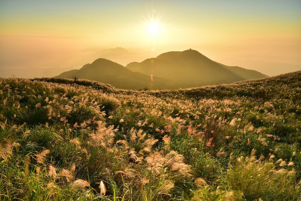
The plant life in the Dajianhou Mountain Special Scenic Area consists of broadleaf forests from the elevation of 500 metres (1,640 ft) and upward. Meanwhile, hardy, resilient silvergrasses dominate the peaks of this region. Silvergrass can grow as tall as 180 metres (591 ft) in some parts, blowing over the trails in windy weather and completely covering the route.
As a result of the heavily acidic soil in the area (which itself is due to regional volcanic activity), the topsoil on the mountains in Dajianhou Mountain Special Scenic Area is nutrient-poor. This means that the soil is not fertile enough to nurture plant life, and only the toughest of plants, such as silvergrass, can survive in these conditions.
The broadleaf forests in the area mainly include tall members of the Laurel family, such as red nanmu and Machilus thunbergii. Arboreal trees like the Taiwan cherry, Formosan sweetgum, and Adinandra millettii feature in the forests, as do shrubberies like Eurya japonica, Laportea aestuans, and Ilex asprella.
Bamboo forests of Pseudosasa usawai are also present in the medium elevations of above 500 metres (1,640 ft) on the mountain slopes of Dajianhou Mountain Special Scenic Area.
Exotic plants that appear in this region, most specifically in the Huangzui Ecological Protection Area, are Dysosma pleiantha, Jasminanthes mucronata, Deutzia cordatula, Eriocaulon sexangulare, and Ligularia japonica.
The varied selection of plant life in the broadleaf and bamboo forests of the region has a major effect on the animals found in the Dajianhou Mountain region.
In particular, there are 79 species of variegated butterfly and single-banded nymphs that flit around the nectar-bearing plants in this area. Additionally, some 43 species of birds have been sighted in this area, notably the Taiwanese blue magpie, the crested serpent eagle, the plumbeous water redstart, and the Taiwanese whistling thrush.
There are 14 species of mammals in the region, such as the Chinese lesser civet, Formosan barking deer, and Formosan ferret-badger. In addition, 9 species of amphibians, 17 kinds of reptiles, and 4 varieties of fish, including Channa asiatica, occupy the Dajianhou Mountain Special Scenic Area.
The extensive area of Yangmingshan National Park was inhabited by the Shihsanhang tribe who settled in the Jinshan region of Dajianhou Mountain Special Scenic Area around 600 to 1,000 years ago. To trade sulphur deposits and agricultural produce of the Yangmingshan area, the Shihsanhang people constructed ancient pathways along the land to reach the more central area of Taipei and the shipping port of Keelung. For this reason, there are many historic trails along the mountain ridges, meadowed grasslands, and dewy valleys in the Dajianhou Mountain area.
Yangmingshan National Park, which contains Dajianhou Mountain Special Scenic Area, was established on September 16, 1985. However, the boundaries of this new national park are slightly different from that of the previously established national park during the Japanese Occupation Era.
The areas of Mount Qixing, Mount Datun, and Mount Guanyin formed the boundaries of Daiton National Park in 1937, when Taiwan was still under Japanese rule. In 1962, after the Japanese had loosened their imperial grip over Taiwan, the area of Daiton National Park was rezoned.
As a result of this rezoning effort, park officials included the outlying areas of the Jinshan and Wanli districts in the new Dajianhou Mountain Special Scenic Area. They also included the northern region of Sanzhi District in the new planning. Combined, these areas form Yangmingshan National Park as we know it today.
While the Dajianhou Mountain Special Scenic Area encompasses a collection of lesser-known hiking trails, they are by no means insignificant. In fact, they are favoured by intrepid hikers seeking a physical challenge. Here are some of the best hikes to check out in the area:
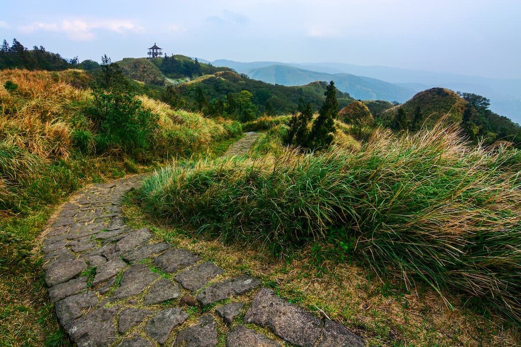
The trek to Mount Dajianhou is not as clear and evident as those on the more popular mountain trails in the region, such as Mount Qixing or Mount Datun. Swarms of engulfing silvergrass overpopulate the track, and in blustering conditions, the silvergrass buries the path, making it extremely challenging to identify the trail. The course can be so heavy in silvergrass, that hikers have been known to cut down their way through the dense jungle of silvergrass.
Hikers begin from the Shanghuangxi parking area and make their way to Lengshui Dashan, climbing until the saddle connects the trail to Mount Dajianhou. The primitive trail follows an earthen road earmarked with mossy stones along a slippery river. Hikers ascend the steep slope of Mount Dajianhou, cutting through rampant shales of silvergrass to reach the summit.
Hikers can enjoy views of the nearby Mount Huangzui, Mount Zhuzi in the north, Mount Xiaoguanyin in the west, and coast of Jinshan in the east from the peak of Mount Dajianhou. Depending on the height of the silvergrass, hikers can also distinguish the western area of Mount Qixing, Mount Shamao, Qingtiangang East Peak and Mount Qigu.
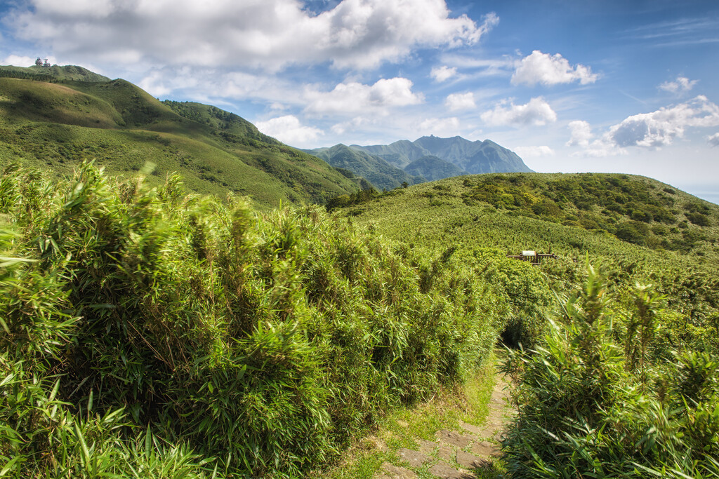
The 4.7 km (3 mi) one-way trek to Mount Huangzui begins from the grassy plains of Qingtiangang in the Qixingshan Special Scenic Area.
Hikers set forth, journeying for an hour, along the flat, fertile fields. Eventually, hikers will be met with broadleaf forests that stay with them until they reach the base of Mount Huangzui and enter the protection area.
The Huangzui Ecological Protection Area covers 6.4 sq km (2.4 sq mi) of land set along the ridgelines of Dajianhou Mountain and Mount Huangzui. It is the only nature conservation area in Dajianhou Mountain Special Scenic Area, and one of two ecological protection areas in Yangmingshan National Park.
Due to the more remote location of this region, its trails are less clogged with hikers. Also, hikers wishing to traverse across this area need to apply for a special hiking permit 3 days prior to the visit as they are entering a protected area.
Hikers on this adventure will follow the trail over rolling terrain until they reach the last steep push up a sharp ascent through Pseudosasa usawai bamboo to reach the volcanic crater of Mount Huangzui.
On the east side of Mount Huangzui, hikers can overlook the Huangzui Pool and see Mount Qixing in the distance to the west. Meanwhile, Mount Zhuzi can be seen to the north, as can the offshore scenery of the cone-shaped Keelung Islet that’s situated just off the northeast coast of Taiwan.
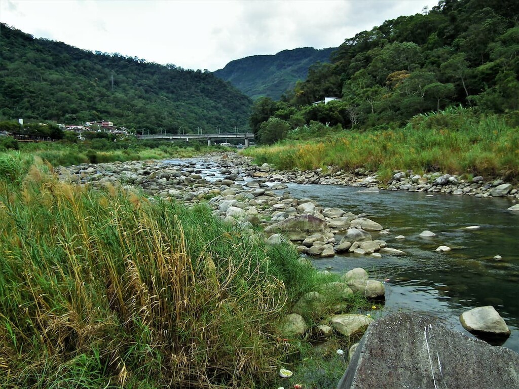
The 6 km (3.7 mi) Lukuping Historic Trail (鹿堀坪古道) was an old route that connected Wanli district to Shilin district of Taipei City. The entire path is nestled beside the Touqian River, meandering through a thicket of bamboo forests that trail towards a 4-metre-high (13 ft) waterfall as hikers ascend the gentle gradient to the summit of the grass-terraced plain of Mount Lukuping.
As this ancient route falls within a secluded area and the trail is not obvious, hikers are advised to have GPS with them. Using a GPS is particularly helpful as many primitive courses form tangents off the main path. Being isolated is one of the highlights of this trail, as sheltered forests and wild, overgrown footpaths signal that one is entirely enveloped by nature.
The chances are high that you could be the only hiker along this trail, leaving you alone to appreciate the rugged beauty of the ancient rampant course.
The splashing and gurgling waters of Touqianxi Waterfall keep you company along the path, as its gushing waters echo in the silent valley. The waterfall is a popular rest stop for hikers to slow down and appreciate the stillness and magnificence of the enclosed emerald foliage surrounding the flowing white waters.
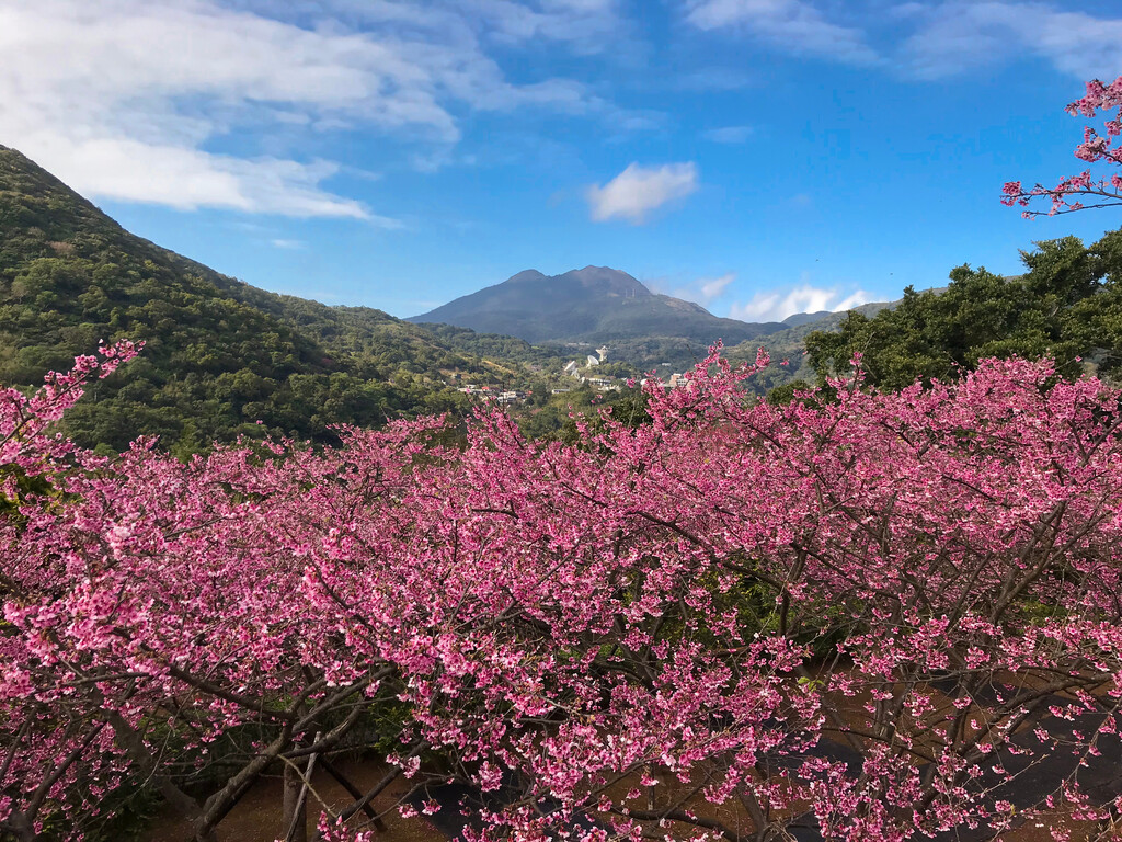
As hikers continue onwards, the fragrant plum blossoms linger through the air as the broadleaf trail gradually changes to silvergrass, signalling the flat expansive grassy region of Mount Lukuping is nearby.
Fresh mountain air and a rugged, raw, untouched, and undeveloped landscape are the highlights of the Fishiping Historic Trail (富士坪古道), which runs along the southeastern edge of Mount Dajian.
The trail commences with a sharp ascent as hikers climb their way up the southeastern slope of Mount Dajian. Along the way, the trail is lined with bamboo forests of Pseudosasa usawai on either side.
After a short, quick climb, hikers journey along the ridgelines of the winding path, which evens out and follows a comfortable, gentle and wide path towards the horizontal fork road ahead of Shipeng Di Gong temple. The right forked way leads hikers upwards through a broadleaf forest to the Fushiping prairie as the upper reaches of the feeble Fuji Creek murmurs alongside the path.
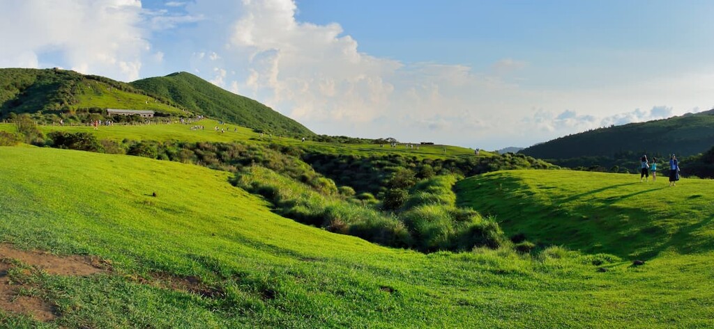
The open field of Fushiping holds grazing cattle and water buffalo on its fertile grassy plain. A second grassland lies just on the north side of Mount Dajian. Although this grassland is smaller in area than its neighbor, it is higher in elevation and, as such, it offers clear views that overlook both Yehliu Cape and the rolling hills and valleys of Keelung.
Also known as the Jinbaoli Trail and the Fishermen’s Trail, the Yulu Ancient Road Trail (魚路古道) intersects the Lengshuikeng area. Beginning from the grass valley of Qingtiangang, hikers embark on a continuous downhill journey of 6.6 km (4 mi) along the old path built in 1903 for fishermen to transport their catch to Shilin or Dadao Cheng.
After a 20-minute trek, the green open meadows appear flanked by peaks bearing thick vegetation. The Yulu Ancient Road Trail links to the Sulphur Mines Historic Trail of the dormant volcano of Dayoukeng that holds numerous sulphur deposits.
Situated along the path is Hanbing’s House, which archaeologists believe to be a tiny stone-made store that also served as a place to rest along the old trading route of Yulu Ancient Road.
Hikers on this adventure will trek through densely shaded broadleaf forests and vast open areas until they reach the end of the trail. This trail finishes at Shuangxi parking area in the Jinshan District, where the trail to Mount Dajianhou commences.
Situated in the northern part of Dajianhou Mountain Special Scenic Area, Bayan Hot Spring (八煙野溪溫泉) is a well-known thermal spring. Though being forbidden to enter by the government due to hazardous conditions, it remains popular for opportunists. If encountering irregular patrols, visitors can be fined with more than 1,500 NTD (approximately 50 USD.)
Here, there are waterfalls and natural pools in which visitors can soak. The springs are characterised by their wild and natural setting, as they are based in a forest with minimal human interference or development.
In the spring valley, the milky blue murky waters of the hot spring range from different levels of warm to colder pools while a mist hangs like a curtain above the pools. The water is high in sulphur content and it ranges in temperature from 104 to 167°F (40 to 75°C). As such, it’s a great place to rest and rejuvenate after a long day of hiking.
As the Dajianhou Mountain Special Scenic Area is situated in the Jinshan and Wanli districts of New Taipei City, there are a number of great places to stay near the mountains. For example, the picturesque port city of Keelung is situated close by, or, alternatively, visitors may wish to stay in the capital, Taipei City, and enjoy the many attractions that it has to offer.
Here are some of the best places to check out during your visit:

Keelung is a coastal city in northern Taiwan that sits just east of Dajianhou Mountain Special Scenic Area. The ancient port city is engulfed by mountains that overlook the central hub of Keelung and its harbor.
The nearby Zhong Zheng Park rests on a coastal hill just outside Keelung, offering exquisite views of the city below from the intricately grand four-storey Zhuputan Temple. This majestic hillside temple can be distinguished from many areas of Keelung below.
Zhengbin Fishing Harbour was once the largest harbour during the Japanese Occupation Era, but it is now a sleepy fishing village. This fishing harbour's charm is the strip of brightly painted houses lining the port, creating a happy rainbow of colours. The fishing boats gently bob in the harbour waters against the backdrop of burnt orange, blossom pink, and deep turquoise blocks of apartment buildings.
Heping Island rests off the coast of Keelung port, and it is connected to the city by a bridge. Beautiful views of the northern coast of Taiwan can be admired from the island. Heping Island features eroded rock formations that appear similar to those in Yehliu Geopark.

Dawulun Beach is a stunning cove encircling blue, green sea waters and soft white stretches of sand. This is a popular place for visitors to swim and snorkel or bathe on the shore and enjoy this paradise's gorgeous scenery.
Miaokou Night Market is a lovely place to stop and savour the freshly caught seafood that vendors enthusiastically sell from their stalls. This narrow stretch of road dotted with yellow Chinese lanterns offers sushi, fresh sashimi, and the most tender calamari.
Taipei is a fascinating city bursting with an abundance of attractions to suit anyone. From exotic food, to wondrous temples, luscious nature walks, quirky neighbourhoods, and show-stopping architecture, this city is brimming with life and plenty of options.
For a birds-eye view of the city basin, hop on the Maokong Gondola, which lifts visitors into the skies of Taipei and transport them to Maokong (貓空) over fields of tea plantations. Maokong is a mountainous village known as one of the largest producers of oolong tea. Here, there are many mountain trails to wander, tea houses to visit and sample the locally grown teas, as well as incredible views of the city and low-lying tea plantations to savour.
Meanwhile, the show-stopping Taipei 101 skyscraper stretches to 508 metres (1,667 ft) at 101 stories. It held the title of the world’s tallest building between 2004 to 2009; however, it now ranks as the number one tallest green building in the world due to its low carbon emissions.
Inspired by a lotus, although some may say it resembles stacked Chinese takeaway boxes, the design of the building is unarguably creative. Indeed, it’s a sleek, forward-thinking symbol of both Taipei and Taiwan.
Dihua Street is a historical gem and an old commercial market lined with ancient Chinese medicine shops, stalls selling incense, teas, and fabrics. This antiquated street was constructed in the 1850s and it’s the oldest street in Taipei. The buildings still display their original architecture and are well-preserved, so a stroll down this ancient street feels like one has traveled back in time.

Ximending is a fun, quirky neighbourhood in Taipei that is often called the ‘Harajuku of Taipei.’ Flashes of neon, pops of blinding bright colour, and pulsating effervescent energy emanate from this otherworldly pedestrian parade. Wandering around this area is hypnotising, and if anything, you will leave this whimsical, light-hearted area in a joyous trance.
As Dajianhou Mountain Special Scenic Area is part of Yangmingshan National Park, which is just north of Taipei, the most convenient place to start your journey to this area would be from Taipei.
From the major cities of Kaohsiung, Tainan, Chiayi, Taichung, and Hsinchu, head to Taipei Main Station on the Taiwan High Speed Rail (HSR) or the local express train (TRA).
Once at Taipei Station, walk south approximately 500 meters to the Taipei Main Station (Gongyuan) bus station, and board the 1717 bus to Jinshan Station. Then, alight at Shuanghuangxi Bridge where you can find the trail to Dajianshanhou Mountain at the nearby Shuanghuangxi Parking Area.
Alternatively, visitors can hire a taxi or rent a car or scooter from Taipei or Keelung. It is a 32 km (20 mi) journey from Taipei and a 29 km (18 mi) journey from Keelung to Dajianhou Mountain Special Scenic Area.