
Scan the QR code and open PeakVisor on your phone
Located in southeast Alberta, Canada, Cypress Hills Provincial Park is a protected area that sits upon a plateau overlooking the Alberta prairies. The park has a unique landscape, ecology, and history compared to the rest of the southern prairies. The tallest hill in the Cypress Hills is Head of the Mountain, which is 1,460 m (4,790 ft) tall and has 592 m (1,942 ft) of prominence.
Cypress Hills Provincial Park is situated in southeast Alberta, Canada. It is part of the Cypress Hills Interprovincial Park, which spans the border of Alberta and Saskatchewan. The other parts of the interprovincial park are the West Block and the Centre Block, both of which are in Saskatchewan.
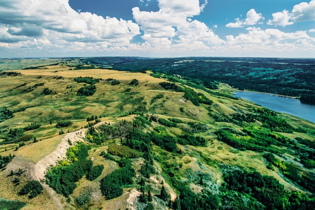
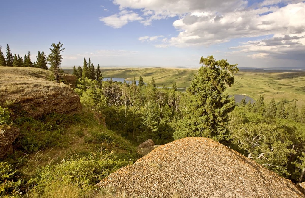
The tallest of the hills in the provincial park is Head of The Mountain, which is 1,460 m (4,790 ft) tall and has 592 m (1,942 ft) of prominence. The main features of the park are Elkwater Lake and the unique montane ecology that is present on the plateau.
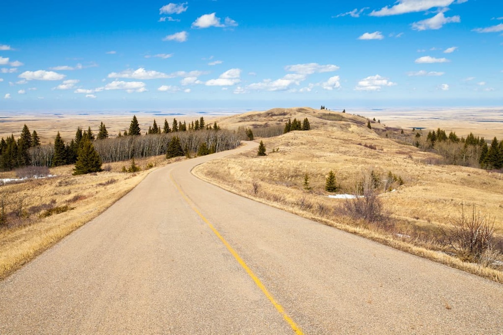
Highway 41 is the primary road into Cypress Hills Provincial Park. Battle Creek Road connects the Alberta side of the park to the Saskatchewan side of the park. Located to the southwest of the Cypress Hills are the Milk River Natural Area and the Onefour Heritage Rangeland Natural Area.
Cypress Hills Provincial Park sits on the remnants of a plateau that previously covered significant portions of southern Alberta. The plateau was created from fluvial deposition between 55 and 11 million years ago into the sea that once covered Alberta and much of the interior of Canada.
As the mountains were formed to the west, the Continental Divide started to form about 75 million years ago. Water from the inland seas started draining to the east, toward the Atlantic and Arctic Oceans.
The erosional forces of the displacing sea moved massive amounts of sediments and debris to the east and away from the uplifting mountains. This created a plateau of sediment across southern Alberta.
However, after the formation of the plateau, erosion continued, especially along the ancient drainages of the South Saskatchewan and Milk River. Since the Cypress Hills sit between the preglacial ancestors of the South Saskatchewan and Milk River drainages, the hills were spared the strongest erosional forces. As a result, the highest parts of the plateau are nearly 600 m (2,000 ft) higher than the surrounding plains.
During the Pleistocene, the tops of the Cypress Hills were spared from the erosive effects of the Laurentide ice sheet. This effect created a number of features in the Cypress Hills called nunataks.
Nunataks, which are high points that remained unglaciated during the major glacial periods, are present throughout the region and often have unique landscapes and ecologies. Other notable nunataks include Plateau Mountain and the mountains of the Highwood Pass in Kananaskis Country, Alberta.
The ice sheet that once covered the region melted away about 14,000 years ago, It left behind moraines and other glacial deposits across what is now Cypress Hills Provincial Park and the surrounding region. While the glaciers significantly affected the surrounding landscape, the park was most affected by the erosional forces of the ancient and more modern rivers.
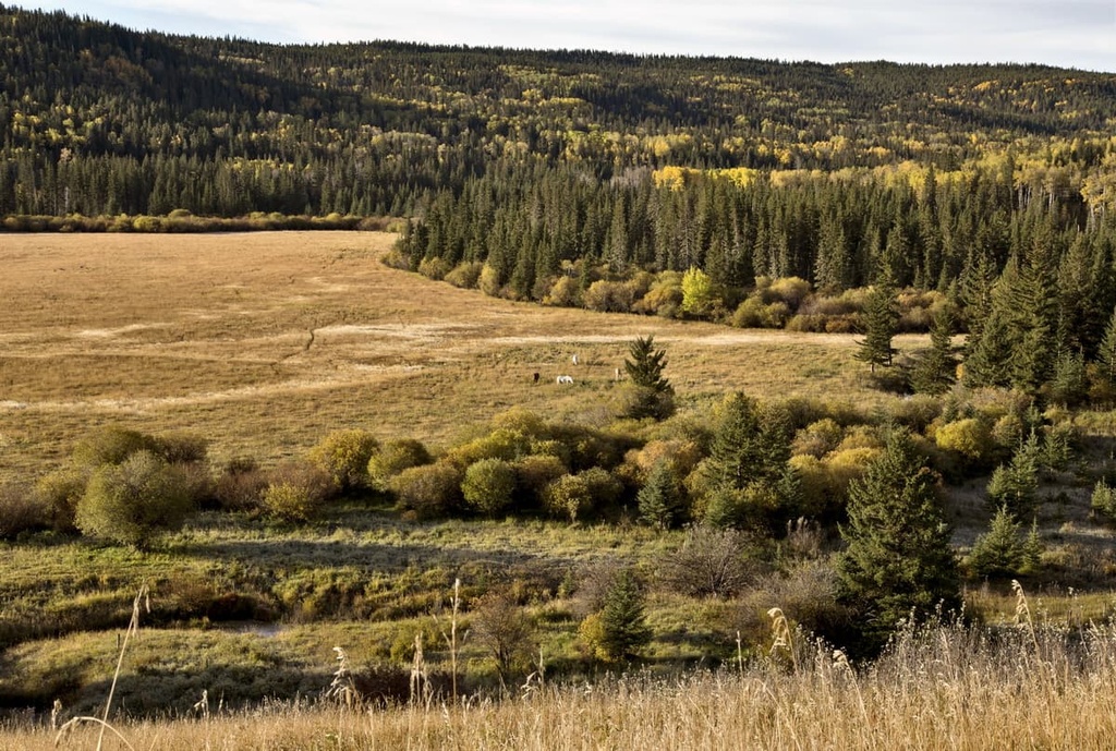
The ecology of Cypress Hills Provincial Park is an anomaly within Alberta ecology. The park hosts the sole montane ecosystem in Alberta that’s located to the east of the Rocky Mountains.
The Cypress Hills Provincial Park, which encompasses most of the ecoregion, is ecologically similar to Bow Valley Provincial Park in the Rocky Mountains or the Municipality of Crowsnest Pass in southern Alberta.
The Cypress Hills are a mosaic of forests and open meadows, with aspen, lodgepole pine, and white spruce dominating the forests. The herbaceous and grassy meadows have many wildflowers, including prairie crocus, three-flowered avens, lupine, blue bells, and prairie rose. The hills are also home to fourteen orchid species, including the striped coralroot orchid and Venus's slipper orchid.
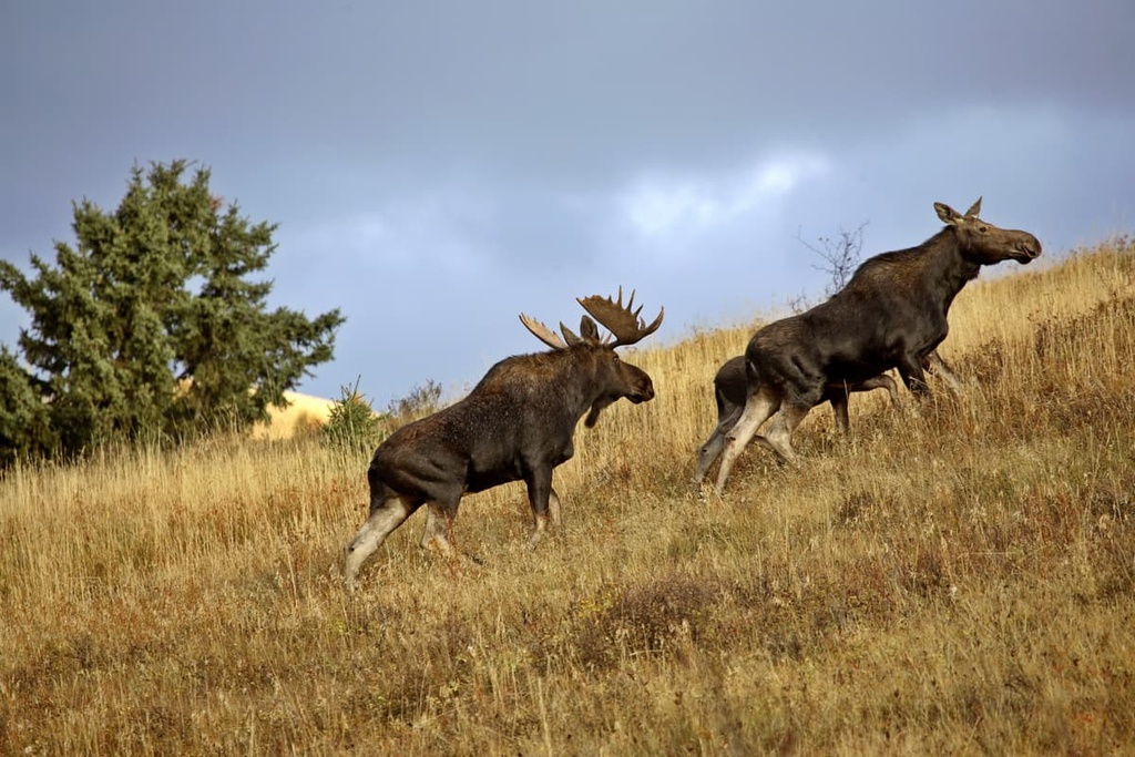
Large mammals that inhabit the hills include moose, elk, mule and white-tailed deer, coyotes, and cougars. There are a wide variety of small mammals, including rodents, bats, shrews, skunks, jackrabbits, Canada lynx, foxes, and bobcats, that call the area home, too. Indeed, the Cypress Hills have the most diverse ecology in southeast Alberta.
Archaeological evidence and cultural knowledge suggest that the Cypress Hills have been inhabited for at least the past 8,000 years. The Cypress Hills were a notable area in prehistory and they were used as a meeting place for many Indigenous peoples.
Cypress County is the traditional territory of the Blackfoot Confederacy, Stoney Nakoda First Nation, and the Métis Nation of Alberta. The Métis settled in the hills for hunting and wintering during the nineteenth century.
In 1873, a horrible event occurred in the Cypress Hills when 13 Nakoda were killed by Canadian and US wolf hunters. The Cypress Hills Massacre was an unnecessary tragedy from what appears to be a misunderstanding about missing horses. The event spurred the new Canadian government to accelerate the recruitment and deployment of the newly formed North-West Mounted Police.
Among the many significant archaeological and cultural sites in Cypress County, there are two exceptional historical sites.
The first is the site of the Cypress Hills Massacre, which was designated as a Canadian Heritage Site. The second site is at South Battle Creek where a tipi ring, lithic artifacts, and broken pottery have been found. This site is believed to have been inhabited between 7,500 and 300 years ago.
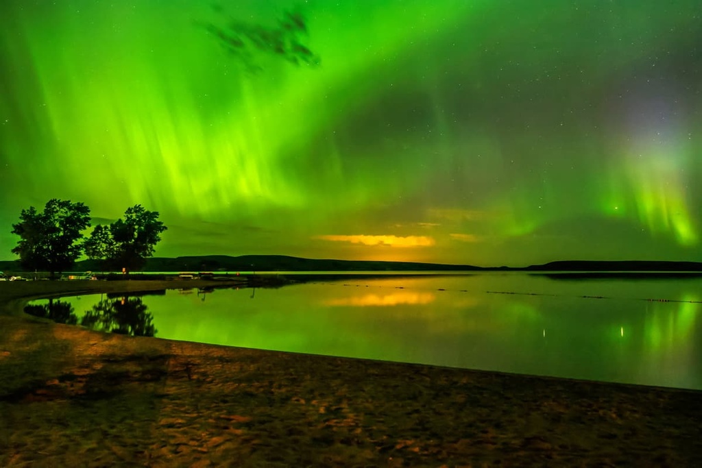
The Cypress Hills are a unique area that stands out in an otherwise vast expanse of prairie grasslands and farms. As was the case in ancient times, locals still visit the area to rest, recover, recreate, and gather with family and friends. The following are some of the main attractions within the park:
Cypress Hills Provincial Park is a wilderness refuge from the expanse of the prairies. The following are the major towns and cities near the park:
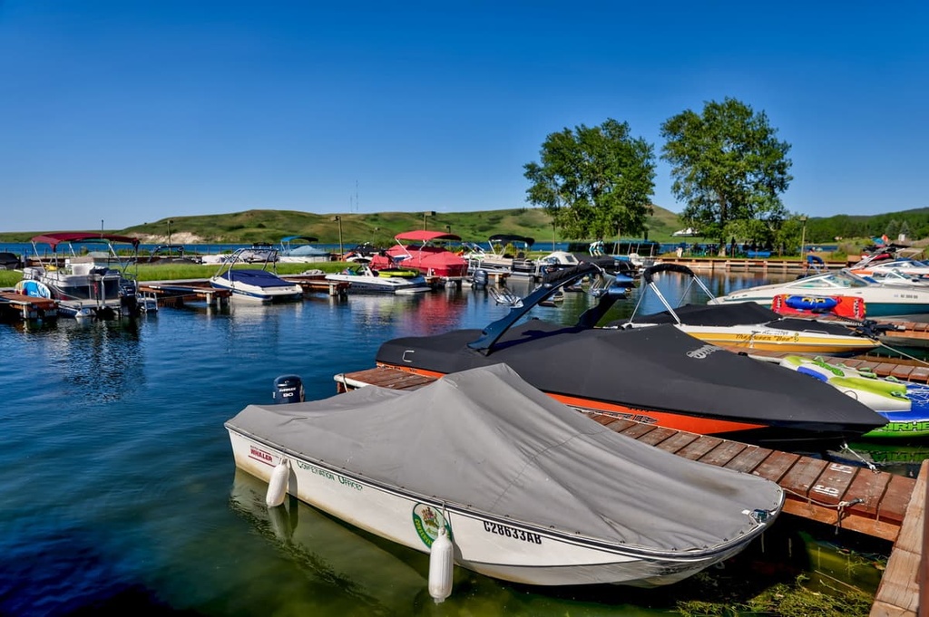
The town of Elkwater is the commercial center for Cypress Hills Provincial Park. It is located along the south shore of Elkwater Lake. There are hotels, cozy cabin cabins, and campgrounds for accommodation in the town.
The lake is a great destination for swimming, boating, and fishing, and there are many nearby trails that wind through the unique prairie wilderness. Some of the notable trails from the town are the Horseshoe Canyon Trail, Old Baldy Trail, and the Fire Lookout Trail.
Medicine Hat is located some 65 km (39 mi) to the north of Cypress Hills Provincial Park. It was built upon the banks of the South Saskatchewan River. As the principal city of Cypress County, many visitors from the city flock to the Cypress Hills during the summer to enjoy the unique wilderness environment.
Medicine Hat originally grew from the railway camp that was raised while the railway workers were constructing the bridge across the South Saskatchewan River. The city has a rich history that includes generations of First Nations culture and settlers that came for free land and cheap gas during the last couple of centuries.
The song, “All Hell for a Basement” by Big Sugar is about Medicine Hat, referring to the massive gas reserves under the city and surrounding area. The abundant natural gas resources allowed the city to attract many industries at the turn of the twentieth century by offering cheap land and power.
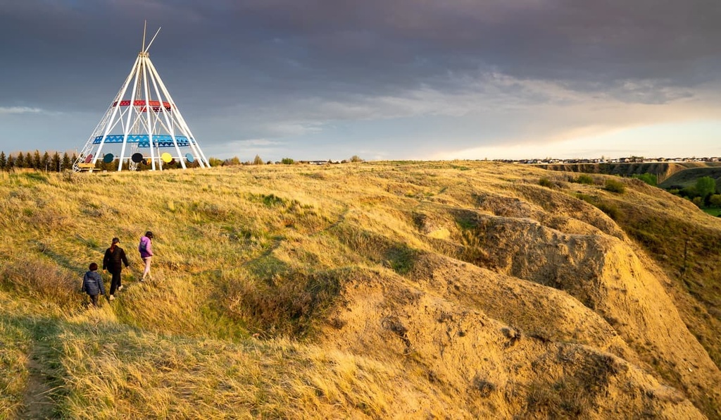
The river valley and the coulees are incredibly beautiful places to hike, thanks to their rugged terrain and fascinating views. Some of the places to visit while in Medicine Hat include the Saamis Teepee, Police Point, and Echodale Regional Park.


