Scan the QR code and open PeakVisor on your phone
The beauty of Bosnia and Herzegovina is undeniable. Here, you can see the most breathtaking mountains, deep lakes, and wild rivers in a relatively small area. The country itself consists of two parts: Bosnia to the north and Herzegovina in the southwest. There are 11102 named peaks in the country, the highest of which is Maglić (2,386 m/7,828 ft) and the most prominent of which is Pločno (2,228 m/7,309 ft).
The small country of Bosnia and Herzegovina sits in the middle of the Balkan Peninsula of southeastern Europe. It is centrally located between the Adriatic Sea and the Pannonian Plain and it is dominated by the Dinaric Alps. As a result, Bosnia and Herzegovina is home to a wide diversity of landscapes.
Bosnia and Herzegovina is currently home to around 3.2 million people and the country covers an area of 51,000 sq. km (31,689 sq. mi). The country shares borders with Croatia to the north and west, Montenegro to the south, and Serbia to the east.
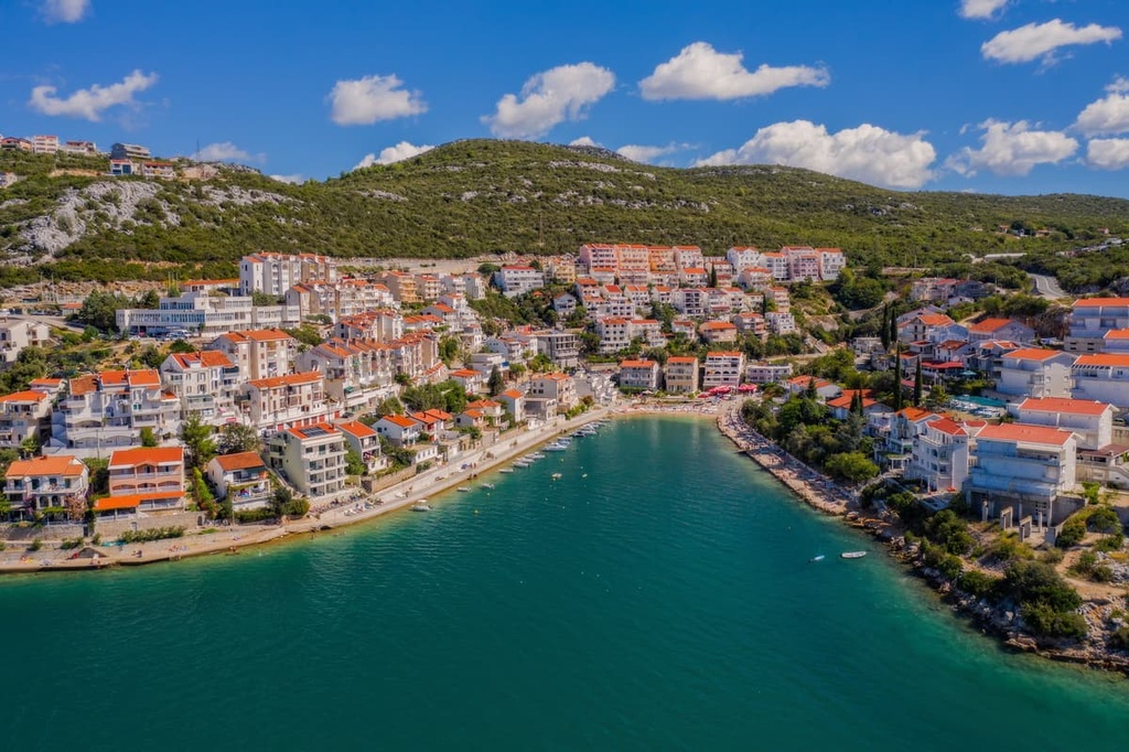
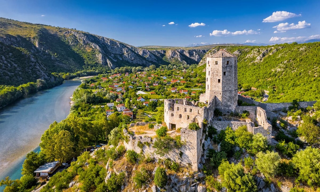
The longest part of Bosnia and Herzegovina’s border is with neighboring Croatia, around which it forms a narrow crescent. Herzegovina actually separates the southernmost part of Croatia into two parts. That’s because Bosnia and Herzegovina has a coastline of around 20 km (12 mi) on the Adriatic sea around the city of Neum.
Bosnia and Herzegovina can be split up into multiple regions. The two largest region of the country are:
Within both Bosnia and Herzegovina there are also many more sub-regions, such as:
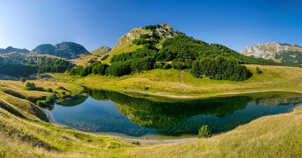
The country itself is highly mountainous and it contains several mountain ranges. The largest range in the country is the Dinaric Alps, which includes subranges such as Volujak, Zelengora, Lelija, Lebršnik, Vranica, Velež, Vlašić, Cincar, Kozara, Grmeč, Čvrsnica, Prenj, Vran, Romanija, Jahorina, Bjelašnica, Treskavica and Trebević.
In addition to being very forested, the country is also full of surface water. Therefore, when visiting Bosnia and Herzegovina, you are sure to find running water almost anywhere.
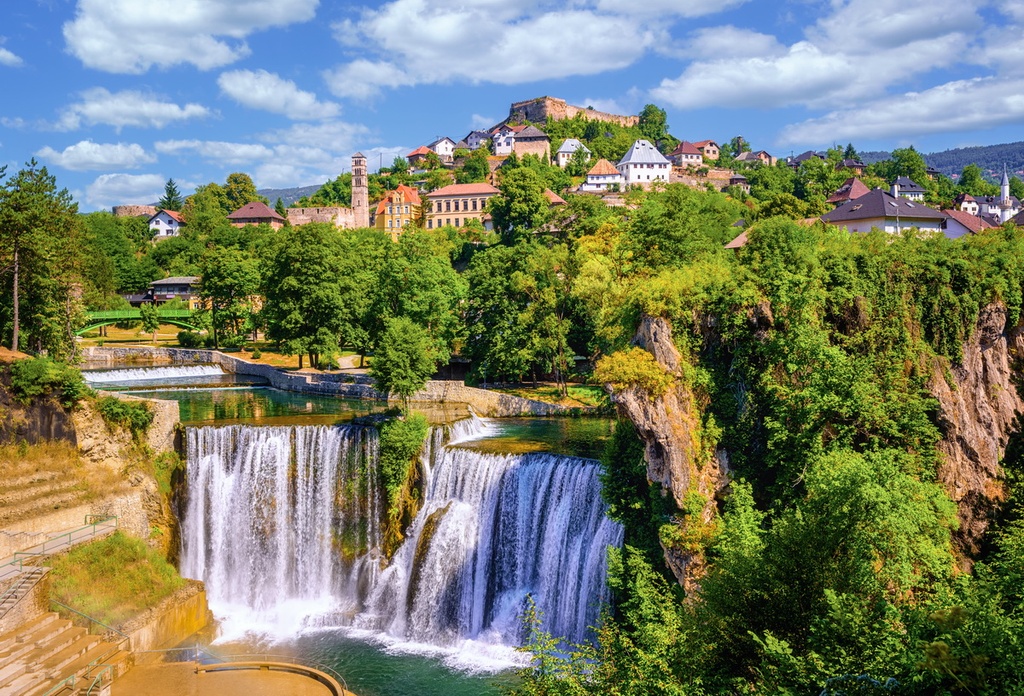
The northern region (Bosnia) actually got its name from its largest waterway, which is also called the Bosna River. There are too many rivers in the country to count, but the most notable ones include Neretva, Bosnia, Sava, Sana, Vrbas, Drina, Una, and Pliva.
The country has been independent since 1992, when it was created after the break-up of Yugoslavia, but it has been plagued by war and internal turmoil for most of its existence. It is home to three constituent peoples: Bosniaks, Serbs, and Croats, with a number of other smaller ethnic, cultural, and religious groups such as Albanians, Romani people, and Jewish people.
The country is divided into two entities: the Federation of Bosnia and Herzegovina and the Republika Srpska (lit. Republic of Srpska). The federation is predominantly inhabited by ethnic Bosniaks and Croats, while the Republika Srpska is mostly home to ethnic Serbs. Locals formed a multiethnic self-governing area in Brčko called the District of Brčko, where neither entity has full control.
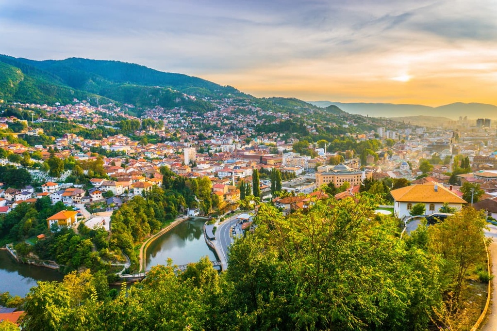
The largest city in Bosnia and Herzegovina is the capital Sarajevo. It is known as the host city for the 1984 Winter Olympics. The second largest town in the country is Banja Luka, while the third-largest city is in Herzegovina, the well-known city of Mostar.
The country has 11 smaller regions called cantons, which are further divided into municipalities. There are 74 municipalities in the Federation of Bosnia and Herzegovina and 64 municipalities in Republika Srpska.
Bosnia and Herzegovina sits on the edge of the European plate, making it relatively safe from earthquakes, unlike its western neighbors.
The oldest rock formations in Bosnia and Herzegovina date to the Paleozoic and Precambrian eras. The primary geologic features of Bosnia and Herzegovina are the Dinaric Alps and the Pannonian Plain.
Most of the country’s geological features are defined by the Dinarides (Dinaric Alps), which consist primarily of sedimentary rocks like sandstones, limestones, dolomites, and conglomerates. Volcanic and carbonate rocks are also present in the northwest, central, eastern and southeastern Bosnian regions.
The area of central and eastern Bosnia is well-known for mining. Some of the many ores that have been mined here over the millennia include hematite and magnetite. Here, one can also find coal and salt mines.
That said, the area of Herzegovina mostly consists of limestone rocks, which dissolve easily in acidic water. This area is rich in karst terrain, which is also seen throughout the Dinarides.
As said before, the country is full of mountains and hills, with an astounding 10,965 named mountains. Some of the highest peaks in the country include:
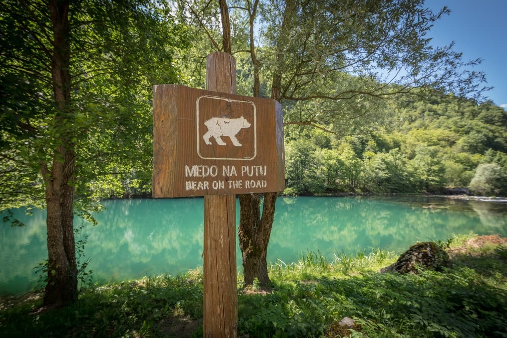
Considering how heavily forested Bosnia and Herzegovina is, it is no surprise that it has amazing biological diversity. The country is home to four terrestrial ecoregions, and numerous endemic species are found here. Approximately 43 percent of the country is dominated by forests and much of the country is rich in rivers and lakes, making it the perfect home for wildlife.
Commonly seen birds in the country include owls, eagles, and ravens. The predators present in Bosnia and Herzegovina are brown bears, wolves, and lynx. Other notable mammals in the country include wild boars, foxes, and deer. There are also plenty of snakes and amphibians, such as salamanders.
The local climate largely influences the ecosystems and their wildlife in Bosnia and Herzegovina.
Near the Adriatic Sea, the country features pleasant temperatures with long summers that are characteristic of a Mediterranean climate. Most of the country’s territory has a continental climate with mild summers and longer winters. The highest mountain peaks and massifs in the country also have an Alpine climate, where snowfall is expected for 8 months a year.
The area consists of these ecoregions: Balkan mixed forests, Pannonian mixed forests, Dinaric mountains mixed forests, and Illyrian deciduous forests.
Here, the winters are long and have high rainfall, so keeping the forest lush is easy. These forests mostly consist of oaks, and a smattering of other hardy trees.
At higher elevations, one can also see species like beech, Bosnian pine, silver fir, and Norway spruce. This region is also home to alpine tundra vegetation, such as juniper pine, edelweiss, and lichen, as well as fauna like bears, wild boars, pheasant, and wolves.
Montane forests often seen in the Dinaric Alps run through the central and south-western parts of Bosnia and Herzegovina. These ecosystems lie on a karst bed, making them porous and scarce with water. Still, in these forests, one can see European beeches, silver firs, Norway spruces, and European black pines all above 1,200 m (4,000 ft) in elevation.
These species are characteristic of higher elevations, while lower elevations (below around 1,200 m/4,000 ft) are home to different types of ashes and oaks. You will see edelweiss, mountain avens, alpine snowbells, and hairy alpine roses at these lower elevations. The fauna found in these forests includes owls, woodpeckers, and salamanders.
Just like the Dinaric Mountain forests, the Illyrian forests also contain different vegetation at lower and higher elevation zones (the ecosystems start to change around 1,200 m/4,000 ft in elevation).
You can find these ecosystems throughout Bosnia and Herzegovina. The trees characteristic to the Illyrian deciduous forests include black pines, silver firs, spruces, and beeches. At lower elevations, you can also find mixed oaks, chestnuts, and hornbeams.
The most easily recognizable sign of the Illyrian deciduous forests are birds of prey like vultures and falcons. You can see deer, chamois, and bears in these forests as well.
Located in the north-western part of Bosnia and Herzegovina lies the Pannonian Plain, and together with it comes the characteristic Pannonian forest.
Since the plain doesn’t exceed into higher elevations, the forests here generally all contain mixed oaks and hornbeams. There are also some low-lying grasslands and steppes. Animal species in the region include moles, vipers, bats, mice, and foxes.
The earliest known evidence for human occupation in Bosnia and Herzegovina dates back to Paleolithic times, with some evidence pointing to the fact that it may have been an early settlement spot for humans in Europe. Evidence of these early inhabitants include stone tools that were found near the town of Stolac along the Bregava River Valley. These tools date back to around 125,000 years ago.
The Neolithic era introduced the first developed farming techniques in what is now Bosnia and Herzegovina, a prevalent technique at that time. Considering the amount of water and arable land, farming caught up quickly in the region.
Later, during the Bronze Age, a local tribe called the Illyrians developed a rich culture that would influence future cultural development through the region. The Illyrians were known as a war-loving people that were split into small tribes.
The Illyrian culture developed in the second millennium BCE on the Adriatic Coast. They had a rich and complex culture that influenced much of the greater Balkan Peninsula.
The Romans conquered the territory that is now Bosnia and Herzegovina in 3 CE after much fighting with the Illyrians. A well-known warlord named Baton was the head of the Illyrians at the time, and he came from what is now Bosnia and Herzegovina.
After their conquest, the Romans brought better infrastructure and roads to the region. Soon after, their religion followed as well, together with their language.
But Roman rule of the region lasted only until 395 CE. The Roman Empire had endured for over 1,100 years, but it finally came to an end in the region, in part, when it met armies of Alaric I of the Visigoths. This change also impacted Bosnia and Herzegovina, which was left without a government.
After the Romans, the Slavic tribes, which Bosnia, Herzegovina, Croatia, Serbia, and Montenegro have to thank for their language, arrived in the region. They brought their beliefs together with their ancient Slavic language, which soon evolved into Bosnian, Serbian, and Croatian.
All three languages, while technically distinct, are very similar and are mutually intelligible. Currently, all three of these languages are official languages of Bosnia and Herzegovina.
During the Middle Ages, the statehood of Bosnia formally began with the establishment of the medieval Bosnian Kingdom. The first Bosnian king was Tvrtko II Kotromanjić. Bosnia was a recognized and modern medieval state which mostly lived off trade with Ragusa.
During this time, the name Herzegovina, formerly known as Hum, appeared in historic records. The name comes from the German word Herzog, which literally translates to ‘duke.’ Therefore, Herzegovina can be loosely translated as ‘duchy.’ In 1463, the Ottoman Empire attacked the kingdom, taking over almost all its territory.
The term ‘Ottoman invasion’ describes the period between 1463 to 1878 in Bosnia and Herzegovina when the Ottoman Empire controlled most of the modern-day territory of the country. This was a time of calmness when local people slowly adapted to the Ottoman ways of life. Some locals accepted the Ottoman religion, Islam, forming what we know today as the Bosniak identity.
The Austro-Hungarian Empire was a multinational state in Central Europe. In 1878 the Ottoman Empire conceded Bosnia and Herzegovina to the Habsburgs, who ruled the empire. As a result, Bosnia and Herzegovina became part of the Austro-Hungarian Empire.
This period of history brought an enormous industrial improvement to Bosnia and Herzegovina. The new government renewed the roads and infrastructure that were left neglected by the Ottomans. Foreign engineers and new technology started the local mining and forestry industries, launching Bosnia and Herzegovina back into the European spotlight.
After the two World Wars, Bosnia and Herzegovina was left almost barren by the killings and fights that took place in its territory. The country slowly rebuilt itself while a new form of government appeared with the Kingdom of Yugoslavia.
The Kingdom of Yugoslavia existed from 1918 to 1945, and its territory consisted of the present-day states of Bosnia and Herzegovina, Croatia, Macedonia, Montenegro, Serbia, and Slovenia.
It was created with the unification of the State of Slovenes, Croats, and Serbs (the "Triune Kingdom") on December 1, 1918. The kingdom’s successor was the Republic of Yugoslavia. After World War II, it began as a socialist state but later developed into a federation.
Yugoslavia was also considered one of the highest points economically in the history of what is now Bosnia and Herzegovina. Of course, Yugoslavia was a communist state with one dictator, Josip Broz Tito. Regardless, industry, tourism, and the economy flourished under communist rule. To this day, some locals still look back to this period with nostalgia for its economic prosperity.
In 1992, Yugoslavia fell apart, soon after the death of its dictator. Afterward, a war started in Bosnia and lasted until 1995. Local ethnic groups fought between themselves, and the fighting led to huge death tolls, with 9,000 people dead in Srebrenica alone.
Today, Bosnia and Herzegovina is a sovereign state known as the Republic of Bosnia and Herzegovina. The country has three distinct ethnic groups, Bosniaks, Serbs, and Croats, and each group has its own language.
As a result of this multi-ethnic status, the Presidency of Bosnia and Herzegovina is actually a three-member body. According to the country’s constitution, the Presidency must include one Serb, one Croat, and one Bosniak to represent the country’s main ethnic groups.
Nowadays, Bosnia and Herzegovina has a fairly diversified economy, and it has seen sizable economic growth since the 1990s. The country’s economy is powered by agriculture and industrial services, though it has a rapidly growing tourism sector, too.
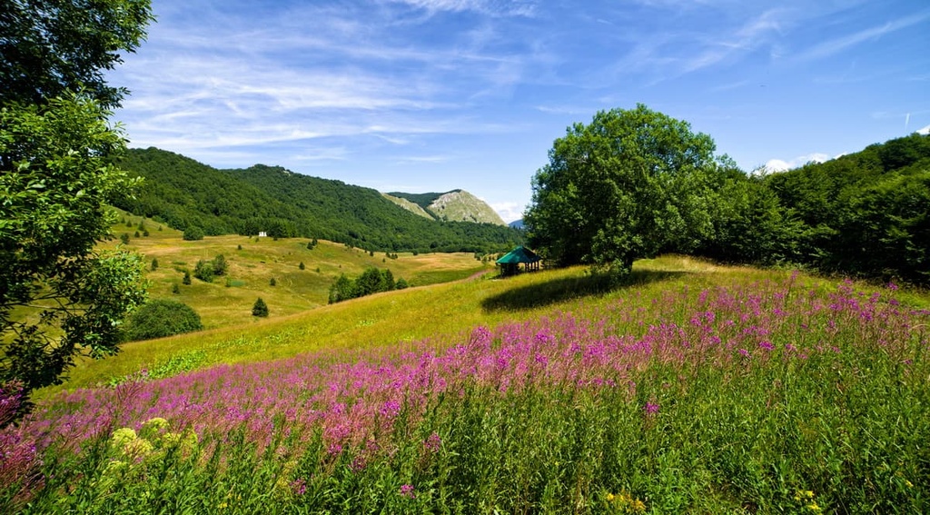
Tourism in Bosnia and Herzegovina is aided by the country’s gorgeous landscapes and its excellent opportunities for outdoor recreation. The country’s major cities are popular tourist destinations, as are its increasingly large number of ski resorts.
As it is a mountainous country, Bosnia and Herzegovina has a lot to offer to visitors looking for outdoor adventure. The most popular outdoor sports here include hiking, climbing, and rafting.
Here are some of the best places to adventure during your next trip to Bosnia and Herzegovina.
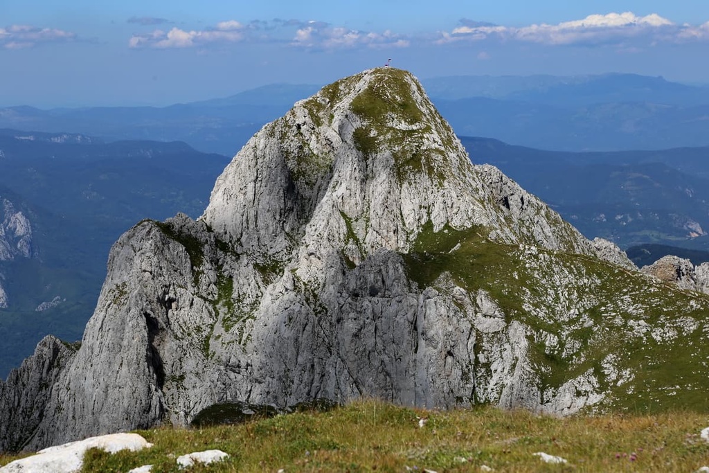
Prenj is a popular hiking destination in Bosnia and Herzegovina. The highest peak of the massif is Zelena Glava, and it has an elevation of 2,115 m (6,936 ft). It is one of the highest peaks in the country.
The Prenj massif is a popular destination for hikers due to its proximity to Sarajevo, the capital of Bosnia. You can get there by car from Sarajevo in about two hours. Of course, Mostar is much closer to Prenj, and one can reach the mountain in under an hour by car from the center of the city.
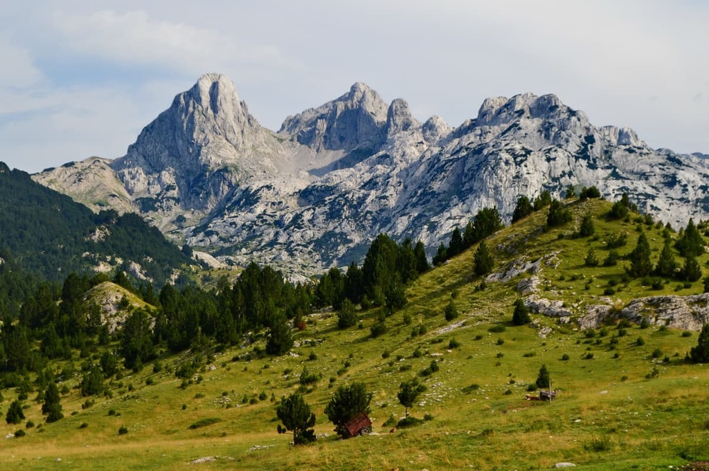
That said, Prenj is not a protected national or natural park in Bosnia and Herzegovina. The trails here are rugged, and it is arguably the only true backcountry left in this part of the Balkans. The most popular trail here travels from the village Bijela in Konjic to the summit of Zelena Glava, with an elevation gain of nearly 2,000 m (6,561 ft).
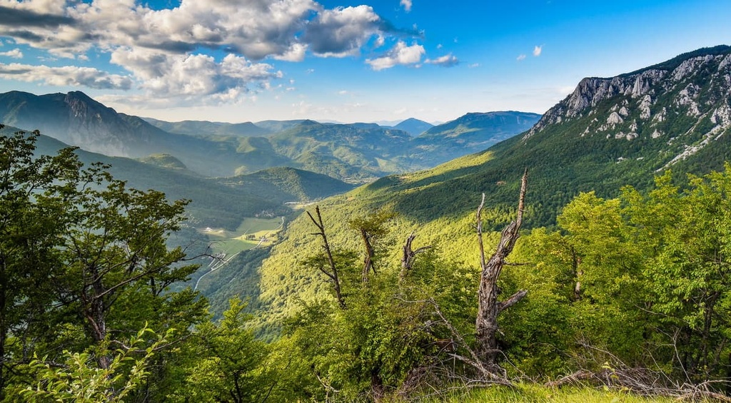
Blidinje National Park is one of the most important nature reserves in Bosnia and Herzegovina.
The park was established in 1975 as a nature reserve to protect its incredible natural habitats and species. In the park, you can find forests with oak and beech trees, meadows with wildflowers, and a number of lakes. The park is also home to three mountain massifs: Vran, Čvrsnica, and Čabulja.
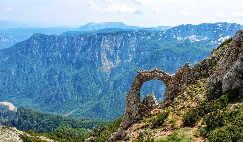
The most popular trail here is the one that takes you from Blidnje to Hajdučka Vrata, which translates to ‘Hajdučka Door.’ Hajdučka is a natural rock arch that’s located under Pločno (2,228 m/7,309 ft), the highest peak of Čvrsnica Mountain and the most prominent peak in Bosnia and Herzegovina.
There are 20 different hiking trails in the park that are available to visitors. One of the popular trails is Hajdučka Staza, which takes you from Blidinje Plateau to the peak of Veliki Vran (2,074 m/6,804 ft) on the Vran massif.
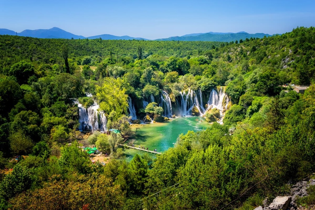
Una National Park in Bosnia and Herzegovina is a beautiful place to hike. It is a part of the Dinaric Alps and has a number of hiking trails, even though there are no popular mountains inside the park itself.
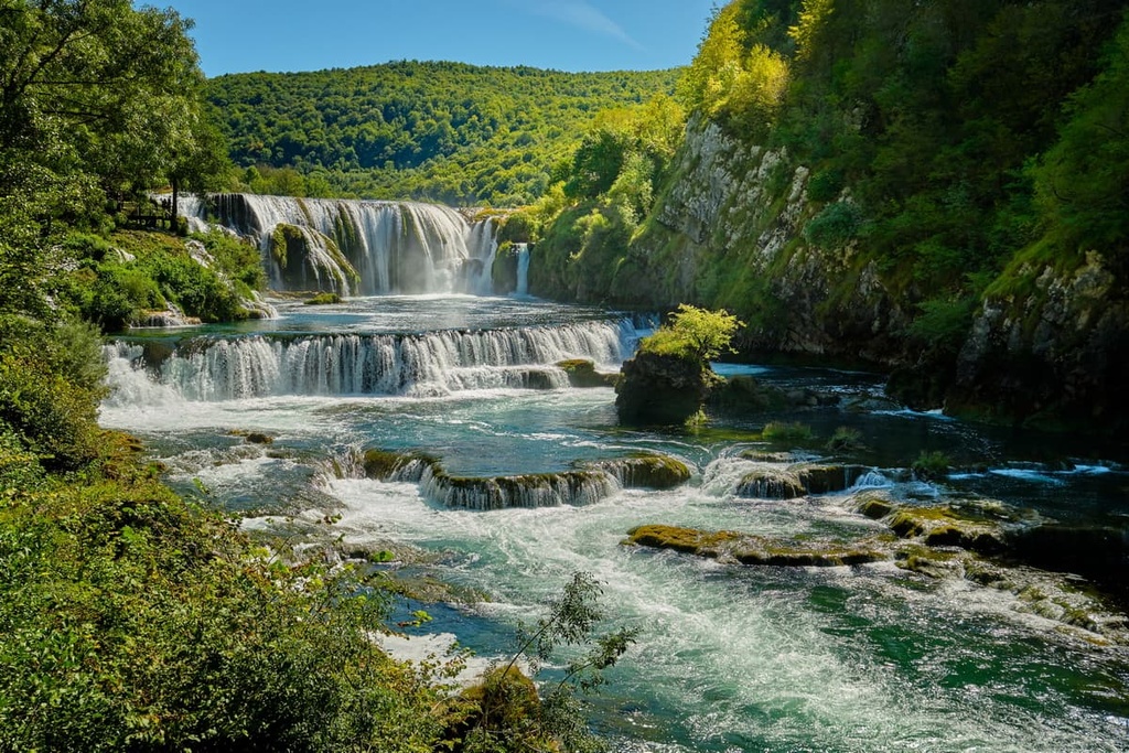
The highlight of this beautiful park is the River Una. Here, you can see the Štrbački Buk, a series of long waterfalls, the most popular tourist destination here. Every year, locals organize a rafting regatta and head down Una River with their boats, kayaks, and canoes.
One of the most popular hikes at the park is from the village of Unac to the village of Vrbanja. The hike takes about 5 hours and is 13 km (8 mi) long, with an elevation gain of about 600 m (1,968 ft). The trail starts in a lush forest and follows alongside the River Una for most of its length. There are also many waterfalls along this route that you can stop at for a break.
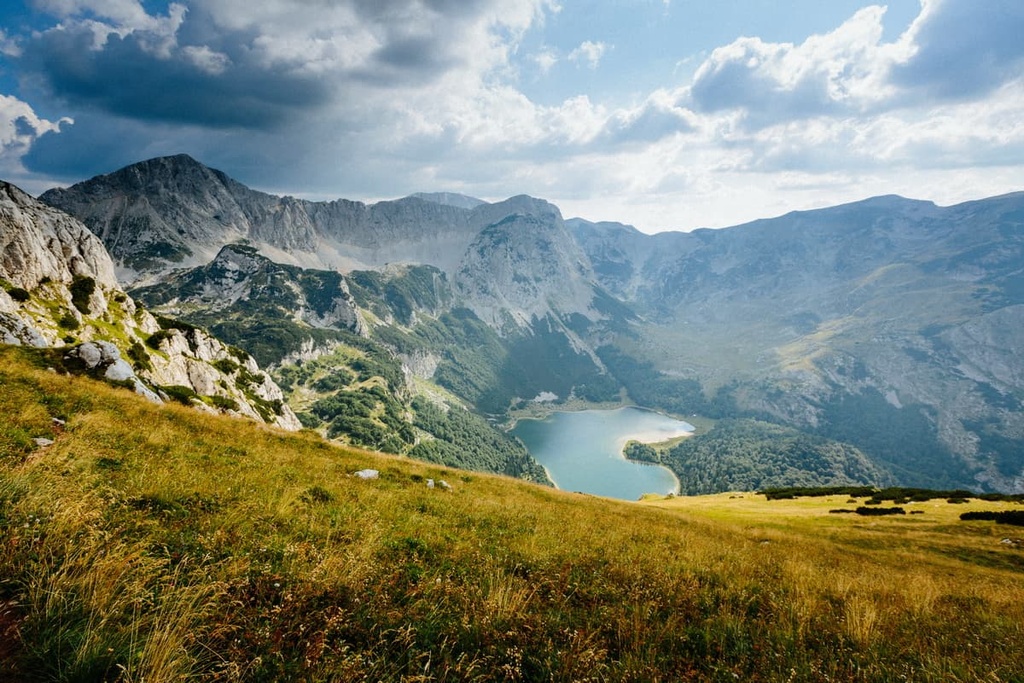
Sutjeska National Park is a protected area in the Republic of Srpska within Bosnia and Herzegovina. It lies in the southeastern part of the country, near the international border with Montenegro. The park was established in 1962 to protect one of Europe’s last remaining ancient forests and its wildlife in the Preučica Primeval Forest.
Sutjeska National Park consists of the Sutjeska River Valley and Tara River Valley and its adjoining canyon. Four mountains surround the park: Lebršnik, Maglić, Zelengora, and Volujak.
If you visit the park, there are plenty of great places to check out during your stay. For example, you can see the Sutjeska communist architecture monument, enjoy rafting on the Tara or Drina rivers and hike in the mountains. The most popular hiking trail is inside the Peručica Forest, and it leads from the park’s entrance in Sutjeska to Skakavac waterfall.
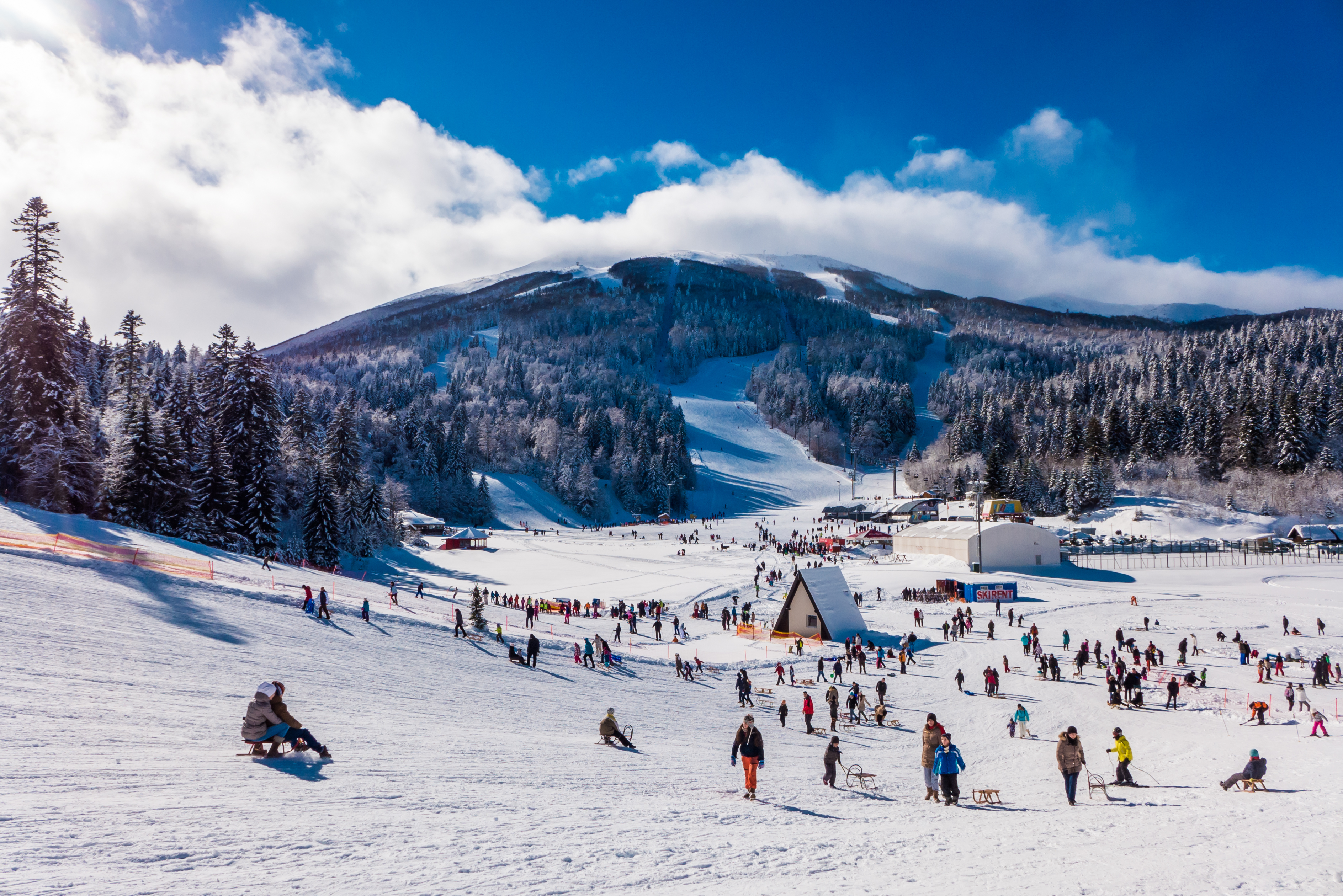
For skiing and snowboarding enthusiasts, there are more than 20 ski resorts in Bosnia and Herzegovina, which are located throughout the country, but mainly in its central part, where you will find most of the resorts, including also the largest of them. It is also one of the main areas for skiing in the Dinaric Alps.
The largest ski resort in Bosnia and Herzegovina is Jahorina with more than 45 km (28 mi) of slopes and more than 15 ski lifts. It is also the main ski resort near Sarajevo, the capital of the country.
Other major areas for skiing in Bosnia and Herzegovina with more than 3 km (1.8 mi) of slopes and more than several ski lifts each include the following in descending order of size:
Check the Bosnia and Herzegovina ski resorts map, including the Federation of Bosnia and Herzegovina and Republika Srpska in the World Mountain Lifts section of the site. It includes information about open ski lifts / slopes in Bosnia and Herzegovina in real-time with opening dates and hours. There are also year-round cable cars, funiculars, cog railways, aerial tramways, and all other types of mountain lifts.
Bosnia and Herzegovina is mostly a rural country, and most of its major cities are relatively small by European standards. Therefore, if you’re looking to get out in nature, there are plenty of places to choose from in the country.
Of course, Bosnia and Herzegovina is also home to modern cities with museums, festivals, and developed infrastructure that are well worth checking out. Here are some of the best cities to visit during your stay in Bosnia and Herzegovina.
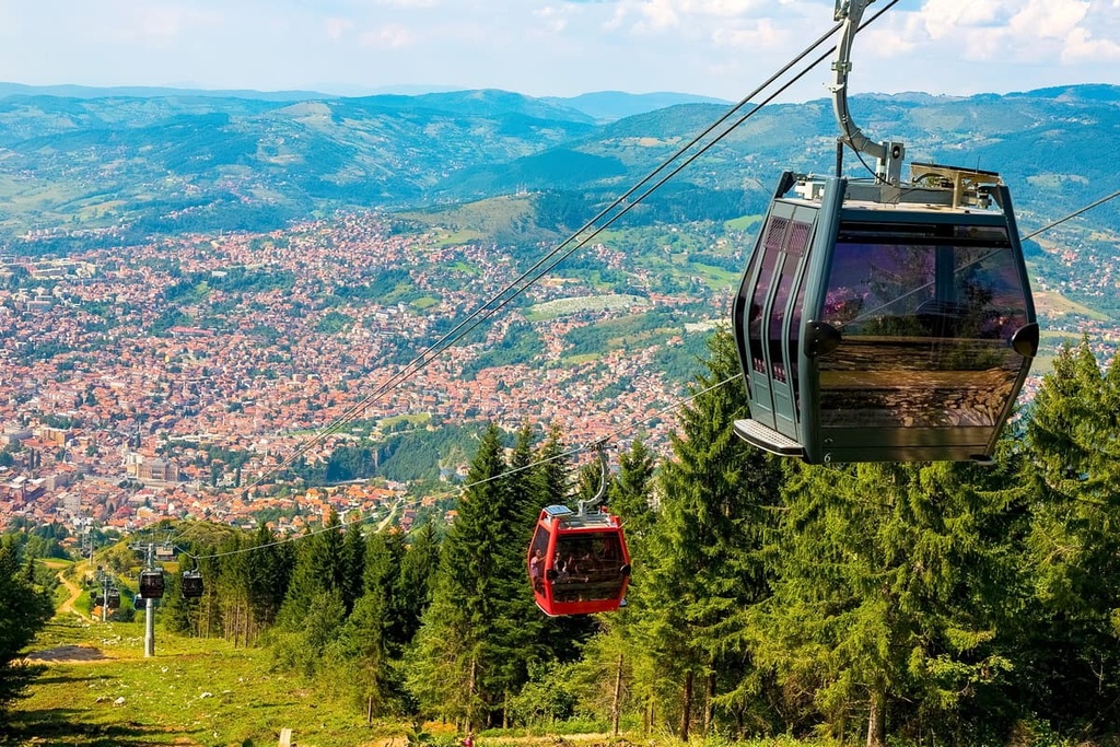
The capital of Bosnia and Herzegovina, Sarajevo, is also the country’s largest city. The city has a rich history, dating back to the fifteenth century when it was a trade capital of the Ottoman Empire.
Sarajevo has been home to many famous people over the centuries, including Nobel Prize winner Ivo Andric and filmmaker Emir Kusturica. Today, Sarajevo is a modern European city that welcomes tourists from all over the world. Many tourists visit Sarajevo during the Sarajevo Film Festival in August each year.
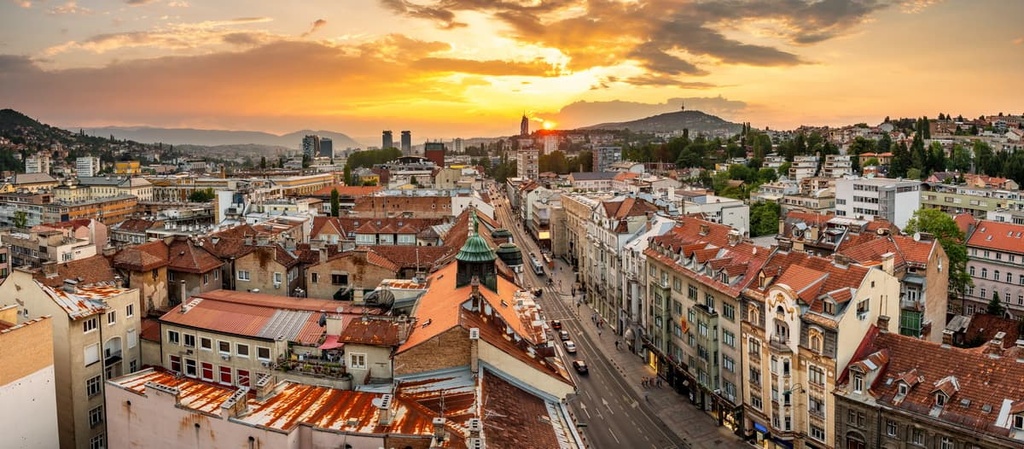
The most popular place in the city is Baščaršija, which is the old Ottoman town center. Tourists looking for outdoor adventures can visit the mountains Bjelašnica and Trebević or try rock climbing in Dariva. Of course, there are numerous accommodation options in Sarajevo to choose from, and you can get to the city by road, rail, or plane.
Banja Luka is the second-largest city in Bosnia and Herzegovina. It is located in the northern part of the country, close to the border with Croatia. The Banja Luka metropolitan area is home to around 200,000 residents.
After World War I, the city became a part of Yugoslavia and was called Banjaluka until 1992, when it reverted to its original name. Named the European Metropolis of Culture numerous times, Banja Luka is a cultural epicenter for the region.
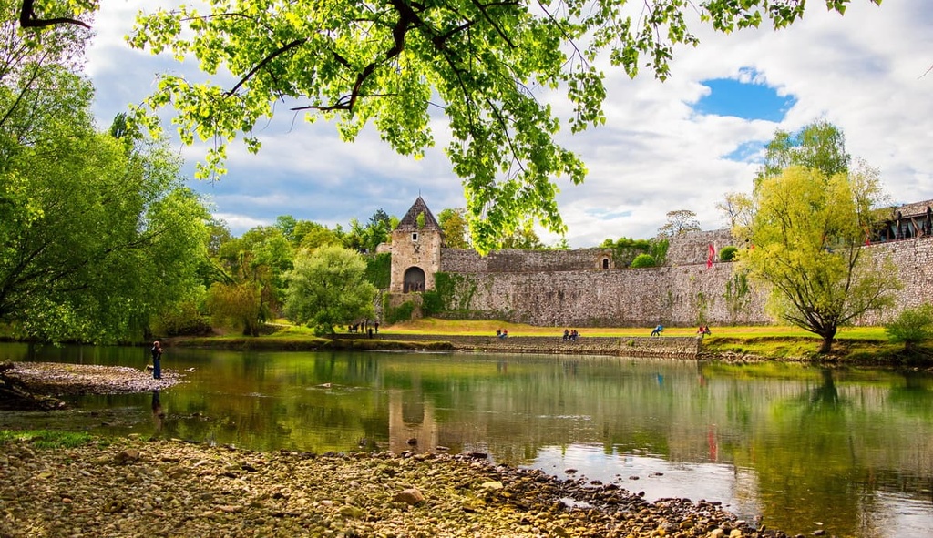
Tourists to Banja Luka can see art galleries, the old Kastel Fortress (Tvrđava Kastel), and enjoy the vivid nightlife. If you’re looking for an adventure, you can also try rock climbing in Tijesno Canyon or rafting on the Vrbas River during your trip.
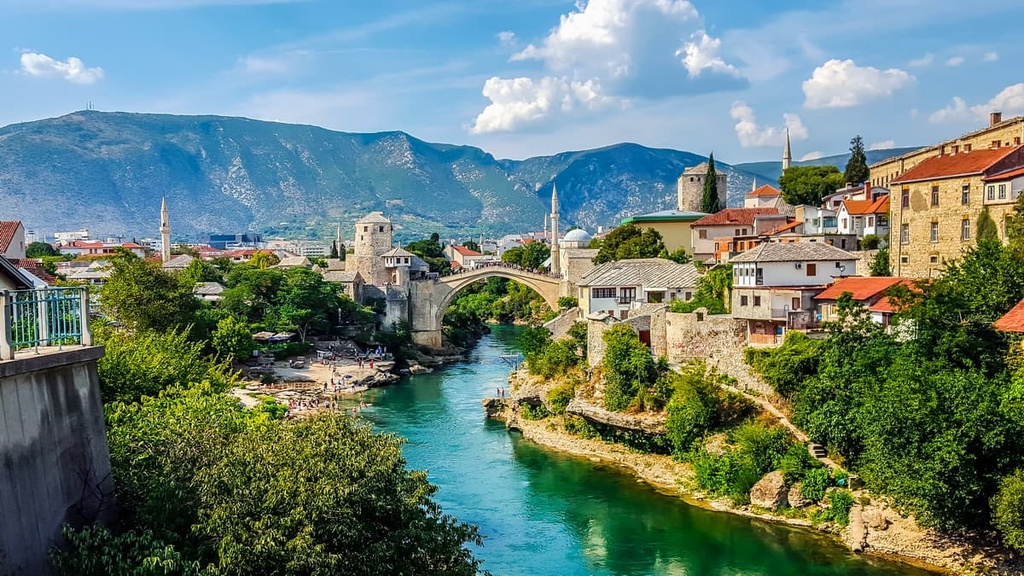
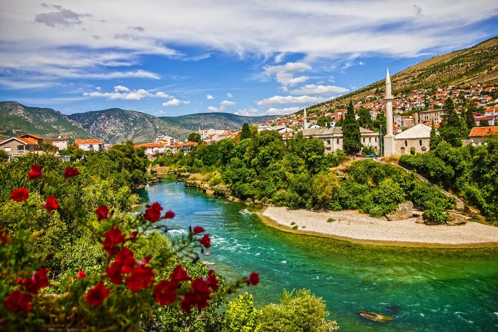
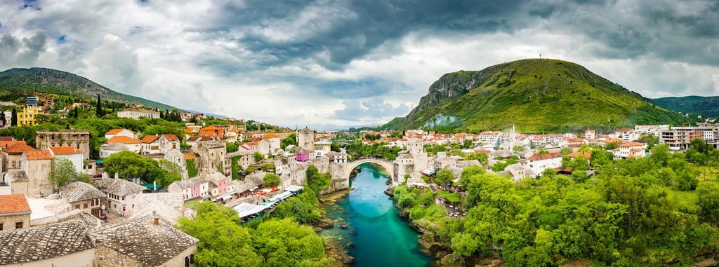
Mostar is the third-largest city in Bosnia and Herzegovina and the largest city in Herzegovina. Many tourists in Bosnia and Herzegovina want to see the Mostar bridge, which was built in 1566 by Mimar Sinan. It is one of the most recognizable symbols of the city of Mostar.
The bridge stands over the Neretva River, connecting two parts of the town that are divided by the river itself. It is a cultural and historical monument and a World Heritage Site. It has been destroyed and rebuilt several times due to natural disasters and wars. Mostar even got its name from this bridge since Most in Bosnian literally means bridge.
The best way to reach Mostar is via the beautiful Herzegovina Railroad. Once there, you can try rafting on the Neretva River and rock climbing at the numerous nearby crags, such as Drežnica, Stolac, and Blagaj.