
Scan the QR code and open PeakVisor on your phone
Encompassing the northwest corner of Alberta, Canada, Mackenzie County is the largest county in Canada. It is filled with vast boreal forests, rivers, muskeg, and some mountainous and hilly terrain. The Caribou Mountains are the tallest feature in the county, rising 1,030 m (3,380 ft) above sea level, overlooking the Peace River and a vast wilderness.
Mackenzie County encompasses the vast wilderness of northwest Alberta, Canada. It borders British Columbia to the west and the Northwest Territories to the north. In clockwise order the surrounding counties are the Regional Municipality of Wood Buffalo to the east, followed by the M.D. of Opportunity, Northern Sunrise County, and County of Northern Lights.
Caribou Wildlands Provincial Park is in the northeast corner of the county, encompassing the Caribou Mountains. The other major protected area in the county is Hay-Zama Lakes Wildland Park which encompasses a huge wetland north of Rainbow Lake.
Adjacent to Mackenzie County, along the eastern border are Wood Buffalo National Park and Birch River Wildland Provincial Park. Another notable park near the county is Birch Mountains Wildland Provincial Park.
There are no cities in the county, and the town of High Level and the Hamlet of La Crete are the largest communities in the county with a population of about 4,000 each. The remaining 4,000 inhabitants are spread out across the county, inhabiting dozens of different localities, settlements, and reserves.
There are five major terrain features in the county, of which the Caribou Mountains (1,030 m/(3,380 ft) are the tallest and most prominent feature. Mount Watt (787 m/2,582ft), Bootis Hill (786 m/2,579 ft), Buffalo Head Hills (786 m, 2,579 ft), and Cameron Hills (749 m/2,457 ft) are the other major features in the county.
The major routes to access the county are Highway 35 which runs through High Level and connects with the Northwest Territories and Highway 88 which comes from the south and terminates near Fort Vermillion. Highway 58 runs east to west through the county and it is one of the access roads to Wood Buffalo National Park.
The geology of Mackenzie County is wrapped up in the geology of the Western Canadian Sedimentary Basin which extends from the Canadian Shield to the Rocky Mountains and encompasses most of Alberta.
While the Western Canadian Sedimentary Basin began to form and fill with sediment as early as the Paleozoic, it was the events at the end of the Mesozoic that made the basin significant today. At the end of the Mesozoic the newly formed Rocky Mountains and the rest of the Canadian Cordillera created a barrier to the west and the Canadian Shield had always been to the east of the basin.
During this time, the sea level rose significantly in response to a warming climate which in turn created large inland seas and reduced the continents to a collection of large islands. A shallow sea covered North America from the Arctic to the Gulf of Mexico, separating the young mountains from the ancient Canadian Shield.
Warm temperatures and the vast coastal areas resulted in a lush tropical environment. Heavy rain fell in the upland areas, quickly eroding channels and depositing the sediment in vast deltas along the coast. The conditions were ideal for the accumulation and burial of vast amounts of plant matter which would convert into the petroleum and coal reserves of the subsequent millions of years.
It was about 75 million years ago when northern Alberta’s seas finally receded and about 45 million years ago when the mountain building halted. By this time, thick layers of sediment had been deposited across Alberta, and Mackenzie County is located along the leading edge of the basin, where the deposits are as much as six kilometers thick.
The mountainous areas and hills of Mackenzie County are typically the remnants of the eroded plateau that once covered Alberta. The Caribou Mountains, for example, are a series of peaks that surround a round plateau.
The plateau rises about 700 m (2,300 ft) around the surrounding lowlands and the peaks of the range rise to about 1,030 m (3,380 ft) in elevation, making them the highest mountains in northern Alberta. Furthermore, while most of Alberta was covered by the continental ice sheet during the Pleistocene, the Caribou Mountains were unglaciated during the last glacial maximum.
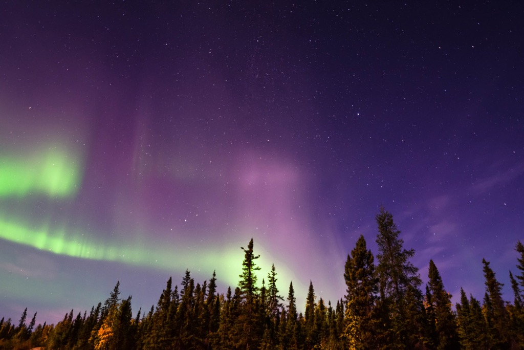
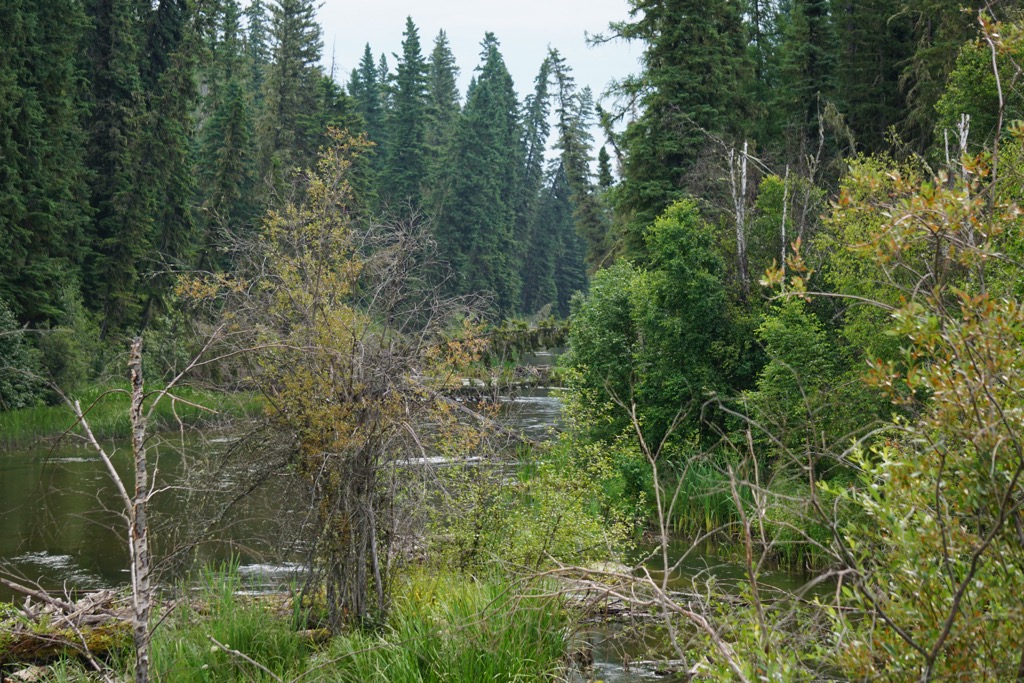
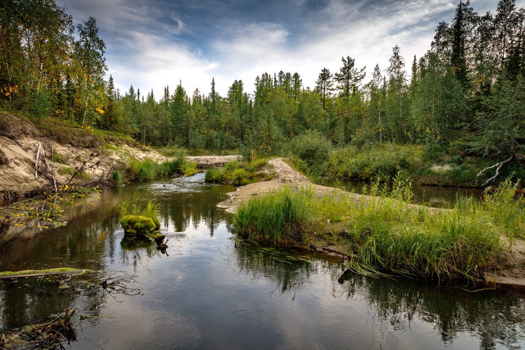
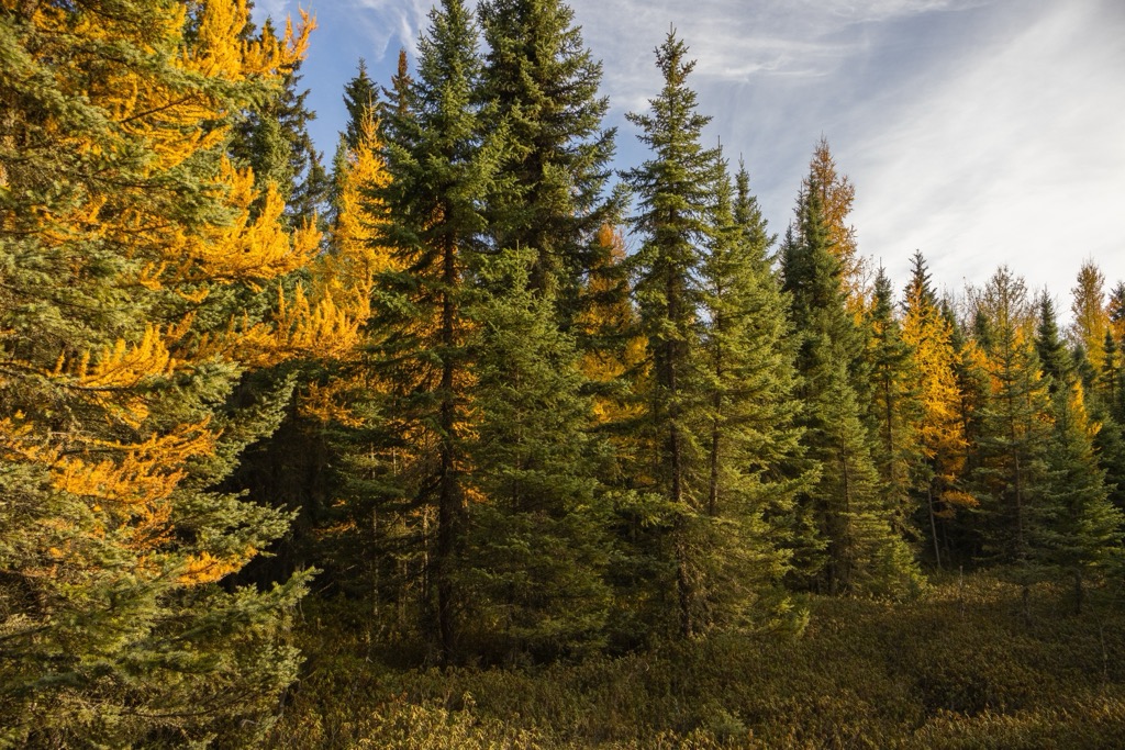
Mackenzie County is filled with a vast wilderness, crossed by rivers, and filled with creeks, wetlands, and meadows. Forests of white spruce, black spruce, jack pine, aspen, and balsam poplar typically fill the view to the horizon.
Mature forests are typically white spruce with components of balsam fir and the ground is covered with feathermosses. While peatlands are dominated by black spruce with an understory of Labrador tea.
Cranberry, prickly rose, green alder, and species of vaccinium are the common understory shrubs across the county. The herbal groundcover typically consists of bunchberry, fireweed, wild sarsaparilla, one-sided wintergreen, and marsh redgrass.
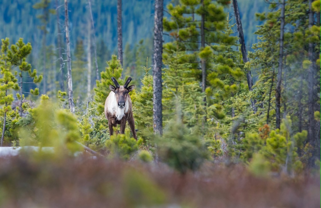
The boreal forests of Alberta provide important habitat for many animal species. Woodland caribou depend on the habitats of Mackenzie County and wood bison are another large mammal that live in and around the county, with particular residence in the adjacent Wood Buffalo National Park.
The forests and meadows are inhabited by black bears, foxes, coyotes, deer, and wolves. The rivers and wetlands are inhabited by beaver, otter, and muskrat, and the wetlands and forests are also important habitats for migrating and nesting birds.
Annually, hundreds of thousands of ducks and around ten thousand geese visit Hay-Zama Lakes Wildland Park in Mackenzie County.
Mackenzie County was covered by the Laurentide ice sheet during the most recent glacial maximum about 18,000 years ago. The subsequent millennia saw the retreat of the ice sheet and the slow and steady advance of vegetation across the county.
It’s believed that the region was finally able to support human populations about 14,000 years ago. The county is of great archeological significance due to its proximity to the ice-free corridor which opened along the eastern slopes of the Rocky Mountains.
Early predictions regarding the initial habitation of North America believed that people had traveled from the north, through the ice-free corridor, at the end of the Pleistocene. However, more recent discoveries indicate a migration of people from the south, slowly inhabiting the eastern slopes and prairies as the glaciers retreated further and further north.
It is speculated that Mackenzie County and the Peace River region may have been where populations from the south may have encountered populations from the south. There are many archeological discoveries in the region that pose more questions than they answer about the human habitation of North America.
The county is the traditional territory of the Dene Tha’ First Nation and the Michif Piyii (Métis). The Dene Tha’ are part of the larger Athapaskan speaking people who inhabit Canada’s northwest and parts of Alaska.
The Dene of Canada’s north share common ancestry with the Apache and Navajo, who are believed to have migrated to the southwestern United States about 1400 BCE. While there is still speculation regarding the origins of the Dene, it is believed they were among the first inhabitants of western Canada.
The Dene Tha’ led a nomadic lifestyle that is still remembered by members of the First Nation. It was around the turn of the century, when the fur trade reached them, that the Dene Tha’ adapted to a semi-permanent lifestyle. Gradually, the members of the nation settled in family groups, residing in log cabins.
Men would hunt caribou, as well as rabbit, deer, and moose. Fishing supplemented their diet and the women would generally tend to gather food, caring for children, and producing clothing from furs and animal hides.
Travel through their homeland was typically on foot, however, they would also use canoes along the rivers, and snowshoes and toboggans during the winter.
The Michif Piyii are the descendants of the mixed parentage of First Nations and European fur traders. Michif is a variant pronunciation of the French word Métis, and it emerged as a language in the early nineteenth century and became consistent by the mid nineteenth century.
Métis and other First Nations who acted as guides and worked with the fur traders typically preceded the westward moving wave of the fur trade. It was common for the eastern First Nations to displace the local indigenous populations as the fur trade moved in.
Today the county is still sparsely populated, with only about 12,000 inhabitants living across the county. Most of those living in the country are directly employed in or servicing the lumber and oil industries. While service roads cross the vast wilderness, the remoteness and harsh climate keep most of Mackenzie County as pristine wilderness.
Mackenzie County is the largest county in Alberta and contains vast tracts of sparsely populated wilderness. The following are the major parks in and adjacent to the county:
Caribou Mountains Wildland Provincial Park encompasses an incredible subarctic wilderness with many amazing natural features such as the Caribou Mountains Escarpment, the Peat Plateau Bog, the Northern Ribbed Fens, and Margaret Lake.
Margaret Lake is home to many fish species such as whitefish, trout, pike, and burbot. It is also the breeding site of many bird species, as are the Northern Ribbed Fens around Horseshoe Lake and the Peat Plateau Bog.
Backcountry camping is permitted in the park, and it is a wonderful place for winter recreation. Many visitors enjoy traveling along the park’s trails in OHVs, and skijoring and snowshoeing are wonderful ways to travel through this incredible wilderness.
Furthermore, the central geological feature of the park is the Caribou Mountains Escarpment is home to many unique species of flora and considerable diversity of wildlife. Due to the high diversity of plants upon the plateau, it is believed that the plateau was a glacial refugium during part of the Pleistocene.
The Hay-Zama Lakes area has long been revered by the Dene Tha’ for its diverse wildlife and vegetation and conservation groups have worked to protect the areas since the 1930s. In 1982 the area was designated a "wetland of international significance”.
Located about 120 km (72 miles) west of High Level, there are no public roads in the park; however, roads lead to the abandoned village of Habay, along the eastern edge of the park. While the wet nature of the park makes it unsuitable for camping, visitors can travel through the park in boats and OHVs to view wildlife, and to go hunting and fishing.
The park consists of many lakes and ponds that are separated by the banks of the rivers that flow into the area. The Hay River is the major river that flows into the area and is the only outlet from the wetlands. Water levels change from year to year, and the entire area can be under water during high-water years or showing only shallow lakes surrounded by vegetation during low-water years.
Thousands of migratory birds come to Hay-Zama Lakes Wildland Park during the spring and fall. Furthermore, migrant birds to the area include the “at risk” trumpeter swan, as well as many other such as gulls, sandpipers, and the American avocet.
Mackenzie County encompasses a vast wilderness in northwestern Alberta. The county is rugged and filled with immense wetlands and dense forests. The following are the major communities in the county:
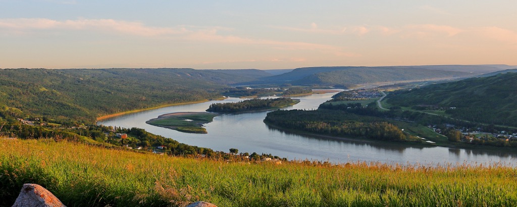
Fur traders first arrived in the area around 1786; however, the area wasn’t settled until 1947 when road access to the area from Fort Vermillion was constructed. High Level is the largest community in Mackenzie County and is named for its location upon the relatively high ground between the Peace River and the Hay River.
After the initial settlement of the area by farmers and homesteaders, oil was discovered in the 1960s which led to an increase in population for the community. High Level is home to some of the northernmost lands suitable for agriculture in Canada.
Situated at the intersection of the Mackenzie Highway and Highway 58, High Level is a prime community from which to explore northwest Alberta or a stopping point for further travels into Northwest Territories. The community of around 4,000 people has all the basic services and amenities wilderness adventurers would need. There are also opportunities for hiring guides to aid in travel through the region.
Located west of High Level, Rainbow Lake is the only other town in Mackenzie County; however, it only has a population of around 500 people. The town is named for the nearby curved lake which formed along the Hay River.
The town has basic services for visitors and can serve as a jumping point for deep wilderness travels in northern Alberta and British Columbia.
Named for the vermillion colored clays lining the river, Fort Vermillion was established as a trading post in 1788. Along with Fort Chipewyan, Fort Vermillion Shares the title of the oldest European settlement in Alberta.
From humble beginnings, the community has grown slowly over the past hundreds of years. Initial access to the fort was only by river, however, a road was eventually built to connect the community to the rest of the province in the 1900s.
However, until 1974, when a bridge was constructed over the Peace River, the community was dependent upon ferries over the river which effectively left them inaccessible during the winter.
The Municipal Office of Mackenzie County is in Fort Vermillion and the community has many modern amenities to serve its residents and the inhabitants of the surrounding area. The community also maintains historic sites relevant to the original fort and the fur trade which opened Alberta to further settlement.


