
Scan the QR code and open PeakVisor on your phone
The Región de la Araucanía is a culturally rich and environmentally beautiful part of Chile, perhaps best known for having the highest proportion of ethnic Mapuche people of any Chilean region. The history of the Mapuche in Araucanía is long and storied and continues to influence the culture and institutions of the region today, alongside years of settlement of various European communities.
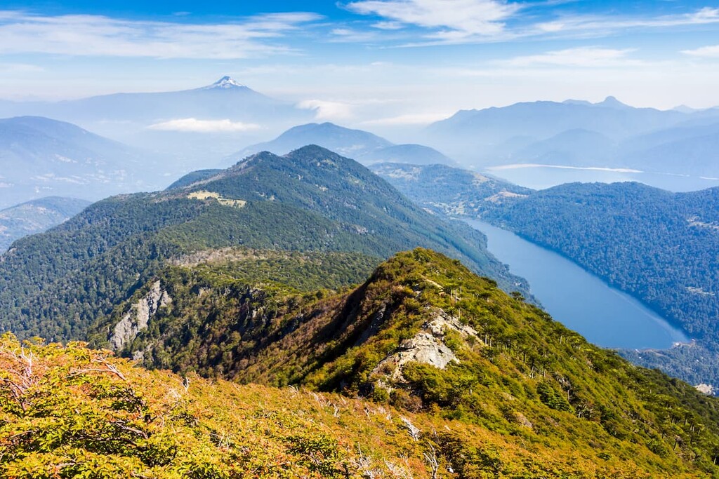
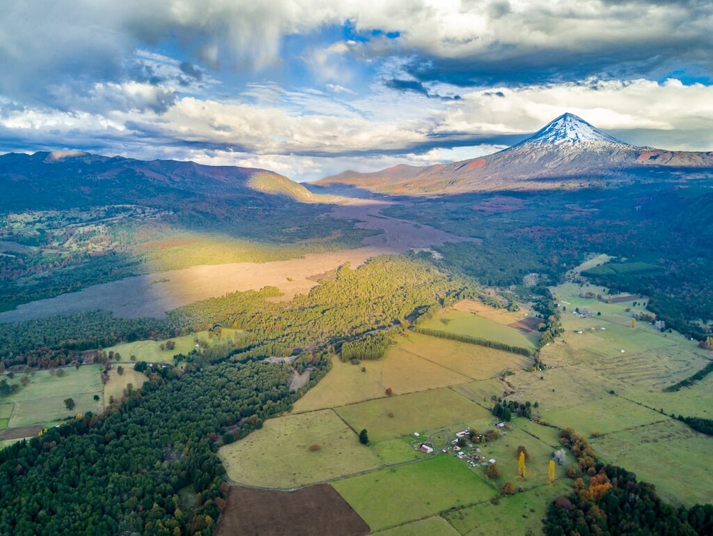
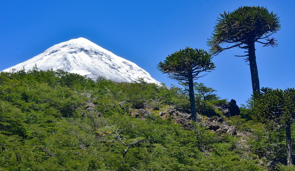
As for its natural landscape, Araucanía is home to about 344 named peaks, spread from the Andes to the Chilean Coast Range and in between. The highest and most prominent of these peaks is the Volcán Lanín, at around 3,747m/12,293ft above sea level and with a prominence of 2,630m/8,628ft.
The Región de la Araucanía covers around 31,842km2/12,294mi2 of land in south-central Chile, seen as the gateway to the country’s southernmost regions. It bordered by the Región del Biobío to the north and the Región de Los Ríos to the south, with the Pacific Ocean to the west and the Argentinian province of Neuquén to the east, demarcated by the presence of the Andes Mountains.
Araucanía only has two provinces within it, Cautín in the south and Malleco in the north. Its capital and largest city is Temuco, in northern Cautín and thus the center of the region.
Three main rivers stretch across the landscape, namely the Imperial River, running through Temuco; the Toltén, in the south; and the Biobío, which marks part of the natural border between Araucanía and Biobío before extending into its namesake region.
The Intermediate Depression separates the Andes and its foothills from the Chilean Coast Range in the west. The Chilean Coast Range, specifically the Nahuelbuta Range within it, exists alongside a smattering of coastal plains, characterizing the Araucanía coast.
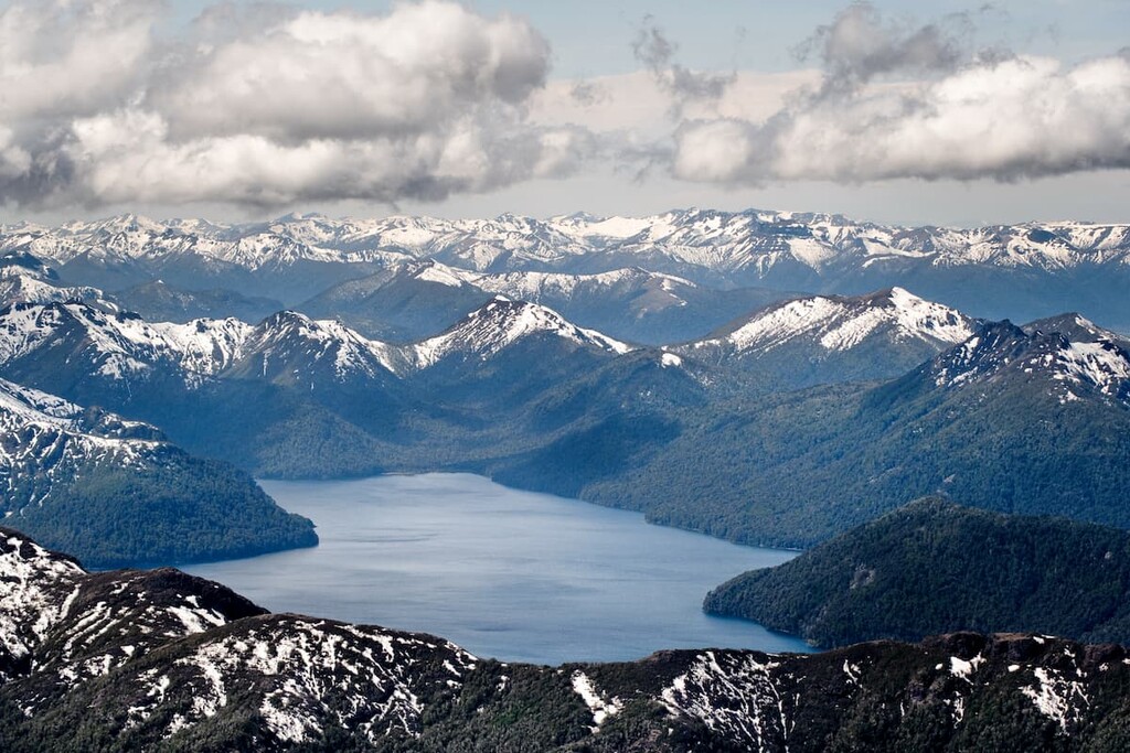
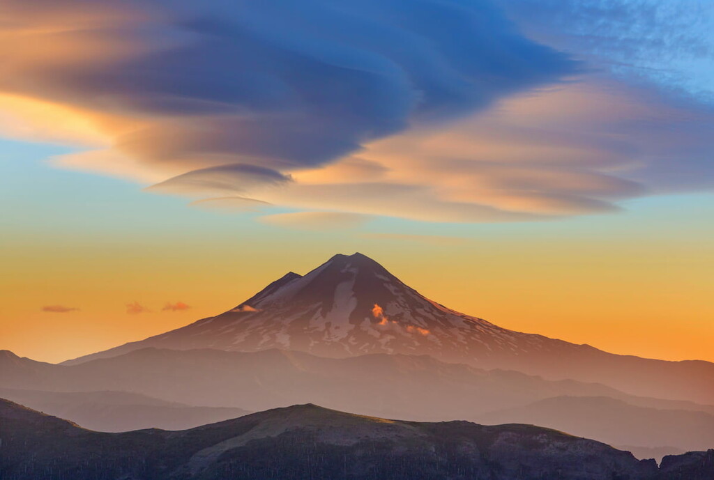
These mountain ranges result, of course, in hundreds of mountains, volcanoes, and hills, though its volcanoes are perhaps the most significant, namely Villarrica and Llaima, both of which are considered some of Chile’s most active volcanoes. Lanín, its tallest peak, is another volcano, but has not erupted in thousands of years.
As for the climate, it is mostly a temperate Mediterranean climate seen throughout much of central Chile, with a warm, dry season and a cold, rainy season. Minor variations in climate can occur in warm, rainy weather as well, and a rainy oceanic climate can be seen along the coast.
The Nahuelbuta Range in the west is composed of Carboniferous period granite at its core, with metamorphic rocks surrounding that granite center. As part of the Chilean Coast Range, this western portion of Araucanía is also marked by the Coastal Batholith of central Chile, a remnant of volcanic arcs from the Choiyoi Group that is now a complex of plutons stretching from north to west down the coast.
Plutons of the North Patagonian Batholith can be seen intruding the Panguipulli Formation in southern Araucanía, a Triassic sedimentary formation of sandstone, mudstone, and conglomerate, covered in the east by Quaternary lavas and moraines and in the west by Holocene alluvium and colluvium.
By the city of Temuco is the Temuco Formation, a likewise sedimentary formation of sandstone, siltstone, andesitic tuff, and claystone where coal, breccia, and conglomerate have also been found. This formation is one of many to overly the Bahía Mansa Metamorphic Complex that lies below much of this part of Chile.
Other sedimentary formations include the Mininco Formation from the Pliocene Epoch and the Cholchol Formation from the Miocene Epoch. There are also formations of volcanic origin, such as the Malleco Formation, consisting of volcaniclastic rocks and lavas, and the Cola de Zorro, also of volcaniclastic rocks.
The region also contains fault zones, such as the Biobío-Aluminé Fault Zone, Huincul Fault Zone, and the Mocha-Villarrica fault zone, which transverses the major Liquiñe-Ofqui Fault and stretches toward the Lanín, Villarrica, and Quetrupillán volcanoes.
Those three volcanoes are part of a stratovolcano chain, aligned over that very fault, and consist largely of gneisses, volcaniclastic sequences, felsic plutons, basalt, ignimbrite, and andesite in varying quantities (such compositions are similar in other volcanoes of the region, such as Llaima and Lonquimay)
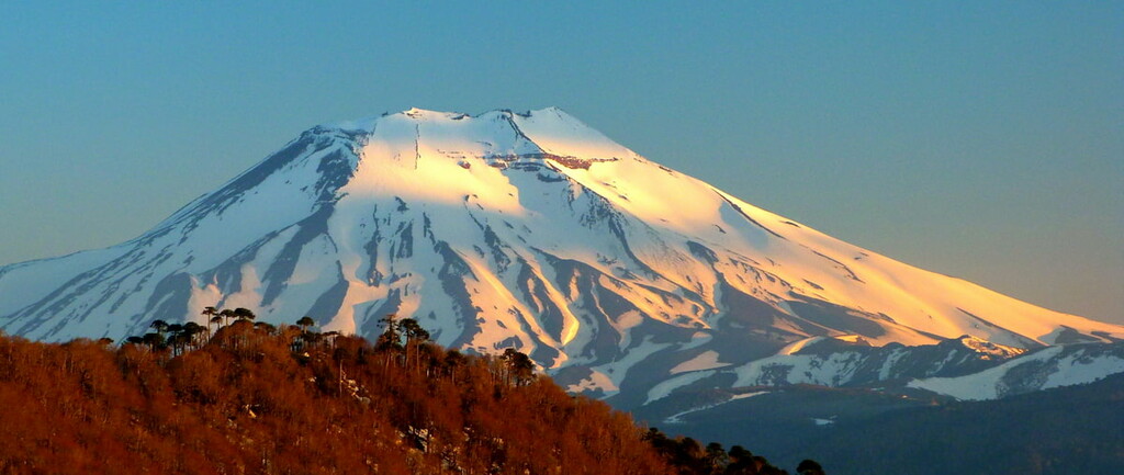
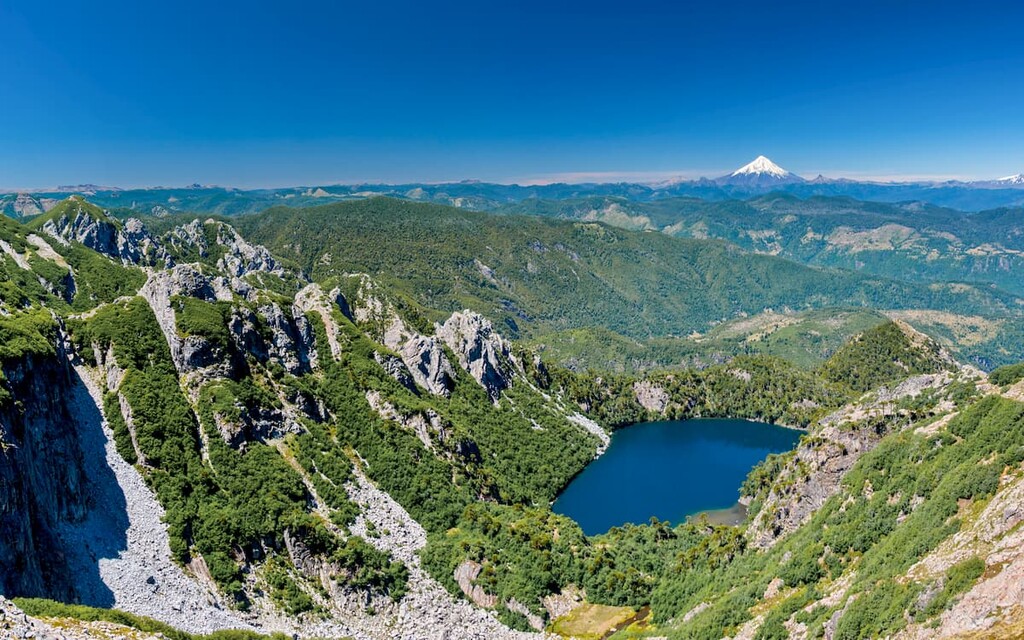
Villarrica in particular is home to an expanse of glaciers, such as the Pichillancahue-Turbio Glacier, and is capped by snow year-round. The Tolhuaca volcano gets its shape from a history of glacial erosion, and the Sollipulli stratovolcano and caldera has also been heavily affected by glacial action, and still contains glaciers today.
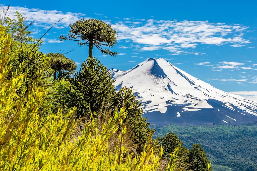
Along the Nahuelbuta Range of the western coast, there are thick forests of coigüe, ñirre, oak, lenga, and the famous coniferous monkey puzzle trees, which are considered the national tree of Chile, and are seemingly omnipresent among the various ecosystems of the Región de la Araucanía.
Among Nahuelbuta, animals like the mountain lion, pudu, Magellanic woodpecker, and Andean and chucao tapaculo can be found. It is one of the extremely few locations where Darwin’s fox can be found, a small fox endemic to small parts of Chile. The mountain lion, pudu, and Magellanic woodpecker can also be found throughout the region's forests.
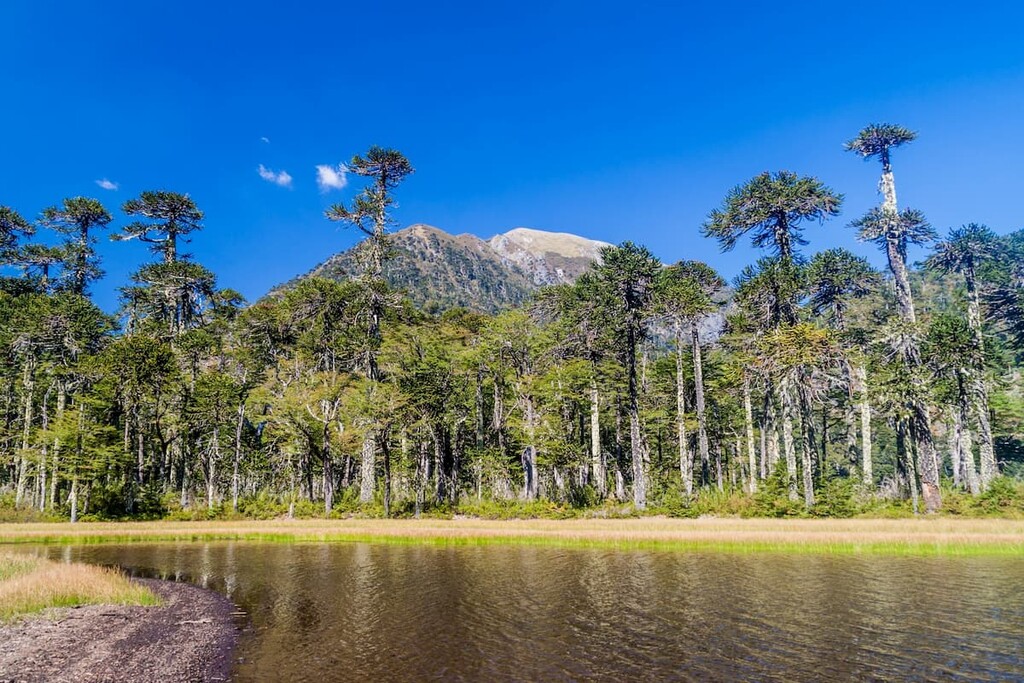
Trees like aforementioned coigüe, lenga, and monkey puzzle are, in fact, prevalent in forests throughout the region. Parque Nacional Tolhuaca boasts all such trees, as well as the Patagonian oak, in the high forests of the Andes foothills.
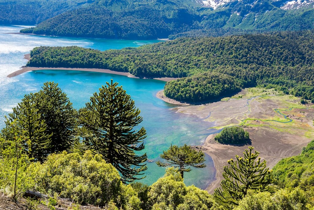
The Malleco Lake inside Tolhuaca allows for a great diversity of bird species, like Andean gulls, Andean condors, ringed kingfishers, and chimango caracaras. Mountain lions, nutrias, South American gray foxes, güiñas, pudus, colocolo opossums, and the endemic Alsodes igneus frog species make up some of the communities of Tolhuaca’s forests.
In the northeast and around the upper Biobío River basin, the land becomes mostly high, subhumid Andean steppe, with scrub forest and deciduous forest present as well. The forests are mainly dominated by monkey puzzle and cypress trees, with guanacos, mountain lions, pudus, culpeos, güiñas, lesser grisons, culpeos, and South American gray foxes among its animal inhabitants.
Monkey puzzle, evidently a dominant player in Araucanía’s ecosystems, can also be seen in the Valdivian temperate and Andean deciduous rainforests of southeastern Araucanía. Patagonian oak and raulí trees are found at the lower elevations, and coigüe in especially wet areas.
Many of the aforementioned mammal and bird species reside in these forests as well, alongside other animals like the geoxus, Darwin’s frog, Molina’s hog-nosed skunk, Harris’s hawk, slender-billed parakeet, and peregrine falcon.
The central Andes region is very similar, albeit without the same influence of the Valdivian temperate rainforests. Monkey puzzle, coigüe, Patagonian oak, and raulí are very common, with populations of lenga, cypress, lleuque, ñirre, mayten, and avellano too.
Lastly, the Valdivian temperate forests reach the Intermediate Depression and its hills, where many of the frequently-mentioned trees are found existing with Chilean myrtle, ulmo, peumo, Chilean laurel, and Chilean citronella trees.
Amphibians like the Chilean four-eyed frog and Darwin’s Frog, birds like the green-backed firecrown, common diuca finch, Rufous-tailed hawk, and Chilean hawk, and mammals like the güiña, colocolo opossum, and South American gray fox may also be seen.
The first settlers of what would become Araucanía likely arrived thousands of years ago, beginning as bands of hunters and gatherers but over time developing larger agricultural societies.
One of the major peoples to settle the land were of the agribusiness-based Pitrén culture, who cleared forests to cultivate corn and potatoes, and who left behind ceramics that imply contact with other cultures like the Molle and Llolleo. The Vergel and Tirúa cultures were other peoples who likely established settlements within the modern-day region.
Eventually, the Mapuche culture arose and became the prominent indigenous community of Araucanía, which became known as the heartland of the Mapuche people. The Mapuche were never conquered by the Inca, despite the Inca Empire’s descent into northern and central Chile. With the arrival of the Spaniards in the 1500s, however, much conflict began.
The Mapuche fervently held off Spanish attempts at conquest throughout the colonial era, and as the Mapuche had a stronghold on the historical area of Araucanía, the region was more or less independent. With Chilean Independence in the 1800, the tides began to change. Newly-independent Chile sought to incorporate the territory into itself, which many Mapuche rejected.
Thus came the Occupation of Araucanía from 1861 to 1883, marked by a sequence of uprisings, battles, and campaigns between the Mapuche and the Chileans. The results were devastating for the Mapuche, with Araucanía officially annexed by Chile in 1882. Even further, the Mapuche population was ravaged by warfare, disease, famine, and displacement.
Chileans and European immigrants established large communities throughout Araucanía, with the Mapuche now a minority in the region. The Mapuche have nevertheless continued in their attempts to protect their land, namely from encroaching forestry and agricultural industries, with programs in effect to attempt to resolve these disputes.
The national parks and reserves of Araucanía provide endless opportunities for exploring the natural beauty of the region on foot.
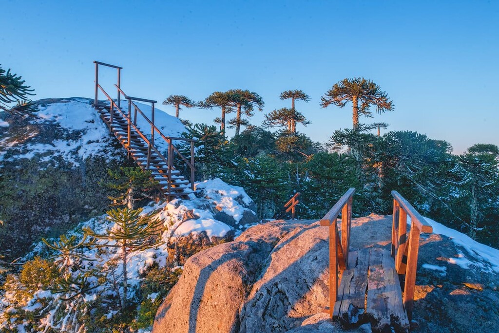
Nahuelbuta is the main national park of Araucanía’s western coast, sitting within the namesake Nahuelbuta Range. The park provides 10 campsites and plenty of spaces for picnicking, as well as many well-marked trails.
One of the most popular trails is the Piedra del Águila, a 4.5km/2.8mi hike to the granite outcrop of Cerro Piedra del Águila, where the Andean volcanoes and Pacific Ocean can be seen in all their glory atop a 1,379m/4,524ft peak. Cerro Anay and Alto de Nahuelbuta also provide brilliant locations for seeing the grand sights of the mountains and the coast.
Other popular trails in the park include:
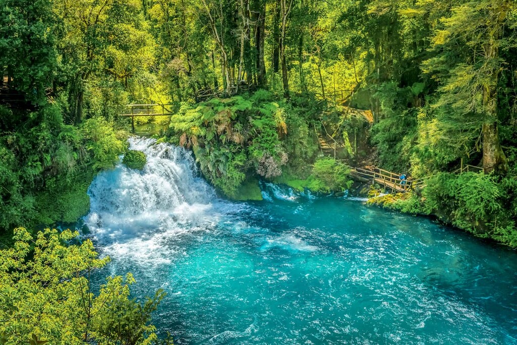
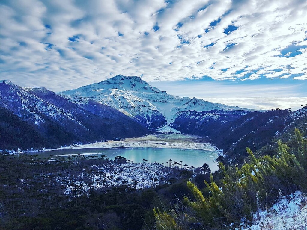
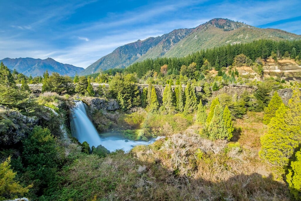
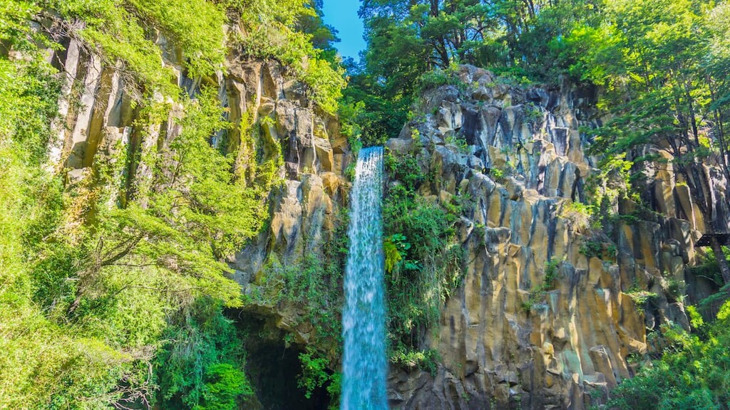
Parque Nacional Tolhuaca is the premiere place to see the scenic volcano of Tolhuaca, and provides four marked trails for one to explore the area. The Salto Malleco waterfall and adjoining Malleco lagoon, the Salto de la Culebra, and the Laguna Verde can all be accessed through the trails, winding through the forests and hills of the park, and ranging from short trips to day-long hikes.
These trails include:
Home to several major Andean volcanoes, particularly Sierra Nevada and Llaima, Parque Nacional Conguillío is a treasure of the Andes with plenty to see. A 6km/3.7mi trail up the Sierra Nevada runs through the forest and leads to several look-outs over the pristine nature, making the occasional stretches of steep and rough mountainside terrain worthwhile.
It is also possible to summit Llaima. To get to the volcano, it is a fairly typical hike, but to safely ascend it requires use of ice axes and crampons, particularly during snowy seasons. Numerous lakes and rivers add to the lush environment, and allow for swimming, fishing, and use of rowboats.
Other major trails include:
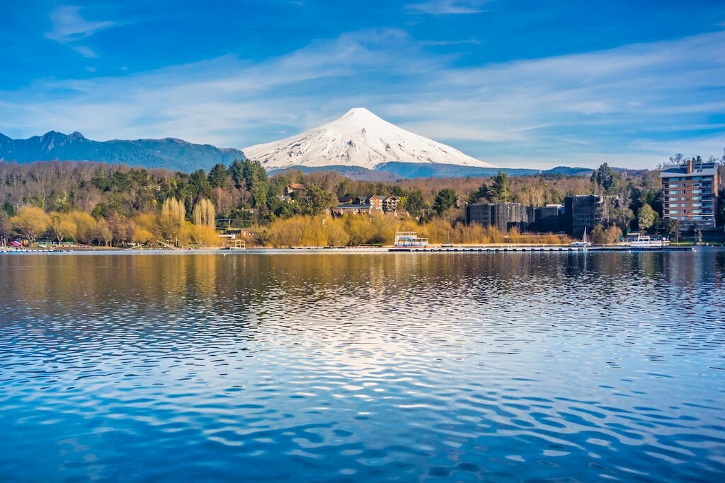
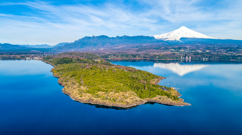
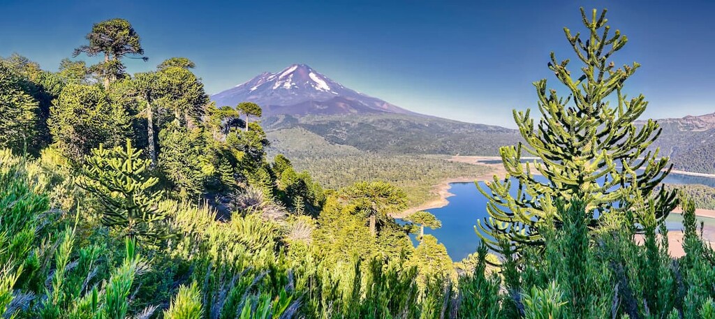
Revolving around a grand trio of volcanoes (Villarrica, Quetrupillán, and Lanín), Parque Nacional Villarrica is an ideal location to witness some of Chile’s natural and geological wonders. Through the aptly-named Los Cráteres trail, one can hike past slag dumps, volcanic caves, and lava trails en route to the massive and many craters of Villarrica.
Another view of Villarrica can be seen by hiking the Pichillancahue glacier, known for its green stones and layers of volcanic ash. The park also hosts a ski resort, camping sites, and the Termas Geometricas, hot springs tucked inside the rich green forest.
Other major trails include:
Parque Nacional Huerquehue rests inside the Valdivian forest foothills of the Andes, where extraordinary lakes, dramatic peaks, and lively vegetation offer many attractions for visitors. The Los Lagos trail is one of the most popular, and leads through a series of pristine lakes backdropped by the mountains.
Other major trails include:
Outside of the national parks, there are still many options for exploring Araucanía and its many peaks, though it may often be suggested or mandatory to organize a trip with a travel organization in order to summit them. Other notable locations for hiking and sightseeing include:
Araucanía is home to many cities and towns of great interest, although Temuco is, by far, the largest. Cities such as Angol and Villarrica, while smaller, are likewise significant spots of cultural and natural interest, as well as many others dispersed throughout the hills, coasts, and plains of the region.
Temuco, located in the center of the region, is the capital city of Araucanía and, with over 250,000 people, its largest. La Araucanía Airport is located just south of the city, and connects it to Santiago. Otherwise, it is connected by Chile’s highway system, there is a railroad that connects it to the city of Victoria just north, and buses and collective taxis are the typical public modes of transport within and out of the city.
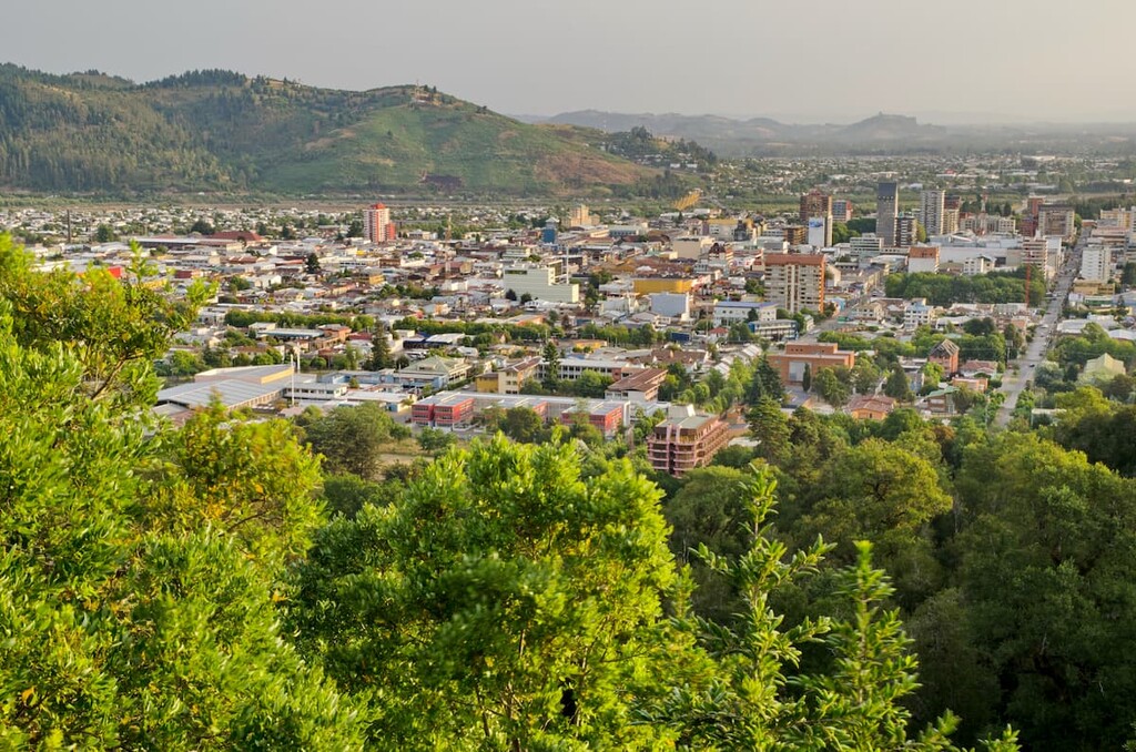
Temuco contains some of the best hotel and commercial infrastructure in Araucanía, making it ideal for tourists. Natural monuments like Cerro Ñielol (the highest point in the city), museums like Museo Araucano and Museo Nacional Ferroviario Pablo Neruda, and sports centers like Parque Estadio Germán Becker are some of the main destinations in city bounds.
There is also the Central Market, where traditional Mapuche handicrafts can be purchased, and Feria Pinto, the major food market of the city. The main street of Temuco is Alemania Avenue, where a medley of architectural styles from Victorian to classic Chilean to Neoclassical decorate universities, night clubs, pubs, and boutiques, but the main street of downtown Temuco is the Plaza Aníbal Pinto, known for its greenery and art galleries.
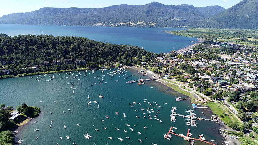
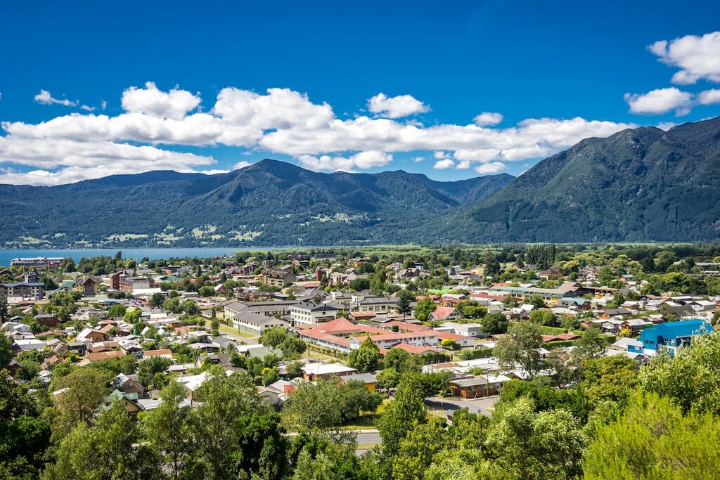
Though it is not one of the larger cities in Araucanía, at a population around 23,000 people, Pucón earns its importance from its proximity to many of the greatest natural sites and experiences in the region. It is a significant center of adventure tourism, which can be felt just by walking down its streets, where Villarrica towers in the near distance and rich blue lakes are always nearby.
With volcanoes, mountains, waterfalls, lakes, rivers, and hot springs all a reasonable distance away, opportunities available in Pucón’s proximity include hiking, fishing, horseback riding, rafting, skiing, ziplining, and more. Parque Nacional Villarrica and Huerquehue are among the nearby destinations, as well as the protected area of El Cañi.
Pucón can be accessed through Route 199-CH, with bus terminals available to and from major cities like Temuco, Concepción, and Santiago, or through the Pucón Airport, with seasonal flights to and from Santiago. Its significance as a tourist destination means there are plenty of options for accommodations within the city.


ultra
volcano
chile-ultras
argentina-ultras
ultra
volcano
chile-ultras
argentina-ultras


