
Scan the QR code and open PeakVisor on your phone
Honolulu County is home to 141 named mountains. The highest is Ka‘ala at 1,232 m.
Honolulu County (formerly known as Oahu County) encompasses the Hawaiian island of Oahu and a vast array of smaller outlying islands. Named for Hawaii’s largest city and state capital, Honolulu County spans 2,128 square miles (5,510 sq. km), though less than 30% of this is land (601 sq. mi / 1,560 sq. km). The county is home to just over one million people, approximately 70% of Hawaii’s total population. There are 141 named mountains in Honolulu County. The highest and the most prominent is Ka‘ala (4,042 ft / 1,232 m).
Despite its status as the main population center in Hawaii, Oahu’s land area is the smallest of Hawaii’s four principal counties (the others being Hawaii County, Maui County, and Kauai County). There is a smaller “quasi” county, Kalawao, on the island of Molokai, though it is a judicial district of Maui County and has no elected government.
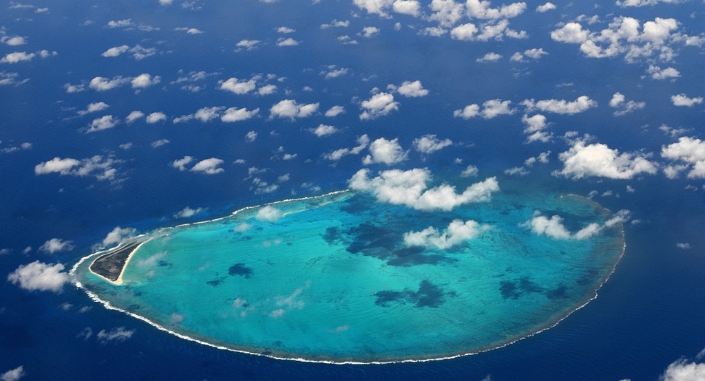
In addition to Oahu, Honolulu County’s land includes hundreds of uninhabited islets and reefs, as well as all of the Northwestern Hawaiian Islands, save for Midway, a U.S. territory.
Also known as the “Leeward Hawaiian Islands,” the Northwestern Hawaiian Islands consist of all land masses beyond Niihau, a private island in Kauai County. The furthest of these is Kure Atoll, which is both the northernmost and oldest landmass in all of the Hawaiian archipelago. Because of this sprawling area—over 1,380 miles (2,220 km) northwest to southeast—Honolulu County is the widest county in the United States by a significant margin.
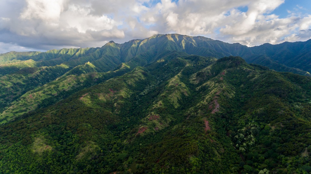
Though only 44 miles (71 km) long and 30 miles (48 km) wide, Oahu's topography is diverse and dramatic. The island is divided into two mountain massifs—Waianae in the west and Ko'olau (Koolau) in the east—both remnants of massive shield volcanoes. These masses (often erroneously called “ranges”) are separated by a central valley, the Oʻahu Plain, an important agricultural area in ancient times.
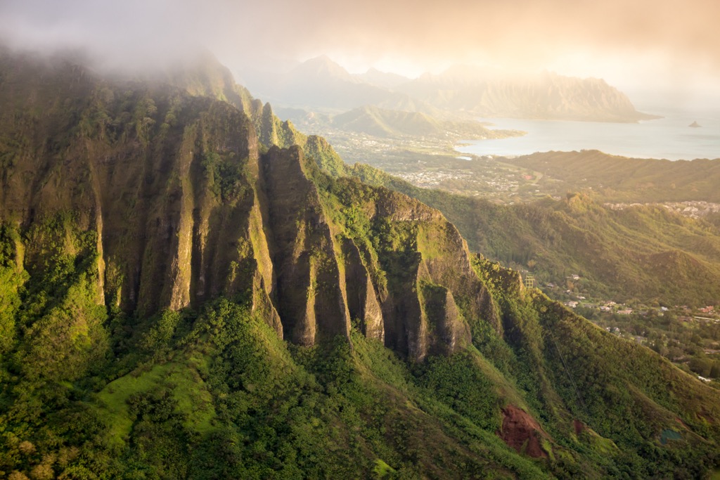
Koolau, crowned by the peak Kōnāhuanui (3,150 ft / 960 m), is exceptionally rugged and steep, famous for its dramatic cliffs, especially along the windward coast. For instance, the Nuʻuanu Pali Lookout (1,161 ft / 354 m) offers stunning views of the sheer cliffs and the lush windward side.
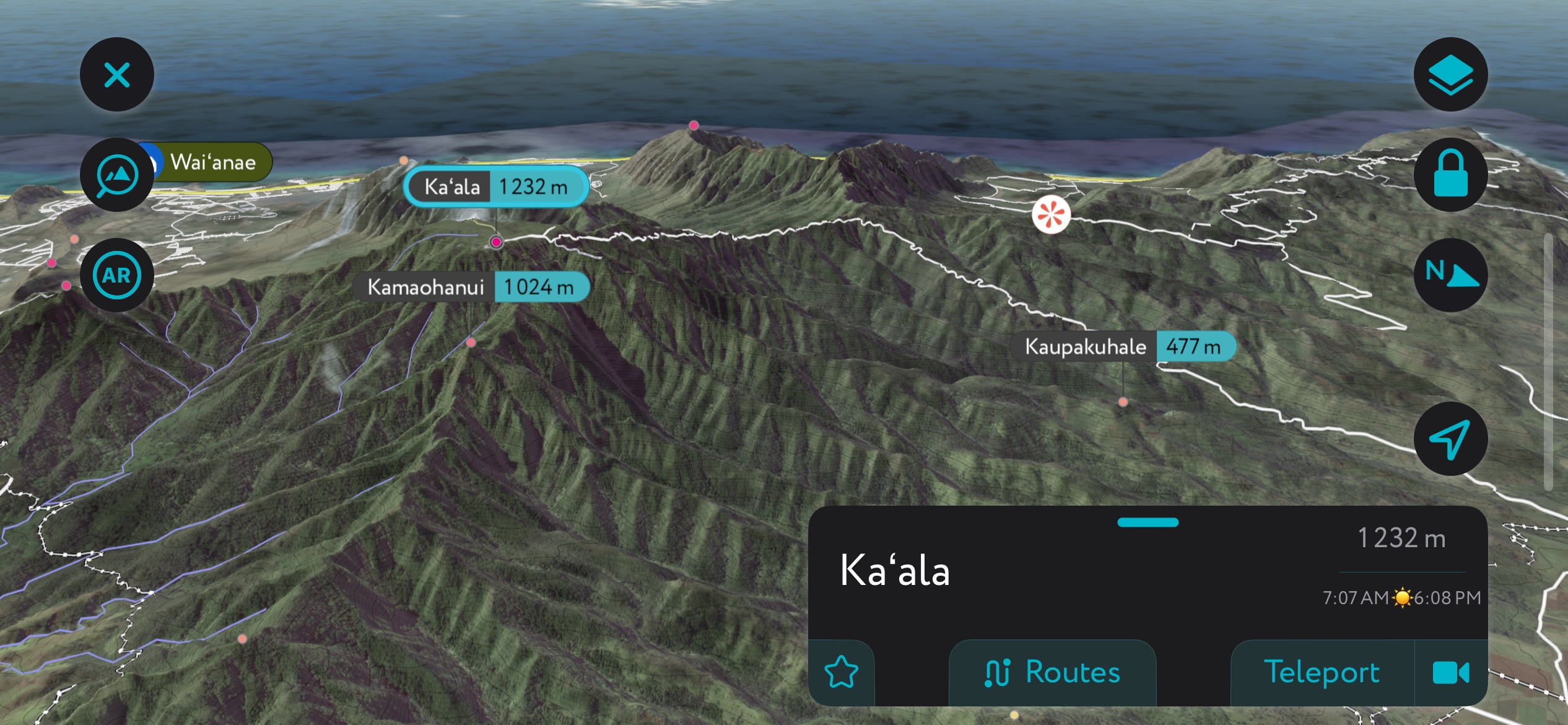
Though older and more eroded, the Waianae Range still boasts significant peaks and valleys, including the island’s highest point, Ka‘ala (4,042 ft / 1,232 m). Ka‘ala is the tallest peak on Oahu and the seventh most prominent mountain in Hawaii. It is also the first in Hawaii’s prominence list that is not an “ultra” or a peak with more than 1,500 meters (4,921 ft) of prominence.
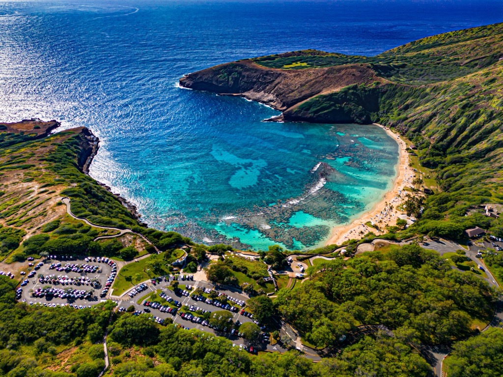
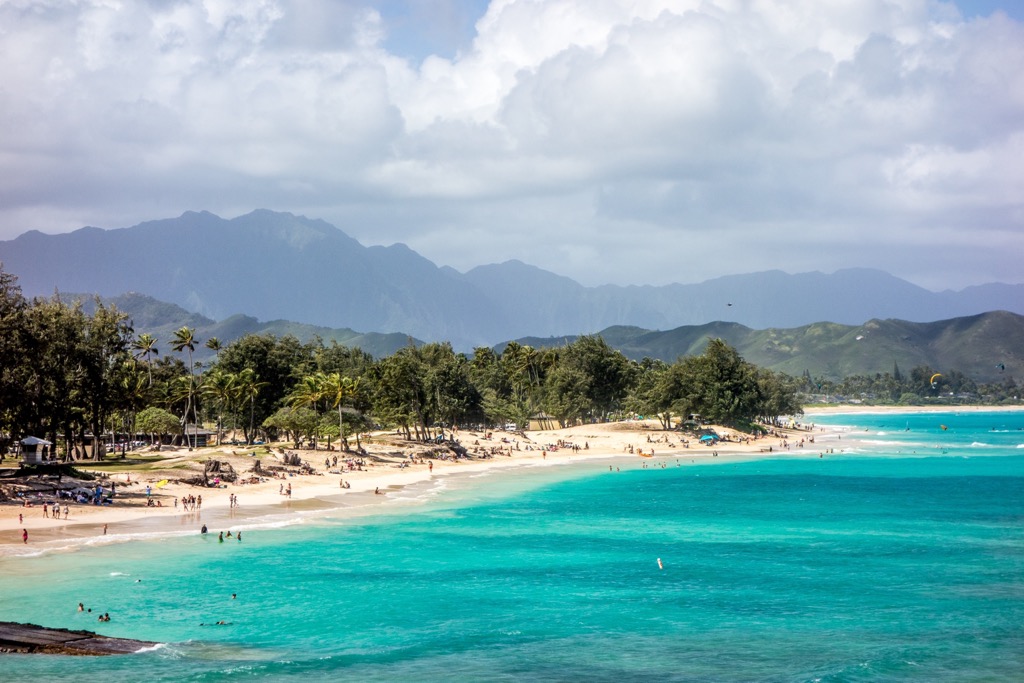
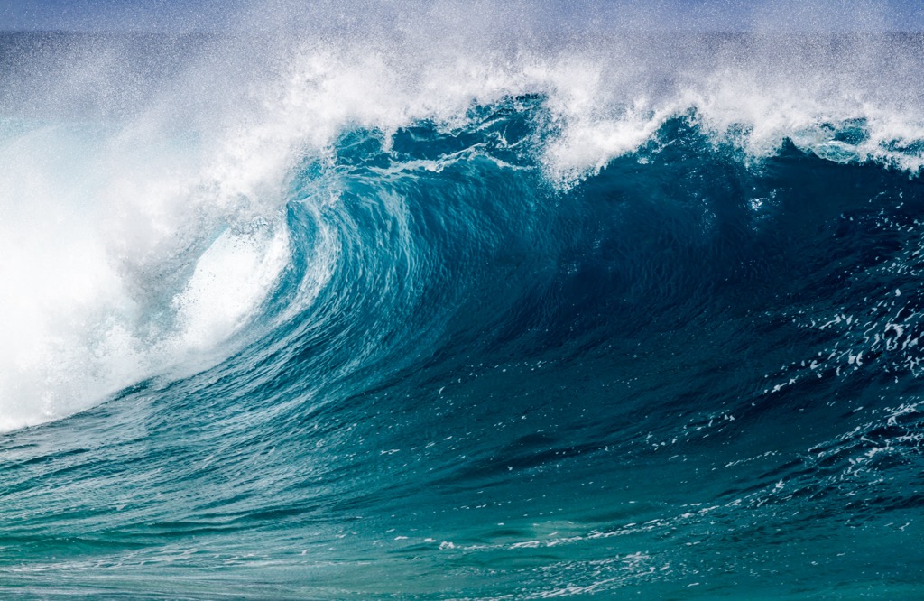
Oahu's coastline is equally varied, entailing 227 miles (365 km) of shoreline. The island’s north shore is renowned for massive winter waves, making it a world-class surfing destination. The south shore, home to the famous Waikiki Beach, has calmer waters suitable for swimming and other water activities.
The south coast is also the site of Pearl Harbor, a U.S. deep-water naval base and the site of the infamous surprise attack by Japan on the United States during the Second World War. (More on this in “Human History” below.)
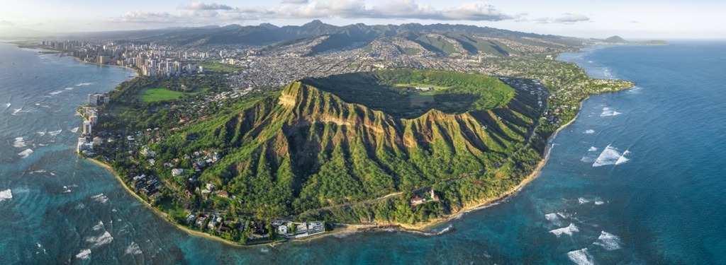
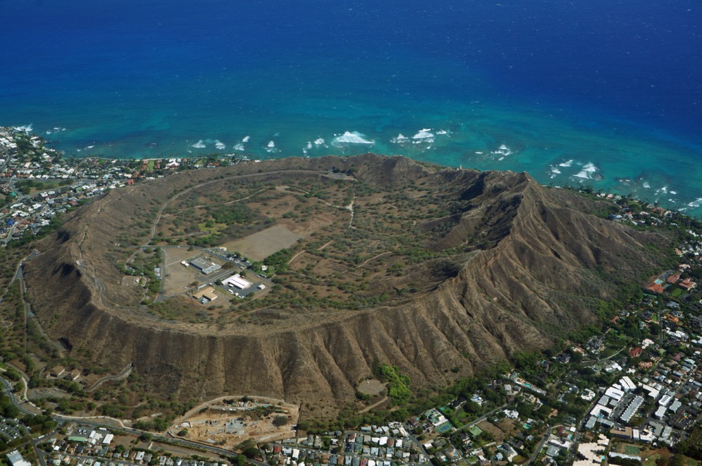
Oahu’s interior, marked by a central plain between the two massifs, features several valleys and plateaus. Notable are the Nuuanu and Manoa valleys, both known for their lush vegetation. Various volcanic craters, such as Diamond Head (761 ft / 232 m), add to the island’s unique geography.
Oahu's climate is typically tropical, with two primary seasons: dry and wet. The dry season, running from April to October, features less rainfall and is generally warmer. The wet season, from November to March, is cooler and sees more precipitation. This weather pattern is heavily influenced by Oahu's location in the Pacific and the trade winds that consistently blow from the northeast.
Beyond this, the island's climate varies depending on the region. The windward (eastern) side of Oahu, exposed to the trade winds, receives more rainfall and is known for its verdant landscapes. In contrast, the leeward (western) side is drier and sunnier, creating a unique microclimate across the island. A short drive can lead from sunny beaches to misty mountains.
Like all the islands of Hawaii, Oahu was formed volcanically, beginning around five million years ago, a product of the Hawaiian hotspot. Hot spots are where the Earth's mantle is unusually hot, and magma rises to the surface. As the Pacific tectonic plate moved over this hotspot, heat and pressure caused magma to break through the Earth's crust, leading to volcanic eruptions. The resulting ash and lava piled up over millions of years, forming the Hawaiian Islands.
Two shield volcanoes, Waianae and Koolau, form Oahu. The former’s high point today is Ka‘ala (4,042 ft / 1,232 m), the latter’s Kōnāhuanui (3,150 ft / 960 m). Waianae, the older of the two, formed between 3.9 and 2.5 million years ago. Its eruptions created the western part of the island. Koolau, slightly younger, began erupting around 2.6 million years ago and ceased activity 1.7 million years ago.
After the volcanic activity ceased, erosion played a significant role in shaping Oahu's landscape. The island's high peaks and ridges were sculpted by the forces of wind, rain, and waves in the resulting few million years. This erosion carved deep valleys and steep cliffs, particularly around Koolau.
The erosion process also contributed to the formation of various other geological features such as beaches, reefs, and the central plains, the latter formed by sediment deposits from the eroded mountains.
Oahu’s diverse geography and varied climate make it home to enormous biodiversity. Like the rest of Hawaii, its isolation means that most species are endemic to the island, and many are quite rare.
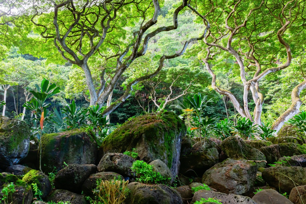
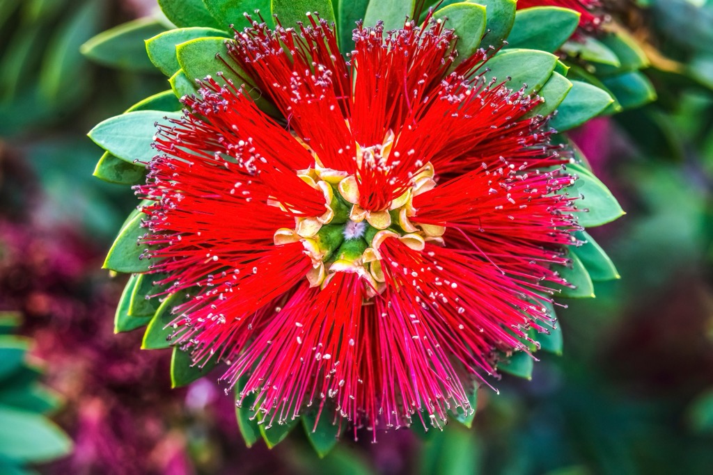
Flora ranges from coastal vegetation to rainforest species. Perhaps the most iconic is the ʻōhiʻa lehua (Metrosideros polymorpha), known for its bright red flowers. These leafy evergreens are vital for maintaining the island's watershed because they have an extremely high water retention rate, retaining precipitation after storms, thus preventing subsequent erosion and flooding. They are the island’s dominant tree above 1,300 ft (400 m) and can grow up to 80 feet (25 m).
Hala trees (Pandanus tectorius), common along the coasts, are also easily spotted due to their long, spiky leaves and pineapple-like fruit. Other notable species of Oahu flora include Hawaiian hibiscus (Hibiscus brackenridgei), Hawaii's state flower, a yellow hibiscus often seen in gardens and natural areas, and silver sword (Argyroxiphium sandwicense), a rare and unique plant found in the higher elevations of Oahu.
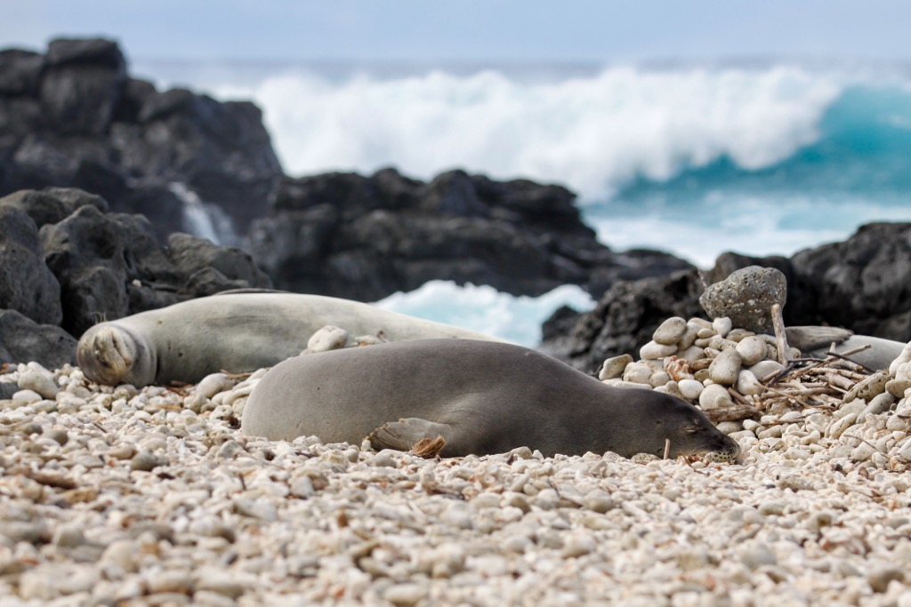
Oahu's fauna, particularly its bird and marine life, is noteworthy. Many bird species are endemic, and some are critically endangered. These include Hawaii’s state bird, the nēnē (Branta sandvicensis), an endemic goose adapted to life in the islands, the Hawaiian green sea turtle (Chelonia mydas), and the Hawaiian monk seal (Monachus schauinslandi), a critically endangered seal and one of the only two mammals native to Hawaii.
Save for the monk seal, the only other native mammal is the Ōpe'ape'a, or Hawaiian hoary bat (Lasiurus cinereus semotus). This small marsupial is the only native land mammal of Hawaii and is considered an endangered species.
Unfortunately, Oahu also has several invasive species which significantly impact its native ecology. These include mongoose—originally introduced to control rats in sugarcane fields but now a serious threat to native birds—and strawberry guava, an invasive plant species that forms dense thickets and outcompetes native flora.
The history of human habitation on Hawaii and Oahu dates back to the first Polynesian settlers, who arrived around 300 CE. These early Hawaiians were skilled navigators and fishermen, traversing vast ocean distances using stars for navigation. They settled in the fertile valleys and coastal areas, developing complex agricultural systems and fishponds to sustain their communities.
The island of Oahu was divided into several chiefdoms, each ruled by an ali'i (chief), and was a center for political and religious activities. Key cultural and religious sites from this era, like the heiau (temples), are still evident across the island.
The first recorded European contact with Oahu was by British explorer Captain James Cook, who landed at Waimea Bay on Kauai in 1778. This contact marked the beginning of significant changes for Hawaii. The subsequent decades saw increased interactions with Europeans and Americans, leading to substantial social, political, and economic changes.
The Hawaiian Kingdom was established in the early 19th century, unifying the islands under a monarchy. During this time, Oahu became the center of the kingdom’s political power, with Honolulu emerging as a key port city in the Pacific. By the late 1800s, however, Hawaii was in the gun sights of the United States, both due to its fertility for crops like sugar and coffee and its key position in the Pacific, crucial for trade.
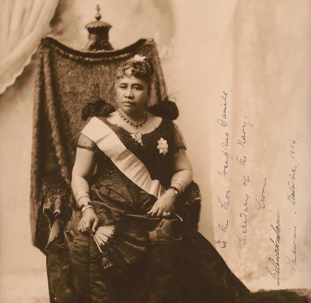
Plantation owners from the United States had come to dominate the economy and politics of the islands. In 1893, they overthrew the Hawaiian monarchy of Queen Liliuokalani with the American government's backing under President Benjamin Harrison.
By 1894, the plantation owners behind the coup—led by Samuel Dole—were petitioning Washington for annexation. Although then-President Grover Cleveland opposed annexation and attempted to restore the monarchy, the island was ultimately annexed after he left office (under President William McKinley in 1898). Hawaii was made a U.S. territory in 1900.
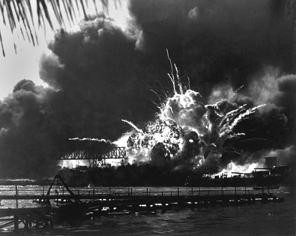
A pivotal moment in Oahu's recent history was the attack on Pearl Harbor by Japan on December 7, 1941. This surprise military strike led to the United States entering World War II. Pearl Harbor, located on the south coast of Oahu, was a critical U.S. naval base. The sneak attack resulted in significant loss of life (around 2,500 killed and 1,200 wounded) and damage to the Pacific Fleet. Today, Pearl Harbor is a National Historic Landmark.
Post-World War II, Oahu experienced rapid modernization and economic growth, mainly driven by tourism and military spending. The island became a melting pot of cultures, with significant influences from Asia, the Pacific, and the mainland United States.
Located on Oahu's North Shore, the luxuriant Waimea Valley is known for Hawaiian ancient archaeological sites and stunning natural beauty. This verdant valley boasts a botanical garden that features over 5,000 tropical and subtropical plants, including rare and endangered Hawaiian species.
The main attraction is the Waimea Valley Trail, an easy 0.95-mile (1.5 km) one-way walk leading to the beautiful Waimea Falls. This paved path is family-friendly and winds through botanical gardens, providing an immersive experience in the valley's flora and fauna. Be sure to bring a swimsuit to dive into the large natural pool at the base of the falls.
The remnants of the Koolau shield volcano stretch along the eastern side of Oahu, offering some of the island’s most breathtaking and challenging hikes. Rugged, emerald-clad cliffs and peaks characterize this massif.
One of the most famous trails in the region is the Lanikai Pillbox Hike, also known as the Kaiwa (Ka’iwa) Ridge Trail. This moderate hike is 1.6 miles (2.6 km) round-trip and leads to historic World War II pillboxes (concrete bunkers), offering stunning views of Lanikai Beach, the Mokulua Islands, and the windward coast. Another notable trail is the Pali Notches (0.7 mi / 1.1 km), a more challenging and perilous trail recommended only for experienced hikers due to its steep sections and narrow ridges.
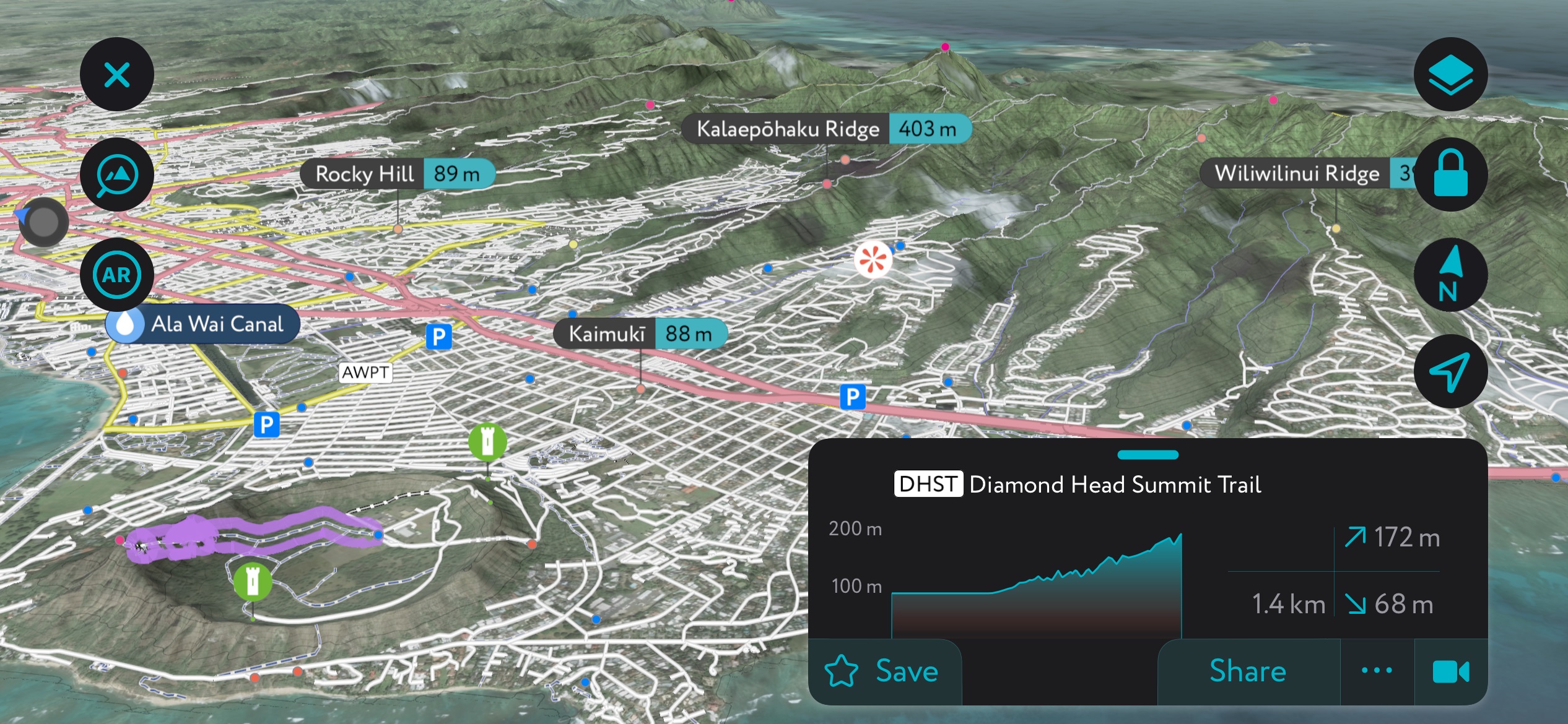
Diamond Head State Monument (Le'ahi in Hawaiian) is named for an iconic volcanic crater (Diamond Head) on the eastern edge of Waikiki's coastline. This landmark is a symbol of Hawaii's natural beauty and offers one of the most famous hiking experiences on Oahu.
The Diamond Head Summit Trail is a well-maintained trail that attracts thousands of visitors annually. This 1.6-mile (2.6 km) round-trip hike is considered moderate but involves steep stairs and a tunnel.
The trail leads to the crater's summit at 761 feet (232 m), where hikers are rewarded with 360-degree views of Honolulu, Waikiki, and the Pacific Ocean. The hike offers a glimpse into the military history of Oahu since it was built as part of Oahu's coastal defense system during the early 20th century.
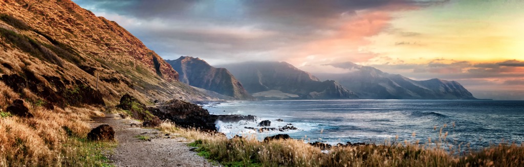
Kaena (Ka'ena) Point, located at the northwestern tip of Oahu, is a remote and wild area known for its rugged coastline and significant cultural and natural resources. The area is a sanctuary for native plants and seabirds and offers a glimpse of Oahu's unspoiled beauty.
The park’s Ka'ena Point Trail is a relatively flat and easy hike, about 6.1 miles (9.8 km) round-trip, leading to a point where the rocky shore meets a sandy beach. The trail runs along the coastline, following a former railroad bed and dirt road. You’ll get plenty of sublime ocean views and the chance to spot monk seals and albatrosses during certain seasons.
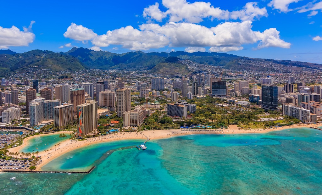
As Hawaii's capital and largest city, Honolulu (pop. 345,000) is the vibrant heart of Oahu. Nestled between the Pacific Ocean and the Koolau massif, it is a cosmopolitan hub blending natural beauty with urban amenities.
Famous for Waikiki Beach, the city is a major tourist destination and also known for the iconic Diamond Head (761 ft / 232 m) crater, historic sites like Iolani Palace—home to the island’s last monarchs—and the Pearl Harbor National Memorial, and a diverse culinary scene. Honolulu is also the state's cultural and economic center, hosting numerous events and festivals that showcase Hawaii's unique heritage.
Located on the windward side of Oahu, Kailua (pop. 38,000) is renowned for its stunning beaches, particularly Kailua Beach and Lanikai Beach, known for their powdery white sand and turquoise waters. It's a relaxed, community-focused town with a charming collection of local shops, eateries, and weekly farmers' markets.
Also on the windward coast, Kaneohe (pop. 34,000) is picturesque, rife with lush greenery and striking mountain views of the Koolau massif. The town is known for the beautiful Hoomaluhia Botanical Garden and the nearby Kaneohe Bay.
This historic surf town on the North Shore (pop. 5,000) is famous for its big wave surfing, particularly during winter. Haleiwa (Haleʻiwa) offers a laid-back atmosphere, with surf shops, art galleries, and local food spots. Don’t miss the shaved ice stands!


Yes. Honolulu County has 141 named mountains. The highest is Ka‘ala at 1,232 m.
The highest mountain in Honolulu County is Ka‘ala, at 1,232 m.
Honolulu County has 141 named mountains.


