
Scan the QR code and open PeakVisor on your phone
Kauaʻi (Kauai) County is in the U.S. state of Hawaii, is home to about 70,000 people, and spans 1,266 sq. mi (3,280 sq km) of land and water across four islands; these are Niʻihau (Niihau), Lehua, Kaʻula (Kaula), and the eponymous island of Kauaʻi (Kauai). The county is home to 261 named mountains. Kawaikini (5,223 ft / 1,595 m) on Kauai is the highest and the most prominent of these summits.
Approximately half of Kauai County’s total area is land (620 sq. mi / 1,600 sq. km), spread between four islands, Lehua, Kaula, Niihau, and Kauai. However, only the latter two are inhabited.
Lehua (0.45 sq. mi / 1.15 sq. km) and Kaula (0.25 sq. mi / 0.6 sq. km) are completely barren and miniscule by comparison. There is only one summit on each island. On the crescent-shaped Lehua—a seabird sanctuary—this is an eponymous point (Mount Lehua) rising to 705 feet (215 m). The United States Coast Guard maintains a lighthouse here. The high point on Kaula is Mount Kaula (548 ft / 167 m).
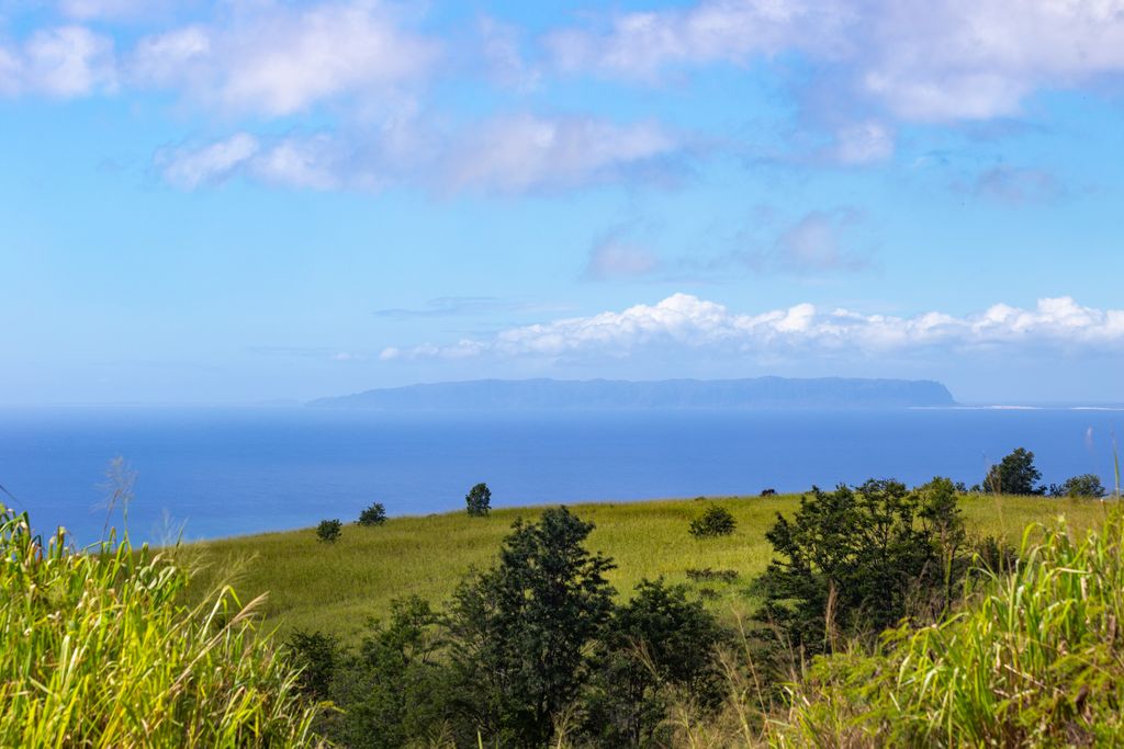
Spanning 70 sq. mi (180 sq. km), Niihau is comparatively larger than Lehua and Kaula but still relatively small. It is the oldest island in the Hawaiian chain with a population of just 80 per the 2020 Census. Niihau is privately owned by the descendants of Elizabeth Sinclair, with access restricted to all except the owning family and their guests, as well as U.S. Navy personnel and government officials. The island is home to several small summits, the highest being Mount Pānīʻau (Paniau) (1,286 ft / 393 m).
Kauai (562 sq mi / 1,456 sq. km) is the largest island in Kauai County, making up over 90% of the county’s land area. Sitting 73 miles (117 km) northwest of Oahu, Kauai is the fourth largest of the Hawaiian islands, after Hawaiʻi, Maui, and Oʻahu, and is the 21st largest in the United States. After Niihau, it is the oldest island in Hawaii.
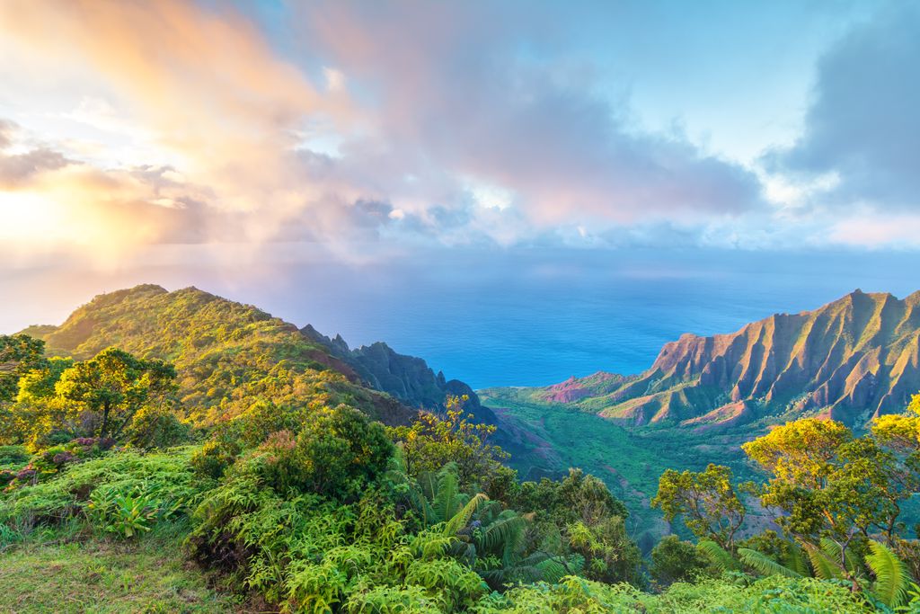
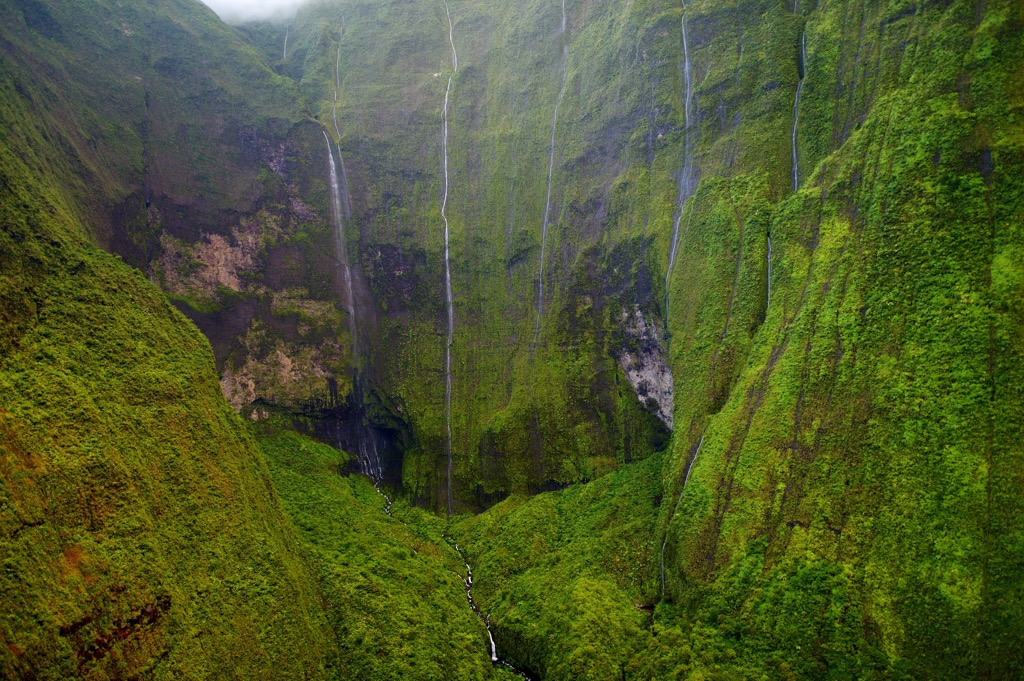
The county is home to 261 named summits, mainly on Kauai. The most notable peak is Kawaikini (5,223 ft / 1,595 m) on Kauai. Nestled within the Lihue-Koloa Forest Reserve, it is the summit of Kauai’s inactive central shield volcano, Waiʻaleʻale (Waialeale) (5,148 ft / 1,569 m), and the fifth most prominent peak in the island chain. The Waialeale summit is one of the rainiest places on Earth, averaging nearly 400 inches (10,100 mm) of rain annually, setting a record of 683 inches (17,300 mm) in 1982.
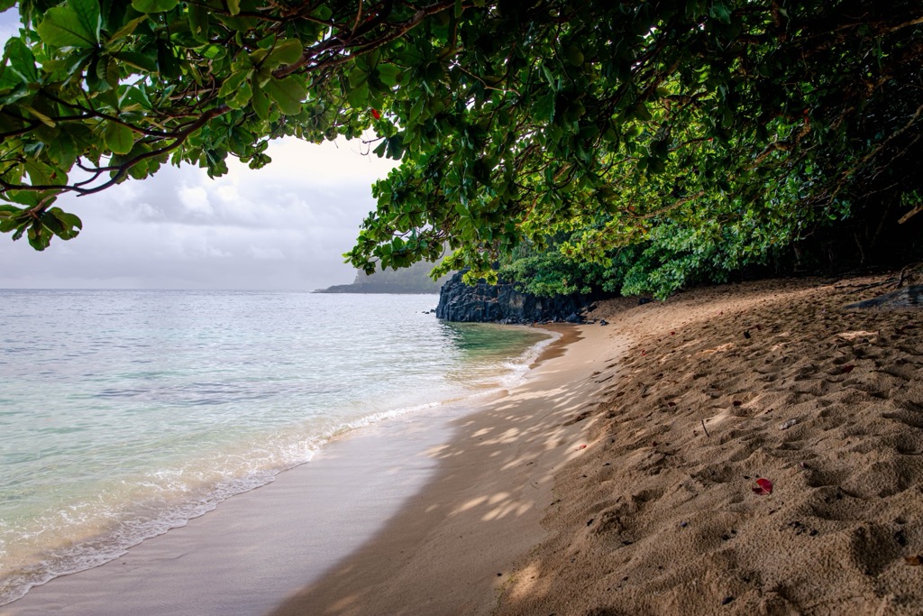
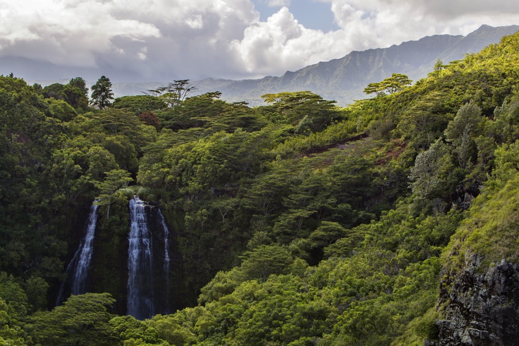
Kauai is often referred to as the “Garden Isle” due to its lush tropical forests, waterfalls, and rivers. The island’s climate varies significantly across its small area. The eastern and northern aspects face trade winds and receive copious amounts of rainfall, supporting dense rainforests and fostering a rich biodiversity. In contrast, the western and southern regions are comparatively drier, characterized by semi-arid landscapes.
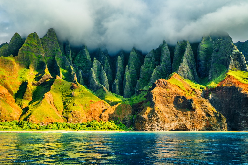
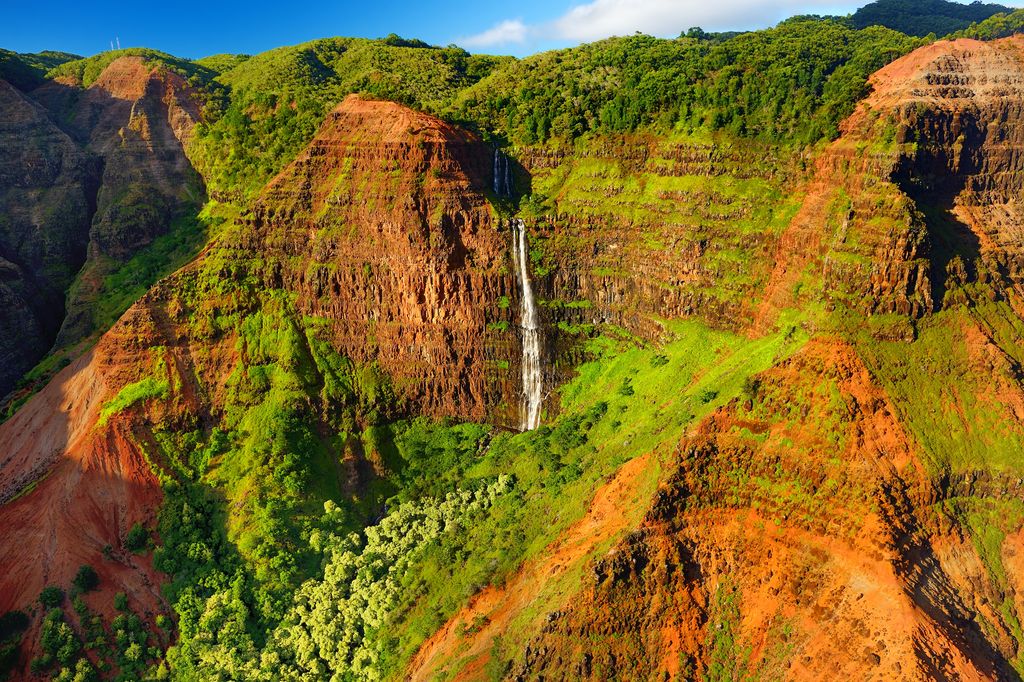
The island's topography is markedly diverse, as well. The Na Pali Coast on the northwest shore features towering cliffs and deep valleys, accessible only by hiking, boat, or helicopter, offering some of the most breathtaking scenery in Hawaii. The Waimea Canyon, known as the “Grand Canyon of the Pacific,” showcases deep gorges and rugged terrain, a stark contrast to the island's lush, green areas.
Rivers such as Wailua and Hanalei play a crucial role in the island's ecosystem. Fed by the island's high annual rainfall, these rivers support a variety of flora and fauna and are essential for agriculture. They also offer numerous recreational activities, including kayaking and canoeing.
Like all the Hawaiian islands, Kauai was formed volcanically from a hotspot in the Earth's mantle, a fixed point where magma rises to the surface. The chain (and Kauai) began to form around five million years ago, as the Pacific Plate moved over this hotspot, generating a series of volcanoes. As these volcanoes erupted, cooling lava and volcanic ash piled up and eventually rose above sea level to form land.
In its early stages, Kauai was characterized by a shield volcano structure with gentle slopes formed by fluid lava flows. The shield volcano Waialeale (5,148 ft / 1,569 m), at the island's center, is the remnant of this volcanic activity.
As the Pacific Plate moved northwest, Hawaii and Kauai gradually moved away from the hotspot. This movement caused the island to slowly cool. Kauai has sunk several thousand feet in the millions of years since its formation. This subsistence, combined with erosion, has led to the island's current topography.
Heavy rainfall, particularly in the central and northern parts of the island, led to the formation of rivers and streams that carved deep valleys and canyons. The most notable example is Waimea Canyon, formed by the Waimea River cutting through the volcanic rock. Meanwhile, wind and wave erosion along the coastlines sculpted cliffs and left sandy beaches. The Na Pali Coast is a prime example of how wind and water have eroded the volcanic rock into dramatic cliffs and valleys.
Kauai’s ecology is as rich and diverse as its geography, with a wide array of endemic flora and fauna owing to both the island's isolation and variety of climates.
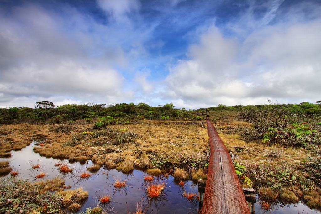
One of the island’s most notable ecological features is the Alakaʻi Swamp, one of the world’s highest-elevation swamps at 5,000 feet. This unique wetland is home to several rare bird species and unusual plant life. In fact, among the near-50 endangered species endemic to Kauai, 21 are only found in the montane wet ecosystem around the Alakaʻi Swamp and the summit of nearby Waialeale (5,148 ft / 1,569 m).
Another noteworthy site is Limahuli Garden and Preserve, a botanical garden and nature preserve in the north of the island. Limahuli is home to numerous native plants and ecosystems and serves as a living laboratory for conservation and study.
Kauai’s higher elevations and wetter regions are home to lush native forests. These forests are dominated by ʻōhiʻa lehua evergreen trees (Metrosideros polymorpha) and hāpuʻu ferns (Cibotium menziesii), providing habitat for numerous bird species. Endemic plants include the māmane tree (Sophora chrysophylla) and a variety of Hawaiian lobelioids. The latter comprises the largest endemic plant family on any island archipelago, with over 125 species.
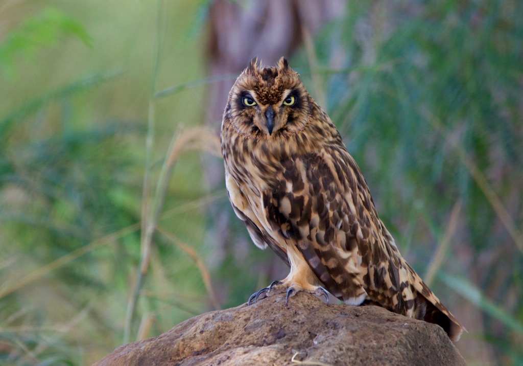
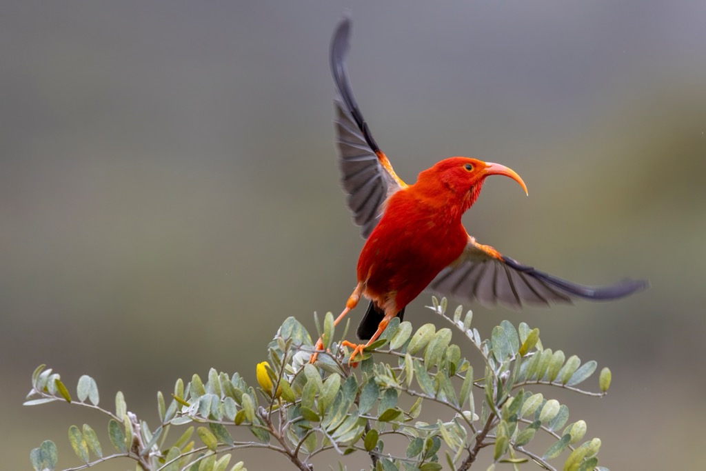
Fauna on Kauai is equally diverse, particularly in the case of avian life. Notable species include the ʻiʻiwi (Drepanis coccinea), a honeycreeper known for its bright red plumage, and the pueo (Asio flammeus sandwichensis), the Hawaiian short-eared owl.
Many of Kauai’s native birds are endangered due to habitat loss and disease, as well as invasive species, such as rats, pigs, and mosquitoes. The ʻelepaio (Muscicapa sandwichensis) and the ʻakikiki (Oreomystis bairdi) are two such species, both critical conservation priorities. The state bird, the nēnē (Branta sandvicensis), or Hawaiian goose, is also endangered.
Some of the island’s endangered species have already been lost. The endemic Kauaʻiʻōʻō (Moho braccatus), a small honeyeater, was last seen in the 1980s and declared extinct in 2023. This bird was the last member of the ʻōʻō (Moho) genus in the Mohoidae avian family. The entire family is now extinct, marking the only extinction of an entire avian family in the last 500+ years.
The waters around Kauai are also teeming with marine life, including coral reefs, sea turtles, monk seals, and a variety of fish species. These marine ecosystems are vital to the island's ecological health and are popular with snorkelers and divers.
The human history of Kauai, the oldest of the main Hawaiian Islands, is as rich and textured as its landscapes. Kauai’s story begins with the ancient Polynesians. These intrepid navigators arrived sometime around 300 or 400 CE, bringing plants and animals that would become staples of Hawaiian life, fundamentally altering the island's ecology and laying the foundations of a complex, thriving society.
Over the centuries, these early settlers developed a rich, vibrant culture intimately connected to the land and sea. They practiced a sustainable form of agriculture, constructing intricate systems of terraces and fishponds that maximized the island's natural resources. Society was organized around a strict kapu (taboo) system, governing everything from fishing rights to religious observances, with the aliʻi (chiefs) at the top of the social hierarchy.
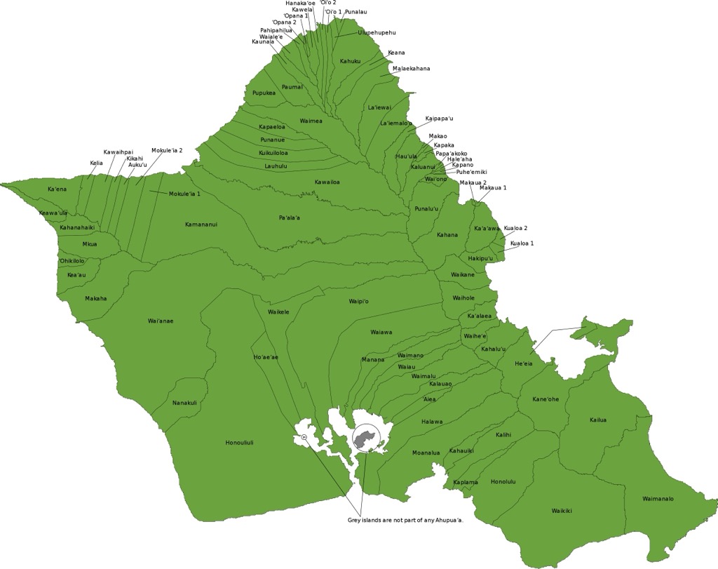
The ancient Hawaiians used a sophisticated land division system, the ahupua'a, allowing sustainable resource management across various ecological zones. An ahupua’a was delineated based on elevation, extending from the mountains to the sea. Thus, each contained a complete watershed and marine resources.
Captain James Cook, the first European to visit Hawaii, landed at Waimea Bay in Kauai in 1778. The arrival of Europeans marked the beginning of significant changes for Kauai and the archipelago, bringing new technologies and ideas, along with diseases that decimated indigenous peoples. The 1800s saw Kauai become a hub for whaling and later sugarcane industries, which drew laborers from Asia and Europe, reshaping the island's cultural landscape.
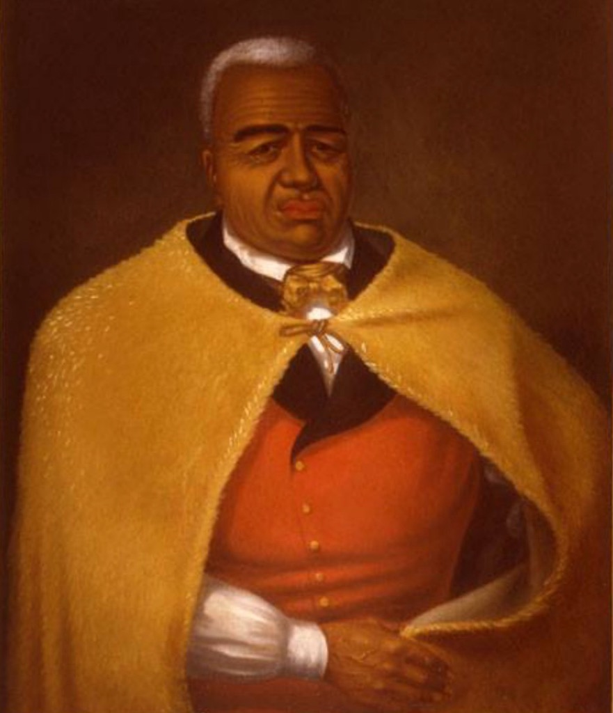
Despite these changes, Kauai remained somewhat isolated from the political turmoil affecting the rest of Hawaii. It was the last of the Hawaiian islands to voluntarily join the unified Kingdom of Hawaiʻi under King Kamehameha I in 1810. This relative isolation allowed Kauai to preserve its unique traditions and ways of life far more effectively than other Hawaiian islands.
The 20th century brought further transformations. The sugar industry dominated the island's economy for decades but eventually gave way to tourism, now the cornerstone of Kauai’s economy. The island has become renowned for its stunning natural beauty, rich cultural heritage, and as a location for numerous Hollywood films, including Jurassic Park, Pirates of the Caribbean, King Kong, and Raiders of the Lost Ark.
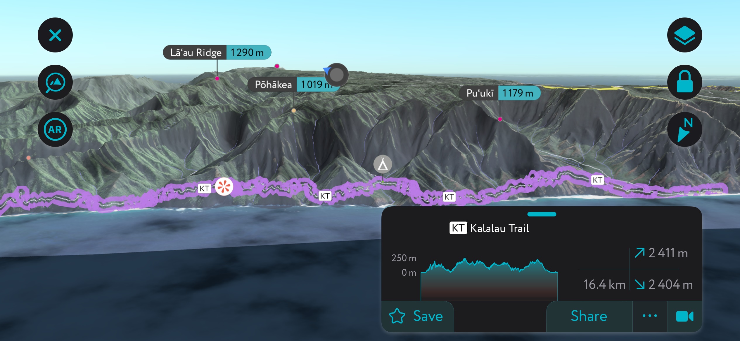
Located along Kauai’s northwest shore, Na Pali Coast State Park is one of the island’s crown jewels, known worldwide for its towering sea cliffs, lush valleys, sea caves, and pristine beaches. The park spans approximately 10 square miles (26 sq. km), though the Na Pali coastline stretches over 15 miles (40 km). Some of Na Pali’s cliffs rise as high as 4,000 feet (1,200 m).
Inaccessible by road, the coast is usually explored via rugged hiking trails, such as the challenging Kalalau Trail (11 mi / 28 km), or by boat tours or helicopter rides, which offer awe-inspiring views of its rugged terrain, cascading waterfalls, and ancient Hawaiian archaeological sites. Other excellent Na Pali trails include Hanakapiai (7.7 mi / 12.3 km) and Awaawapuhi (5.8 mi / 9.3 km).
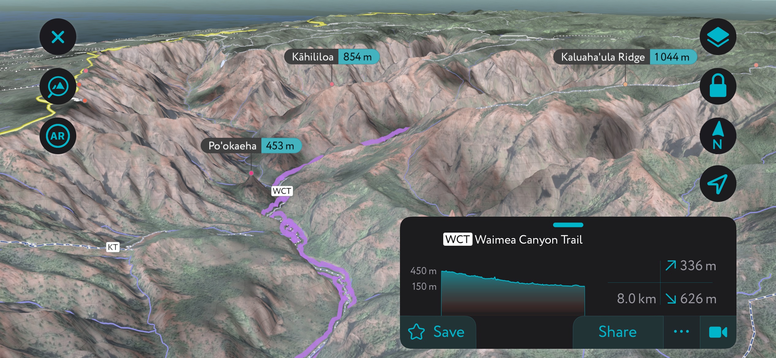
Known as the “Grand Canyon of the Pacific,” Waimea Canyon is a spectacular gash amid the greenery of Kauai, running for 14 miles (23 km) on either side of the Waimea River. At points, this canyon is over a mile (1.6 km) wide and 3,600 feet (1,097 m) deep. The landscape is a dramatic tapestry of rugged crags, deep valley gorges, and vibrant, colorful striations in the rock, revealing the area's volcanic origins and the geological processes that continue to shape it today.
The 3.7-mile (6 km) round trip Waimea Canyon Trail is the best overview of the canyon, taking you along the canyon rim for stunning views of both the gorge below and the ocean.
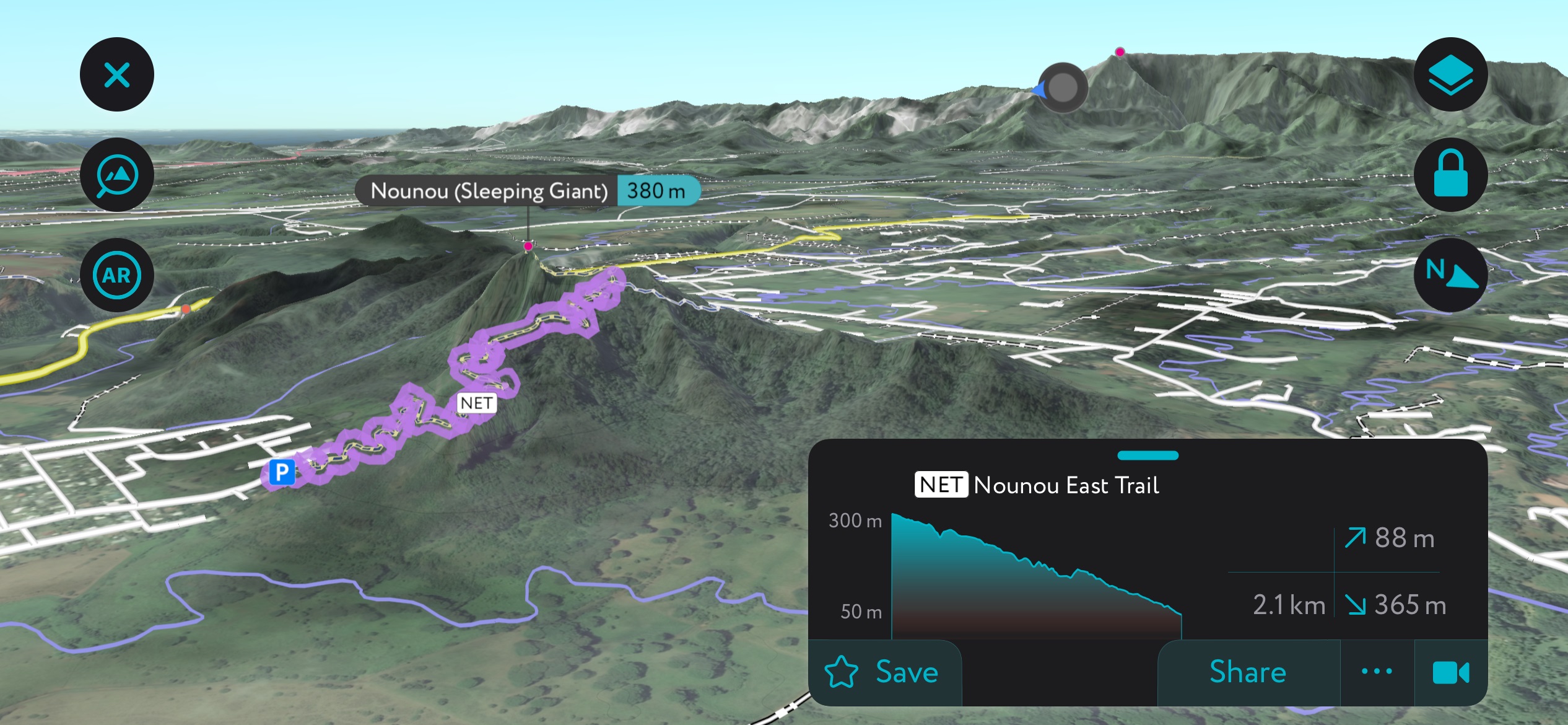
The two-mile (3.2 km) Sleeping Giant Trail, also known as Nounou East, is another must-hike trail on Kauai. The trail is situated along Kauai’s eastern shore near Wailua and summits Sleeping Giant Mountain (1,247 ft / 380 m), winding through lush forests and up steep inclines.
Though Nounou East Trail is relatively short, it features rapid elevation gain (over 1,000 ft / 300 m). Sleeping Giant’s summit can also be reached from the west via the West Kuamoo Trail, though the eastern trail is drier in the rainy season and offers better traction.
Kauai, though not known for large urban centers, is home to several charming towns, each with its own unique appeal.
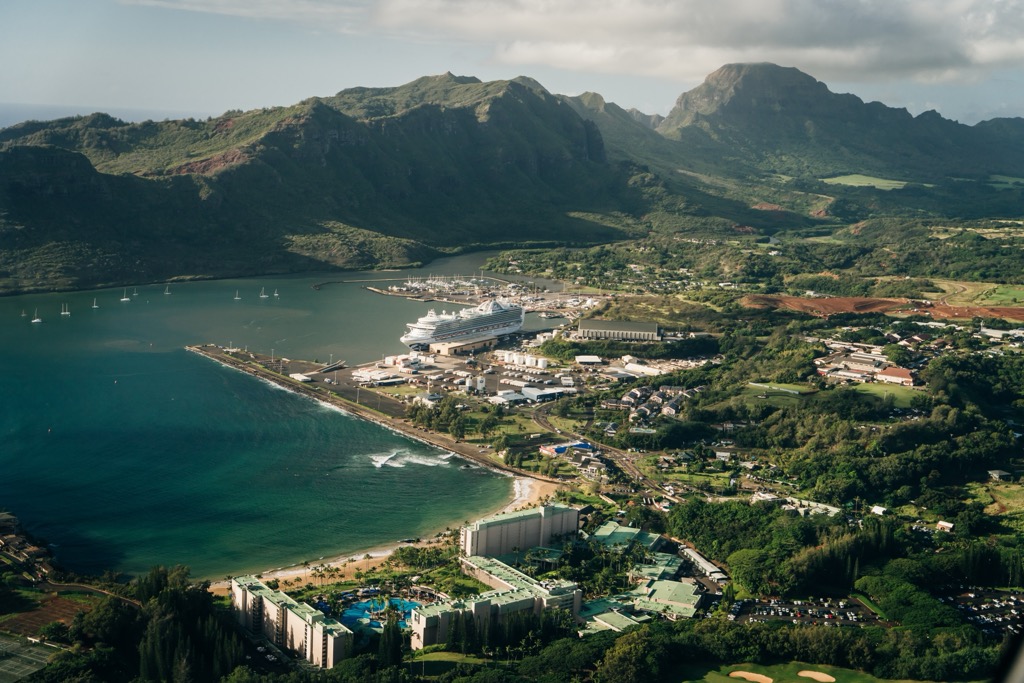
The island's capital and commercial center, Līhuʻe (pop. 8,004), is home to Kauai’s main airport and serves as a gateway to the island. It offers a mix of historic sites, such as the 19th-century Kilohana Plantation, and contemporary amenities, making it a hub of activity.
Nestled on the North Shore, Hanalei is a picturesque town known for its stunning crescent-shaped bay, historic pier, and backdrop of majestic mountains. It's a haven for surfers, artists, and those seeking a laid-back beachfront ambiance. It’s also notable for the Hanalei National Wildlife Refuge, a haven for rare water birds.

Famous for its proximity to Waimea Canyon, Waimea Town (pop. 2,057) has a rich history, as the site where Captain James Cook first landed in Hawaii in 1778. It's a quaint town with historic charm, offering insight into the island's past and access to the natural wonders of the west side. Don’t miss catching a film at the historic Waimea Theater, which dates to 1938.


