
Scan the QR code and open PeakVisor on your phone
Maui County is home to 399 named mountains. The highest is Red Hill at 3,055 m.
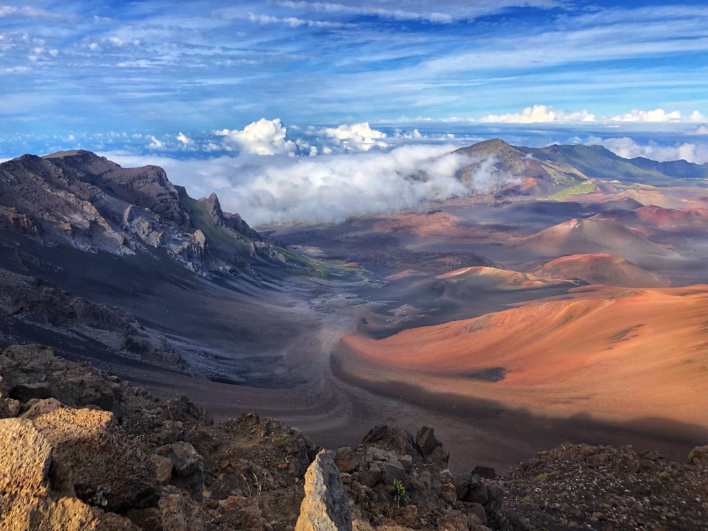
Spanning 2,398 square miles (6,210 sq. km), Maui County is the smallest of the four counties in the U.S. state of Hawaii. The 1,162 square miles (3,010 sq. km) of land in Maui County encompasses the islands of Maui, Lānaʻi (Lanai), Molokaʻi (Molokai), Kahoʻolawe (Kahoolawe), and the islet Molokini, though these latter two are uninhabited. Maui County is home to around 170,000 people, 95% of which live on Maui. There are 399 named mountains in Maui County; the highest and the most prominent is Red Hill (10,023 ft / 3,055 m) or Puʻu ʻUlaʻula on Maui. This peak is the apex of the massive shield volcano Haleakalā—the “East Maui Volcano”—which formed over 75% of the island.
The five islands of Maui County are pieces of an ancient landmass, Maui Nui, which slowly broke apart during the last million years. Maui Nui is the remnants of the expulsions of seven ancient shield volcanoes, which comprise the present-day “islands” in Maui County.
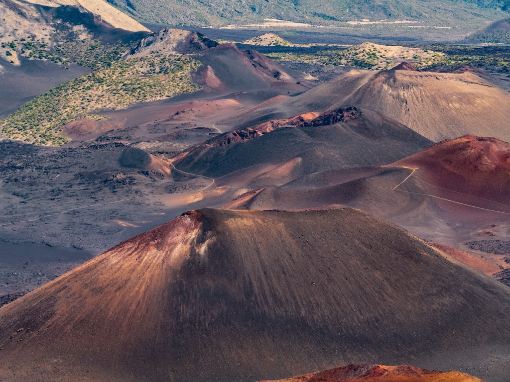
The islands in the archipelago are dominated by Maui, the largest of the group. Geographically, the West Maui Mountains and the larger East Maui Volcano, also known as Haleakalā, divide the island into two massifs. The division is quite similar to Oahu, divided by Waianae in the west and Koolau in the east. The dramatic crater of the dormant Haleakalā, nearly 2,600 feet (800 m) deep, is a notable landmark on the island.
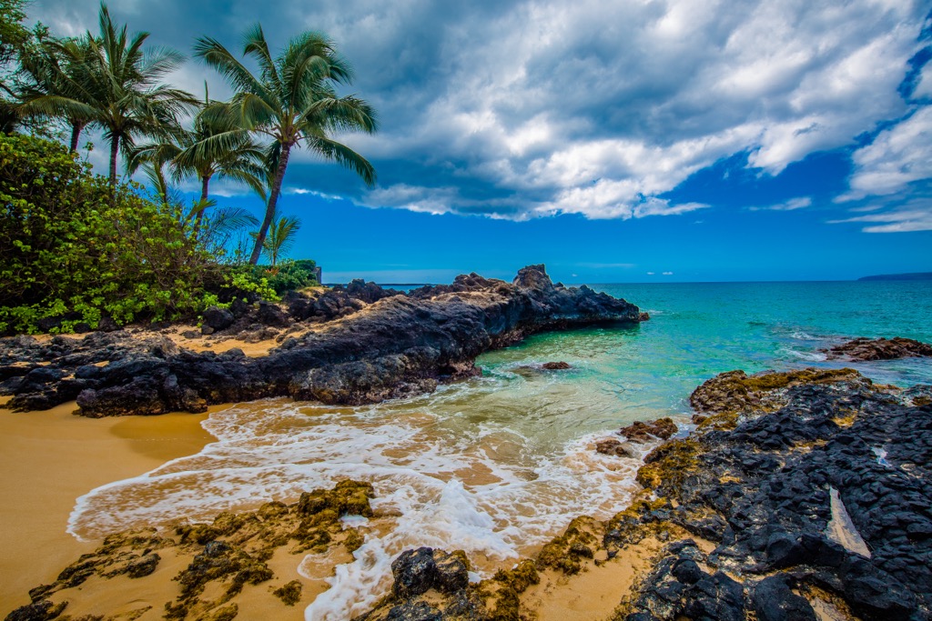
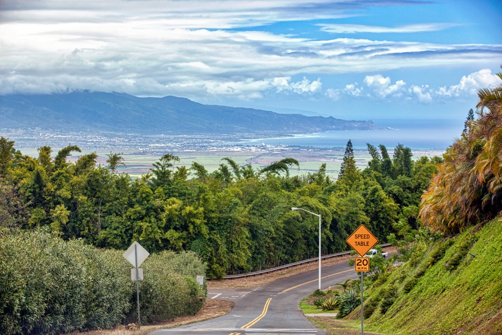
Maui’s varied terrain creates numerous microclimates, ranging from the dry, sunny coasts of Kihei and Lahaina to Hana's wet, verdant slopes. A sprawling central valley of agricultural and urban land lies between the two massifs mentioned above, giving Maui one of its nicknames: “Valley Isle.”
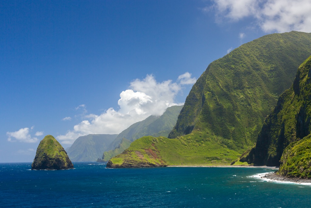
Molokai, also known as the “Friendly Isle,” is significantly less developed than Maui and retains much of its natural charm. Its northern coast features the highest sea cliffs in the world—stretching upwards of 4,000 feet (1,200 m)—while the southern coast boasts the longest continuous fringing reef.
Like Maui, Molokai features a broad central plateau. The Kamakou Preserve in the eastern aspect houses a lush, native rainforest, crowned by an eponymous summit, Kamakou (4,944 ft / 1,507 m), the island’s highest and most prominent peak.
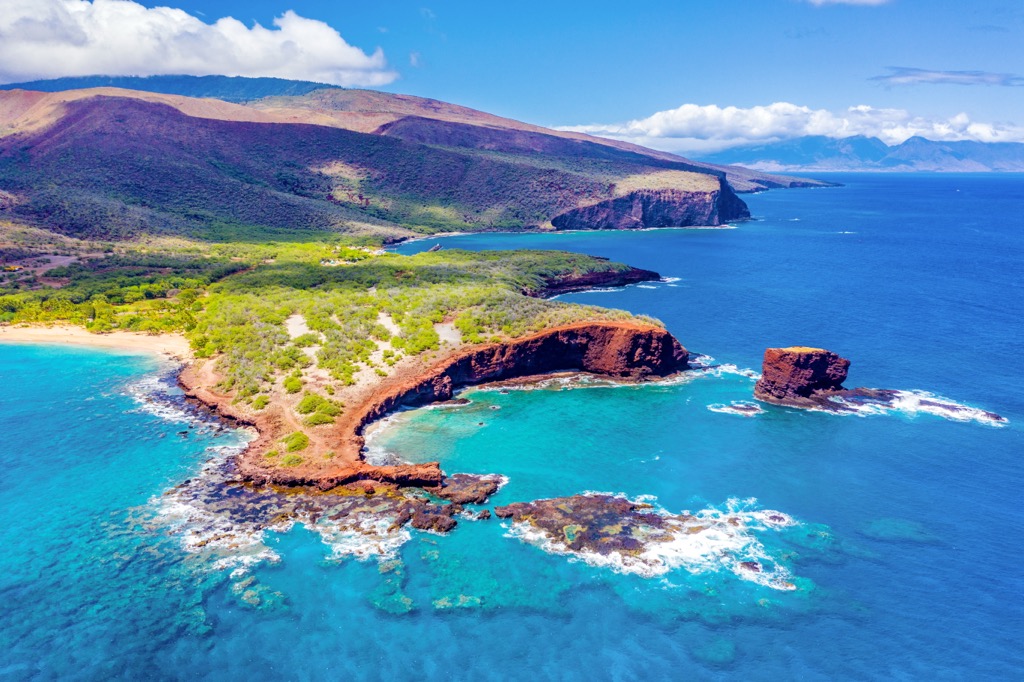
Lanai, once a pineapple plantation island, is now defined by a contrast of luxury resorts and natural beauty. The landscape ranges from the dry landscapes in the south to the more verdant highlands in the north. Lanai’s Keahiakawelo rock garden, also known as the Garden of the Gods, hosts numerous unique geological formations. Meanwhile, the marine preserve at Hulopoe Bay offers an excellent overview of the island's diverse ecology. Lanai’s highest point is Lānaʻihale (3,379 ft / 1,030 m).
Kahoolawe, the smallest of the main Maui County islands, is arid and uninhabited, used historically for military training. Its terrain is mostly barren, but restoration efforts are underway to revive its native vegetation. The fifth and final island in Maui County, Molokini, is a crescent-shaped, partially submerged volcanic crater only 0.4 miles (0.6 km) wide.
Maui County's climate is tropical, with the influence of the Pacific Ocean moderating temperatures. The islands experience a wet season from November to March and a dry season from April to October. Though the overlying climate is tropical, the varied topography across the islands creates numerous microclimates, ranging from arid desert-like conditions to typical Hawaiian rainforests.
This climatic diversity supports a range of biomes, including coastal beaches, dry grasslands, dense rainforests, and alpine ecosystems, each hosting unique flora and fauna. Like other islands in the Hawaiian archipelago, the isolation of the islands in Maui County has led to the development of many endemic species and Maui’s recognition as a biodiversity hotspot.
NOTE: There is a sometimes recognized “fifth” county in Hawaii, Kalawao County, which nests inside Maui County and comprises the Kalaupapa Peninsula on Molokai’s north coast. However, this county is a Maui County judicial district with no elected government.
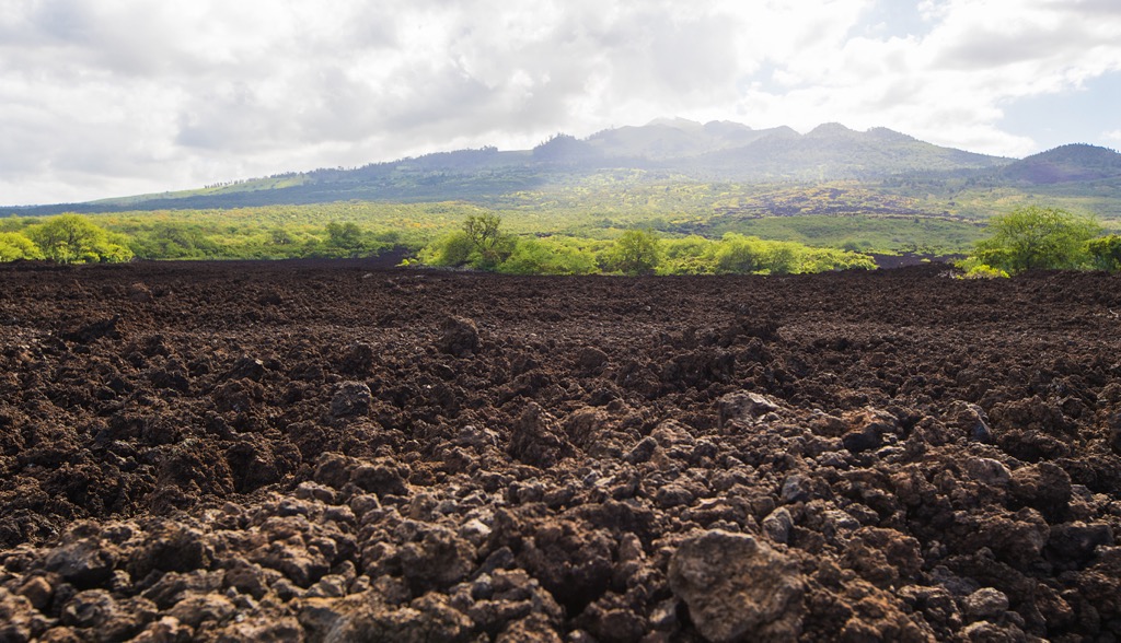
Like all the Hawaiian islands, the geology of the Maui County islands is deeply intertwined with its origins as part of the larger volcanic landmass. In this case, that landmass was known as Maui Nui, or “Greater Maui.”
The Hawaiian islands began formation millions of years ago, as the Pacific Plate moved over a stationary hotspot in the Earth's mantle. This hotspot produced a series of volcanic eruptions. The amassing and subsequent cooling of the lava and ash from these eruptions formed the islands we know today.
Over time, the volcanic islands around Maui coalesced into a single, massive landmass (Maui Nui), likely around 1.2 million years ago. The landmass was much larger than the current combined land area of the individual islands. In fact, in its prime, Maui Nui was over 5,600 square miles (14,504 sq. km), far larger even than the “Big Island,” Hawaii (4,028 sq. mi / 10,432 sq. km).
Maui Nui formed from the expulsions of seven shield volcanoes. Penguin Bank, West Molokai, and East Molokai are the oldest (~2 million years old), while Lanai, West Maui, Haleakalā (East Maui), and Kahoolawe are slightly younger, around 1.5 million years old.
Though we often think of landmasses like Maui Nui as “breaking apart,” a more apt description is that they flooded as sea levels rose and submerged the low-lying land between its volcanic summits.
This separation began around 600,000 years ago when the land bridge between Molokai and the others flooded. Two hundred thousand years later, Lanai separated. Finally, Maui and Kahoolawe severed ties between 200,000 and 150,000 years ago. Though they are distinctly separate islands, the seafloor between them remains relatively shallow, about 1,600 feet (500 m), evidence of their history as a single landmass.
The rise and fall of sea levels also played a crucial role in shaping the flora and fauna of Maui Nui’s descendent islands. During periods of lower sea levels, land bridges between the islands were exposed, allowing for the intermingling of species. As sea levels rose, these bridges were submerged, leading to the isolation of the islands and the evolution of endemic flora and fauna.
Like the other islands of the Hawaiian archipelago, Maui County’s diverse topography, varied climates, and relative geographic isolation have led to the development of a remarkable array of endemic species. The following species of flora and fauna are unique to the Hawaiian Islands, and many are found only within Maui County.
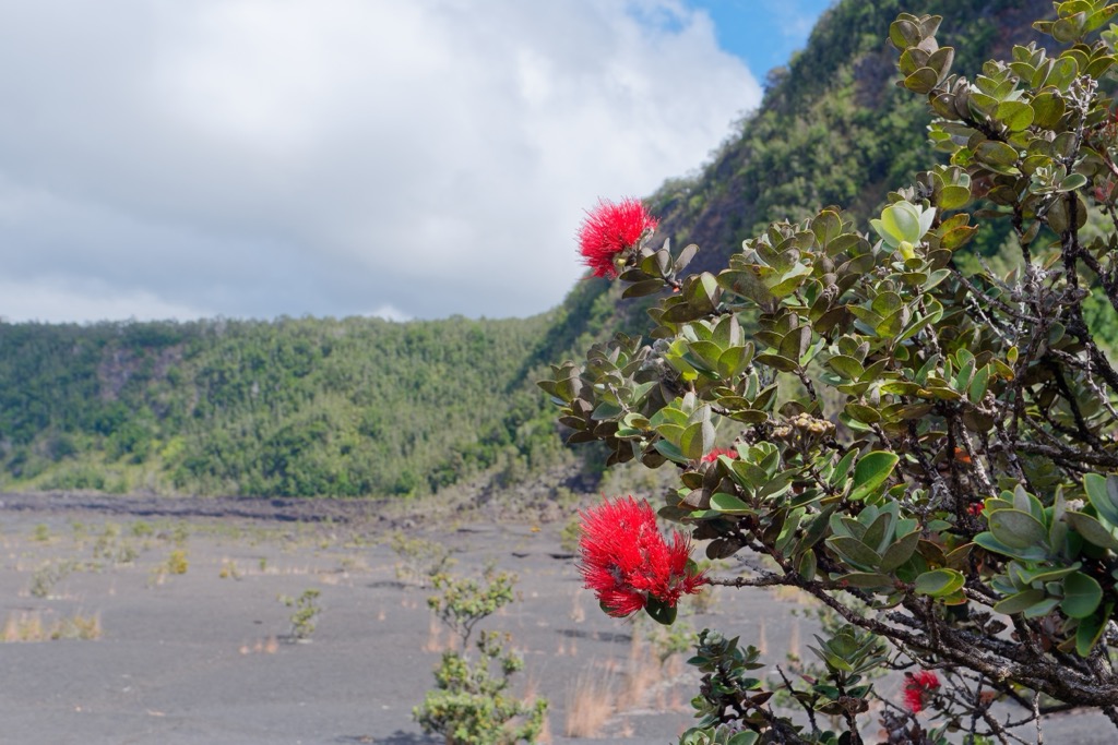
The ʻōhiʻa lehua (Metrosideros polymorpha) is one of Hawaii's most common endemic trees, known for its bright red or yellow flowers. It plays a vital role in the Hawaiian ecosystem as a pioneer species—the first to colonize after volcanic eruptions—and an essential nectar source for native birds.
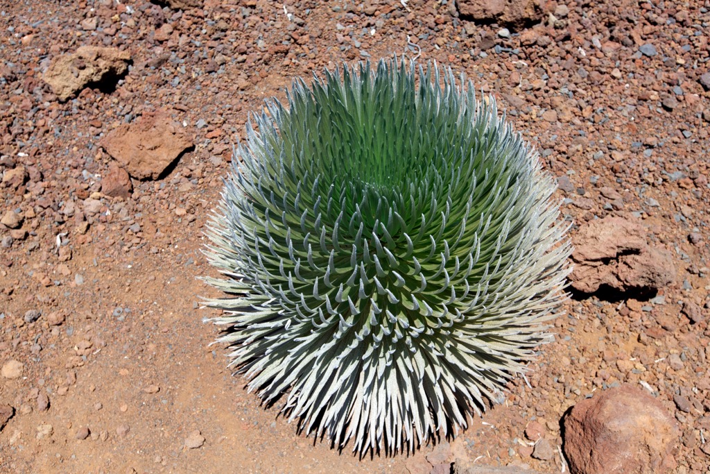
The Haleakalā silversword (Argyroxiphium sandwicense subsp. macrocephalum) is found only on the slopes of Haleakalā on Maui. This striking plant is known for its silver-green, sword-like leaves and a flowering spike reaching six feet tall. It blooms only once in its lifetime, then dies.
The Maui parrotbill (Pseudonestor xanthophrys) is a small, yellow-headed, critically endangered bird found only in the dense rainforests of East Maui. It's known for its thick, curved beak, adapted for cracking open tough seeds and branches. Hawaiian petrels (Pterodroma sandwichensis) are oceanic birds that nest in the high-elevation slopes of Haleakalā. Known locally as ʻuaʻu, these birds are characterized by their dark gray backs and white bellies and can make long-distance oceanic flights.
Axis deer (Axis axis) were introduced from Asia in the 1860s. Also known as chital, these small deer have thrived in Maui County, particularly on the islands of Maui and Lānaʻi. While not native, their significant population notably impacts the local ecology.
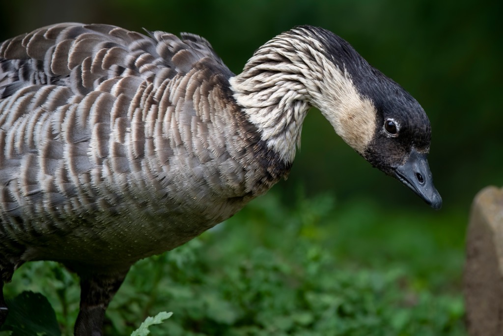
No list of Hawaiian fauna is complete, of course, without mention of the nēnē goose (Branta sandvicensis). The state bird of Hawaii, the nēnē, is an endemic species found in various habitats across Maui County and the Hawaiian islands. It is distinguishable by its buff-colored cheeks and neck and adapted to life in the Hawaiian Islands, with reduced webbing on its feet to facilitate walking on rough lava.
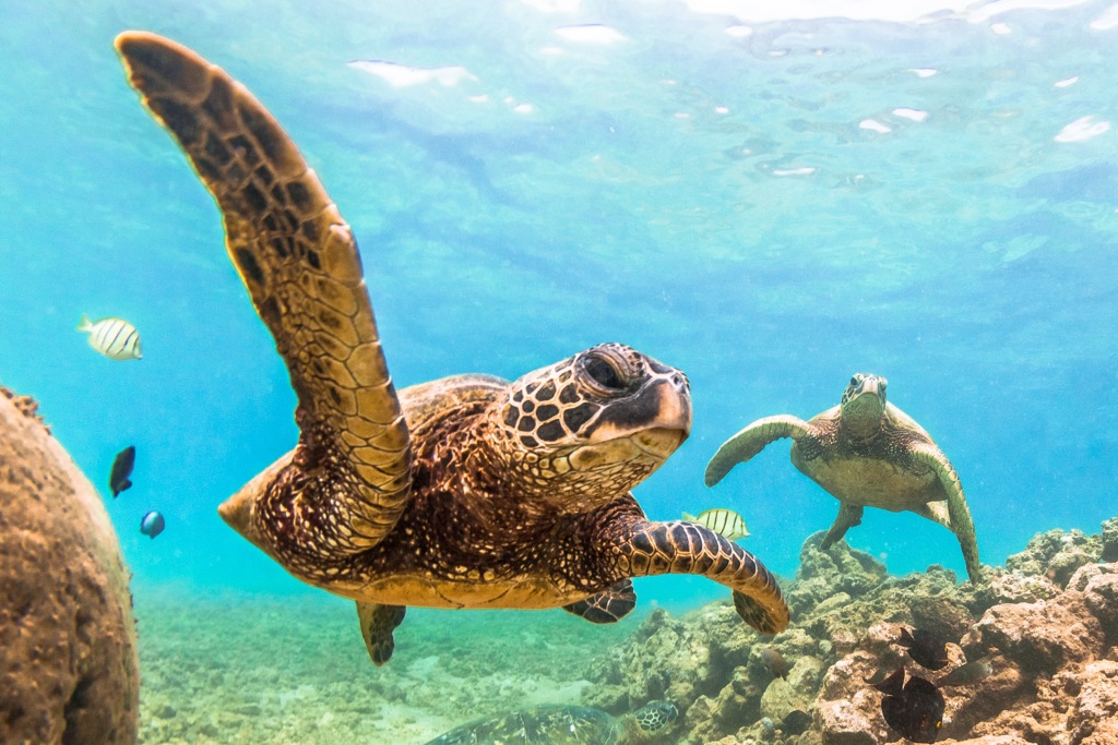
The Hawaiian green sea turtle (Chelonia mydas), known locally as Honu, is often spotted along the coastlines of Maui County. While in the waters, you may also encounter manta rays (Manta birostris), known for their large size and graceful swimming. While not endemic, they are a significant part of the marine ecosystem and a popular sight for snorkelers and divers.
As with the rest of the Hawaiian archipelago, the first inhabitants of the region today known as Maui County were Polynesians, who navigated vast stretches of ocean and arrived in the Hawaiian Islands around 300 or 400 CE. These early settlers brought plants, animals, and cultural practices, laying the foundations for future Hawaiian culture.
Before long, each island in the region developed its own chiefdoms and social structures. They built heiaus (religious temples), cultivated taro root in loʻi (irrigated terraces), and fished in the surrounding oceans. The society was organized around a kapu (taboo) system, which governed daily life.
Notable historical figures from the pre-colonial era include Piʻilani of Maui, who unified the island under a single rule in the 1500s, and King Kamehameha I, who conquered Maui in the late 1700s as part of his campaign to unify the Hawaiian Islands.
European contact began in the 18th century with the arrival of explorers like Captain James Cook in 1778. This contact introduced new technologies, diseases, and cultural changes. The 19th century saw the establishment of the Kingdom of Hawaii under Kamehameha, with Maui playing a crucial role in the kingdom's economy and politics.
Lahaina, on Maui, was the kingdom's first capital, followed by Honolulu. Along with European contact came the introduction of Christianity, which profoundly impacted the local culture, leading to the decline of the traditional Hawaiian religion and practices.
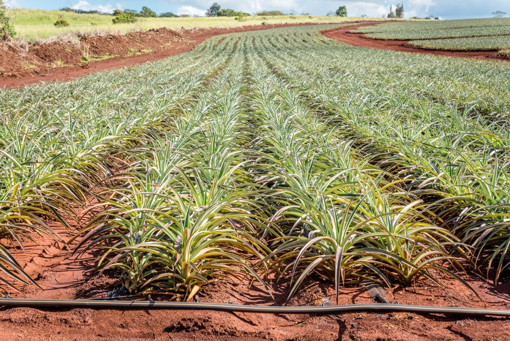
The 19th century also saw the development of sugar and pineapple plantations, which became the backbone of Hawaii's economy. This era brought an influx of workers from countries like Japan, China, Portugal, and the Philippines, creating a multicultural society. The islands of Maui and Molokai had extensive plantations, while Lanai became known as the “Pineapple Island” due to its large Dole plantation.
Hawaii’s fertile soils were also its undoing. It was a group of plantation owners that orchestrated the coup against the Hawaiian ruler Queen Liliuokalani in 1893, leading to the kingdom’s eventual demise and annexation by the United States at the turn of the century.
Like elsewhere in Hawaii, the late 20th and early 21st centuries have seen a shift from agriculture to tourism as the primary economic driver for the island of Maui.
The islands have become a world-renowned tourist destination known for beautiful beaches, natural scenery, and cultural heritage. Fortunately, efforts to preserve Hawaiian culture and natural resources have gained momentum, with numerous initiatives underway to restore native ecosystems, protect endangered species, and revive traditional Hawaiian practices. Nevertheless, these recent efforts persist against the backdrop of a changing climate, which is increasingly threatening Maui's complex and fragile ecosystems.
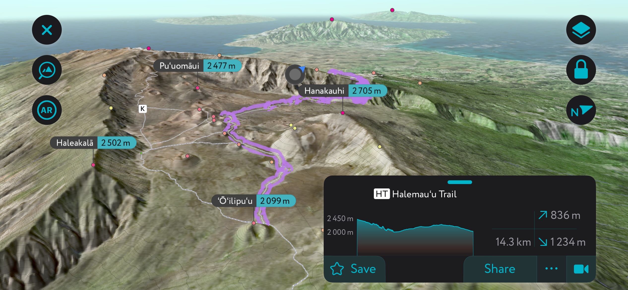
Haleakalā National Park, home to the dormant Haleakalā Volcano, Maui’s highest point, offers some of the island’s most breathtaking hikes. The best trail here is the Sliding Sands Trail (11 mi / 17.7 km), which descends into the vast crater, showcasing otherworldly landscapes and rare native plants. Hiking the Sliding Sands is a challenging and unforgettable experience, offering stunning views of the volcanic terrain and a chance to experience the quiet and isolation of the wilderness.
Iao Valley State Park is a stellar hiking destination known for its lush scenery and historical significance. The Iao Valley Needle Lookout Trail and Ethnobotanical Loop (0.6 mi / 1 km) is a short, easy hike leading to a viewpoint of the Iao Needle (1,293 ft / 394 m), a natural rock pinnacle surrounded by a verdant valley.
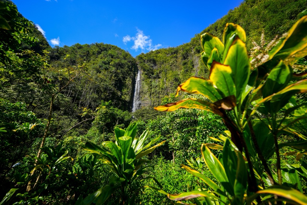
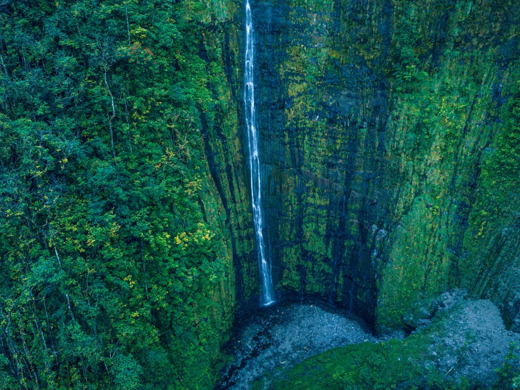
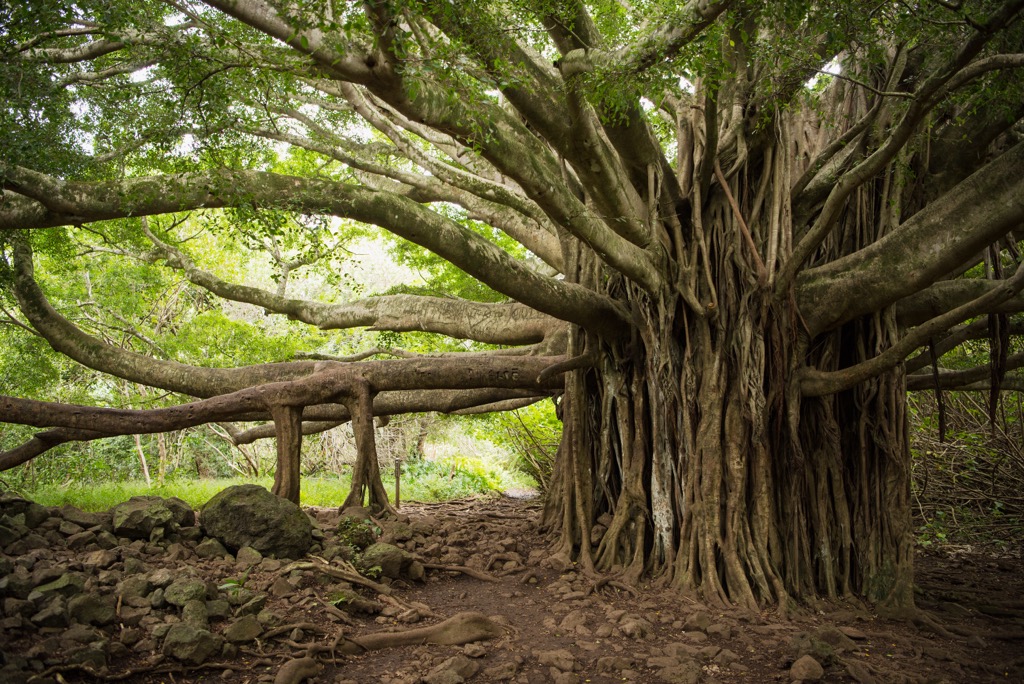
Located in the Kīpahulu District of the aforementioned Haleakalā National Park, the Pipiwai Trail (4 mi / 6.4 km) is one of Maui's most stunning hikes. This trail takes hikers past a massive banyan tree, through a bamboo forest, and finally to the spectacular Waimoku Falls, a 400-foot cascading waterfall. The trail is well-maintained and offers diverse scenery, making it a favorite for hikers seeking a moderate hike with rewarding views.
Kahului (pop. 30,000) is the largest town in Maui and serves as the island's main commercial and retail center. Located on the north shore, it is home to Maui's main airport and deep-draft harbor, making it the entry point for most visitors.
For those interested in culture and history, the Alexander & Baldwin Sugar Museum offers insights into Maui's plantation past. The Maui Arts and Cultural Center (MACC) is a premier music, dance, theater, and visual arts venue.
Outdoor activities include exploring Kanaha Beach Park, known for its windsurfing and kitesurfing conditions, and the Maui Nui Botanical Gardens, which focuses on conserving native Hawaiian plants. Kahului's central location makes it a convenient base for exploring other parts of Maui.
Lahaina, once the capital of the Kingdom of Hawaii and a historic whaling village, is one of Maui's most famous towns, with a population of 13,000. Located on the island's west side, Lahaina served as a major whaling center in the 19th century, which is evident in its historic architecture and the Lahaina Historic District. Front Street, the main thoroughfare, is lined with shops, art galleries, restaurants, and lively bars, making it a tourist hub.
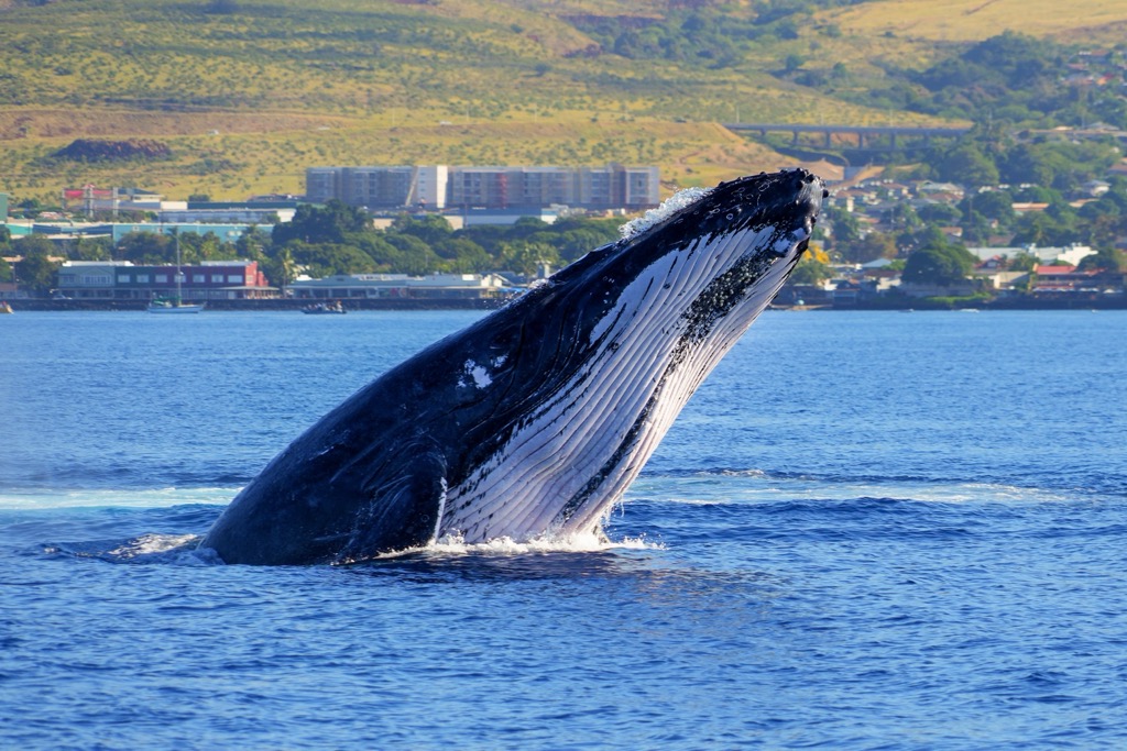
Visitors can also explore the Banyan Tree Park, home to one of the largest banyan trees in the United States, and visit the Baldwin Home Museum to glimpse 19th-century missionary life. The Old Lahaina Luau offers an authentic Hawaiian experience with traditional food, music, and dance. For marine enthusiasts, Lahaina is a gateway to whale-watching tours during winter, when humpback whales frequent nearby waters.
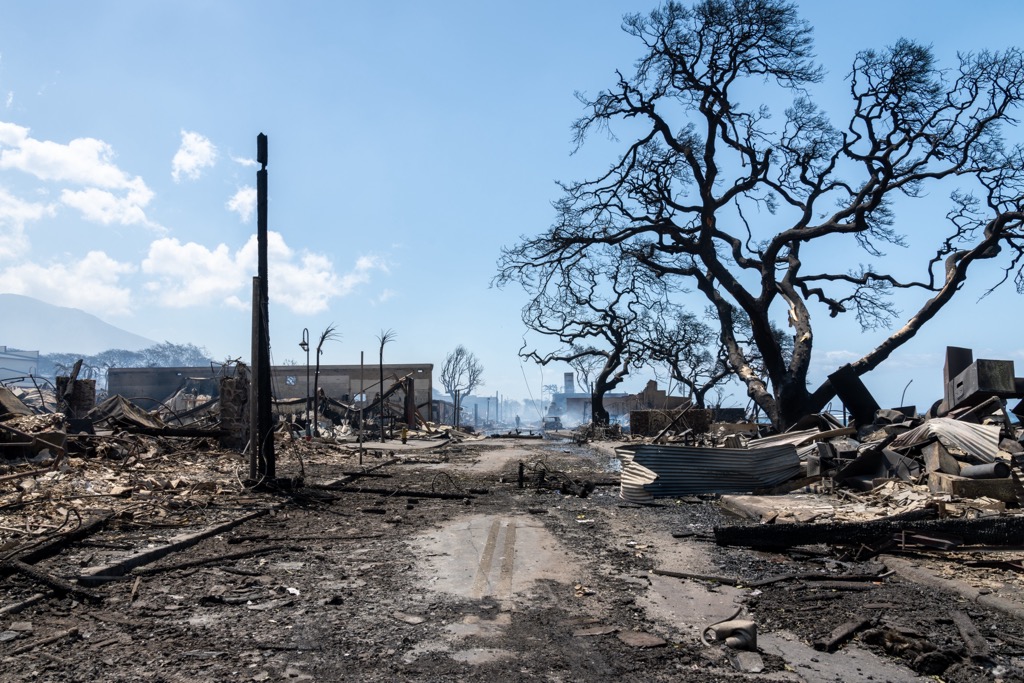
Much of Lahaina was destroyed in the August 2023 wildfires that ripped through Hawaii, killing 100 people and resulting in six billion dollars of property damage. The fire was America’s deadliest since the 1918 Cloquet Fire, which killed 453 people in Minnesota.
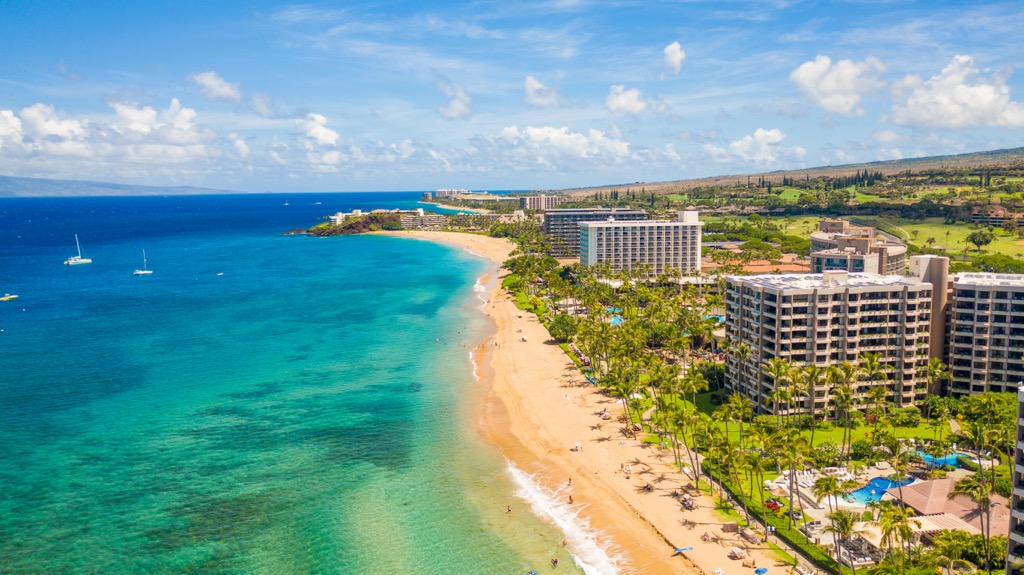
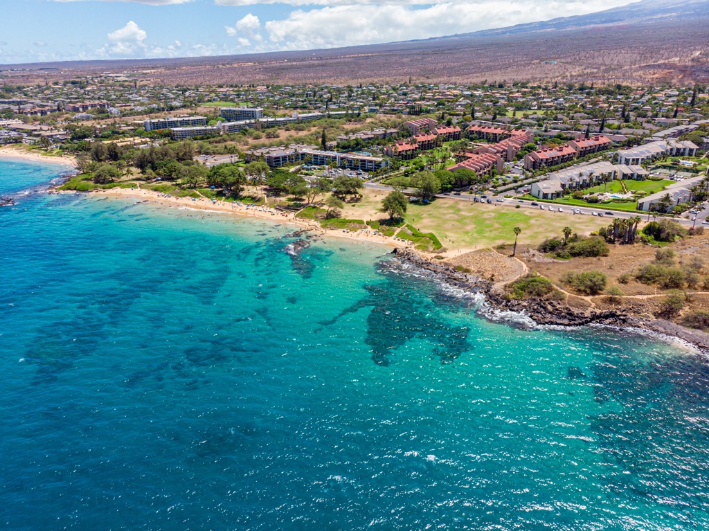
Kihei (pop. 23,000) is situated on Maui's sunny southwest coast, known for its beautiful beaches, clear waters, and favorable weather. This laid-back town is a popular destination for both relaxation and adventure. Kihei's coastline is dotted with numerous beaches, such as the Kamaole Beach Parks, perfect for swimming, snorkeling, and sunbathing. The town has a casual, beach-town atmosphere with a mix of restaurants, shopping, and lodging.
For wildlife enthusiasts, the visitor center for the Hawaiian Islands Humpback Whale National Marine Sanctuary provides educational exhibits and information about Hawaii's humpback whales. The nearby Kealia Pond National Wildlife Refuge offers a chance to see native Hawaiian birds in their natural habitat. Kihei is also an excellent location for water sports, including stand-up paddleboarding, kayaking, and diving, with several reefs and dive spots nearby.


Yes. Maui County has 399 named mountains. The highest is Red Hill at 3,055 m.
The highest mountain in Maui County is Red Hill, at 3,055 m.
Maui County has 399 named mountains.


