Scan the QR code and open PeakVisor on your phone
The West Mountains in southwestern Idaho, USA, measure approximately 75 mi (120 km) north-south and 10 - 15 mi (15 - 25 km) wide. The range is located in Adams, Boise, Gem, and Valley counties. The Boise National Forest encompasses the southern portion of the range and the Payette National Forest covers the north. There are 46 named mountains. Granite Peak (8,268 ft/2,520 m) is the tallest and the most prominent.
Located in southwestern Idaho north of Boise, the West Mountains stretch about 75 mi (120 km) north-south and 10 - 15 mi (15 - 25 km) wide. Occupying the Adams, Boise, Gem and Valley counties, the mountains form the western boundary of the Long Valley. The North Fork Payette River drains from the eastern slopes.
The southern part of the range lies within the 2.6 million acre (1.05 million ha) Boise National Forest and the northern portion is part of the 2.3 million acre (930,000 ha) Payette National Forest. Although it is a scenic range in a popular area, the mountains do not receive as many visitors as nearby mountains because of the modest peaks. The tallest peaks in the range are Granite Peak (8,268 ft/2,520 m) and Snowbank Mountain (8,189 ft/2,496 m).
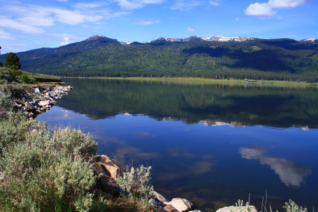
Nearby recreation sites include the Tamarack Ski resort and Lake Cascade State Park on eastern edge of mountains.
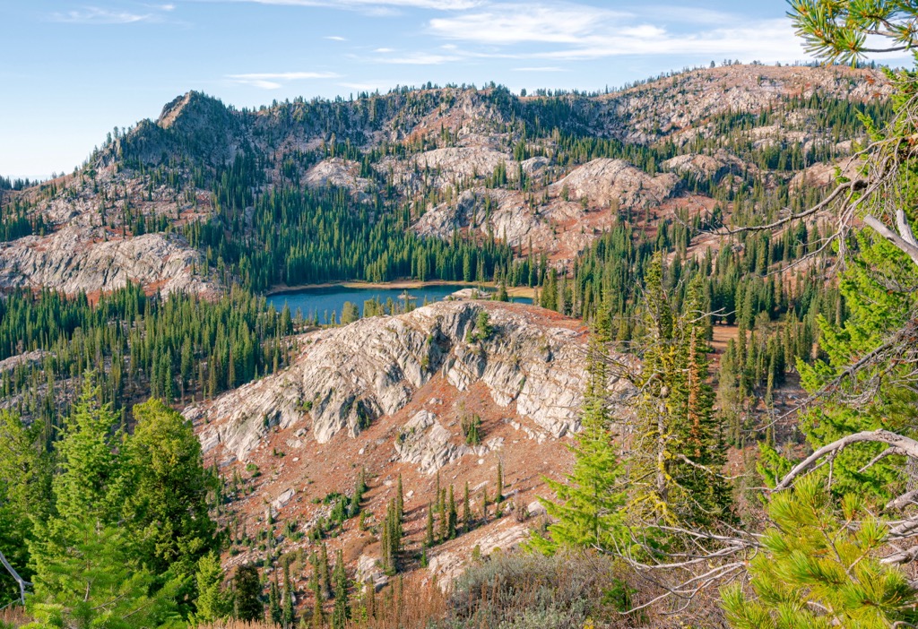
A long granite ridge with a few rugged peaks forms the West Mountains. It is made up of Idaho Batholith granite.
The batholith began forming during the late Cretaceous Period between 100 and 64 million years ago. At this time, the ocean floor of the Pacific Plate subducted under the continental North American Plate. The intense pressure and heat melted the subducted plate and created magma chambers miles beneath the earth’s surface.
The liquid magma was lighter relatively than the surrounding rock and rose upwards, encompassing the surrounding rock as it did. About ten miles (16 km) deep, the magma began to cool and harden, forming the granitic Idaho Batholith. Millions of years of uplift, erosion, and stream cutting eventually exposed the batholith and gave the mountains their current shape.
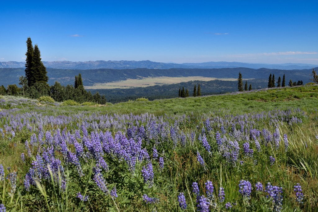
Split between the Boise and Payette National Forests, the range supports mainly conifer forests. Ponderosa pine, Douglas fir, Engelmann spruce, lodgepole pine, grand fir, subalpine fir, western larch, and whitebark pine are common. The high country boasts meadows and mountain lakes. Sagebrush steppe grows at lower elevations in some places. Streams on the eastern slopes drain into the North Fork Payette River.
The mountains support a wide range of wildlife including mule deer, elk, mountain goats, black bears, mountain lions, coyotes, foxes, and a number of small rodents. Many of the streams and lakes support native trout populations.
Southwestern Idaho is the traditional territory of the Shoshone-Bannock tribes. Both tribes were semi-nomadic and migrated seasonally for fishing, hunting, and berry gathering opportunities. They had a strong horse culture and hunted bison from horseback.
The Bannock came from the west and frequently overlapped with the Shoshone tribe. They had peaceful relations and frequently intermarried, not to mention shared a mutual opponent in the Blackfeet of Montana where they would travel to hunt bison.
As settlers began arriving, competition for resources created tension with indigenous groups. The Shoshone-Bannock signed peace treaties in 1863 and 1868 in what is known as the Fort Bridger Treaty. It created the Fort Hall Reservation in southeastern Idaho.
Boise National Forest was established in 1908 and Payette National Forest in 1944.
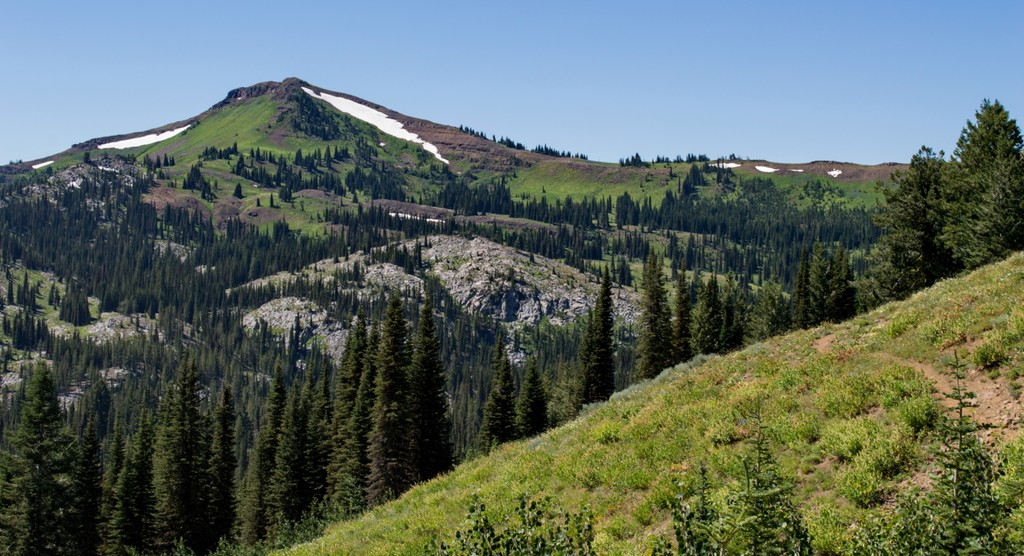
The West Mountains offer hiking, mountain biking, horseback riding, and ATVing opportunities. With smaller peaks, the mountains tend to see less traffic than nearby taller peaks but still have beautiful forest, streams, and vistas across surrounding mountains and valleys.
The West Mountain Trail ascends the West Mountain ridge after climbing from the valley through forests and meadows. The trail spans a total of 16.1 mi (25.9 km) but can be made shorter. The route passes Snowbank Mountain, Jacob’s Ladder, Hangman’s Tree, and Tripod Lookout.
The trail to Council Mountain Hot Spring is 4.5 mi (7.2 km) out and back with 1,245 ft (379 m) of elevation gain. The trail is pretty although with little shade along the way and only lightly used. The hot springs can run quite hot and then cold and may be shallow at times. While it makes a nice end destination, don’t go with the expectation of regulated hot spring pools.
The Blue Lake Trail is a gentle 1.6 mi (2.6 km) out and back with 380 ft (115 m) elevation gain. The trailhead is high so the trail actually begins with a short descent before leveling out and arriving at the lake. It can be rocky in places. This is considered a great hike for families or new hikers, easy with a rewarding final destination. The road to the trailhead can be rough and is best done in a high clearance vehicle.
Boise, Idaho is two hours drive south of the mountains and the resort town of McCall, Idaho is about 2.5 hours to the north. Other large cities are a bit of a trek with Salt Lake City, Utah, Bozeman, Montana, and Portland, Oregon being seven, nine, and ten hours away, respectively, by car.
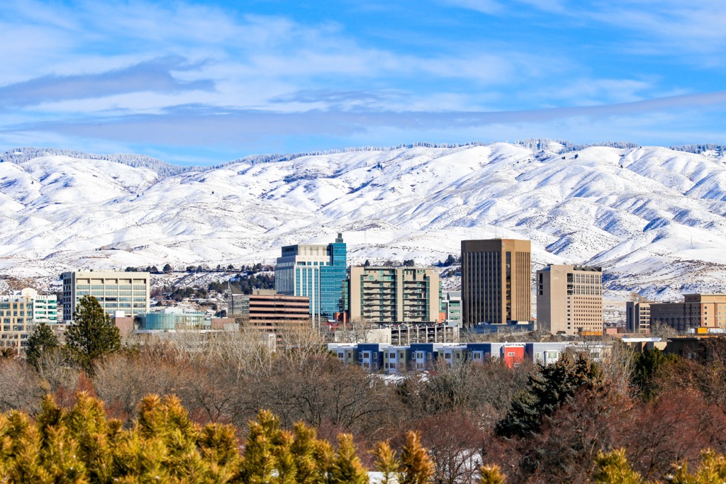
Home to 240,000 people, Boise, Idaho is perfectly situated for outdoor enthusiasts. Surrounding the city are hot springs, trails for mountain biking and hiking, streams and lakes for fishing, and great slopes for skiing and snowboarding. The hike up Table Rock Trail is a popular one near the city with great views from the top. It is 3.4 mi (5.5 km) one way and gains just under 1,000 ft (305 m).
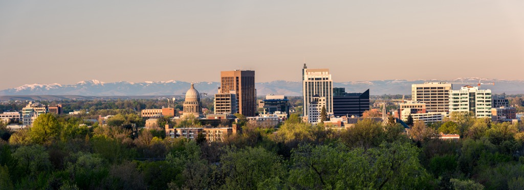
In the city itself, check out the Boise Art Museum, the Idaho Black History Museum, and the Basque Museum and Cultural Center for a taste of the state’s culture and history. The city has food halls and a modest selection of restaurants and cuisines. There are plenty of hotels from fancy to budget, and campsites and RV parks nearby.
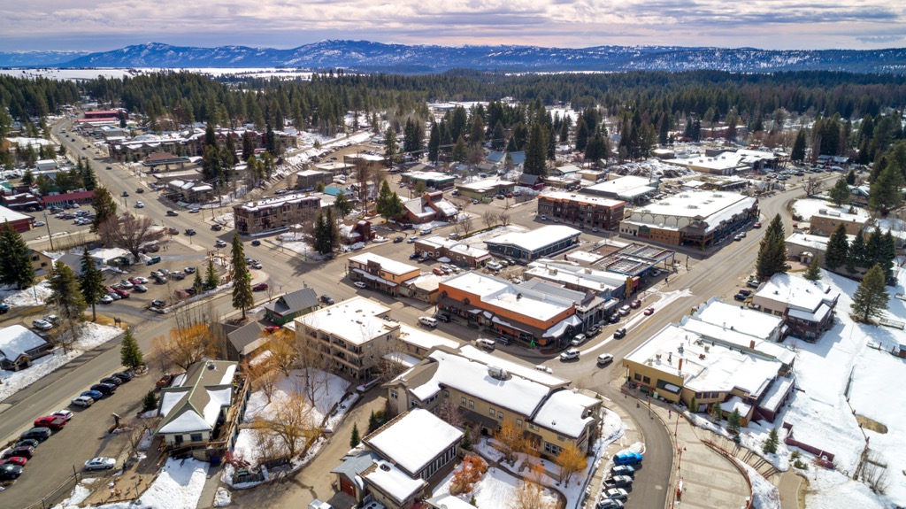
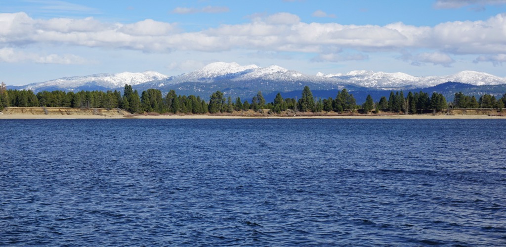
McCall is a resort town that is home to nearly 4,000 people. The downtown lies on the shores of Payette Lake. Ponderosa State Park and three ski resorts are nearby. The town offers quick access to many trails for hiking and biking, as well as great spots for rock climbing and fishing.
If you’re looking for a bite to eat, you’ll find options including bakeries, pubs, bistros, barbecue, Mexican, Italian, Asian, and fine dining. There are resorts, lodges, hotels, campsites, and RV parks for accommodation.