
Scan the QR code and open PeakVisor on your phone
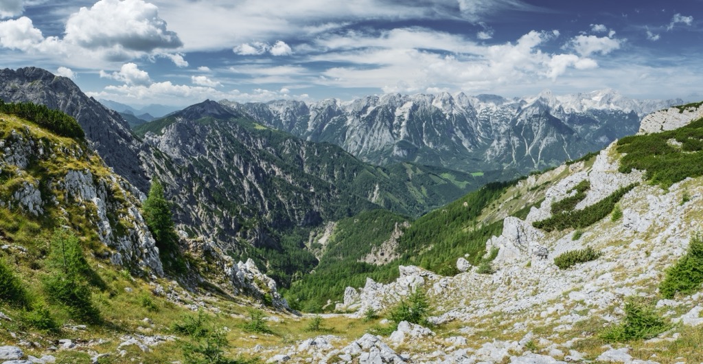
The Totes Gebirge, or the ‘Dead Mountains’ in English, is a mountain range and extended plateau located along the border of Upper Austria and Styria in the country of Austria. It is part of the Salzkammergut and Upper Austria Alps in the Northern Limestone Alps. There are 612 mountains in the Totes Gebirge; Großer Priel is the tallest (2,515 m / 8,251 ft) and most prominent (1,710 m / 5,610 ft).
The Totes Gebirge (‘Dead Mountains’ in English) is part of the Salzkammergut and Upper Austria Alps and lies along the border of Upper Austria and Styria in Austria.
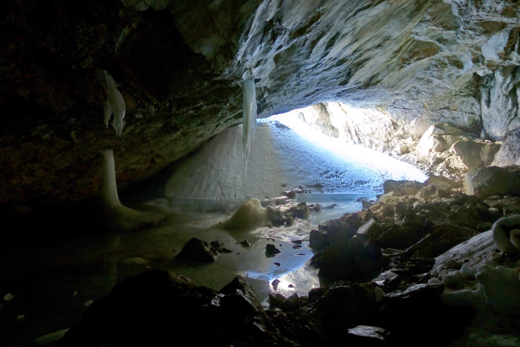
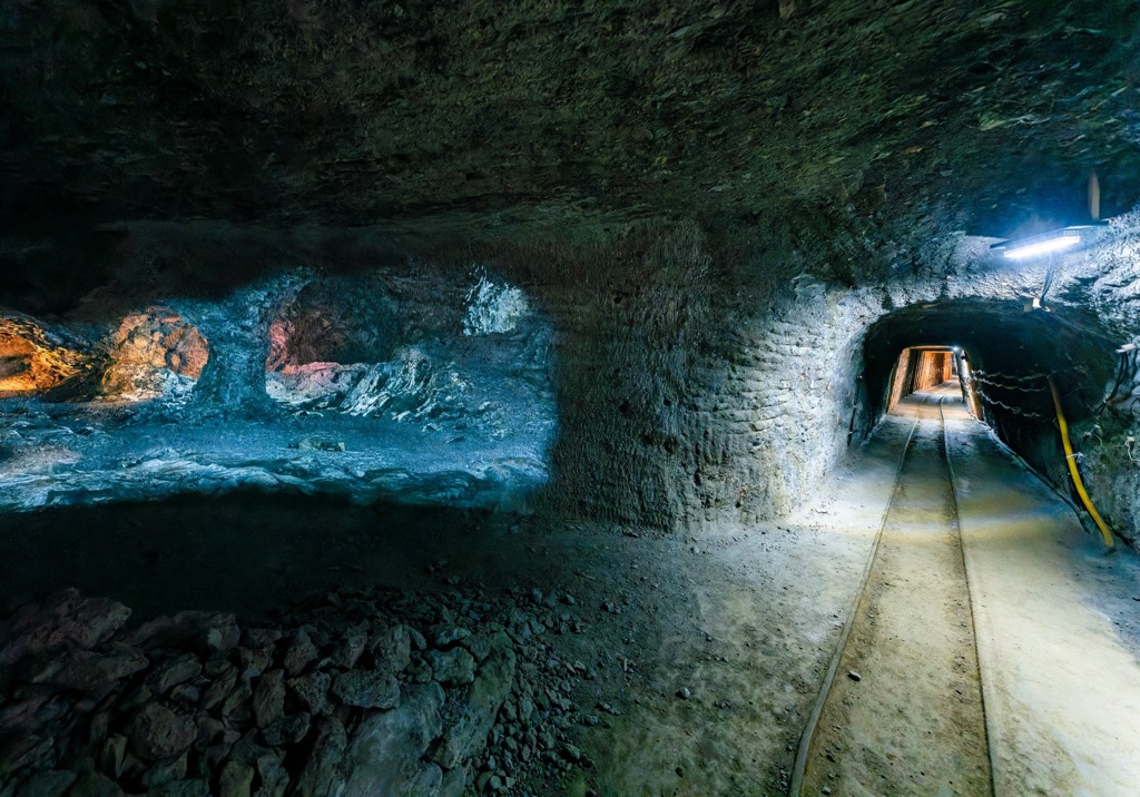
The range contains an arid plateau, steep cliffs on the Styria-facing side, and extensive karst formations, including hundreds of caves, gorges, crevices, and shafts. After all, the region is part of the Austrian Northern Limestone Alps; soluble rocks like limestone are conducive to the formation of karst features. The Schönberg Cave in the western part of the range is the longest in the Eastern Alps, extending an impressive 135 km (84 mi) long and reaching a depth of 1,061 m (3,481 ft).
Although the area receives relatively high precipitation, the upper slopes and plateau are dry, with little vegetation. With widespread limestone, the ground is soluble. Water quickly drains into the karst waterways and emerges as springs in the valleys far below.
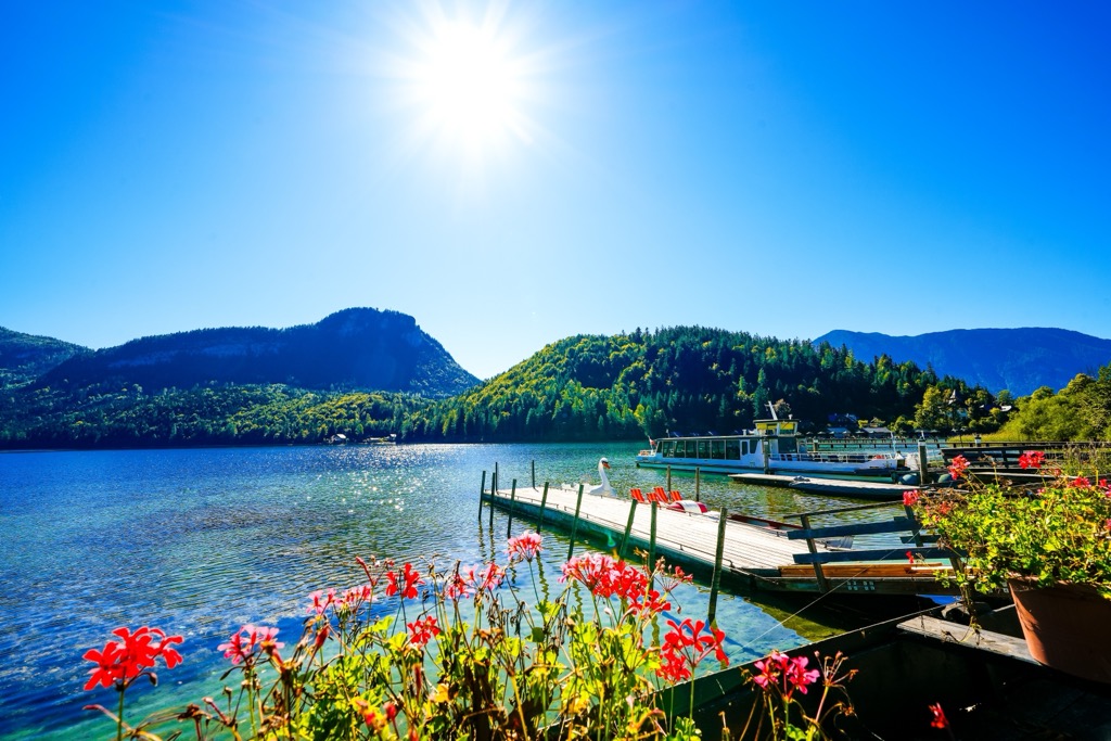
A few large lakes, such as the Grundlesee and the Altausseer See, sit in the mountain’s southwest basin, where the Traun Glacier once sat. Altausseer See has been less disturbed by humans and maintains a relatively pristine state.
The mountains are divided into three sections – the Priel Group, the Warscheneckstock Group, and the Schönberg Group – and are neighbored by the Salzkammergut Mountains and Ennstaler Alps.
The most notable feature of the Totes Gebirge is its karst formations. The range primarily comprises carbonate rocks such as Dachstein limestone, Wetterstein limestone, sandstone, and siltstone. The range contains over 600 caves, enormous gorges, and crevices that drain water into springs in the valleys below.
The geologic history of the Alps dates back over 200 million years. Around this time, Pangea began to split along the Eurasian and African plates, creating a shallow seaway known as the Tethys Sea, where sediment and shells collected on the ocean floor.
During the early Cretaceous era, around 140 million years ago, the African plate drifted north, pushing sediment and folding deposits on the ocean floor over each other. This process formed Dachstein and Wetterstein limestone, two rock types found in the range.
The Alpine orogeny raised the Alps when the African and Eurasian plates collided. The collision has been ongoing since Cretaceous times. The majority of mountain building occurred between 65 and 2.5 million years ago. The uplift no longer outpaces the rate of erosion, so the Alps are not considered a growing range.
Several fossils have been discovered in the Dachstein limestone, including pachyrisma grande mollusks and megalodon fossils whose shape resembles a cloven cow track. Meanwhile, a Mystriosuchus fossil, an enormous marine reptile from the Triassic era, was discovered around 2,000 m (6,560 ft) above sea level.

A fault zone runs west of the Lawinenstein to the Salzteigjoch, splitting the range into eastern and western portions. As the last ice age ended, glaciers formed large lakes in the region, leaving behind large moraines. The area has some history of mining for gypsum and anhydrite, although there is a notable lack of salt mining even though neighboring ranges have been mined for salt extensively.
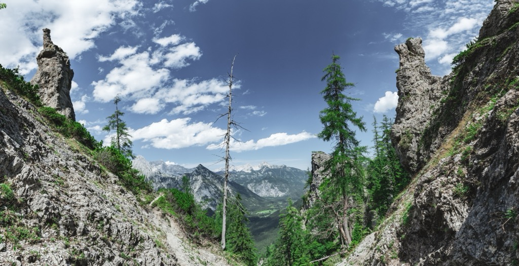
The Totes Gebirge is protected as a Natura 2000 area. The subalpine forest supports conifers like spruce, larch, and Swiss pine. There is no clear tree line, but rather, there is a gradual fade between plant communities. As elevation increases, spruce and larch decrease and Swiss pine dominates. Alpine meadows stretch along the slopes with wildflowers blooming in summer. The upper plateau has relatively little vegetation, featuring karst formations and fossilized snails, corals, and shells.
Ranging from lower elevations around Lake Altaussee up along the slopes, the Totes Gebirge is home to a variety of wildlife. Avian species include goshawks, sparrowhawks, common sandpipers, Tengmaim’s owl, rock partridges, golden eagles, gray herons, tufted ducks, eagle owls, grouse, swans. For mammals, deer, rodents, and many bats, such as the lesser horseshoe bat and the greater mouse-eared bat, make their home here.

Humans have inhabited this region of Europe for tens of thousands of years, with homo neanderthalensis preceding homo sapiens. Human artifacts from the Middle and Upper Paleolithic have been discovered in some of the caves of the Totes Gebirge, along with remains of prehistoric bears and other animals.
The arid range has been striking in the modern industrial period due to its lack of salt mining. Where other places nearby, such as the area around Hallstatt and the Sandling massif, have supported salt mining activities sometimes for thousands of years, the Totes Gebirge is relatively devoid of this essential resource.
Human use of the slopes has altered the ecological composition. For example, the average treeline is around 1,800 m (5,905 ft) but historically lay over 2,000 m (6,560 ft). Where alpine pasture has been left unused, mountain pines are becoming more widespread at lower altitudes than where they have grown in the past.
Forests in the protected area have now been preserved for two centuries. Without significant mining resources and being arid at upper elevations, much of the alpine zone is relatively undisturbed. The Cumberland Wildlife Park lies on the northern edge of the Totes Gebirge, preserving critical habitats and species from the range.
Sigmund Graf and several hunters made the first recorded ascent of Großer Priel in 1817. Meanwhile, Hinterstoder is famous for its World Cup ski races, the first of which took place in 1986.
As a relatively undisturbed range, the outdoor recreation in The Totes Gebirge has dozens of mountain huts, ski resorts, and trails that are great for both summer and winter trekking. Public transport makes it easy to get to multiple starting points, and there are numerous variations you can put together for multi-day hikes and ski tours across the range.

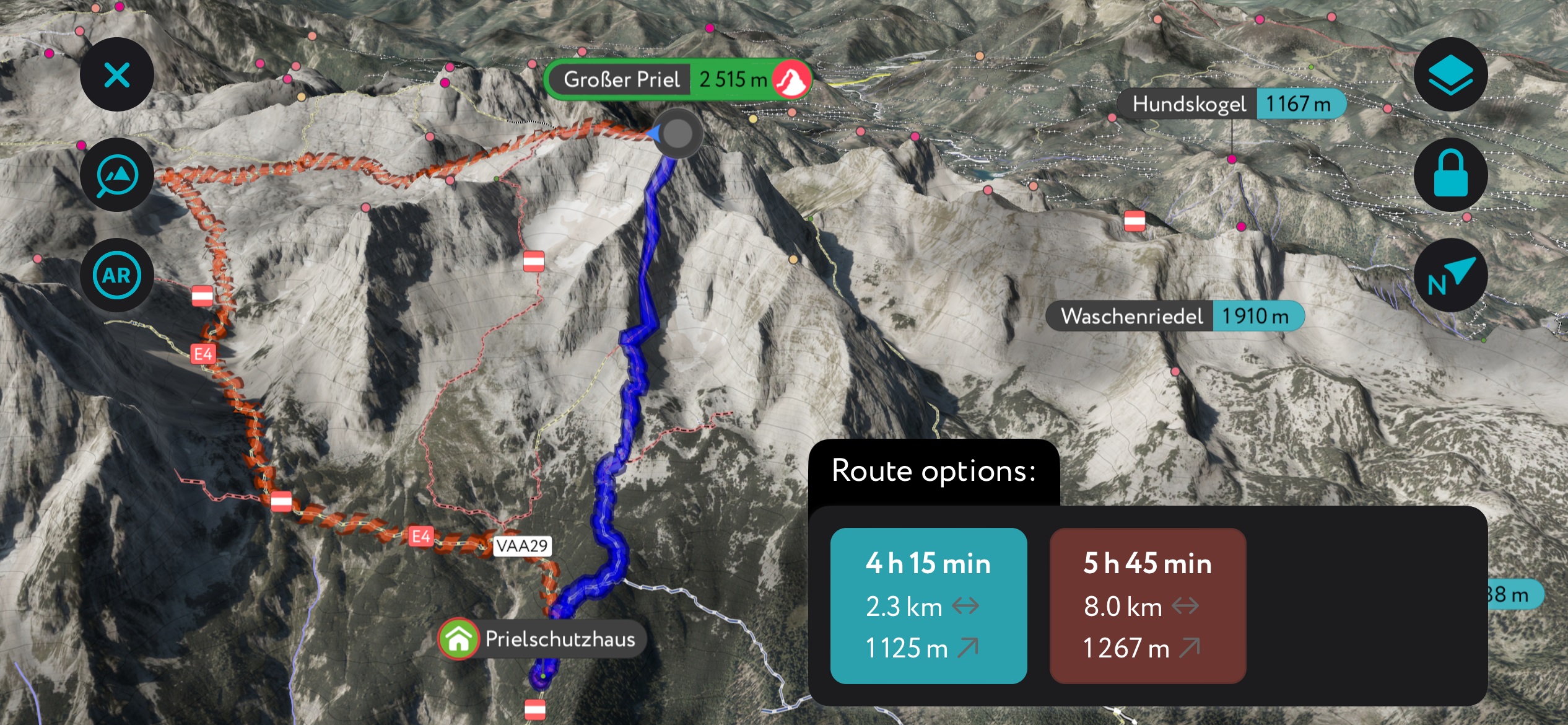
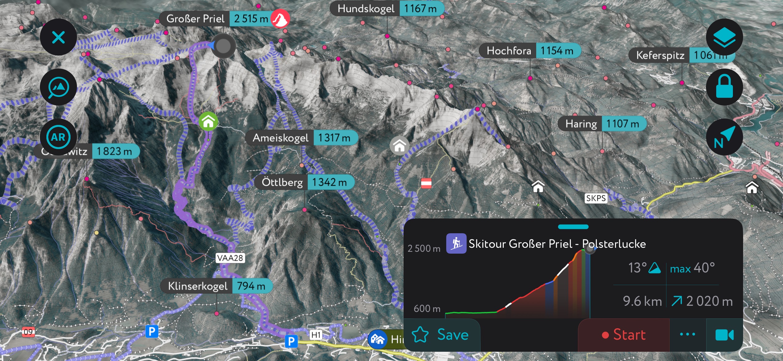
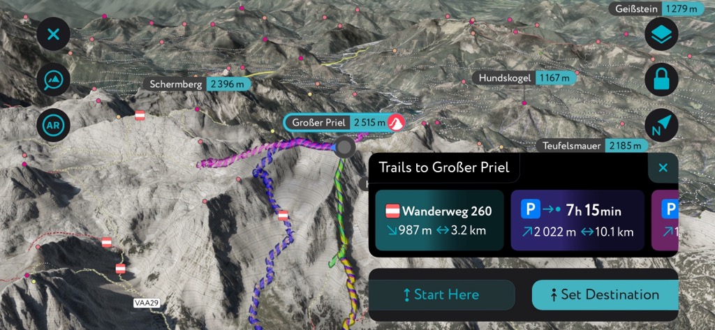
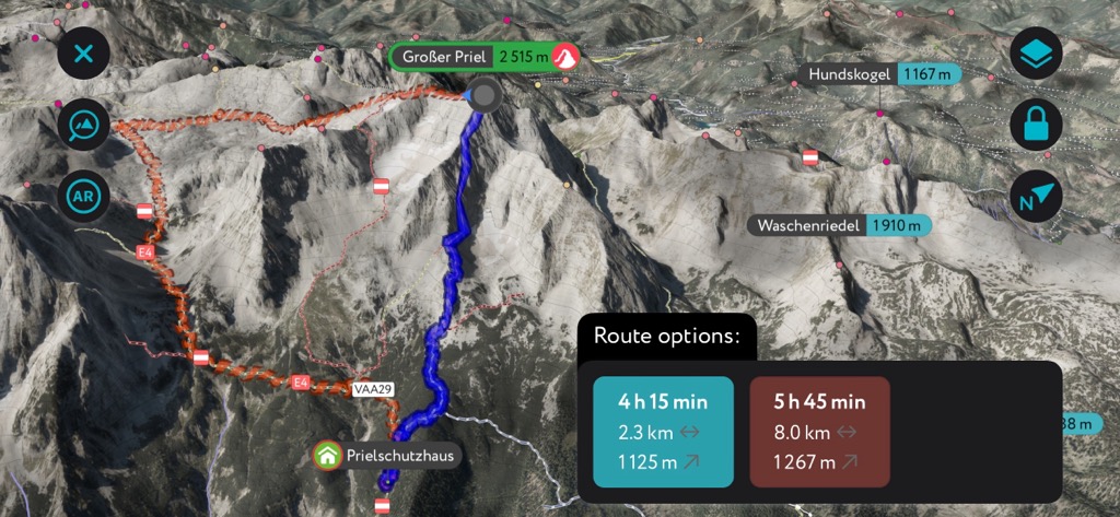
Großer Priel (2,515 m / 8,251 ft), the tallest peak in the range, is commonly reached from the Prielschutzhaus on the south or the Welser Hütte on the north side. Once at the summit, multiple trails lead from Großer Priel to the rest of the plateau.
From the south side, the hike begins a few kilometers beyond the Schiederweiher car park. From there, the route climbs steeply to Prielschutzhaus, taking around two and a half hours. From the hut, the trail continues to the ridge wall of Großer Priel. An option for a popular via ferrata section is classic but requires a harness, mountaineering experience, and basic via ferrata skills. The alternative follows Kuehkar and crosses over Brotfallscharte to reach the summit ridge.
The route is nearly 14 mi (22 km) long and gains over 7,300 m (2,225 ft) of elevation as an out-and-back hike. One option is to descend to the Welser Hütte and drive to the parking lot at Almtalerhaus.
One itinerary for a multi-day hike through western and central Totes Gebirge is a five-day route that begins at Rettenbachtal and ends at Hinterstoder. From the first through the fourth night, hikers can stay at Ischler Hütte, Appelhaus, Pühringerhütte, and Prielschutzhaus. This route is 45 km (28 mi) with about 3,000 m (9,845 ft) of elevation gain.
Most of the trails along this route are easy and well-marked, although the east ridge of Schönberg is steep and supported by a wire rope, and the plateau’s karst terrain requires good fitness and navigation.
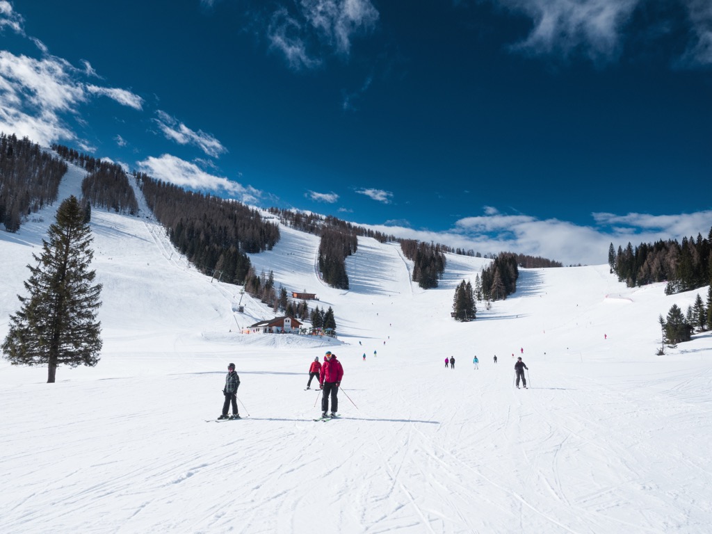
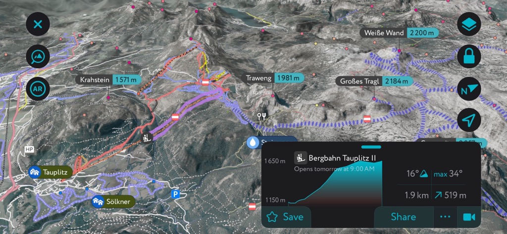
The Die Tauplitz Ski Resort rises above Bad Mitterndorf, offering 43.5 km (27 mi) of slopes and 2 km (1.2 mi) of ski routes accessible via 15 lifts. The resort lies in one of the snowiest parts of the Alps and has routes for all levels, ranging from beginner to experienced freeriders. If you want to stay in the heart of it all, the resort village of Tauplitzalm has rustic lodges and hotels with immediate access to the slopes.
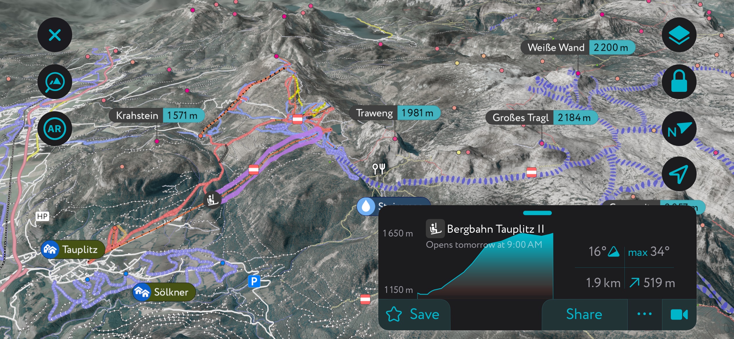
In summer, the area is open for hikers to enjoy the lakes, alpine zones, and mountain meadows. The recreation options include more challenging hikes, such as summitting Almkogel or the family-friendly lakes route in Krallersee, Großee, Märchensee, Tauplitzee, Steirersee, and Schwarzensee.
Hinterstoder is another large ski resort with 40 km (25 mi) of slopes and 13 lifts. The slopes are varied for all levels. More advanced skiers can take advantage of the Hannes-Trinkl World Cup run and the SNOWtrail adventure slope.
The Totes Gebirge gets plenty of snow most winters, much more than many other parts of the Alps. The continental influence brings colder air and many powder days. With mountain huts scattered throughout the range, ski touring is the thing to do here in the winter.
The PeakVisor app has dozens of routes throughout the range, but let’s get right to the prize: the Großer Priel. It’s the highest peak in the Totes Gebirge and is best accessed in two days, with a stopover at the lovely Prielschutzhaus. The best thing about this route is that you can ascend on sunny south faces and descend via the shadowy north face for a steep and powdery descent. You’ll have to skin back up or arrange transportation because you won’t finish where you started.
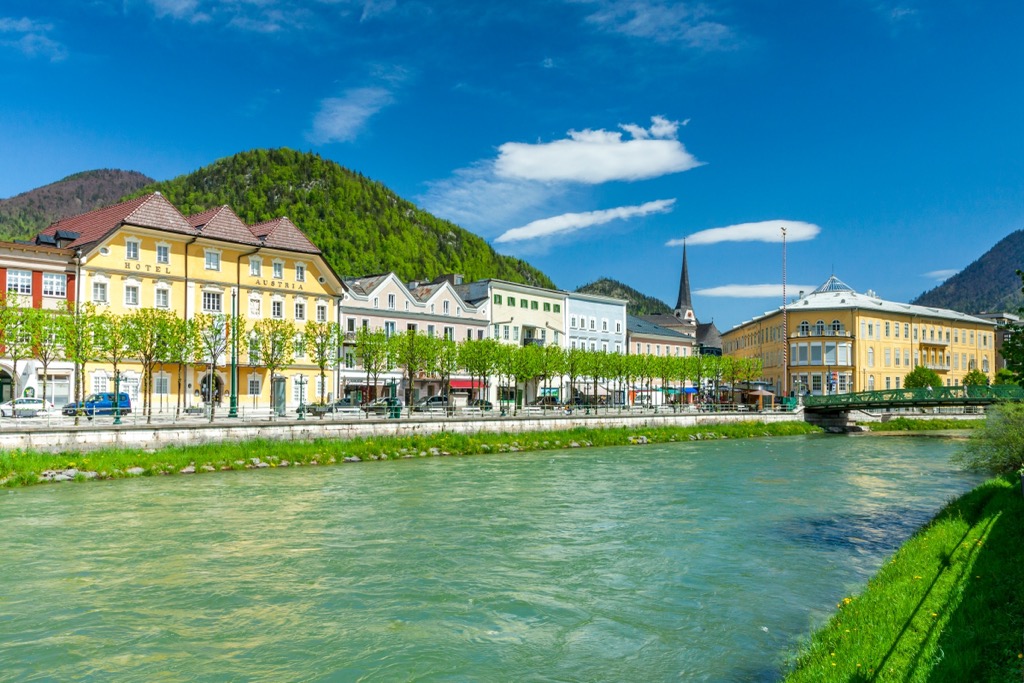
Ski resort towns like Hinterstoder and Tauplitz are great spots if you want to be based directly in the mountains. Suppose you’re coming from a bit further away or looking for cultural components added to the mix. In that case, Bad Ischl is considered the gateway to the Salzkammergut Lakes District, while Salzburg is a major city a little over an hour’s drive from the southern portion of the Totes Gebirge.
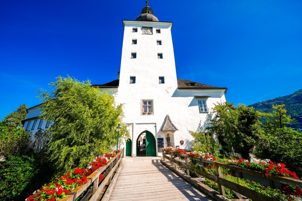
Bad Ischl, an elegant and picturesque spa town, is the gateway to the Salzkammergut region and has a population of slightly over 14,000. Centrally located, buses and trains run regularly from Bad Ischl to other villages. It is the biggest town in the area with a wide variety of accommodation options, including for travelers on a budget.
The town once served as the summer home of Habsburg emperor Franz Joseph I. The emperor’s former residence, the Kaiservilla, is open for tours. These guided tours are often lengthy and best if you have more than one day in town.
Other attractions include visiting the City Museum to learn about the local history and stopping at the thermal spa. The Katrin cable car runs to the top of Katrin, where a restaurant offers regional dishes with seasonal ingredients. You can also hike up or down in lieu of the cable car.
Bad Ischl's central location makes it an excellent base for day trips to the mountains and other villages. Hallstatt, a UNESCO World Heritage Site, is a popular (some may say too popular) destination for its location on Lake Hallstatt, access to hiking trails, and proximity to the Dachstein Ice Cave and the Mammut Cave.
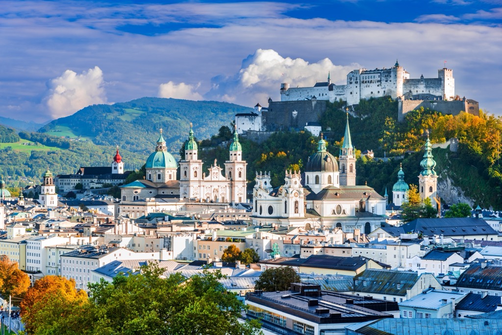
Salzburg is Austria’s fourth largest city and home to just over 150,000 people. It has an international airport and is a UNESCO World Heritage Site. With a well-preserved historic center, festivals throughout the year, and a backdrop of mountains and clear lakes, the city draws many tourists each year.
Upon arriving, you can orient yourself to town with a guided or self-guided tour. A few must-see historical sites include the Salzburg Cathedral, the medieval Hohensalzburg Fortress, and Mozart’s home.
The city hosts numerous festivals, including the Salzburg Festival in July and August and Mozart Week in January. Several elaborate gardens are worth visiting. For a day trip, visitors can reach the scenic village of Hallstatt on the banks of Lake Hallstatt in just over an hour. Salzburg’s proximity to the mountains and its urban amenities offer visitors a cultural experience while working as a base for day hikes or a kick-off point for longer treks.
Salzburg’s downtown is pedestrian-friendly. The city is well connected to the region via buses and trains, making it easy for visitors to get from the urban center into smaller mountain towns.


