Scan the QR code and open PeakVisor on your phone
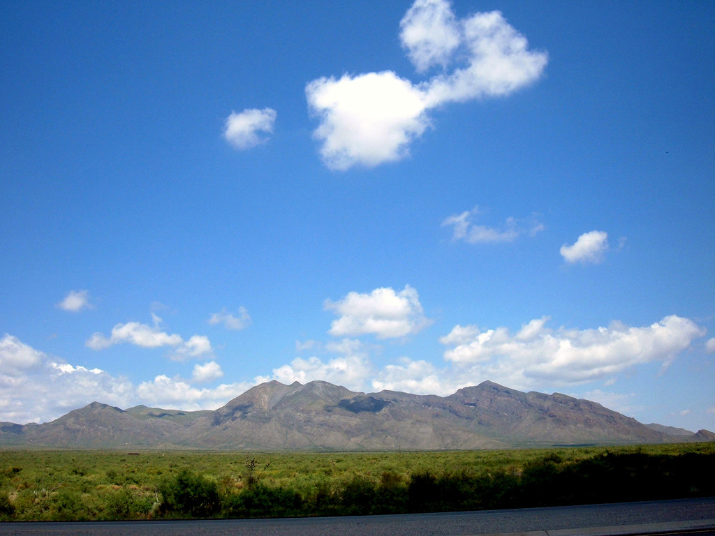
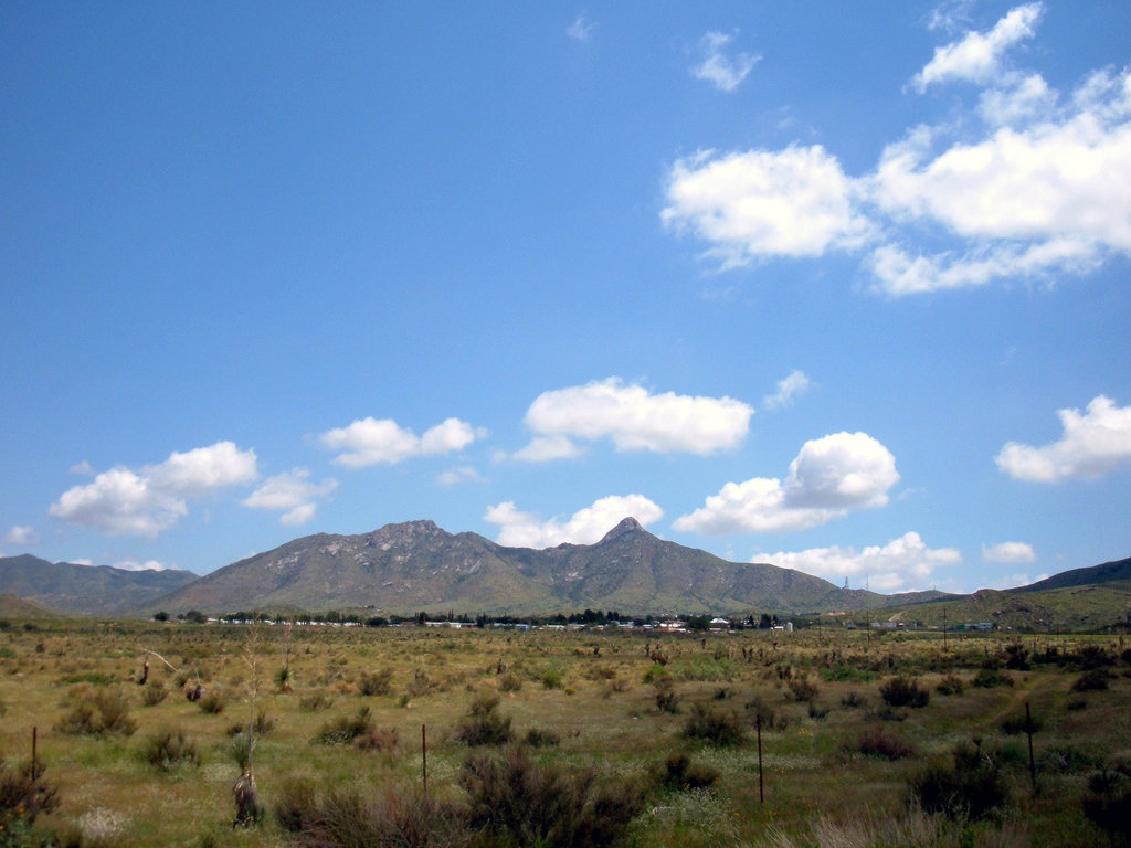
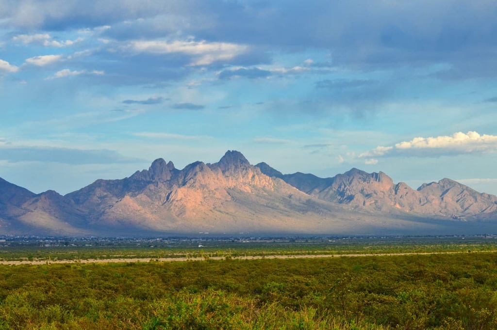
The San Andres Mountains run approximately 80 mi (130 km) long north-south and 12 mi (20 km) wide through Sierra, Doña Ana, and Socorro counties in south central New Mexico, USA. The range lies within the White Sands Missile Range and is therefore closed to public access. Of the range’s 47 mountains, Salinas Peak is the tallest at 8,973 ft (2,735 m) and the most prominent (3,622 ft/1,104 m).
Located in Sierra, Doña Ana, and Socorro counties in south central New Mexico, the San Andres Mountains measure around 80 mi (130 km) long north-south and 12 mi (20 km) wide. They are neighbored by White Sands National Park to the east, the Organ Mountains-Desert Peaks National Monument and Organ Needles Study Area to the south, and the Jornada Experimental Range to the west.
The White Sands Missile Range (WSMR), a 2.2 million acre (890,300 ha) U.S. military installation, encompasses the mountains. For this reason, although there are some access roads for those working and living there, the range is closed to the public. Nearby to the north is Trinity Site where the first atomic bomb was tested in 1945.
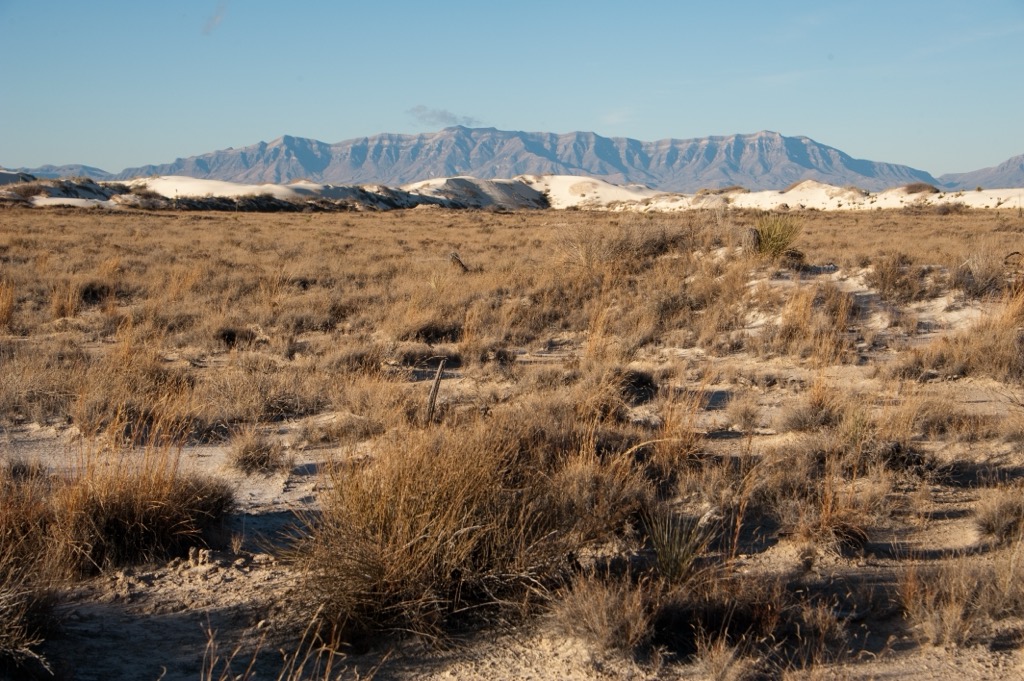
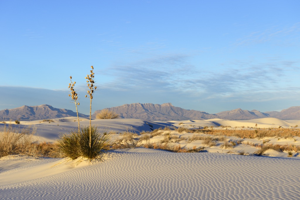
The mountains occupy the northern edges of the Chihuahuan Desert. To the east is the Tularosa Basin, to the northeast is Oscura Peak, and to the northwest is the Jornada del Muerto – a desertous stretch of the historic Camino Real.
The southern portion of the range lies within the boundaries of the San Andres National Wildlife Refuge. The refuge protects 57,215 acres (23,154 ha) with perimeters measuring more than 20 mi (32 km) long and about 6 mi (10 km) wide. It was established in 1941 to protect desert bighorn sheep populations.
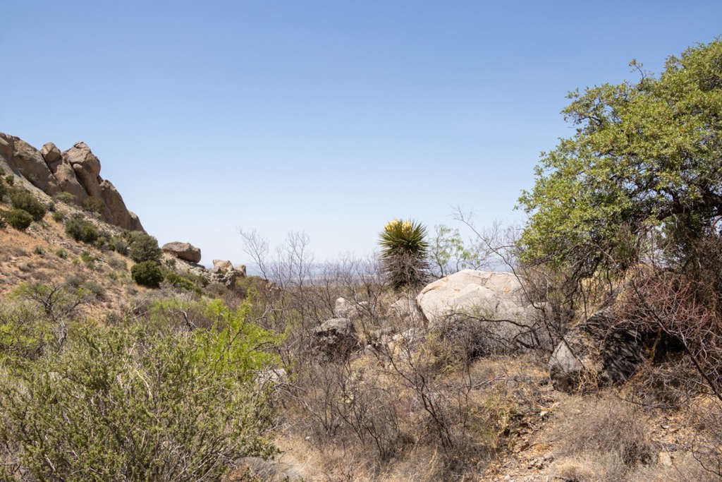
The San Andres Mountains are fault-block mountains and part of the Southwest Basins and Ranges, a geologic province that stretches across the United States’ southwest in a series of mountains and valleys. Along the lower regions of the eastern escarpment, exposed Precambrian rocks include granites, schists, gneisses, and amphibolites intersected by pegmatite and diabase dikes.
From Sulphur Canyon to south of Hembrillo Canyon are exposed micas, quartz-feldspar schist, quartzite, amphibolite, phyllite, talc schist, talc, and dolomite. In areas these rocks are overlaid by sandstones and limestones. Some of the range’s high ridges between 7,000 and 8,000 ft (2,130 and 2,440 m) are made up of Middle Pennsylvanian limestone.
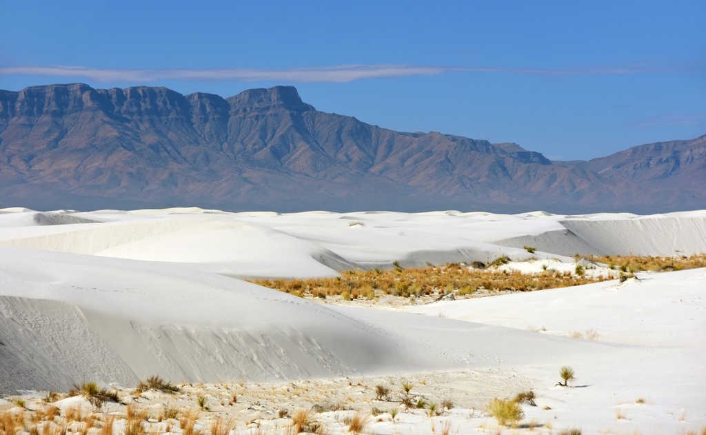
The adjacent White Sands National Monument spans a dune field of decomposed gypsum that originated in the San Andres Mountains.
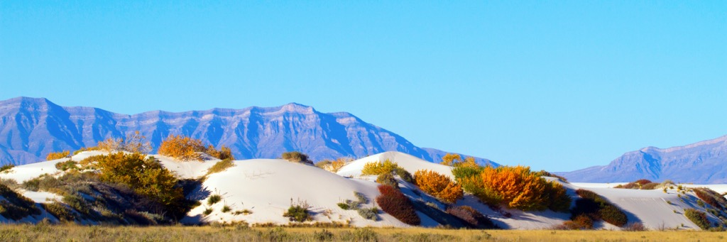
Situated in the northernmost reaches of the Chihuahuan Desert, conditions around the range are fairly dry and barren. Habitats range from creosote and Chihuahuan desert grasslands to pinyon-juniper woodlands at higher elevations. Some oak and pine grow near the mountain tops and springs and streams support riparian communities.
The base of the mountains in the White Sands Missile Range has a desert climate. Summer temperatures reach into the 90s F (30s C) and winter temperatures reach highs in the upper 50s F (10 C). The area receives about 11 in (28 cm) of rain and 1 in (2.5 cm) snow annually.
The range is home to bighorn sheep, mule deer, mountain lions, black bears, bobcats, gray foxes, and javelinas. Oryx, a type of African antelope, live at lower elevations. They were introduced to the White Sands Missile Range in 1969.
A disease-causing scabies mite decimated the bighorn sheep herd in 1978. The herd was reduced to the point of having only a single ewe. However, with careful intervention and precautions, the refuge was able to transplant desert bighorn back into the area in the early 2000s from Kofa National Wildlife Refuge in Arizona and Red Rock bighorn breeding facility in New Mexico. The herd is growing and currently numbers around 200 animals.
Evidence of Mogollon culture dates back to 900 AD around the wildlife refuge. Around 700 years ago, the Apache moved into the region from the northwest and called the land home for several centuries. By the 1880s, conflicts with settlers increased dramatically and the Apache were eventually driven off their land. During this time of conflict, there were several skirmishes in the San Andres Mountains between Apache Chief Victorio and the United States Cavalry.
Beginning in the mid 1500s, Spanish explorers and missionaries passed along the western edge of the San Andres Mountains along the Camino Real. The mountains were given their current name by missionaries. Settlers from northern Mexico would venture to gather salt from the playas in the Tularosa Basin. The wagon tracks from this path can still be seen in a few spots today.
From the 1880s through the Great Depression, prospectors arrived in the mountains looking for minerals. Remains of old mines can still be seen today. Ranchers also moved in, populating the area with cattle, “steeldust” horses, and Angora goats until the land was claimed as part of the White Sands Missile Range in 1945.
Rising from the surrounding desert, the San Andres Mountains are an impressive landmark. However, as part of the White Sands Missile Range, access to the mountains is closed to the public. Those hoping to pass by the area can check the U.S. Army WSMR Visitor Information page for the latest closures or roadblocks.
For anyone who has access to the WSMR, there is a road along the western slopes to the summit of Salinas Peak (8,973 ft/2,735 m). Those who make it to the top will be rewarded with sweeping and breathtaking views across the neighboring peaks and surrounding desert plains.

Las Cruces is the nearest big city and is located about two hours by car to the south. El Paso, Texas is slightly further south. There are sites for camping and RV parks at the nearby White Sands National Park.
Las Cruces, New Mexico has a population of 113,000. With an average of 320 days of sunshine each year, there is ample opportunity to get outside on over 100 mi (160 km) of nearby hiking and biking trails and 500,000 acres (202,350 ha) of public land. Las Cruces is a great base for visits to White Sands National Park, Organ Mountains-Desert Peaks National Monument, and Prehistoric Trackways National Monument.
The New Mexico Farm & Ranch Heritage Museum covers 47 acres (19 ha) and offers an interactive experience to learn about ranching, farming, and skills such as blacksmithing, quilting, and water dowsing.
The city offers quality Mexican and New Mexican food, not to mention American classics like steakhouses, barbecue, and delis. Those looking to stay over will find motels and hotels for all budgets, as well as B&Bs and campgrounds.
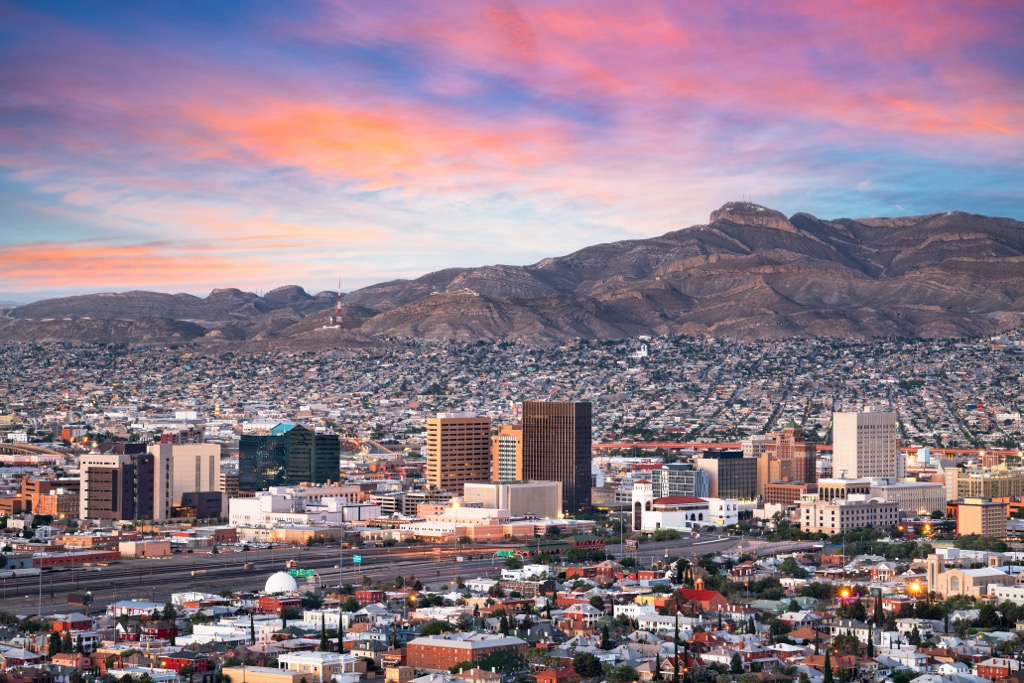
El Paso, Texas is home to 680,000 people and surrounded by the stark beauty of the Chihuahuan Desert. Take in the scenery with a long hike in the Franklin Mountains, a short hike to the Aztec Caves, or by bouldering and admiring pictographs at the Hueco Tanks State Park & Historic Site.
In town, visit the El Paso Zoo, a waterpark, or find the latest live performances and music. The city does steakhouses, Mexican food, and barbecue particularly well. Historic hotels offer one-of-a-kind and elegant stays, though visitors can also find budget-friendly motels, campgrounds, and RV parks.