Scan the QR code and open PeakVisor on your phone
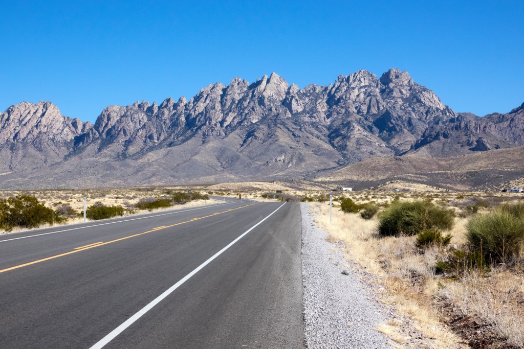
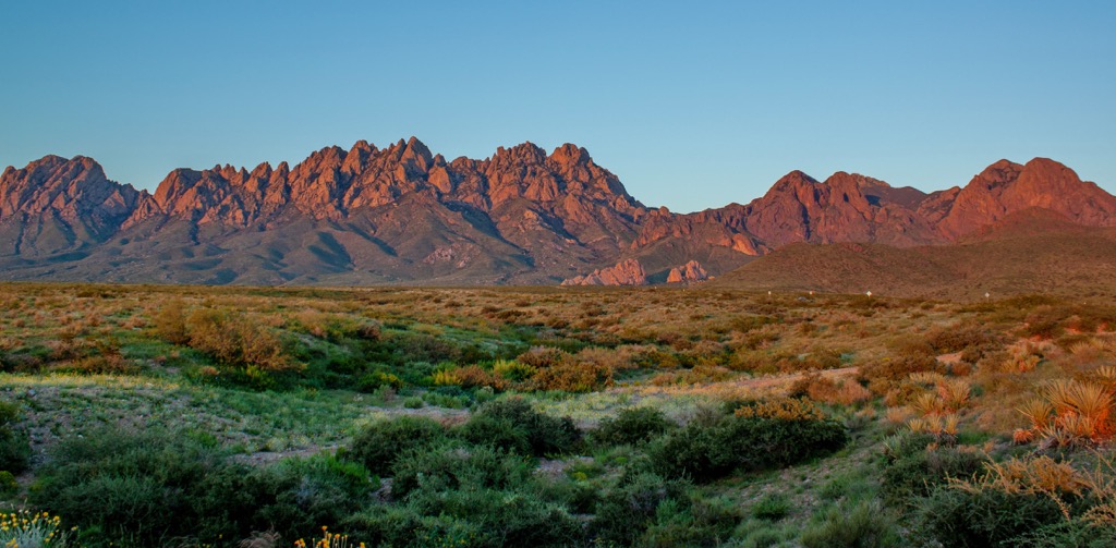
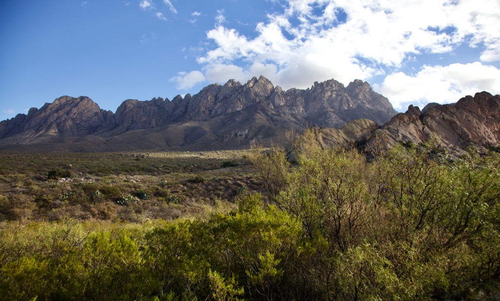
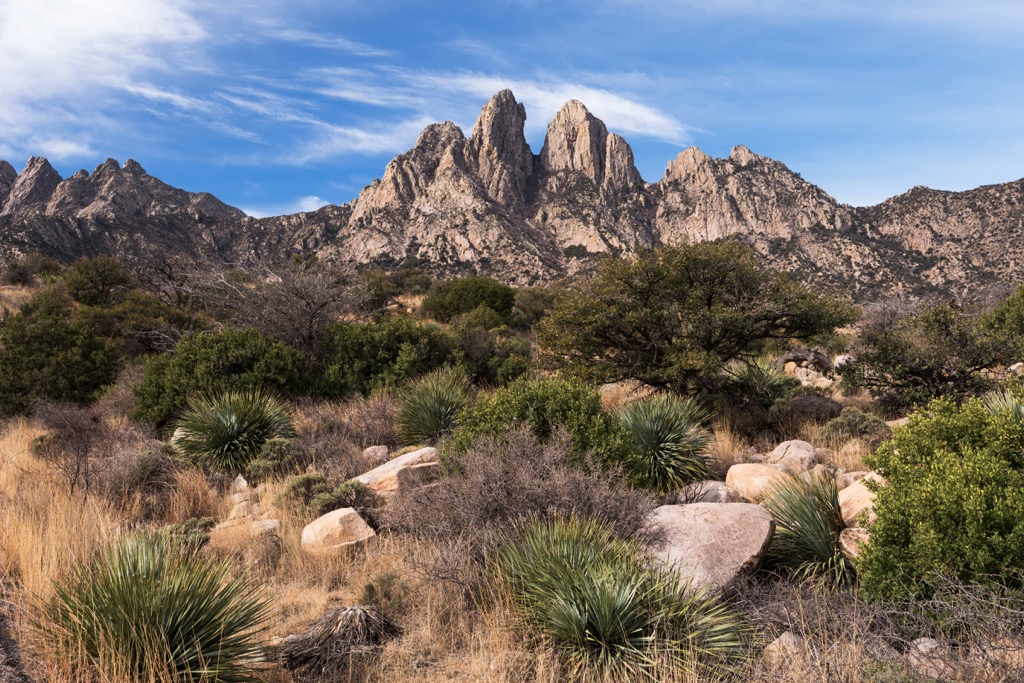
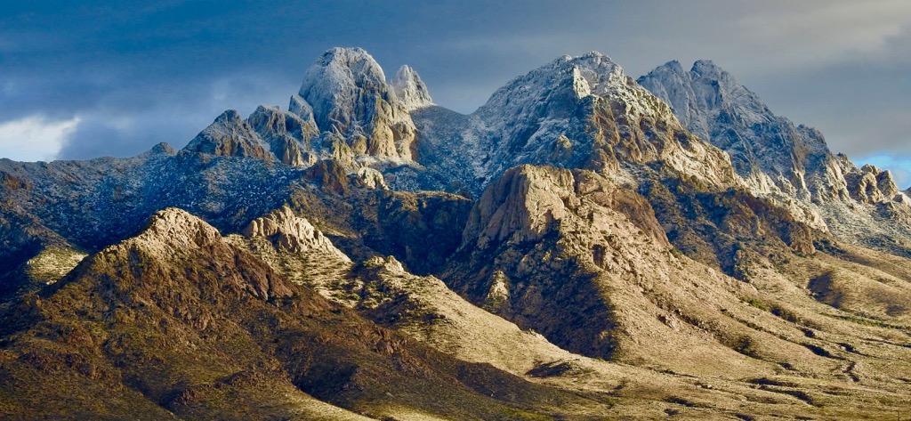
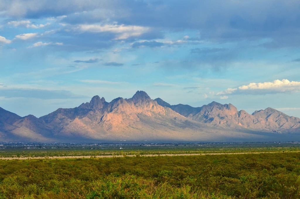
The Organ Mountains lie in Doña Ana County in the US state of New Mexico. The impressive set of granite spires rises from Chihuahuan Desert to the tallest point at 8,976 ft (2,736 m). The Needle is the tallest and most prominent (3,734 ft/1,138 m) of the range’s 48 peaks.
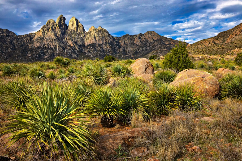
Located in Doña Ana County in New Mexico, the Organ Mountains make for an impressive formation rising above the surrounding desert. The range’s tallest point, The Needle (8,976 ft/2,736 m) rises over the Tularosa Basin to the northeast.
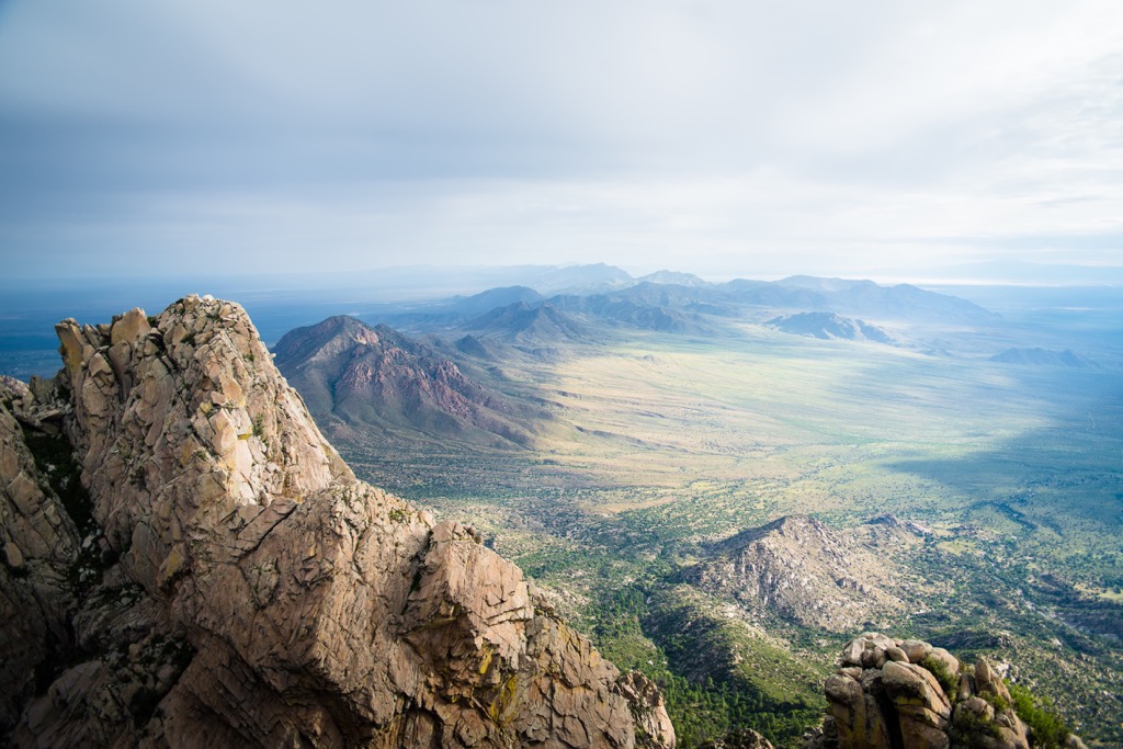
The range is overlapped by several special designations. The Organ Mountains-Desert Peaks National Monument is 500,000 acres (202,340 ha) and encompasses the Organ Mountains, the Desert Peaks, the Potrillo Mountains, and the Doña Ana Mountains. Contained within the national monument is the roughly 7,600 acre (3,075 ha) Organ Needles Wilderness Study Area. This area covers part of the Organ Mountains ridgeline. The range also lies within the Organ Mountains Wilderness Area.
Other protected areas near the range include the Peña Blanca Wilderness Study Area, Aden Lava Flow Wilderness, and San Andres National Wildlife Refuge.
The Organ Mountains are part of the Basin and Range Province and their geologic history dates back to the Paleozic Era 541 to 251.9 million years ago when the area was covered by a warm, shallow sea. Fossils from this era are preserved in shales and limestones west of the Organ Needles.
The majority of rocks in the range were formed by the Organ caldera volcano during the Eocene Epoch about 36 million years ago. Magma flowed into the upper crust about 4.5 to 5.5 miles (7.2 to 8.8 km) deep. This caused three explosive eruptions. Each eruption led to the collapse of the ground above the magma chamber and created the caldera.
The eruptions left behind tuff formations known, from oldest to youngest, as the Cueva Tuff, Achenbach Park Tuff, and Squaw Mountain Tuff. Orejon andesite can be found in the Fillmore Canyon. These dark, crystal-rich exposed lava flows formed around 43 million years ago.
Following the eruptions, magma still flowed. As it cooled beneath the earth’s surface, granite formed. About 18 million years ago during the Miocene Epoch, the Earth’s crust began to extend and fault. This caused rocks in the region to tilt and uplift which explains why the plutonic, cooled magma rocks are visible in the north and the volcanic rocks can be seen in the south.
The range’s tallest point, The Needle, is made of a vertically-jointed granite called quartz monzonite.
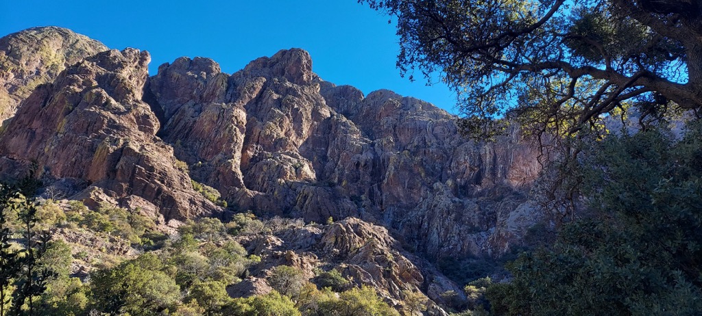
The Organ Mountains house rocky peaks, open woodlands, and narrow canyons. Ecosystems range from Chihuahuan Desert through mesquite and juniper woodlands to ponderosa pine at the highest elevations.
Lower elevations from the desert through foothills of the mountains support prickly pear cactus, cholla, barrel cacti, apache plume, mesquite, creosote, lechuguilla agave, sotol, acacias, and gramma grasses. Higher elevations see mountain mahogany, oaks, junipers, and ponderosa pine.
Lichens, evening primrose, and Organ Mountain pincushion cactus grow well here. Mexican poppies bloom after late summer rains. The range receives between 3 and 21 inches (8 and 53 cm) of rain each year with more precipitation occurring the higher the elevation. Some seasonal springs flow in the canyons and there are a handful of perennial springs.
The mountains support a range of wildlife. Common mammals include desert mule deer, Colorado chipmunks, cottontails, jackrabbits, gray foxes, coyotes, bobcats, and mountain lions. A variety of birds live or migrate through the range including songbirds, hummingbirds, and raptors. Three types of rattlesnakes – the western diamondback, black-tailed rattler, and banded rock rattler – are found here, as are horned lizards, several species of toads, and a number of other reptiles.
Humans have inhabited the area around the Organ Mountains since the Paleoindian period. Over thousands of years, early human ancestors shifted from hunting large game like mule deer and bighorn sheep (now extirpated in the mountains) to cultivating corn, beans, and squash.
The Jornada Mogollon Culture, an early farming society, left the area during the late 13th century. Within a few hundred years, the Apache moved in, followed by Spanish missionaries, priests, and settlers. The Apache frequently raided early Hispanic and Anglo settlers, elevating tensions between the groups as more outsiders arrived to stay.
The Organ Mountains have been the site for several locally significant events. In 1861, a Confederate group led by Lieutenant Colonel John Robert Baylor passed through the mountains to overtake a retreating Union force in the northern part of the range. In 1908, a cowboy named Wayne Brazel shot well-known lawman Pat Garrett.
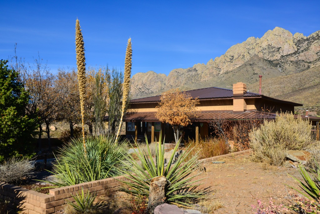
Mining had moderate success during the 19th century with the discovery of some viable sites of gold, silver, iron, and lead. There are no mining operations active in the mountains today. Ranching began in the late 1800s. Over time, W.B Cox dominated the ranching scene and his family’s historic home is now the Organ Mountain National Recreation Area’s visitor center.
Several trails from the visitor center pass by historic houses of settlers in this remote and rugged landscape.
The Organ Mountains have a range of trails from easy, informative strolls to technically challenging scramble routes. From the Aguirre Spring Campground on the east side, you can access the Pine Tree Trail or the Baylor Pass National Recreational Trail. To the north, you can explore the 6 mi (9.7 km) trail along the historic pass where Confederate forces overtook Union forces. The western side offers access to the Soledad Canyon Trail and Bar Canyon Loop.
Those looking for a challenge can tackle The Needle. This is a difficult climb, taking in 4,000 ft (1,220 m) of elevation gain, and requires route finding and Class 3 or 4 scrambling. Rock climbers should take note to carry water and to watch out for cactus, thornbush, yucca, and rattlesnakes. Another challenging route is the Organ Needle Trail.
The Baylor Pass National Recreation Trail is six miles (9.7 km) one way between the Aguirre Spring Campground on the east side and Baylor Canyon Road on the west side. It is open for hikers and horses and has about 920 ft (280 m) of elevation gain.
The Pine Tree Trail also leaves from the Aguirre Spring Campground and is a four mile (6.4 km) loop trail open only to hikers. Both The Baylor Pass Trail and Pine Tree Trail offer great views of the Organ Mountains and Tularosa Basin.
Those wanting to add a few miles to their Baylor Pass hike can choose to summit Baylor Peak (7,733 ft/2,357 m). From the pass, look for a rugged trail heading towards the peak. It will require some bushwacking on the way up but views from the top are great.
This is a great, easy trail for those interested in history. The Dripping Springs Trail Complex is located at the A.B. Cox Visitor Center. The Visitor Center is a great information resource with exhibits about the area’s history, prehistory, and a native plant garden.
The trail itself is 1.5 miles (2.4 km) one way, largely uphill. It passes Dripping Springs to arrive at the historic resort of Colonel Eugen Van Patten, a settler who was part of the area’s stagecoach operation. The trail also goes by the ruins of Dr. Nathan Boyd’s home who homesteaded nearby in the early 1900s.
Las Cruces, New Mexico and El Paso, Texas are both only a short drive from the mountains. There are campgrounds near the mountains for those wanting to stay nearby.
Las Cruces has a population of 113,000 people and is only half an hour by car from the mountains. In addition to the Organ Mountains, there are plenty of trails to hike, bike, and horseback ride in the neighboring Doña Ana Mountains and Slot Canyon. The city is also a great stop over if you’re planning to visit White Sands National Park.
Another way to get a taste of local life and history is with a visit to the New Mexico Farm and Ranch Heritage Museum. This 47 acre (19 ha) museum covers centuries of farming and ranching in the region, with cow milking, blacksmithing, quilting, and water dowsing demonstrations.
The city offers great Mexican and New Mexican cuisine. It also has a host of other dining options including American classics like BBQ and grills, and some international cuisines. There are hotels and motels to match any budget, as well as B&Bs, RV parks, and campgrounds.
El Paso is home to 678,000 people and sits on the border with Mexico. It is a one hour drive south from the Organ Mountains. From the city, top spots to explore in the area include the Franklin Mountains, the Aztec Caves, and the Hueco Tanks State Park & Historic Site with pictographs from early inhabitants.
In town, be sure to check out artists and farmers markets for a taste of local life. The city offers a range of cuisines but does Mexican food, steakhouses, BBQ, and grills particularly well. There are affordable hotels and motels for those on a budget, and lovely historic hotels if you’re looking for a fancier stay. Campgrounds and RV parks are located outside the city.