Get PeakVisor App
Sign In
Search by GPS coordinates
- Latitude
- ° ' ''
- Longitude
- ° ' ''
- Units of Length

Yes
Cancel
❤ Wishlist ×
Choose
Delete
Spanning Jordan to Turkey, the Levant Ranges feature some of the best mountain hikes in Western Asia and the largest ski area in the Middle East.
There are 8835 named mountains in the Levant Ranges. The highest and the most prominent mountain is Qurnat as Sawdā (3,088 m / 10,131 ft).
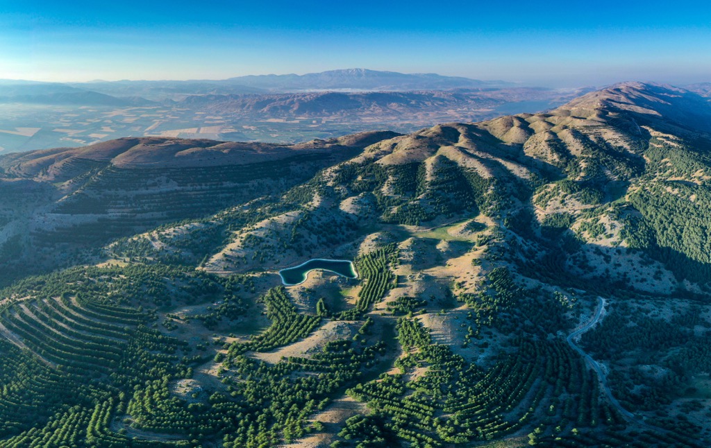
The Levant is a loose geographical area in Western Asia on the Mediterranean Sea's eastern coastline. Its boundaries are the Taurus Mountains to the north, the Arabian Desert to the south, Upper Mesopotamia to the east, and the Mediterranean Sea to the west.
Today, the Levant comprises Syria, Lebanon, Israel, the Palestinian Territories, Jordan, the Hatay Province of Turkey, and Cyprus. Historically, it has included surrounding countries like Egypt, Iraq, and Libya.
Here's a breakdown of the primary mountain ranges of the Levant, including their highest summits and defining geographical features.
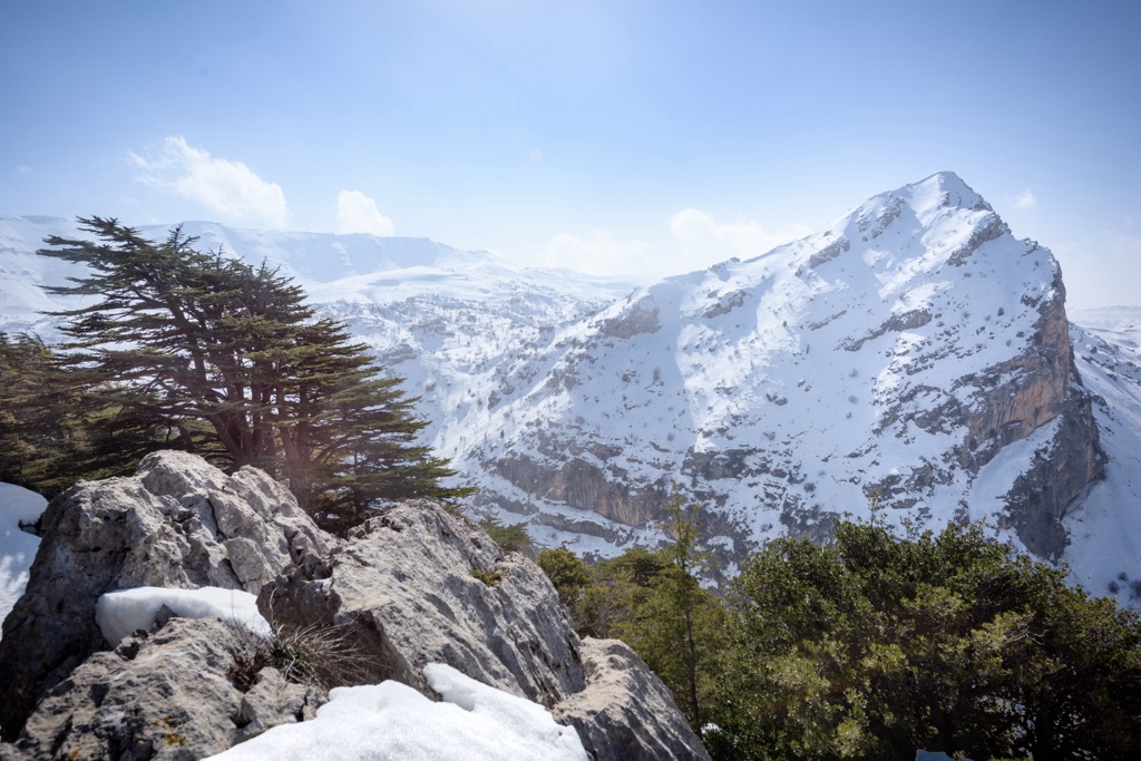
The Mount Lebanon Range (جَبَل لُبْنَان) stretches 170 km (110 mi) parallel to the Mediterranean Sea across the Mount Lebanon Governorate, the North Governorate, and the Akkar Governorate in northern Lebanon.
The range has a year-round alpine climate and receives the most snowfall of any area of the Levant. Approximately 30 km (18.6 mi) northeast of Beirut is the Mzaar Kfardebian, the largest ski resort in the Middle East.
It's the highest mountain range in the Levant, home to the highest summits in the Levant Ranges, including Qurnat as Sawdā (3,088 m / 10,131 ft), Ez Znânîr (3,071 m / 10,075 ft), and Er Rahal (2,956 m / 9,698 ft).
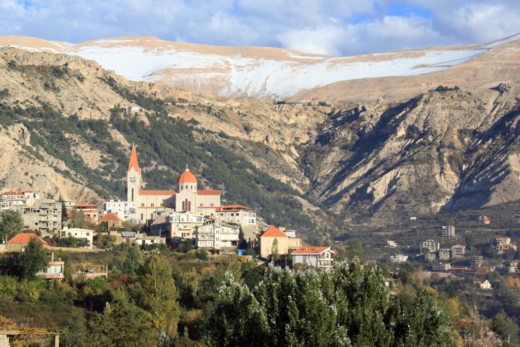
The only 3,000ers in the Levant are part of the Mount Lebanon Range. These summits are located in the North Governorate’s Miniyeh–Danniyeh District and Baalbek District. This northern mountainous region is sometimes called the Northern Levant Coastal Ranges.
The Anti-Lebanon Mountains (جبال لبنان الشرقية) run for 150 km (93 miles) along the Lebanese-Syrian border. It's called the Anti-Lebanon Mountains because it runs parallel to the more coastal Mount Lebanon Range.
The crest of the Anti-Lebanon Mountains forms a natural border between Lebanon and Syria. Despite its name, most of the range falls within Syria's borders. The range has an average elevation of roughly 2,000 m (6,500 ft).
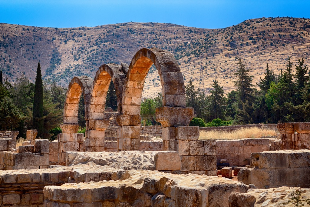
It extends from the Homs Plain in the north and past the Zabadani Saddle of Mount Hermon (Jabal al-Shaykh) (2,814 m / 9,232 ft) in Golan Heights to the south. The Anti-Lebanon Mountains are reliably snow-covered throughout winter and spring.
Mount Hermon (Jabal al-Shaykh) and Tal'at Musa (2,613 m / 8,573 ft) are the highest summits in the Anti-Lebanon Range. Mount Hermon (Jabal al-Shaykh) is noteworthy for being the highest mountain in Syria.
The Syrian Coastal Mountain Range (سلسلة الجبال الساحلية), or the Al-Anṣariyyah Mountains, is a 32 km (20 mi) wide mountain range on Syria's coastline. The Homs Gap separates the Syrian Coastal Mountain Range from the Anti-Lebanon Mountains to the south.
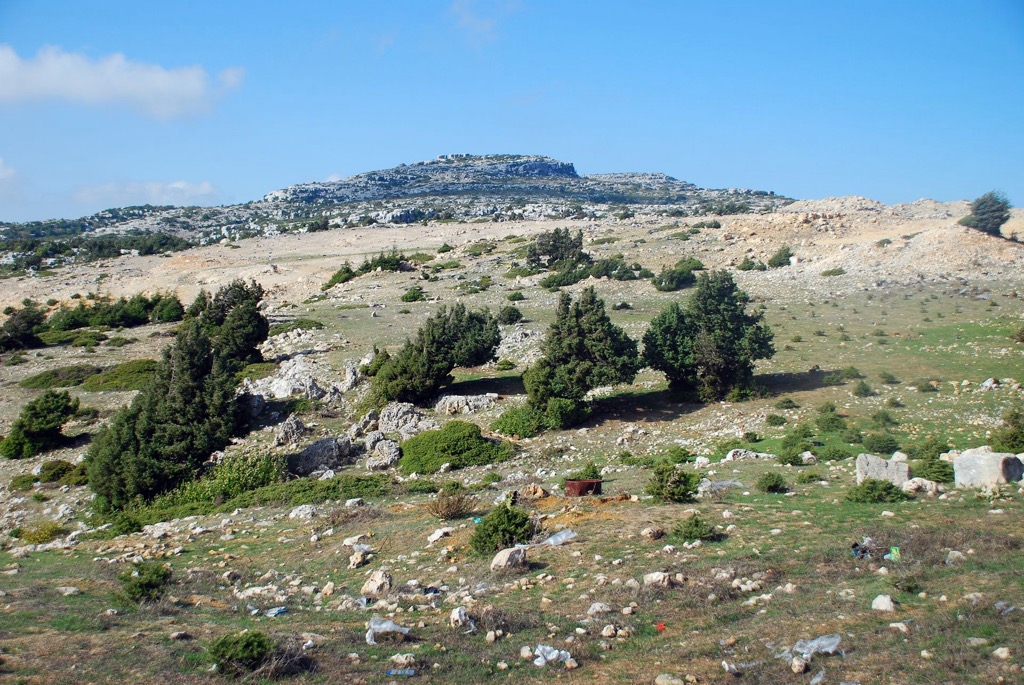
It's a low mountain range with an average elevation of approximately 1,200 m (3,900 ft). The highest mountain in the range is Nabi Yunis (1,562 m / 5,125 ft), located east of Latakia. Other high summits in the range include Shārat Ruwādī (1 560 m / 5,118 ft) and Jabal al Qamū‘ah (1,548 m / 5,079 ft).
On the western side of the Al-Anṣariyyah Mountains is a coastal plain, one of Syria's most fertile areas thanks to moisture carried over the Mediterranean Sea. On the eastern side is the Ghab Valley, a 64 km (40 mi) long trench through which the Orontes River flows.
The Golan Heights Chain is at the southern end of the Anti-Lebanon Mountains. Western Golan Heights, south of Mount Hermon, is internationally recognized as an Israeli-occupied area of Syria.
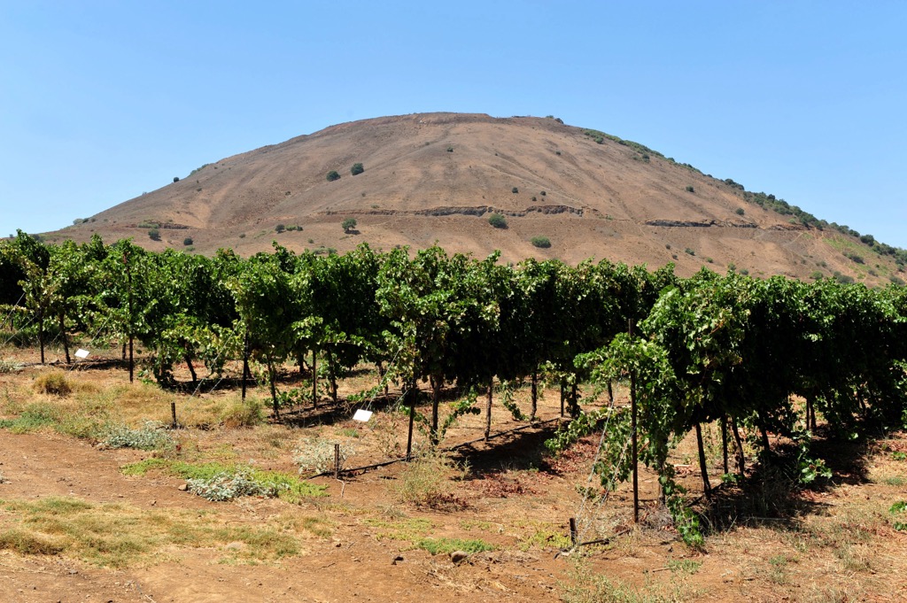
Golan Heights' topography consists primarily of a basalt plateau with a chain of dormant volcanoes in eastern Golan from Mount Ram (1,197 m / 3,927 ft) in the north to Tel Saki (594 m / 1,949 ft) in the south.
The highest summit in the Golan Heights Chain is Mount Hermonit (1,216 m / 3,990 ft). Other notable summits in this chain include Mount Hozek (1,158 m / 3,799 ft), Mount Avital (Tall Abu an Nada) (1,204 m / 3,950 ft), and Mount Bental (Tal Al-Gharam) (1,171 m / 3,842 ft).
The Jordanian Highlands span 300 km (186.4 mi) from north to south in the western portion of Jordan. They extend from the Yarmouk River Valley to Jordan's border with Saudi Arabia.
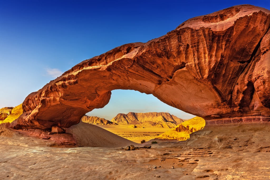
The highest peaks in the Jordanian Highlands are between 1,200 m and 1,700 m in elevation. To the west, the Jordanian Highlands steeply lose elevation by 1,000 m (3,280 ft) into the Jordan Rift Valley.
The Wadi Rum, also known as the Valley of the Moon, is at the southern end of the Jordanian Highlands. It's the largest wadi in Jordan and home to Jordan's highest mountains, including Jabal Rum (1,751 m / 5,745 ft) and Jabal Umm al Dami (1,854 m / 6,083 ft).
The Carmel Mountains are a 39 km (24 mi) coastal mountain range in Israel's northwestern Haifa District. The range is the largest natural space in northern Israel and is the basis of Mount Carmel National Park, Israel's largest national park.
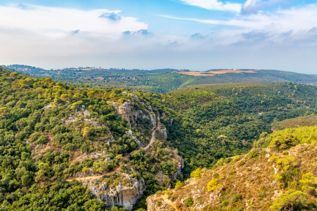
The range's namesake, Mount Carmel (546 m / 1,791 ft), is a UNESCO World Heritage Site and is home to four caves on its north side and the Nahal Me'arot Valley on its south side. Mount Carmel is the highest mountain in the Carmel Mountains.
The Troodos Mountains are Cyprus' most extensive mountain range. They stretch over 75 km (46.6 mi) across the island's western and central areas. The range is heavily forested, with the 700 sq km (270.2 sq mi) Paphos Forest at its western end.
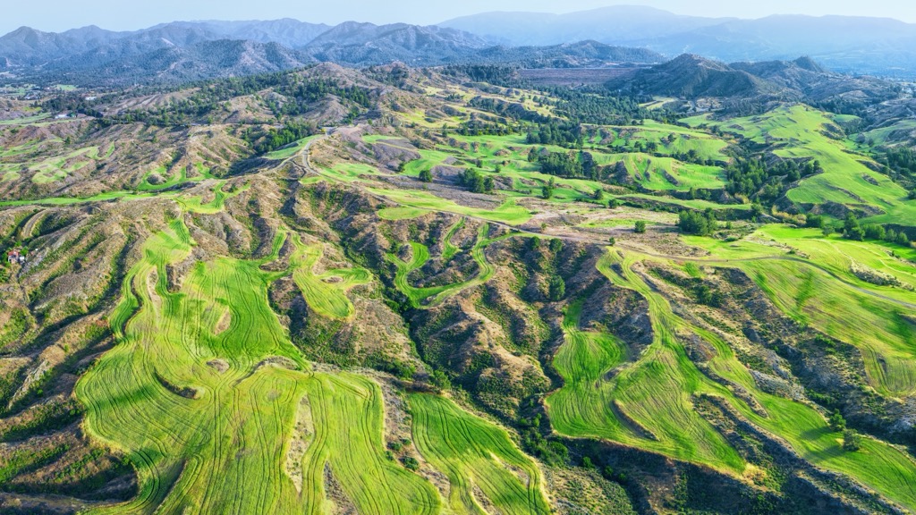
The Troodos Mountains are home to the best ski areas in Cyprus and the country's highest mountains, including Olympus (Chionistra) (1,952 m / 6,404 ft), Madari (1,613 m / 5,292 ft), and Papoutsa (1,554 m / 5,098 ft)
Nicosia, the capital of Cyprus, is located 35 mi (56 km) northeast of Olympus.
The Nur Mountains (Nur Dağları) are located in the Hatay Province in Turkey. They're approximately 100 mi (200 km) long and run parallel to the Gulf of Alexandretta south of the Taurus Mountains and Ceyhan River.
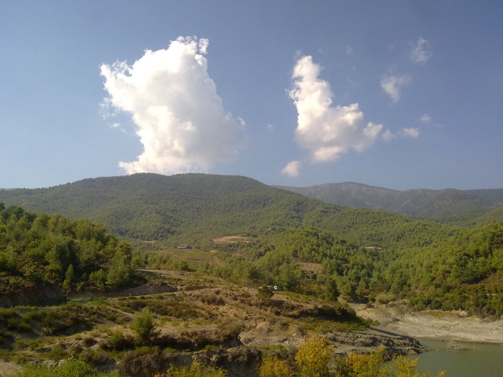
Two major mountain passes, the Belen Pass (660 m / 2,165 ft) and the Bahçe Pass, connect the Hatay Province with Anatolia and northern Syria. The highest summits in the Nur Mountains are Bozdağ (2,238 m / 7,343 ft), Harmankaya Tepe (2,234 m / 7,329 ft), and Sineklidağı Tepesi (2,207 m / 7,241 ft).
The Levant has a complex and diverse geological history for a relatively small geographical region, due partly to its position at the convergence of the Arabian and African tectonic plates.
The Levant has a crystalline basement of igneous and metamorphic rocks from the Arabian-Nubian Shield, which formed during the East African Orogeny over 500 million years ago.
Marine sediment and a marine carbonate sequence then covered these igneous and metamorphic rocks. This basement is exposed at surface level in the southern Levant. The sedimentary strata overlying the basement rocks are between 1 km (0.6 mi) and 7 km (4.3 mi) thick. It's at its thickest to the northwest.
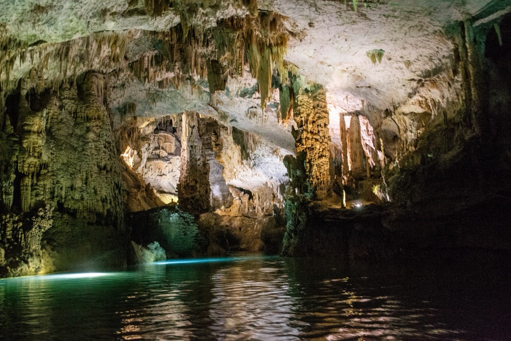
Between 37 and 25 million years ago, the northeastern Afro-Arabian plate's tectonic uplift led to thermal activity, creating a 3,000 km (1,864 mi) by 1,500 km (932 mi) crustal dome on either side of the present-day Red Sea.
The Red Sea – Gulf of Suez rift system, formed by the anti-clockwise rotation of the Arabian Plate, created a new boundary plate, the Dead Sea Transform (DST). The DST is a series of faults around 1,000 km (621 mi) long between the Gulf of Aqaba and Anatolia. The most recent tectonic activity in the region is caused by the DST's ongoing collision with the Eurasian Plate.
The Jordanian Highlands formed due to the rotation of the Arabian Plate. They're a relatively new geographical feature, having formed less than 3 million years ago.
The Anti-Lebanon Mountains and Mount Lebanon Range are anticlines composed primarily of Jurassic limestone, dolomite, chalk, and basalt. Lebanon is a heavily sedimentary country—70% of exposed rocks are limestone karst.
The dormant and extinct volcanoes of Golan Heights formed around 4 million years ago and are composed mainly of Jurassic limestone. The Troodos Mountains comprise Troodos Ophiolite, which was exposed following the collision of the African and Eurasian tectonic plates.
Despite its predominantly arid landscape, the Levant supports a wealth of diverse and fascinating ecosystems.
There are over 125 mammal species in the Levant. Common grazing mammals include Arabian oryx, Nubian ibex, roe deer, wild boars, Cypriot mouflons, and gazelles. High in the mountains, you might spot a rock hyrax, which can live at elevations exceeding 4,200 m (13,800 ft).
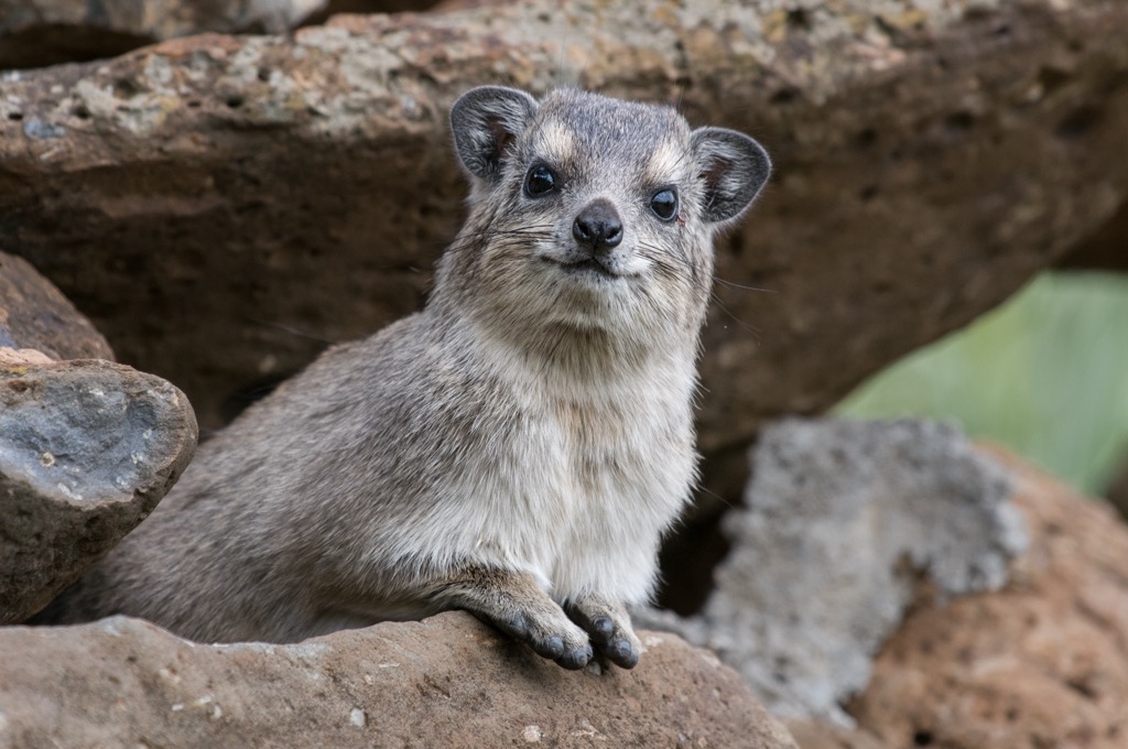
Carnivorous and predatory mammals inhabiting the Levant include critically endangered sand cats, strip hyenas, Arabian wolves, Syrian brown bears, and golden jackals. Asiatic lions and cheetahs used to be present but were hunted to extinction locally.
Approximately 500 bird species pass through or nest in the Levant. Notable bird species include hoopoes, sociable lapwings, greater bustards, northern bald ibises, Syrian serins, flamingos, white-headed ducks, and aquatic warblers.
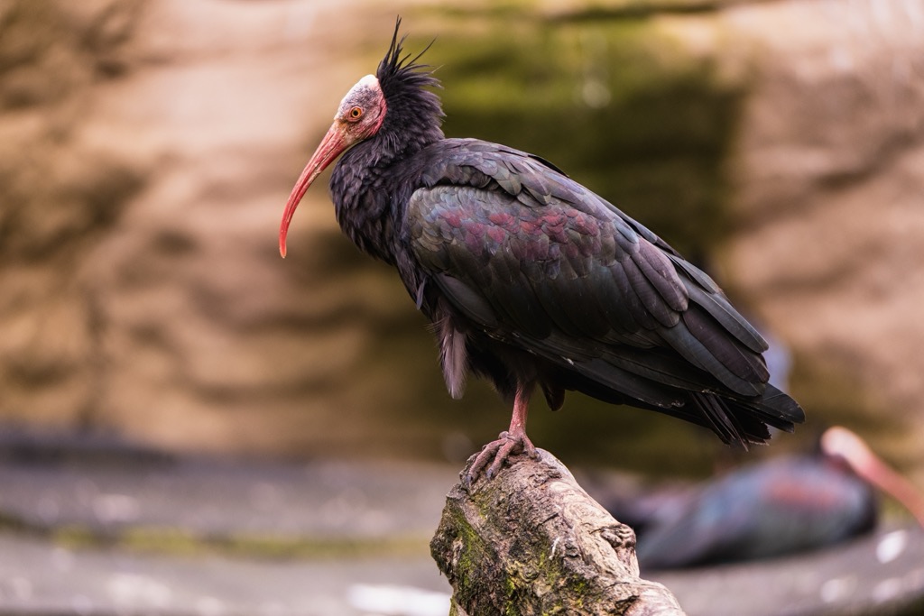
Notable predatory birds in the Levant include lesser kestrels, Egyptian vultures, steppe eagles, eastern imperial eagles, Pharaoh eagle-owls, barn owls, and saker falcons.
Ecologists are particularly interested in the Levant due to its high frequency of endemism. For example, 10% of all reptile species and 25% of all fish species in the Levant are endemic.
One such endemic reptile species is the Palestine viper, found across the Levant (excluding Cyprus). Its bite can be fatal and is the leading cause of snakebites in the region. Blunt-nosed vipers and Lebanon vipers are two other noteworthy venomous snake species in the Levant.
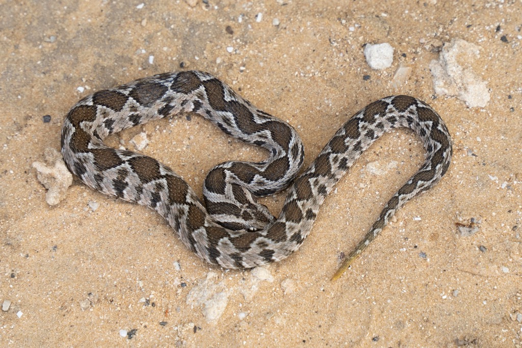
Other reptile species in the Levant include skinks, geckos, desert monitors, European cat snakes, and agamid lizards. Amphibian species in the Levant include southern banded newts, Hula-painted frogs, and European green toads.
Thanks to their fertile soil and coastal locations, the Levant's mountains are home to some of the largest green areas in the region.
For example, the Mount Lebanon Range is home to the largest Lebanese cedar forest in the country, known as Cedars of God. Lebanese cedar trees are the national symbol of Lebanon.
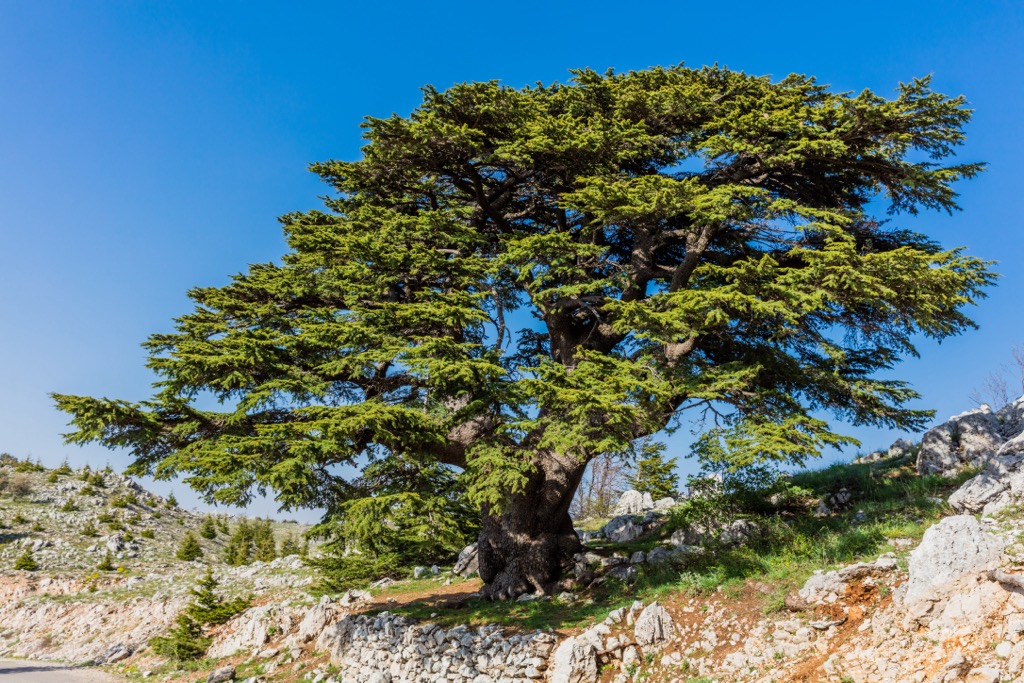
Lebanon is one of the most heavily forested countries in the Levant, with forests consisting of firs, pines, oaks, beeches, and cypresses. In shrubland areas, Pistacia, Ceratonia, and wild almond species thrive.
Due to its dry summers and mild winters, Syria's forests are primarily conifer-sclerophyllous-broadleaf forests composed of species such as Aleppo pines and evergreen oaks. At the southern end of the Levant in Jordan, pines, oaks, cypresses, wild olives, and pistachio trees dominate the forests.

The Troodos Mountains are heavily forested, with pine forests comprising Turkish and black pines. Some black pines in the Troodos Mountains are over 500 years old.
Poppy anemones, also known as Spanish marigolds, are common vibrant wildflowers that grow in coastal areas across the southern Levant and heavily resemble poppies. Other common flowering plants in the Levant include tulips, crocuses, and fritillaries.
The Levant has a long human history and is home to some of the oldest cities in the world. For example, humans have inhabited Damascus and Beirut for over 5,000 years.
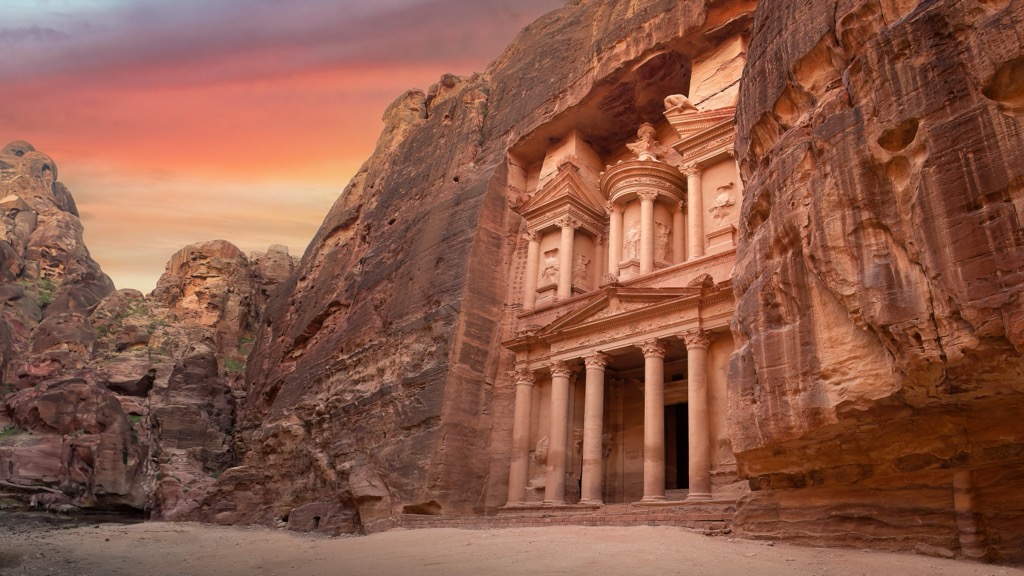
The Nabataean Kingdom, which originated from Bedouin tribes, built Petra as long as 2,500 years ago. Islam was first introduced to the region during the Muslim conquest of the Levant in the 7th century CE.
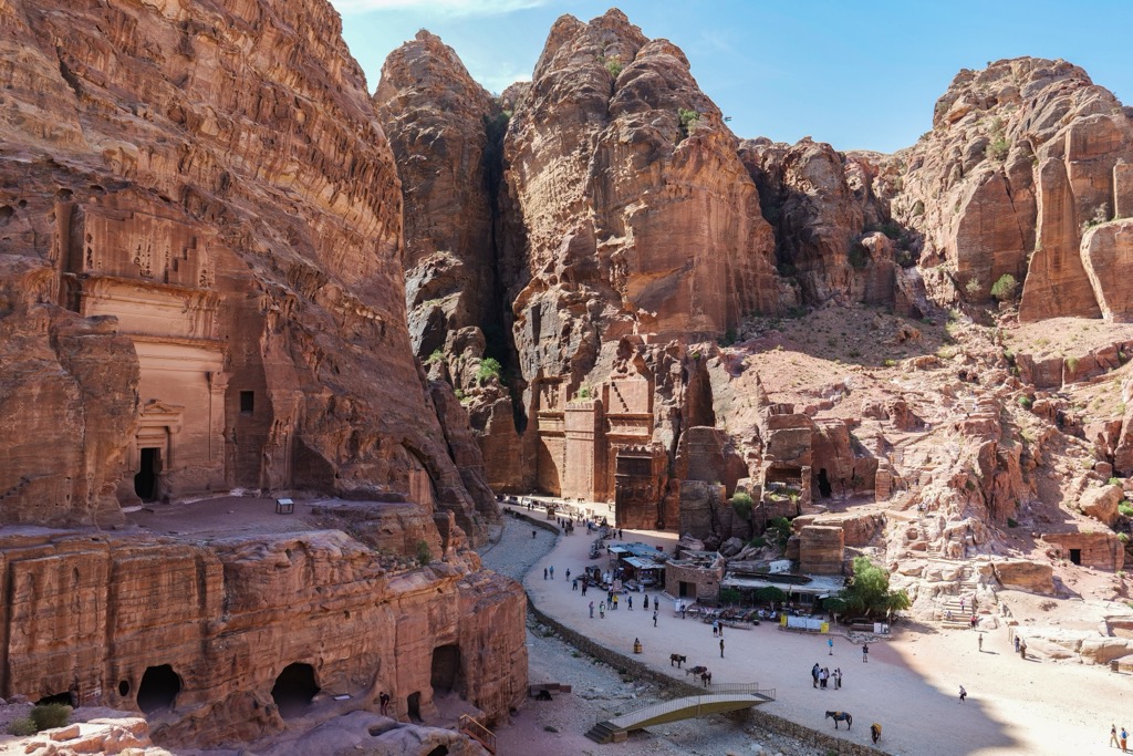
The recent hiking history of the Levant is marred by conflict and unrest. The Lebanese Civil War kept hikers away from the highest mountains in the Levant for over 15 years. Today, the ongoing Syrian Civil War and Israel–Hamas War make hiking in certain areas potentially dangerous.
Of all the Levantine countries, Lebanon has an especially deep connection with its mountains. The route of the name "Lebanon" means "white," referring to the snow-capped summits of the Mount Lebanon Range.
Following the Lebanese Civil War, the 470 km (292 mi) Lebanon Mountain Trail (LMT) was developed to showcase Lebanon's natural beauty and attract international travelers back to the country. Projects like the LMT contribute to Lebanon's economic stability.
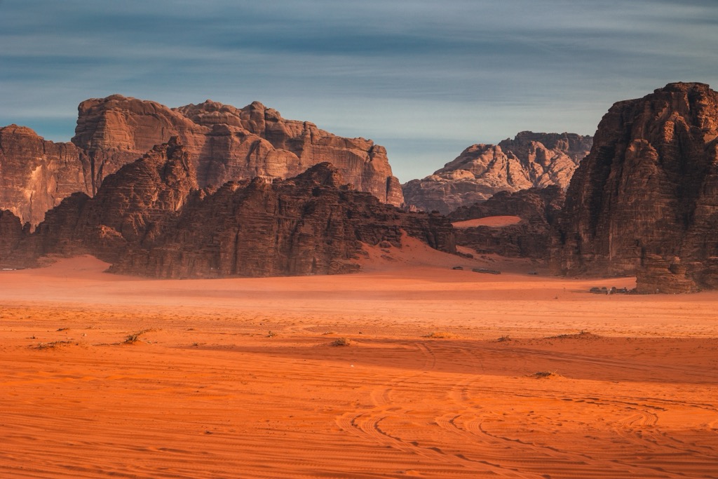
First ascents in the Levant are not well documented — people have been exploring the region's mountains for thousands of years without any record.
Sheikh Hamdan made the first documented ascent of Jabal Rum, the most popular rock-climbing spot in Jordan and the entire Levant, in 1949. Charmian Longstaff and Sylvia Branford made the first European ascent in 1952. Rock climbing became popular in Jabal Rum after Tony Howard published Treks and Climb in Wadi Rum in 1987.
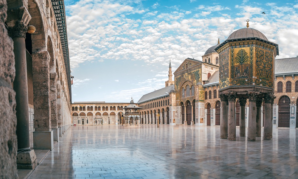
The Levant is an ethnically and religiously diverse region where Islam, Christianity, and Judaism meet. Most of the Levant's population is Muslim, with Sunnis the largest denomination.
Levantine Arabic is the predominant Arabic variation spoken by Arabs in the Levant. Over 54 million people speak Levantine Arabic, making it the world's most popular Arabic variety after Egyptian. Other languages in the Levant include Aramaic, Hebrew, Turkish, and Armenian.
Bedouins are tribes of nomadic Arabs who inhabit isolated areas of the Levant. They are especially common in Jordan, where over 1.5 million are said to live.
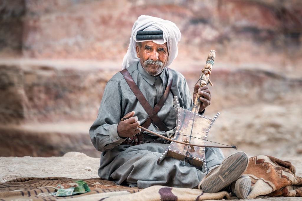
Literally meaning "desert dweller," Bedouins are pastoral tribes that traditionally herd camels, sheep, and goats. Most Bedouin tribes are Muslim, but a small number of Christian tribes exist. Bedouins can be hired as guides in the Levant, and many work full-time as guides around Wadi Rum and Petra.
Due to ongoing regional conflicts, hiking in the Levant Ranges can be dangerous.
The Syrian Civil War and the Israeli-Hamas War mean you should reconsider travel to certain areas. You may need special permission from the local military to hike to certain areas, especially within the Anti-Lebanon Mountains on the Lebanon-Syria border.
Even traveling to countries not directly involved in conflicts can be risky. For example, the UK Foreign Office currently advises against all travel to Lebanon due to the ongoing conflict between Israel and the Palestinian Territories. You should avoid Lebanon's southern and western borders due to artillery strikes and terrorism.
When hiking in the Levant Ranges, ensure you seek the correct government permissions, map your route carefully, and inform others of your itinerary.
Qurnat as Sawdā (3,088 m / 10,131 ft) is the highest mountain in Lebanon and the Levant. It's one of only four 3,000ers in the Levant, all in the Mount Lebanon Range. It's located within the North Governorate, less than 30 km (18.6 mi) to the southeast of Tripoli.
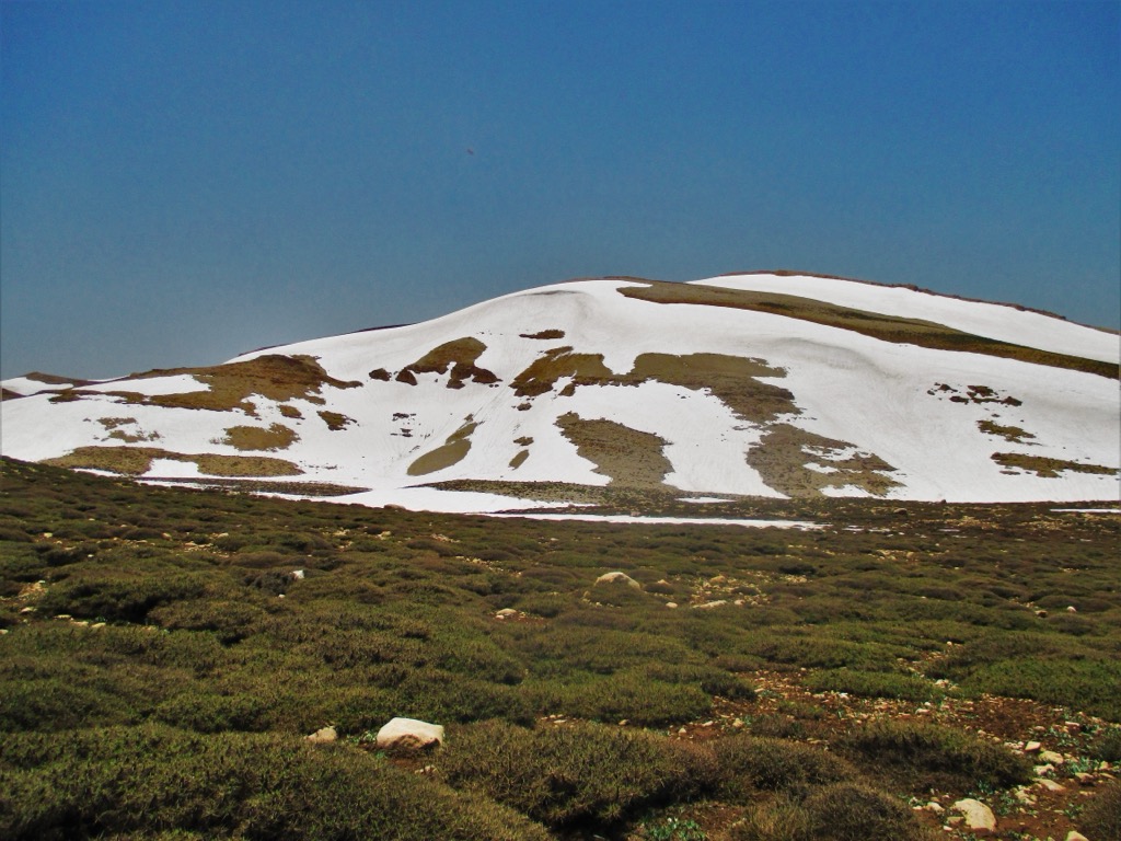
The best time to climb Qurnat as Sawdā is between April and October. During winter, the mountain is heavily snow-covered and dangerous. There is a ski resort on Qurnat as Sawdā in winter.
The starting point for the hike up is the Cedars Ski Resort Lifts, 6.5 km to the mountain's southwest. You'll follow the course of the ski lifts steeply uphill onto Dahr al Qadib's (2,998 m / 9,836 ft) saddle at 2,820 m (9,255 ft). The landscape then plateaus as you follow a faint track before climbing uphill again to the summit of Qurnat as Sawdā.
The hike to Qurnat as Sawdā is approximately 18 km (11 mi) in length.
Straddling the Lebanese-Syrian border at the southern tip of the Anti-Lebanon Mountains is Mount Hermon (Jabal al-Shaykh) (2,814 m / 9,232 ft). In winter, Mount Hermon is home to the Mount Hermon – Neve Ativ Ski Resort, the only ski resort in Israel.
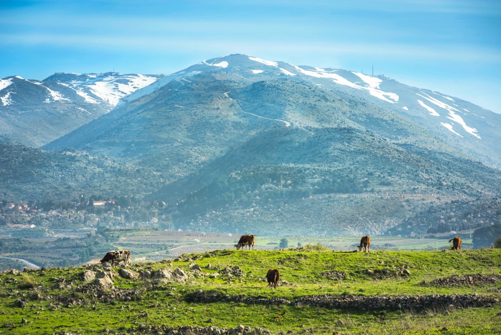
The highest mountain in Syria, Mount Hermon's summit, is the United Nations buffer zone between Syria and the Israeli-occupied area of Golan Heights. It's the world's highest permanently occupied UN outpost, nicknamed "Hermon Hotel."
Mount Hermon is very popular with hikers due to its religious significance to Christianity and Judaism. Mount Hermon is mentioned several times in the Hebrew Bible, and in the New Testament, it's one of the possible sites of the Transfiguration of Jesus.
Mount Hermon is accessible up to 2,040m (6,690 ft) due to the UN base on the summit. You can only climb Mount Hermon from the Israeli-occupied side of the mountain, and you'll need special permission from the Israeli military at least a day in advance. There is also a cable car up the mountain, which doesn't require army permission.
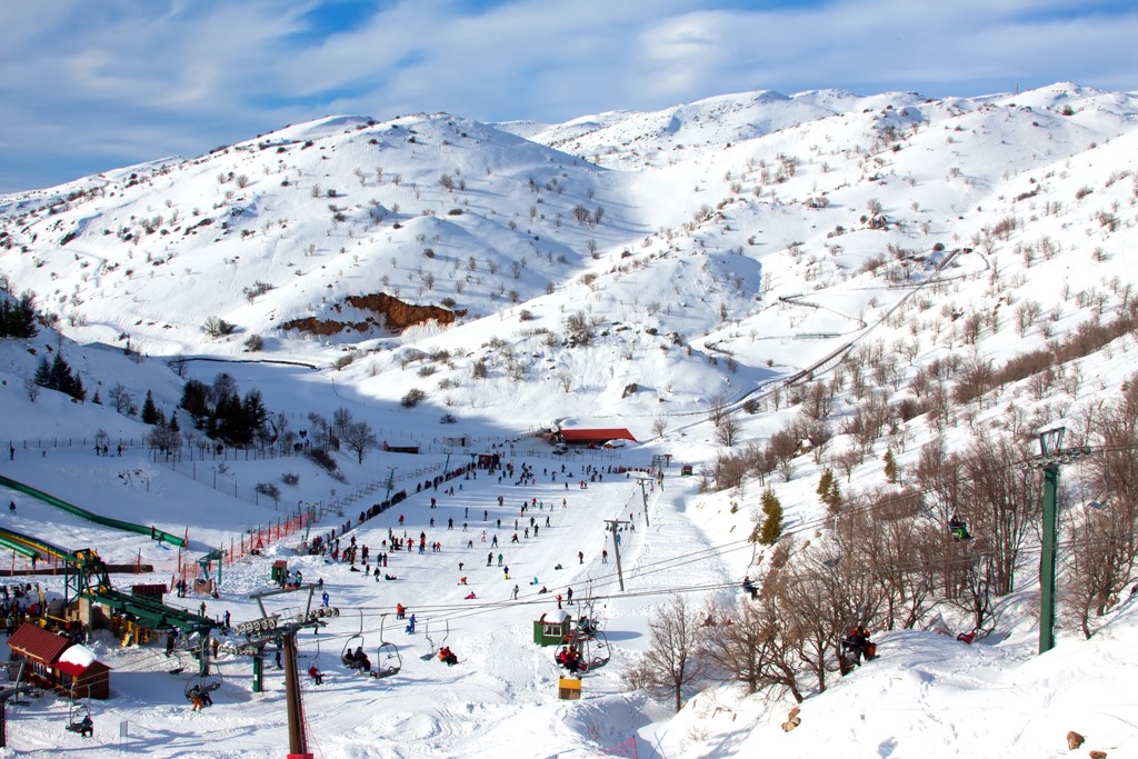
One of the most popular routes up Mount Hermon's summit is the Nahal Guvta Trail from Neve Ativ. The trail leads directly to the summit of Mount Habushit (1,955 m / 6,414 ft), from which you can take a short climb through the Mount Hermon ski area.
This out-and-back trail is approximately 4 km (2.5 mi) in length.
Olympus (Chionistra) (1,952 m / 6,404 ft) is the highest mountain in Cyprus.
Situated at the heart of the Troodos Mountains, Olympus affords sweeping views of the entire southern part of the island. In summer, you'll find numerous hiking trails worth exploring. In winter, Olympus gets plenty of snow and is home to the Cyprus Ski Club, which includes the Sun Valley and North Face ski areas.
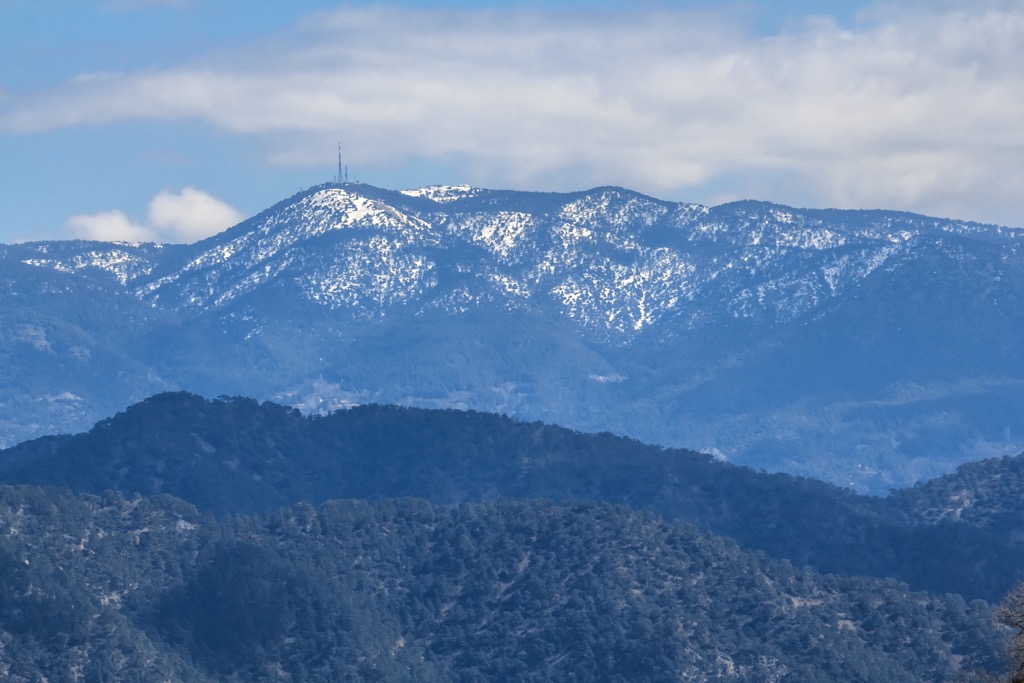
It's worth noting that the true summit of Olympus is inaccessible, as it's the site of a long-range military radar. The Artemis Nature Trail is among the most popular near Olympus' summit.
The trailhead is located at the Cyprus Ski Club car park, 800 m (2,624 ft) southeast of the summit. It's a straightforward walk suitable for hikers of all abilities.
The Artemis Trail loops around Olympus' summit, passing through black pines and sweeping viewpoints. The Artemis Trail is approximately 8 km (5 mi) in length.
Jabal Umm al Dami (1,854 m / 6,083 ft), or Jebel Um Adami, is Jordan's highest mountain. It's located near the Saudi Arabian border on the southern edge of the Wadi Rum, a beautiful dry river valley filled with otherworldly rock formations.
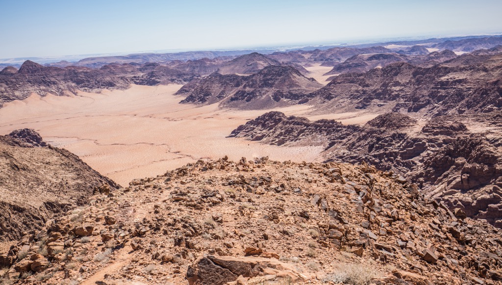
Consider hiring a guide when climbing Jabal Umm al Dami, as the mountain is only accessible via a 4x4 drive and has no clear trail. Many tour groups arrange to meet at Wadi Rum Village.
The most popular way to scale Jabal Umm al Dami is from the east. The hike is rocky and steep in places but manageable for hikers with good fitness levels. From the summit, you'll enjoy sweeping views of the Arabian Desert to the south and the Wadi Rum with Jabal Rum (1,751 m / 5,745 ft) to the north.
This out-and-back hike is approximately 3 km (1.8 mi) in length.
The Lebanon Mountain Trail (LMT) is possibly the finest long-distance hiking trail in the Levant Ranges. It is roughly 450 km (280 mi) long and meanders the length of Lebanon from Andqet in the north through the Mount Lebanon Range to Marjayoun in the south.
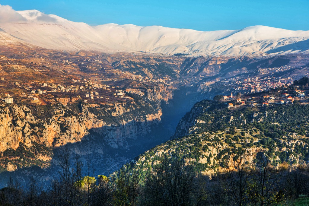
The trial is divided into 27 stages, each of which can be completed in a day. The LMT is free to access; however, you'll need a permit to access the southernmost section of the trail, which you can obtain from the Army Security Service office.
The LMT passes through 76 towns and villages, five nature reserves, and one World Heritage Site. This World Heritage Site is Qadisha Valley, a sublime valley filled with monasteries and home to the Forest of the Cedars of God, which contains cedar trees over 1,000 years old.
The highest point on the LMT is 2,072 m (6,798 ft) in elevation on stage 10 at Tem Rtiba. The total elevation gain on the LMT is approximately 20,000 m (65,617 ft).
The Levant is one of the best winter sports areas in the Middle East. Lebanon is excellent for skiing, as it's home to multiple ski resorts, including the largest ski resort in the Middle East.
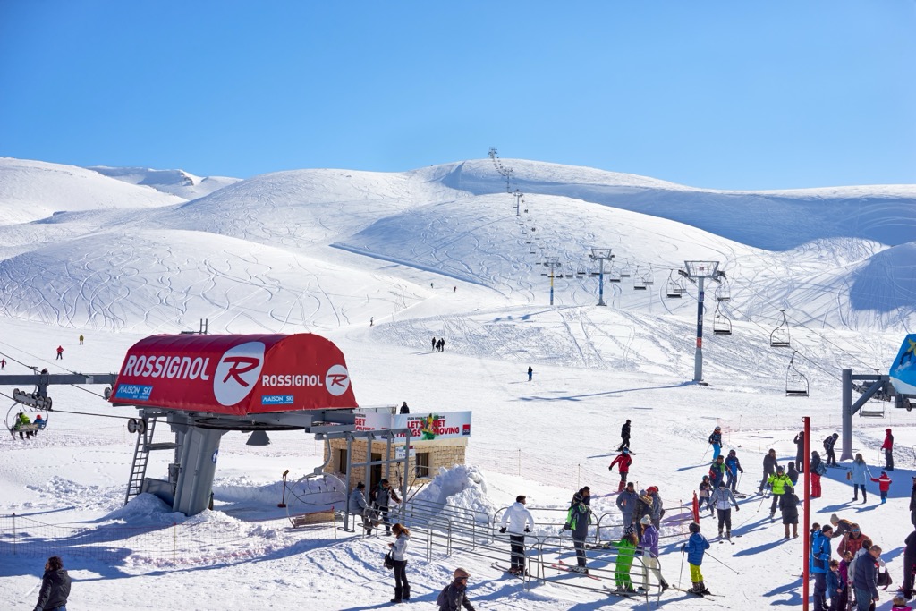
There are five significant ski resorts in the Levant Ranges:
The Levant is a region where different cultures and beliefs converge, resulting in some of the Middle East's most diverse and multicultural cities.
Amman (عَمَّان) is the capital city of Jordan and the largest city in the Levant, with a population of over 4 million. It's located in the northwest of the country, adjacent to the Jordanian Highlands.
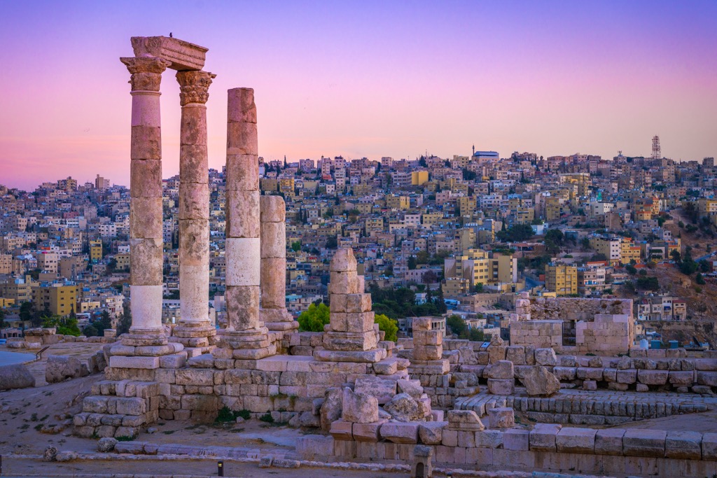
Amman is one of the top 100 most-visited cities globally and is known for its ancient landmarks like the 2nd-century Roman Theatre and prehistoric Amman Citadel. Amman also serves as a starting point for tourists planning a trip to Petra, located 235 km (146 mi) to the south.
Queen Alia International Airport, the third-busiest international airport in the Levant with 7.8 million annual passengers, is located 30 km (18 mi) south of Amman.
Tel Aviv (תֵּל אָבִיב-יָפוֹ), Israel's largest city with an urban population of over 1.3 million, rests on the Levantine Sea's coastline.
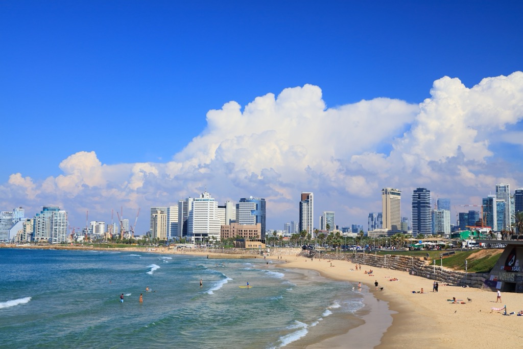
Tel Aviv is Israel's financial capital and is renowned for its UNESCO-protected White City, which features 4,000 buildings from different international architectural styles. The Tel Aviv Museum of Art and the Camel Market are among the city’s top attractions.
Ben Gurion International Airport, the busiest airport in the Levant with over 21 million annual passengers, is located 10 km (6.2 mi) southeast of downtown Tel Aviv.
Beirut (بيروت) is the capital of Lebanon and the second-largest city in the Levant. Its urban population is 2.5 million people. Beirut affords easy access to the Mount Lebanon Range, which is located less than 30 km (18.6 mi) to the east.
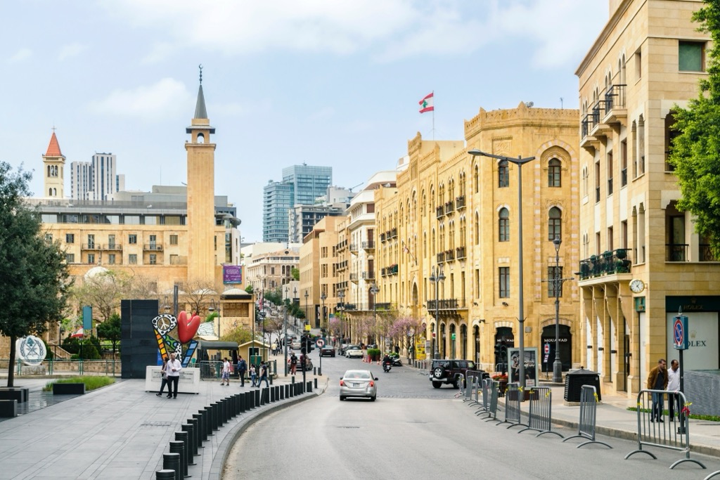
Beirut is one of the world's oldest cities, dating back 5,000 years, and features some of the best historic sites and museums in the region, including the National Museum of Beirut.
Beirut–Rafic Hariri International Airport is the fourth busiest airport in the Levant, with 7.1 million passengers annually. It's located 9 km (5.6 mi) south of Beirut's city center.
Damascus (دِمَشق) is the capital of Syria and the third-largest city in the Levant, with a population of roughly 2.4 million. It's located approximately 20 km (12.4 mi) from the Lebanese border in the foothills of the Anti-Lebanon Mountains.
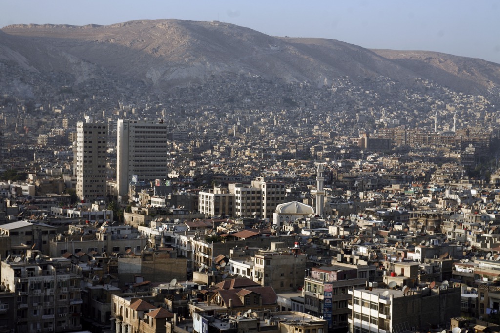
The oldest current capital in the world and considered by some to be the fourth-holiest city in Islam, Damascus has been continually inhabited for over 5,000 years. The Syrian Civil War has heavily damaged Damascus, and it now ranks as one of the least livable cities worldwide, according to the Global Liveability Ranking.
Damascus International Airport, once the busiest airport in Syria, with over 5.5 million passengers annually, has been closed intermittently since the outbreak of the war. Most major airlines have ceased flights to and from the airport.
Nicosia (Lefkosia) is Cyprus' capital and largest city, with a population of over 300,000.
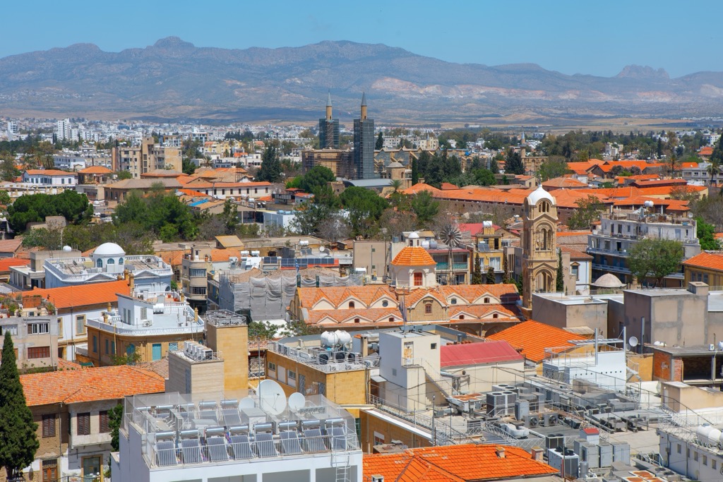
The city is segregated between Greek Cypriot and Turkish Cypriot communities, with most of the population living in the southern Republic of Cyprus. Military presence is high in Nicosia, but the city is considered safe from unrest.
Nicosia's central location is a good base for exploring the Troodos Mountains, with Olympus less than 45 km (28 mi) to the southwest.
Larnaca International Airport, the busiest airport in Cyprus with over 8 million annual passengers, is located 40 km (25 mi) southeast of Nicosia.
Explore Levant Ranges with the PeakVisor 3D Map and identify its summits.


