
Scan the QR code and open PeakVisor on your phone
Iraq is home to 4,208 named mountains. The highest is Cheekha Dar at 3,611 m.
Iraq (Arabic: جمهورية العراق, Kurdish: کۆماری عێراق), also known as the Republic of Iraq, is a country in western Asia, typically known as the “Middle East.” Having gained recognition as a dangerous conflict zone, foreign hikers rarely explore Iraq, and it may be an option for an adventure off the beaten path. There are 4208 named mountains; Cheekha Dar (3,611 m/11,847 ft) is the highest point, while the most prominent mountain is Haji Ebrahim.
Iraq is the 58th largest country globally, encompassing an area of approximately 438,317 sq km (169,235 sq mi). One of the easternmost Arab states, Iraq is bordered by six countries: Turkey to the north, Iran to the east, Syria and Jordan to the west, and Saudi Arabia and Kuwait to the south. Iraq is almost entirely landlocked, apart from a 58 km (36 mi) strip of coastline along the northern end of the Persian Gulf.
Iraq is home to 43 million people but is notable for the fact that its population was 30 million in 800 AD, falling to 5 million by the start of the 20th century. Indeed, Iraq is the cradle of civilization, likely one of the first places on Earth to feature permanently settled societies.
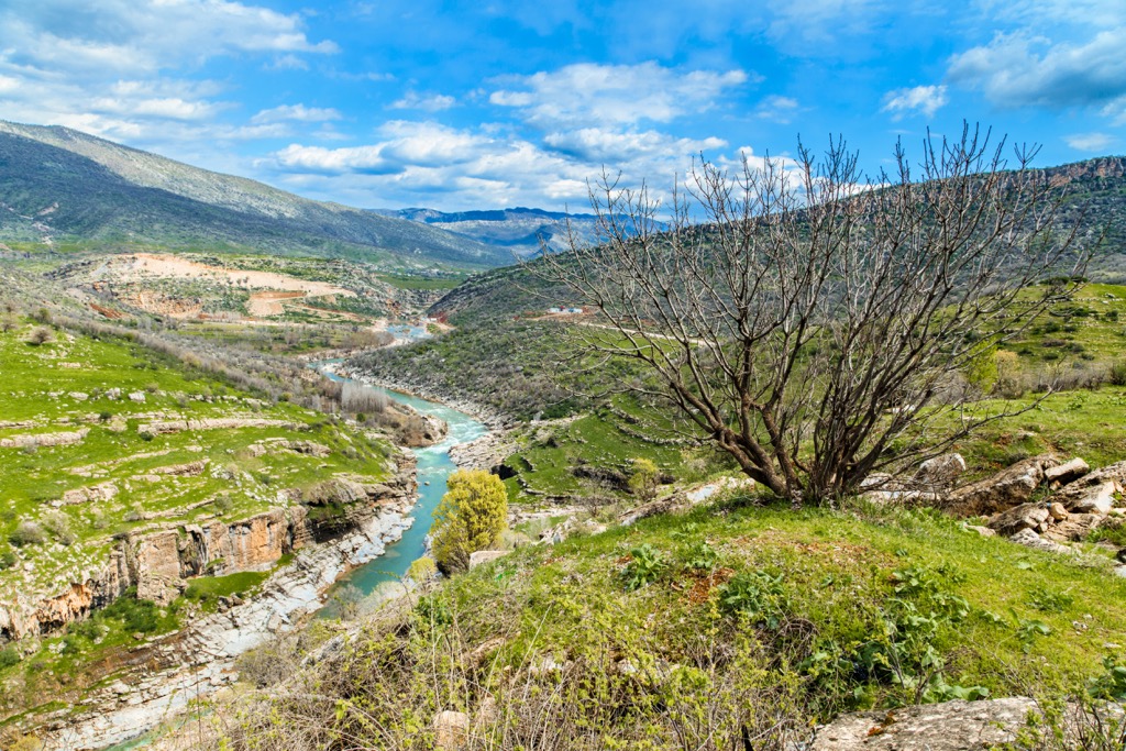
The Tigris and Euphrates Rivers served as the bastion of these early civilizations. While natural climate shifts likely dried the region out in the first millennium AD, human-triggered climate change has severely intensified the trend of desertification.
There are currently no national parks in Iraq — Halgurd Sakran National Park is in development on the border region between Iraq, Iran, and Turkey.
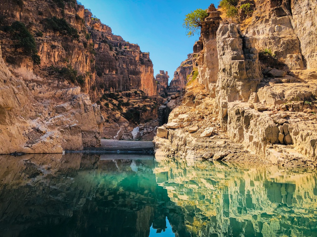
Upper and Lower Mesopotamia constitute large sections of Iraq's landmass. Upper Mesopotamia covers Iraq's northwestern corner, from the Hamrin Mountains north of the Tigris River as far south as the Euphrates River and the city of Hīt. It's an extensive upland with deserts in the north and semi-deserts in the south.
Lower Mesopotamia encompasses most of the Mesopotamian Alluvial Plain, from just north of Baghdad to the Persian Gulf. The Mesopotamian Alluvial Plain is an extensive marshy river delta and home to several lakes, including Iraq's largest lake, Lake Tharthar, with a surface area of 2,710 sq km (1,050 sq mi).
The Euphrates and Tigris are Iraq's longest and most important rivers, at 2,800 km (1,739 mi) and 1,900 km (1,180 mi), respectively.
Iraq's major cities are found along or near the Euphrates and Tigris Rivers, including the capital, Baghdad. Other major cities along these rivers include Basra, Mosul, and Erbil.
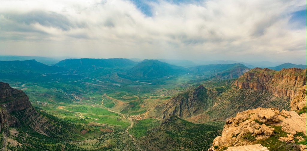
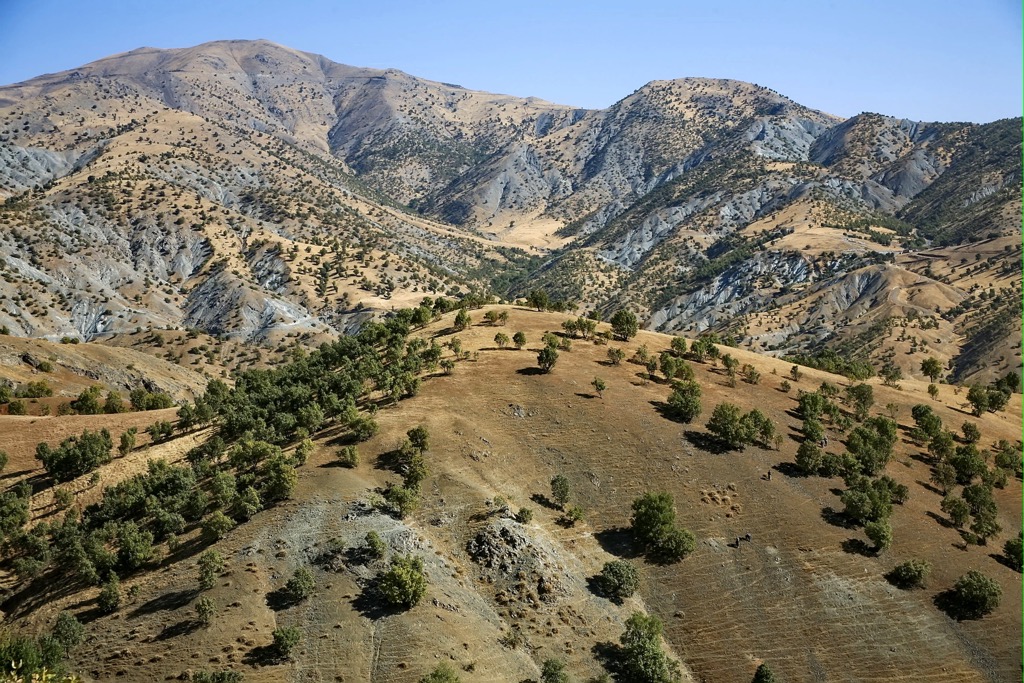
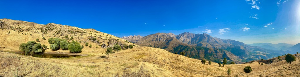
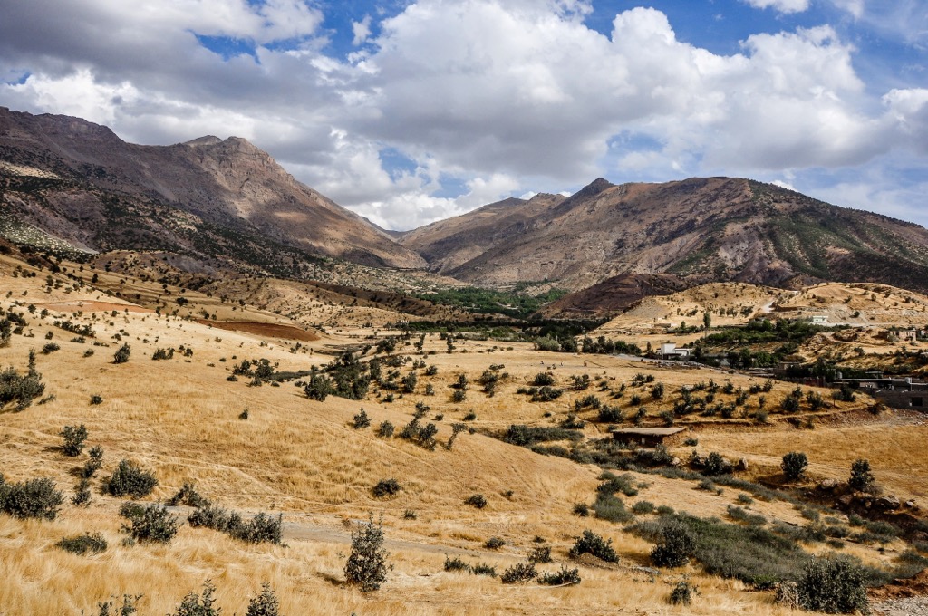
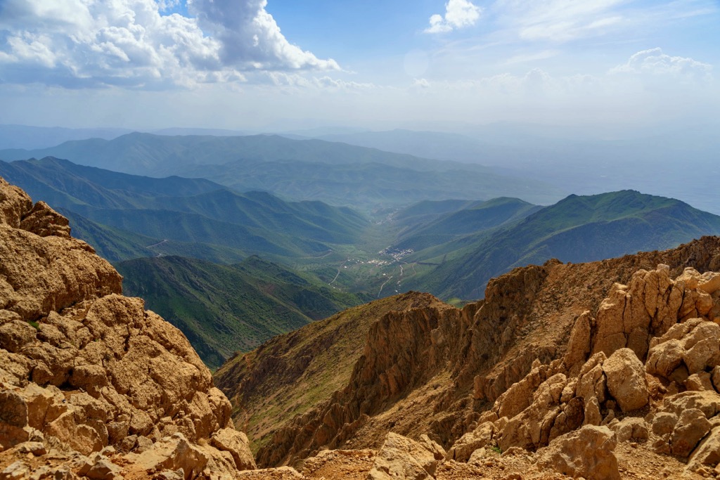
The highlands in Iraq’s northeast are the country's most mountainous area, consisting mainly of the Hamrin and Zagros Mountains between the cities of Mosul and Kirkuk.
Steppes mostly separate the highlands, with only a few valleys in the region. Cheekha Dar, Iraq's highest mountain, is in the Zagros Mountains on the Iraq-Iran border. Around 30 percent of Iraq is mountainous, with almost all highlands in the country's north.
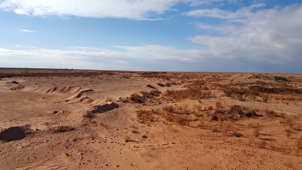
Roughly 40 percent of Iraq comprises rocky deserts. Most of the country's deserts lie to the south and southwest of the Euphrates River, forming parts of the greater Syrian and Arabian Deserts.
Naturally, Iraq's deserts are the most sparsely populated parts of the country, with few settlements. Most of the population are pastoral Bedouin People, and Wadis (river valleys that are dry most of the year) are commonplace. The south and southwestern deserts cover an area of approximately 64,900 square miles (168,000 square kilometers).
Iraq's basement rocks are poorly understood; however, geologists have identified that these basement rocks are covered in a sedimentary rock layer up to 4 km (2.5 mi) thick. Most of this sedimentary layer formed over 250 million years ago during the Paleozoic.
At this time, the Arabian Plate was an extension of the African Plate and part of the Gondwana supercontinent. Depressions, known as grabens, formed in the Arabian Plate, allowing sediment from the Paleo-Tethys Ocean to accumulate.
Some of the oldest surface rock is from the Khabour Quartzite Formation of Cambrian and Ordovician origin. Like Iraq's basement rocks, geologists know very little about their formation.
The youngest sedimentary rocks in Iraq run in a northwest-to-southeast trend in a central depression and date back to the Neogene and Quaternary.
Iraq has the world's second-largest phosphate reserves after Morocco, representing nine percent of global reserves.
Iraq consists mainly of deserts and the Tigris- Euphrates river systems. The Highlands to the north and northeast contain Iraq's highest and most famous mountains, including Halgurd Mountain (3,607 m/11,834 ft), Haji Ebrahim (3,586 m/11,768 ft), and Mount Korek (2,107 m/6,913 ft).
With marshlands, deserts, highlands, and extensive river deltas, Iraq is home to an array of biodiverse environments.
Iraq's largest carnivorous mammal is the Persian leopard, inhabiting the northern forests. Other carnivorous mammals include sand cats, Eurasian otters, and gray wolves. Iraq also hosts a wealth of omnivorous and herbivorous mammals, such as Bactrian camels, Ruppell's foxes, goitered gazelles, and Indian crested porcupines.
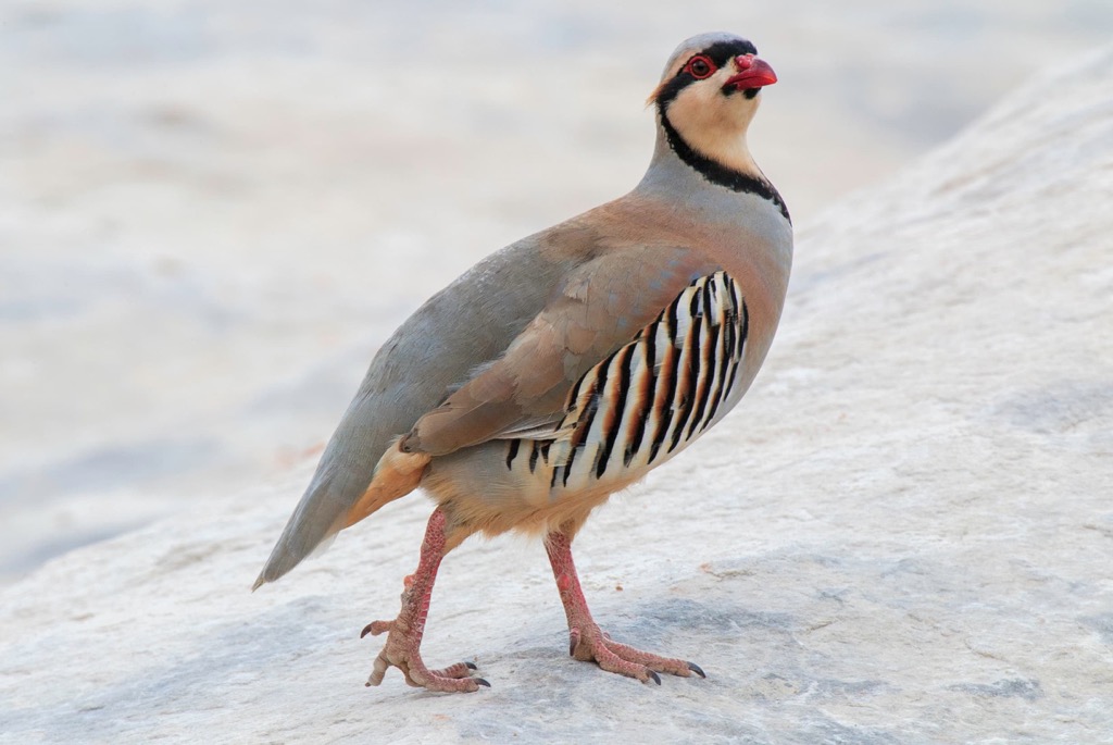
Iraq features several endangered mammal and bird species, including northern bald ibises, Persian fallow deer, and bandicoot rats. Additionally, there are globally significant populations of several bird species in Iraq — 90% of the world's Basra reed-warblers and 50% of marbled teals inhabit Iraq. The Chukar partridge is the national bird.
Iraq's marshlands are home to most of the country’s nesting grounds, with over 40 recorded bird species. Notable examples include greater spotted eagles, cormorants, purple herons, and pied kingfishers.
Over 65 reptile species are found in Iraq, including several venomous snakes like Saharan horned vipers, blunt-nosed vipers, and Armenian vipers. Other reptiles and amphibians include Near Eastern fire salamanders, Kurdistan newts, European pond turtles, and desert monitors.
Notable insect species in Iraq include bumble bees, scarabs, robber flies, burrowing wolf spiders, and white-faced bush crickets.
The flora of Iraq is at its richest along the Euphrates and Tigris Rivers. Here papyrus, lotus, and tall reeds cover the river banks. Several tree species, such as willows, poplars, and alders, can be found along the rivers and surrounding alluvial plains.
Roses are the national flower of Iraq. Other common flowers and plants include golden pothos, common myrtle, oleander, date palms, and snake plants.
One of Iraq's most unique plants is the Anastatica. Also known as the rose of Jericho, the Anastatica is a type of tumbleweed and a resurrection plant that can be revived from a dried state.

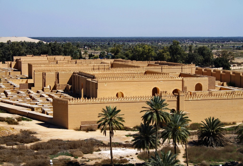
Present-day Iraq is the site of Mesopotamia, one of the oldest literate civilizations and most influential societies in the Middle East, alongside ancient Egypt.
Historians and scholars believe Mesopotamia developed writing between 3,400 and 3,100 BCE. During the Ubaid period of Mesopotamian history, the Sumer civilization is considered the world's oldest.
Between 10-11,000 BCE and 539, Mesopotamia was host to several periods of civilization. The region was known as the Fertile Crescent, and climatic attributes largely contributed to its historical importance. An abundance of water and fertile river deltas, particularly where the Tigris and Euphrates merged, was the lifeblood of these societies.
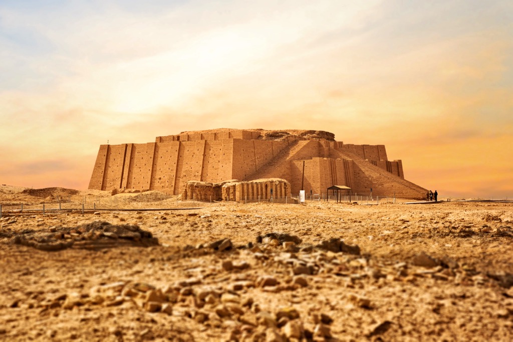
Because permanent settlement was born out of these deltas, the region is known as the ‘Cradle of Civilization.’ Generally speaking, vast agricultural resources created wealth, contributing to leisure time and ultimately harnessing the inventive power of humanity. The wheel, mathematics, and writing all came into existence during this period.
Mesopotamian self-rule lasted until 539 BCE when the Fall of Babylon ended the Neo-Babylonian Empire, with the Achaemenid Persian Empire under Cyrus the Great taking control.
Mesopotamia remained under Persian rule until the collapse of the Achaemenid Empire in 330 BCE following its defeat by Alexander the Great.
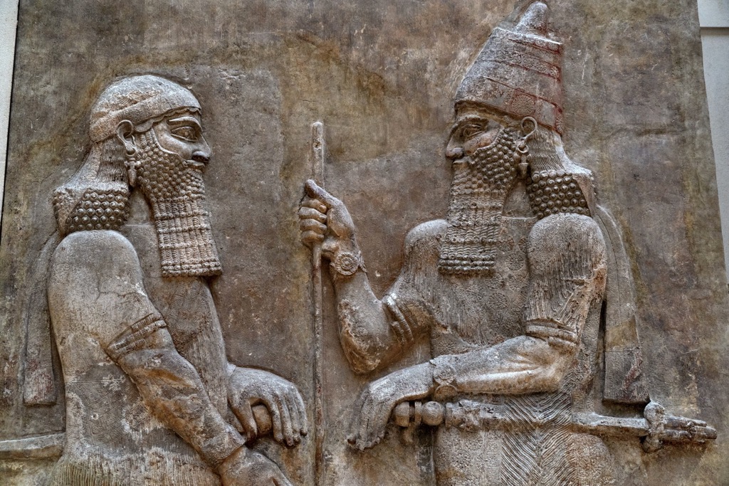
For the next 700 years, Mesopotamia came under the control of the Greeks, Parthians, and Romans. The Greeks and Parthians established capitals: Seleucia and Ctesiphon.
In the third century CE, Mesopotamia again came under the control of Persians in the form of the Sassanid Empire. Around this time, nomadic tribes, mainly from near modern Saudi Arabia, began settling in Lower Mesopotamia, creating the Lakhmid Kingdom. It was around 300 CE that the term al-ʿIrāq was first recorded.
Mesopotamia came under Islamic rule for the first time following the Battle of al-Qadisiyya in 636 CE, with the Rashidun Caliphate conquering the region. The Rashidun Caliphate founded the city of Kufa, replacing Al-Hirah as the capital.
The Rashidun Caliphate's rule was short-lived and overthrown by the Umayyads in 661. In the mid-eighth century, Iraq became the center of the Abbasid Caliphate's control, with capitals first in Kufa and then Baghdad after its founding in 762.
Iraq became one of the world's most important intellectual and cultural centers during the Islamic Golden Age between the eighth and thirteenth centuries. It began to decline in importance following the Mongolian invasion of 1258.
Iraq was the Mongol province of Ilkhanate until 1335. It was eventually absorbed into the Ottoman Empire in the sixteenth century, with intermittent rule by Iranian Mamluks and Safavids during the fifteenth, sixteenth, and eighteenth centuries.
Ottoman control of Iraq lasted until World War I. The Ottomans sided with Germany and the Central Powers, with Britain subsequently invading Iraq during the Mesopotamian Campaign.
Despite a defeat during the Siege of Kut in 1916, Britain eventually won the Mesopotamian Campaign with the capture of Baghdad in 1917. The British Mandate of Mesopotamia saw Iraq managed by Britain and the self-governing Hashemite monarchy, which originated in Jordan.
During the following unrest, Kurds fought for independence, with Britain employing Christian Assyrians to quell revolts. Iraq was eventually granted complete independence in 1932 under the Anglo-Iraqi Treaty.
The Independent Kingdom of Iraq lasted until 1958 when a coup d'état led by Abd al-Karīm Qāsim and Abdul Salam Arif overthrew the Hashemite monarchy. The subsequent Republic of Iraq lasted until 1968 and ended in Ba'athist rule amid the First Kurdish-Iraqi War.
Saddam Hussein was President of Iraq from 1979 to 2003. During his administration, the Iran-Iraq War ended in a stalemate, and the Gulf War resulted in the Liberation of Kuwait.
The U.S. invaded Iraq in 2003 in the aftermath of the 9/11 terrorist attack in New York City. The ill-fated invasion resulted in the deposition of Saddam Hussein, with the U.S. officially withdrawing from Iraq in 2011.
Foreign governments, many of whom were formal allies of the U.S., heavily criticized the war. Twenty years after the invasion, the Iraq War is generally regarded as one of the great policy disasters of the modern U.S. and has contributed to a less militarily interventive foreign policy.
Iraq isn't a popular tourist destination but does attract international hikers looking for an exhilarating and potentially dangerous adventure.
Most Western governments advise against all but essential travel to Iraq. For example, the U.S. government has a "Level 4 - Do Not Travel" advisory for Iraq due to the risk of armed conflicts, terrorism, and kidnapping. However, citizens of less regionally controversial nations may have an easier time traveling to Iraq.
Hiring a local guide is necessary in many areas of Iraq due to the presence of landmines from past military conflicts.
Carefully prepare for hiking in Iraq. Aside from the potential armed conflict, the country's extreme temperatures, isolated mountain ranges, and challenging, steep summits mean it's a dangerous location. Bring plenty of food and water, a handheld GPS, and appropriate gear. Inform others of your itinerary and check weather forecasts in advance.
Rescue and medical assistance may be slow or non-existent in Iraq. Proceed with caution.
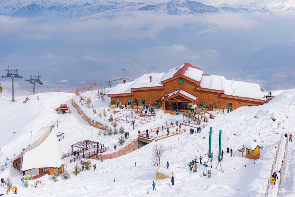
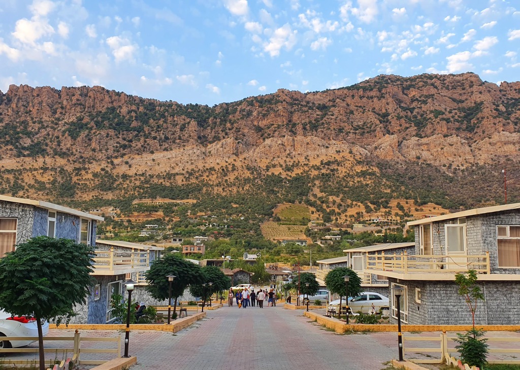
Mount Korek is in the Erbil Governorate in the Kurdistan Region of Iraq. It's a major tourist attraction with The Korek Mountain Resort & Spa atop the mountain and several cafes and restaurants in the area. Bekhal Waterfalls, situated to Mount Korek's northeast, attracts visitors nationwide.
Aside from its ski resort, Mount Korek is an excellent hiking destination with sweeping views of Hasan Bag Mountain (2,510 m/8,238 ft) to the northeast and the Rawanduz Valley. The summit of Mount Halgurd to the northeast is visible on a clear day from Mount Korek.
The trail to Mount Korek's summit essentially follows a service road that is paved and well-marked. You can pick up the route east of Rawanduz near the Teleferic Korek Mountain cable car stop. This out-and-back is approximately 16 km (10 mi) in length.
Kosrat Mountain 1,565 m/5,135 ft) is in the Sulaymaniyah Governorate of the Kurdistan Region. It's frequently summited for its views of Dokan village and Dukan Lake, the largest lake in Kurdistan.
A local guide is necessary to climb Kosrat — landmines left over from the Iran-Iraq War are common around the mountain. Make arrangements before traveling.
One of the best starting points for hiking Kosrat is from Khalakan village. The best route up Kosrat Mountain is from the west, heading northeast and then southeast along the ridge. There's a short but moderately-difficult scramble to reach the top of the summit tower. The route is about 12 km (7.5 mi) in length.
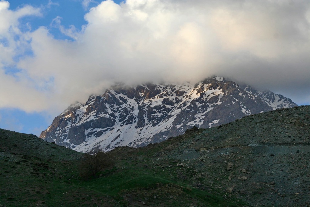
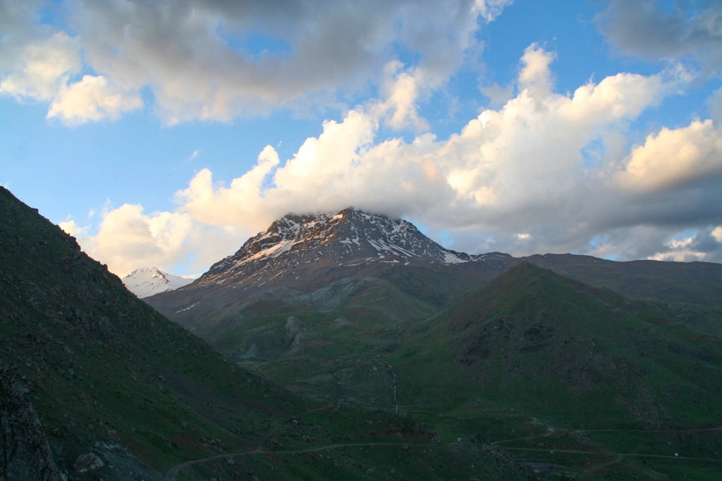
Cheekha Dar rests on the Iraq-Iran border within the Erbil Governorate of the Kurdistan Region. Iraq's highest mountain, Cheekha Dar, is rarely climbed due to its dangerous border position, but it is scalable with adequate preparation and determination.
You'll need to get a Kurdish Army guide to safely climb Cheekha Dar due to landmines and the presence of smugglers. From the Kurdistani capital, Erbil, travel to the small village of Gundah Zhur.
From Gundah Zhur, it's about a day's walk to the old Kurdish Hut at the mountain's base, which can serve as a starting point for the main ascent. You can reach the Cheeka Dar's summit from the old hut in one day, but it's best completed over two days.
Halgurd Mountain, also known as Hallgord Mountain, is the highest mountain entirely within Iraq. It's located within the Erbil Governorate, around 7 km (4.3 mi) southwest of Cheekha Dar.
The easiest way to climb Halgurd is by hiring a guide or joining a tour group to organize transportation and get you safely up and down the mountain. You can usually find guides and tour organizers in Erbil and Sulaymaniyah.
Starting in Erbil, you'll usually travel to Choman, where you can drive to Halgurd and begin your ascent. You'll need a Kurdistan Mountaineering and Climbing Federation permit to climb Halgurd. The hike is fairly technical, with some steep areas to navigate.
Depending on your starting point, you can climb Halgurd within a day — it’s usually a 9-10 hour round trip.
Piramagrun Mountain (2,611 m/8,566 ft), also known as Jabal Birah Magrun, is one of the most recognizable mountains in the Sulaymaniyah Governorate.
As with many Iraqi mountains, information on the hike is scarce. The summit offers spectacular views of the Zewe Valley and nearby peaks, including Kanir (1,944 m/6,378 ft) and Qimmat Mīrqūrī (1,908 m/6,260 ft).
While a guide isn't required for Pirmagrun, it's highly recommended. You can reach Piramagrun Mountain by driving from Sulaymaniyah northwest and following signposts to the small village of Zewe. Drive through the village north to the picnic area at the end of Zewe Road.
Hiking Piramagrun Mountain is tricky and includes a moderately challenging scramble up a gully. The walk takes around 5 hours to complete depending on your route.
The Zagros Mountain Trail (ZMT) is one of Iraq's newest long-distance hiking trails, meandering for 215 km (133.5 mi) through the Kurdistan Region's Zagros Mountains.
The ZMT starts in the village of Shush, around 70 km (43 mi) north of Erbil, and ends at the foot of Halgurd Mountain. Designated rest stops along the route include Akre, Zoragvan, Khalan, Soran, Rwanduz, and Choman.
The trail is not yet ready for independent hikers, but you can join weekly walks along the ZMT by signing up on the ZMT website. Hikes leave from Ankawa in Erbil and return before sunset.
Rich in ancient Mesopotamian ruins and Arabic culture, Iraq is fascinating, despite its reputation as an unstable conflict zone.
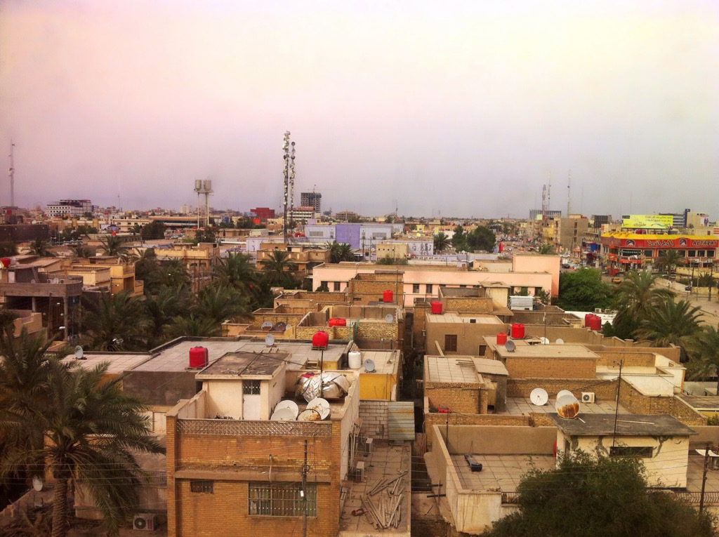
Baghdad is Iraq's largest city and capital. With a population of over 8 million people, it's the second-largest Arab city after Cairo, Egypt.
Despite infrastructural damage caused by the 2003 Iraq invasion, Baghdad holds many of Iraq's best cultural and historical attractions, such as the Iraqi National Museum, the Mutanabbi Statue, and the Yassin Mosque. It's also an economic hub, with major shopping areas like Babylon Mall and Mansour Mall.
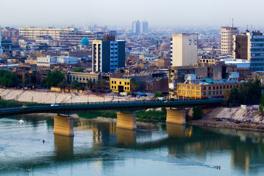
Baghdad is situated in central Iraq and is the country's best-connected city. Iraq's largest international airport, Baghdad International Airport, is less than 25 km (15.5 mi) from downtown Baghdad.
Basra, or al-Baṣrah, is Iraq's southernmost major city and one of its most important ports due to its position near the Persian Gulf. It's consistently Iraq's hottest city, with temperatures over 50 degrees Celsius (122 degrees Fahrenheit). It's famed for its association with the fictional mariner Sinbad the Sailor.
Basra is Iraq's economic capital and home to modern shopping centers like Basra Times Square Mall and Shanshal Mall. Popular attractions for families in Basra include Basra Family Park and Happy Land Amusement Park.
Iraq's second largest airport, Basra International Airport, is located 15 km (9 mi) from Basra's city center.
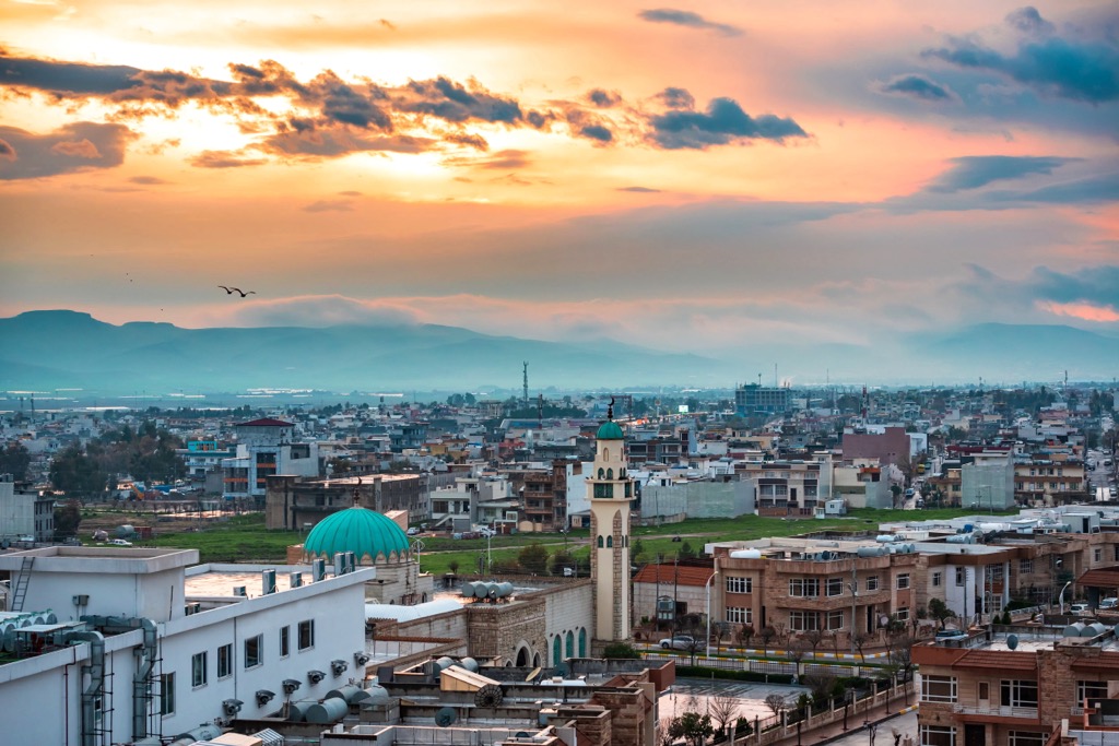
The northern city of Mosul is Iraq's second-largest, with a population of over 3.7 million. Resting on the banks of the Tigris, Mosul is one of Iraq's most culturally diverse cities. It's home to a significant Christian population and ethnic groups such as Turkmen, Assyrians, and Kurds.
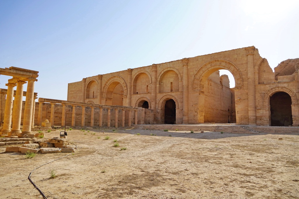
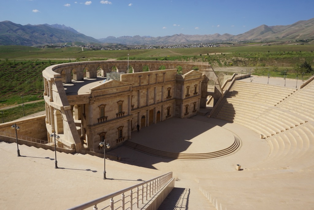
With historical connections to Mesopotamia, Mosul features many ancient ruins, such as the second-century remains of Hatra and several gates from the sixth-century BCE Assyrian city of Nineveh. Mosul is also home to significant religious buildings, including the Mosul Grand Mosque and Mor Mattai Monastery. Iraqi and U.S. bombing campaigns have badly damaged the city.
Mosul's location in the northern Nineveh Governorate is a good jumping-off point to explore the Zagros Mountains to the northeast.
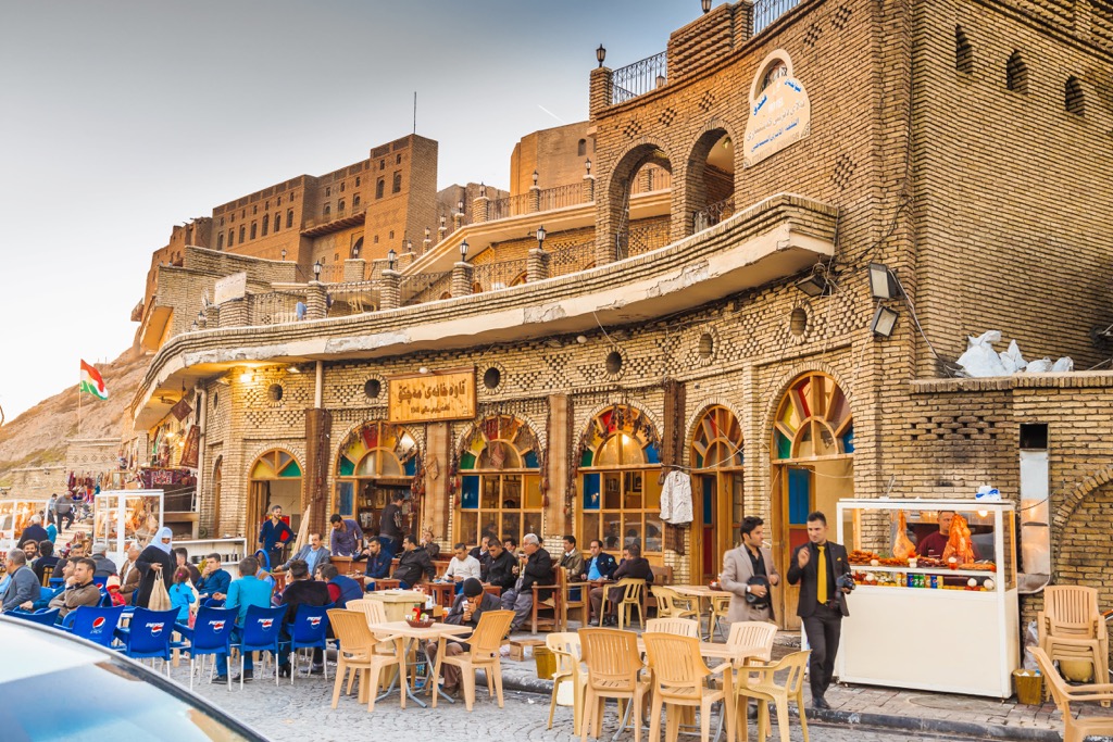
Erbil is the Kurdistan Region's capital and an excellent place to stay before exploring Iraq's finest mountains. It's around 100 km (62 mi) from Mount Korek and 200 km (124 mi) from Mount Halgurd.
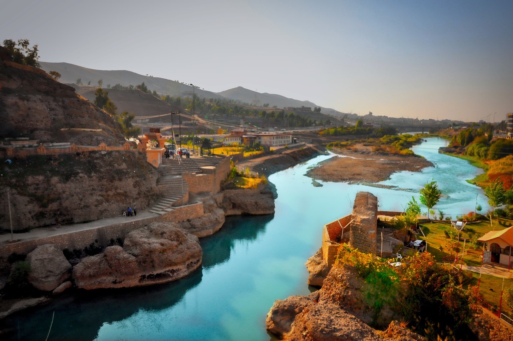
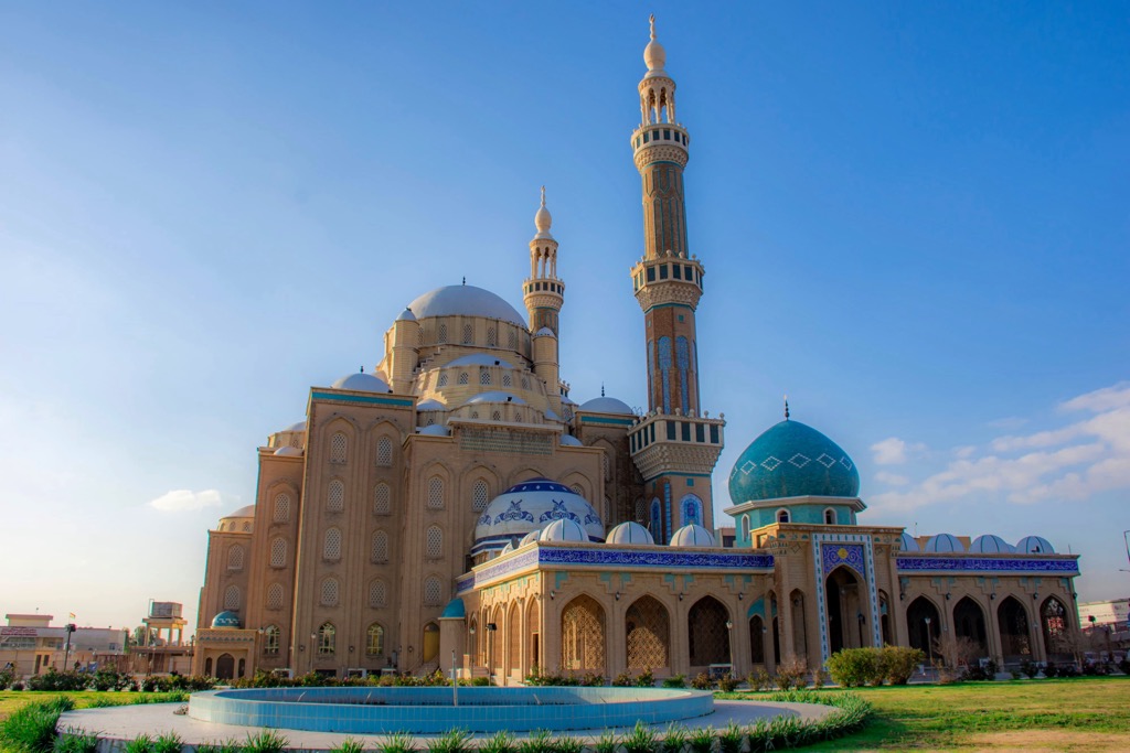
Erbil is an ancient city that humans have constantly inhabited since at least the sixth century BCE. The raised Citadel of Erbil is at the city's heart, a UNESCO World Heritage Site. Other attractions in Erbil include Jalil Khayat Mosque and Sami Abdulrahman Park.
Erbil International Airport is less than 8 km (5 mi) from downtown Erbil.
Sulaymaniyah is another prominent city in the Kurdistan Region. It's among the best bases to explore Iraq's highest mountains due to its position near the Iraq-Iran border.
Piramagrun Mountain is less than 30 km (18.5 mi) to the northwest of Sulaymaniyah. The Azmar, Goizha, and Qaiwan Mountains surround Sulaymaniyah in the north. Top attractions in Sulaymaniyah include City Star Mall, Slemani Museum, and Sarchnar Park.
Sulaymaniyah International Airport is located 14 km (8.5 mi) from the center of Sulaymaniyah.


Yes. Iraq has 4,208 named mountains. The highest is Cheekha Dar at 3,611 m.
The highest mountain in Iraq is Cheekha Dar, at 3,611 m.
Iraq has 4,208 named mountains.


