Scan the QR code and open PeakVisor on your phone
Lebanon (pop. 5.3 million) is a small nation in the Middle East, bordered by Syria to the north and east and Israel to the south. It also neighbors Cyprus to the west across the Mediterranean Sea. Despite its small size, Lebanon is spectacularly mountainous. In fact, it is the 9th most mountainous country in the world by peaks per land area, with 3329 named summits inside its mere 10,452 square kilometers (2,582,745 acres) of territory.
Lebanon’s principal mountain range (the Lebanon Mountains, also sometimes referred to as “Mount Lebanon”) is the apex of the Levant Ranges. The Levant Ranges are a vast and historically significant mountain chain spanning the eastern shores of the Mediterranean (north-south) across Israel, Jordan, Palestine, and Syria, with vestiges also in Turkey and Egypt. The highest and most prominent peak in Lebanon (and the Levant Range) is Qurnet Al Sawda (3,088 m/10,131 ft).
While Lebanon still suffers from some of the unrest that plagues the Middle East, there is a wealth of opportunity for outdoor adventure here, as well as rich history and spectacular cuisine (although note that this author is of Lebanese descent and grew up on Baba ghanoush, tabouleh, and shawarma, so he may be a bit biased).
Lebanon is a very narrow country, hemmed in by the Mediterranean Sea to its west and Syria to the east. On average, it is only 56 kilometers (35 mi) wide, in some places as narrow as 32 kilometers (20 mi), though its coastline is remarkably long for a country of its area (225 km/140 mi).
Four topographical strips divide Lebanon’s terrain, running north-south from west to east. These are the coastal strip or the maritime plain, western Lebanon, the central plateau or Beqaa Valley, and eastern Lebanon. These regions' landscape, climate, soil, and vegetation vary dramatically.
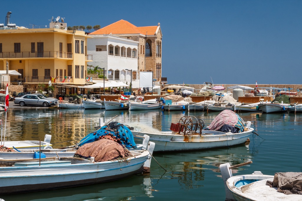
The coastal strip is narrow (only 6.5 km/4 mi) at its widest point. The shores of Lebanon are primarily rocky, though the undersea terrain is mellow and regular, without deep estuaries, gulfs, or other natural harbor formations. Fruits and vegetables are commonly grown along the coast, and it is home to almost all of Lebanon’s major cities, including Beirut, Tripoli, Byblos, Tyre, and Sidon.
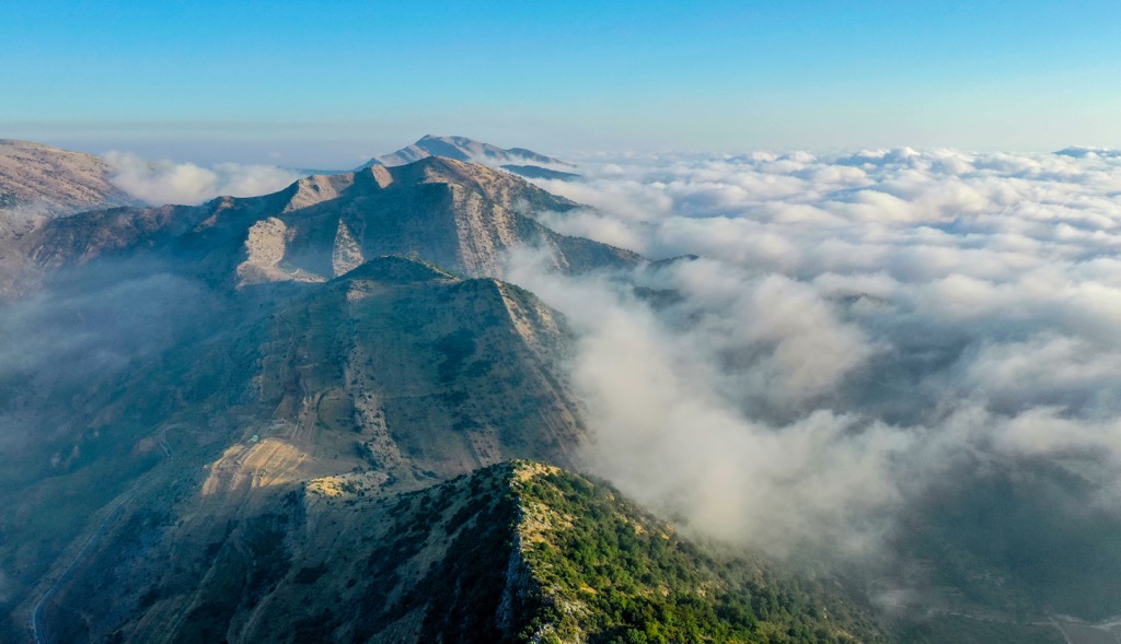
The second major region of Lebanon is the country’s largest mountain range, the Lebanon Mountains. These are the highest peaks in the Levant Range, which begins with the Nur Mountains of southern Turkey and ends with the towering massif of Mount Sinai (2,285 m/7,497 ft) in Egypt.
The Lebanon Mountains are notable because they are clearly truncated at both ends. In the north, the Kebir River separates them from the Al-Ansariyah (Syrian Coastal Range). In the south, they are cut off by the Qasimiyah portion of the Litani River. In total, the range is 169 kilometers (105 mi) long. Its highest point is Qurnet Al Sawda (3,088 m/10,131 ft). The southern reaches of the Lebanon Mountains become the eponymous mountains of the Shuf (Chouf) District, crowned by Machraa en Naanaa (1,946 m/6,385 ft).
Lying between the Lebanon and Anti-Lebanon Mountains (see below) is the third geographic region of Lebanon, the Beqaa Valley, or central highlands, which contains over 40 percent of Lebanon’s arable land. The Beqaa is part of the Great Rift Valley system, stretching from Syria to the Red Sea.
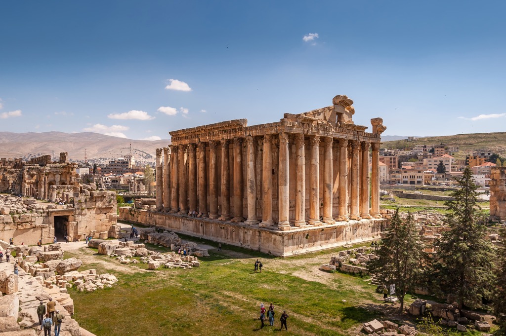
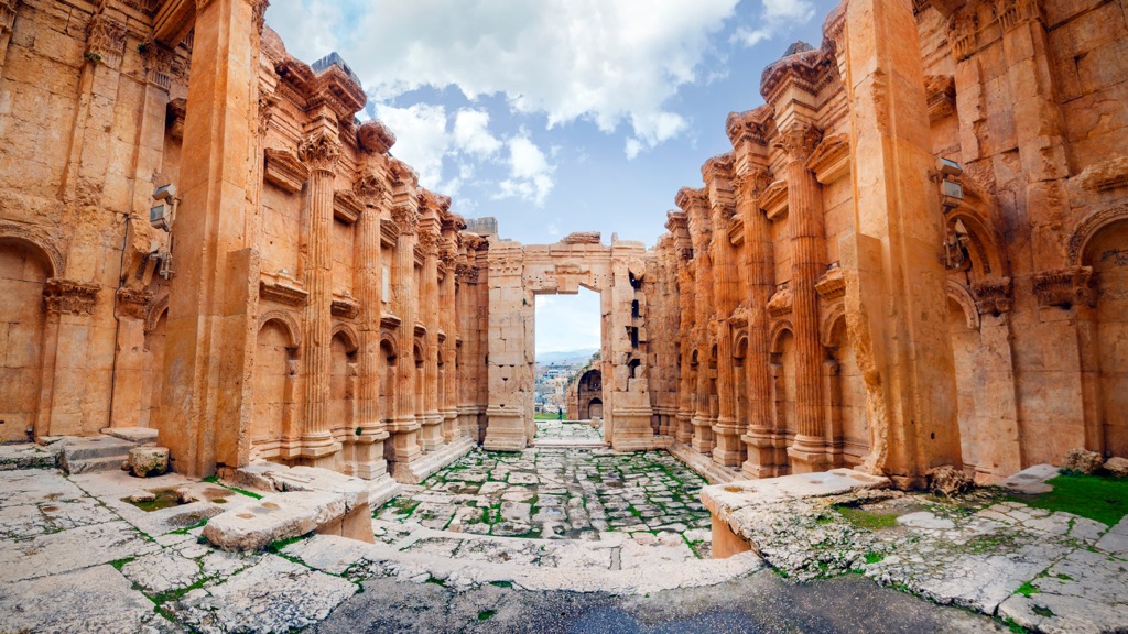
The fertile Beqaa, rife with orchards and vineyards, is the nation’s agricultural heartland and has served as such for centuries. In Roman times, it provided grain for all the Roman provinces of the Levant. Crops here include wheat, cotton, maize, and various vegetables.
The other notable mountain range of Lebanon is the aptly-named “Anti-Lebanon.” This north-south peak band is the fourth geographic region of Lebanon and marks the country’s eastern border with Syria. Many geologists believe the twin ranges were once united, though the Beqaa separates them today.
Anti-Lebanon’s highest peak, the apex (2,814 m/9,232 ft) of the Jabal Ash Shaykh massif, is the high point of Syria. The Anti-Lebanon is almost equal to the Lebanon range, divided by the Barada River, a crucial waterway flowing down into the desert to Damascus, Syria’s capital. The Anti-Lebanon is generally drier and more barren than the Lebanon Mountains, likely due to its distance from the sea. As a result, these mountains are much more sparsely populated.
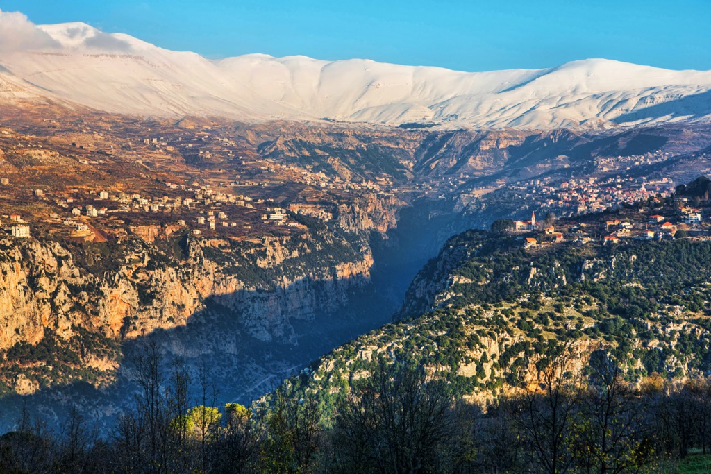
Lebanon’s climate is characteristic of the Mediterranean, with long, hot, dry summers and moderate, wet winters. In the high points of the Lebanon Mountains, many peaks are snowcapped nearly year-round.
The Beqaa and Anti-Lebanon are largely shielded from the maritime climate of the Mediterranean by the higher Lebanon Range. However, unlike the arid, barren land in Syria to the east, all three ranges receive snowfall. Nevertheless, water is becoming increasingly scarce in Lebanon due to climate change. Lebanon's Ministry of Environment estimates rainfall has decreased by as much as 20 percent in the last four decades.
Lebanon is positioned on the northern rim of the Arabian Plate, and upheaval between this and the Anatolian Plate (as well as the larger Eurasian Plate) has resulted in Lebanon’s spectacularly mountainous terrain. The country’s geological makeup comprises sedimentary rocks, primarily limestone, sandstone, and marlstone.
The most common rock type in the country (over 70 percent) is karstic limestone, while the remaining rock is predominantly sandstone. The former is responsible for much of Lebanon’s most unique natural formations. These include the Jeita Grotto, the longest cave system in the Middle East, inhabited in prehistoric times, the lush, verdant Nahr Ibrahim river valley, and the Wadi Qadisha, a UNESCO World Heritage site at the foot of Mount al-Makmal (2,588 m/8,491 ft).
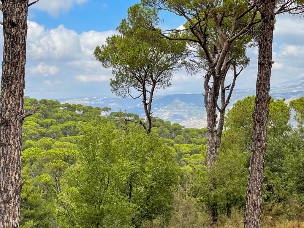
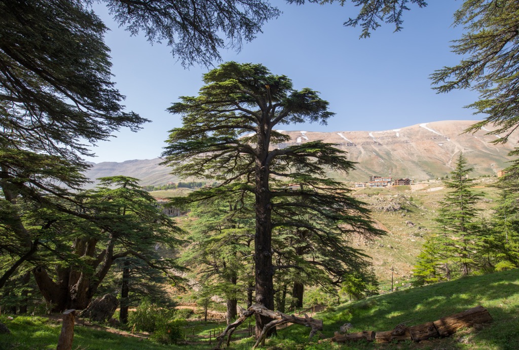
Lebanon is home to over 3,000 plant species and is much more heavily forested than other countries in the Levant, likely due to its higher elevation and mountainous terrain. Vegetation types range from subtropical to desert to alpine. The most notable flora is undoubtedly the Lebanon cedar. This unique species of cedar is the country’s national symbol, displayed on its flag and coat of arms.
Urban expansion, overgrazing, and violent conflict have decimated Lebanese cedar. However, the tree has been protected in many regions, including the nature reserve at Al Chouf, which spans 550 square kilometers (212 square miles). Other notable trees are the Lebanese wild apple, Syrian maple, Judas tree, and the ever-present Aleppo pine and Mount Tabor oak. Cypress, fir, maple, beech, and juniper also abound.
Plants from the Ceratonia and Pistacia families and wild almonds are typical of the scrub vegetation. There are also many flowering plants, mosses, and ferns, notably the endangered Lebanon violet, a purple flower that only grows in the heights of the Lebanon Mountains.
Grazing animals in Lebanon include mountain gazelles, Nubian ibex, and roe deer. Golden jackals, red foxes, striped hyenas, and gray wolves are common, as are packs of wild boar. There are many varieties of rodents, like mice, squirrels, jerboas, and gerbils, notably the Middle East blind mole-rat, Günther's vole, and—in alpine heights—rock hyrax.
Other noteworthy mammal species are the least weasel, Egyptian mongoose, beech marten, Caucasian badger, honey badger, European otter, marbled polecat, caracal, and porcupines. The Syrian brown bear formerly occupied both the Lebanon and Anti-Lebanon ranges. Though they were considered extinct by the 1980s, a sighting was reported in 2016, indicating a small population may still survive.
There is only one endemic fish in Lebanon, the Levantine minnow, which lives in Lake Yammoune. There are a variety of reptiles and amphibians in Lebanon, including tortoises, snakes, lizards (including chameleons), frogs, and toads.
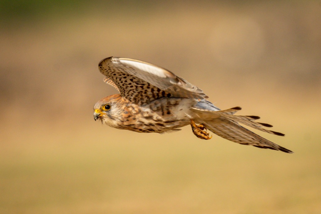
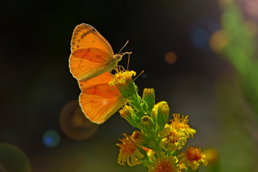
Rare birds of Lebanon include the ferruginous duck, lesser kestrel, great snipe, and greater spotted eagle in wetland regions. In the mountains, one can find Syrian serin, chukar partridge, long-legged buzzards, and horned owls. Migratory birds, such as ruff, gray herons, white wagtails, and Audouin's gull, frequent the islands off Lebanon's coasts. These shores are breeding grounds for loggerhead and green sea turtles, and endangered Mediterranean monk seals have also been sighted here.
Because of its strategic position on the eastern shores of the Mediterranean, Lebanon has long served as a link to India and Asia as a whole. Like much of the Levant, it traces its historical roots to the sea-faring Phoenicians, who settled there as early as 3000 BCE, establishing city-states like Byblos, Tyre, and Sidon along the coast. Circa 600 BCE, the Persians conquered the region. Only two hundred years later, Alexander the Great swept through, merging the existing Persian/Phonecian culture with previously foreign Hellenistic language, architecture, and arts.
With the spread of the Romans before the turn of the millennium, Lebanon became part of the province of Syria. As elsewhere in the Roman Empire, Christianity spread throughout Lebanon at this time. It remains a prominent religion in the country today, in contrast to many neighboring Middle Eastern nations. Christians were once a majority in Lebanon and remain the majority of the Lebanese diaspora (including this author’s family, which immigrated to the United States in the early 20th century).
Following the Romans, the Byzantines, and later the Islamic Rashidun Caliphate, ruled over the region, ushering in an era of multiple Islamic dynasties, including the Umayyads, Abbasids, Fatimids, and Mamluks.
The country was a focal point of the Crusaders from the 11th to 13 centuries (AD), and cities like Tripoli and Sidon became important Crusader strongholds, bases for pushes further south and east into the Holy Land until the Mamluks ultimately cast out the Europeans.
For most of the following four centuries, the region subsisted under the yoke of the Ottoman Empire. However, various revolts and rebellions continued to spring up, including the Druze-Maronite conflict, based out of the Lebanon Mountains. Like in neighboring Israel, Ottoman rule lasted until their defeat, along with the Central Powers (Germany, Austria-Hungary), in World War I.
The fall of the Ottoman Empire after World War I led to the establishment of the State of Greater Lebanon in 1920 under the French Mandate. Lebanon's borders were drawn, and its modern identity started to take shape. In 1943, Lebanon gained independence from France, and the National Pact, an agreement between Lebanon's religious communities, established a power-sharing system that remains in place today.
Lebanon's post-independence years were marked by periods of stability and prosperity but also by internal political tensions and external conflicts. The country served as a regional hub for commerce, banking, and tourism but faced numerous challenges, including the Palestinian refugee crisis, civil wars, and external interference.
The Lebanese Civil War, which lasted from 1975 to 1990, was a devastating conflict that tore the nation apart along sectarian lines. It caused immense suffering, loss of life, and destruction of infrastructure. After the war's end, Lebanon entered a period of post-war reconstruction and reconciliation, striving to rebuild its society and economy.
Lebanon’s wilderness is best visited in autumn and spring, which offer the most moderate climes for hiking.
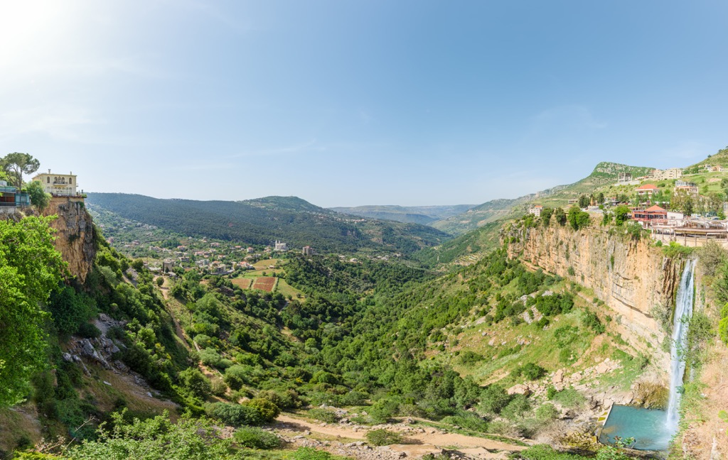
This protected reserve in the Qadisha Valley houses one of the last remaining strongholds of Lebanese cedar, some of which are estimated to be over 1,000 years old. References to these cedars are even found in the Epic of Gilgamesh, written as early as 4,000 years ago. These trees stretch over 40 meters (131 ft) tall and have trunks as wide as 2.5 meters (8 ft).
Hiking trails abound throughout the park, and walking among these ancient trees is a must-do for any nature-loving tourist. The larger Qadisha (Holy) Valley is a worthy hiking destination in its own right, as well. This deep gorge is rife with picturesque cliff faces, lush greenery, and more than a few ancient monasteries.
Along with the Qadisha, the lush Narh Ibrahim river valley in the Kisrwan District offers some of the most beautiful hiking in Lebanon. This river is known for its healing properties, and it feeds the ancient city of Byblos (first inhabited in 8000 BCE). This river valley houses many ancient temples and shrines and plenty of hiking trails ranging from mellow to intense.
The trail out of Ibri village comes highly recommended, in contrast to the popular trail at Chouwen, which has suffered from littering and poor maintenance in recent years.
Nestled along the Mediterranean coastline is Horsh Ehden, another of Lebanon’s most important nature reserves. Lebanon cedar is found here, as are several endangered animals, like the eastern imperial eagle. There are around 40 kilometers (25 mi) of magnificent established trails, but walking the eponymous 4.6-mile loop will allow you to see the park's most beautiful areas.
More than 1,000 unique plant species are in the reserve, accounting for nearly 40% of Lebanon’s native plants, and 115 are endemic to Lebanon. The most ecologically significant plants include Cilician fir, Greek juniper, and Kotschy oak. Horsh Ehden is also the only protected area in Lebanon with a population of Lebanese wild apples.
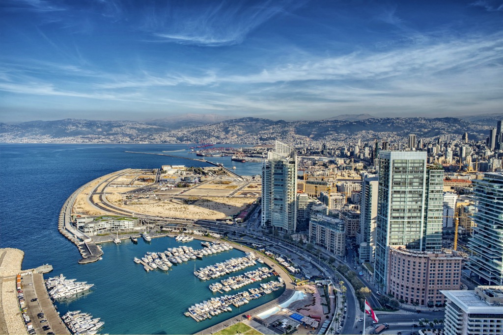
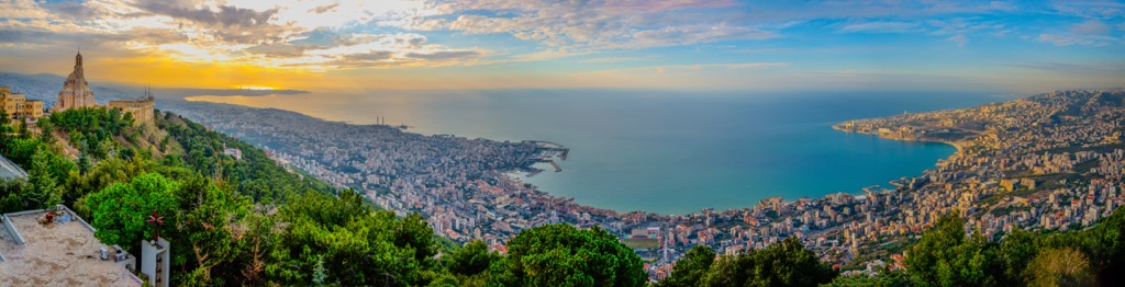
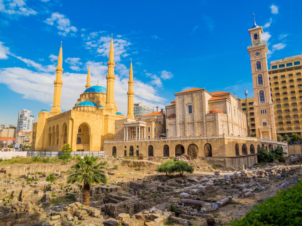
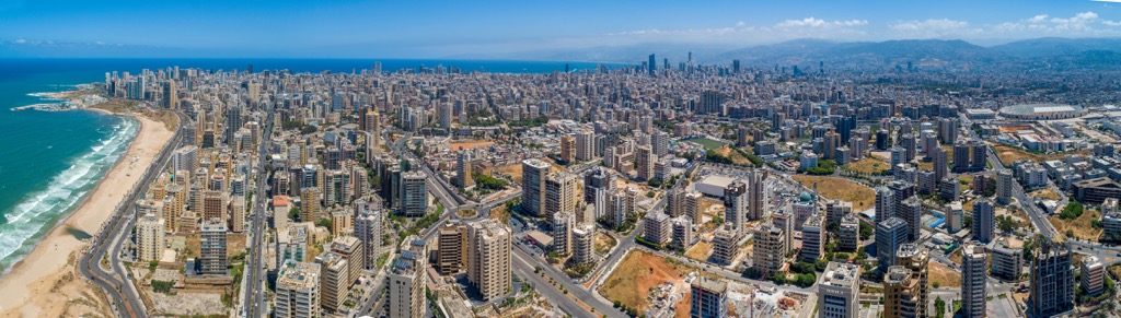
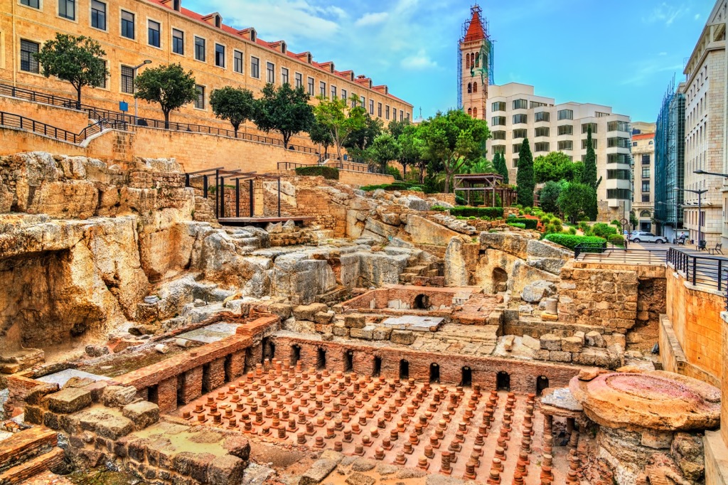
Beirut, Lebanon’s vibrant capital (pop 2.5 million), blends history, culture, and modernity. Historically-minded visitors can explore archaeological wonders like the Roman Baths, the National Museum of Beirut (an archaeological treasure trove), and the Pigeon Rocks, a pair of seaside spires and a natural arch.
The city's diverse neighborhoods offer a tapestry of experiences, from the bustling streets of historic Gemmayzeh to Hamra, one of Beirut’s intellectual hubs, home to both the University of Beirut and Lebanese American University. Beirut's culinary scene is a gastronomic delight, with a plethora of delectable Lebanese dishes. Soak in the Mediterranean sun on the city's beaches by day, and dive into its lively nightlife by night.
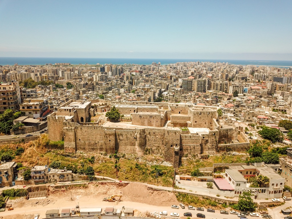
No trip to Lebanon is complete without a visit to Tripoli (pop. 250,000). The second-largest city and northernmost port in Lebanon, Tripoli’s history dates to at least 1400 BCE. Among other noteworthy sights, visitors should see the Mansouri Great Mosque (built circa 1294 CE) and the Citadel of Raymond de Saint-Gilles, the largest Crusader fortress in Lebanon. Tripoli also has the world’s second-highest concentration of Mamluk slave soldier architecture outside Cairo. The high point of the Tripoli District (Qada Tarablos) is Dahret Houâra (290 m/951 ft).
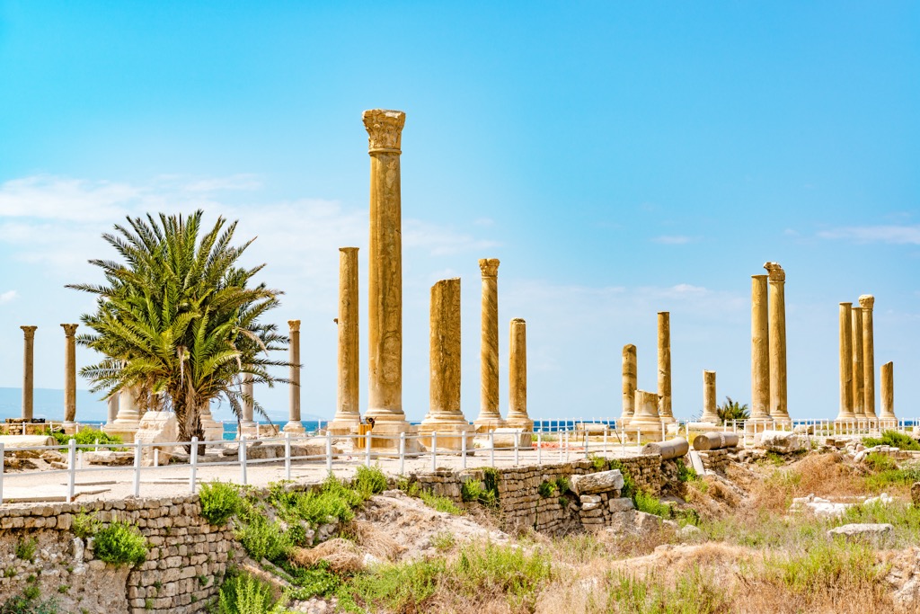
Byblos and Sidon are two other mid-sized cities (among many) worth mentioning for the international tourist, but Tyre (pop. 60,000) is perhaps Lebanon’s most fascinating destination. The southern coastal city is over 4,000 years old, one of the oldest inhabited cities in the world. Notable sights include the Phoenician Ruins, Roman Hippodrome, and sprawling Al Mina archaeological excavations (streets paved with Roman and Byzantine mosaics, public baths from 100 to 200 AD, and a 12th-century Crusader cathedral).
This is all without mentioning the mazes of captivating souks (traditional Arab marketplaces) throughout the city. Here, travelers can sample all manner of Lebanese cuisine and shop for handicrafts. Be sure to enjoy a stroll along the Corniche (a seaside “boardwalk” area) as the sun goes down, and don’t miss out on scuba diving, snorkeling, and other water sports activities in the sun-dappled waters of the Mediterranean. The high point of the Tyre District (Qada Sour) is Jabal Blât (761 m/2,497 ft).