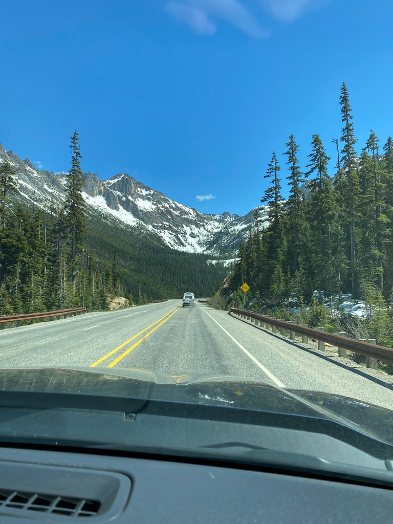
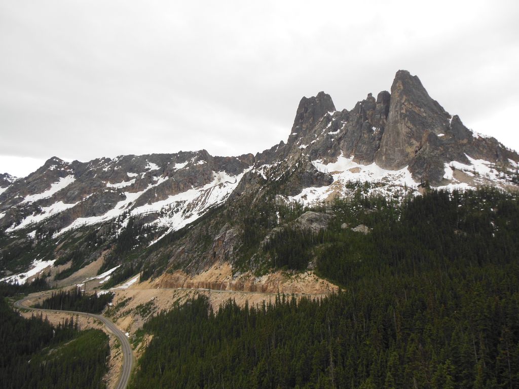
Washington Pass (el. 5477 ft./1669 m.) and Rainy Pass (el. 4875 ft./1486 m.) are two mountain passes on State Route 20 (North Cascades Highway) in the North Cascades mountains of Washington state. Rainy Pass is about 4 miles to the west of Washington Pass. The passes are typically closed between November and April due to heavy snowfall. The north–south Pacific Crest Trail crosses east-west Highway 20 at Rainy Pass. The Washington Pass Overlook Trail, designated a National Recreation Trail in 1978, runs a short 0.2 miles (0.32 km) from the pass to an overlook with views of Liberty Bell Mountain and the highway 700 feet (210 m) below.
We use GPS information embedded into the photo when it is available.
3D mountains overlay
Adjust mountain panorama to perfectly match your photos because recorded by camera photo position might be imprecise.
Move tool
Rotate tool
Zoom
More customization
Choose which peak labels should make into the final photo and what photo title should be.
Next
Photo Location
Satellitte
Flat map
Relief map
Latitude
Longitude
Altitude
OR
Latitude
°'''
Longitude
°'''
Apply
Register Peak
Peak Name
Latitude
Longitude
Altitude
Register
Teleport
PeakVisor
This 3D model of Sagarmatha National Park in Nepal was made using the PeakVisor app topographic data. The mobile app features higher precision models worldwide, more topographic details, and works offline. Download PeakVisor maps today.
Download OBJ model
PeakVisor
The download should start shortly. If you find it useful please consider supporting the PeakVisor app.
PeakVisor for iOS and Android
Be a superhero of outdoor navigation with state-of-the-art 3D maps and mountain identification in the palm of your hand!


.jpg)


