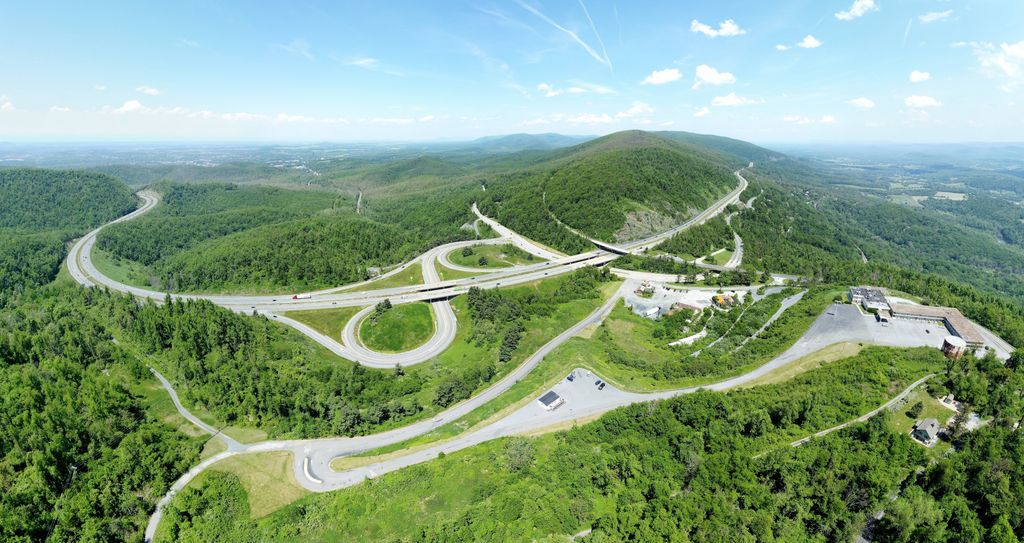
Rockfish Gap is a wind gap located in the Blue Ridge Mountains between Charlottesville and Waynesboro, Virginia, United States, through Afton Mountain, which is frequently used to refer to the gap. Joining the Shenandoah Valley to the Piedmont region of the state, it is the site of the mountain crossing of Interstate 64, U.S. Route 250, and the former Blue Ridge Railroad which later became part of the Chesapeake and Ohio Railway and is currently part of the CSX line. With an elevation of about 1,900 feet (580 m), it is one of the lowest gaps between Manassas Gap and the James River. Rockfish Gap lies along a drainage divide between southeast-flowing streams that drain to the James River and northwest-flowing streams in the Shenandoah River system. The scenic Skyline Drive, which runs north through Shenandoah National Park to Front Royal, and the Blue Ridge Parkway, which runs south to a point near Cherokee, North Carolina, each generally following the mountain ridgetops, meet a short distance north of Rockfish Gap (such that the roadway on the bridge over the gap is actually part of the Blue Ridge Parkway). The Appalachian Trail also passes through the gap.
We use GPS information embedded into the photo when it is available.
3D mountains overlay
Adjust mountain panorama to perfectly match your photos because recorded by camera photo position might be imprecise.
Move tool
Rotate tool
Zoom
More customization
Choose which peak labels should make into the final photo and what photo title should be.
Next
Photo Location
Satellitte
Flat map
Relief map
Latitude
Longitude
Altitude
OR
Latitude
°'''
Longitude
°'''
Apply
Register Peak
Peak Name
Latitude
Longitude
Altitude
Register
Teleport
PeakVisor
This 3D model of Sagarmatha National Park in Nepal was made using the PeakVisor app topographic data. The mobile app features higher precision models worldwide, more topographic details, and works offline. Download PeakVisor maps today.
Download OBJ model
PeakVisor
The download should start shortly. If you find it useful please consider supporting the PeakVisor app.
PeakVisor for iOS and Android
Be a superhero of outdoor navigation with state-of-the-art 3D maps and mountain identification in the palm of your hand!


_in_Rockfish_Gap%2C_Augusta_County%2C_Virginia.jpg)