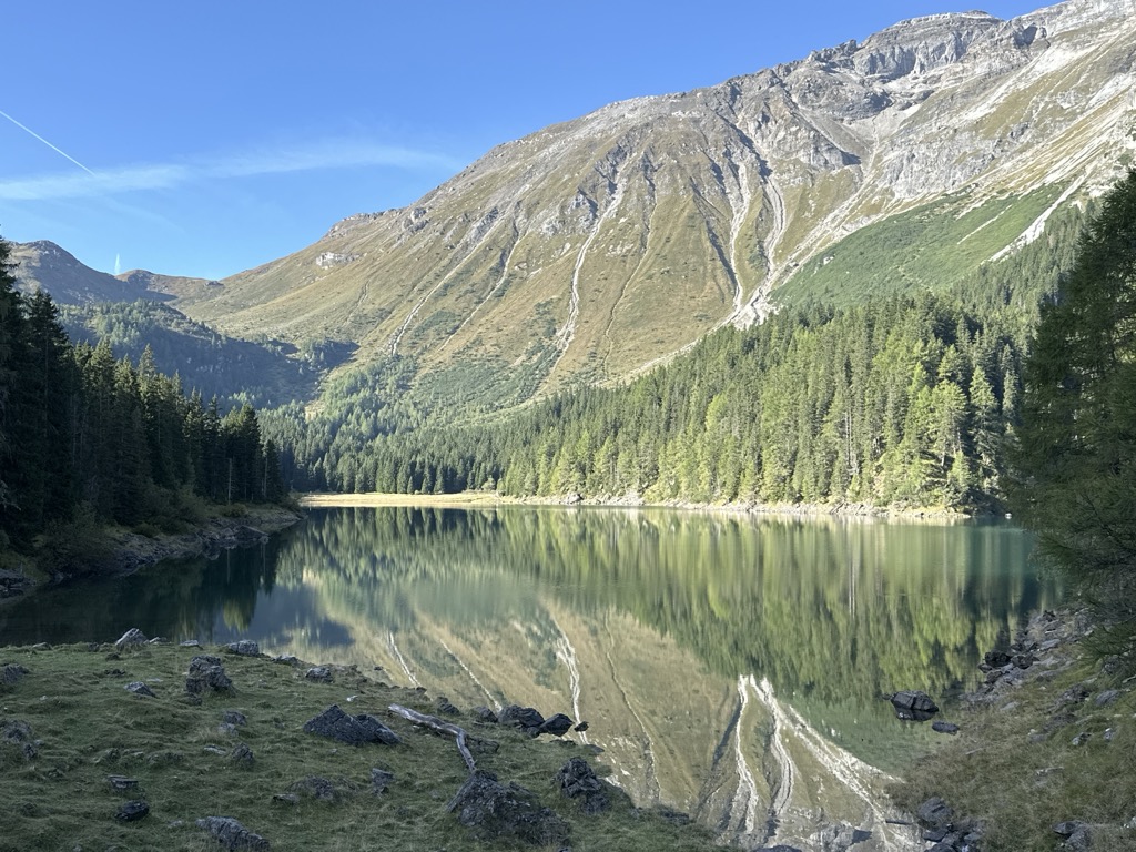
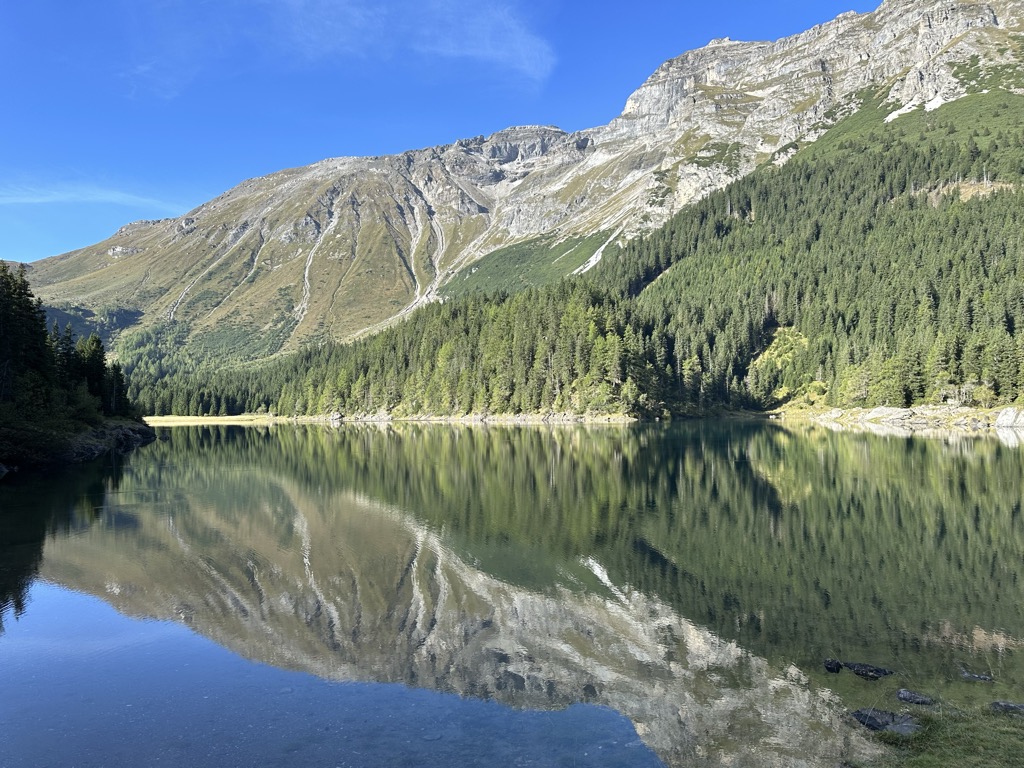
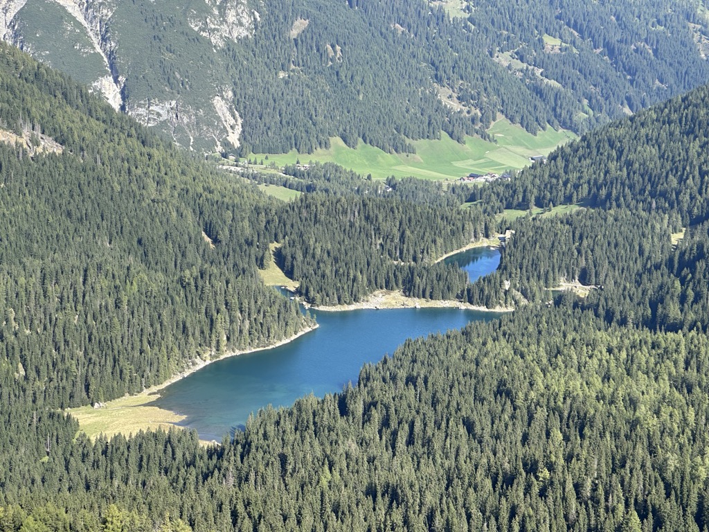
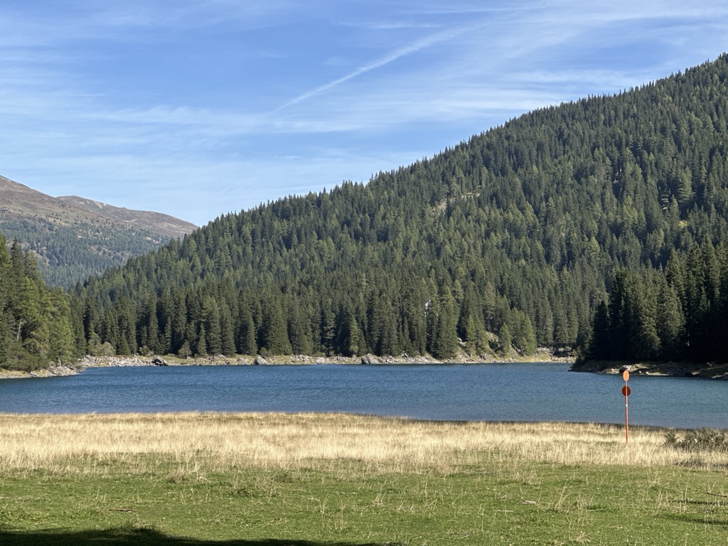
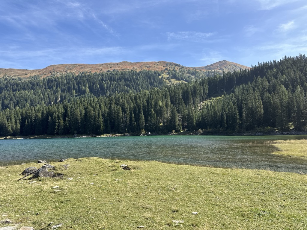
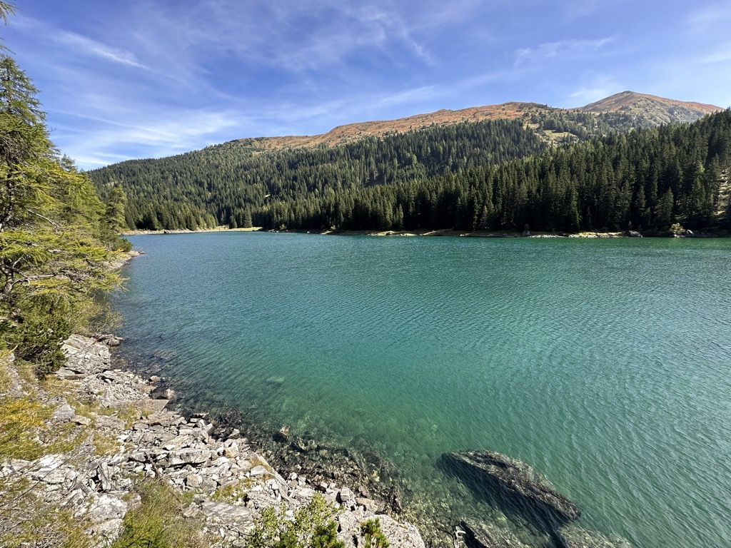
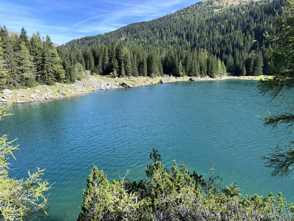
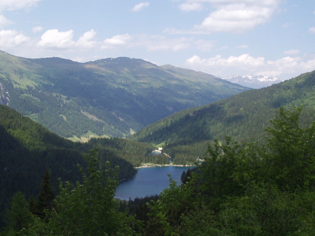
Lake Obernberg (German: Obernberger See) is a lake of Tyrol, Austria. Lake Obernberg lies at an elevation of 1,590 metres in the municipality Obernberg am Brenner near the Brenner. It is the biggest lake on the southern side of Tyrol. The fresh water is provided by the Obernberger Seebach subterranean springs. Around the lake are travel paths. There was a prehistoric rock fall from the Obernberger Tribulaun (a peak on the north side of the lake). The lake is now separated into two parts, however in late spring and early summer the water level rise and the parts can get connected. On the rocks a chapel (Maria am See) was built in 1935. The lake has a high quality on the surface and is one of the most beautiful mountain lakes of Tyrol. On the bottom of the lake is a curtain of algae making the water muddy at 13 metres. Bathing is prohibited, so that the fish population and the quality of the water remains untouched. Trout and other fish live in the lake.
We use GPS information embedded into the photo when it is available.
3D mountains overlay
Adjust mountain panorama to perfectly match your photos because recorded by camera photo position might be imprecise.
Move tool
Rotate tool
Zoom
More customization
Choose which peak labels should make into the final photo and what photo title should be.
Next
Photo Location
Satellitte
Flat map
Relief map
Latitude
Longitude
Altitude
OR
Latitude
°'''
Longitude
°'''
Apply
Register Peak
Peak Name
Latitude
Longitude
Altitude
Register
Teleport
PeakVisor
This 3D model of Sagarmatha National Park in Nepal was made using the PeakVisor app topographic data. The mobile app features higher precision models worldwide, more topographic details, and works offline. Download PeakVisor maps today.
Download OBJ model
PeakVisor
The download should start shortly. If you find it useful please consider supporting the PeakVisor app.
PeakVisor for iOS and Android
Be a superhero of outdoor navigation with state-of-the-art 3D maps and mountain identification in the palm of your hand!