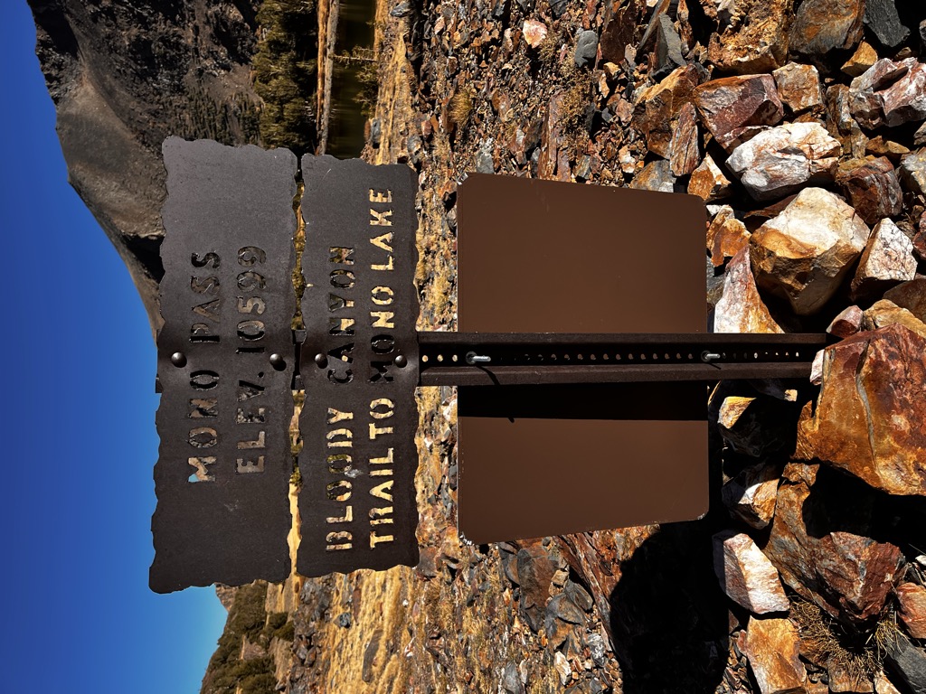
Mono Pass is a mountain pass, just outside Yosemite National Park, near the region of Tuolumne Meadows. Mono Pass is between Mount Gibbs and Mount Lewis. There is another pass also named Mono less than 40 miles away in the Rock Creek/Little Lakes Valley area. Both Mono Passes are in the Inyo National Forest. The Mono Pass in the Rock Creek/Little Lakes Valley area is accessed by the Mosquito Flats Trailhead rather than the Mono Pass Trailhead in Yosemite National Park. Mono Pass is on the Great Basin Divide, which demarcates the Great Basin. The latter is the largest area in North America from which waters don't drain towards an ocean. Tioga Pass, the east entrance to the national park on highway 120, 4.5 miles north-northwest, is likewise on the Great Basin Divide.
We use GPS information embedded into the photo when it is available.
3D mountains overlay
Adjust mountain panorama to perfectly match your photos because recorded by camera photo position might be imprecise.
Move tool
Rotate tool
Zoom
More customization
Choose which peak labels should make into the final photo and what photo title should be.
Next
Photo Location
Satellitte
Flat map
Relief map
Latitude
Longitude
Altitude
OR
Latitude
°'''
Longitude
°'''
Apply
Register Peak
Peak Name
Latitude
Longitude
Altitude
Register
Teleport
PeakVisor
This 3D model of Sagarmatha National Park in Nepal was made using the PeakVisor app topographic data. The mobile app features higher precision models worldwide, more topographic details, and works offline. Download PeakVisor maps today.
Download OBJ model
PeakVisor
The download should start shortly. If you find it useful please consider supporting the PeakVisor app.
PeakVisor for iOS and Android
Be a superhero of outdoor navigation with state-of-the-art 3D maps and mountain identification in the palm of your hand!