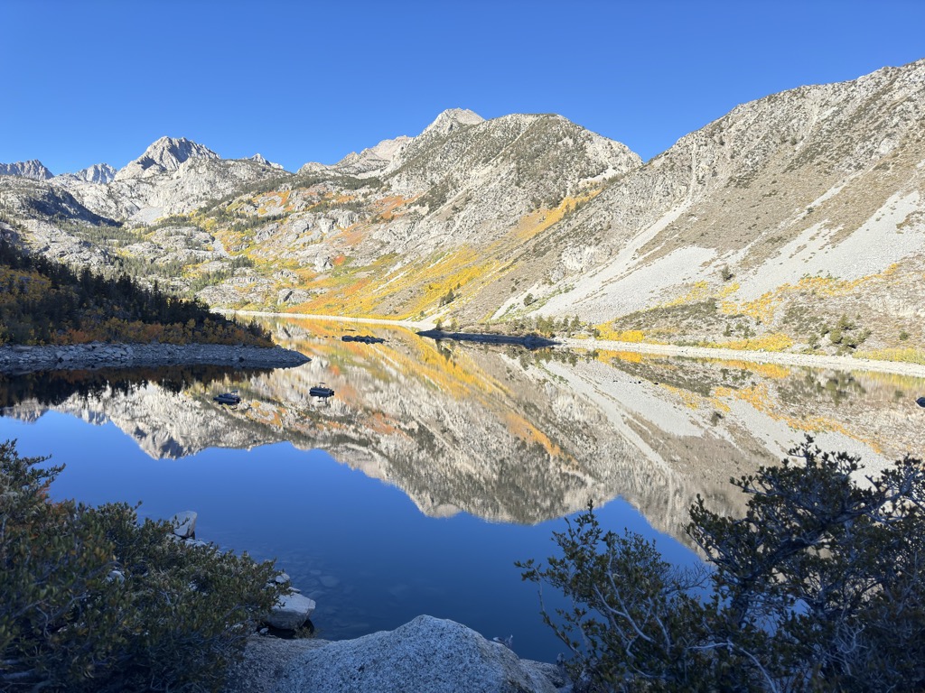
Lake Sabrina is a lake created by damming the middle fork of Bishop Creek. It is located south-west of Bishop, California on California State Route 168, in the Inyo National Forest. It has a cafe as well as a dock. The dam was built in 1907–8 to supply a constant flow of water to the hydraulic power plants. The lake is part of the Bishop Creek system. Local residents pronounce the lake "Sah-bry-nuh;" however, the lake was originally named after Mrs. Sabrina (pronounced: suh-BREE-nuh) Hobbs, wife of C.M. Hobbs first General Manager of California Nevada Power Company which built the dam. The reason for the lake's name pronunciation changing over the years is unclear. The segment of the State Route 168 from Lake Sabrina east to the community of Aspendell is subject to closure to most vehicles during the winter months, usually not opening until mid- or late-April, due to snow removal. The winter road closure gate is actually located to the southwest of Aspendell.
We use GPS information embedded into the photo when it is available.
3D mountains overlay
Adjust mountain panorama to perfectly match your photos because recorded by camera photo position might be imprecise.
Move tool
Rotate tool
Zoom
More customization
Choose which peak labels should make into the final photo and what photo title should be.
Next
Photo Location
Satellitte
Flat map
Relief map
Latitude
Longitude
Altitude
OR
Latitude
°'''
Longitude
°'''
Apply
Register Peak
Peak Name
Latitude
Longitude
Altitude
Register
Teleport
PeakVisor
This 3D model of Sagarmatha National Park in Nepal was made using the PeakVisor app topographic data. The mobile app features higher precision models worldwide, more topographic details, and works offline. Download PeakVisor maps today.
Download OBJ model
PeakVisor
The download should start shortly. If you find it useful please consider supporting the PeakVisor app.
PeakVisor for iOS and Android
Be a superhero of outdoor navigation with state-of-the-art 3D maps and mountain identification in the palm of your hand!