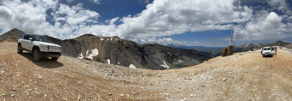
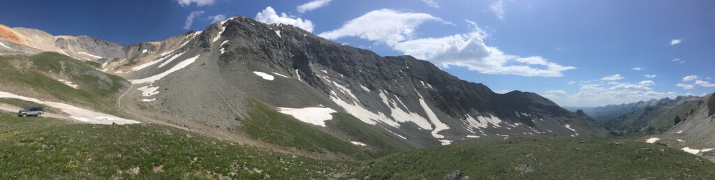
Imogene Pass is a 13,114 ft (3,997 m) high mountain pass in the San Juan Mountains in the southwest part of the US state of Colorado. It crosses a ridge connecting Ouray, Colorado with Telluride, Colorado, and is the highest mountain pass in the San Juan Mountains, and the second highest vehicular mountain crossing in Colorado. The road is accessible by four wheel drive vehicles, and is not for the novice driver. From Ouray, the road turns off the road to Yankee Boy Basin above the Camp Bird Mine near the ghost town of Sneffels southwest of Ouray, and climbs through Imogene Basin to the summit. From Telluride, the road takes off north of downtown and climbs past the ghost town of Tomboy through Savage Basin to the summit. The first long distance alternating current power line was constructed over Imogene Pass to carry power from the Telluride area to the Camp Bird Mine. "Fort Peabody" was constructed in 1904 by a local unit of the Colorado National Guard on top of the pass to prevent union miners from crossing during a labor strike. An annual foot race is held over the pass between Ouray and Telluride on the first Saturday following Labor Day. The grueling 17 mi (27 km) race starts at around 7,800 ft (2,400 m) before cresting the pass at its peak, an elevation gain of just over a mile.
We use GPS information embedded into the photo when it is available.
3D mountains overlay
Adjust mountain panorama to perfectly match your photos because recorded by camera photo position might be imprecise.
Move tool
Rotate tool
Zoom
More customization
Choose which peak labels should make into the final photo and what photo title should be.
Next
Photo Location
Satellitte
Flat map
Relief map
Latitude
Longitude
Altitude
OR
Latitude
°'''
Longitude
°'''
Apply
Register Peak
Peak Name
Latitude
Longitude
Altitude
Register
Teleport
PeakVisor
This 3D model of Sagarmatha National Park in Nepal was made using the PeakVisor app topographic data. The mobile app features higher precision models worldwide, more topographic details, and works offline. Download PeakVisor maps today.
Download OBJ model
PeakVisor
The download should start shortly. If you find it useful please consider supporting the PeakVisor app.
PeakVisor for iOS and Android
Be a superhero of outdoor navigation with state-of-the-art 3D maps and mountain identification in the palm of your hand!