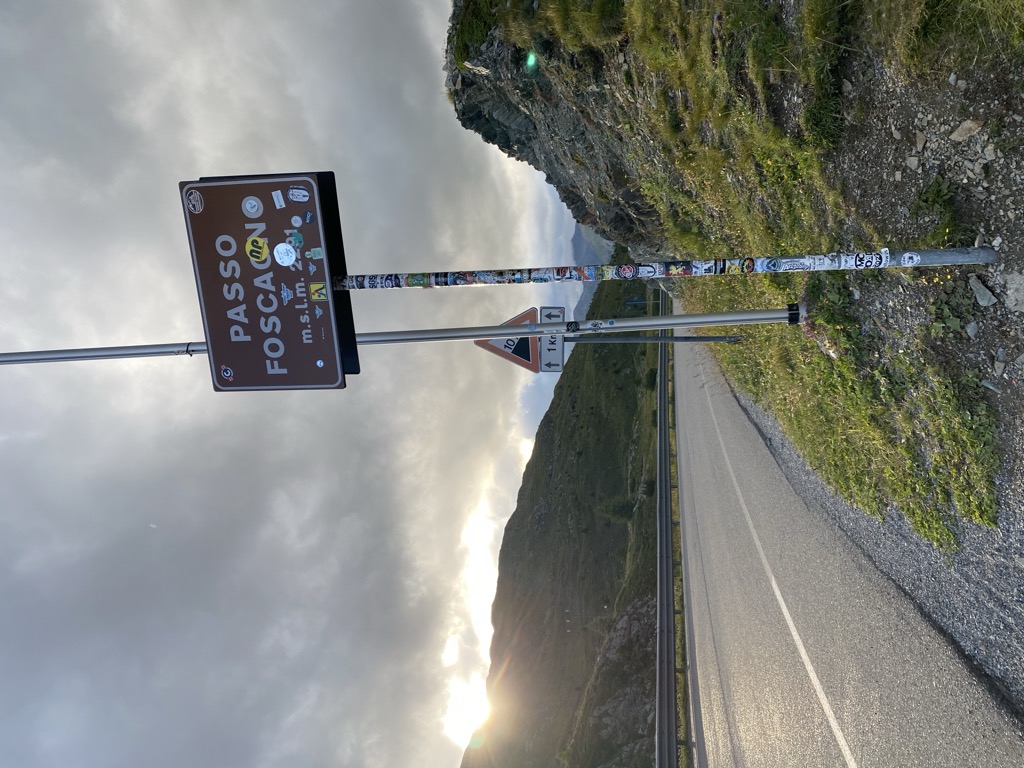
Foscagno Pass (Italian: Passo di Foscagno, Romansh: Pass da Fus-chagn) (el. 2291 m.) is a high mountain pass in the Alps in the province of Sondrio, northern Italy. The road (SS 301) connects Bormio in the east and Livigno in the west. It is the only link between Livigno and the rest of Italy, and is usually open all year round. This route also includes the subsidiary Eira Pass (Italian: Passo d'Eira) (2209 m) which lies between the Foscagno Pass and Livigno itself. Here lies the village of Trepalle, part of Livigno municipality, and one of Europe's highest inhabited parishes. Although both sides of the pass are in the same country, Italy, you are required to pass through customs at the top. This is due to the duty-free status of Livigno. The pass is located on the main alpine watershed. Water on the north side of the pass flows down into the Inn and Danube, whereas water on the south side flows down into the Adda and Po.
We use GPS information embedded into the photo when it is available.
3D mountains overlay
Adjust mountain panorama to perfectly match your photos because recorded by camera photo position might be imprecise.
Move tool
Rotate tool
Zoom
More customization
Choose which peak labels should make into the final photo and what photo title should be.
Next
Photo Location
Satellitte
Flat map
Relief map
Latitude
Longitude
Altitude
OR
Latitude
°'''
Longitude
°'''
Apply
Register Peak
Peak Name
Latitude
Longitude
Altitude
Register
Teleport
PeakVisor
This 3D model of Sagarmatha National Park in Nepal was made using the PeakVisor app topographic data. The mobile app features higher precision models worldwide, more topographic details, and works offline. Download PeakVisor maps today.
Download OBJ model
PeakVisor
The download should start shortly. If you find it useful please consider supporting the PeakVisor app.
PeakVisor for iOS and Android
Be a superhero of outdoor navigation with state-of-the-art 3D maps and mountain identification in the palm of your hand!