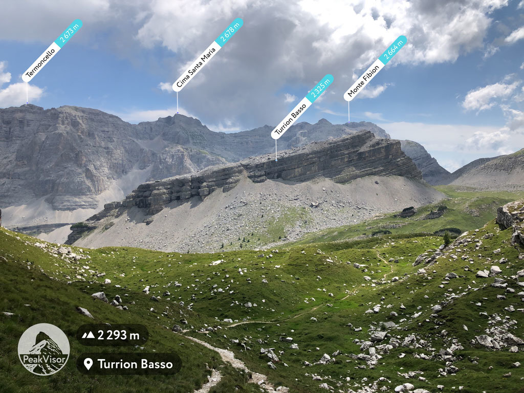
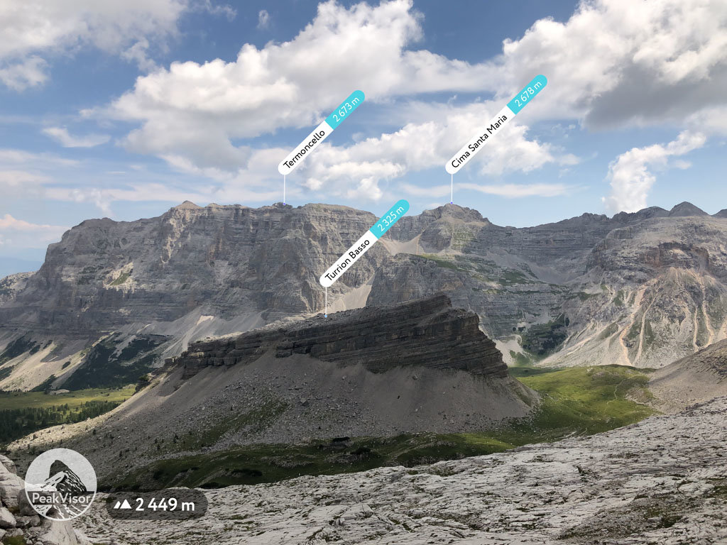
At an elevation of 2,325 m (7,628 ft.), and with a prominence of 99 m (325 ft.), Turrion Basso forms part of the Southern Rhaetian Alps. It is situated in the Province of South Tyrol, Italy.
This mountain of stratified rock is much-photographed due to its unique profile and the fact that the shape changes depending on the angle from which one views it. It is an easy, four-hour climb to the summit. It is a good idea to check the latest weather forecast before setting out.
The climb starts from the Carlomagno Pass, which can be reached by road from Santa Caterina di Valfurva or from Lake Tovel and Madonna di Campiglio. The path leads to the Grostè cableway and proceeds through a gully connecting the base with the summit. In the summer, a shuttle service to the base of Turrion Basso is available from the village of Tuenno.
On the way up, one needs to be wary of slippery scree. The summit is a gently sloping plateau.
The nearest mountain hut is Malga Flavona located 1 853m/6 080ft N of the summit.
By prominence Turrion Basso is
# 37 out of 207 in the Brenta group # 48 out of 307 in Parco naturale dell'Adamello-Brenta
We use GPS information embedded into the photo when it is available.
3D mountains overlay
Adjust mountain panorama to perfectly match your photos because recorded by camera photo position might be imprecise.
Move tool
Rotate tool
Zoom
More customization
Choose which peak labels should make into the final photo and what photo title should be.
Next
Photo Location
Satellitte
Flat map
Relief map
Latitude
Longitude
Altitude
OR
Latitude
°'''
Longitude
°'''
Apply
Register Peak
Peak Name
Latitude
Longitude
Altitude
Register
Teleport
PeakVisor
This 3D model of Sagarmatha National Park in Nepal was made using the PeakVisor app topographic data. The mobile app features higher precision models worldwide, more topographic details, and works offline. Download PeakVisor maps today.
Download OBJ model
PeakVisor
The download should start shortly. If you find it useful please consider supporting the PeakVisor app.
PeakVisor for iOS and Android
Be a superhero of outdoor navigation with state-of-the-art 3D maps and mountain identification in the palm of your hand!