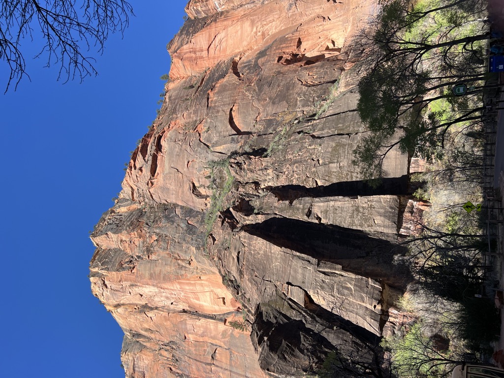
The Pulpit is a 4,600-foot (1,400 m) elevation Navajo Sandstone pillar located in Zion National Park, in Washington County of southwest Utah, United States. The Pulpit is situated in the Temple of Sinawava at the north end of Zion Canyon, rising 160 feet (49 meters) above the canyon floor and the North Fork of the Virgin River which drains precipitation runoff from this rock. It is a photographic icon seen from the parking area at the end of Zion Canyon Scenic Drive, and the entrance to The Narrows. Neighbors include Mountain of Mystery to the north, Observation Point to the southeast, Angels Landing and The Organ to the south, and Cathedral Mountain to the southwest. The first ascent was made April 15, 1967, by Fred Beckey, Eric Bjornstad, Hal Woodworth, Pat Callis, and Galen Rowell.
We use GPS information embedded into the photo when it is available.
3D mountains overlay
Adjust mountain panorama to perfectly match your photos because recorded by camera photo position might be imprecise.
Move tool
Rotate tool
Zoom
More customization
Choose which peak labels should make into the final photo and what photo title should be.
Next
Photo Location
Satellitte
Flat map
Relief map
Latitude
Longitude
Altitude
OR
Latitude
°'''
Longitude
°'''
Apply
Register Peak
Peak Name
Latitude
Longitude
Altitude
Register
Teleport
PeakVisor
This 3D model of Sagarmatha National Park in Nepal was made using the PeakVisor app topographic data. The mobile app features higher precision models worldwide, more topographic details, and works offline. Download PeakVisor maps today.
Download OBJ model
PeakVisor
The download should start shortly. If you find it useful please consider supporting the PeakVisor app.
PeakVisor for iOS and Android
Be a superhero of outdoor navigation with state-of-the-art 3D maps and mountain identification in the palm of your hand!


.jpg)


