The Schottmalhorn is an edge summit of the Reiter Alm in the Berchtesgaden Alps, in Bavaria, Germany. It stands at an elevation of 2,045 m (6,709 ft) above sea level (NHN).
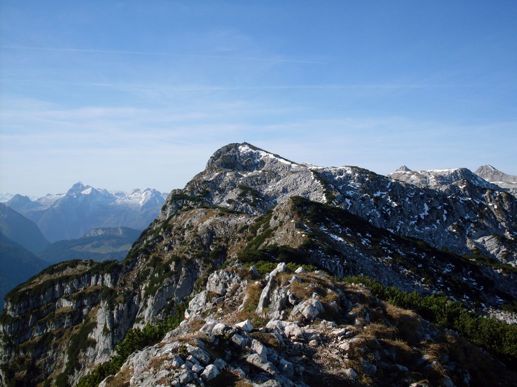
Despite its low prominence and isolation, the Schottmalhorn provides a surprisingly good panoramic view of the entire Reiter Alm and its peaks. Additionally, the view to the east includes the Hoher Göll, Großer Priel, and Dachstein, while to the southeast, the Watzmann and Hochkalter can be seen. To the south are the Großglockner and Leoganger Steinberge, and to the west and north are the Chiemgau Alps with the Sonntagshorn and Hochstaufen. The view of the Hintersee and Ramsau from the summit is particularly impressive.
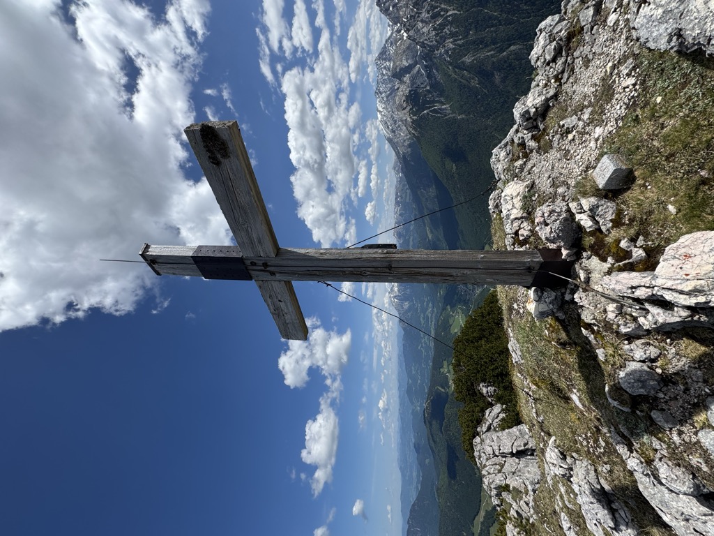
There's a hiking trail (T2) leading to the summit.
The nearest mountain hut is Halsalm located 1 175m/3 856ft SSE of the summit.
By elevation Schottmalhorn is
# 97 out of 172 in Nationalpark Berchtesgaden # 97 out of 321 in Landkreis Berchtesgadener Land # 13 out of 67 in the Reiter Alpe
By prominence Schottmalhorn is
# 70 out of 172 in Nationalpark Berchtesgaden # 37 out of 67 in the Reiter Alpe
We use GPS information embedded into the photo when it is available.
3D mountains overlay
Adjust mountain panorama to perfectly match your photos because recorded by camera photo position might be imprecise.
Move tool
Rotate tool
Zoom
More customization
Choose which peak labels should make into the final photo and what photo title should be.
Next
Photo Location
Satellitte
Flat map
Relief map
Latitude
Longitude
Altitude
OR
Latitude
°'''
Longitude
°'''
Apply
Register Peak
Peak Name
Latitude
Longitude
Altitude
Register
Teleport
PeakVisor
This 3D model of Sagarmatha National Park in Nepal was made using the PeakVisor app topographic data. The mobile app features higher precision models worldwide, more topographic details, and works offline. Download PeakVisor maps today.
Download OBJ model
PeakVisor
The download should start shortly. If you find it useful please consider supporting the PeakVisor app.
PeakVisor for iOS and Android
Be a superhero of outdoor navigation with state-of-the-art 3D maps and mountain identification in the palm of your hand!