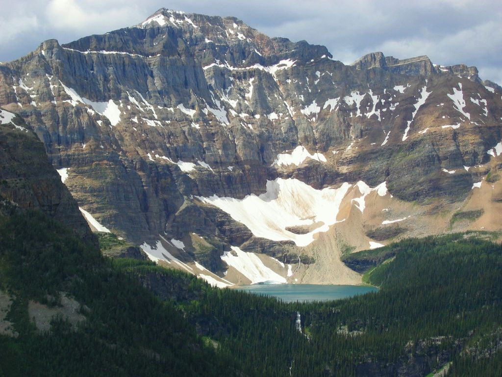
Scarab Peak is a 2,918 metres (9,573 ft) mountain summit located on the Continental Divide, on the shared border between Banff and Kootenay national parks in Canada. Scarab Peak is part of the Ball Range in the Canadian Rockies. The peak is situated one kilometre east-southeast of Haiduk Peak and 8.32 km (5.17 mi) southeast of Mount Ball. The mountain's name scarab was in keeping with the Egyptian theme of the immediate area, e.g., Egypt Lake, Mummy Lake, Pharaoh Peaks, names which were applied in 1922 by Arthur O. Wheeler of the Interprovincial Boundary Survey. Wheeler regarded the area particularly beautiful when he wrote: "After 30 years of exploration, surveys and mapping the main ranges of the Canadian Rockies, the writer ... can safely say that outstanding among them for scenic charm and interest may be classed the group of peaks, lakes and alpine meadows of the Egypt Lake area."
We use GPS information embedded into the photo when it is available.
3D mountains overlay
Adjust mountain panorama to perfectly match your photos because recorded by camera photo position might be imprecise.
Move tool
Rotate tool
Zoom
More customization
Choose which peak labels should make into the final photo and what photo title should be.
Next
Photo Location
Satellitte
Flat map
Relief map
Latitude
Longitude
Altitude
OR
Latitude
°'''
Longitude
°'''
Apply
Register Peak
Peak Name
Latitude
Longitude
Altitude
Register
Teleport
PeakVisor
This 3D model of Sagarmatha National Park in Nepal was made using the PeakVisor app topographic data. The mobile app features higher precision models worldwide, more topographic details, and works offline. Download PeakVisor maps today.
Download OBJ model
PeakVisor
The download should start shortly. If you find it useful please consider supporting the PeakVisor app.
PeakVisor for iOS and Android
Be a superhero of outdoor navigation with state-of-the-art 3D maps and mountain identification in the palm of your hand!