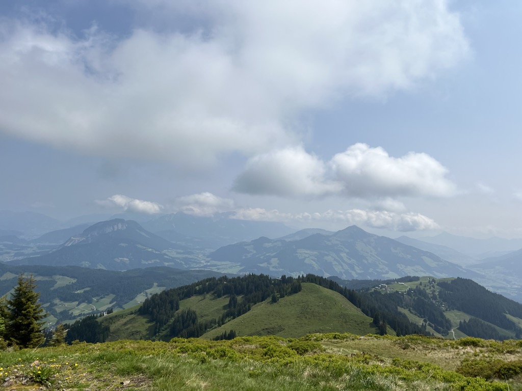
The Roßkopf is a mountain in the Austrian state of Tyrol in the Kitzbühel Alps. It is 1,731 metres (5,679 ft) high and lies about 7 kilometres due south of Wörgl. To the northeast an arête descends to the Marchbachjoch or Markbachjoch (1,496 m); another ridge runs northeast to the Kirchköpfl (1,487 m) and a third to the Turmkogel (1,648 m) to the south. The summit of the Roßkopf is the highest in the local area. It is marked by a large summit cross.
The summit may be climbed on a number of routes, most of which are designated as "easy", and is also a destination for snowshoe tours.
There's a hiking trail (T2) leading to the summit.
The nearest mountain hut is Brixentaler Holzalm located 741m/2 430ft SE of the summit.
By prominence Rosskopf is
# 37 out of 320 in Bezirk Kufstein # 26 out of 426 in Bezirk Kitzbühel # 40 out of 691 in the Tyrol Schistose Alps # 30 out of 463 in the Kitzbühel Alps
We use GPS information embedded into the photo when it is available.
3D mountains overlay
Adjust mountain panorama to perfectly match your photos because recorded by camera photo position might be imprecise.
Move tool
Rotate tool
Zoom
More customization
Choose which peak labels should make into the final photo and what photo title should be.
Next
Photo Location
Satellitte
Flat map
Relief map
Latitude
Longitude
Altitude
OR
Latitude
°'''
Longitude
°'''
Apply
Register Peak
Peak Name
Latitude
Longitude
Altitude
Register
Teleport
PeakVisor
This 3D model of Sagarmatha National Park in Nepal was made using the PeakVisor app topographic data. The mobile app features higher precision models worldwide, more topographic details, and works offline. Download PeakVisor maps today.
Download OBJ model
PeakVisor
The download should start shortly. If you find it useful please consider supporting the PeakVisor app.
PeakVisor for iOS and Android
Be a superhero of outdoor navigation with state-of-the-art 3D maps and mountain identification in the palm of your hand!