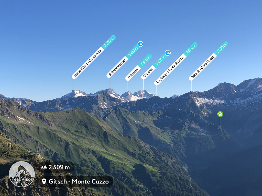
At an elevation of 2,930 m (9,613 ft.), and with a prominence of 97 m (318 ft.), Röteck, or Cima Rossa, forms part of the Western Tauern Alps. It is situated in Trentino-Alto Adige/Südtirol, in the province of South Tyrol, Italy.
This mountain, being the highest peak in the Texel group of the Ötztal Alps, is sought out by climbers and hikers. Although not extremely difficult to climb, one needs to be physically fit to scale it. At the base of the mountain, on the Swiss side, is the lake Lago di Malvaglia, or Bacino di Val Malvaglia as it is also called. This lake is also a popular camping destination due to the forests of evergreen trees on the slopes surrounding the lake.
The nearest mountain hut is Walter-Brenninger-Biwak located 1 374m/4 507ft SSE of the summit.
We use GPS information embedded into the photo when it is available.
3D mountains overlay
Adjust mountain panorama to perfectly match your photos because recorded by camera photo position might be imprecise.
Move tool
Rotate tool
Zoom
More customization
Choose which peak labels should make into the final photo and what photo title should be.
Next
Photo Location
Satellitte
Flat map
Relief map
Latitude
Longitude
Altitude
OR
Latitude
°'''
Longitude
°'''
Apply
Register Peak
Peak Name
Latitude
Longitude
Altitude
Register
Teleport
PeakVisor
This 3D model of Sagarmatha National Park in Nepal was made using the PeakVisor app topographic data. The mobile app features higher precision models worldwide, more topographic details, and works offline. Download PeakVisor maps today.
Download OBJ model
PeakVisor
The download should start shortly. If you find it useful please consider supporting the PeakVisor app.
PeakVisor for iOS and Android
Be a superhero of outdoor navigation with state-of-the-art 3D maps and mountain identification in the palm of your hand!