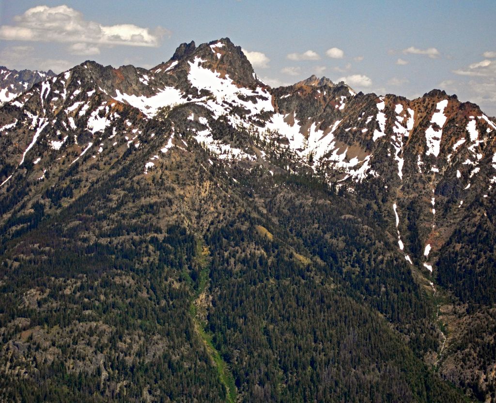
Riddle Peaks, also known as Riddle Peak, is an 8,212-foot (2,503-metre) mountain summit located at the head of Riddle Creek in the North Cascades, in Chelan County of Washington state. Riddle Peak is situated on the Glacier Peak Wilderness boundary, six miles west of Lake Chelan, and 2.5 mi (4.0 km) northeast of Holden, on land managed by the Wenatchee National Forest. The nearest higher neighbor is Flora Mountain, 2.25 miles (3.62 km) to the northeast, and Martin Peak lies 3.7 miles (6.0 km) to the west-northwest. Precipitation runoff from the mountain drains into Lake Chelan via Railroad Creek, Riddle Creek, and Devore Creek. Topographic relief is significant since the southern aspect of the mountain rises 5,000 feet above the Railroad Creek valley in approximately 2 mi (3.2 km). The first ascent of the peak was made September 11, 1940, by Everett and Ida Zacher Darr, Joe Leuthold, and Eldon Metzger via an easy ridge from Tenmile Pass.
We use GPS information embedded into the photo when it is available.
3D mountains overlay
Adjust mountain panorama to perfectly match your photos because recorded by camera photo position might be imprecise.
Move tool
Rotate tool
Zoom
More customization
Choose which peak labels should make into the final photo and what photo title should be.
Next
Photo Location
Satellitte
Flat map
Relief map
Latitude
Longitude
Altitude
OR
Latitude
°'''
Longitude
°'''
Apply
Register Peak
Peak Name
Latitude
Longitude
Altitude
Register
Teleport
PeakVisor
This 3D model of Sagarmatha National Park in Nepal was made using the PeakVisor app topographic data. The mobile app features higher precision models worldwide, more topographic details, and works offline. Download PeakVisor maps today.
Download OBJ model
PeakVisor
The download should start shortly. If you find it useful please consider supporting the PeakVisor app.
PeakVisor for iOS and Android
Be a superhero of outdoor navigation with state-of-the-art 3D maps and mountain identification in the palm of your hand!