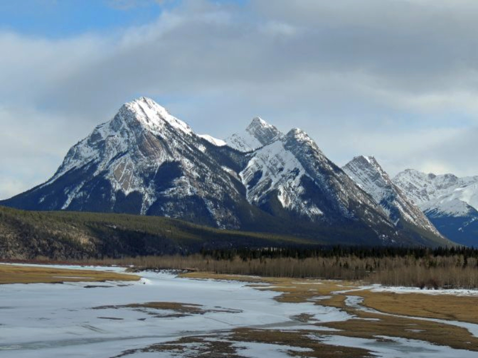
Ex Coelis Mountain is a 2,545-metre (8,350-foot) mountain with five peaks located in the North Saskatchewan River valley of the Canadian Rockies of Alberta, Canada. It is situated south of Abraham Lake and just outside the eastern boundary of Banff National Park. Its nearest higher peak is Hatter Peak, 8.0 km (5.0 mi) to the southeast. Ex Coelis Mountain can be seen from the David Thompson Highway east of Saskatchewan Crossing. Ex Coelis Mountain is composed of sedimentary rock laid down from the Precambrian to Jurassic periods that was pushed east and over the top of younger rock during the Laramide orogeny.
By elevation Rhine Peak is
# 13 out of 22 in Kootenay-Cline Provincial Park # 29 out of 44 in Upper Clearwater/Ram Public Land Use Zone # 100 out of 152 in Clearwater County
By prominence Rhine Peak is
# 6 out of 22 in Kootenay-Cline Provincial Park # 20 out of 44 in Upper Clearwater/Ram Public Land Use Zone # 53 out of 152 in Clearwater County
We use GPS information embedded into the photo when it is available.
3D mountains overlay
Adjust mountain panorama to perfectly match your photos because recorded by camera photo position might be imprecise.
Move tool
Rotate tool
Zoom
More customization
Choose which peak labels should make into the final photo and what photo title should be.
Next
Photo Location
Satellitte
Flat map
Relief map
Latitude
Longitude
Altitude
OR
Latitude
°'''
Longitude
°'''
Apply
Register Peak
Peak Name
Latitude
Longitude
Altitude
Register
Teleport
PeakVisor
This 3D model of Sagarmatha National Park in Nepal was made using the PeakVisor app topographic data. The mobile app features higher precision models worldwide, more topographic details, and works offline. Download PeakVisor maps today.
Download OBJ model
PeakVisor
The download should start shortly. If you find it useful please consider supporting the PeakVisor app.
PeakVisor for iOS and Android
Be a superhero of outdoor navigation with state-of-the-art 3D maps and mountain identification in the palm of your hand!